Renwick

Settlement in Cumberland Eden

England

Renwick

North Cumbria View View looking across farmland above Huddlesceugh Hall towards the North Lakes.
North Cumbria View Credit: Peter McDermott

Renwick is a small village located in the county of Cumberland, England. Situated in the northern part of the county, Renwick is nestled within the picturesque landscape of the Eden Valley. With a population of around 250 inhabitants, the village exudes a cozy and tight-knit community atmosphere.

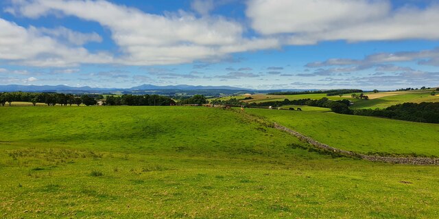
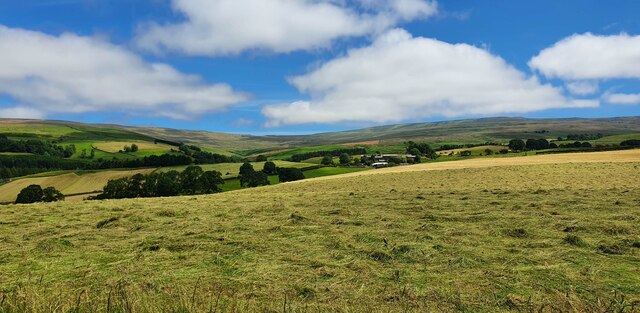
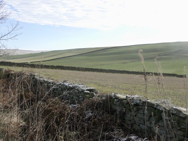
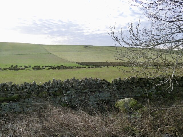
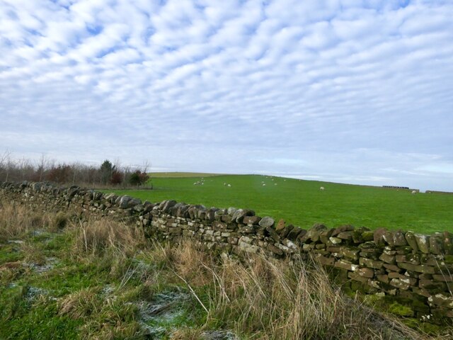
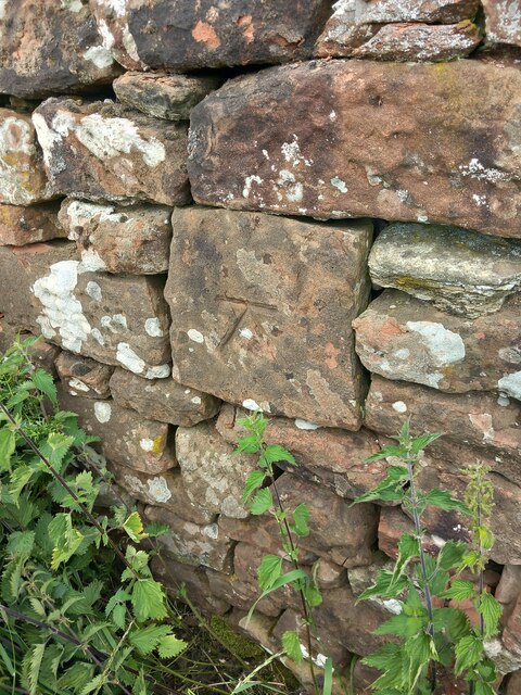
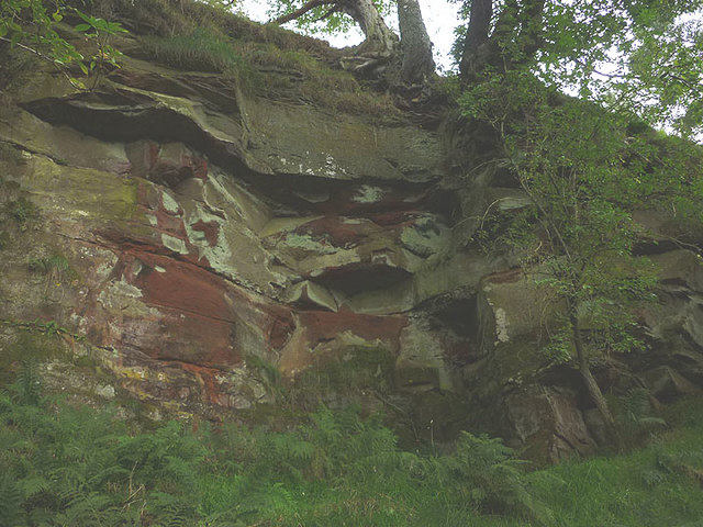
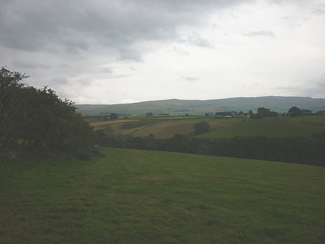
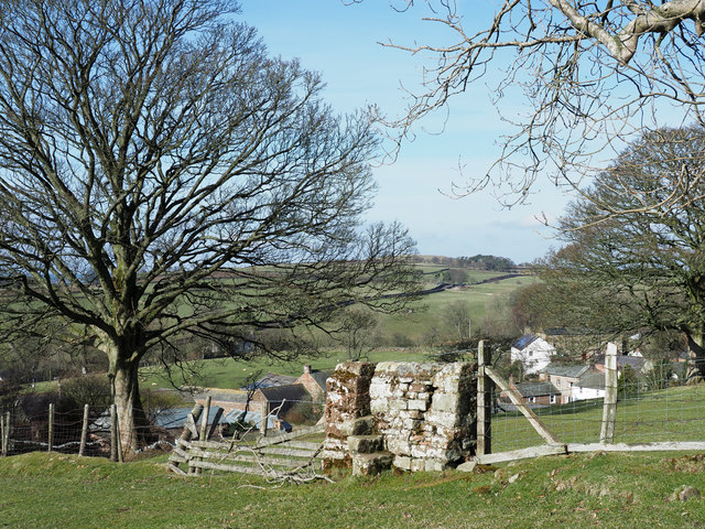
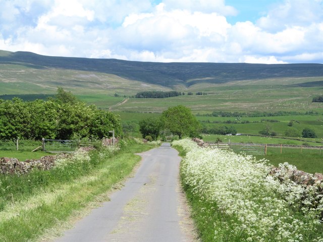
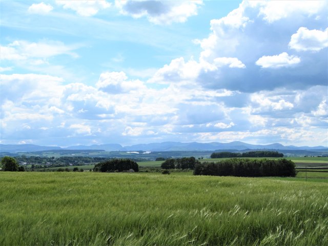
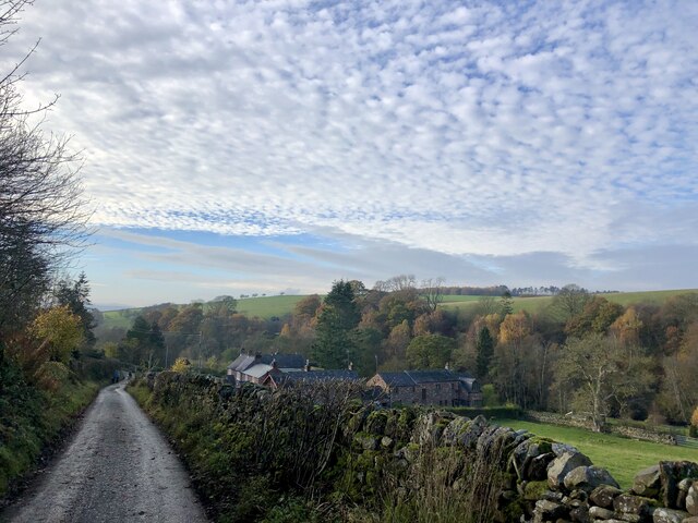
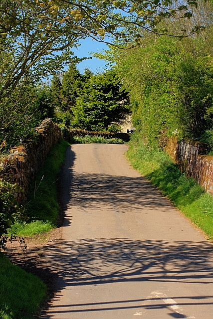
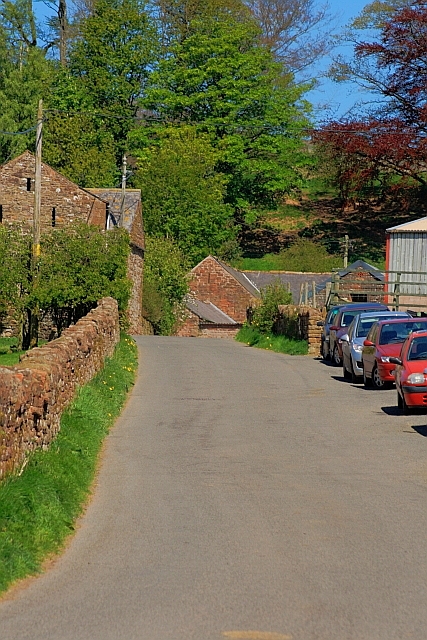
Renwick is known for its scenic beauty, surrounded by rolling hills and lush green fields. The village is also blessed with proximity to the River Eden, which adds to its natural charm. Walking through the village, visitors are greeted by well-preserved historic buildings, reflecting the village's rich history.

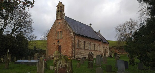
One of the notable landmarks in Renwick is the St. Lawrence Church, a beautiful 12th-century church that stands proudly at the heart of the village. With its ancient architecture and tranquil surroundings, it serves as a reminder of Renwick's past.

Despite its small size, Renwick offers a range of amenities to its residents. These include a local pub, which serves as a meeting place for locals and visitors alike, and a village hall that hosts various community events throughout the year.

Renwick is also an ideal base for exploring the wider region of Cumberland. The village is conveniently located near the Lake District National Park, known for its stunning lakes, mountains, and hiking trails, making it a popular destination for outdoor enthusiasts.

In conclusion, Renwick is a charming and idyllic village in Cumberland, offering a tranquil escape and serving as a gateway to the natural beauty of the surrounding area.

If you have any feedback on the listing, please let us know in the comments section below.

Renwick Images

Images are sourced within 2km of 54.784318/-2.632825 or Grid Reference NY5943. Thanks to Geograph Open Source API. All images are credited.

North Cumbria View View looking across farmland above Huddlesceugh Hall towards the North Lakes.
North Cumbria View
View looking across farmland above Huddlesceugh Hall towards the North Lakes.
Haresceugh View looking towards Haresceugh and the Pennines.
Haresceugh
View looking towards Haresceugh and the Pennines.
Old Boundary Maker on Raven Bridge, Kirkoswald Parish Boundary Marker set in the parapet of Raven Bridge, Raven Beck, on the south side of the road. Inscribed KIRKOSWALD / HIGH QR on the left and RENWICK on the right with DIVI OF above. High Quarter was a division of Kirkoswald parish. Renwick parish was absorbed into Kirkoswald parish in 1934 so now this is entirely in Kirkoswald parish. See also <span class="nowrap"><a title="http://www.geog.port.ac.uk/webmap/thelakes/photos/btf97.jpg" rel="nofollow ugc noopener" href="http://www.geog.port.ac.uk/webmap/thelakes/photos/btf97.jpg">Link</a><img style="margin-left:2px;" alt="External link" title="External link - shift click to open in new window" src="https://s1.geograph.org.uk/img/external.png" width="10" height="10"/></span>.

Milestone Society National ID: CU_KIRK01pb
Old Boundary Maker on Raven Bridge, Kirkoswald
Parish Boundary Marker set in the parapet of Raven Bridge, Raven Beck, on the south side of the road. Inscribed KIRKOSWALD / HIGH QR on the left and RENWICK on the right with DIVI OF above. High Quarter was a division of Kirkoswald parish. Renwick parish was absorbed into Kirkoswald parish in 1934 so now this is entirely in Kirkoswald parish. See also LinkExternal link. Milestone Society National ID: CU_KIRK01pb
All Saints Church, Renwick All Saints Church is located in Renwick in the Eden district of Cumbria. There has been a church on this site at Renwick since medieval times. The present church was built 1845-1846, replacing an earlier church of 1737. It is thought to be the fourth church on this site. The church has an unusual two decker pulpit, dating from c.1735.
All Saints Church, Renwick
All Saints Church is located in Renwick in the Eden district of Cumbria. There has been a church on this site at Renwick since medieval times. The present church was built 1845-1846, replacing an earlier church of 1737. It is thought to be the fourth church on this site. The church has an unusual two decker pulpit, dating from c.1735.
Scales Moor
Scales Moor
Scales Moor
Scales Moor
Scales Rigg
Scales Rigg
OS Benchmark or not In the position of an OS bench mark as marked on 1860s OS map yet lacking the central line of the arrow.
OS Benchmark or not
In the position of an OS bench mark as marked on 1860s OS map yet lacking the central line of the arrow.
Disused quarry by Raven Beck A small working of soft red sandstone beside the beck. Most likely dating to Victorian times judging by the graffiti carved on the walls.
Disused quarry by Raven Beck
A small working of soft red sandstone beside the beck. Most likely dating to Victorian times judging by the graffiti carved on the walls.
Graffiti in disused quarry by Raven Beck The carved year '1896' on the wall of <a href="https://www.geograph.org.uk/photo/5529535">NY5841 : Disused quarry by Raven Beck</a>.
Graffiti in disused quarry by Raven Beck
The carved year '1896' on the wall of NY5841 : Disused quarry by Raven Beck.
Graffiti in disused quarry by Raven Beck (2) This could be a pair of initials: 'JL' and 'JO' (or 'JC' or 'JG'?) carved on the face of <a href="https://www.geograph.org.uk/photo/5529535">NY5841 : Disused quarry by Raven Beck</a>.
Graffiti in disused quarry by Raven Beck (2)
This could be a pair of initials: 'JL' and 'JO' (or 'JC' or 'JG'?) carved on the face of NY5841 : Disused quarry by Raven Beck.
Footpath above Raven Beck Climbing out of the valley by Park Head.
Footpath above Raven Beck
Climbing out of the valley by Park Head.
Wall fragment with stile A curious feature close to the village of Renwick. A fence rises between fields beside which runs the route of a public footpath. The footpath crosses the barrier from one side to the other but at that point, and only there, the fencing is replaced by a short section of walling into which is built the stile.
Wall fragment with stile
A curious feature close to the village of Renwick. A fence rises between fields beside which runs the route of a public footpath. The footpath crosses the barrier from one side to the other but at that point, and only there, the fencing is replaced by a short section of walling into which is built the stile.
Flower fringed lane near Renwick Cow parsley along the roadside adds to the attractive scene here, with the brooding north Pennines ahead.
Flower fringed lane near Renwick
Cow parsley along the roadside adds to the attractive scene here, with the brooding north Pennines ahead.
Barley field, Viol Moor There's a gradual rise from the Vale of Eden eastwards towards the North Pennine scarp, so at this point one is already at the 220m contour. From this crop field one looks over the vale towards the distant Lake District mountains with Blencathra in the centre of the frame.
Barley field, Viol Moor
There's a gradual rise from the Vale of Eden eastwards towards the North Pennine scarp, so at this point one is already at the 220m contour. From this crop field one looks over the vale towards the distant Lake District mountains with Blencathra in the centre of the frame.
Low Mill in the valley of the Raven Beck Narrow back road that passes through Low Mill and Park Head.
Low Mill in the valley of the Raven Beck
Narrow back road that passes through Low Mill and Park Head.
Road to the School, Renwick
Road to Townhead
Road to Townhead
Show me another place!

Renwick is located at Grid Ref: NY5943 (Lat: 54.784318, Lng: -2.632825)

Administrative County: Cumbria

District: Eden

Police Authority: Cumbria

What 3 Words

///tensions.refer.flames. Near Alston, Cumbria

Related Wikis

Renwick, Cumbria

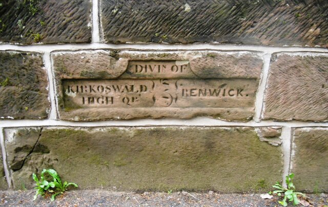
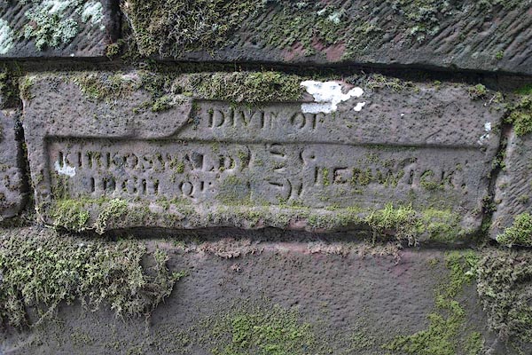
Renwick, formerly known as Ravenwick, is a small village and former civil parish, now in the parish of Kirkoswald, in the Eden district, in the county...

Busk, Cumbria

Busk is a hamlet in Cumbria, England. It is located 3.7 miles (6.0 km) by road to the east of Kirkoswald. == See also == List of places in Cumbria ��2...

Unthank, Glassonby

Unthank is a village near Gamblesby in the civil parish of Glassonby in Cumbria, England. It is first mentioned in writing as Unthanke in 1332. == See... ==

Croglin

Croglin is the name of a village, former civil parish, beck (stream), and grange now in the parish of Ainstable, in the Westmorland and Furness district...

Kirkoswald Castle

Kirkoswald Castle is located to the southeast of the village of Kirkoswald, Cumbria, England. It is built from Penrith red sandstone and is still partially...

Gamblesby

Gamblesby is a village near Melmerby, and former civil parish, now in the parish of Glassonby, in the Westmorland and Furness district, in the ceremonial...

St John's Church, Gamblesby

St. John's Church was a Victorian parish Church of England church in the village of Gamblesby, Cumbria, England.The Gothic Revival-style church, with tall...

Kirkoswald, Cumbria

Kirkoswald is a village, civil parish, and former market town located in Westmorland and Furness, England, about 9 miles (14 km) from Penrith. The village...

Nearby Amenities

Located within 500m of 54.784318,-2.632825
Renwick
Place: village
Source: NPE
Wikidata: Q4797643
Wikipedia: en:Renwick, Cumbria
Lat/Long: 54.7843507/-2.6279808
Methodist Church (N bound)
Naptan AtcoCode: 090074362744
Naptan Bearing: N
Naptan BusStopType: CUS
Naptan CommonName: Methodist Church (N bound)
Naptan Indicator: o/s
Naptan Landmark: Renwick Church
Naptan NaptanCode: cumdamwd
Naptan Street: No name
Naptan Verified: no
Source: naptan_import
Lat/Long: 54.785325/-2.6283698
Methodist Church (N bound)
Naptan AtcoCode: 090074363769
Naptan Bearing: SE
Naptan BusStopType: CUS
Naptan CommonName: Methodist Church (N bound)
Naptan Indicator: opp
Naptan Landmark: Methodist Church
Naptan NaptanCode: cumdamwj
Naptan Street: No name
Naptan Verified: no
Source: naptan_import
Lat/Long: 54.7853526/-2.6282614
Post Box
Ref: CA10 270
Lat/Long: 54.7854138/-2.6284341
Grit Bin
Lat/Long: 54.7854872/-2.6284979
Generator Method: photovoltaic
Generator Output Electricity: yes
Generator Source: solar
Generator Type: solar_photovoltaic_panel
Location: roof
Power: generator
Lat/Long: 54.7846542/-2.628631
Power: pole
Lat/Long: 54.7837338/-2.6275995
Power: pole
Lat/Long: 54.7829971/-2.6280514
Power: pole
Lat/Long: 54.7823847/-2.6284355
Power: pole
Lat/Long: 54.7818185/-2.6278419
Power: pole
Lat/Long: 54.7826962/-2.6293064
Power: pole
Lat/Long: 54.7833951/-2.6312228
Power: pole
Lat/Long: 54.7839944/-2.6307914
Power: pole
Lat/Long: 54.7845215/-2.6304114
Power: pole
Lat/Long: 54.7830433/-2.6269997
Power: pole
Lat/Long: 54.7834567/-2.626936
Telephone
Booth: K6
Covered: booth
Lat/Long: 54.7840788/-2.6270669
Power: pole
Lat/Long: 54.7865274/-2.6296758
The data included in this document is from www.openstreetmap.org. The data is made available under ODbL.

Have you been to Renwick?

Leave your review of Renwick below (or comments, questions and feedback).