Raby Park

Settlement in Yorkshire

England

Raby Park

Quiet times on the old A1 The A1 once passed through the centre of Wetherby, then along this route to the north of the town.  Later a by-pass was built and the road became a dual carriageway, but now it is quiet again as the A1 has become a motorway on a parallel route a half mile to the east.
Quiet times on the old A1 Credit: Gordon Hatton

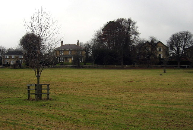
Raby Park is a picturesque estate located in the county of Yorkshire, England. This expansive parkland is set within the idyllic countryside, offering visitors a serene and tranquil retreat. Covering an area of approximately 1,000 acres, Raby Park is renowned for its stunning landscapes, impressive architecture, and rich history.

The park is home to Raby Castle, a Grade I listed medieval fortress that dates back to the 14th century. This magnificent structure stands proudly at the heart of the estate, showcasing its grandeur and historic significance. Visitors can explore the castle's opulent interiors, including its lavish state rooms, art collections, and beautifully maintained gardens.

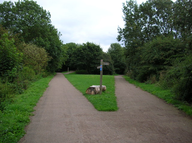
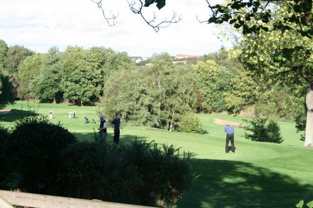
The park itself boasts a diverse range of natural features, including rolling hills, lush woodlands, and meandering rivers. It is a haven for wildlife enthusiasts, with various species of birds, mammals, and plants thriving within its boundaries. Walking trails and cycling paths are scattered throughout the park, allowing visitors to fully immerse themselves in its natural beauty.

In addition to its natural and architectural wonders, Raby Park offers a range of recreational activities. The estate hosts regular events, such as outdoor concerts, craft fairs, and historical reenactments, providing entertainment for visitors of all ages. The park also features a charming tea room, where guests can indulge in traditional British refreshments while admiring the scenic views.

Overall, Raby Park is a true gem in the Yorkshire countryside, offering a perfect blend of history, nature, and leisure. Whether it's exploring the castle, embarking on a scenic walk, or simply enjoying a peaceful picnic, Raby Park provides a memorable experience for all who visit.

If you have any feedback on the listing, please let us know in the comments section below.

Raby Park Images

Images are sourced within 2km of 53.931075/-1.389987 or Grid Reference SE4048. Thanks to Geograph Open Source API. All images are credited.
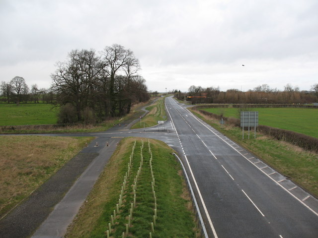
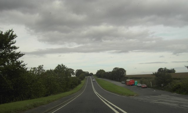
Quiet times on the old A1 The A1 once passed through the centre of Wetherby, then along this route to the north of the town.  Later a by-pass was built and the road became a dual carriageway, but now it is quiet again as the A1 has become a motorway on a parallel route a half mile to the east.
Quiet times on the old A1
The A1 once passed through the centre of Wetherby, then along this route to the north of the town. Later a by-pass was built and the road became a dual carriageway, but now it is quiet again as the A1 has become a motorway on a parallel route a half mile to the east.
New roundabout at Kirk Deighton A new [2006] roundabout and junction at Kirk Deighton on the line of the old A1 Wetherby by-pass, now by-passed in turn by the A1 motorway.
New roundabout at Kirk Deighton
A new [2006] roundabout and junction at Kirk Deighton on the line of the old A1 Wetherby by-pass, now by-passed in turn by the A1 motorway.
Cows graze beside the cricket pitch at Kirk Deighton
Sunday evening cricket at Kirk Deighton
How now, brown cow? Cattle contentedly grazing outside Kirk Deighton.
How now, brown cow?
Cattle contentedly grazing outside Kirk Deighton.
Heading North Joining the A1M at Wetherby.
Heading North
Joining the A1M at Wetherby.
Northwest of Wetherby Looking Northwest. The trees in the photo are those at SE392496, Photo taken from footpath near the old railway line.
Northwest of Wetherby
Looking Northwest. The trees in the photo are those at SE392496, Photo taken from footpath near the old railway line.
Wetherby, field and houses Taken from the junction of the A661 and the Sicklinghall Rd looking NW.
Wetherby, field and houses
Taken from the junction of the A661 and the Sicklinghall Rd looking NW.
Sicklinghall Road, North and West Yorkshire Looking west from the junction with Northgate Lane (from Linton) towards the village of Sicklinghall about 1.5 miles away. To the left of shot is West Yorkshire and to the right is North Yorkshire. The county boundary follows the white line down the middle of the road.
Sicklinghall Road, North and West Yorkshire
Looking west from the junction with Northgate Lane (from Linton) towards the village of Sicklinghall about 1.5 miles away. To the left of shot is West Yorkshire and to the right is North Yorkshire. The county boundary follows the white line down the middle of the road.
Paper Pulp Mountain near Wetherby Paper pulp is an environmentally friendly soil conditioner. This mound is waiting to be spread on local fields once the harvest has been gathered. The pulp is a waste product from the paper making industry and would have been disposed of in a landfill site.
Paper Pulp Mountain near Wetherby
Paper pulp is an environmentally friendly soil conditioner. This mound is waiting to be spread on local fields once the harvest has been gathered. The pulp is a waste product from the paper making industry and would have been disposed of in a landfill site.
Welcome to Linton A cast reconstituted stone sign on Northgate Lane.
Welcome to Linton
A cast reconstituted stone sign on Northgate Lane.
Harland Way The Harland Way is a cycle route between Spofforth and Wetherby making use of the old railway which used to be here.
Harland Way
The Harland Way is a cycle route between Spofforth and Wetherby making use of the old railway which used to be here.
Harland Way Junction The Harland Way is a cycle route between Spofforth and Wetherby making use of the old railways. The left hand track took the railway to Tadcaster, and the right to join another line going to Leeds between Leeds and Garforth.
Harland Way Junction
The Harland Way is a cycle route between Spofforth and Wetherby making use of the old railways. The left hand track took the railway to Tadcaster, and the right to join another line going to Leeds between Leeds and Garforth.
Golf Course, Linton Ings I had hoped to be able to capture the old railway running through this square but couldn't see anywhere immediately obvious where I could gain access, and I had to be elsewhere, so I had to make do with this shot of the golf course instead. Facing east, the old railway is somewhere in the trees beyond, and further on flows the River Wharfe before it passes through Wetherby town centre.
Golf Course, Linton Ings
I had hoped to be able to capture the old railway running through this square but couldn't see anywhere immediately obvious where I could gain access, and I had to be elsewhere, so I had to make do with this shot of the golf course instead. Facing east, the old railway is somewhere in the trees beyond, and further on flows the River Wharfe before it passes through Wetherby town centre.
Road sign with Grid Reference These old road signs make it easy to check exactly where you are.
Road sign with Grid Reference
These old road signs make it easy to check exactly where you are.
A58 Lay By Lay By on the A58 towards Wetherby.
A58 Lay By
Lay By on the A58 towards Wetherby.
Wetherby triangle The Harland way is a cycle route built by Sustrans on the former Harrogate to Tadcaster railway. This is part of a branch on the route, behind a line used to run to Cross Gates, between Leeds and Garforth, this has not been converted to cycle route yet. Ahead is a triangle, formerly enabling access to this line from both directions, Tadcaster to the right, Harrogate to the left. Weatherby Station was situated here at the junction, but closed in January 1964, this group of lines being the first to be closed specifically as a result of the 1963 Beeching Report.
Wetherby triangle
The Harland way is a cycle route built by Sustrans on the former Harrogate to Tadcaster railway. This is part of a branch on the route, behind a line used to run to Cross Gates, between Leeds and Garforth, this has not been converted to cycle route yet. Ahead is a triangle, formerly enabling access to this line from both directions, Tadcaster to the right, Harrogate to the left. Weatherby Station was situated here at the junction, but closed in January 1964, this group of lines being the first to be closed specifically as a result of the 1963 Beeching Report.
Harland Way - Wetherby triangle The Harland way is a cycle route built by Sustrans on the former Harrogate to Tadcaster railway. This is a section of the Wetherby triangle. Ahead leads towards Harrogate; behind used to be to Garforth, but now only leads to a car park.
Harland Way - Wetherby triangle
The Harland way is a cycle route built by Sustrans on the former Harrogate to Tadcaster railway. This is a section of the Wetherby triangle. Ahead leads towards Harrogate; behind used to be to Garforth, but now only leads to a car park.
Show me another place!

Raby Park is located at Grid Ref: SE4048 (Lat: 53.931075, Lng: -1.389987)

Division: West Riding

Unitary Authority: Leeds

Police Authority: West Yorkshire

What 3 Words

///perky.method.menswear. Near Wetherby, West Yorkshire

Related Wikis

Tempo FM

Tempo FM is the local community radio station for Wetherby, Boston Spa, as well as the surrounding villages in the West Yorkshire and North Yorkshire areas...
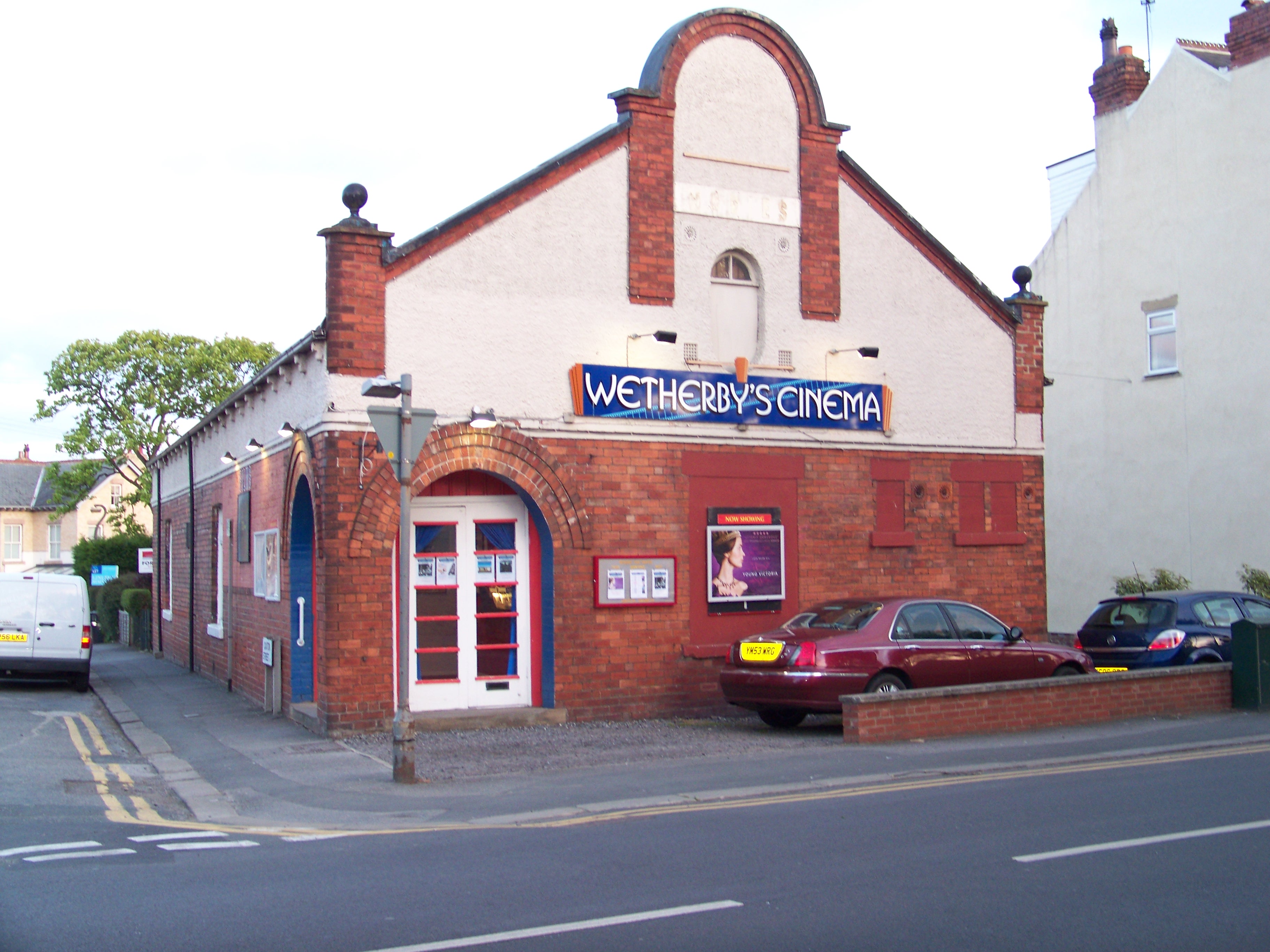
Wetherby's Cinema

Wetherby's Cinema, officially the Wetherby Film Theatre and formerly the Rodney Bingo Hall, Rodney Cinema and the Raby Picture House, is a cinema in Wetherby...

St Joseph's Church, Wetherby

St Joseph's Church is an active Roman Catholic church in Wetherby, West Yorkshire, England. == History == Prior to the construction of a Catholic church...

St James' Parish Church, Wetherby

St James' Parish Church is an Anglican parish church serving the parish of Wetherby with Linton in Wetherby, West Yorkshire, England. == History == Wetherby...

Nearby Amenities

Located within 500m of 53.931075,-1.389987
Mini Roundabout
Lat/Long: 53.9301939/-1.3850476
Wetherby
Place: town
Postal Code: LS22
Lat/Long: 53.928397/-1.3866664
Barrier: cycle_barrier
Cycle Barrier: tilted
Lat/Long: 53.9334625/-1.3889292
Barrier: cycle_barrier
Cycle Barrier: tilted
Lat/Long: 53.9338398/-1.3871759
Crossing
Crossing: traffic_signals
Crossing Island: no
Crossing Ref: pelican
Tactile Paving: yes
Lat/Long: 53.928584/-1.3870073
Crossing
Crossing: traffic_signals
Crossing Island: no
Crossing Ref: pelican
Tactile Paving: yes
Lat/Long: 53.928385/-1.3856536
Town Hall
Building: public
Information: visitor_centre
Tourism: information
Lat/Long: 53.9283565/-1.3867723
Pub
Swan & Talbot
Accommodation: yes
Addr City: Wetherby
Addr Housenumber: 34
Addr Postcode: LS22 6NN
Addr Street: North Street
Fhrs Id: 1531260
Floor Material: lino
Note Accomodation: Accommodation appears to be in a separate block to north
Note Parking: 3 hour vouchers for Morrisons car park at rear
Operator: Craft Union
Outdoor Seating: yes
Parking: yes
Real Ale: Theakston's Best. May vary
Wheelchair: no
Wheelchair Description: Big step at front entrance, lots of steps at back
Lat/Long: 53.9294773/-1.3851593
Fuel
Morrisons
Addr City: Wetherby
Addr Postcode: LS22 7TS
Addr Street: Deighton Road
Brand: Morrisons
Brand Wikidata: Q922344
Brand Wikipedia: en:Morrisons
Fhrs Id: 818450
Website: https://my.morrisons.com/storefinder/110/wetherby
Lat/Long: 53.9319417/-1.3832418
Pub
The Royal Oak
Addr City: Wetherby
Addr Housenumber: 60
Addr Postcode: LS22 6NR
Addr Street: North Street
Fhrs Id: 702414
Guest House: bed_and_breakfast
Source Addr: FHRS Open Data
Tourism: guest_house
Website: www.theroyaloakwetherby.co.uk
Lat/Long: 53.9308259/-1.3843302
Entrance: yes
Lat/Long: 53.9299141/-1.386015
Atm
Lat/Long: 53.9290919/-1.3838043
Building: commercial
Disused Amenity: bank
Old Name: HSBC UK
Operational Status: closed
Lat/Long: 53.9291673/-1.3855047
Post Box
Check Date: 2021-08-13
Operator: Royal Mail
Operator Wikidata: Q638098
Post Box Type: pillar
Ref: LS22 456
Royal Cypher: EIIR
Royal Cypher Wikidata: Q33102113
Lat/Long: 53.9290255/-1.3854835
Cafe
Source: survey
Lat/Long: 53.9289794/-1.3846059
Sant Angelo
Addr City: Wetherby
Addr Postcode: LS22 6LT
Addr Street: High Street
Cuisine: italian
Disused Amenity: restaurant
Fhrs Id: 322777
Lat/Long: 53.9283802/-1.3855017
Bank
NatWest
Brand: NatWest
Brand Wikidata: Q2740021
Brand Wikipedia: en:NatWest
Lat/Long: 53.9285076/-1.3857663
Bank
Lloyds Bank
Addr Country: GB
Atm: yes
Brand: Lloyds Bank
Brand Wikidata: Q1152847
Brand Wikipedia: en:Lloyds Bank
Contact Website: https://branches.lloydsbank.com/wetherby/55-market-place
Lat/Long: 53.928524/-1.3862439
Pub
Black Bull
Addr City: Wetherby
Addr Housenumber: 53
Addr Postcode: LS22 6LN
Addr Street: Market Place
Fhrs Id: 803041
Source Addr: FHRS Open Data
Lat/Long: 53.9285555/-1.3863967
Wetherby One Stop Shop (Leeds Council)
Addr City: Wetherby
Addr Housename: Wetherby Council Offices
Addr Housenumber: 24
Addr Postcode: LS22 6NL
Addr Street: Westgate
Fhrs Id: 320882
Lat/Long: 53.9299417/-1.3885635
Indoor: yes
Information: visitor_centre
Tourism: information
Lat/Long: 53.9287053/-1.3875296
Cooplands
Addr City: Wetherby
Addr Housenumber: 45
Addr Postcode: LS22 6LN
Addr Street: Market Place
Brand: Cooplands
Brand Wikidata: Q5167971
Brand Wikipedia: en:Cooplands
Fhrs Id: 322899
Shop: bakery
Lat/Long: 53.9286498/-1.3868013
Bus Station
Wetherby
Bus: yes
Naptan AtcoCode: 450G7954
Public Transport: station
Wheelchair: yes
Wikidata: Q7990090
Lat/Long: 53.927223/-1.3866108
Toilets
Check Date: 2023-05-14
Lat/Long: 53.9279274/-1.386277
Pub
Crown Inn
Addr City: Wetherby
Addr Housenumber: 25
Addr Postcode: LS22 6LR
Addr Street: High Street
Fhrs Id: 320624
Source Addr: FHRS Open Data
Lat/Long: 53.9277289/-1.3858331
Brunswick Court
Place: square
Lat/Long: 53.9278806/-1.3853638
Fast Food
Moji's
Addr City: Wetherby
Addr Housenumber: 2
Addr Postcode: LS22 6LE
Addr Street: Castle Gate
Cuisine: pizza
Fhrs Id: 320834
Opening Hours: Mo-Su 17:00-24:00
Takeaway: only
Lat/Long: 53.9276232/-1.3872666
Bank
Barclays
Brand: Barclays
Brand Wikidata: Q245343
Brand Wikipedia: en:Barclays
Operator: Barclays Bank PLC
Lat/Long: 53.9280581/-1.3865979
Fast Food
The Wetherby Whaler
Addr City: Wetherby
Addr Housenumber: 18
Addr Postcode: LS22 6NE
Addr Street: Market Place
Cuisine: fish_and_chips
Fhrs Id: 320631
Opening Hours: Mo-Th 11:30-20:00; Fr,Sa 11:30-20:30; Su 12:00-20:00
Lat/Long: 53.9276522/-1.3864986
Parking
Created By: Potlatch 0.7b
Lat/Long: 53.9283636/-1.3869808
Turning Circle
Lat/Long: 53.9337773/-1.3956563
Turning Circle
Lat/Long: 53.9345764/-1.3939668
Crossing
Crossing: uncontrolled
Crossing Island: no
Crossing Ref: zebra
Tactile Paving: yes
Lat/Long: 53.9305392/-1.3879476
Mini Roundabout
Source: survey
Lat/Long: 53.9299609/-1.3927209
Wetherby
Abandoned Railway: station
Railway: site
Source: NPE
Lat/Long: 53.9298266/-1.3972993
Barrier: bollard
Bicycle: yes
Foot: yes
Lat/Long: 53.9353705/-1.3899044
Barrier: bollard
Bicycle: yes
Foot: yes
Lat/Long: 53.9348901/-1.3897335
Bus Stop
Deighton Road York Road
Bus: yes
Local Ref: 45014428
Naptan AtcoCode: 450014428
Naptan Bearing: NE
Naptan CommonName: Deighton Road York Road
Naptan Crossing: York Road
Naptan Indicator: Stop 45014428
Naptan Landmark: Garage
Naptan PlusbusZoneRef: LEEDS
Naptan ShortCommonName: York Road
Naptan Street: Deighton Road
Naptan Verified: no
Public Transport: platform
Shelter: no
Source: naptan_import
Lat/Long: 53.9319307/-1.3837285
Bus Stop
Deighton Road York Road
Bench: no
Bus: yes
Local Ref: 45014881
Naptan AtcoCode: 450014881
Naptan Bearing: S
Naptan CommonName: Deighton Road York Road
Naptan Crossing: York Road
Naptan Indicator: Stop 45014881
Naptan PlusbusZoneRef: LEEDS
Naptan ShortCommonName: York Road
Naptan Street: Deighton Road
Naptan Verified: no
Public Transport: platform
Shelter: no
Source: naptan_import
Lat/Long: 53.9321626/-1.38339
Bus Stop
Stand B Wetherby Bus Station
Bus: yes
Local Ref: 45014895
Naptan AtcoCode: 450014895
Naptan Bearing: N
Naptan CommonName: Stand B Wetherby Market Place
Naptan Crossing: Castle Gate
Naptan Indicator: Stop 45014895
Naptan PlusbusZoneRef: LEEDS
Naptan ShortCommonName: Wetherby Bus Stn B
Naptan Street: Market Place
Naptan Verified: no
Public Transport: platform
Ref: B
Source: naptan_import
Lat/Long: 53.9274521/-1.386749
Bus Stop
West Gate Crossley Street
Bus: yes
Local Ref: 45014896
Naptan AtcoCode: 450014896
Naptan Bearing: E
Naptan CommonName: West Gate Crossley Street
Naptan Crossing: Crossley Street
Naptan Indicator: Stop 45014896
Naptan PlusbusZoneRef: LEEDS
Naptan ShortCommonName: Crossley Street
Naptan Street: West Gate
Naptan Verified: no
Public Transport: platform
Shelter: no
Source: naptan_import
Lat/Long: 53.9299137/-1.3918303
Bus Stop
Linton Road Station Gardens
Bus: yes
Local Ref: 45014897
Naptan AtcoCode: 450014897
Naptan Bearing: E
Naptan CommonName: Linton Road Station Gardens
Naptan Crossing: Station Gardens
Naptan Indicator: Stop 45014897
Naptan PlusbusZoneRef: LEEDS
Naptan ShortCommonName: Station Gardens
Naptan Street: Linton Road
Naptan Verified: no
Public Transport: platform
Source: naptan_import
Lat/Long: 53.9295223/-1.3962071
School Services
Local Ref: 45025105
Naptan AtcoCode: 450025105
Naptan Bearing: E
Naptan BusStopType: CUS
Naptan CommonName: School Services
Naptan Indicator: Stop 45025105
Naptan Landmark: School
Naptan PlusbusZoneRef: LEEDS
Naptan ShortCommonName: School Services
Naptan Verified: no
Source: naptan_import
Lat/Long: 53.9335918/-1.3904364
Bus Stop
Stand A Wetherby Bus Station
Bus: yes
Local Ref: 45025353
Naptan AtcoCode: 450025353
Naptan Bearing: W
Naptan CommonName: Stand A Wetherby Bus Station
Naptan Crossing: Scott Lane
Naptan Indicator: Stop 45025353
Naptan Landmark: Wetherby Bus Station
Naptan PlusbusZoneRef: LEEDS
Naptan ShortCommonName: Wetherby Bus Stn A
Naptan Street: Market Place (Wetherby Bus Station)
Naptan Verified: no
Public Transport: platform
Ref: A
Source: naptan_import
Wheelchair: yes
Lat/Long: 53.9271577/-1.3869163
Bus Stop
North Street Horsefair
Bench: no
Bin: no
Bus: yes
Naptan AtcoCode: 450028637
Naptan Bearing: N
Naptan CommonName: North Street Horsefair
Naptan Crossing: Horsefair
Naptan Landmark: Unknown
Naptan PlusbusZoneRef: LEEDS
Naptan ShortCommonName: Horsefair
Naptan Street: North Street
Naptan Verified: no
Public Transport: platform
Shelter: no
Source: naptan_import
Tactile Paving: no
Lat/Long: 53.928577/-1.3854325
Bus Stop
North Street Bank Street
Bus: yes
Naptan AtcoCode: 450028638
Naptan Bearing: N
Naptan CommonName: North Street Bank Street
Naptan Crossing: Bank Street
Naptan Landmark: Unknown
Naptan PlusbusZoneRef: LEEDS
Naptan ShortCommonName: Bank Street
Naptan Street: North Street
Naptan Verified: no
Public Transport: platform
Source: naptan_import
Lat/Long: 53.9290458/-1.3855377
Bus Stop
West Gate Crossley Street
Bus: yes
Local Ref: 45027895
Naptan AtcoCode: 450027895
Naptan Bearing: W
Naptan CommonName: West Gate Crossley Street
Naptan Crossing: Crossley Street
Naptan Indicator: Stop 45027895
Naptan Landmark: Unknown
Naptan PlusbusZoneRef: LEEDS
Naptan ShortCommonName: Crossley Street
Naptan Street: West Gate
Naptan Verified: no
Public Transport: platform
Ref: 45027895
Source: naptan_import
Lat/Long: 53.929828/-1.3918719
Bus Stop
Morrisons Car Park
Bus: yes
Naptan AtcoCode: 450028411
Naptan Bearing: S
Naptan BusStopType: CUS
Naptan CommonName: Morrisons Car Park
Naptan Landmark: Unknown
Naptan PlusbusZoneRef: LEEDS
Naptan ShortCommonName: Morrisons Car Park
Naptan Street: Morrisons Car Park
Naptan Verified: no
Public Transport: platform
Source: naptan_import
Lat/Long: 53.9290579/-1.3833155
Linton Road Station Gardens
Local Ref: 45050238
Naptan AtcoCode: 450050238
Naptan Bearing: W
Naptan BusStopType: CUS
Naptan CommonName: Linton Road Station Gardens
Naptan Indicator: Stop 45050238
Naptan PlusbusZoneRef: LEEDS
Naptan ShortCommonName: Station Gardens
Naptan Street: Linton Road
Naptan Verified: no
Source: naptan_import
Lat/Long: 53.9294413/-1.3961778
Noexit: yes
Lat/Long: 53.9296638/-1.3870963
Noexit: yes
Lat/Long: 53.93413/-1.3872917
Noexit: yes
Lat/Long: 53.9288684/-1.3881914
Turning Circle
Lat/Long: 53.9326892/-1.3903383
Turning Circle
Noexit: yes
Lat/Long: 53.9310469/-1.3851513
Turning Circle
Lat/Long: 53.9305296/-1.394841
Turning Circle
Lat/Long: 53.9309527/-1.3877174
Noexit: yes
Lat/Long: 53.9335667/-1.3897415
Turning Circle
Lat/Long: 53.9271579/-1.3892509
Stand A Wetherby Bus Station
Bus: yes
Public Transport: stop_position
Ref: A
Lat/Long: 53.9271904/-1.3869181
Pub
Mews
Addr City: Wetherby
Addr Housenumber: 16
Addr Postcode: LS22 6NQ
Addr Street: Bank Street
Fhrs Id: 504565
Floor Material: rough_wood
Food: yes
Outdoor Seating: yes
Real Ale: 4 or 5 beers
Source: survey
Source Addr: FHRS Open Data
Website: https://www.markettowntaverns.co.uk/muse.asp?Tavern=Muse&Section=Main
Wheelchair: limited
Wheelchair Description: Small lip at main entrance
Lat/Long: 53.9290586/-1.3862986
Place Of Worship
The Methodist Church Wetherby
Addr City: Wetherby
Addr Housenumber: 6
Addr Postcode: LS22 6NQ
Addr Street: Bank Street
Denomination: methodist
Religion: christian
Wheelchair: yes
Lat/Long: 53.9291499/-1.3870276
Turning Circle
Lat/Long: 53.9270043/-1.3877462
Noexit: yes
Lat/Long: 53.9270919/-1.3876675
Noexit: yes
Lat/Long: 53.9301304/-1.38855
Noexit: yes
Lat/Long: 53.9281011/-1.3850095
Noexit: yes
Lat/Long: 53.9294424/-1.3875823
Post Box
Brand: Royal Mail
Brand Wikidata: Q638098
Operator: Royal Mail
Operator Wikidata: Q638098
Post Box Design: type_k
Post Box Type: pillar
Ref: LS22 1
Royal Cypher: EIIR
Royal Cypher Wikidata: Q33102113
Lat/Long: 53.9302083/-1.3849258
Fast Food
Pizza Milano
Addr City: Wetherby
Addr Housenumber: 26a
Addr Postcode: LS22 6LT
Addr Street: High Street
Cuisine: pizza
Fhrs Id: 1649506
Lat/Long: 53.9281412/-1.3855561
Crossing
Crossing: traffic_signals
Crossing Island: no
Crossing Ref: pelican
Tactile Paving: yes
Traffic Signals Vibration: yes
Lat/Long: 53.930385/-1.3849168
Post Office
Wetherby Post Office
Addr City: Wetherby
Addr Housenumber: 28
Addr Postcode: LS22 6LT
Addr Street: High Street
Brand: Post Office
Brand Wikidata: Q1783168
Opening Hours: Mo-Fr 09:00-17:30; Sa 09:00-14:30
Ref Pol Id: 22716
Website: https://www.postoffice.co.uk/branch-finder/3573230/wetherby
Lat/Long: 53.9282439/-1.3855454
North St Deli
Addr City: Wetherby
Addr Housenumber: 29
Addr Postcode: LS22 6NU
Addr Street: North Street
Fhrs Id: 1568605
Phone: +44 1937 585113
Shop: deli
Lat/Long: 53.9306363/-1.3849606
Pharmacy
Boots
Addr City: Wetherby
Addr Housename: Horsefair Centre
Addr Housenumber: 22-28
Addr Postcode: LS22 6NN
Addr Street: North Street
Addr Unit: 1
Brand: Boots
Brand Wikidata: Q6123139
Brand Wikipedia: en:Boots (company)
Fhrs Id: 467278
Healthcare: pharmacy
Website: https://www.boots.com/stores/564-wetherby-horsefair-centre-ls22-6fl
Lat/Long: 53.929095/-1.3852074
Fast Food
Frying Pan
Addr City: Wetherby
Addr Housenumber: 54-56
Addr Postcode: LS22 6NR
Addr Street: North Street
Cuisine: fish_and_chips
Fhrs Id: 813500
Source Addr: FHRS Open Data
Lat/Long: 53.9307263/-1.3844296
Restaurant
Mango
Addr City: Wetherby
Addr Housenumber: 12-14
Addr Postcode: LS22 6NQ
Addr Street: Bank Street
Diet Vegetarian: yes
Fhrs Id: 322223
Source Addr: FHRS Open Data
Lat/Long: 53.9289403/-1.3862052
Post Box
Brand: Royal Mail
Brand Wikidata: Q638098
Collection Times: Mo-Fr 18:00, Sa 12:00
Operator: Royal Mail
Operator Wikidata: Q638098
Post Box Type: meter
Ref: LS22 5
Royal Cypher: EIIR
Royal Cypher Wikidata: Q33102113
Lat/Long: 53.9303615/-1.3848051
Bank
Skipton Building Society
Brand: Skipton Building Society
Brand Wikidata: Q16931747
Brand Wikipedia: en:Skipton Building Society
Lat/Long: 53.9283946/-1.3870434
Bench
Backrest: yes
Lat/Long: 53.9283249/-1.3867774
The Market Place
Addr City: Wetherby
Addr Housenumber: 23A
Addr Postcode: LS22 6LQ
Addr Street: Market Place
Fhrs Id: 320632
Shop: deli
Source Addr: FHRS Open Data
Lat/Long: 53.9282018/-1.3870434
Crossing
Button Operated: yes
Crossing: traffic_signals
Crossing Island: no
Crossing Ref: pelican
Tactile Paving: yes
Traffic Signals Sound: yes
Traffic Signals Vibration: yes
Lat/Long: 53.9273595/-1.3865669
Bicycle Parking
Bicycle Parking: stands
Capacity: 4
Check Date Capacity: 2023-05-14
Covered: no
Lat/Long: 53.9284276/-1.3867989
Bench
Backrest: yes
Lat/Long: 53.9284243/-1.3862356
Bicycle Parking
Bicycle Parking: stands
Capacity: 4
Covered: no
Lat/Long: 53.9282965/-1.3867694
Post Box
Collection Times: Mo-Fr 17:15; Sa 11:45
Operator: Royal Mail
Operator Wikidata: Q638098
Post Box Type: pillar
Ref: LS22 763
Royal Cypher: EIIR
Royal Cypher Wikidata: Q33102113
Lat/Long: 53.9275417/-1.3865684
C A Johnson & Sons
Addr City: Wetherby
Addr Housenumber: 59
Addr Postcode: LS22 6LN
Addr Street: Market Place
Fhrs Id: 467281
Shop: greengrocer
Lat/Long: 53.9284592/-1.3860213
Bench
Backrest: yes
Lat/Long: 53.9283801/-1.3862276
Bench
Backrest: yes
Lat/Long: 53.9283928/-1.3867882
Entrance: yes
Lat/Long: 53.9287093/-1.387492
Bench
Backrest: yes
Lat/Long: 53.928647/-1.38733
Bench
Backrest: yes
Lat/Long: 53.9287053/-1.3874426
Bicycle Parking
Bicycle Parking: stands
Capacity: 2
Covered: no
Lat/Long: 53.928658/-1.3873621
Bench
Backrest: yes
Lat/Long: 53.928778/-1.3875445
Telephone
Booth: KX100
Covered: booth
Lat/Long: 53.9286565/-1.3873112
Noexit: yes
Lat/Long: 53.9300657/-1.3829187
Doctors
Crossley Street Surgery
Healthcare: doctor
Lat/Long: 53.9306022/-1.3887404
The Candy Shop
Addr City: Wetherby
Addr Housenumber: 1
Addr Postcode: LS22 6RT
Addr Street: Crossley Street
Fhrs Id: 467284
Shop: newsagent
Source Addr: FHRS Open Data
Lat/Long: 53.93034/-1.3886412
Noexit: yes
Lat/Long: 53.9301166/-1.3871725
Atm
Fee: no
Lat/Long: 53.9302462/-1.38961
Crossing
Crossing: zebra
Lat/Long: 53.9303425/-1.3893816
Pharmacy
Day Lewis Pharmacy
Brand: Day Lewis Pharmacy
Brand Wikidata: Q62563772
Dispensing: yes
Healthcare: pharmacy
Lat/Long: 53.9307759/-1.388845
Noexit: yes
Lat/Long: 53.9324659/-1.3851568
Restaurant
ASK Italian
Addr City: Wetherby
Addr Housenumber: 1
Addr Postcode: LS22 6LQ
Addr Street: Market Place
Brand: ASK Italian
Brand Wikidata: Q4807056
Cuisine: italian
Fhrs Id: 1230693
Website: https://www.askitalian.co.uk/italian/restaurants/wetherby
Lat/Long: 53.9271352/-1.3864741
Cafe
Costa
Addr City: Wetherby
Addr Housename: River View Court
Addr Housenumber: 1
Addr Postcode: LS22 6LE
Addr Street: Castle Gate
Addr Unit: 5
Brand: Costa
Brand Wikidata: Q608845
Brand Wikipedia: en:Costa Coffee
Cuisine: coffee_shop
Fhrs Id: 953886
Takeaway: yes
Lat/Long: 53.9274802/-1.3869547
Restaurant
Spice 4 U
Addr City: Wetherby
Addr Housenumber: 36
Addr Postcode: LS22 6NN
Addr Street: North Street
Cuisine: indian
Delivery: yes
Fhrs Id: 916361
Opening Hours: Mo-Su 17:00-24:00
Takeaway: yes
Lat/Long: 53.9295317/-1.3851511
Bar
Bar 3
Addr City: Wetherby
Addr Housenumber: 9
Addr Postcode: LS22 6LQ
Addr Street: Market Place
Fhrs Id: 778667
Old Name: Three Legged Inn
Operator: Stonegate
Operator Wikidata: Q7619176
Outdoor Seating: yes
Smoking: isolated
Website: https://www.crafted-social.co.uk/bar-three-wetherby
Lat/Long: 53.9277818/-1.3869923
Cafe
Pomfrets
Addr City: Wetherby
Addr Housenumber: 9
Addr Postcode: LS22 6NG
Addr Street: The Shambles
Cuisine: coffee_shop
Fhrs Id: 687627
Outdoor Seating: yes
Lat/Long: 53.928047/-1.3861247
Bright Ideas
Shop: electronics
Lat/Long: 53.9305963/-1.3845435
Studio
Tempo FM Radio Station
Studio: radio
Wikidata: Q7698877
Lat/Long: 53.9299717/-1.388485
Post Box
Brand: Royal Mail
Brand Wikidata: Q638098
Collection Times: Mo-Fr 09:00, Sa 07:00
Operator: Royal Mail
Operator Wikidata: Q638098
Post Box Type: wall
Ref: LS22 455
Royal Cypher: EIIR
Royal Cypher Wikidata: Q33102113
Lat/Long: 53.9314644/-1.3838647
Noexit: yes
Lat/Long: 53.9304825/-1.3846965
Noexit: yes
Lat/Long: 53.9302464/-1.3845717
Post Box
Operator: Royal Mail
Operator Wikidata: Q638098
Post Box Type: wall
Ref: LS22 454
Royal Cypher: GVIR
Royal Cypher Wikidata: Q33102169
Lat/Long: 53.9294026/-1.389481
Atm
Check Date: 2021-08-13
Lat/Long: 53.9310097/-1.3845568
Barleyfields
Place: neighbourhood
Lat/Long: 53.932691/-1.3882426
Spofforth Hill
Place: neighbourhood
Lat/Long: 53.9320088/-1.3972333
The Oven Door
Addr City: Wetherby
Addr Housenumber: 12
Addr Postcode: LS22 6NN
Addr Street: North Street
Fhrs Id: 322771
Shop: bakery
Lat/Long: 53.9287551/-1.3852952
Andrews Family Butchers
Addr City: Wetherby
Addr Housenumber: 8
Addr Postcode: LS22 6NN
Addr Street: North Street
Fhrs Id: 537092
Shop: butcher
Lat/Long: 53.9286675/-1.3853073
C'est Chocolat
Addr City: Wetherby
Addr Housenumber: 3
Addr Postcode: LS22 6LP
Addr Street: Church Street
Fhrs Id: 1208438
Shop: confectionery
Website: https://cestchocolat.co.uk/
Lat/Long: 53.9288895/-1.3866904
Fast Food
Jalalz Takeaway
Addr City: Wetherby
Addr Housenumber: 3
Addr Postcode: LS22 6NQ
Addr Street: Bank Street
Cuisine: indian
Fhrs Id: 1109165
Old Name: Saffron
Lat/Long: 53.928677/-1.385998
Bar
Snug&Chatter
Addr City: Wetherby
Addr Housenumber: 6-8
Addr Postcode: LS22 6NQ
Addr Street: Bank Street
Fhrs Id: 1576587
Food: yes
Note: Didn't go in but looks food-led
Old Name: Dont Tell The Duke
Old Name 2: Sir Dukes Bar & Grill
Website: http://donttelltheduke.co.uk/
Lat/Long: 53.928842/-1.385994
Restaurant
Yum Yum Thai
Addr City: Wetherby
Addr Housenumber: 9
Addr Postcode: LS22 6NQ
Addr Street: Bank Street
Cuisine: thai
Fhrs Id: 323045
Lat/Long: 53.9289146/-1.3865264
Cafe
Phoenix Cafe
Addr City: Wetherby
Addr Housenumber: 2
Addr Postcode: LS22 6LL
Addr Street: Westgate
Fhrs Id: 322287
Lat/Long: 53.9287425/-1.3870856
The Artisan Cheese Company
Addr City: Wetherby
Addr Housenumber: 8
Addr Postcode: LS22 6LP
Addr Street: Church Street
Fhrs Id: 759679
Shop: cheese
Website: https://www.artisancheese.co/
Lat/Long: 53.928868/-1.3865706
Fast Food
Lucky Garden
Addr City: Wetherby
Addr Housenumber: 11
Addr Postcode: LS22 6LL
Addr Street: Westgate
Cuisine: chinese
Fhrs Id: 323130
Takeaway: only
Lat/Long: 53.9289415/-1.3878313
Appleton's
Addr City: Wetherby
Addr Housenumber: 51
Addr Postcode: LS22 6LN
Addr Street: Market Place
Fhrs Id: 688931
Shop: butcher
Website: https://www.appletonsbutchers.co.uk/
Lat/Long: 53.9285735/-1.3865022
Restaurant
Kofi & Co
Addr City: Wetherby
Addr Housenumber: 61
Addr Postcode: LS22 6LN
Addr Street: Market Place
Fhrs Id: 1281849
Old Name: Filmore & Union
Website: https://www.kofiandco.co.uk/
Lat/Long: 53.9284409/-1.3859309
The Paper Shop
Addr City: Wetherby
Addr Housenumber: 20
Addr Postcode: LS22 6NE
Addr Street: Market Place
Fhrs Id: 467280
Opening Hours: Mo-Sa 07:00-18:00; Su 08:00-15:00
Shop: newsagent
Lat/Long: 53.9277325/-1.3865331
Cafe
Tuesday Lunch Club
Addr City: Wetherby
Addr Housename: Northgates House
Addr Housenumber: 17
Addr Postcode: LS22 6DZ
Addr Street: Northgates
Lat/Long: 53.9308579/-1.3867906
Fast Food
Pizza Bella
Addr City: Wetherby
Addr Housenumber: 32
Addr Postcode: LS22 6NE
Addr Street: Market Place
Cuisine: pizza
Fhrs Id: 1592275
Takeaway: yes
Lat/Long: 53.9283429/-1.3859873
Cafe
Gourmet Cafe
Addr City: Wetherby
Addr Housenumber: 5-7
Addr Postcode: LS22 6NG
Addr Street: The Shambles
Fhrs Id: 1137710
Lat/Long: 53.9281384/-1.3861227
Restaurant
Bengal Lounge
Addr City: Wetherby
Addr Housenumber: 31
Addr Postcode: LS22 6LR
Addr Street: High Street
Cuisine: indian
Fhrs Id: 1028725
Takeaway: yes
Lat/Long: 53.9280066/-1.3858317
J B Wilkinson And Sons
Addr City: Wetherby
Addr Housenumber: 26
Addr Postcode: LS22 6LT
Addr Street: High Street
Fhrs Id: 320625
Shop: butcher
Lat/Long: 53.9281905/-1.3855514
Touchwood
Addr City: Wetherby
Addr Housenumber: 20a
Addr Postcode: LS22 6LT
Addr Street: High Street
Fhrs Id: 687524
Shop: houseware
Lat/Long: 53.9277231/-1.3855353
Social Facility
Wetherby And District Foodbank
Addr City: Wetherby
Addr Housename: Barleyfields Youth Centre
Addr Postcode: LS22 6PN
Addr Street: Barleyfields Lane
Fhrs Id: 780859
Social Facility: food_bank
Lat/Long: 53.9315124/-1.3885112
Post Box
Brand: Royal Mail
Brand Wikidata: Q638098
Operator: Royal Mail
Operator Wikidata: Q638098
Post Box Type: lamp
Ref: LS22 534
Royal Cypher: EIIR
Royal Cypher Wikidata: Q33102113
Lat/Long: 53.9333813/-1.388872
Post Box
Brand: Royal Mail
Brand Wikidata: Q638098
Operator: Royal Mail
Operator Wikidata: Q638098
Post Box Type: pillar
Ref: LS22 482
Royal Cypher: GR
Royal Cypher Wikidata: Q33102273
Lat/Long: 53.9322104/-1.397101
Defibrillator
Defibrillator Location: North external wall of town hall, to right of steps
Emergency: defibrillator
Indoor: no
Lat/Long: 53.9284503/-1.3866944
Entrance: yes
Lat/Long: 53.9289368/-1.3835552
Entrance: yes
Lat/Long: 53.9290876/-1.3836305
Entrance: yes
Lat/Long: 53.9290204/-1.3835984
Westbourne Catering Ltd
Addr City: Wetherby
Addr Housename: Masonic Hall
Addr Postcode: LS22 7SZ
Addr Street: Deighton Road
Craft: caterer
Fhrs Id: 1135400
Lat/Long: 53.9330458/-1.3836792
Fast Food
Wetherby Spice
Addr City: Wetherby
Addr Housenumber: 21
Addr Postcode: LS22 6LR
Addr Street: High Street
Cuisine: indian
Fhrs Id: 1608228
Takeaway: only
Website: http://wetherbyspicels22.co.uk/
Lat/Long: 53.9276165/-1.3859671
Costello's Bakery
Addr City: Wetherby
Addr Housenumber: 45
Addr Postcode: LS22 6LR
Addr Street: High Street
Fhrs Id: 1069791
Shop: bakery
Lat/Long: 53.9283307/-1.3858136
PollieAnn Bakes
Addr City: Wetherby
Addr Housenumber: 1a
Addr Postcode: LS22 6LP
Addr Street: Church Street
Fhrs Id: 1065670
Shop: bakery
Lat/Long: 53.9286801/-1.3867664
Ace Cards
Shop: gift
Lat/Long: 53.9282004/-1.3862807
Specsavers
Brand: Specsavers
Brand Wikidata: Q2000610
Brand Wikipedia: en:Specsavers
Shop: optician
Lat/Long: 53.9290238/-1.3850752
Superdrug
Addr City: Wetherby
Addr Housename: Horsefair Centre
Addr Housenumber: 22-28
Addr Postcode: LS22 6FL
Addr Street: North Street
Addr Unit: 5-6
Brand: Superdrug
Brand Wikidata: Q7643261
Brand Wikipedia: en:Superdrug
Contact Website: https://www.superdrug.com/store/wetherby
Fhrs Id: 321713
Shop: chemist
Lat/Long: 53.9290021/-1.3848258
No 6
Shop: clothes
Lat/Long: 53.9278995/-1.3862672
Daniel's of Wetherby
Shop: beauty
Lat/Long: 53.9289346/-1.3866749
Cafe
The Cafe
Lat/Long: 53.9288123/-1.3848583
Charles Clinkard
Shop: shoes
Lat/Long: 53.9288588/-1.3852606
American Nails & Spa
Shop: beauty
Lat/Long: 53.929935/-1.3853157
Timpson
Brand: Timpson
Brand Wikidata: Q7807658
Craft: key_cutter
Lat/Long: 53.928296/-1.3861349
Kings Barber
Shop: hairdresser
Lat/Long: 53.9277795/-1.3862847
Twenty Seven
Shop: gift
Lat/Long: 53.9287131/-1.3853047
Espada Boutique
Shop: clothes
Lat/Long: 53.9282198/-1.3858149
The Rainflorist
Opening Hours: Mo-Fr 09:30-17:00; Sa 09:30-15:00
Shop: florist
Lat/Long: 53.9278974/-1.3859979
Pub
The Brunswick
Lat/Long: 53.927946/-1.3854937
Blu Hair Pink Beauty
Shop: beauty
Lat/Long: 53.9284613/-1.3848965
Sam's Barbers
Shop: hairdresser
Lat/Long: 53.9288081/-1.3852896
Penton & Parr
Shop: estate_agent
Lat/Long: 53.9286132/-1.3866646
Unique
Male: yes
Shop: hairdresser
Lat/Long: 53.9281216/-1.3862817
Bank
Leeds Building Society
Brand: Leeds Building Society
Brand Wikidata: Q6515848
Brand Wikipedia: en:Leeds Building Society
Lat/Long: 53.9290311/-1.3851802
Capelli
Shop: beauty
Lat/Long: 53.9298842/-1.3853362
Innersense Aesthetics
Shop: beauty
Lat/Long: 53.9293984/-1.3866145
Bicycle Parking
Bicycle Parking: stands
Covered: no
Lat/Long: 53.9282027/-1.3841494
Saks
Shop: hairdresser
Lat/Long: 53.9279552/-1.3858383
Kool Kidz
Shop: clothes
Lat/Long: 53.9299971/-1.3852858
Barnardo's
Brand: Barnardo's
Brand Wikidata: Q2884670
Brand Wikipedia: en:Barnardo's
Shop: charity
Lat/Long: 53.9290087/-1.3849615
Wetherby Barbers
Shop: hairdresser
Lat/Long: 53.927787/-1.3861801
Oxfam
Addr City: Wetherby
Addr Housename: Westgate House
Addr Housenumber: 1
Addr Postcode: LS22 6LL
Addr Street: Westgate
Brand: Oxfam
Brand Wikidata: Q267941
Brand Wikipedia: en:Oxfam
Contact Website: https://www.oxfam.org.uk/shops/oxfam-shop-wetherby/
Shop: charity
Lat/Long: 53.9285265/-1.3871781
Bicycle Parking
Bicycle Parking: stands
Capacity: 4
Covered: no
Lat/Long: 53.9283372/-1.3846564
Linley & Simpson
Shop: estate_agent
Lat/Long: 53.9292436/-1.3851995
Cafe
Bottle & Bean
Lat/Long: 53.9286522/-1.3866533
Sevenoaks
Shop: hifi
Lat/Long: 53.9286421/-1.3850086
Cameron Beaumont
Shop: optician
Lat/Long: 53.9285393/-1.3853418
Nicolla
Shop: florist
Lat/Long: 53.9286343/-1.3859388
The Barking Lot
Shop: pet
Lat/Long: 53.9283833/-1.3846933
Practically Perfect
Shop: clothes
Lat/Long: 53.9280382/-1.3862745
Card Factory
Brand: Card Factory
Brand Wikidata: Q5038192
Brand Wikipedia: en:Card Factory
Shop: gift
Lat/Long: 53.928825/-1.384994
Floor Design Wetherby
Shop: flooring
Lat/Long: 53.9300663/-1.3852492
Tarbett's
Addr City: Wetherby
Addr Housenumber: 32b
Addr Postcode: LS22 6NE
Addr Street: Market Place
Fhrs Id: 1018259
Shop: seafood
Lat/Long: 53.9283321/-1.3860588
Turning Circle
Lat/Long: 53.9344877/-1.3855553
William Hill
Addr City: Wetherby
Addr Housenumber: 8-10
Addr Postcode: LS22 6RD
Addr Street: Cross Street
Brand: William Hill
Brand Wikidata: Q4053147
Brand Wikipedia: en:William Hill (bookmaker)
Fhrs Id: 467276
Shop: bookmaker
Lat/Long: 53.927896/-1.3864473
Wetherby Bike Shack
Addr City: Wetherby
Addr Housenumber: 9
Addr Postcode: LS22 6JG
Addr Street: Horsefair
Shop: bicycle
Website: https://wetherbybikeshack.co.uk/
Lat/Long: 53.9282819/-1.3847541
Waste Basket
Ref UK Leedscc Bin: 4469
Lat/Long: 53.929535/-1.396721
Waste Basket
Ref UK Leedscc Bin: 4470
Lat/Long: 53.930582/-1.393729
Waste Basket
Ref UK Leedscc Bin: 4466
Lat/Long: 53.927062/-1.386842
Waste Basket
Ref UK Leedscc Bin: 4467
Lat/Long: 53.927103/-1.386553
Waste Basket
Ref UK Leedscc Bin: 2047
Lat/Long: 53.927344/-1.386675
Waste Basket
Ref UK Leedscc Bin: 2048
Lat/Long: 53.927509/-1.386808
Waste Basket
Ref UK Leedscc Bin: 2046
Lat/Long: 53.927366/-1.386436
Waste Basket
Ref UK Leedscc Bin: 2045
Lat/Long: 53.927541/-1.386585
Waste Basket
Ref UK Leedscc Bin: 2050
Lat/Long: 53.927758/-1.386892
Waste Basket
Ref UK Leedscc Bin: 2049
Lat/Long: 53.927724/-1.38663
Waste Basket
Ref UK Leedscc Bin: 2039
Lat/Long: 53.927996/-1.386906
Waste Basket
Ref UK Leedscc Bin: 2051
Lat/Long: 53.928027/-1.386936
Waste Basket
Ref UK Leedscc Bin: 2038
Lat/Long: 53.928492/-1.387071
Waste Basket
Ref UK Leedscc Bin: 3567
Lat/Long: 53.928686/-1.38734
Waste Basket
Ref UK Leedscc Bin: 853
Lat/Long: 53.930355/-1.389881
Waste Basket
Ref UK Leedscc Bin: 3469
Lat/Long: 53.928286/-1.386531
Waste Basket
Ref UK Leedscc Bin: 3568
Lat/Long: 53.928993/-1.387543
Waste Basket
Ref UK Leedscc Bin: 3569
Lat/Long: 53.929163/-1.387716
Waste Basket
Ref UK Leedscc Bin: 3566
Lat/Long: 53.928594/-1.386697
Waste Basket
Ref UK Leedscc Bin: 3565
Lat/Long: 53.928469/-1.386078
Waste Basket
Ref UK Leedscc Bin: 3468
Lat/Long: 53.928427/-1.385765
Waste Basket
Ref UK Leedscc Bin: 4464
Lat/Long: 53.928155/-1.384546
Waste Basket
Ref UK Leedscc Bin: 4462
Lat/Long: 53.929025/-1.385613
Waste Basket
Ref UK Leedscc Bin: 4463
Lat/Long: 53.928525/-1.384804
Waste Basket
Ref UK Leedscc Bin: 2957
Lat/Long: 53.9304433/-1.3875016
Waste Basket
Ref UK Leedscc Bin: 2336
Lat/Long: 53.929327/-1.385209
Waste Basket
Ref UK Leedscc Bin: 2337
Lat/Long: 53.929794/-1.385326
Waste Basket
Ref UK Leedscc Bin: 854
Lat/Long: 53.930306/-1.38586
Waste Basket
Ref UK Leedscc Bin: 2338
Lat/Long: 53.930019/-1.385022
Waste Basket
Ref UK Leedscc Bin: 2339
Lat/Long: 53.930149/-1.385184
Waste Basket
Ref UK Leedscc Bin: 855
Lat/Long: 53.9303135/-1.3850435
Waste Basket
Ref UK Leedscc Bin: 4461
Lat/Long: 53.93202/-1.383817
Waste Basket
Ref UK Leedscc Bin: 4460
Lat/Long: 53.933222/-1.383463
Wetherby Town Council
Addr City: Wetherby
Addr Housename: The Town Hall
Addr Postcode: LS22 6NE
Addr Street: Market Place
Fhrs Id: 320635
Lat/Long: 53.9283682/-1.3866216
Social Facility
Meet Up Monday
Addr City: Wetherby
Addr Housename: Wetherby Methodist Church
Addr Housenumber: 6
Addr Postcode: LS22 6NQ
Addr Street: Bank Street
Fhrs Id: 1200382
Opening Hours: Mo 13:00-16:00
Social Facility: outreach
Wikidata: Q26428457
Lat/Long: 53.9291318/-1.3870253
Restaurant
All Seasons
Addr City: Wetherby
Addr Housename: Westgate House
Addr Housenumber: 1-3
Addr Postcode: LS22 6LL
Addr Street: Westgate
Cuisine: chinese
Fhrs Id: 1423464
Level: 1
Lat/Long: 53.9285459/-1.3872533
Restaurant
Filmore And Union
Addr City: Wetherby
Addr Housenumber: 22
Addr Postcode: LS22 6NE
Addr Street: Market Place
Fhrs Id: 1018402
Lat/Long: 53.9278944/-1.3865975
Turning Circle
Lat/Long: 53.9341266/-1.3954782
Noexit: yes
Lat/Long: 53.9315422/-1.3923185
Crossing
Crossing: marked
Crossing Island: yes
Crossing Ref: zebra
Tactile Paving: yes
Lat/Long: 53.9299482/-1.392442
Crossing
Crossing: uncontrolled
Crossing Island: yes
Tactile Paving: yes
Lat/Long: 53.9301212/-1.3930334
Noexit: yes
Lat/Long: 53.9333495/-1.3910949
Crossing
Crossing: uncontrolled
Crossing Island: no
Crossing Ref: zebra
Lat/Long: 53.9335457/-1.3905215
Noexit: yes
Lat/Long: 53.9300209/-1.3936959
Noexit: yes
Lat/Long: 53.9297848/-1.3925151
Noexit: yes
Lat/Long: 53.9297065/-1.3925494
Noexit: yes
Lat/Long: 53.9299663/-1.3891612
Noexit: yes
Lat/Long: 53.9297068/-1.3882528
Crossing
Crossing: uncontrolled
Crossing Island: no
Crossing Ref: zebra
Tactile Paving: yes
Lat/Long: 53.9318616/-1.3836754
Noexit: yes
Lat/Long: 53.9293308/-1.3859424
Noexit: yes
Lat/Long: 53.9321205/-1.3828272
Noexit: yes
Lat/Long: 53.9318592/-1.382469
Noexit: yes
Lat/Long: 53.930773/-1.38853
Noexit: yes
Lat/Long: 53.9313371/-1.3885018
Noexit: yes
Lat/Long: 53.9310004/-1.3884924
Noexit: yes
Lat/Long: 53.9311105/-1.388797
Noexit: yes
Lat/Long: 53.9309575/-1.3887468
Noexit: yes
Lat/Long: 53.9324856/-1.390907
Noexit: yes
Lat/Long: 53.9333472/-1.3847281
Noexit: yes
Lat/Long: 53.9329895/-1.3848697
Entrance: main
Lat/Long: 53.9322397/-1.3844028
Entrance: main
Lat/Long: 53.9321717/-1.3840089
Entrance: main
Lat/Long: 53.932254/-1.3836383
Entrance: main
Lat/Long: 53.9320258/-1.3838428
Entrance: main
Lat/Long: 53.9318374/-1.3839388
Entrance: main
Lat/Long: 53.9318921/-1.3845145
Entrance: main
Lat/Long: 53.9320884/-1.384713
Entrance: main
Lat/Long: 53.9320106/-1.3850947
Noexit: yes
Lat/Long: 53.9323924/-1.3836571
Noexit: yes
Lat/Long: 53.9324917/-1.3843841
Noexit: yes
Lat/Long: 53.9325081/-1.3846274
Noexit: yes
Lat/Long: 53.9325199/-1.3848815
Noexit: yes
Lat/Long: 53.9325308/-1.3851299
Noexit: yes
Lat/Long: 53.9304179/-1.385166
Noexit: yes
Lat/Long: 53.9310703/-1.3892857
Noexit: yes
Lat/Long: 53.9295688/-1.3847501
Noexit: yes
Lat/Long: 53.9298606/-1.3842431
Noexit: yes
Lat/Long: 53.9297058/-1.3886138
Noexit: yes
Lat/Long: 53.9299238/-1.3881773
Noexit: yes
Lat/Long: 53.9300094/-1.3882175
Noexit: yes
Lat/Long: 53.9297769/-1.388127
Noexit: yes
Lat/Long: 53.9292538/-1.3860349
Noexit: yes
Lat/Long: 53.9273924/-1.3861132
Noexit: yes
Lat/Long: 53.9276315/-1.3861569
Noexit: yes
Lat/Long: 53.927558/-1.386179
Wetherby East Junction
Railway: junction
Lat/Long: 53.9337371/-1.3847101
Wetherby South Junction
Railway: junction
Lat/Long: 53.9312118/-1.3943195
Noexit: yes
Lat/Long: 53.9294153/-1.3944564
Noexit: yes
Lat/Long: 53.9288943/-1.3898046
Noexit: yes
Lat/Long: 53.9269935/-1.3882864
Stand B Wetherby Bus Station
Bus: yes
Local Ref: 45014895
Public Transport: stop_position
Ref: B
Lat/Long: 53.9275146/-1.3866733
West Gate Crossley Street
Bus: yes
Public Transport: stop_position
Ref: 45027895
Lat/Long: 53.9298832/-1.3919622
Barrier: cycle_barrier
Cycle Barrier: tilted
Lat/Long: 53.9344318/-1.3924708
Barrier: bollard
Lat/Long: 53.934419/-1.3926216
Barrier: cycle_barrier
Cycle Barrier: tilted
Lat/Long: 53.9337507/-1.3897624
Barrier: cycle_barrier
Cycle Barrier: tilted
Lat/Long: 53.9349262/-1.3896529
Noexit: yes
Lat/Long: 53.933191/-1.3848245
Barrier: cycle_barrier
Cycle Barrier: tilted
Lat/Long: 53.9332494/-1.3833557
Noexit: yes
Lat/Long: 53.9321488/-1.3915756
Barrier: bollard
Lat/Long: 53.9318173/-1.3914778
Noexit: yes
Lat/Long: 53.9289879/-1.3899101
Barrier: cycle_barrier
Cycle Barrier: tilted
Lat/Long: 53.9309964/-1.3949452
The Huguenot Arch
Colour: blue
Historic: memorial
Memorial: plaque
Openplaques Id: 50860
Lat/Long: 53.9290891/-1.3855433
Entrance: main
Lat/Long: 53.9291489/-1.3846292
Information: guidepost
Tourism: information
Lat/Long: 53.9294225/-1.3964223
Information: guidepost
Tourism: information
Lat/Long: 53.9315251/-1.3838025
Wetherby Bike Shack
Shop: bicycle
Lat/Long: 53.9283691/-1.3846405
Information: guidepost
Tourism: information
Lat/Long: 53.9294192/-1.3964306
The data included in this document is from www.openstreetmap.org. The data is made available under ODbL.

Have you been to Raby Park?

Leave your review of Raby Park below (or comments, questions and feedback).