Bishopsbourne

Settlement in Kent Canterbury

England

Bishopsbourne

The Black Robin Grade II listed.
The Black Robin Credit: N Chadwick

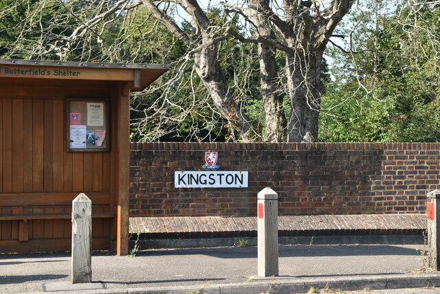
Bishopsbourne is a small village located in the county of Kent, England. Situated about five miles south-east of Canterbury, the village is nestled in the picturesque countryside of the Elham Valley. It is part of the civil parish of Bishopsbourne and Kingston, which also includes the neighboring village of Kingston.

The history of Bishopsbourne can be traced back to the Roman era, with evidence of Roman pottery and coins discovered in the area. The village takes its name from the nearby watercourse, the Nailbourn River, which derives from the Old English words "nægl" meaning nail, and "burna" meaning brook. Interestingly, the river was known for its iron-rich waters that turned objects a reddish-brown color, resembling the color of rusted nails.

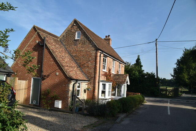
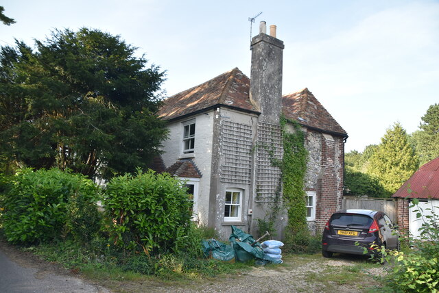
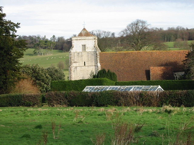
The village is known for its charming, traditional architecture, with many historic buildings dating back to the 17th and 18th centuries. St. Mary's Church, a Grade I listed building, is a prominent feature in the village and has a rich history dating back to the 12th century.

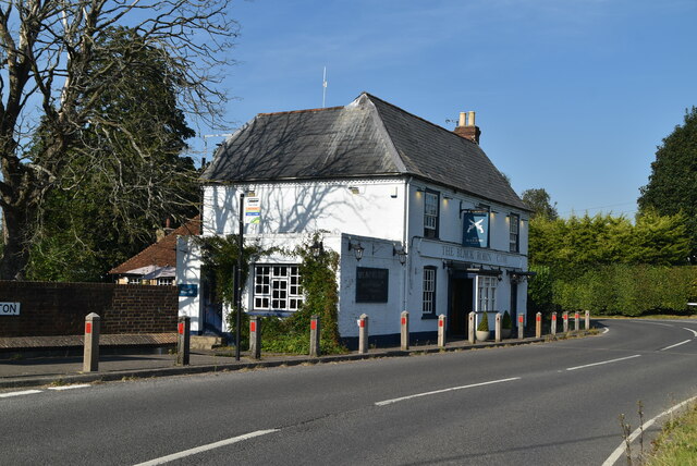
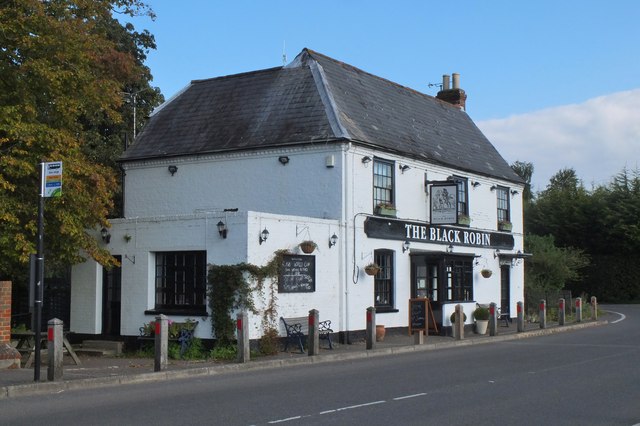
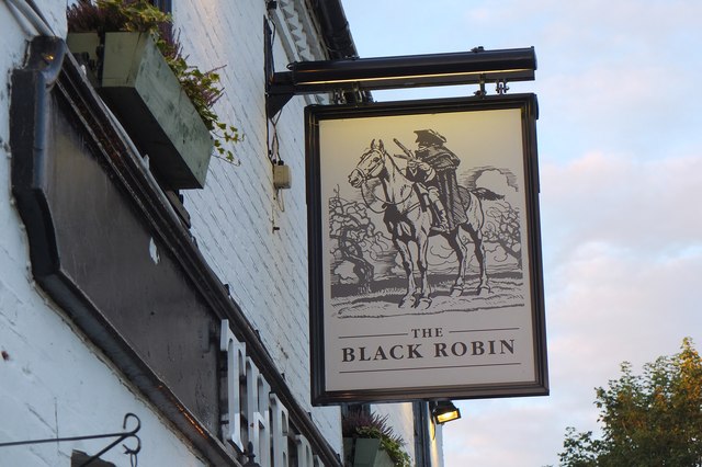
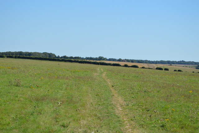
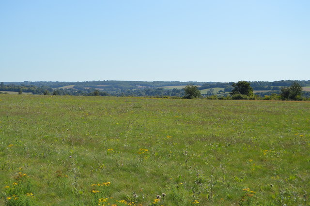
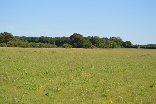
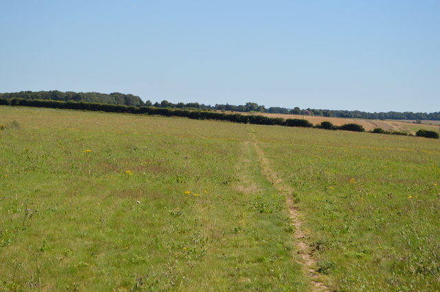
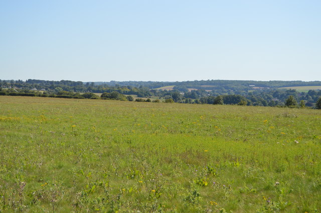
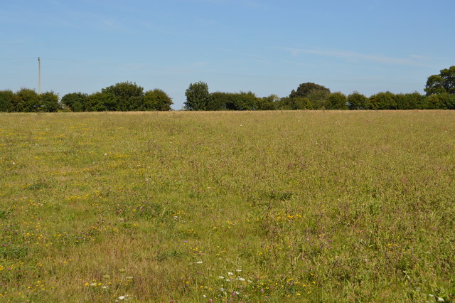
Surrounded by rolling hills and lush green fields, Bishopsbourne offers a tranquil and idyllic setting. The village is home to a close-knit community and has a primary school, a village hall, and a local pub. The surrounding countryside provides ample opportunities for outdoor activities such as walking, cycling, and horse riding.

Overall, Bishopsbourne is a quintessential English village that boasts a rich history, stunning natural beauty, and a strong sense of community. It offers a peaceful retreat while still being conveniently located near the bustling city of Canterbury.

If you have any feedback on the listing, please let us know in the comments section below.

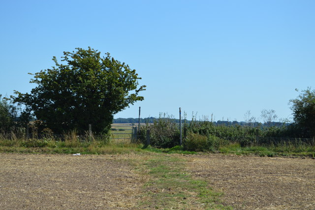
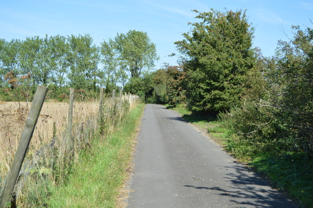
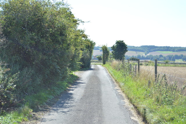
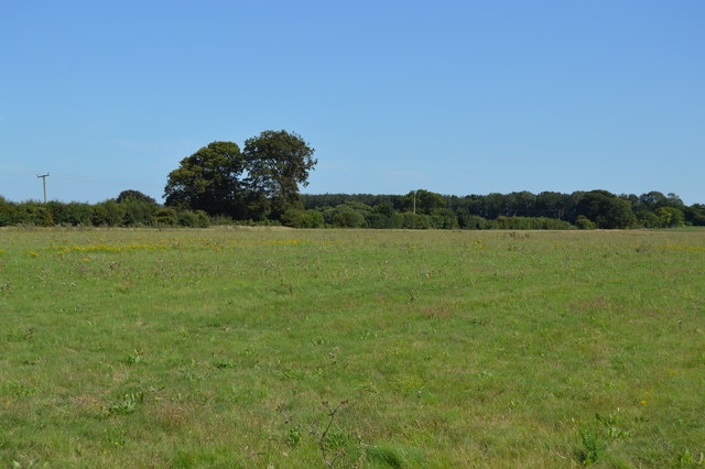
Bishopsbourne Images

Images are sourced within 2km of 51.230618/1.133187 or Grid Reference TR1852. Thanks to Geograph Open Source API. All images are credited.

The Black Robin Grade II listed.
The Black Robin
Grade II listed.
Kingston sign Kingston is a small village in the Elham Valley, 5 miles SE of Canterbury.
Wikipedia: <span class="nowrap"><a title="https://en.wikipedia.org/wiki/Kingston,_Kent" rel="nofollow ugc noopener" href="https://en.wikipedia.org/wiki/Kingston,_Kent">Link</a><img style="margin-left:2px;" alt="External link" title="External link - shift click to open in new window" src="https://s1.geograph.org.uk/img/external.png" width="10" height="10"/></span>
Kingston sign
Kingston is a small village in the Elham Valley, 5 miles SE of Canterbury. Wikipedia: LinkExternal link
The Old Post Office Cottage Kingston is a small village in the Elham Valley, 5 miles SE of Canterbury.
Wikipedia: <span class="nowrap"><a title="https://en.wikipedia.org/wiki/Kingston,_Kent" rel="nofollow ugc noopener" href="https://en.wikipedia.org/wiki/Kingston,_Kent">Link</a><img style="margin-left:2px;" alt="External link" title="External link - shift click to open in new window" src="https://s1.geograph.org.uk/img/external.png" width="10" height="10"/></span>
The Old Post Office Cottage
Kingston is a small village in the Elham Valley, 5 miles SE of Canterbury. Wikipedia: LinkExternal link
The Old Forge Kingston is a small village in the Elham Valley, 5 miles SE of Canterbury.
Wikipedia: <span class="nowrap"><a title="https://en.wikipedia.org/wiki/Kingston,_Kent" rel="nofollow ugc noopener" href="https://en.wikipedia.org/wiki/Kingston,_Kent">Link</a><img style="margin-left:2px;" alt="External link" title="External link - shift click to open in new window" src="https://s1.geograph.org.uk/img/external.png" width="10" height="10"/></span>
The Old Forge
Kingston is a small village in the Elham Valley, 5 miles SE of Canterbury. Wikipedia: LinkExternal link
The Black Robin Public house on the road to Bridge.
The Black Robin
Public house on the road to Bridge.
Black Robin Inn sign, Kingston The pub dates back to 1741 and according to legend, Black Robin was a notorious highwayman who eventually met his end on the gallows at Barham Cross Roads. There is also a connection with smugglers who sold their goods tax-free here. See the pub's website <span class="nowrap"><a title="http://www.theblackrobinpub.com/the-legend-of-the-black-robin.html" rel="nofollow ugc noopener" href="http://www.theblackrobinpub.com/the-legend-of-the-black-robin.html">Link</a><img style="margin-left:2px;" alt="External link" title="External link - shift click to open in new window" src="https://s1.geograph.org.uk/img/external.png" width="10" height="10"/></span> for more on the legend of the Black Robin.
Black Robin Inn sign, Kingston
The pub dates back to 1741 and according to legend, Black Robin was a notorious highwayman who eventually met his end on the gallows at Barham Cross Roads. There is also a connection with smugglers who sold their goods tax-free here. See the pub's website LinkExternal link for more on the legend of the Black Robin.
Telecom mast
Telecom mast
Telecom mast
Telecom mast
North Downs Way A long distance path in southern England. It runs from Farnham to Dover, past Godalming, Guildford, Dorking, Merstham, Otford and Rochester, along the Surrey Hills Area of Outstanding Natural Beauty (AONB) and Kent Downs AONB. East of Boughton Lees, the path splits in two, the northern section running via Canterbury and the southern via Wye. The two sections of the path reunite at Dover. The northern route is 211 km long, and the southern route 201 km, the total length of the North Downs Way being 246 km.
The pathway is mixed in that it varies throughout its length from footpath status to bridleway, byway and road. Some 19% of the Way follows roads, though 75% of those are minor lanes. It is marked by an acorn. See <a href="https://www.geograph.org.uk/photo/1165027">TQ6561 : Crossover in Long Distance pathways</a>.
See <span class="nowrap"><a title="http://www.nationaltrail.co.uk/Northdowns/" rel="nofollow ugc noopener" href="http://www.nationaltrail.co.uk/Northdowns/">Link</a><img style="margin-left:2px;" alt="External link" title="External link - shift click to open in new window" src="https://s1.geograph.org.uk/img/external.png" width="10" height="10"/></span> for more details and an interactive map of the trail.
North Downs Way
A long distance path in southern England. It runs from Farnham to Dover, past Godalming, Guildford, Dorking, Merstham, Otford and Rochester, along the Surrey Hills Area of Outstanding Natural Beauty (AONB) and Kent Downs AONB. East of Boughton Lees, the path splits in two, the northern section running via Canterbury and the southern via Wye. The two sections of the path reunite at Dover. The northern route is 211 km long, and the southern route 201 km, the total length of the North Downs Way being 246 km. The pathway is mixed in that it varies throughout its length from footpath status to bridleway, byway and road. Some 19% of the Way follows roads, though 75% of those are minor lanes. It is marked by an acorn. See TQ6561 : Crossover in Long Distance pathways. See LinkExternal link for more details and an interactive map of the trail.
Lane crossing the North Downs Way
Lane to the A2
Lane to the A2
Barham Downs
Barham Downs
North Downs Way A long distance path in southern England. It runs from Farnham to Dover, past Godalming, Guildford, Dorking, Merstham, Otford and Rochester, along the Surrey Hills Area of Outstanding Natural Beauty (AONB) and Kent Downs AONB. East of Boughton Lees, the path splits in two, the northern section running via Canterbury and the southern via Wye. The two sections of the path reunite at Dover. The northern route is 211 km long, and the southern route 201 km, the total length of the North Downs Way being 246 km.
The pathway is mixed in that it varies throughout its length from footpath status to bridleway, byway and road. Some 19% of the Way follows roads, though 75% of those are minor lanes. It is marked by an acorn. See <a href="https://www.geograph.org.uk/photo/1165027">TQ6561 : Crossover in Long Distance pathways</a>.
See <span class="nowrap"><a title="http://www.nationaltrail.co.uk/Northdowns/" rel="nofollow ugc noopener" href="http://www.nationaltrail.co.uk/Northdowns/">Link</a><img style="margin-left:2px;" alt="External link" title="External link - shift click to open in new window" src="https://s1.geograph.org.uk/img/external.png" width="10" height="10"/></span> for more details and an interactive map of the trail.
North Downs Way
A long distance path in southern England. It runs from Farnham to Dover, past Godalming, Guildford, Dorking, Merstham, Otford and Rochester, along the Surrey Hills Area of Outstanding Natural Beauty (AONB) and Kent Downs AONB. East of Boughton Lees, the path splits in two, the northern section running via Canterbury and the southern via Wye. The two sections of the path reunite at Dover. The northern route is 211 km long, and the southern route 201 km, the total length of the North Downs Way being 246 km. The pathway is mixed in that it varies throughout its length from footpath status to bridleway, byway and road. Some 19% of the Way follows roads, though 75% of those are minor lanes. It is marked by an acorn. See TQ6561 : Crossover in Long Distance pathways. See LinkExternal link for more details and an interactive map of the trail.
Chalk grassland
Chalk grassland
Chalk grassland
Chalk grassland
North Downs Way A long distance path in southern England. It runs from Farnham to Dover, past Godalming, Guildford, Dorking, Merstham, Otford and Rochester, along the Surrey Hills Area of Outstanding Natural Beauty (AONB) and Kent Downs AONB. East of Boughton Lees, the path splits in two, the northern section running via Canterbury and the southern via Wye. The two sections of the path reunite at Dover. The northern route is 211 km long, and the southern route 201 km, the total length of the North Downs Way being 246 km.
The pathway is mixed in that it varies throughout its length from footpath status to bridleway, byway and road. Some 19% of the Way follows roads, though 75% of those are minor lanes. It is marked by an acorn. See <a href="https://www.geograph.org.uk/photo/1165027">TQ6561 : Crossover in Long Distance pathways</a>.
See <span class="nowrap"><a title="http://www.nationaltrail.co.uk/Northdowns/" rel="nofollow ugc noopener" href="http://www.nationaltrail.co.uk/Northdowns/">Link</a><img style="margin-left:2px;" alt="External link" title="External link - shift click to open in new window" src="https://s1.geograph.org.uk/img/external.png" width="10" height="10"/></span> for more details and an interactive map of the trail.
North Downs Way
A long distance path in southern England. It runs from Farnham to Dover, past Godalming, Guildford, Dorking, Merstham, Otford and Rochester, along the Surrey Hills Area of Outstanding Natural Beauty (AONB) and Kent Downs AONB. East of Boughton Lees, the path splits in two, the northern section running via Canterbury and the southern via Wye. The two sections of the path reunite at Dover. The northern route is 211 km long, and the southern route 201 km, the total length of the North Downs Way being 246 km. The pathway is mixed in that it varies throughout its length from footpath status to bridleway, byway and road. Some 19% of the Way follows roads, though 75% of those are minor lanes. It is marked by an acorn. See TQ6561 : Crossover in Long Distance pathways. See LinkExternal link for more details and an interactive map of the trail.
Chalk Grassland
Chalk Grassland
Indistinct path
Indistinct path
Show me another place!

Bishopsbourne is located at Grid Ref: TR1852 (Lat: 51.230618, Lng: 1.133187)

Administrative County: Kent

District: Canterbury

Police Authority: Kent

What 3 Words

///elbow.nicknames.honestly. Near Bridge, Kent

Related Wikis

Bishopsbourne

Bishopsbourne is a mostly rural and wooded village and civil parish in Kent, England. It has two short developed sections of streets at the foot of the...

Bishopsbourne railway station

Bishopsbourne was a station on the Elham Valley Railway. It opened in 1889 and closed to passengers in 1940 and freight in 1947. == History == The station...

Bourne Paddock

Bourne Paddock was a cricket ground at Bourne Park House, the seat of Sir Horatio Mann, at Bishopsbourne around 4 miles (6.4 km) south-east of Canterbury...
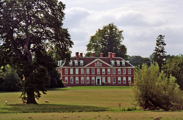
Bourne Park House

Bourne Park House is a Queen Anne style country house on Bourne Park Road, between Bishopsbourne and Bridge near Canterbury in Kent. Built in 1701, it...

Higham Park

Higham Park is a Grade II* listed neoclassical style house and gardens, located at Bridge, Kent, 3 miles (4.8 km) south of Canterbury. == History... ==

Kingston, Kent

Kingston is a village and civil parish between Canterbury and Dover in Kent, South East England. The parish contains the hamlet of Marley. == History... ==

Bridge, Kent

Bridge is a village and civil parish near Canterbury in Kent, South East England. Bridge village is in the Nailbourne valley in a rural setting on the...
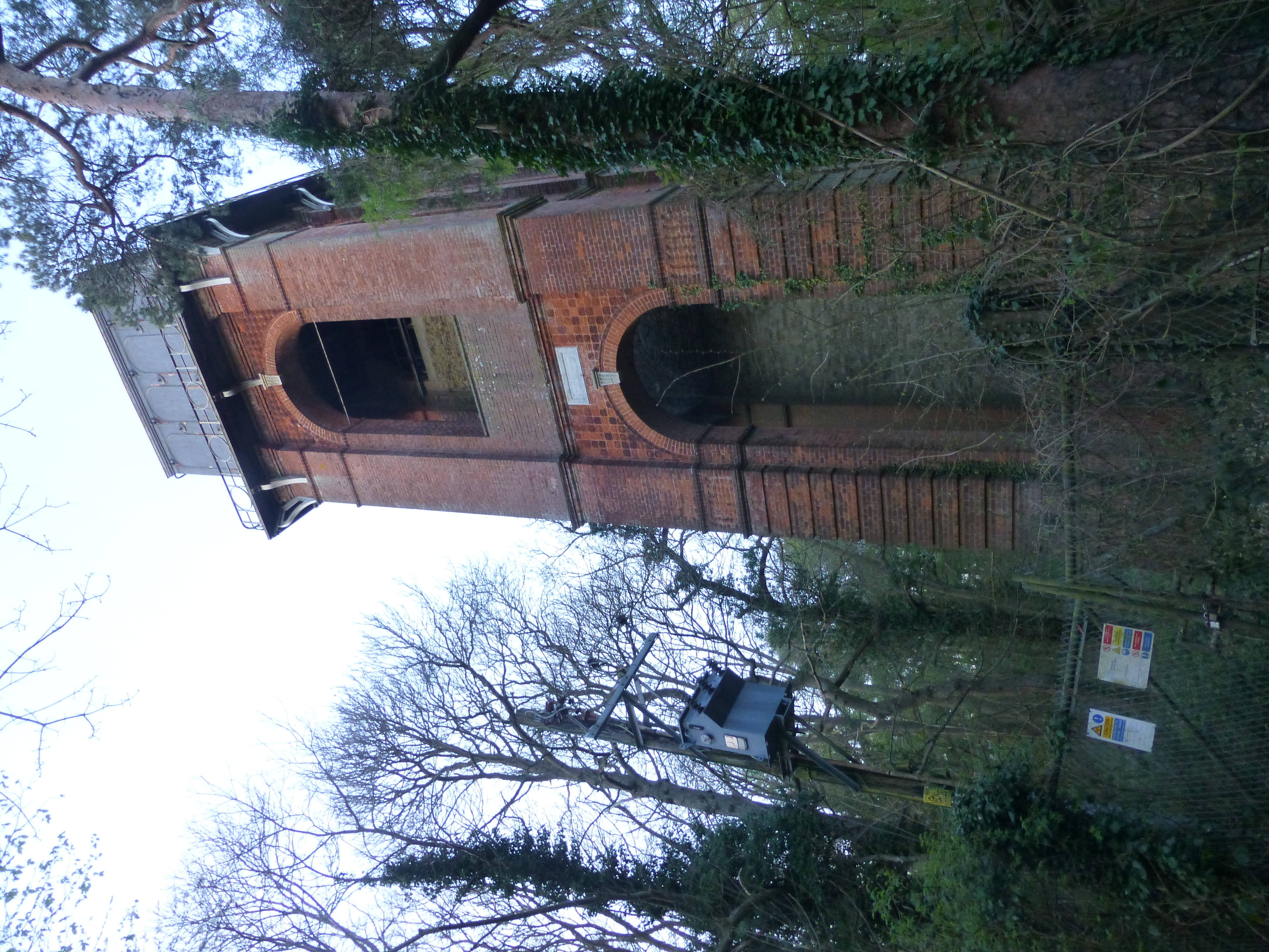
Adisham Water Tower

Adisham Water Tower is a Grade II listed building located in the parish of Adisham, Kent. The structure was built in 1903 in an Edwardian Italianate Revival...

Related Videos

Bridge Patrixbourne Bishopsbourne Village, a Walking History Tour Guide Using Old Postcards Kent UK

Bridge, Patrixbourne, Bishopsbourne Village, Kent, UK, A walking history tour guide of Bridge, Patrixbourne, Bishopsbourne ...

5 miles around Bishopsbourne in Kent

5 mile hike around this pretty village.

Dancing in the garden 🪴

canterbury #kent #dreamyescapes #gardening #gardenofdreams #englishgardens #honeymoon.

Nearby Amenities

Located within 500m of 51.230618,1.133187
Bishopsbourne
Is In: Kent, England, UK
Place: village
Source: survey
Lat/Long: 51.2302312/1.1336489
Townhall
Bishopsbourne Village Hall
Lat/Long: 51.2301815/1.1351255
Pub
Mermaid Inn
Addr City: Canterbury
Addr Postcode: CT4 5HX
Addr Street: The Street
Addr Village: Bishopsbourne
Contact Phone: +44 1227 830581
Contact Twitter: TheMedmaidInn1
Contact Website: https://www.mermaidinnbishopsbourne.co.uk/
Fhrs Id: 1274310
Opening Hours: Mo-Tu 18:00-23:00;We-Fr 12:00-15:00,18:00-23:00;Sa 12:00-23:00;Su 12:00-18:30
Source Addr: FHRS Open Data
Lat/Long: 51.229455/1.1358641
Post Box
Post Box Mounting: brick_pillar
Post Box Type: wall
Postal Code: CT4
Ref: CT4 201
Source: survey
Lat/Long: 51.2294454/1.135983
Bisshishopsbourne
Historic Railway: station
Note: Now a private residence
Railway: site
Source: Bing
Lat/Long: 51.2291616/1.1288656
Worgans Farm Shop
Addr City: Canterbury
Addr Housename: Court Lodge Farm
Addr Postcode: CT4 5HU
Addr Street: Frog Lane
Addr Village: Bishopsbourne
Contact Facebook: https://www.facebook.com/worgansbutchers/
Contact Website: http://www.worgans.co.uk/
Fhrs Id: 1132675
Opening Hours: Mo-Sa 08:00-16:00
Organic: yes
Phone: +44 1227 832814
Shop: farm
Source Addr: FHRS Open Data
Lat/Long: 51.2323475/1.1355846
Barrier: kissing_gate
Foot: yes
Locked: no
Material: metal
Wheelchair: no
Lat/Long: 51.2325881/1.1347193
Cafe
Tadpoles Tea Room
Addr City: Bishopsbourne
Addr Housename: Court Lodge Farm
Addr Postcode: CT4 5HU
Addr Street: Frog Lane
Opening Hours: Tu-Su 08:30-17:00
Outdoor Seating: yes
Phone: +44 1227 830178
Website: https://www.tadpoletearoom.com/
Lat/Long: 51.2320663/1.1357251
Telephone
Booth: K6
Covered: booth
Listed Status: Grade II
Lat/Long: 51.2293584/1.1359174
Leisure: playground
Lat/Long: 51.2302474/1.135559
Gilda Bakery
Addr City: Bishopsbourne
Addr Housename: Court Lodge Farm
Addr Postcode: CT4 5HU
Addr Street: Frog Lane
Addr Unit: 1
Contact Phone: 01227 531235
Contact Website: https://gildabakery.com/
Fhrs Id: 1520923
Opening Hours: We-Sa 08:00-14:00; Su 08:00-12:30
Shop: bakery
Lat/Long: 51.2321086/1.1355011
Entrance: yes
Lat/Long: 51.2321294/1.1355342
Entrance: yes
Lat/Long: 51.2321294/1.1356648
Access: customers
Entrance: yes
Lat/Long: 51.2323265/1.1356131
Access: customers
Entrance: yes
Lat/Long: 51.2323833/1.1355982
The data included in this document is from www.openstreetmap.org. The data is made available under ODbL.

Have you been to Bishopsbourne?

Leave your review of Bishopsbourne below (or comments, questions and feedback).