Bishopsgarth

Settlement in Durham

England

Bishopsgarth

Rothwell Crescent, Roseworth, Stockton
Rothwell Crescent, Roseworth, Stockton Credit: David Robinson

Bishopsgarth is a small residential area located in Durham, England. Situated in the western part of the city, it is approximately two miles away from the city center. The neighborhood is nestled between the A167 road to the west and the River Wear to the east, providing easy access to both the city and the scenic countryside.

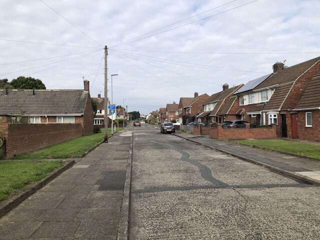
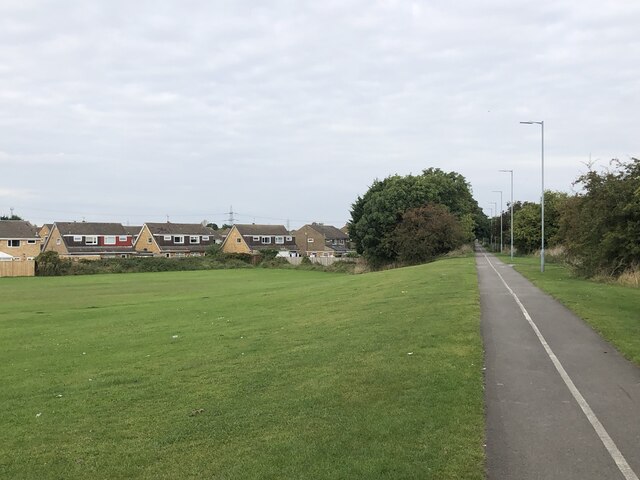
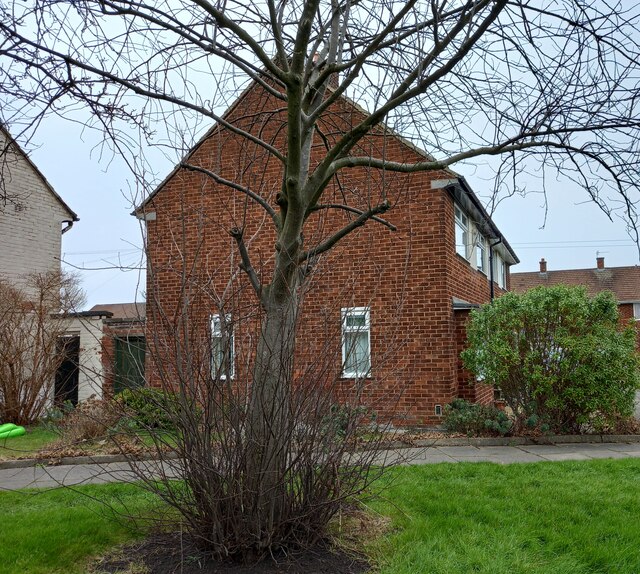
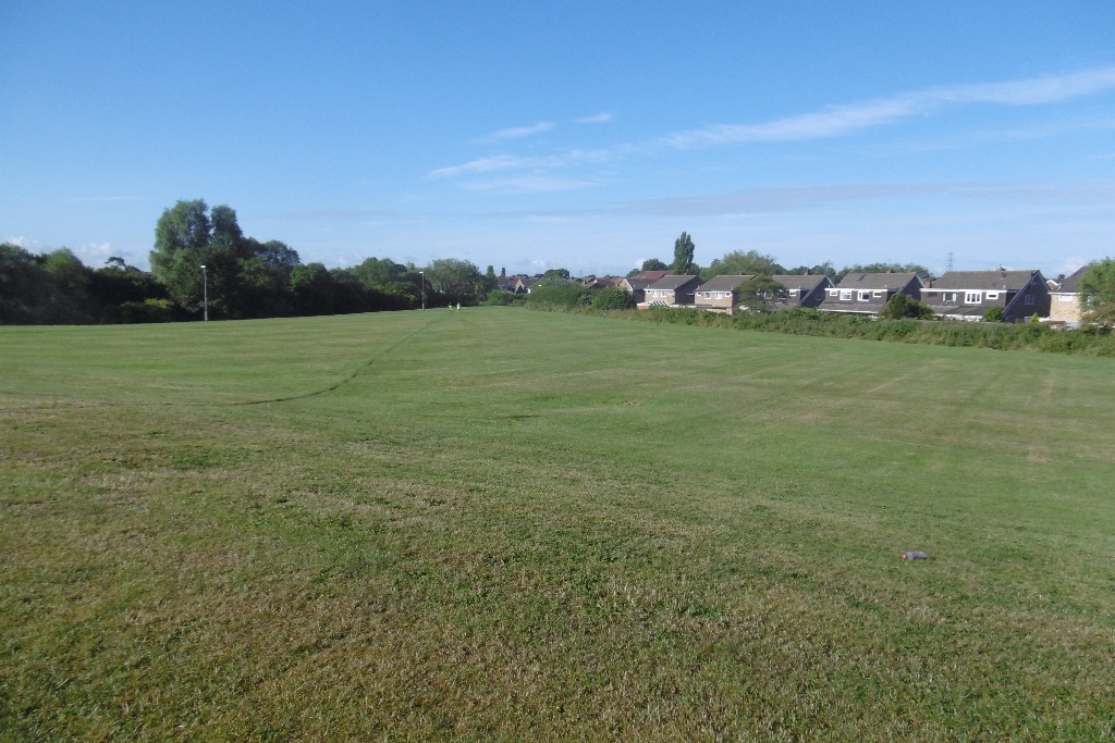
Bishopsgarth is predominantly a residential area, with a mix of housing options including detached houses, semi-detached houses, and terraced houses. The architecture varies, from modern developments to more traditional-style homes, giving the area a diverse and charming character. The neighborhood is known for its well-maintained streets, green spaces, and general sense of tranquility.

Residents of Bishopsgarth enjoy a range of amenities in the surrounding area. There are several local shops and convenience stores nearby, providing easy access to everyday essentials. The area also benefits from good transportation links, with regular bus services connecting it to the city center and other surrounding areas.

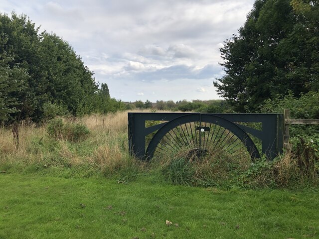
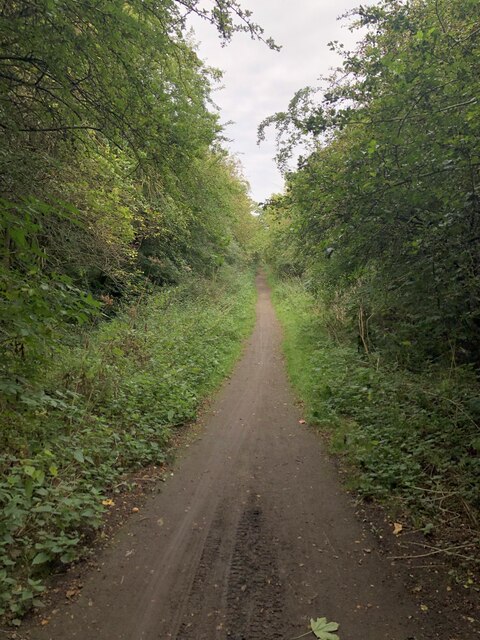
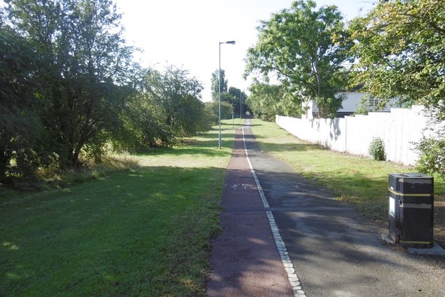
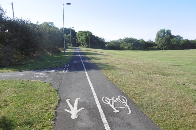
For recreational activities, Bishopsgarth is close to a number of parks and green spaces where residents can enjoy outdoor pursuits. The nearby Riverside Park offers beautiful riverside walks and picnic spots, while the broader Durham countryside is easily accessible for those seeking more extensive outdoor adventures.

Overall, Bishopsgarth offers a peaceful and well-connected residential environment, making it an attractive place to live for families and professionals seeking a balance between city and country living.

If you have any feedback on the listing, please let us know in the comments section below.
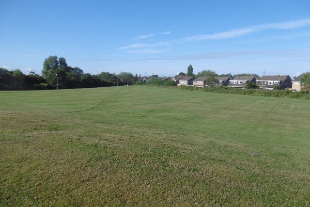
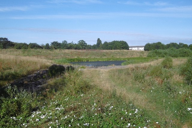
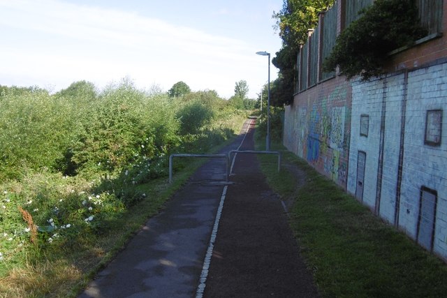
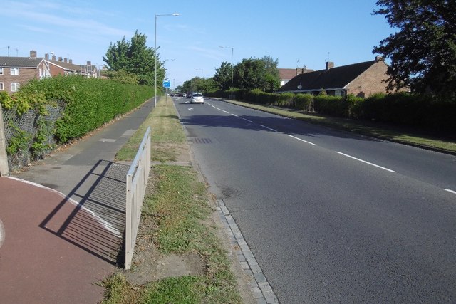
Bishopsgarth Images

Images are sourced within 2km of 54.578026/-1.359478 or Grid Reference NZ4120. Thanks to Geograph Open Source API. All images are credited.

Rothwell Crescent, Roseworth, Stockton
Overgrown Entrance to Nature Reserve Gated entrance that doesn't appear to see a lot of use at the north end of Hardwick Dene & Elm Tree Woods Nature Reserve. The reserve lies within urban Stockton, behind the site of the General Hospital.
Overgrown Entrance to Nature Reserve
Gated entrance that doesn't appear to see a lot of use at the north end of Hardwick Dene & Elm Tree Woods Nature Reserve. The reserve lies within urban Stockton, behind the site of the General Hospital.
Pedestrian & Cycle Route Part of the National Cycle Route 1, this stretch of former railway line was an early example of electrification in Britain. The route was part of the Shildon - Newport (Middlesbrough) line that was electrified by NER in 1915 using 1500 V DC overhead. The electrification was removed in 1935, reduced coal traffic making renewal / upgrade uneconomic.
Pedestrian & Cycle Route
Part of the National Cycle Route 1, this stretch of former railway line was an early example of electrification in Britain. The route was part of the Shildon - Newport (Middlesbrough) line that was electrified by NER in 1915 using 1500 V DC overhead. The electrification was removed in 1935, reduced coal traffic making renewal / upgrade uneconomic.
National Cycle Route 1, Former Castle Eden Branch Former railway now used as the National Cycle Route 1. This Castle Eden Railway didn't actually pass through Castle Eden, it ran from Bowesfield Junction, Stockton to Wingate where the line continued onward to Sunderland via the Durham & Sunderland Railway.
National Cycle Route 1, Former Castle Eden Branch
Former railway now used as the National Cycle Route 1. This Castle Eden Railway didn't actually pass through Castle Eden, it ran from Bowesfield Junction, Stockton to Wingate where the line continued onward to Sunderland via the Durham & Sunderland Railway.
Bridge over Former Castle Eden Railway The bridge carries Letch Lane over  the former Castle Eden Railway, now part of the National Cycle Route 1.
Bridge over Former Castle Eden Railway
The bridge carries Letch Lane over the former Castle Eden Railway, now part of the National Cycle Route 1.
Norton, 89 Renvyle Avenue The OS Flush Bracket, S8808, is embedded into the south west facing wall of the private house.
Norton, 89 Renvyle Avenue
The OS Flush Bracket, S8808, is embedded into the south west facing wall of the private house.
Norton, 89 Renvyle Avenue The OS Flush Bracket, S8808, is embedded into the south west facing wall of the private house. It can be seen at the bottom right of the gable end.
Norton, 89 Renvyle Avenue
The OS Flush Bracket, S8808, is embedded into the south west facing wall of the private house. It can be seen at the bottom right of the gable end.
Embanked reservoir near Coalgarth Farm. Looking roughly south east towards the reservoir from Redmarshall Road. Two corners of the embankment can be seen. The reservoir is capped and grassed on top; hence it is not shown in blue on the OS map.
Embanked reservoir near Coalgarth Farm.
Looking roughly south east towards the reservoir from Redmarshall Road. Two corners of the embankment can be seen. The reservoir is capped and grassed on top; hence it is not shown in blue on the OS map.
Stockton and Castle Eden Branch trackbed The site of Carlton South Junction where a curve left to join the West Hartlepool Branch of the North Eastern Railway.  Now a cycle / walking route.
Stockton and Castle Eden Branch trackbed
The site of Carlton South Junction where a curve left to join the West Hartlepool Branch of the North Eastern Railway. Now a cycle / walking route.
Bridge, Letch Lane Over the Castle Eden Branch trackbed north of Stockton.
Bridge, Letch Lane
Over the Castle Eden Branch trackbed north of Stockton.
Castle Eden Branch trackbed The path is quite narrow on this first bit of rural rails to trails conversion north of Stockton.
Castle Eden Branch trackbed
The path is quite narrow on this first bit of rural rails to trails conversion north of Stockton.
Harrogate Road, Stockton The edge of Stockton. The road once crossed the Castle Eden Railway by a bridge here.
Harrogate Road, Stockton
The edge of Stockton. The road once crossed the Castle Eden Railway by a bridge here.
Site of the Stockton and Castle Eden Branch Now in  urban Stockton, the railway trackbed is used as path.  This is the start of over 30km of urban riding during which the half (if lucky) of the path for bikes kept swapping over.
Site of the Stockton and Castle Eden Branch
Now in urban Stockton, the railway trackbed is used as path. This is the start of over 30km of urban riding during which the half (if lucky) of the path for bikes kept swapping over.
Path, Stockton Really too narrow to split in two like this.  There is a vast area of mown grass on the right. The 1953 1:25,000 map shows farmland on either side of the railway.
Path, Stockton
Really too narrow to split in two like this. There is a vast area of mown grass on the right. The 1953 1:25,000 map shows farmland on either side of the railway.
Mown area, Bishopsgarth Farmland on the 1953 1:25,000 map.
Mown area, Bishopsgarth
Farmland on the 1953 1:25,000 map.
Hardwick Dene and Elmtree Woods Nature Reserve Near the site of High Newham Farm, a wetland area.
Hardwick Dene and Elmtree Woods Nature Reserve
Near the site of High Newham Farm, a wetland area.
Path passing Butterwick Hospice Hardwick Dene and Elmtree Woods Nature Reserve on the left.
Path passing Butterwick Hospice
Hardwick Dene and Elmtree Woods Nature Reserve on the left.
Durham Road, Stockton A cycle path emerges from the left.
Durham Road, Stockton
A cycle path emerges from the left.
Show me another place!

Bishopsgarth is located at Grid Ref: NZ4120 (Lat: 54.578026, Lng: -1.359478)

Unitary Authority: Stockton-on-Tees

Police Authority: Cleveland

What 3 Words

///pull.deed.double. Near Carlton, Co. Durham

Nearby Locations

Bishopsgarth

Related Wikis

Bishopsgarth

Bishopsgarth is a west Stockton area in the borough of Stockton-on-Tees, County Durham, England. It is part of Bishopsgarth and Elm Tree Ward, which had...

Outwood Academy Bishopsgarth

Outwood Academy Bishopsgarth (formerly Bishopsgarth School) is a comprehensive secondary school with academy status in the Bishopsgarth area of Stockton...

Elm Tree Farm

Elm Tree Farm is a west Stockton area in the borough of Stockton-on-Tees, County Durham, northern England. Whitehouse Primary School is in the area. It...

University Hospital of North Tees

The University Hospital of North Tees is a general hospital in Stockton-on-Tees, England which provides healthcare to people living in the south east of...

Nearby Amenities

Located within 500m of 54.578026,-1.359478
Crossing
Crossing: island
Lat/Long: 54.5757771/-1.3569357
Bus Stop
Darlington Back Lane
Local Ref: 1
Lat/Long: 54.5745253/-1.3608765
Junction: yes
Lat/Long: 54.5772553/-1.3521096
Turning Circle
Lat/Long: 54.5735965/-1.3586824
Direction: both
Traffic Calming: cushion
Lat/Long: 54.5762503/-1.3610592
Direction: both
Traffic Calming: cushion
Lat/Long: 54.5754161/-1.3608965
Traffic Calming: cushion
Lat/Long: 54.579377/-1.360614
Traffic Calming: cushion
Lat/Long: 54.5799166/-1.3604606
Traffic Calming: cushion
Lat/Long: 54.5810575/-1.3610767
Sainsbury's Local
Addr City: Stockton-on-Tees
Addr Country: GB
Addr Housenumber: 1-3
Addr Postcode: TS19 8XQ
Addr Street: Marske Parade
Brand: Sainsbury's Local
Brand Wikidata: Q13218434
Brand Wikipedia: en:Sainsbury's Local
Fhrs Id: 251678
Shop: convenience
Source Addr: FHRS Open Data
Website: https://stores.sainsburys.co.uk/4615/bishopsgarth-local
Lat/Long: 54.5780633/-1.3607587
Traffic Calming: choker
Lat/Long: 54.5823325/-1.3595001
Public Transport: stop_position
Lat/Long: 54.5813208/-1.3554629
Traffic Calming: hump
Lat/Long: 54.5816027/-1.3558885
Bus: yes
Public Transport: stop_position
Lat/Long: 54.5745072/-1.3563143
Bus Stop
Bus: yes
Naptan AtcoCode: 077072475B
Naptan NaptanCode: sktdmpd
Public Transport: platform
Lat/Long: 54.5760319/-1.3647931
Crossing
Bicycle: yes
Crossing: traffic_signals
Crossing Ref: toucan
Lat/Long: 54.5793316/-1.3638988
Barrier: bollard
Bicycle: yes
Bollard: foldable
Foot: yes
Horse: yes
Maxwidth: 1
Motor Vehicle: no
Lat/Long: 54.575948/-1.3549842
Barrier: cycle_barrier
Bicycle: yes
Foot: yes
Horse: yes
Maxwidth: 1
Lat/Long: 54.576392/-1.3554203
Direction: both
Traffic Calming: hump
Lat/Long: 54.5780176/-1.3626805
Bus Stop
Darlington Back Lane
Local Ref: 2
Lat/Long: 54.5743353/-1.3607265
Bus Stop
Darlington Back Lane
Local Ref: 4
Lat/Long: 54.5754625/-1.3592767
Crossing
Crossing: uncontrolled
Lat/Long: 54.5751221/-1.3609767
Crossing
Crossing: island
Lat/Long: 54.5764897/-1.3540745
Bus Stop
Darlington Back Lane
Local Ref: 3
Lat/Long: 54.5751938/-1.3606009
Public Transport: stop_position
Lat/Long: 54.5797133/-1.3560163
Public Transport: stop_position
Lat/Long: 54.5798037/-1.3556054
Public Transport: stop_position
Lat/Long: 54.5815062/-1.3588319
Bus: yes
Public Transport: stop_position
Lat/Long: 54.5749793/-1.3564666
The Mitre (SB)
Bus: yes
Public Transport: stop_position
Lat/Long: 54.5760419/-1.3648592
Bus: yes
Public Transport: stop_position
Lat/Long: 54.5779206/-1.364321
Crossing
Crossing: traffic_signals
Lat/Long: 54.5802833/-1.3636071
Bus: yes
Public Transport: stop_position
Lat/Long: 54.5788072/-1.3640634
The Mitre (NB)
Bus: yes
Public Transport: stop_position
Lat/Long: 54.5758382/-1.3649178
Bus Stop
Kerb: raised
Public Transport: platform
Tactile Paving: yes
Lat/Long: 54.5797536/-1.3560225
Traffic Calming: cushion
Lat/Long: 54.5808139/-1.354691
Bus Stop
Naptan AtcoCode: 077072468B
Naptan NaptanCode: sktdmgd
Public Transport: platform
Tactile Paving: yes
Lat/Long: 54.5812907/-1.3555115
Bus Stop
Kerb: raised
Public Transport: platform
Tactile Paving: yes
Lat/Long: 54.5815292/-1.3587697
Bus Stop
Public Transport: platform
Lat/Long: 54.5797705/-1.355576
Generator Method: photovoltaic
Generator Output Electricity: yes
Generator Source: solar
Generator Type: solar_photovoltaic_panel
Location: roof
Power: generator
Lat/Long: 54.5768611/-1.354655
Generator Method: photovoltaic
Generator Output Electricity: yes
Generator Source: solar
Generator Type: solar_photovoltaic_panel
Location: roof
Power: generator
Lat/Long: 54.5768782/-1.3545933
Generator Method: photovoltaic
Generator Output Electricity: yes
Generator Source: solar
Generator Type: solar_photovoltaic_panel
Location: roof
Power: generator
Lat/Long: 54.5760822/-1.3535848
Generator Method: photovoltaic
Generator Output Electricity: yes
Generator Source: solar
Generator Type: solar_photovoltaic_panel
Location: roof
Power: generator
Lat/Long: 54.5751261/-1.3598424
Generator Method: photovoltaic
Generator Output Electricity: yes
Generator Source: solar
Generator Type: solar_photovoltaic_panel
Location: roof
Power: generator
Lat/Long: 54.5741964/-1.3592362
Generator Method: photovoltaic
Generator Output Electricity: yes
Generator Source: solar
Generator Type: solar_photovoltaic_panel
Location: roof
Power: generator
Lat/Long: 54.5752474/-1.3553631
Generator Method: photovoltaic
Generator Output Electricity: yes
Generator Source: solar
Generator Type: solar_photovoltaic_panel
Location: roof
Power: generator
Lat/Long: 54.5742648/-1.3555884
Generator Method: photovoltaic
Generator Output Electricity: yes
Generator Source: solar
Generator Type: solar_photovoltaic_panel
Location: roof
Power: generator
Lat/Long: 54.5743767/-1.3635466
Generator Method: photovoltaic
Generator Output Electricity: yes
Generator Source: solar
Generator Type: solar_photovoltaic_panel
Location: roof
Power: generator
Lat/Long: 54.5741077/-1.361728
Generator Method: photovoltaic
Generator Output Electricity: yes
Generator Source: solar
Generator Type: solar_photovoltaic_panel
Location: roof
Power: generator
Lat/Long: 54.5742446/-1.3610306
Generator Method: photovoltaic
Generator Output Electricity: yes
Generator Source: solar
Generator Type: solar_photovoltaic_panel
Location: roof
Power: generator
Lat/Long: 54.5746177/-1.3604862
Generator Method: photovoltaic
Generator Output Electricity: yes
Generator Source: solar
Generator Type: solar_photovoltaic_panel
Location: roof
Power: generator
Lat/Long: 54.5744078/-1.3602099
Generator Method: photovoltaic
Generator Output Electricity: yes
Generator Source: solar
Generator Type: solar_photovoltaic_panel
Location: roof
Power: generator
Lat/Long: 54.5745695/-1.3594186
Generator Method: photovoltaic
Generator Output Electricity: yes
Generator Source: solar
Generator Type: solar_photovoltaic_panel
Location: roof
Power: generator
Lat/Long: 54.574826/-1.3590673
Generator Method: photovoltaic
Generator Output Electricity: yes
Generator Source: solar
Generator Type: solar_photovoltaic_panel
Location: roof
Power: generator
Lat/Long: 54.5754464/-1.3606283
Generator Method: photovoltaic
Generator Output Electricity: yes
Generator Source: solar
Generator Type: solar_photovoltaic_panel
Location: roof
Power: generator
Lat/Long: 54.5754293/-1.360698
Generator Method: photovoltaic
Generator Output Electricity: yes
Generator Source: solar
Generator Type: solar_photovoltaic_panel
Location: roof
Power: generator
Lat/Long: 54.5754868/-1.3615
Generator Method: photovoltaic
Generator Output Electricity: yes
Generator Source: solar
Generator Type: solar_photovoltaic_panel
Location: roof
Power: generator
Lat/Long: 54.5762626/-1.3635278
Generator Method: photovoltaic
Generator Output Electricity: yes
Generator Source: solar
Generator Type: solar_photovoltaic_panel
Location: roof
Power: generator
Lat/Long: 54.5757604/-1.3602904
Generator Method: photovoltaic
Generator Output Electricity: yes
Generator Source: solar
Generator Type: solar_photovoltaic_panel
Location: roof
Power: generator
Lat/Long: 54.5762734/-1.3607463
Generator Method: photovoltaic
Generator Output Electricity: yes
Generator Source: solar
Generator Type: solar_photovoltaic_panel
Location: roof
Power: generator
Lat/Long: 54.5763465/-1.360741
Generator Method: photovoltaic
Generator Output Electricity: yes
Generator Source: solar
Generator Type: solar_photovoltaic_panel
Location: roof
Power: generator
Lat/Long: 54.5762968/-1.3612613
Generator Method: photovoltaic
Generator Output Electricity: yes
Generator Source: solar
Generator Type: solar_photovoltaic_panel
Location: roof
Power: generator
Lat/Long: 54.5761102/-1.3613901
Generator Method: photovoltaic
Generator Output Electricity: yes
Generator Source: solar
Generator Type: solar_photovoltaic_panel
Location: roof
Power: generator
Lat/Long: 54.5761055/-1.3613257
Generator Method: photovoltaic
Generator Output Electricity: yes
Generator Source: solar
Generator Type: solar_photovoltaic_panel
Location: roof
Power: generator
Lat/Long: 54.5769077/-1.3605613
Generator Method: photovoltaic
Generator Output Electricity: yes
Generator Source: solar
Generator Type: solar_photovoltaic_panel
Location: roof
Power: generator
Lat/Long: 54.5766652/-1.3607276
Generator Method: photovoltaic
Generator Output Electricity: yes
Generator Source: solar
Generator Type: solar_photovoltaic_panel
Location: roof
Power: generator
Lat/Long: 54.5766574/-1.3606498
Generator Method: photovoltaic
Generator Output Electricity: yes
Generator Source: solar
Generator Type: solar_photovoltaic_panel
Location: roof
Power: generator
Lat/Long: 54.5765269/-1.3611728
Generator Method: photovoltaic
Generator Output Electricity: yes
Generator Source: solar
Generator Type: solar_photovoltaic_panel
Location: roof
Power: generator
Lat/Long: 54.5765424/-1.3612452
Generator Method: photovoltaic
Generator Output Electricity: yes
Generator Source: solar
Generator Type: solar_photovoltaic_panel
Location: roof
Power: generator
Lat/Long: 54.5765921/-1.3612345
Generator Method: photovoltaic
Generator Output Electricity: yes
Generator Source: solar
Generator Type: solar_photovoltaic_panel
Location: roof
Power: generator
Lat/Long: 54.5765859/-1.3611648
Generator Method: photovoltaic
Generator Output Electricity: yes
Generator Source: solar
Generator Type: solar_photovoltaic_panel
Location: roof
Power: generator
Lat/Long: 54.576603/-1.362876
Generator Method: photovoltaic
Generator Output Electricity: yes
Generator Source: solar
Generator Type: solar_photovoltaic_panel
Location: roof
Power: generator
Lat/Long: 54.5765921/-1.3628063
Generator Method: photovoltaic
Generator Output Electricity: yes
Generator Source: solar
Generator Type: solar_photovoltaic_panel
Location: roof
Power: generator
Lat/Long: 54.5768176/-1.3639972
Generator Method: photovoltaic
Generator Output Electricity: yes
Generator Source: solar
Generator Type: solar_photovoltaic_panel
Location: roof
Power: generator
Lat/Long: 54.5768285/-1.3638148
Generator Method: photovoltaic
Generator Output Electricity: yes
Generator Source: solar
Generator Type: solar_photovoltaic_panel
Location: roof
Power: generator
Lat/Long: 54.5768129/-1.3637343
Generator Method: photovoltaic
Generator Output Electricity: yes
Generator Source: solar
Generator Type: solar_photovoltaic_panel
Location: roof
Power: generator
Lat/Long: 54.5770896/-1.3634661
Generator Method: photovoltaic
Generator Output Electricity: yes
Generator Source: solar
Generator Type: solar_photovoltaic_panel
Location: roof
Power: generator
Lat/Long: 54.5776073/-1.3623664
Generator Method: photovoltaic
Generator Output Electricity: yes
Generator Source: solar
Generator Type: solar_photovoltaic_panel
Location: roof
Power: generator
Lat/Long: 54.5776027/-1.362294
Generator Method: photovoltaic
Generator Output Electricity: yes
Generator Source: solar
Generator Type: solar_photovoltaic_panel
Location: roof
Power: generator
Lat/Long: 54.5775498/-1.3628519
Generator Method: photovoltaic
Generator Output Electricity: yes
Generator Source: solar
Generator Type: solar_photovoltaic_panel
Location: roof
Power: generator
Lat/Long: 54.577542/-1.3628143
Generator Method: photovoltaic
Generator Output Electricity: yes
Generator Source: solar
Generator Type: solar_photovoltaic_panel
Location: roof
Power: generator
Lat/Long: 54.5771689/-1.363855
Generator Method: photovoltaic
Generator Output Electricity: yes
Generator Source: solar
Generator Type: solar_photovoltaic_panel
Location: roof
Power: generator
Lat/Long: 54.5771658/-1.3637745
Generator Method: photovoltaic
Generator Output Electricity: yes
Generator Source: solar
Generator Type: solar_photovoltaic_panel
Location: roof
Power: generator
Lat/Long: 54.5772575/-1.3638335
Generator Method: photovoltaic
Generator Output Electricity: yes
Generator Source: solar
Generator Type: solar_photovoltaic_panel
Location: roof
Power: generator
Lat/Long: 54.577256/-1.3637611
Generator Method: photovoltaic
Generator Output Electricity: yes
Generator Source: solar
Generator Type: solar_photovoltaic_panel
Location: roof
Power: generator
Lat/Long: 54.5774301/-1.3638067
Generator Method: photovoltaic
Generator Output Electricity: yes
Generator Source: solar
Generator Type: solar_photovoltaic_panel
Location: roof
Power: generator
Lat/Long: 54.5774223/-1.3637048
Generator Method: photovoltaic
Generator Output Electricity: yes
Generator Source: solar
Generator Type: solar_photovoltaic_panel
Location: roof
Power: generator
Lat/Long: 54.5771285/-1.361095
Generator Method: photovoltaic
Generator Output Electricity: yes
Generator Source: solar
Generator Type: solar_photovoltaic_panel
Location: roof
Power: generator
Lat/Long: 54.5771192/-1.3610199
Generator Method: photovoltaic
Generator Output Electricity: yes
Generator Source: solar
Generator Type: solar_photovoltaic_panel
Location: roof
Power: generator
Lat/Long: 54.5773213/-1.3611031
Generator Method: photovoltaic
Generator Output Electricity: yes
Generator Source: solar
Generator Type: solar_photovoltaic_panel
Location: roof
Power: generator
Lat/Long: 54.5773104/-1.3610199
Generator Method: photovoltaic
Generator Output Electricity: yes
Generator Source: solar
Generator Type: solar_photovoltaic_panel
Location: roof
Power: generator
Lat/Long: 54.5779587/-1.363745
Generator Method: photovoltaic
Generator Output Electricity: yes
Generator Source: solar
Generator Type: solar_photovoltaic_panel
Location: roof
Power: generator
Lat/Long: 54.5795443/-1.3629189
Generator Method: photovoltaic
Generator Output Electricity: yes
Generator Source: solar
Generator Type: solar_photovoltaic_panel
Location: roof
Power: generator
Lat/Long: 54.5795319/-1.3628384
Generator Method: photovoltaic
Generator Output Electricity: yes
Generator Source: solar
Generator Type: solar_photovoltaic_panel
Location: roof
Power: generator
Lat/Long: 54.579535/-1.360352
Generator Method: photovoltaic
Generator Output Electricity: yes
Generator Source: solar
Generator Type: solar_photovoltaic_panel
Location: roof
Power: generator
Lat/Long: 54.5795226/-1.3602582
Generator Method: photovoltaic
Generator Output Electricity: yes
Generator Source: solar
Generator Type: solar_photovoltaic_panel
Location: roof
Power: generator
Lat/Long: 54.5798692/-1.3612559
Generator Method: photovoltaic
Generator Output Electricity: yes
Generator Source: solar
Generator Type: solar_photovoltaic_panel
Location: roof
Power: generator
Lat/Long: 54.5798568/-1.3612077
Generator Method: photovoltaic
Generator Output Electricity: yes
Generator Source: solar
Generator Type: solar_photovoltaic_panel
Location: roof
Power: generator
Lat/Long: 54.5804693/-1.3609394
Generator Method: photovoltaic
Generator Output Electricity: yes
Generator Source: solar
Generator Type: solar_photovoltaic_panel
Location: roof
Power: generator
Lat/Long: 54.5804817/-1.3608617
Generator Method: photovoltaic
Generator Output Electricity: yes
Generator Source: solar
Generator Type: solar_photovoltaic_panel
Location: roof
Power: generator
Lat/Long: 54.5814517/-1.3629806
Generator Method: photovoltaic
Generator Output Electricity: yes
Generator Source: solar
Generator Type: solar_photovoltaic_panel
Location: roof
Power: generator
Lat/Long: 54.5814486/-1.362927
Generator Method: photovoltaic
Generator Output Electricity: yes
Generator Source: solar
Generator Type: solar_photovoltaic_panel
Location: roof
Power: generator
Lat/Long: 54.5815714/-1.3621035
Generator Method: photovoltaic
Generator Output Electricity: yes
Generator Source: solar
Generator Type: solar_photovoltaic_panel
Location: roof
Power: generator
Lat/Long: 54.5815698/-1.3620311
Generator Method: photovoltaic
Generator Output Electricity: yes
Generator Source: solar
Generator Type: solar_photovoltaic_panel
Location: roof
Power: generator
Lat/Long: 54.5814828/-1.3611916
Generator Method: photovoltaic
Generator Output Electricity: yes
Generator Source: solar
Generator Type: solar_photovoltaic_panel
Location: roof
Power: generator
Lat/Long: 54.5816367/-1.3607973
Generator Method: photovoltaic
Generator Output Electricity: yes
Generator Source: solar
Generator Type: solar_photovoltaic_panel
Location: roof
Power: generator
Lat/Long: 54.5816009/-1.3607651
Crossing
Crossing: unmarked
Lat/Long: 54.5740783/-1.3559853
Bus Stop
Bench: yes
Bus: yes
Departures Board: timetable
Naptan AtcoCode: 077072400B
Naptan NaptanCode: sktawpd
Public Transport: platform
Shelter: yes
Lat/Long: 54.5745094/-1.3561751
Bus Stop
Bus: yes
Public Transport: platform
Lat/Long: 54.5749358/-1.356596
Barrier: kerb
Lat/Long: 54.5746813/-1.3543472
Direction: both
Traffic Calming: cushion
Lat/Long: 54.5788281/-1.3607717
Direction: both
Traffic Calming: cushion
Lat/Long: 54.5779062/-1.3615765
Direction: both
Traffic Calming: cushion
Lat/Long: 54.5781374/-1.3639222
Bus Stop
Bus: yes
Public Transport: platform
Lat/Long: 54.5787795/-1.3641437
Direction: both
Traffic Calming: cushion
Lat/Long: 54.5771301/-1.3607994
Bus Stop
Bus: yes
Naptan AtcoCode: 077072474B
Naptan NaptanCode: sktdmjw
Public Transport: platform
Lat/Long: 54.5779211/-1.3641935
Barrier: kerb
Kerb: flush
Tactile Paving: no
Lat/Long: 54.5771996/-1.3598036
Crossing
Crossing: unmarked
Lat/Long: 54.57732/-1.3607457
Crossing
Crossing: unmarked
Lat/Long: 54.5776364/-1.3611054
Crossing
Crossing: unmarked
Lat/Long: 54.5774944/-1.3605951
Crossing
Crossing: unmarked
Lat/Long: 54.5782017/-1.3607961
Barrier: bollard
Lat/Long: 54.577767/-1.3611512
Barrier: bollard
Lat/Long: 54.5777879/-1.3611602
Barrier: bollard
Lat/Long: 54.5778104/-1.361181
Barrier: bollard
Lat/Long: 54.5778271/-1.3612065
Barrier: bollard
Lat/Long: 54.5778388/-1.3612385
Barrier: bollard
Lat/Long: 54.5778482/-1.3612794
Barrier: bollard
Lat/Long: 54.5779471/-1.3611064
Barrier: bollard
Lat/Long: 54.5779241/-1.3611443
Barrier: bollard
Lat/Long: 54.5779117/-1.3611795
Barrier: bollard
Lat/Long: 54.5779057/-1.3612191
Post Box
Lat/Long: 54.5778303/-1.3609355
Waste Basket
Lat/Long: 54.5777978/-1.3609463
Barrier: kerb
Kerb: lowered
Lat/Long: 54.5780862/-1.3629517
Barrier: kerb
Kerb: lowered
Lat/Long: 54.5780723/-1.3627995
Barrier: kerb
Kerb: lowered
Lat/Long: 54.5779957/-1.3620582
Barrier: kerb
Kerb: lowered
Lat/Long: 54.5779778/-1.3618905
Traffic Calming: cushion
Lat/Long: 54.5817388/-1.361646
Bus Stop
Bus: yes
Naptan AtcoCode: 077072475A
Naptan NaptanCode: sktdmpa
Public Transport: platform
Lat/Long: 54.5758281/-1.365038
Barrier: kerb
Lat/Long: 54.5776233/-1.3635167
Barrier: kerb
Lat/Long: 54.5775119/-1.3635939
Barrier: kerb
Lat/Long: 54.5775857/-1.3635745
Crossing
Bicycle: yes
Crossing: traffic_signals
Crossing Ref: toucan
Lat/Long: 54.5763047/-1.3550652
Barrier: kerb
Lat/Long: 54.5810982/-1.3628777
Barrier: kerb
Lat/Long: 54.5810842/-1.3627386
Barrier: kerb
Lat/Long: 54.5770277/-1.3637273
Barrier: kerb
Lat/Long: 54.5770079/-1.3635641
Barrier: kerb
Lat/Long: 54.5768707/-1.3631236
Barrier: kerb
Lat/Long: 54.576929/-1.3630865
Barrier: kerb
Lat/Long: 54.5755299/-1.362359
Barrier: kerb
Lat/Long: 54.5755503/-1.3622422
Barrier: kerb
Lat/Long: 54.5764111/-1.3632519
Barrier: kerb
Lat/Long: 54.5763404/-1.3632726
Barrier: kerb
Lat/Long: 54.5758768/-1.3634038
Barrier: kerb
Lat/Long: 54.5758068/-1.3634227
Barrier: kerb
Lat/Long: 54.5753383/-1.3634145
Barrier: kerb
Lat/Long: 54.5753003/-1.3633399
Barrier: kerb
Lat/Long: 54.577419/-1.3625361
Barrier: kerb
Lat/Long: 54.5775076/-1.3625122
Barrier: kerb
Kerb: lowered
Lat/Long: 54.5779344/-1.3623609
Barrier: kerb
Kerb: lowered
Lat/Long: 54.5779577/-1.3625668
Barrier: kerb
Lat/Long: 54.5755263/-1.3538594
Barrier: kerb
Lat/Long: 54.5752148/-1.3564006
Barrier: kerb
Lat/Long: 54.5751707/-1.356376
Barrier: kerb
Lat/Long: 54.5749035/-1.3550429
Barrier: kerb
Lat/Long: 54.574973/-1.3550478
Barrier: kerb
Lat/Long: 54.574679/-1.354819
Barrier: kerb
Lat/Long: 54.5746085/-1.3548256
Barrier: kerb
Wheelchair: no
Lat/Long: 54.5771386/-1.3530339
Barrier: kerb
Wheelchair: no
Lat/Long: 54.57714/-1.3529456
Barrier: kerb
Kerb: lowered
Lat/Long: 54.5771911/-1.353085
Barrier: kerb
Kerb: lowered
Lat/Long: 54.5771961/-1.3529037
Barrier: kerb
Kerb: lowered
Lat/Long: 54.5771074/-1.3538457
Barrier: kerb
Kerb: lowered
Lat/Long: 54.5771494/-1.3538972
Barrier: kerb
Kerb: lowered
Lat/Long: 54.5803888/-1.3622517
Barrier: kerb
Wheelchair: limited
Lat/Long: 54.5803204/-1.3621515
Barrier: kerb
Kerb: lowered
Lat/Long: 54.5804626/-1.3622414
Barrier: kerb
Lat/Long: 54.5800699/-1.3623122
Barrier: kerb
Lat/Long: 54.5801287/-1.3622396
Barrier: kerb
Kerb: lowered
Lat/Long: 54.5771719/-1.3549133
Barrier: kerb
Kerb: lowered
Lat/Long: 54.5771727/-1.3547497
Barrier: kerb
Lat/Long: 54.5771004/-1.354869
Barrier: kerb
Lat/Long: 54.5771006/-1.3547943
Barrier: cycle_barrier
Lat/Long: 54.5788684/-1.3606499
Street Lamp
Lat/Long: 54.5759538/-1.3556792
Barrier: kerb
Wheelchair: no
Lat/Long: 54.5759535/-1.3557402
Traffic Signals
Crossing: no
Traffic Signals Direction: backward
Lat/Long: 54.5793748/-1.3638861
Traffic Signals
Crossing: no
Traffic Signals Direction: forward
Lat/Long: 54.5793094/-1.3639057
Traffic Signals
Crossing: no
Traffic Signals Direction: backward
Lat/Long: 54.5803222/-1.3635946
Traffic Signals
Crossing: no
Traffic Signals Direction: forward
Lat/Long: 54.5802537/-1.3636162
Bench
Backrest: no
Material: wood
Lat/Long: 54.5777454/-1.3579658
Waste Basket
Lat/Long: 54.577557/-1.3583842
Waste Basket
Lat/Long: 54.5778841/-1.3582716
The data included in this document is from www.openstreetmap.org. The data is made available under ODbL.

Have you been to Bishopsgarth?

Leave your review of Bishopsgarth below (or comments, questions and feedback).