Pound Hill

Settlement in Sussex Crawley

England

Pound Hill

The Hawth The Arts Centre in Crawley. Taken during the annual juggling convention held there (in 1999 in this case)
The Hawth Credit: Alan Simkins

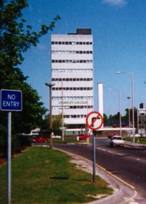
Pound Hill is a residential area located in the town of Crawley, West Sussex, England. Situated approximately 30 miles south of London, it forms part of the borough of Crawley and falls within the administrative county of West Sussex. Pound Hill is positioned in the northeastern part of the town, bordered by the neighborhoods of Three Bridges and Maidenbower.

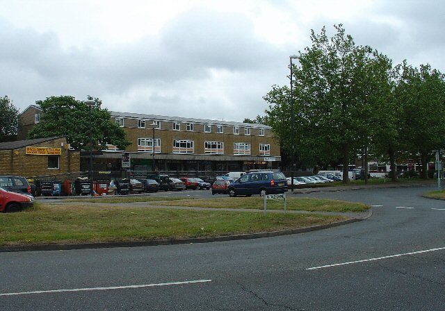
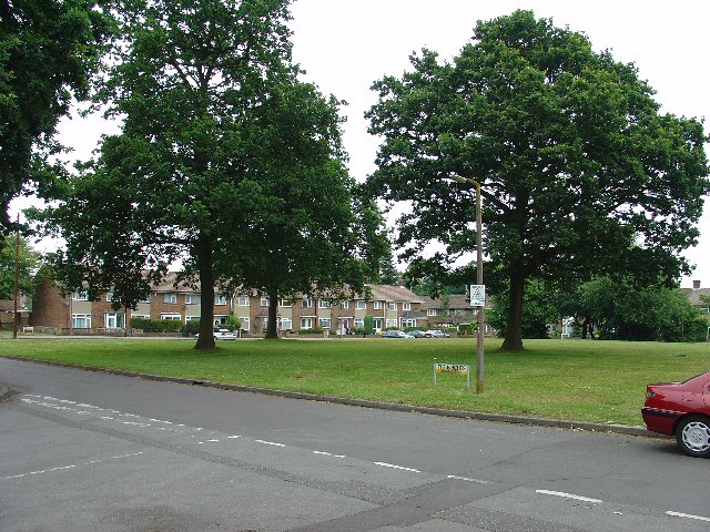
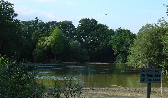
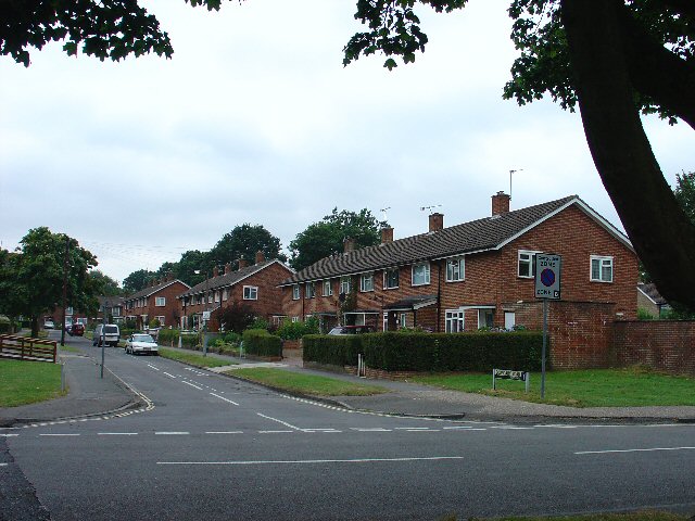
Predominantly developed in the 1960s and 1970s, Pound Hill is characterized by its well-planned layout, featuring a mix of detached and semi-detached houses, as well as a number of modern apartment buildings. The area is known for its green spaces, with several parks and recreational areas, including the popular Pound Hill Playing Fields and Grattons Park.

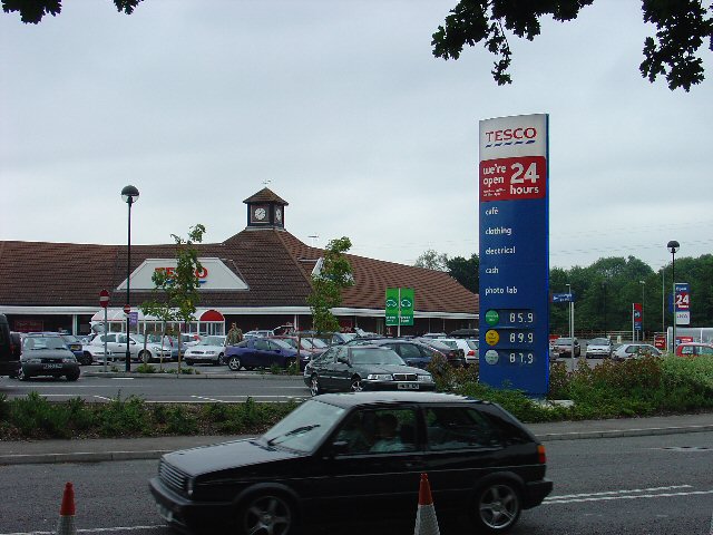
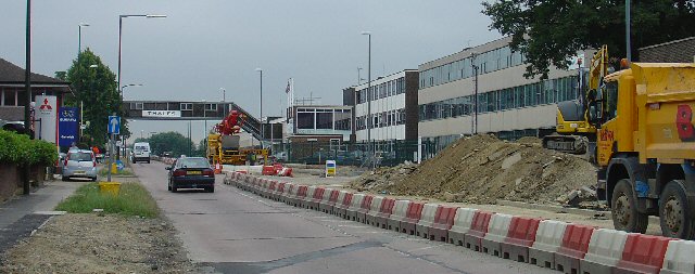
Pound Hill offers a range of amenities to its residents, including a small shopping center known as the Pound Hill Parade, which houses a supermarket, convenience stores, cafés, and other essential services. The area also benefits from excellent transport links, with Three Bridges railway station nearby, providing regular train services to London and other major cities in the region.

Furthermore, Pound Hill boasts a strong sense of community, with various local organizations and clubs catering to different interests and age groups. The area is served by several schools, making it an attractive choice for families. Pound Hill combines the tranquility of suburban living with easy access to urban facilities, making it a desirable place to reside in the Crawley area.

If you have any feedback on the listing, please let us know in the comments section below.
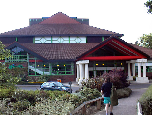
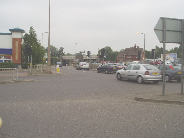
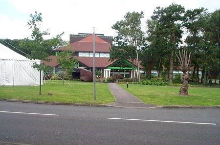
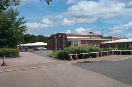
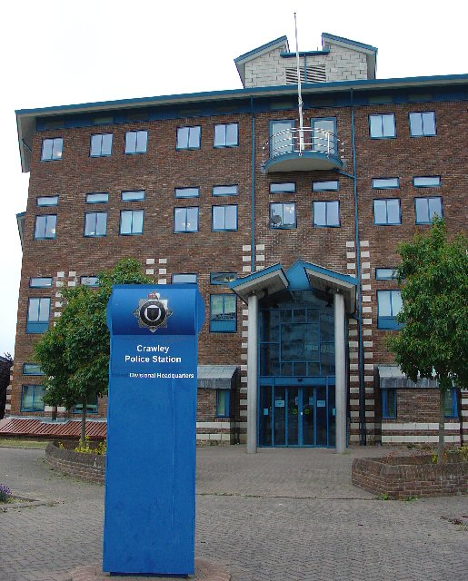
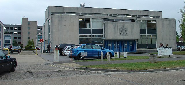
Pound Hill Images

Images are sourced within 2km of 51.119815/-0.15462 or Grid Reference TQ2937. Thanks to Geograph Open Source API. All images are credited.

The Hawth The Arts Centre in Crawley. Taken during the annual juggling convention held there (in 1999 in this case)
The Hawth
The Arts Centre in Crawley. Taken during the annual juggling convention held there (in 1999 in this case)
Road by Three Bridges station The station at Three Bridges is on the London-Brighton line but this is also where trains heading off to Crawley or Horsham or the coast normally pass through. But I can see only one Bridge - where are the other two?
Road by Three Bridges station
The station at Three Bridges is on the London-Brighton line but this is also where trains heading off to Crawley or Horsham or the coast normally pass through. But I can see only one Bridge - where are the other two?
Hawth Theatre Council-built and owned Theatre opened in 1988
Hawth Theatre
Council-built and owned Theatre opened in 1988
Maidenbower Junior School Built and opened as a Middle School in the late 1990s, it became a Junior School following the Crawley Schools' Re-organisation in 2004
Maidenbower Junior School
Built and opened as a Middle School in the late 1990s, it became a Junior School following the Crawley Schools' Re-organisation in 2004
Crawley College College of Further Education
Crawley College
College of Further Education
Furnace Green Parade, Furnace Green, Crawley At the centre of the local community, this local parade of shops provides access to most everyday needs for the residents of this Crawley neighbourhood. The style of the parade is slightly more modern than that of Tilgate (TQ2735) - late 1950s?
Furnace Green Parade, Furnace Green, Crawley
At the centre of the local community, this local parade of shops provides access to most everyday needs for the residents of this Crawley neighbourhood. The style of the parade is slightly more modern than that of Tilgate (TQ2735) - late 1950s?
Worth Way, just before passing under B2036, Crawley The disused railway between Crawley and East Grinstead was converted into a hard surfaced route for non-motorised traffic. Here we see the route heading towards E. Grinstead, just before passing under the Balcombe Road. The tunnel is not an original from the days when steam trains used to ply this route.
Worth Way, just before passing under B2036, Crawley
The disused railway between Crawley and East Grinstead was converted into a hard surfaced route for non-motorised traffic. Here we see the route heading towards E. Grinstead, just before passing under the Balcombe Road. The tunnel is not an original from the days when steam trains used to ply this route.
Open Space in Residential Area of Three Bridges, Crawley, West Sussex A grass covered square open space with a number of oak trees. This grid square has a high proportion of residential usage and holds approximately half of the housing in the Three Bridges neighbourhood of Crawley. Such open spaces are common throughout the various Crawley neighbourhoods.
Open Space in Residential Area of Three Bridges, Crawley, West Sussex
A grass covered square open space with a number of oak trees. This grid square has a high proportion of residential usage and holds approximately half of the housing in the Three Bridges neighbourhood of Crawley. Such open spaces are common throughout the various Crawley neighbourhoods.
Tesco Superstore, Hazelwick Avenue, Crawley, West Sussex One of three major supermarkets in Crawley, the others being Asda (Southgate) and Sainsbury's (West Green).
Tesco Superstore, Hazelwick Avenue, Crawley, West Sussex
One of three major supermarkets in Crawley, the others being Asda (Southgate) and Sainsbury's (West Green).
Cycle Subway (on National Cycle Network Route 20) between Manor Royal Industrial Estate and Northgate, Crawley, West Sussex National Cycle Network route 20 passes through Crawley. Here we see where the cycle path is routed under the main Crawley dual carriageway inner bypass. NCN 20 is a route from London to Brighton.
Cycle Subway (on National Cycle Network Route 20) between Manor Royal Industrial Estate and Northgate, Crawley, West Sussex
National Cycle Network route 20 passes through Crawley. Here we see where the cycle path is routed under the main Crawley dual carriageway inner bypass. NCN 20 is a route from London to Brighton.
Northgate Shopping Parade, Crawley, West Sussex Shopping parade at the heart of the residential area of Northgate, which occupies most of this grid square. As is common with most of the neighbourhood parades in Crawley, the Northgate one includes its own pub (The Black Dog)
Northgate Shopping Parade, Crawley, West Sussex
Shopping parade at the heart of the residential area of Northgate, which occupies most of this grid square. As is common with most of the neighbourhood parades in Crawley, the Northgate one includes its own pub (The Black Dog)
Gatwick Road, Manor Royal Industrial Estate, Crawley, West Sussex The Manor Royal industrial estate is centred on TQ2738, but also spreads over about a third of this grid square. A feature here is the bridge over the main road linking two buildings belonging to the same organisation. The road building works are connected with the installation of the "Fastway" guided bus network throughout Crawley.
Gatwick Road, Manor Royal Industrial Estate, Crawley, West Sussex
The Manor Royal industrial estate is centred on TQ2738, but also spreads over about a third of this grid square. A feature here is the bridge over the main road linking two buildings belonging to the same organisation. The road building works are connected with the installation of the "Fastway" guided bus network throughout Crawley.
Milton Mount Lake, Pound Hill, Crawley, West Sussex Milton Mount Lake was once in the grounds of the Worth Park country estate. The estate was absorbed into the residential neighbourhood of Pound Hill and built upon. In the background, it is just possible to see an aircraft that has just taken off from Gatwick airport. The E end of the runway is 2km north of here. Aircraft taking off would not normally be seen from here, as they usually take off into the West (against the prevailing wind). The wind on this day was from the east.
Milton Mount Lake, Pound Hill, Crawley, West Sussex
Milton Mount Lake was once in the grounds of the Worth Park country estate. The estate was absorbed into the residential neighbourhood of Pound Hill and built upon. In the background, it is just possible to see an aircraft that has just taken off from Gatwick airport. The E end of the runway is 2km north of here. Aircraft taking off would not normally be seen from here, as they usually take off into the West (against the prevailing wind). The wind on this day was from the east.
Old Stable Block of Worth Park House, Milton Mount, Pound Hill, Crawley, West Sussex This is the old Victoria Stable block of Worth Park House. There is a carved plaque on the wall with the date 1882. The original Worth Park House was demolished and the site is now Milton Mount Gardens, but this stable block remains.
Old Stable Block of Worth Park House, Milton Mount, Pound Hill, Crawley, West Sussex
This is the old Victoria Stable block of Worth Park House. There is a carved plaque on the wall with the date 1882. The original Worth Park House was demolished and the site is now Milton Mount Gardens, but this stable block remains.
St Elizabeth Church of England Church, Northgate, Crawley, West Sussex Adjacent to the shopping parade, this small church is of a modern design, contemporary with the rest of the buildings in the area.
St Elizabeth Church of England Church, Northgate, Crawley, West Sussex
Adjacent to the shopping parade, this small church is of a modern design, contemporary with the rest of the buildings in the area.
Houses, Boundary Road, Northgate, Crawley, West Sussex A typical street of houses in the Northgate neighbourhood of Crawley. Adjacent to St Elizabeth's church.
Houses, Boundary Road, Northgate, Crawley, West Sussex
A typical street of houses in the Northgate neighbourhood of Crawley. Adjacent to St Elizabeth's church.
Crawley Police Station. Situated in the heart of the town. A very modern police station built a few years ago. Opposite the Magistrates court.
Crawley Police Station.
Situated in the heart of the town. A very modern police station built a few years ago. Opposite the Magistrates court.
Crawley Magistrates Court Conveniently situated opposite the Police Station, in the centre of Crawley. This area has a block of civic buildings, including the Library and health service offices.
Crawley Magistrates Court
Conveniently situated opposite the Police Station, in the centre of Crawley. This area has a block of civic buildings, including the Library and health service offices.
Show me another place!

Pound Hill is located at Grid Ref: TQ2937 (Lat: 51.119815, Lng: -0.15462)

Administrative County: West Sussex

District: Crawley

Police Authority: Sussex

What 3 Words

///recall.repay.stole. Near Maidenbower, West Sussex

Related Wikis

Pound Hill

Pound Hill is one of 14 neighbourhoods within the town of Crawley in West Sussex, England. Pound Hill is located on the east of Crawley. It is bordered...

Three Bridges, West Sussex

Three Bridges is one of 14 neighbourhoods within the town of Crawley, in the county of West Sussex in England. == History == Three Bridges, at first a...

Three Bridges railway station

Three Bridges railway station is located in and named after the village of Three Bridges, which is now a district of Crawley, West Sussex, England. It...

Three Bridges Depot

Three Bridges Depot is an Electric Traction Depot located in Three Bridges, West Sussex, England. The depot is about 1.5 km south of Three Bridges railway...

Nearby Amenities

Located within 500m of 51.119815,-0.15462
Crossing
Bicycle: yes
Button Operated: yes
Crossing: traffic_signals
Crossing Island: no
Crossing Ref: toucan
Kerb: lowered
Tactile Paving: yes
Lat/Long: 51.1188015/-0.1595139
Traffic Calming: cushion
Lat/Long: 51.1180139/-0.1552056
Traffic Signals
Crossing: no
Traffic Signals: signal
Traffic Signals Direction: forward
Lat/Long: 51.118746/-0.1591105
Pound Hill
Is In: West Sussex, England, UK
Place: village
Wikidata: Q2393416
Lat/Long: 51.1212595/-0.1502329
Crossing
Crossing: traffic_signals
Crossing Ref: puffin
Kerb: lowered
Traffic Signals: signal
Traffic Signals Direction: forward
Lat/Long: 51.1183917/-0.1613168
Booth: K6
Removed Amenity: telephone
Lat/Long: 51.1219769/-0.1535556
Crossing
Crossing: unmarked
Crossing Island: no
Crossing Markings: no
Kerb: lowered
Tactile Paving: yes
Lat/Long: 51.1221835/-0.1525806
Post Box
Burns Road
Collection Plate: CP1D
Collection Times: Mo-Fr 09:00; Sa 07:00
Operator: Royal Mail
Post Box Type: pillar
Ref: RH10 60D
Royal Cypher: EIIR
Royal Cypher Wikidata: Q33102113
Source: survey
Lat/Long: 51.1217721/-0.1542292
Place Of Worship
Christ Church United Reformed
Created By: Potlatch 0.10f
Denomination: united_reformed
Religion: christian
Lat/Long: 51.1194095/-0.1575489
Noexit: yes
Lat/Long: 51.1193145/-0.1615219
Crossing
Bicycle: no
Button Operated: yes
Crossing: traffic_signals
Traffic Signals: crossing
Lat/Long: 51.1199528/-0.1482496
Crossing
Bicycle: yes
Button Operated: yes
Crossing: traffic_signals
Crossing Island: no
Crossing Ref: toucan
Kerb: lowered
Tactile Paving: yes
Lat/Long: 51.1184778/-0.1603493
Crossing
Bicycle: yes
Crossing: traffic_signals
Crossing Island: no
Crossing Ref: toucan
Kerb: lowered
Tactile Paving: yes
Lat/Long: 51.118618/-0.1600851
Power: tower
Lat/Long: 51.1195239/-0.1617521
Pub
The Hillside Inn
Brand: Vintage Inns
Brand Wikidata: Q87067899
Contact Website: https://www.vintageinn.co.uk/restaurants/south-east/thehillsideinncrawley
Outdoor Seating: yes
Smoking: outside
Lat/Long: 51.1186071/-0.1477756
Post Box
Pound Hill Parade P O
Collection Plate: CP1
Collection Times: Mo-Fr 17:00; Sa 11:45
Operator: Royal Mail
Operator Wikidata: Q638098
Post Box Type: pillar
Ref: RH10 89
Royal Cypher: EIIR
Royal Cypher Wikidata: Q33102113
Source: survey
Lat/Long: 51.1176564/-0.1538997
Post Box
St Mary's Drive
Collection Times: Mo-Fr 17:15; Sa 11:30
Operator: Royal Mail
Operator Wikidata: Q638098
Post Box Type: pillar
Ref: RH10 98
Royal Cypher: EIIR
Royal Cypher Wikidata: Q33102113
Source: survey
Lat/Long: 51.1229269/-0.1592323
Elevator
Lat/Long: 51.1177489/-0.1609684
Elevator
Lat/Long: 51.1177482/-0.1607664
Bus Stop
Burleys Road
Bench: no
Bus: yes
Naptan AtcoCode: 4400CY0179
Naptan Bearing: SE
Naptan CommonName: Burleys Rd
Naptan Indicator: Opp Burleys Rd
Naptan Landmark: Burleys Road
Naptan NaptanCode: wsxajwga
Naptan PlusbusZoneRef: CRAWLEY
Naptan Street: Worth Road
Naptan Verified: no
Public Transport: platform
Shelter: no
Source: naptan_import
Lat/Long: 51.116174/-0.151172
Bus Stop
Pound Hill Parade
Bench: yes
Bus: yes
Naptan AtcoCode: 4400CY0180
Naptan Bearing: SE
Naptan CommonName: Pound Hill Parade
Naptan Indicator: o/s shops
Naptan Landmark: Pound Hill Place
Naptan NaptanCode: wsxajwgd
Naptan PlusbusZoneRef: CRAWLEY
Naptan Street: Worth Road
Naptan Verified: no
Passenger Information Display: no
Public Transport: platform
Shelter: no
Source: naptan_import
Lat/Long: 51.1174441/-0.1542391
Bus Stop
Pound Hill Parade
Bench: yes
Bus: yes
Naptan AtcoCode: 4400CY0181
Naptan Bearing: NW
Naptan CommonName: Pound Hill Parade
Naptan Indicator: opposite St Barnabas Church
Naptan Landmark: Pound Hill Place
Naptan NaptanCode: wsxajwgj
Naptan PlusbusZoneRef: CRAWLEY
Naptan Street: Worth Road
Naptan Verified: yes
Passenger Information Display: no
Public Transport: platform
Shelter: yes
Source: naptan_import
Lat/Long: 51.1176774/-0.1548312
Bus Stop
Burns Road
Bus: yes
Naptan AtcoCode: 4400CY0196
Naptan Bearing: E
Naptan CommonName: Burns Road
Naptan Indicator: opp
Naptan Landmark: Burns Road
Naptan NaptanCode: wsxajwmj
Naptan PlusbusZoneRef: CRAWLEY
Naptan ShortCommonName: Burns Road
Naptan Street: Chaucer Road
Naptan Verified: no
Public Transport: platform
Source: naptan_import
Lat/Long: 51.1239331/-0.1549737
Bus Stop
Burns Road
Bus: yes
Naptan AtcoCode: 4400CY0197
Naptan Bearing: W
Naptan CommonName: Burns Road
Naptan Indicator: adj
Naptan Landmark: Burns Road
Naptan NaptanCode: wsxajwmp
Naptan PlusbusZoneRef: CRAWLEY
Naptan ShortCommonName: Burns Road
Naptan Street: Chaucer Road
Naptan Verified: no
Public Transport: platform
Source: naptan_import
Lat/Long: 51.1238196/-0.1557653
Bus Stop
Park Way
Bus: yes
Naptan AtcoCode: 4400CY0200
Naptan Bearing: N
Naptan CommonName: Park Way
Naptan Indicator: outside 27
Naptan Landmark: Park Way
Naptan NaptanCode: wsxajwpa
Naptan PlusbusZoneRef: CRAWLEY
Naptan Street: St Marys Drive
Naptan Verified: no
Public Transport: platform
Source: naptan_import
Lat/Long: 51.1197877/-0.1593957
Bus Stop
Park Way
Bus: yes
Naptan AtcoCode: 4400CY0201
Naptan Bearing: S
Naptan CommonName: Park Way
Naptan Indicator: outside 16
Naptan Landmark: Park Way
Naptan NaptanCode: wsxajwpd
Naptan PlusbusZoneRef: CRAWLEY
Naptan Street: St Marys Drive
Naptan Verified: no
Public Transport: platform
Source: naptan_import
Lat/Long: 51.1195041/-0.1592399
Bus Stop
Worth Park Avenue
Bus: yes
Naptan AtcoCode: 4400CY0522
Naptan Bearing: SW
Naptan CommonName: Worth Park Avenue
Naptan Indicator: o/s Pound Hill Middle School
Naptan Landmark: Barnwood Close
Naptan PlusbusZoneRef: CRAWLEY
Naptan Street: Worth Park Avenue
Naptan Verified: yes
Public Transport: platform
Source: naptan_import
Lat/Long: 51.1201798/-0.1556827
Bus Stop
Worth Park Avenue
Bus: yes
Naptan AtcoCode: 4400CY0523
Naptan Bearing: NE
Naptan CommonName: Worth Park Avenue
Naptan Indicator: opp Pound Hill Middle School
Naptan Landmark: Barnwood Close
Naptan PlusbusZoneRef: CRAWLEY
Naptan Street: Worth Park Avenue
Naptan Verified: yes
Public Transport: platform
Source: naptan_import
Lat/Long: 51.1204855/-0.1555558
Bus Stop
Balcombe Court
Bus: yes
Naptan AtcoCode: 4400CY0538
Naptan Bearing: N
Naptan CommonName: Balcombe Court
Naptan Indicator: Hill Side Inn
Naptan Landmark: Balcombe Court
Naptan PlusbusZoneRef: CRAWLEY
Naptan Street: Balcombe Rd
Naptan Verified: no
Public Transport: platform
Source: naptan_import
Lat/Long: 51.118631/-0.1481737
Bus Stop
Station Hill
Bus: yes
Naptan AtcoCode: 4400CY0540
Naptan Bearing: S
Naptan CommonName: Station Hill
Naptan Indicator: Rear of Three Bridges Station
Naptan Landmark: Maunsell Place
Naptan NaptanCode: wsxgdtaw
Naptan PlusbusZoneRef: CRAWLEY
Naptan Street: Station Hill
Naptan Verified: no
Public Transport: platform
Source: naptan_import
Lat/Long: 51.1169646/-0.1601568
Bus Stop
Station Hill
Bus: yes
Naptan AtcoCode: 4400CY0541
Naptan Bearing: N
Naptan CommonName: Station Hill
Naptan Crossing: Maunsell Park
Naptan Indicator: Rear of Three Bridges Station
Naptan Landmark: Maunsell Park
Naptan NaptanCode: wsxgdtda
Naptan PlusbusZoneRef: CRAWLEY
Naptan Street: Station Hill
Naptan Verified: no
Public Transport: platform
Source: naptan_import
Lat/Long: 51.1176273/-0.1603349
Chaucer Road
Naptan AtcoCode: 4400CY0553
Naptan Bearing: S
Naptan BusStopType: CUS
Naptan CommonName: Chaucer Road
Naptan Indicator: opp
Naptan Landmark: Worth Park Aveune
Naptan ShortCommonName: HAIL AND RIDE
Naptan Street: Grattons Drive
Naptan Verified: no
Source: naptan_import
Lat/Long: 51.1233551/-0.1542537
Chaucer Road
Naptan AtcoCode: 4400CY0554
Naptan Bearing: N
Naptan BusStopType: CUS
Naptan CommonName: Chaucer Road
Naptan Indicator: adj
Naptan Landmark: Worth Park Aveune
Naptan ShortCommonName: HAIL AND RIDE
Naptan Street: Grattons Drive
Naptan Verified: no
Source: naptan_import
Lat/Long: 51.1229873/-0.1543112
Bus Stop
Balcombe Court
Bus: yes
Naptan AtcoCode: 4400CY0555
Naptan Bearing: S
Naptan CommonName: Balcombe Court
Naptan Indicator: adj
Naptan Landmark: Turners Hill Road
Naptan ShortCommonName: Balcombe Court
Naptan Street: Balcombe Road
Naptan Verified: no
Public Transport: platform
Source: naptan_import
Lat/Long: 51.1185868/-0.1480892
Bus Stop
Greyhound Slip
Bus: yes
Naptan AtcoCode: 4400CY0556
Naptan Bearing: N
Naptan CommonName: Greyhound Slip
Naptan Indicator: opp
Naptan Landmark: Wentworth Drive
Naptan ShortCommonName: Greyhound Slip
Naptan Street: Balcombe Road
Naptan Verified: no
Public Transport: platform
Source: naptan_import
Lat/Long: 51.1214653/-0.1481997
Crossing
Lat/Long: 51.1186185/-0.1614135
Railway: switch
Lat/Long: 51.1216452/-0.1607966
Railway: switch
Lat/Long: 51.1209116/-0.1609388
Railway: switch
Lat/Long: 51.1218758/-0.1607966
Railway: switch
Lat/Long: 51.1206502/-0.1608664
Railway: switch
Lat/Long: 51.1187392/-0.1610702
Railway: switch
Lat/Long: 51.1194035/-0.1609522
Railway: switch
Lat/Long: 51.1203598/-0.1608664
Railway: switch
Lat/Long: 51.1191266/-0.160971
Railway: switch
Lat/Long: 51.1196281/-0.1609495
Railway: switch
Lat/Long: 51.1214364/-0.1608771
Railway: switch
Lat/Long: 51.1189701/-0.1610648
Railway: switch
Lat/Long: 51.1189169/-0.1609388
Post Box
Mereworth Drive
Collection Plate: CP1D
Collection Times: Mo-Fr 09:00; Sa 07:00
Operator: Royal Mail
Operator Wikidata: Q638098
Post Box Type: pillar
Ref: RH10 51D
Royal Cypher: EIIR
Royal Cypher Wikidata: Q33102113
Source: survey
Lat/Long: 51.1218476/-0.1500003
Traffic Signals
Bicycle: yes
Button Operated: yes
Crossing: traffic_signals
Crossing Ref: toucan
Kerb: lowered
Segregated: no
Traffic Signals: signal
Traffic Signals Direction: forward
Lat/Long: 51.1188344/-0.1577901
Traffic Signals
Traffic Signals: signal
Traffic Signals Direction: forward
Lat/Long: 51.1189699/-0.157912
Traffic Calming: cushion
Lat/Long: 51.1161052/-0.1512078
Traffic Calming: cushion
Lat/Long: 51.1165461/-0.1524487
Traffic Calming: cushion
Lat/Long: 51.1168573/-0.1533363
Traffic Calming: cushion
Lat/Long: 51.1175788/-0.154568
Waste Basket
Waste: dog_excrement
Lat/Long: 51.1178078/-0.1547948
Traffic Calming: cushion
Lat/Long: 51.118359/-0.156219
Bench
Lat/Long: 51.1174558/-0.1542081
Waste Basket
Lat/Long: 51.117433/-0.1541553
Traffic Signals
Bicycle: yes
Button Operated: yes
Crossing: traffic_signals
Crossing Ref: toucan
Traffic Signals: signal
Traffic Signals Direction: forward
Lat/Long: 51.1190696/-0.1577167
Waste Basket
Lat/Long: 51.1173696/-0.1540696
Bench
Lat/Long: 51.1173863/-0.1540881
Waste Basket
Lat/Long: 51.1174834/-0.1539784
Barrier: bollard
Lat/Long: 51.1175305/-0.1540256
Waste Basket
Lat/Long: 51.1176596/-0.1539218
Bench
Lat/Long: 51.1176639/-0.1539495
Bench
Lat/Long: 51.1176966/-0.1539842
Waste Basket
Lat/Long: 51.1177183/-0.1539668
Barrier: bollard
Lat/Long: 51.11779/-0.1544632
Waste Basket
Check Date: 2024-02-06
Lat/Long: 51.1178453/-0.1544054
Traffic Signals
Crossing: no
Traffic Signals: signal
Traffic Signals Direction: forward
Lat/Long: 51.1186558/-0.1603672
Traffic Signals
Crossing: no
Traffic Signals: signal
Traffic Signals Direction: forward
Lat/Long: 51.1187466/-0.1602449
Crossing
Bicycle: yes
Crossing: traffic_signals
Crossing Island: no
Crossing Ref: toucan
Kerb: lowered
Tactile Paving: yes
Lat/Long: 51.1184472/-0.1602047
Crossing
Bicycle: no
Crossing: traffic_signals
Crossing Island: no
Crossing Ref: puffin
Kerb: lowered
Tactile Paving: yes
Traffic Signals: signal
Traffic Signals Direction: both
Lat/Long: 51.1219159/-0.1528377
Three Bridges
Public Transport: stop_position
Railway: stop
Ref: 4
Train: yes
Lat/Long: 51.1182257/-0.1608808
Three Bridges
Public Transport: stop_position
Railway: stop
Ref: 2
Train: yes
Lat/Long: 51.118225/-0.1610436
Crossing
Crossing: traffic_signals
Crossing Ref: puffin
Lat/Long: 51.1172348/-0.1540514
Traffic Signals
Bicycle: yes
Button Operated: yes
Crossing: traffic_signals
Crossing Ref: toucan
Traffic Signals: signal
Traffic Signals Direction: forward
Lat/Long: 51.1190079/-0.1575595
Crossing
Crossing: unmarked
Crossing Island: no
Crossing Markings: no
Kerb: lowered
Tactile Paving: yes
Lat/Long: 51.1218466/-0.153356
Crossing
Bicycle: yes
Button Operated: yes
Crossing: traffic_signals
Kerb: lowered
Lat/Long: 51.1188529/-0.1576464
Fire Hydrant
Emergency: fire_hydrant
Fire Hydrant Type: underground
Survey Date: 2018-11-09
Water Source: main
Lat/Long: 51.120791/-0.1520469
Traffic Signals
Crossing: no
Traffic Signals Direction: forward
Lat/Long: 51.1190107/-0.1593468
Three Bridges
Public Transport: stop_position
Railway: stop
Ref: 1
Train: yes
Lat/Long: 51.1182375/-0.1611932
Crossing
Lat/Long: 51.1186276/-0.1613576
Traffic Signals
Crossing: no
Traffic Signals: signal
Traffic Signals Direction: forward
Lat/Long: 51.118628/-0.1600166
Traffic Signals
Crossing: no
Traffic Signals: signal
Traffic Signals Direction: forward
Lat/Long: 51.1184357/-0.1603264
Traffic Signals
Crossing: no
Traffic Signals: signal
Traffic Signals Direction: forward
Lat/Long: 51.1187968/-0.1595787
Childcare
Worth Park Playgroup
Website: http://www.worthparkplaygroup.com/
Lat/Long: 51.119513/-0.1576375
Parking
Layer: -1
Parking: underground
Lat/Long: 51.1179196/-0.1597936
Crossing
Crossing: traffic_signals
Lat/Long: 51.1182453/-0.1557359
The data included in this document is from www.openstreetmap.org. The data is made available under ODbL.

Have you been to Pound Hill?

Leave your review of Pound Hill below (or comments, questions and feedback).