Port Erroll

Settlement in Aberdeenshire

Scotland

Port Erroll

Stormy Coast A rough day at New Slains Castle with big waves battering the rocky Buchan coast.
Stormy Coast Credit: Colin Smith

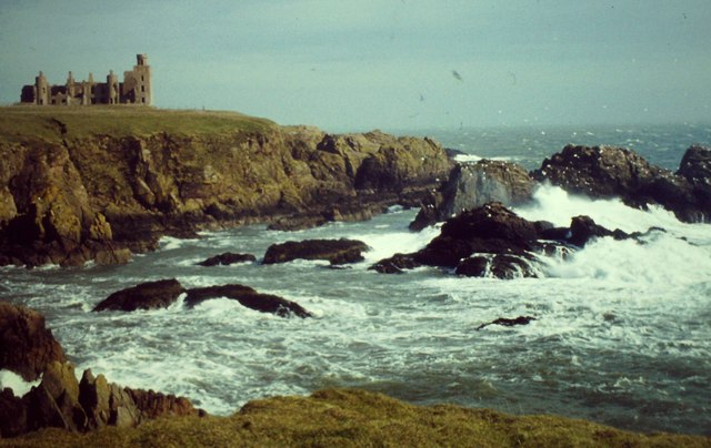
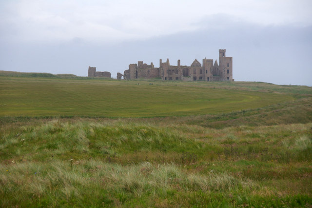
Port Erroll is a small coastal village located in Aberdeenshire, Scotland. It is situated along the North Sea coast, approximately 40 miles north of Aberdeen. The village is named after the nearby ruined castle of Erroll, which once belonged to the Earls of Erroll.

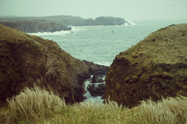
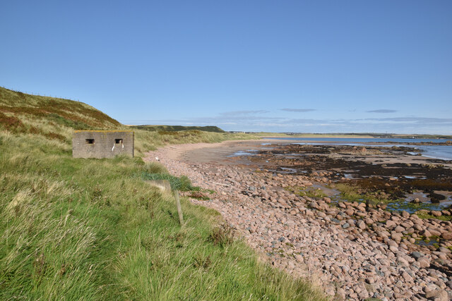
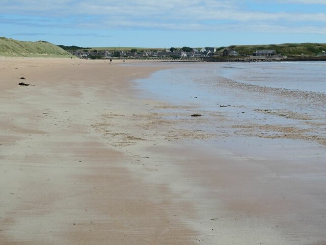
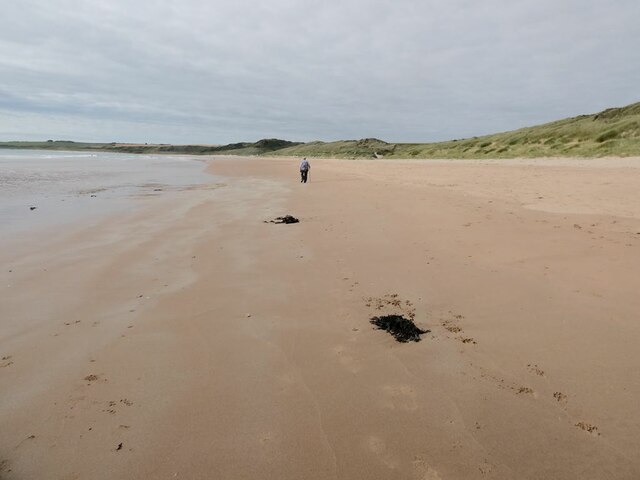
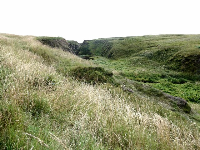
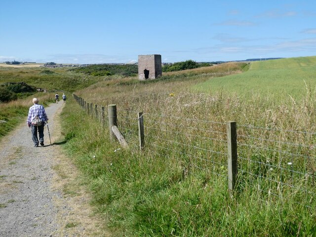
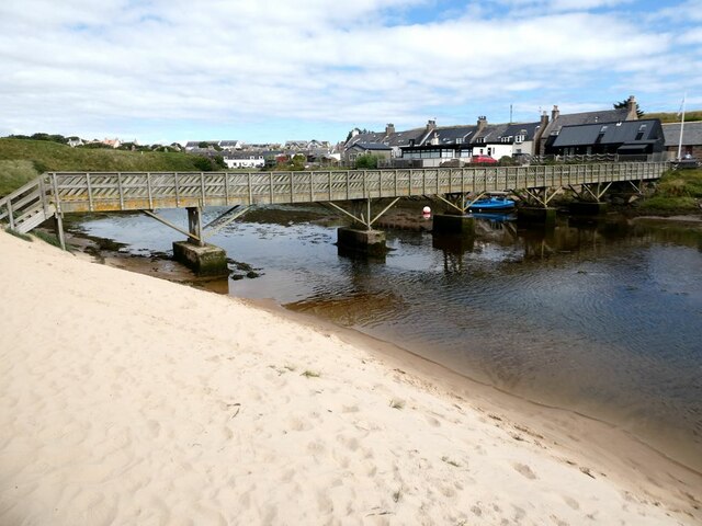
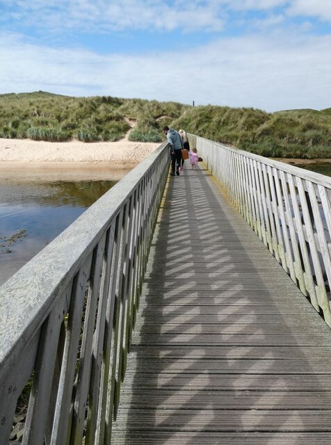
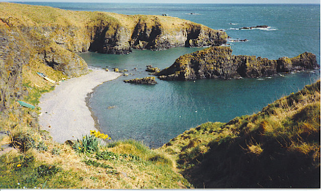
Port Erroll is known for its picturesque beauty, with stunning views of the sea and surrounding countryside. The village is surrounded by rolling hills and cliffs, providing ample opportunities for outdoor activities such as hiking and birdwatching. The sandy beach is a popular spot for locals and tourists alike, offering a peaceful retreat for relaxation and sunbathing.

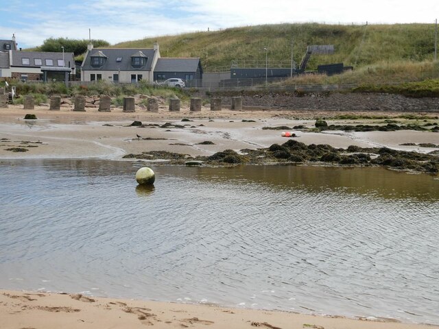
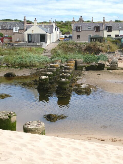
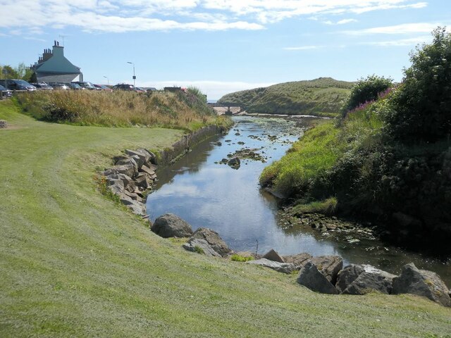
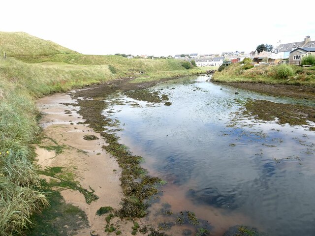
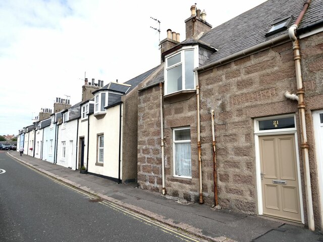
The village itself has a charming and traditional feel, with a small harbor serving as the focal point. The harbor is home to a small fleet of fishing boats, which bring in fresh seafood that is enjoyed by locals and visitors in the village's restaurants and cafes. The village also has a few shops and amenities, including a post office and a convenience store.

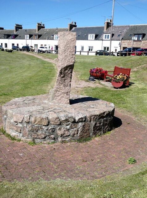
Port Erroll has a close-knit community, with friendly locals who take pride in their village. The community often organizes events and festivals, such as the annual Port Erroll Gala, which brings together residents for a day of games, music, and food.

Overall, Port Erroll is a hidden gem along the Aberdeenshire coast, offering natural beauty, a peaceful atmosphere, and a strong sense of community.

If you have any feedback on the listing, please let us know in the comments section below.
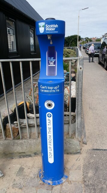
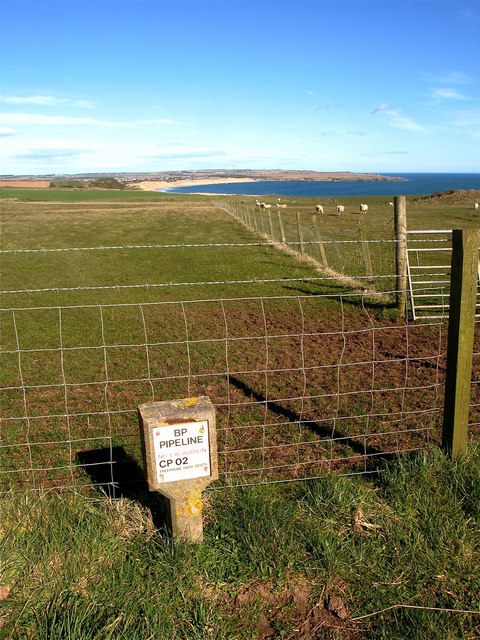
Port Erroll Images

Images are sourced within 2km of 57.405307/-1.8518677 or Grid Reference NK0935. Thanks to Geograph Open Source API. All images are credited.

Stormy Coast A rough day at New Slains Castle with big waves battering the rocky Buchan coast.
Stormy Coast
A rough day at New Slains Castle with big waves battering the rocky Buchan coast.
Long Haven Deep and extensive geo to the north of New Slains Castle.
Long Haven
Deep and extensive geo to the north of New Slains Castle.
Slains Castle from above Port Erroll harbour
Pillbox at Cruden Beach
The beach at Cruden Bay Looking north-east towards the village.
The beach at Cruden Bay
Looking north-east towards the village.
The beach at Cruden Bay Looking south-west.
The beach at Cruden Bay
Looking south-west.
Mouth of the Water of Cruden A line of anti-tank blocks on the far bank.
Mouth of the Water of Cruden
A line of anti-tank blocks on the far bank.
Old bridge piers in the mouth of the Water of Cruden Piers  of an old bridge - although it is not clear what bridge this was. The houses of Port Erroll beyond.
Old bridge piers in the mouth of the Water of Cruden
Piers of an old bridge - although it is not clear what bridge this was. The houses of Port Erroll beyond.
Valley behind Goat's Hillock A well-vegetated low-lying valley runs between the river front at Cruden Bay and the open coast at the Donnons.
Valley behind Goat's Hillock
A well-vegetated low-lying valley runs between the river front at Cruden Bay and the open coast at the Donnons.
The path from Slains Castle to Cruden Bay The concrete structure in the field is probably the old dovecote for Slains Castle.
The path from Slains Castle to Cruden Bay
The concrete structure in the field is probably the old dovecote for Slains Castle.
Water of Cruden Looking downstream towards Ladies Bridge.
Water of Cruden
Looking downstream towards Ladies Bridge.
Water of Cruden Looking upstream  from Ladies Bridge.
Water of Cruden
Looking upstream from Ladies Bridge.
Ladies Bridge The original bridge which provided the only practicable access to the beach was built  in 1922, funded by a group of local ladies (hence "Ladies" Bridge). After falling into disrepair, it was rebuilt in 2015.
Ladies Bridge
The original bridge which provided the only practicable access to the beach was built in 1922, funded by a group of local ladies (hence "Ladies" Bridge). After falling into disrepair, it was rebuilt in 2015.
Aviation memorial Memorial commemorating the first flight across the North Sea from Cruden Bay to Maleneset in Norway by Tryggve Gran on 30 July 1914.
Aviation memorial
Memorial commemorating the first flight across the North Sea from Cruden Bay to Maleneset in Norway by Tryggve Gran on 30 July 1914.
Cottage on Harbour Street In Port Errol.
Cottage on Harbour Street
In Port Errol.
Hydration Station Useful facility  on Harbour Street.
Hydration Station
Useful facility on Harbour Street.
Whinnyfold: Scotland's third oil boom Just under my feet there is a major pipeline bringing ashore Scotland's oil. The complex Forties pipeline system carries about 700 thousand barrels per day, 30% of the UK's oil. It is owned and operated by UK-based global energy company BP. The system, which consists of a 36-inch pipeline originating at the Forties Charlie platform, carries crude oil 169 kilometres to the Cruden Bay pumping station,  mile or so from here. From there, the crude flows a further 209 km south to the processing facility at Grangemouth on the Firth of Forth.

North Sea oil is in fact Scotland's third oil industry. The first was based not on petroleum oil but on whale oil. In the 18th and 19th centuries whalers sailed to Greenland from Scottish ports, particularly Dundee, Aberdeen and Peterhead. There they harpooned Bowhead whales and brought back their blubber in barrels. The blubber was boiled back in Scotland and the oil used for a range of purposes including street lighting and textile and jute manufacture. 

The second oil industry came about thanks to one James 'Paraffin' Young. In 1851 he began to distil oil, at first from coal and later from rock shales, near to Bathgate, in West Lothian. This was the foundation of the modern oil industry, providing the raw material for a new range of chemicals. His legacy can still be seen in the landscape of West Lothian in the form of huge red mounds or bings, of spent shale from which oil has been extracted <a href="https://www.geograph.org.uk/photo/1789176">NT0873 : Red bing and dark sky</a>.
Whinnyfold: Scotland's third oil boom
Just under my feet there is a major pipeline bringing ashore Scotland's oil. The complex Forties pipeline system carries about 700 thousand barrels per day, 30% of the UK's oil. It is owned and operated by UK-based global energy company BP. The system, which consists of a 36-inch pipeline originating at the Forties Charlie platform, carries crude oil 169 kilometres to the Cruden Bay pumping station, mile or so from here. From there, the crude flows a further 209 km south to the processing facility at Grangemouth on the Firth of Forth. North Sea oil is in fact Scotland's third oil industry. The first was based not on petroleum oil but on whale oil. In the 18th and 19th centuries whalers sailed to Greenland from Scottish ports, particularly Dundee, Aberdeen and Peterhead. There they harpooned Bowhead whales and brought back their blubber in barrels. The blubber was boiled back in Scotland and the oil used for a range of purposes including street lighting and textile and jute manufacture. The second oil industry came about thanks to one James 'Paraffin' Young. In 1851 he began to distil oil, at first from coal and later from rock shales, near to Bathgate, in West Lothian. This was the foundation of the modern oil industry, providing the raw material for a new range of chemicals. His legacy can still be seen in the landscape of West Lothian in the form of huge red mounds or bings, of spent shale from which oil has been extracted NT0873 : Red bing and dark sky.
Show me another place!

Port Erroll is located at Grid Ref: NK0935 (Lat: 57.405307, Lng: -1.8518677)

Unitary Authority: Aberdeenshire

Police Authority: North East

What 3 Words

///claps.condense.breaches. Near Port Erroll, Aberdeenshire

Related Wikis

Water of Cruden

The Water of Cruden is a short broadly east-flowing river in Buchan in northeast Scotland. Its headwaters streams rise in the countryside north of Ellon...

Cruden Bay Hotel

Cruden Bay Hotel was a hotel in Cruden Bay, Aberdeenshire, Scotland. Following the success of the Palace Hotel in Aberdeen, it was built between 1897 and...

Cruden Bay

Cruden Bay is a small village in Scotland, on the north coast of the Bay of Cruden in Aberdeenshire, 26 miles (42 km) north of Aberdeen. Just west of Slains...

Cruden Bay Hotel Tramway

The Cruden Bay Hotel Tramway operated an electric tramway service between the Cruden Bay Hotel and Cruden Bay railway station between 1899 and 1940....

New Slains Castle

Slains Castle, also known as New Slains Castle to distinguish it from the nearby Old Slains Castle, is a ruined castle in Aberdeenshire, Scotland. It overlooks...

Cruden Bay railway station

Cruden Bay railway station was a railway station serving Cruden Bay, Aberdeenshire, Scotland. == History == The station opened on 2 August 1897.The station...

Whinnyfold

Whinnyfold or Whinneyfold is a small coastal village at the southern end of the Bay of Cruden in Aberdeenshire, Scotland. Whinnyfold (locally pronounced...

St Olaf's Church (Cruden)

St Olaf's Church (also known as Old Parish Church) is a Category B listed building in Cruden, Aberdeenshire, Scotland, dating to 1776. It is of Church...

Nearby Amenities

Located within 500m of 57.405307,-1.8518677
Bay of Cruden
Natural: bay
Lat/Long: 57.4055783/-1.8565194
The data included in this document is from www.openstreetmap.org. The data is made available under ODbL.

Have you been to Port Erroll?

Leave your review of Port Erroll below (or comments, questions and feedback).