Paul

Settlement in Cornwall

England

Paul

Mousehole A view of Mousehole village and harbour from the North Quay car park.
Mousehole Credit: Kevin Pearson

The requested URL returned error: 429 Too Many Requests

If you have any feedback on the listing, please let us know in the comments section below.

Paul Images

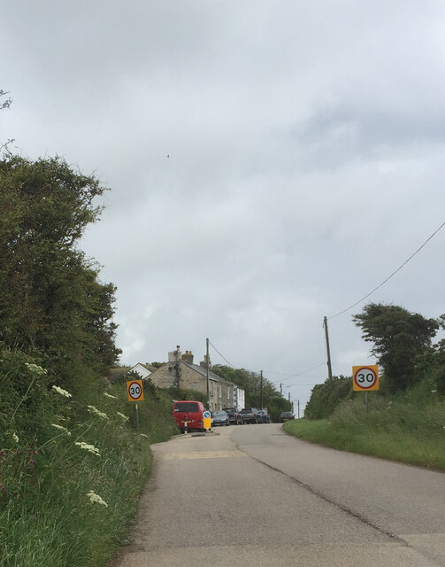
Images are sourced within 2km of 50.090411/-5.547309 or Grid Reference SW4627. Thanks to Geograph Open Source API. All images are credited.

Mousehole A view of Mousehole village and harbour from the North Quay car park.
Mousehole
A view of Mousehole village and harbour from the North Quay car park.
Mousehole Harbour from the sea Harbour view from above the anchorage
Mousehole Harbour from the sea
Harbour view from above the anchorage
Newlyn harbour from Fore Street
The Newlyn Fishermen Memorial
Royal National Mission to Deep Sea Fishermen, Newlyn
Coastal views
Coastal views
Sea front at Mousehole The sea front at Mousehole between the north harbour wall and Tavis Vor, with St. Clement's Isle in the background.
Sea front at Mousehole
The sea front at Mousehole between the north harbour wall and Tavis Vor, with St. Clement's Isle in the background.
Mousehole Harbour from the Ship Inn Mousehole Harbour breakwaters, with St. Clement's Isle in the background.
Photograph taken from the Ship Inn on South Cliff in Mousehole.
Mousehole Harbour from the Ship Inn
Mousehole Harbour breakwaters, with St. Clement's Isle in the background. Photograph taken from the Ship Inn on South Cliff in Mousehole.
View towards Newlyn Tidal Observatory from Tolcarne FBM
Newlyn Harbour A view of Newlyn Harbour taken from behind the RNLI station and looking southeast with the Mary Williams Pier on the left and the South Pier in the background.
Newlyn Harbour
A view of Newlyn Harbour taken from behind the RNLI station and looking southeast with the Mary Williams Pier on the left and the South Pier in the background.
Newlyn Harbour View of Newlyn Harbour, taken looking south from the Mary Williams Pier.
Newlyn Harbour
View of Newlyn Harbour, taken looking south from the Mary Williams Pier.
Street in Tolcarne
Street in Tolcarne
Boats in Mousehole Harbour Boats drawn up on the southern car park in Mousehole Harbour for the winter.
Boats in Mousehole Harbour
Boats drawn up on the southern car park in Mousehole Harbour for the winter.
St. Clement's Isle off Mousehole A photograph taken from the southern arm of Mousehole Harbour, looking out to St. Clement's Isle over a stormy sea.
St. Clement's Isle off Mousehole
A photograph taken from the southern arm of Mousehole Harbour, looking out to St. Clement's Isle over a stormy sea.
Storm at Mousehole Storm sea breaking over the southern pier of Mousehole Harbour.
Photograph taken from steps up to Gurnick Street.
Storm at Mousehole
Storm sea breaking over the southern pier of Mousehole Harbour. Photograph taken from steps up to Gurnick Street.
Mousehole Harbour Looking across Mousehole Harbour to St. Clement's Isle.
Photograph taken from The Ship Inn.
Mousehole Harbour
Looking across Mousehole Harbour to St. Clement's Isle. Photograph taken from The Ship Inn.
Street in Paul
Street in Paul
Mousehole Harbour from North Cliff The old fishing port of Mousehole which nowadays is a tourist hotspot in this part of Cornwall.
Mousehole Harbour from North Cliff
The old fishing port of Mousehole which nowadays is a tourist hotspot in this part of Cornwall.
Show me another place!

Paul is located at Grid Ref: SW4627 (Lat: 50.090411, Lng: -5.547309)

Unitary Authority: Cornwall

Police Authority: Devon and Cornwall

What 3 Words

///character.leaves.dull. Near Penzance, Cornwall

Nearby Locations

Paul Trungle Moor

Related Wikis

Paul, Cornwall

Paul (Cornish: Breweni) is a village in Cornwall, England, United Kingdom. It is in the civil parish of Penzance. The village is two miles (3 km) south...

St Pol de Léon's Church, Paul

St Pol de Léon's Church, also known as Paul Parish Church, is a parish church in the Church of England Diocese of Truro, located in Paul, Cornwall, England...

Mousehole A.F.C.

Mousehole Association Football Club is a football club based in Paul, Cornwall. They are currently members of the Southern League Division One South and...

Trevithal

Trevithal (grid reference SW462266) is a hamlet in Penzance, Cornwall, England, United Kingdom. == References ==

Nearby Amenities

Located within 500m of 50.090411,-5.547309
Paul
Is In: Cornwall, England, UK
Is In Country: England
Is In Country Code: GB
Is In County: Cornwall
Name Kw: Breweni
Place: village
Postal Code: TR19 6
Source: npe
Wikidata: Q1002828
Lat/Long: 50.0896133/-5.5464147
Post Box
Check Date: 2022-05-22
Check Date Collection Times: 2022-05-22
Collection Times: Mo-Fr 09:00; Sa 07:00
Operator: Royal Mail
Post Box Type: lamp
Ref: TR19 78D
Royal Cypher: EIIR
Royal Cypher Wikidata: Q33102113
Source: survey
Lat/Long: 50.0898494/-5.5467358
Power: pole
Lat/Long: 50.0906587/-5.541959
Power: pole
Lat/Long: 50.0912369/-5.5431847
Power: pole
Lat/Long: 50.0922247/-5.5490668
Power: pole
Lat/Long: 50.0923279/-5.5505689
Power: pole
Lat/Long: 50.0926376/-5.5517893
Power: pole
Lat/Long: 50.0923726/-5.5490668
Power: pole
Lat/Long: 50.0924225/-5.5477633
Power: pole
Lat/Long: 50.0911836/-5.5414601
Power: pole
Lat/Long: 50.0918461/-5.5445902
Power: pole
Lat/Long: 50.0929147/-5.5527012
Power: pole
Lat/Long: 50.0914985/-5.5489676
Power: pole
Lat/Long: 50.0907086/-5.5420475
Dolly Pentreath Memorial
Historic: memorial
Inscription: Here lieth interred DOLLY PENTREATH who died in 1777. Said to have been the last person who conversed in the ancient Cornish the peculiar language of this county from the earliest records till it expired in the eighteenth century in this parish of S. Paul
Lat/Long: 50.089398/-5.5460556
Direction: S
Generator Method: photovoltaic
Generator Output Electricity: small_installation
Generator Source: solar
Generator Type: solar_photovoltaic_panel
Location: roof
Power: generator
Source: bing
Lat/Long: 50.0901544/-5.5495709
Direction: SW
Generator Method: photovoltaic
Generator Output Electricity: small_installation
Generator Source: solar
Generator Type: solar_photovoltaic_panel
Location: roof
Power: generator
Source: bing
Lat/Long: 50.0891348/-5.5487274
Direction: S
Generator Method: photovoltaic
Generator Output Electricity: small_installation
Generator Source: solar
Generator Type: solar_photovoltaic_panel
Location: roof
Power: generator
Source: bing
Lat/Long: 50.089565/-5.5480193
Direction: SE
Generator Method: photovoltaic
Generator Output Electricity: small_installation
Generator Source: solar
Generator Type: solar_photovoltaic_panel
Location: roof
Power: generator
Source: bing
Lat/Long: 50.0893766/-5.5465917
Material: wood
Power: pole
Lat/Long: 50.0877873/-5.549528
Power: pole
Lat/Long: 50.0876006/-5.5485316
Power: pole
Transformer: distribution
Lat/Long: 50.0886142/-5.5463617
Power: pole
Lat/Long: 50.0879646/-5.5460304
Power: pole
Lat/Long: 50.0875438/-5.5471864
Power: pole
Lat/Long: 50.0874044/-5.5457689
Power: pole
Lat/Long: 50.0873149/-5.5447336
Power: pole
Lat/Long: 50.0874406/-5.5444627
Bus Stop
Boslandew Hill
Bus: yes
Naptan AtcoCode: 0800COD40156
Naptan Bearing: NE
Naptan CommonName: Boslandew Hill
Naptan Indicator: NE-bound
Naptan NaptanCode: coradtaj
Naptan Verified: no
Public Transport: platform
Source: naptan
Lat/Long: 50.0898371/-5.5468784
Paul Labyrinth
Tourism: attraction
Lat/Long: 50.0884848/-5.5455342
Barrier: stile
Lat/Long: 50.0888499/-5.5423209
Barrier: stile
Lat/Long: 50.0918467/-5.5460339
Barrier: stile
Lat/Long: 50.0889766/-5.5433649
Barrier: stile
Material: stone
Stile: stepover
Lat/Long: 50.0887455/-5.5440195
Fire Hydrant
Emergency: fire_hydrant
Fire Hydrant Type: underground
Survey Date: 2022-05-22
Lat/Long: 50.0893333/-5.5472985
Fire Hydrant
Emergency: fire_hydrant
Fire Hydrant Type: underground
Survey Date: 2022-05-22
Lat/Long: 50.0883357/-5.5432712
Fire Hydrant
Emergency: fire_hydrant
Fire Hydrant Type: underground
Survey Date: 2022-05-22
Lat/Long: 50.089125/-5.5449264
Bench
Survey Date: 2022-05-22
Lat/Long: 50.0898108/-5.5467451
Bench
Survey Date: 2022-05-22
Lat/Long: 50.0886433/-5.5440459
Fire Hydrant
Emergency: fire_hydrant
Fire Hydrant Type: underground
Survey Date: 2022-05-22
Lat/Long: 50.089817/-5.5468939
Barrier: stile
Lat/Long: 50.0881383/-5.5495831
Power: pole
Lat/Long: 50.0910551/-5.5483558
Power: pole
Transformer: distribution
Lat/Long: 50.090681/-5.5478396
Power: pole
Lat/Long: 50.0924896/-5.5460438
Power: pole
Lat/Long: 50.0917944/-5.5408484
Power: pole
Transformer: distribution
Lat/Long: 50.0884559/-5.5438793
Power: pole
Lat/Long: 50.0897638/-5.5428171
Power: pole
Lat/Long: 50.0891477/-5.5434287
Power: pole
Lat/Long: 50.0885265/-5.5440456
Power: pole
Lat/Long: 50.0881892/-5.5443808
Power: pole
Lat/Long: 50.0877314/-5.5448207
Power: pole
Lat/Long: 50.088468/-5.5532482
Power: pole
Lat/Long: 50.0882873/-5.5521727
Power: pole
Lat/Long: 50.0880653/-5.5509737
The data included in this document is from www.openstreetmap.org. The data is made available under ODbL.

Have you been to Paul?

Leave your review of Paul below (or comments, questions and feedback).