Trungle Moor

Urban Greenspace in Cornwall

England

Trungle Moor

Mousehole Harbour from the sea Harbour view from above the anchorage
Mousehole Harbour from the sea Credit: David Bagshaw

Trungle Moor, located in Cornwall, England, is a serene and picturesque urban greenspace that offers a tranquil escape from the bustling city life. Covering an area of approximately 50 acres, this expanse of open land is nestled amidst the beautiful Cornish countryside, offering visitors a chance to immerse themselves in nature.

The moor is characterized by its gently undulating terrain, dotted with patches of heather and gorse, providing a vibrant splash of color against the green landscape. The moorland is also home to a variety of native plant species, including bilberry, bracken, and bog cotton, which add to the area's natural beauty.

Trungle Moor boasts an extensive network of footpaths and trails, making it an ideal destination for walkers, hikers, and nature enthusiasts. These paths wind their way through the moor, offering visitors the opportunity to explore the diverse habitats and wildlife that call this greenspace home. From observing the playful antics of rabbits and squirrels to catching a glimpse of the elusive Dartford warbler, Trungle Moor provides ample opportunities for wildlife spotting.

Visitors to Trungle Moor can also enjoy panoramic views of the surrounding countryside, with glimpses of the nearby mining heritage that Cornwall is famous for. The moor is located in close proximity to several historic mining sites, adding an element of cultural significance to the natural landscape.

Overall, Trungle Moor is a hidden gem in the heart of Cornwall, offering a peaceful retreat for those seeking solace in nature. Whether it's a leisurely stroll, a bird-watching expedition, or simply a moment of tranquility, this urban greenspace provides a much-needed respite from the fast-paced urban life.

If you have any feedback on the listing, please let us know in the comments section below.
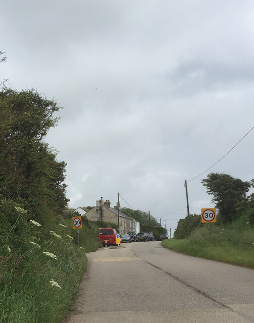
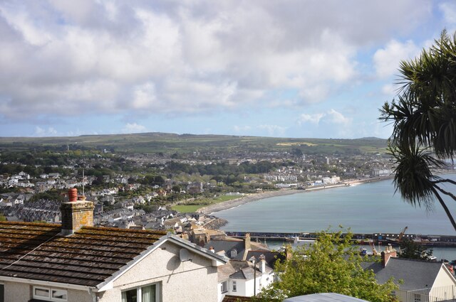
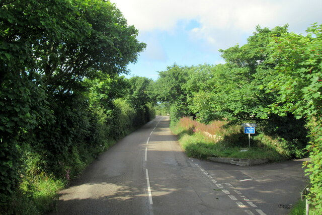
Trungle Moor Images

Images are sourced within 2km of 50.089475/-5.5519393 or Grid Reference SW4627. Thanks to Geograph Open Source API. All images are credited.

Mousehole Harbour from the sea Harbour view from above the anchorage
Mousehole Harbour from the sea
Harbour view from above the anchorage
Newlyn harbour from Fore Street
Royal National Mission to Deep Sea Fishermen, Newlyn
Sea front at Mousehole The sea front at Mousehole between the north harbour wall and Tavis Vor, with St. Clement's Isle in the background.
Sea front at Mousehole
The sea front at Mousehole between the north harbour wall and Tavis Vor, with St. Clement's Isle in the background.
Mousehole Harbour from the Ship Inn Mousehole Harbour breakwaters, with St. Clement's Isle in the background.
Photograph taken from the Ship Inn on South Cliff in Mousehole.
Mousehole Harbour from the Ship Inn
Mousehole Harbour breakwaters, with St. Clement's Isle in the background. Photograph taken from the Ship Inn on South Cliff in Mousehole.
Newlyn Harbour A view of Newlyn Harbour taken from behind the RNLI station and looking southeast with the Mary Williams Pier on the left and the South Pier in the background.
Newlyn Harbour
A view of Newlyn Harbour taken from behind the RNLI station and looking southeast with the Mary Williams Pier on the left and the South Pier in the background.
Newlyn Harbour View of Newlyn Harbour, taken looking south from the Mary Williams Pier.
Newlyn Harbour
View of Newlyn Harbour, taken looking south from the Mary Williams Pier.
Boats in Mousehole Harbour Boats drawn up on the southern car park in Mousehole Harbour for the winter.
Boats in Mousehole Harbour
Boats drawn up on the southern car park in Mousehole Harbour for the winter.
St. Clement's Isle off Mousehole A photograph taken from the southern arm of Mousehole Harbour, looking out to St. Clement's Isle over a stormy sea.
St. Clement's Isle off Mousehole
A photograph taken from the southern arm of Mousehole Harbour, looking out to St. Clement's Isle over a stormy sea.
Storm at Mousehole Storm sea breaking over the southern pier of Mousehole Harbour.
Photograph taken from steps up to Gurnick Street.
Storm at Mousehole
Storm sea breaking over the southern pier of Mousehole Harbour. Photograph taken from steps up to Gurnick Street.
Mousehole Harbour Looking across Mousehole Harbour to St. Clement's Isle.
Photograph taken from The Ship Inn.
Mousehole Harbour
Looking across Mousehole Harbour to St. Clement's Isle. Photograph taken from The Ship Inn.
Street in Paul
Street in Paul
Mousehole Harbour from North Cliff The old fishing port of Mousehole which nowadays is a tourist hotspot in this part of Cornwall.
Mousehole Harbour from North Cliff
The old fishing port of Mousehole which nowadays is a tourist hotspot in this part of Cornwall.
South Quay in Mousehole View over the South Quay and out to St. Clement's Isle from Gurnick Street in Mousehole.
South Quay in Mousehole
View over the South Quay and out to St. Clement's Isle from Gurnick Street in Mousehole.
Alley off Gurnick Street in Mousehole Looking down an alley over Gurnick Street and onto the South Quay in Mousehole.
Alley off Gurnick Street in Mousehole
Looking down an alley over Gurnick Street and onto the South Quay in Mousehole.
View of Mousehole from Raginnis Hill A view over Mousehole from Raginnis Hill, with Mounts Bay and St. Michael's Mount in the background.
View of Mousehole from Raginnis Hill
A view over Mousehole from Raginnis Hill, with Mounts Bay and St. Michael's Mount in the background.
Looking across towards Penzance A view from Chywoone Hill across Newlyn towards Penzance.  Newlyn Harbour North  Quay crosses the bay from left to right.
Looking across towards Penzance
A view from Chywoone Hill across Newlyn towards Penzance. Newlyn Harbour North Quay crosses the bay from left to right.
The B3315 at turning for Chyenhal
Show me another place!

Trungle Moor is located at Grid Ref: SW4627 (Lat: 50.089475, Lng: -5.5519393)

Unitary Authority: Cornwall

Police Authority: Devon and Cornwall

What 3 Words

///pumpkin.saints.concerned. Near Penzance, Cornwall

Nearby Locations

Trungle Moor Paul

Related Wikis

Mousehole A.F.C.

Mousehole Association Football Club is a football club based in Paul, Cornwall. They are currently members of the Southern League Division One South and...

Paul, Cornwall

Paul (Cornish: Breweni) is a village in Cornwall, England, United Kingdom. It is in the civil parish of Penzance. The village is two miles (3 km) south...

Sheffield, Cornwall

Sheffield is a hamlet in Cornwall, England, situated near the village of Paul. == History == Sheffield is thought to have been established to house the...

St Pol de Léon's Church, Paul

St Pol de Léon's Church, also known as Paul Parish Church, is a parish church in the Church of England Diocese of Truro, located in Paul, Cornwall, England...

Nearby Amenities

Located within 500m of 50.089475,-5.5519393
Paul
Is In: Cornwall, England, UK
Is In Country: England
Is In Country Code: GB
Is In County: Cornwall
Name Kw: Breweni
Place: village
Postal Code: TR19 6
Source: npe
Wikidata: Q1002828
Lat/Long: 50.0896133/-5.5464147
Sheffield
Is In: Cornwall, England, UK
Is In Country: England
Is In Country Code: GB
Is In County: Cornwall
Place: hamlet
Wikidata: Q7492565
Lat/Long: 50.0862858/-5.5547898
Bus Stop
Belgravia Place
Naptan AtcoCode: 0800COD40045
Naptan Bearing: W
Naptan CommonName: Belgravia Place
Naptan Crossing: B3315
Naptan NaptanCode: coradmwa
Naptan Street: Unclassified
Naptan Verified: no
Source: naptan_import
Lat/Long: 50.0859208/-5.5548855
Bus Stop
Long Row
Bench: no
Bin: no
Lit: yes
Naptan AtcoCode: 0800COX38434
Naptan Bearing: S
Naptan CommonName: Long Row
Naptan Indicator: Opp
Naptan NaptanCode: coradmtw
Naptan Street: B3315
Naptan Verified: no
Public Transport: platform
Shelter: no
Source: naptan_import
Tactile Paving: no
Lat/Long: 50.0864305/-5.5551958
Bus Stop
South Place
Naptan AtcoCode: 0800COZ06392
Naptan Bearing: E
Naptan CommonName: South Place
Naptan Crossing: B3315
Naptan NaptanCode: corgamdp
Naptan Street: Unclassified
Naptan Verified: no
Public Transport: platform
Source: naptan_import
Lat/Long: 50.0859898/-5.5548975
Post Box
Check Date: 2022-05-22
Check Date Collection Times: 2022-05-22
Collection Times: Mo-Fr 11:45; Sa 11:45
Operator: Royal Mail
Post Box Type: lamp
Ref: TR19 111
Royal Cypher: EIIR
Royal Cypher Wikidata: Q33102113
Source: survey
Lat/Long: 50.0866445/-5.5552124
Post Box
Check Date: 2022-05-22
Check Date Collection Times: 2022-05-22
Collection Times: Mo-Fr 09:00; Sa 07:00
Operator: Royal Mail
Post Box Type: lamp
Ref: TR19 78D
Royal Cypher: EIIR
Royal Cypher Wikidata: Q33102113
Source: survey
Lat/Long: 50.0898494/-5.5467358
Power: pole
Lat/Long: 50.0933036/-5.5542086
Power: pole
Lat/Long: 50.0922247/-5.5490668
Power: pole
Lat/Long: 50.0923279/-5.5505689
Power: pole
Lat/Long: 50.0926376/-5.5517893
Power: pole
Lat/Long: 50.0923726/-5.5490668
Power: pole
Lat/Long: 50.0924225/-5.5477633
Power: pole
Lat/Long: 50.0929147/-5.5527012
Power: pole
Lat/Long: 50.0914985/-5.5489676
Dolly Pentreath Memorial
Historic: memorial
Inscription: Here lieth interred DOLLY PENTREATH who died in 1777. Said to have been the last person who conversed in the ancient Cornish the peculiar language of this county from the earliest records till it expired in the eighteenth century in this parish of S. Paul
Lat/Long: 50.089398/-5.5460556
Direction: S
Generator Method: photovoltaic
Generator Output Electricity: small_installation
Generator Source: solar
Generator Type: solar_photovoltaic_panel
Location: roof
Power: generator
Source: bing
Lat/Long: 50.0901544/-5.5495709
Direction: SW
Generator Method: photovoltaic
Generator Output Electricity: small_installation
Generator Source: solar
Generator Type: solar_photovoltaic_panel
Location: roof
Power: generator
Source: bing
Lat/Long: 50.0891348/-5.5487274
Direction: S
Generator Method: photovoltaic
Generator Output Electricity: small_installation
Generator Source: solar
Generator Type: solar_photovoltaic_panel
Location: roof
Power: generator
Source: bing
Lat/Long: 50.089565/-5.5480193
Direction: SE
Generator Method: photovoltaic
Generator Output Electricity: small_installation
Generator Source: solar
Generator Type: solar_photovoltaic_panel
Location: roof
Power: generator
Source: bing
Lat/Long: 50.0893766/-5.5465917
Material: wood
Power: pole
Lat/Long: 50.0877873/-5.549528
Power: pole
Lat/Long: 50.0876006/-5.5485316
Power: pole
Transformer: distribution
Lat/Long: 50.0886142/-5.5463617
Power: pole
Lat/Long: 50.0879646/-5.5460304
Power: pole
Lat/Long: 50.0875438/-5.5471864
Power: pole
Lat/Long: 50.0874044/-5.5457689
Bus Stop
Boslandew Hill
Bus: yes
Naptan AtcoCode: 0800COD40156
Naptan Bearing: NE
Naptan CommonName: Boslandew Hill
Naptan Indicator: NE-bound
Naptan NaptanCode: coradtaj
Naptan Verified: no
Public Transport: platform
Source: naptan
Lat/Long: 50.0898371/-5.5468784
Paul Labyrinth
Tourism: attraction
Lat/Long: 50.0884848/-5.5455342
Barrier: stile
Lat/Long: 50.0918467/-5.5460339
Fire Hydrant
Emergency: fire_hydrant
Fire Hydrant Type: underground
Survey Date: 2022-05-22
Lat/Long: 50.0870442/-5.5552476
Fire Hydrant
Emergency: fire_hydrant
Fire Hydrant Type: underground
Survey Date: 2022-05-22
Lat/Long: 50.0893333/-5.5472985
Bench
Survey Date: 2022-05-22
Lat/Long: 50.0898108/-5.5467451
Fire Hydrant
Emergency: fire_hydrant
Fire Hydrant Type: underground
Survey Date: 2022-05-22
Lat/Long: 50.089817/-5.5468939
Booth: K6
Disused Amenity: telephone
Lat/Long: 50.0869005/-5.5551187
Barrier: stile
Lat/Long: 50.0877735/-5.5536574
Barrier: stile
Lat/Long: 50.0877312/-5.5536609
Barrier: stile
Lat/Long: 50.0881383/-5.5495831
Power: pole
Lat/Long: 50.09335/-5.5541655
Power: pole
Lat/Long: 50.0910551/-5.5483558
Power: pole
Transformer: distribution
Lat/Long: 50.090681/-5.5478396
Power: pole
Transformer: distribution
Lat/Long: 50.0886917/-5.5544928
Power: pole
Lat/Long: 50.088468/-5.5532482
Power: pole
Lat/Long: 50.0882873/-5.5521727
Power: pole
Lat/Long: 50.0880653/-5.5509737
Power: pole
Transformer: distribution
Lat/Long: 50.0858728/-5.5486456
Power: pole
Transformer: distribution
Lat/Long: 50.0858314/-5.5547556
Power: pole
Lat/Long: 50.0854253/-5.554297
The data included in this document is from www.openstreetmap.org. The data is made available under ODbL.

Have you been to Trungle Moor?

Leave your review of Trungle Moor below (or comments, questions and feedback).