Paradise Green

Settlement in Yorkshire

England

Paradise Green

The Hare and Hounds, Horton Bank Top, Bradford This closed pub lies between Beacon Road and Great Horton Road.
The Hare and Hounds, Horton Bank Top, Bradford Credit: habiloid

Paradise Green is a picturesque village located in the heart of Yorkshire, England. Nestled amidst rolling hills and lush green fields, the village exudes charm and tranquility. With a population of around 1,000 residents, Paradise Green offers a close-knit community where neighbors know each other by name.

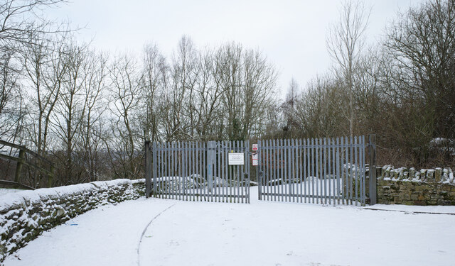
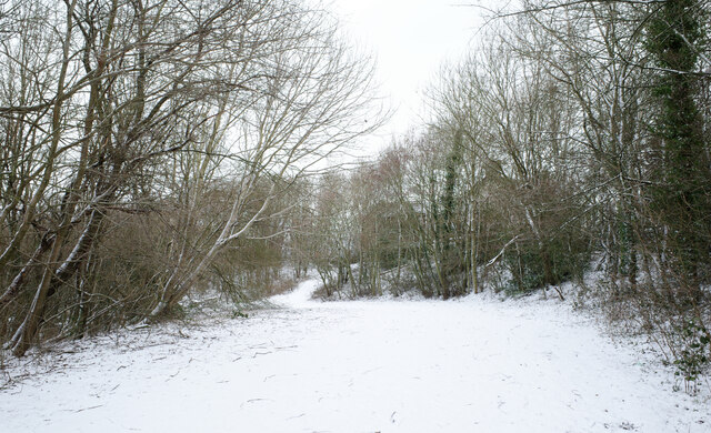
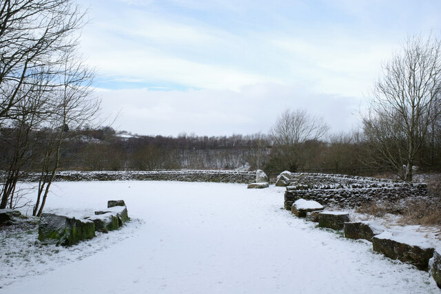
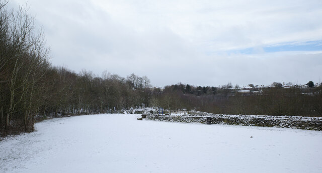
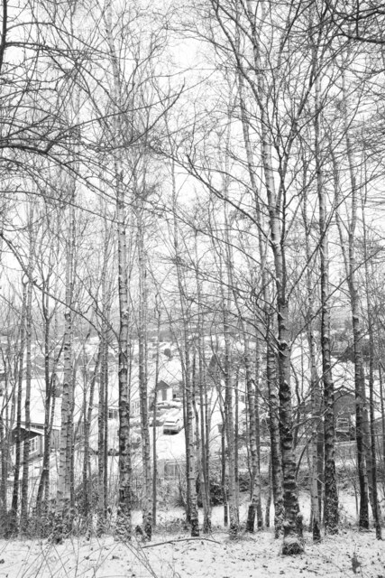
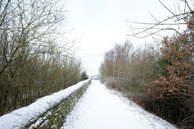
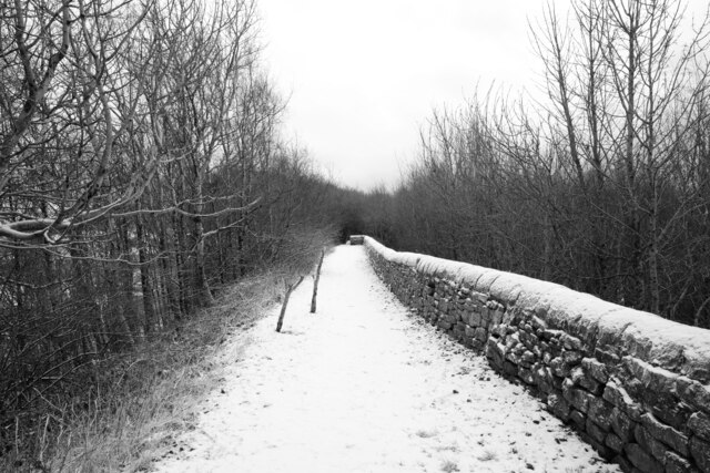
The village is known for its idyllic surroundings, with breathtaking landscapes that attract nature lovers and outdoor enthusiasts. Walking trails crisscross the area, providing opportunities for residents and visitors to explore the countryside and enjoy the fresh air. The nearby Paradise Green Forest is a popular spot for hiking, birdwatching, and picnicking.

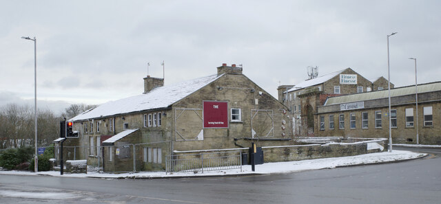
The village itself boasts a rich history, evident in its well-preserved architecture. Traditional stone cottages line the streets, their charming facades adding to the village's rustic appeal. The centerpiece of Paradise Green is the historic St. Mary's Church, a stunning medieval structure that dates back to the 12th century. The church's impressive stained-glass windows and intricate stone carvings are a testament to the village's heritage.

Despite its quaint size, Paradise Green offers a range of amenities to its residents. The village has a local pub, The Green Inn, where locals gather to socialize and enjoy traditional British cuisine. Additionally, there is a small grocery store, a post office, and a primary school, providing convenience for families.

In summary, Paradise Green is a charming village in Yorkshire, offering a perfect blend of natural beauty, historical significance, and community spirit. It is a place where residents can truly appreciate the wonders of rural England.

If you have any feedback on the listing, please let us know in the comments section below.

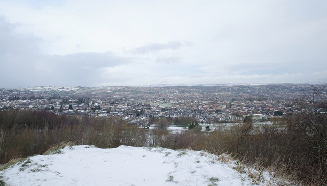
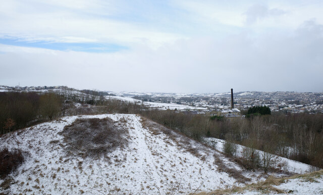
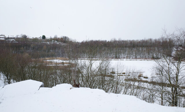
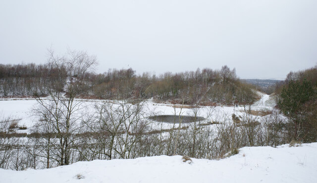
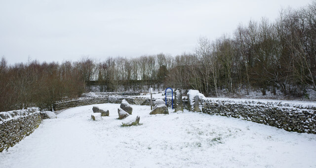
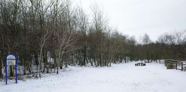
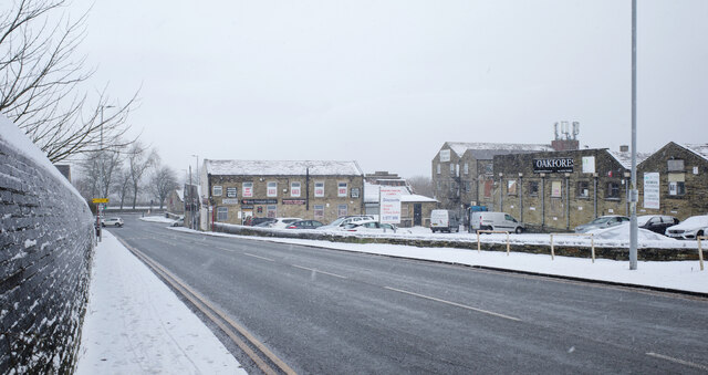
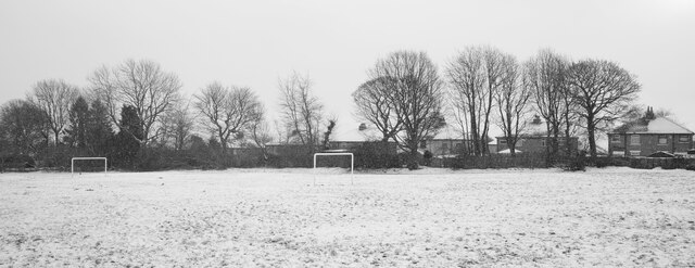
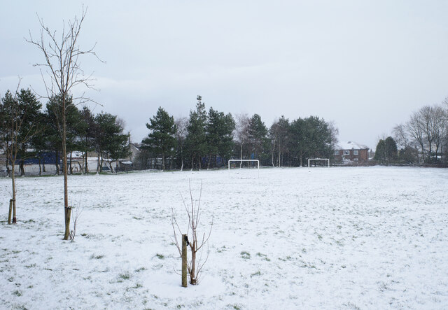
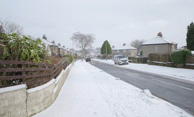
Paradise Green Images

Images are sourced within 2km of 53.782613/-1.791896 or Grid Reference SE1331. Thanks to Geograph Open Source API. All images are credited.

The Hare and Hounds, Horton Bank Top, Bradford This closed pub lies between Beacon Road and Great Horton Road.
The Hare and Hounds, Horton Bank Top, Bradford
This closed pub lies between Beacon Road and Great Horton Road.
The entrance to Horton Bank Country Park, Horton Bank Top, Bradford
Horton Bank Country Park, Bradford
Car park, Horton Bank Country Park, Bradford
A view from Horton Bank Country Park, Bradford
Horton Bank Country Park, Bradford
A view from Horton Bank Country Park, Bradford
Horton Bank Country Park, Bradford
Cooper Lane (B6147), Bradford
Cooper Lane Recreation Ground, Bradford
Westbury Road, Bradford
Show me another place!

Paradise Green is located at Grid Ref: SE1331 (Lat: 53.782613, Lng: -1.791896)

Division: West Riding

Unitary Authority: Bradford

Police Authority: West Yorkshire

What 3 Words

///half.nodded.mouth. Near Clayton, West Yorkshire

Related Wikis

Great Horton

Great Horton is a ward of the City of Bradford, West Yorkshire, England, with a population of 17,683 at the 2011 Census.Great Horton is west of Bradford...

Great Horton railway station

Great Horton railway station was a railway station on the Queensbury-Bradford section of the Queensbury Lines which ran between Bradford, Keighley and...

Dixons Kings Academy

Dixons Kings Academy is a mixed free school for pupils aged 11 to 16 located in Bradford, West Yorkshire, England. The school opened as the Kings Science...

Little Horton

Little Horton (population 17,368 – 2001 UK census) is a ward in the City of Bradford Metropolitan District Council in the county of West Yorkshire, England...

Nearby Amenities

Located within 500m of 53.782613,-1.791896
Scholemoor
Place: locality
Lat/Long: 53.78604/-1.796595
Fuel
Operator: Tesco
Lat/Long: 53.7796932/-1.7876351
Mini Roundabout
Direction: clockwise
Lat/Long: 53.7850588/-1.7871142
Bus Stop
Great Horton Road Bartle Fold
Local Ref: 45015359
Naptan AtcoCode: 450015359
Naptan Bearing: NE
Naptan CommonName: Great Horton Road Bartle Fold
Naptan Crossing: Bartle Fold
Naptan Indicator: Stop 45015359
Naptan Notes: Response removed from site 3p ttcase 02/08/07New case fitted 14/11/07
Naptan PlusbusZoneRef: LEEDS
Naptan ShortCommonName: Bartle Fold
Naptan Street: Great Horton Road
Naptan Verified: no
Source: naptan_import
Lat/Long: 53.7799027/-1.7861745
Bus Stop
Great Horton Road Ward Street
Local Ref: 45015360
Naptan AtcoCode: 450015360
Naptan Bearing: SW
Naptan CommonName: Great Horton Road Ward Street
Naptan Crossing: Ward Street
Naptan Indicator: Stop 45015360
Naptan PlusbusZoneRef: LEEDS
Naptan ShortCommonName: Ward Street
Naptan Street: Great Horton Road
Naptan Verified: no
Source: naptan_import
Lat/Long: 53.7795082/-1.7867229
Bus Stop
Great Horton Road Southfield Lane
Local Ref: 45015361
Naptan AtcoCode: 450015361
Naptan Bearing: SW
Naptan CommonName: Great Horton Road Southfield Lane
Naptan Crossing: Southfield Lane
Naptan Indicator: Stop 45015361
Naptan Landmark: Ladbrokes
Naptan Notes: New TF shelter and 3P case fitted awaiting survey
Naptan PlusbusZoneRef: LEEDS
Naptan ShortCommonName: Southfield Lane
Naptan Street: Great Horton Road
Naptan Verified: no
Source: naptan_import
Lat/Long: 53.7807367/-1.7850928
Bus Stop
Great Horton Road Westcroft Road
Local Ref: 45015362
Naptan AtcoCode: 450015362
Naptan Bearing: NE
Naptan CommonName: Great Horton Road Westcroft Road
Naptan Crossing: Westcroft Road
Naptan Indicator: Stop 45015362
Naptan PlusbusZoneRef: LEEDS
Naptan ShortCommonName: Westcroft Road
Naptan Street: Great Horton Road
Naptan Verified: no
Source: naptan_import
Lat/Long: 53.7810063/-1.7850914
Bus Stop
Clayton Road Scholemoor Lane
Bus: yes
Departures Board: timetable
Local Ref: 45021364
Naptan AtcoCode: 450021364
Naptan Bearing: W
Naptan CommonName: Clayton Road Scholemoor Lane
Naptan Crossing: Scholemoor Lane
Naptan Indicator: Stop 45021364
Naptan Landmark: Quora Retail Park
Naptan Notes: L/C 32
Naptan PlusbusZoneRef: BRADFORD
Naptan ShortCommonName: Scholemoor Lane
Naptan Street: Clayton Road
Naptan Verified: no
Operator: FirstBus
Public Transport: platform
Ref: 45021364
Shelter: yes
Source: naptan_import;local knowledge
Lat/Long: 53.7837433/-1.7989081
Bus Stop
Clayton Road Scholemoor Lane
Local Ref: 45021365
Naptan AtcoCode: 450021365
Naptan Bearing: E
Naptan CommonName: Clayton Road Scholemoor Lane
Naptan Crossing: Scholemoor Lane
Naptan Indicator: Stop 45021365
Naptan PlusbusZoneRef: LEEDS
Naptan ShortCommonName: Scholemoor Lane
Naptan Street: Clayton Road
Naptan Verified: no
Source: naptan_import
Lat/Long: 53.7840031/-1.7975062
Bus Stop
Clayton Road Spencer Road
Local Ref: 45021366
Naptan AtcoCode: 450021366
Naptan Bearing: NE
Naptan CommonName: Clayton Road Spencer Road
Naptan Crossing: Spencer Road
Naptan Indicator: Stop 45021366
Naptan PlusbusZoneRef: LEEDS
Naptan ShortCommonName: Spencer Road
Naptan Street: Clayton Road
Naptan Verified: no
Source: naptan_import
Lat/Long: 53.7846529/-1.793815
Bus Stop
Clayton Road Spencer Road
Local Ref: 45021367
Naptan AtcoCode: 450021367
Naptan Bearing: SW
Naptan CommonName: Clayton Road Spencer Road
Naptan Crossing: Spencer Road
Naptan Indicator: Stop 45021367
Naptan PlusbusZoneRef: LEEDS
Naptan ShortCommonName: Spencer Road
Naptan Street: Clayton Road
Naptan Verified: no
Source: naptan_import
Lat/Long: 53.7845448/-1.7936486
Bus Stop
Clayton Road Springfield Avenue
Local Ref: 45021368
Naptan AtcoCode: 450021368
Naptan Bearing: SW
Naptan CommonName: Clayton Road Springfield Avenue
Naptan Crossing: Springfiled Avenue
Naptan Indicator: Stop 45021368
Naptan Landmark: Sports Ground
Naptan PlusbusZoneRef: LEEDS
Naptan ShortCommonName: Springfield Avenue
Naptan Street: Clayton Road
Naptan Verified: no
Source: naptan_import
Lat/Long: 53.7856109/-1.791655
Bus Stop
Clayton Road Springfield Avenue
Local Ref: 45021369
Naptan AtcoCode: 450021369
Naptan Bearing: NE
Naptan CommonName: Clayton Road Springfield Avenue
Naptan Crossing: Springfield Avenue
Naptan Indicator: Stop 45021369
Naptan Landmark: Sports Field
Naptan PlusbusZoneRef: LEEDS
Naptan ShortCommonName: Springfield Avenue
Naptan Street: Clayton Road
Naptan Verified: no
Source: naptan_import
Lat/Long: 53.7859519/-1.7913043
Bus Stop
Beckside Road Spencer Road
Local Ref: 45021373
Naptan AtcoCode: 450021373
Naptan Bearing: N
Naptan CommonName: Beckside Road Spencer Road
Naptan Crossing: Spencer Road
Naptan Indicator: Stop 45021373
Naptan PlusbusZoneRef: LEEDS
Naptan ShortCommonName: Spencer Road
Naptan Street: Beckside Road
Naptan Verified: no
Source: naptan_import
Lat/Long: 53.7845601/-1.7869704
Bus Stop
Beckside Road Beckside Lane
Local Ref: 45021374
Naptan AtcoCode: 450021374
Naptan Bearing: S
Naptan CommonName: Beckside Road Beckside Lane
Naptan Crossing: Beckside Lane
Naptan Indicator: Stop 45021374
Naptan Landmark: Unknown
Naptan Notes: OSR taken place 160805
Naptan PlusbusZoneRef: LEEDS
Naptan ShortCommonName: Beckside Lane
Naptan Street: Beckside Road
Naptan Verified: no
Source: naptan_import
Lat/Long: 53.7842719/-1.7866835
Mini Roundabout
Direction: clockwise
Lat/Long: 53.7851135/-1.7969806
Ele: 190.1
Lat/Long: 53.7850088/-1.7980447
Ele: 191.4
Lat/Long: 53.7842423/-1.7967894
Ele: 191.0
Lat/Long: 53.7820259/-1.7969309
Ele: 195.3
Lat/Long: 53.7816874/-1.7981456
Ele: 193.6
Lat/Long: 53.7818582/-1.7980086
Post Box
Ele: 185.8
Operator: Royal Mail
Lat/Long: 53.784259/-1.7953998
Paradise Green
Ele: 184.4
Is In: Scholemoor
Place: locality
Lat/Long: 53.7842911/-1.795108
Post Office
Ele: 185.7
Lat/Long: 53.7842568/-1.7952942
Pharmacy
Boots
Brand Wikidata: Q6123139
Ele: 183.7
Operator: Boots
Lat/Long: 53.7843234/-1.7949256
Ele: 183.5
Lat/Long: 53.7844369/-1.7944171
Ele: 183.6
Lat/Long: 53.784876/-1.7934866
Ele: 184.0
Lat/Long: 53.7853565/-1.7941683
Ele: 183.5
Lat/Long: 53.7850541/-1.7937142
Ele: 187.2
Lat/Long: 53.7851644/-1.7964235
Ele: 188.5
Lat/Long: 53.7855473/-1.7970663
Ele: 188.8
Lat/Long: 53.7856173/-1.796894
Ele: 182.5
Lat/Long: 53.7859397/-1.7939738
Ele: 183.0
Lat/Long: 53.7857219/-1.7918734
Ele: 182.9
Lat/Long: 53.7858726/-1.7929542
Ele: 179.1
Lat/Long: 53.7861921/-1.7907969
Ele: 182.3
Lat/Long: 53.7862611/-1.7886885
Ele: 176.7
Lat/Long: 53.7858342/-1.787649
Ele: 166.7
Lat/Long: 53.7843555/-1.7869178
Ele: 189.2
Lat/Long: 53.7820641/-1.789213
Ele: 179.5
Lat/Long: 53.7824564/-1.7848898
Ele: 199.9
Lat/Long: 53.781221/-1.784687
Place Of Worship
Great Horton Methodist Church
Denomination: methodist
Religion: christian
Wikidata: Q26426075
Lat/Long: 53.7814878/-1.7851079
Ele: 199.7
Lat/Long: 53.7808484/-1.7857316
Ele: 201.2
Lat/Long: 53.7811922/-1.7861298
Parking
Lat/Long: 53.7815055/-1.7872081
Ele: 189.2
Lat/Long: 53.7820641/-1.7892129
Ele: 194.3
Lat/Long: 53.7817753/-1.7968592
Ele: 182.3
Lat/Long: 53.7815165/-1.7909967
Ele: 183.8
Lat/Long: 53.7812165/-1.7935561
Ele: 194.9
Lat/Long: 53.7815964/-1.7959799
Ele: 195.0
Lat/Long: 53.7816154/-1.795978
Turning Circle
Lat/Long: 53.783812/-1.7917901
Turning Circle
Lat/Long: 53.7837759/-1.7930668
Addr City: Bradford
Addr Housename: Concept House
Addr Postcode: BD7 2LW
Addr Street: Brackenbeck Road
Lat/Long: 53.78281/-1.7910249
Fix Station
Shop: computer
Lat/Long: 53.78651/-1.7883407
Crossing
Crossing: marked
Lat/Long: 53.7809868/-1.7869692
Crossing
Crossing: marked
Crossing Ref: zebra
Lat/Long: 53.783198/-1.7973023
Barrier: bollard
Lat/Long: 53.7852731/-1.7865055
Barrier: bollard
Lat/Long: 53.7853669/-1.7862235
Crossing
Crossing: marked
Lat/Long: 53.7834546/-1.7968798
Crossing
Crossing: marked
Lat/Long: 53.7833397/-1.7972467
Crossing
Crossing: marked
Lat/Long: 53.7831382/-1.7974166
Crossing
Crossing: marked
Lat/Long: 53.783225/-1.7974553
Crossing
Crossing: marked
Lat/Long: 53.7833619/-1.7973869
Crossing
Crossing: marked
Lat/Long: 53.7835435/-1.7974251
Crossing
Crossing: marked
Lat/Long: 53.7834259/-1.7977852
Crossing
Crossing: marked
Lat/Long: 53.7832833/-1.7978469
Crossing
Crossing: marked
Lat/Long: 53.7836365/-1.7980408
Crossing
Crossing: marked
Lat/Long: 53.7834908/-1.798189
Crossing
Crossing: marked
Lat/Long: 53.7833439/-1.7982536
Crossing
Crossing: marked
Lat/Long: 53.7834252/-1.7982718
Crossing
Crossing: marked
Lat/Long: 53.7830736/-1.7975217
Crossing
Crossing: marked
Lat/Long: 53.7831373/-1.7979221
Crossing
Crossing: marked
Lat/Long: 53.7832002/-1.7983176
Crossing
Crossing: marked
Lat/Long: 53.7832089/-1.7985099
Crossing
Crossing: marked
Lat/Long: 53.7810368/-1.7877873
Crossing
Crossing: marked
Lat/Long: 53.7807675/-1.7875086
Crossing
Crossing: marked
Lat/Long: 53.781/-1.7866102
Crossing
Crossing: marked
Lat/Long: 53.7805872/-1.7871731
Great Horton
Abandoned Railway: station
Railway: site
Wikidata: Q5599331
Wikipedia: en:Great Horton railway station
Lat/Long: 53.7836045/-1.7850297
Barrier: yes
Foot: yes
Lat/Long: 53.7787421/-1.7884203
Team Sport
Sport: karting
Lat/Long: 53.7837702/-1.7856652
Booth: K6
Listed Status: Grade II
Removed Amenity: telephone
Lat/Long: 53.7801602/-1.7859228
Booth: K6
Covered: booth
Listed Status: Grade II
Removed Amenity: telephone
Lat/Long: 53.7801776/-1.7859497
Crossing
Crossing: marked
Lat/Long: 53.7805356/-1.7853786
Crossing
Crossing: marked
Lat/Long: 53.7795409/-1.787284
Pub
The Flying Squirrel
Addr City: Bradford
Addr Country: GB
Addr Housename: Quora Retail Park
Addr Postcode: BD7 2SG
Addr Street: Clayton Road
Fhrs Id: 1085319
Lat/Long: 53.7834059/-1.7986277
Addr City: Bradford
Addr Country: GB
Addr Housename: Quora Retail Park
Addr Postcode: BD7 2SG
Addr Street: Clayton Road
Addr Unit: 4
Shop: yes
Lat/Long: 53.7829572/-1.7983333
Heron Foods
Addr City: Bradford
Addr Country: GB
Addr Housename: Quora Retail Park
Addr Postcode: BD7 2SG
Addr Street: Clayton Road
Addr Unit: 3
Brand: Heron Foods
Brand Wikidata: Q5743472
Brand Wikipedia: en:Heron Foods
Contact Website: https://heronfoods.com/store/clayton/
Fhrs Id: 1089105
Shop: supermarket
Lat/Long: 53.7829318/-1.7981325
Home Bargains
Addr City: Bradford
Addr Country: GB
Addr Housename: Quora Retail Park
Addr Postcode: BD7 2SG
Addr Street: Clayton Road
Addr Unit: 2
Brand: Home Bargains
Brand Wikidata: Q5888229
Brand Wikipedia: en:Home Bargains
Contact Website: https://storelocator.homebargains.co.uk/store/A658/Clayton+Road,+Bradford+
Fhrs Id: 1094305
Shop: variety_store
Lat/Long: 53.7828817/-1.7977376
Fast Food
Greggs
Addr City: Bradford
Addr Country: GB
Addr Housename: Quora Retail Park
Addr Postcode: BD7 2SG
Addr Street: Clayton Road
Addr Unit: 6
Brand: Greggs
Brand Wikidata: Q3403981
Brand Wikipedia: en:Greggs
Contact Website: https://www.greggs.co.uk/shop-finder?shop-code=5074
Cuisine: sandwich;bakery
Fhrs Id: 1083922
Takeaway: yes
Lat/Long: 53.7837355/-1.7973617
Cafe
Starbucks
Addr City: Bradford
Addr Country: GB
Addr Housename: Quora Retail Park
Addr Postcode: BD7 2SG
Addr Street: Clayton Road
Addr Unit: 5
Brand: Starbucks
Brand Wikidata: Q37158
Brand Wikipedia: en:Starbucks
Cuisine: coffee_shop
Fhrs Id: 1097032
Official Name: Starbucks Coffee
Takeaway: yes
Website: https://www.starbucks.com/store-locator/store/1023570/bradford-clayton-road-dt-unit-5-scots-works-clayton-road-bradford-eng-bd-7-
Lat/Long: 53.7836468/-1.7969915
ALDI
Addr City: Bradford
Addr Country: GB
Addr Housename: Quora Retail Park
Addr Postcode: BD7 2SG
Addr Street: Clayton Road
Addr Unit: 1
Brand: ALDI
Brand Wikidata: Q41171672
Brand Wikipedia: en:Aldi
Contact Website: https://stores.aldi.co.uk/bradford/clayton-road
Fhrs Id: 1094631
Shop: supermarket
Lat/Long: 53.7828022/-1.7971101
The data included in this document is from www.openstreetmap.org. The data is made available under ODbL.

Have you been to Paradise Green?

Leave your review of Paradise Green below (or comments, questions and feedback).