Oxlease

Settlement in Hertfordshire Welwyn Hatfield

England

Oxlease

Inside the Horse and Groom, Hatfield A lovely old public  house.
Inside the Horse and Groom, Hatfield Credit: Christine Matthews

Oxlease is a small village located in the county of Hertfordshire, England. Situated approximately 15 miles north of London, it falls within the district of Three Rivers. The village is known for its picturesque surroundings, with open fields and woodland areas that provide a tranquil atmosphere.

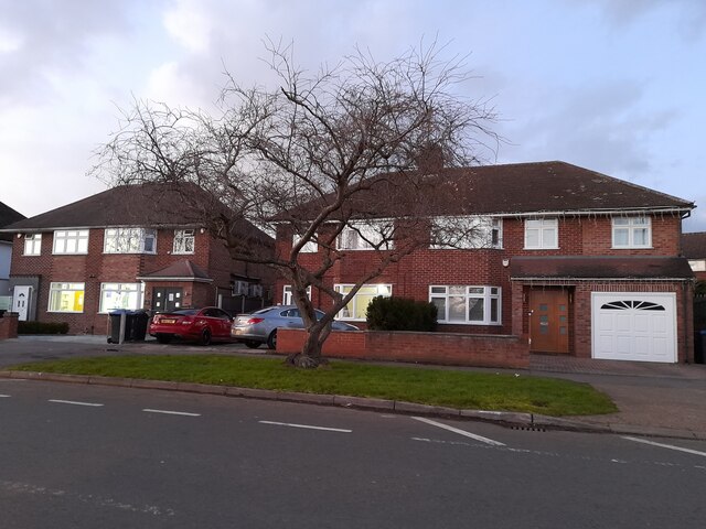
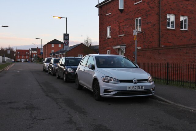
Oxlease is primarily a residential area, with a population of around 1,000 residents. The village is characterized by a mix of traditional cottages and modern houses, offering a variety of housing options for its inhabitants. The community is close-knit, fostering a friendly and welcoming atmosphere.

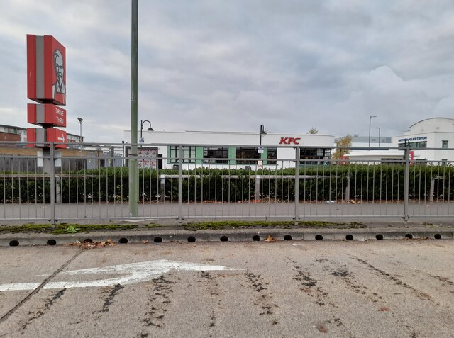
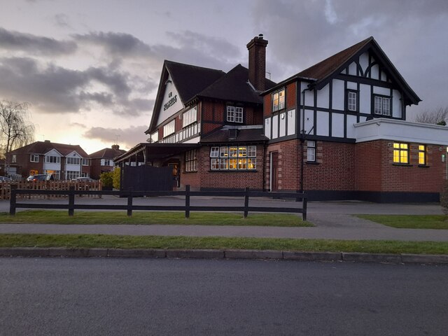
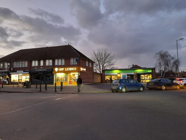
Despite its small size, Oxlease benefits from a range of amenities for its residents. There is a local convenience store that provides daily necessities, as well as a post office and a few small businesses. The village also has a primary school, catering to the educational needs of the local children.

For recreational activities, Oxlease offers several green spaces and parks, making it ideal for outdoor enthusiasts. The village is surrounded by beautiful countryside, making it a popular destination for nature walks and cycling. Additionally, there are several sports clubs and facilities nearby, allowing residents to participate in various sports and activities.

Transportation in Oxlease is well-connected, with good road links to nearby towns and cities. The village is easily accessible via the M25 motorway and is serviced by a local bus network. The nearest train station is a short drive away, providing convenient access to London and other major cities.

Overall, Oxlease is a charming village that offers a peaceful and scenic living environment, while also providing essential amenities and convenient transport links for its residents.

If you have any feedback on the listing, please let us know in the comments section below.
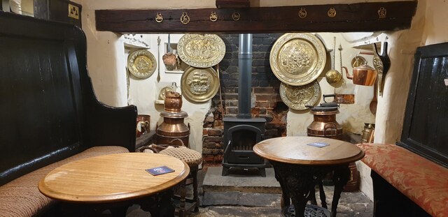
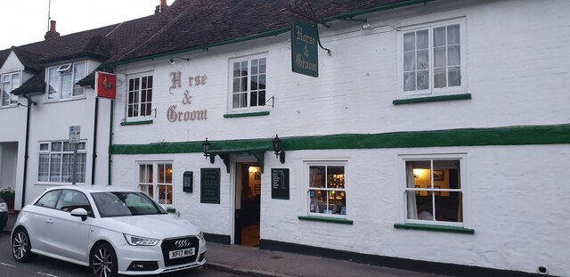
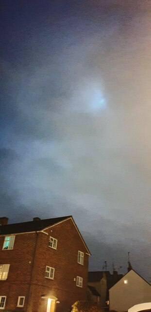
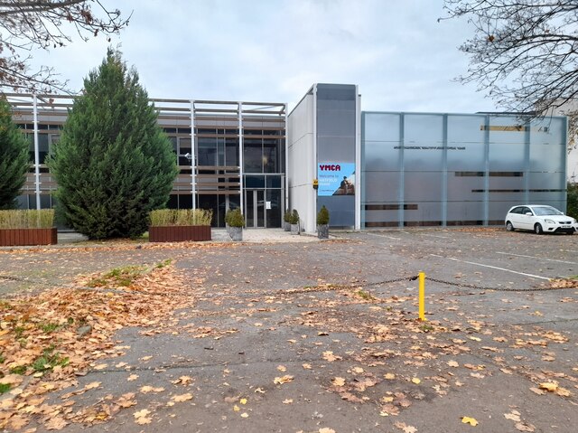
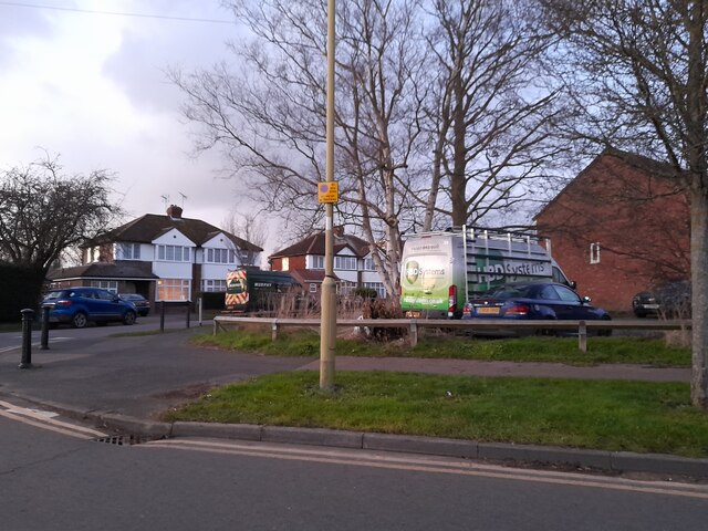
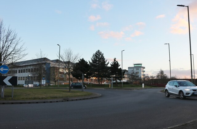
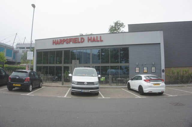
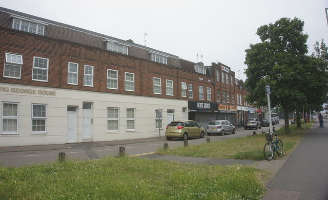
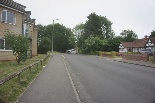
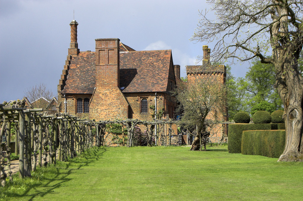
Oxlease Images

Images are sourced within 2km of 51.754226/-0.226887 or Grid Reference TL2207. Thanks to Geograph Open Source API. All images are credited.

Inside the Horse and Groom, Hatfield A lovely old public  house.
Inside the Horse and Groom, Hatfield
A lovely old public house.
Horse and Groom, Hatfield A lovely old public  house.
Horse and Groom, Hatfield
A lovely old public house.
Old Hatfield at Night Moon behind clouds.
Old Hatfield at Night
Moon behind clouds.
The Galleria, Hatfield
The YMCA on Comet Way, Hatfield
The Galleria, Hatfield
KFC on Comet Way, Hatfield This is an original art deco building which has been fully restored
KFC on Comet Way, Hatfield
This is an original art deco building which has been fully restored
The Hopfields, Birchwood A very typical suburban pub style.
The Hopfields, Birchwood
A very typical suburban pub style.
Shops on Birchwood Avenue, Hatfield
Birchwood Avenue, Hatfield
Houses on Birchwood Avenue, Hatfield
Roundabout on Dragon Road, Hatfield
The Runway, Hatfield
Hatfield Central Travelodge
Harpsfield Hall public house A Wetherspoons public house, Hatfield.
Harpsfield Hall public house
A Wetherspoons public house, Hatfield.
Harpsfield Broadway, Hatfield
St Albans Road West, Hatfield
Show me another place!

Oxlease is located at Grid Ref: TL2207 (Lat: 51.754226, Lng: -0.226887)

Administrative County: Hertfordshire

District: Welwyn Hatfield

Police Authority: Hertfordshire

What 3 Words

///lift.chair.tent. Near Hatfield, Hertfordshire

Nearby Locations

Oxlease Howe Dell

Related Wikis

Hatfield rail crash

The Hatfield rail crash was a railway accident on 17 October 2000, at Hatfield, Hertfordshire. It was caused by a metal fatigue-induced derailment, killing...

Oxleys Wood

Oxleys Wood is a 1.2 hectare Local Nature Reserve in Hatfield in Hertfordshire. The declaring authority is Welwyn Hatfield Borough Council. The wood floods...

Howe Dell

Howe Dell is a 4 hectare Local Nature Reserve in Hatfield in Hertfordshire. The declaring authority is Welwyn Hatfield Borough Council. The site is woodland...

Bishop's Hatfield Girls' School

Bishop's Hatfield Girls' School is a girls' secondary academy school for years 7 to sixth form. It is located in Hatfield, Hertfordshire in Wood's Avenue...

Onslow St Audrey's School

Onslow St Audrey's School is a co-educational secondary school and sixth form situated in Hatfield, Hertfordshire in England. It specialises in business...

Hatfield, Hertfordshire

Hatfield is a town and civil parish in Hertfordshire, England, in the borough of Welwyn Hatfield. It had a population of 29,616 in 2001, 39,201 at the...

University of Hertfordshire

The University of Hertfordshire (UH) is a public university in Hertfordshire, United Kingdom. The university is based largely in Hatfield, Hertfordshire...

The Galleria, Hatfield

The Galleria is a designer outlet centre in Hatfield, Hertfordshire in South-East England. == History == The Galleria was constructed in 1991 as part of...

Nearby Amenities

Located within 500m of 51.754226,-0.226887
Turning Circle
Lat/Long: 51.7517744/-0.2286447
Mini Roundabout
Direction: clockwise
Lat/Long: 51.7530349/-0.2226086
Turning Circle
Lat/Long: 51.7528693/-0.2280323
Turning Circle
Lat/Long: 51.7534656/-0.2283054
Turning Circle
Lat/Long: 51.7529124/-0.2300441
Hatfield Rail Crash (2000) Memorial
Historic: memorial
Note: Dedicated to victims of a railway Accident in 2000
Lat/Long: 51.7557729/-0.22031
Bus Stop
Elm Drive
Bus: yes
Naptan AtcoCode: 210021602560
Naptan Bearing: SW
Naptan CommonName: Elm Drive
Naptan Indicator: opp
Naptan Landmark: Unknown
Naptan NaptanCode: hrtapmtj
Naptan PlusbusZoneRef: HATFILD
Naptan ShortCommonName: NA
Naptan Street: Woods Avenue
Naptan Verified: no
Public Transport: platform
Shelter: no
Source: naptan_import
Lat/Long: 51.7557592/-0.2251831
Bus Stop
St Peter's Church
Bus: yes
Naptan AtcoCode: 210021602680
Naptan Bearing: S
Naptan CommonName: St Peter's Church
Naptan Crossing: St Peters Church
Naptan Indicator: nr
Naptan Landmark: St Peters Church
Naptan NaptanCode: hrtapmpd
Naptan PlusbusZoneRef: HATFILD
Naptan ShortCommonName: NA
Naptan Street: Bishops Rise
Naptan Verified: no
Public Transport: platform
Source: naptan_import
Lat/Long: 51.754102/-0.2340121
Bus Stop
Oxlease Drive
Bus: yes
Naptan AtcoCode: 210021605160
Naptan Bearing: N
Naptan CommonName: Oxlease Drive
Naptan Indicator: opp
Naptan Landmark: Unknown
Naptan NaptanCode: hrtapdjm
Naptan PlusbusZoneRef: HATFILD
Naptan ShortCommonName: NA
Naptan Street: Travellers Lane
Naptan Verified: no
Public Transport: platform
Shelter: yes
Source: naptan_import
Lat/Long: 51.753533/-0.2272807
Bus Stop
Elm Drive
Bus: yes
Local Ref: NR
Naptan AtcoCode: 210021605180
Naptan Bearing: NE
Naptan CommonName: Elm Drive
Naptan Indicator: nr
Naptan Landmark: Unknown
Naptan NaptanCode: hrtapdjp
Naptan PlusbusZoneRef: HATFILD
Naptan ShortCommonName: NA
Naptan Street: Woods Avenue
Naptan Verified: no
Public Transport: platform
Shelter: no
Source: naptan_import
Lat/Long: 51.7553389/-0.2262525
Bus Stop
St Philip Howard School
Bus: yes
Local Ref: NR
Naptan AtcoCode: 210021605200
Naptan Bearing: N
Naptan CommonName: St Philip Howard School
Naptan Crossing: Woods Avenue St Philip Howard School
Naptan Indicator: nr
Naptan Landmark: Woods Avenue St Philip Howard School
Naptan NaptanCode: hrtapdjt
Naptan PlusbusZoneRef: HATFILD
Naptan ShortCommonName: NA
Naptan Street: Woods Avenue
Naptan Verified: no
Public Transport: platform
Shelter: no
Source: naptan_import
Lat/Long: 51.7581554/-0.2248481
Turning Circle
Lat/Long: 51.7532662/-0.2255361
Oxlease
Is In: Hatfield
Place: suburb
Lat/Long: 51.7543772/-0.2268252
Barrier: bollard
Bollard: fixed
Material: concrete
Lat/Long: 51.7546486/-0.2339776
Crossing
Crossing: traffic_signals
Tactile: yes
Lat/Long: 51.7556912/-0.225513
Turning Circle
Lat/Long: 51.7516598/-0.2296327
Post Box
Collection Times: Mo-Fr 09:00; Sa 07:00
Operator: Royal Mail
Operator Wikidata: Q638098
Post Box Type: pillar
Ref: AL10 273
Royal Cypher: EIIR
Royal Cypher Wikidata: Q33102113
Lat/Long: 51.7537399/-0.2302465
Post Box
Collection Times: Mo-Fr 09:00, Sa 07:00
Operator: Royal Mail
Operator Wikidata: Q638098
Post Box Type: pillar
Ref: AL10 299
Lat/Long: 51.7532873/-0.2229719
Post Box
Collection Times: Mo-Fr 09:00, Sa 07:00
Operator: Royal Mail
Operator Wikidata: Q638098
Post Box Type: pillar
Ref: AL10 304
Lat/Long: 51.751694/-0.227439
Traffic Calming: chicane
Lat/Long: 51.7531847/-0.2272277
Turning Circle
Lat/Long: 51.7531234/-0.2263309
Crossing
Crossing: unmarked
Crossing Island: no
Crossing Markings: no
Tactile Paving: yes
Lat/Long: 51.7528343/-0.2327878
Crossing
Crossing: unmarked
Crossing Island: yes
Crossing Markings: no
Tactile Paving: yes
Lat/Long: 51.7542091/-0.2269143
Crossing
Crossing: unmarked
Crossing Island: yes
Crossing Markings: no
Tactile Paving: yes
Lat/Long: 51.7545396/-0.2267838
Crossing
Crossing: unmarked
Crossing Island: yes
Crossing Markings: no
Tactile Paving: yes
Lat/Long: 51.7544005/-0.2271279
Crossing
Crossing: unmarked
Crossing Island: no
Crossing Markings: no
Tactile Paving: yes
Lat/Long: 51.7550893/-0.2263396
Crossing
Crossing: unmarked
Crossing Island: yes
Crossing Markings: no
Tactile Paving: yes
Lat/Long: 51.7543447/-0.2265871
Traffic Calming: chicane
Lat/Long: 51.7514754/-0.227318
Crossing
Crossing: unmarked
Crossing Island: no
Crossing Markings: no
Kerb: lowered
Tactile Paving: yes
Lat/Long: 51.7541516/-0.2288676
Crossing
Crossing: unmarked
Crossing Island: no
Crossing Markings: no
Kerb: lowered
Tactile Paving: yes
Lat/Long: 51.7536613/-0.2302321
Bus Stop
Oxlease Drive
Bus: yes
Local Ref: NR
Naptan AtcoCode: 210021602580
Naptan Bearing: S
Naptan CommonName: Oxlease Drive
Naptan Indicator: nr
Naptan Landmark: Unknown
Naptan NaptanCode: hrtapmtp
Naptan PlusbusZoneRef: HATFILD
Naptan ShortCommonName: NA
Naptan Street: Travellers Lane
Naptan Verified: no
Public Transport: platform
Shelter: no
Source: naptan_import
Lat/Long: 51.7537068/-0.2270398
Crossing
Crossing: unmarked
Crossing Island: no
Crossing Markings: no
Tactile Paving: yes
Lat/Long: 51.7499414/-0.226833
Crossing
Crossing: unmarked
Crossing Island: no
Crossing Markings: no
Tactile Paving: yes
Lat/Long: 51.7502615/-0.2269332
Crossing
Crossing: traffic_signals
Crossing Island: no
Crossing Ref: toucan
Tactile Paving: yes
Lat/Long: 51.757568/-0.2243777
Crossing
Crossing: unmarked
Crossing Island: no
Crossing Markings: no
Tactile Paving: yes
Lat/Long: 51.7573261/-0.2241235
Communication Mobile Phone: yes
Man Made: mast
Tower Construction: lattice
Tower Type: communication
Lat/Long: 51.7544005/-0.2317382
Artist Name: William Mitchell
Artwork Type: mural
Listed Status: Grade II
Tourism: artwork
Lat/Long: 51.754234/-0.2329053
Crossing
Crossing: unmarked
Crossing Island: no
Crossing Markings: no
Tactile Paving: no
Lat/Long: 51.7533374/-0.230815
Artist Name: William Mitchell
Artwork Type: sculpture
Tourism: artwork
Lat/Long: 51.7547285/-0.2329523
Entrance: yes
Lat/Long: 51.7536479/-0.2338347
Crossing
Crossing: unmarked
Crossing Island: no
Crossing Markings: no
Tactile Paving: no
Lat/Long: 51.7544727/-0.2276926
Entrance: yes
Lat/Long: 51.7546281/-0.2273268
Telephone
Booth: KX200
Covered: booth
Operator: BT
Operator Wikidata: Q593786
Lat/Long: 51.7516555/-0.2274368
Sculption | Modern Sculpture
Addr City: Hatfield
Addr Housenumber: 16
Addr Street: Linnet Walk
Contact Instagram: https://www.instagram.com/martinjamesbushell
Craft: sculptor
Currency XBT: yes
Payment Onchain: yes
Survey Date: 2022-10-19
Website: https://sculption.co.uk/
Lat/Long: 51.7501863/-0.2294282
Crossing
Crossing: unmarked
Crossing Island: no
Crossing Markings: no
Tactile Paving: no
Lat/Long: 51.7537654/-0.2295826
Crossing
Crossing: unmarked
Crossing Island: no
Crossing Markings: no
Tactile Paving: no
Lat/Long: 51.753117/-0.2310797
Crossing
Crossing: unmarked
Crossing Island: no
Crossing Markings: no
Tactile Paving: no
Lat/Long: 51.7527135/-0.2328893
Crossing
Crossing: unmarked
Crossing Island: no
Crossing Markings: no
Tactile Paving: no
Lat/Long: 51.7529187/-0.2315632
Crossing
Crossing: unmarked
Crossing Island: no
Crossing Markings: no
Tactile Paving: no
Lat/Long: 51.7534366/-0.2339284
Direction: both
Surface: asphalt
Traffic Calming: cushion
Lat/Long: 51.7539406/-0.2340587
Traffic Signals
Traffic Signals: pedestrian_crossing
Traffic Signals Direction: forward
Lat/Long: 51.7557227/-0.2254576
Traffic Signals
Crossing Ref: pelican
Traffic Signals: pedestrian_crossing
Traffic Signals Direction: backward
Lat/Long: 51.7556614/-0.2255654
Traffic Signals
Traffic Signals: pedestrian_crossing
Traffic Signals Direction: forward
Lat/Long: 51.7576287/-0.2244189
Traffic Signals
Traffic Signals: pedestrian_crossing
Traffic Signals Direction: backward
Lat/Long: 51.7575112/-0.2243476
Crossing
Crossing: unmarked
Crossing Island: no
Crossing Markings: no
Tactile Paving: no
Lat/Long: 51.7555543/-0.2258946
Barrier: cycle_barrier
Bicycle: yes
Description: Kissing gate for pedestrians plus 20cm wide gap for bicycles, so can only be used by 2 wheel bikes and able bodied cyclists.
Foot: yes
Horse: no
Motor Vehicle: no
Lat/Long: 51.7517426/-0.2235479
Barrier: bollard
Bollard: fixed
Material: concrete
Lat/Long: 51.7547076/-0.234013
The data included in this document is from www.openstreetmap.org. The data is made available under ODbL.

Have you been to Oxlease?

Leave your review of Oxlease below (or comments, questions and feedback).