Oxhill

Settlement in Warwickshire Stratford-on-Avon

England

Oxhill

Oxhill, St. Lawrence's Church
Oxhill, St. Lawrence's Church Credit: Michael Garlick

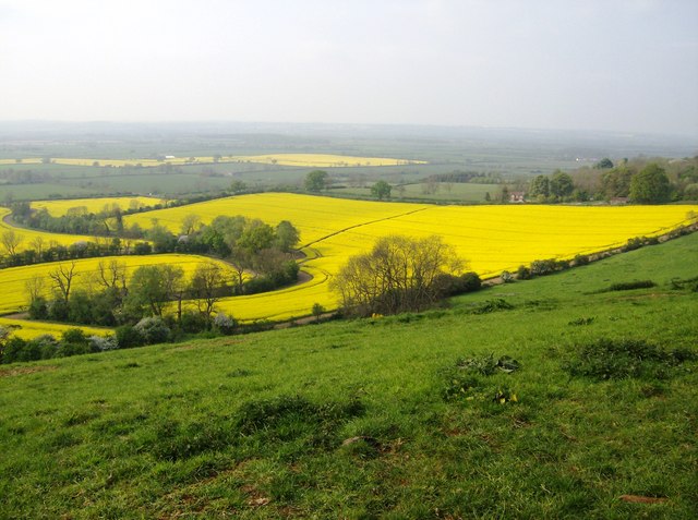
Oxhill is a picturesque village located in the county of Warwickshire, England. Situated on the edge of the Cotswolds, it is surrounded by rolling hills and stunning countryside landscapes. With a population of around 300 residents, Oxhill has managed to preserve its traditional charm and character.

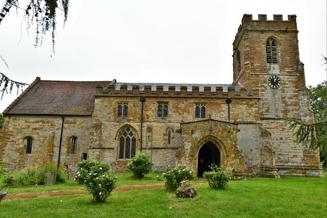
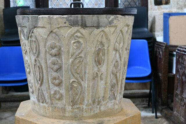
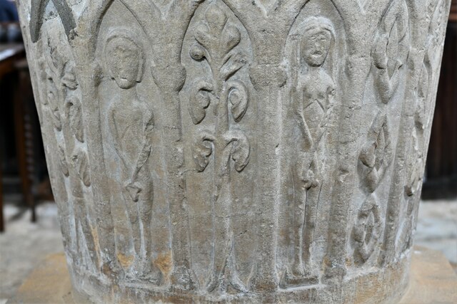
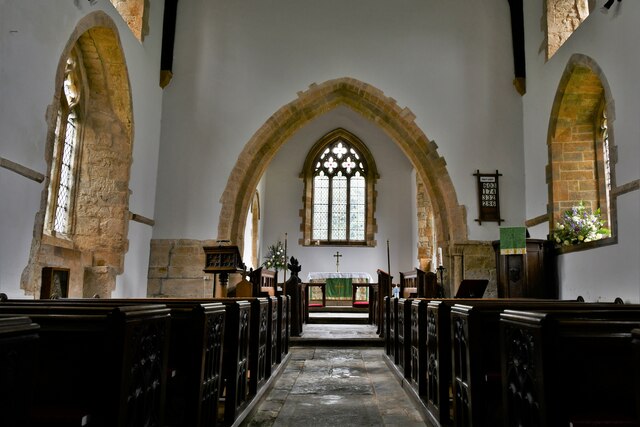
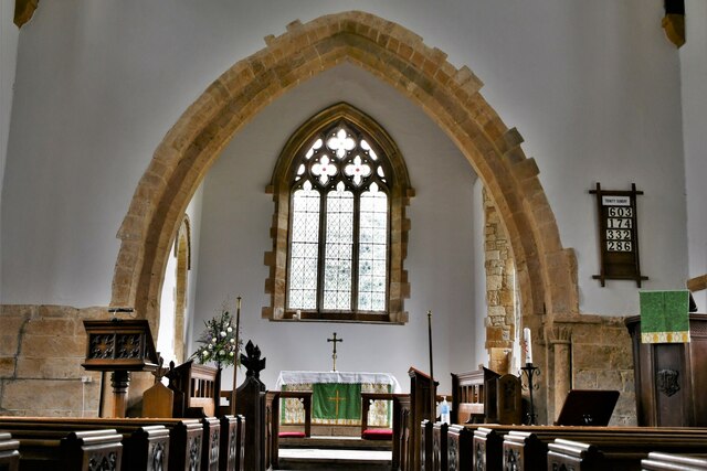
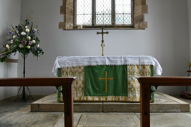
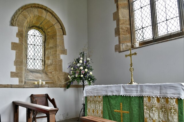
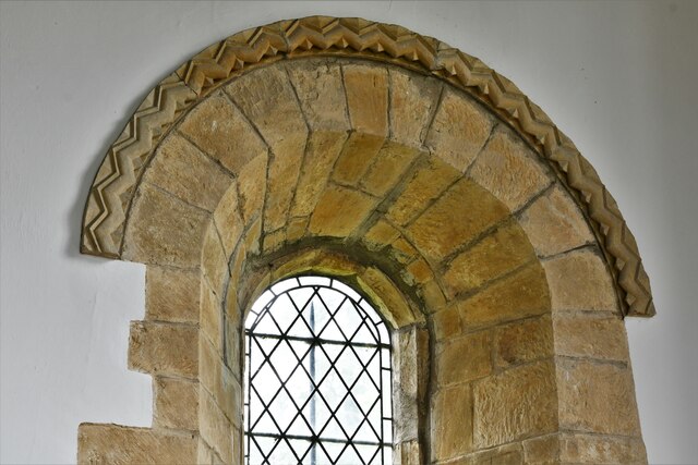
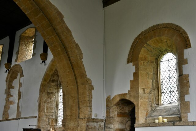
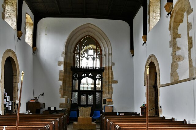
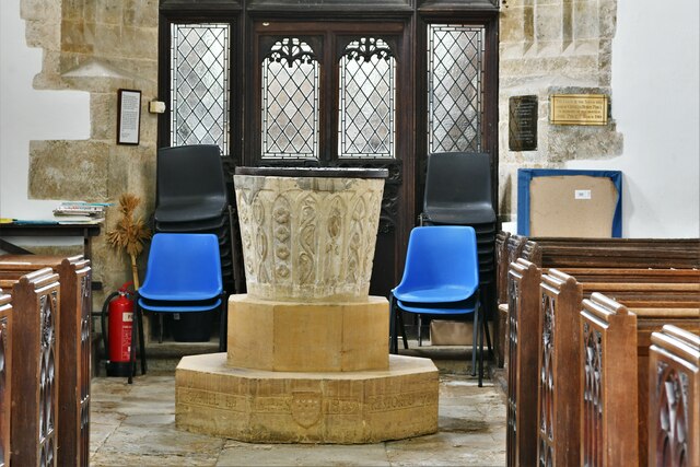
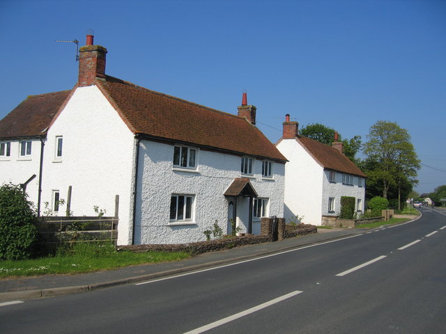
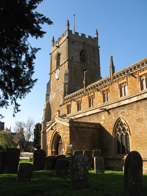
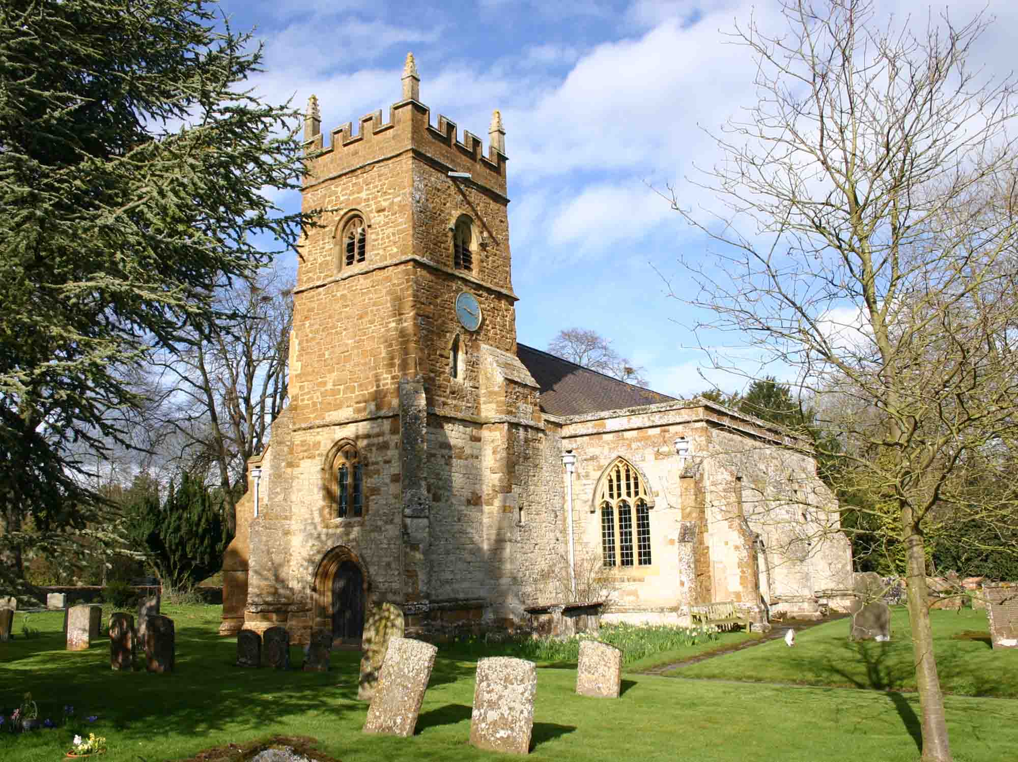
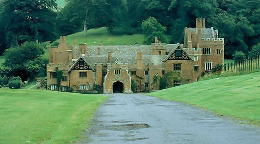
The village is known for its historic buildings, many of which date back to the 17th century. The parish church of St. Lawrence is a prominent feature, with its beautiful architecture and rich history. The village also boasts a number of thatched cottages, stone houses, and timber-framed buildings, adding to its enchanting atmosphere.

Oxhill offers a close-knit community feel, with a range of local amenities including a village hall, a primary school, and a pub. The pub, known as The Peacock, is a popular gathering spot for locals and visitors alike, serving traditional English pub fare and a selection of local ales and ciders.

The surrounding countryside provides ample opportunities for outdoor activities, including hiking, cycling, and horseback riding. The nearby Edgehill escarpment offers breathtaking views of the surrounding area and is a popular spot for nature enthusiasts.

Despite its rural location, Oxhill benefits from good transport links, with easy access to the nearby towns of Stratford-upon-Avon, Warwick, and Banbury. The village is also within commuting distance of larger cities such as Birmingham and Oxford.

Overall, Oxhill offers a peaceful and idyllic setting, making it a desirable place to live for those seeking a quintessential English village experience.

If you have any feedback on the listing, please let us know in the comments section below.

Oxhill Images

Images are sourced within 2km of 52.110928/-1.5408594 or Grid Reference SP3145. Thanks to Geograph Open Source API. All images are credited.

Oxhill, St. Lawrence's Church
Oxhill, St. Lawrence's Church: Norman tub font with blind arcading  1
Oxhill, St. Lawrence's Church: Norman tub font with blind arcading 1
Oxhill, St. Lawrence's Church: Norman tub font with blind arcading  2
Oxhill, St. Lawrence's Church: Norman tub font with blind arcading 2
Oxhill, St. Lawrence's Church: Norman tub font with blind arcading  3
Oxhill, St. Lawrence's Church: Norman tub font with blind arcading 3
Oxhill, St. Lawrence's Church: Norman tub font with blind arcading and Adam and Eve depiction  4
Oxhill, St. Lawrence's Church: Norman tub font with blind arcading and Adam and Eve depiction 4
Oxhill, St. Lawrence's Church: Norman tub font with blind arcading and Adam and Eve depiction  5
Oxhill, St. Lawrence's Church: Norman tub font with blind arcading and Adam and Eve depiction 5
Oxhill, St. Lawrence's Church: Norman tub font with blind arcading 6
Oxhill, St. Lawrence's Church: The nave
Oxhill, St. Lawrence's Church: The chancel arch
Oxhill, St. Lawrence's Church: Chancel arch capital 1
Oxhill, St. Lawrence's Church: Chancel arch capital 2
Oxhill, St. Lawrence's Church: The altar
Oxhill, St. Lawrence's Church: The altar and Norman window
Oxhill, St. Lawrence's Church: Norman north chancel window
Oxhill, St. Lawrence's Church: The nave from the chancel
Oxhill, St. Lawrence's Church: Norman tub font with blind arcading and Adam and Eve depiction  7
Oxhill, St. Lawrence's Church: Norman tub font with blind arcading and Adam and Eve depiction 7
Oxhill, St. Lawrence's Church: c16th Maiden's Wreath Found during the roof timbers restoration in 1967.
Oxhill, St. Lawrence's Church: c16th Maiden's Wreath
Found during the roof timbers restoration in 1967.
Show me another place!

Oxhill is located at Grid Ref: SP3145 (Lat: 52.110928, Lng: -1.5408594)

Administrative County: Warwickshire

District: Stratford-on-Avon

Police Authority: Warwickshire

What 3 Words

///emulated.replying.trapdoor. Near Eattington, Warwickshire

Nearby Locations

Oxhill

Related Wikis

Oxhill, Warwickshire

Oxhill is a village in South Warwickshire, England, off the A422 road between Stratford-upon-Avon and Banbury. The population taken at the 2011 census...

Vale of Red Horse

The Vale of Red Horse, also called the Vale of the Red Horse or Red Horse Vale, is a rural district in southern Warwickshire, England, lying between the...

Whatcote

Whatcote is a village and civil parish in Warwickshire, England, about 4 miles (6.4 km) northeast of Shipston on Stour in the Vale of the Red Horse. The...

Pillerton Priors

Pillerton Priors or Over Pillerton is a settlement and civil parish 11 miles (18 km) south of Warwick, in the Stratford-on-Avon district, in the county...

Tysoe

Tysoe is a civil parish in the Stratford-on-Avon District of Warwickshire, England. The parish is on the boundary with Oxfordshire, about 7+1⁄2 miles...

Pillerton Hersey

Pillerton Hersey is a village and civil parish about 5.5 miles (9 km) north of Shipston-on-Stour in Warwickshire, England. The village is on a stream that...

Compton Wynyates (parish)

Compton Wynyates or Compton Wyniates is an ancient parish and civil parish in Stratford-on-Avon District, Warwickshire, England. It includes the house...

Idlicote

Idlicote is a small settlement and civil parish in the English county of Warwickshire, about 3 miles (5 km) north-east of Shipston-on-Stour and 8 miles...

Nearby Amenities

Located within 500m of 52.110928,-1.5408594
Bus Stop
Peacock
Bus: yes
Naptan AtcoCode: 4200F051800
Naptan Bearing: N
Naptan CommonName: Peacock
Naptan Indicator: Adj
Naptan NaptanCode: warawapa
Naptan Street: Main Street
Naptan Verified: no
Public Transport: platform
Source: naptan_import
Lat/Long: 52.1093759/-1.5395939
Bus Stop
Oxhill Village Hall
Bus: yes
Naptan AtcoCode: 4200F051900
Naptan Bearing: N
Naptan CommonName: Oxhill Village Hall
Naptan Indicator: Village Hall
Naptan Landmark: Oxhill Village Hall
Naptan NaptanCode: warawapd
Naptan Street: Main Street
Naptan Verified: no
Public Transport: platform
Source: naptan_import
Lat/Long: 52.1109461/-1.5410818
Oxhill
Place: village
Source: OS Streetview
Wikidata: Q7115622
Lat/Long: 52.1098227/-1.5413579
Post Box
Collection Times: Mo-Fr 09:00; Sa 07:00
Operator: Royal Mail
Operator Wikidata: Q638098
Post Box Type: lamp
Ref: CV35 236D
Royal Cypher: EIIR
Royal Cypher Wikidata: Q33102113
Source: survey
Lat/Long: 52.107578/-1.5383334
Post Box
Collection Times: Mo-Fr 16:00; Sa 11:00
Operator: Royal Mail
Operator Wikidata: Q638098
Post Box Type: lamp
Ref: CV35 161
Royal Cypher: EIIR
Royal Cypher Wikidata: Q33102113
Source: survey
Lat/Long: 52.1107817/-1.5407386
Tomb of Myrtilla
Heritage: 2
Heritage Operator: Historic England
Historic: tomb
Listed Status: Grade II*
Lat/Long: 52.1070175/-1.5384896
Turning Circle
Lat/Long: 52.1120701/-1.5396948
Give Way
Source: bing
Lat/Long: 52.1094474/-1.5394083
Generator Method: photovoltaic
Generator Output Electricity: yes
Generator Source: solar
Generator Type: solar_photovoltaic_panel
Location: roof
Power: generator
Lat/Long: 52.1103558/-1.5404624
Generator Method: photovoltaic
Generator Output Electricity: yes
Generator Source: solar
Generator Type: solar_photovoltaic_panel
Location: roof
Power: generator
Lat/Long: 52.1118342/-1.5397006
Generator Method: photovoltaic
Generator Output Electricity: yes
Generator Source: solar
Generator Type: solar_photovoltaic_panel
Location: roof
Power: generator
Lat/Long: 52.109533/-1.5412778
Generator Method: photovoltaic
Generator Output Electricity: yes
Generator Source: solar
Generator Type: solar_photovoltaic_panel
Location: roof
Power: generator
Lat/Long: 52.109421/-1.5413019
Generator Method: photovoltaic
Generator Output Electricity: yes
Generator Source: solar
Generator Type: solar_photovoltaic_panel
Location: roof
Power: generator
Lat/Long: 52.1094902/-1.5418518
Generator Method: photovoltaic
Generator Output Electricity: yes
Generator Source: solar
Generator Type: solar_photovoltaic_panel
Location: roof
Power: generator
Lat/Long: 52.1097307/-1.5416318
Generator Method: photovoltaic
Generator Output Electricity: yes
Generator Source: solar
Generator Type: solar_photovoltaic_panel
Location: roof
Power: generator
Lat/Long: 52.1098213/-1.5424714
Generator Method: photovoltaic
Generator Output Electricity: yes
Generator Source: solar
Generator Type: solar_photovoltaic_panel
Location: roof
Power: generator
Lat/Long: 52.1097439/-1.5420502
Generator Method: photovoltaic
Generator Output Electricity: yes
Generator Source: solar
Generator Type: solar_photovoltaic_panel
Location: roof
Power: generator
Lat/Long: 52.1095264/-1.5422165
Generator Method: photovoltaic
Generator Output Electricity: yes
Generator Source: solar
Generator Type: solar_photovoltaic_panel
Location: roof
Power: generator
Lat/Long: 52.1094111/-1.5423721
Generator Method: photovoltaic
Generator Output Electricity: yes
Generator Source: solar
Generator Type: solar_photovoltaic_panel
Location: roof
Power: generator
Lat/Long: 52.1095857/-1.5427342
Generator Method: photovoltaic
Generator Output Electricity: yes
Generator Source: solar
Generator Type: solar_photovoltaic_panel
Location: roof
Power: generator
Lat/Long: 52.1089828/-1.5445527
Generator Method: photovoltaic
Generator Output Electricity: yes
Generator Source: solar
Generator Type: solar_photovoltaic_panel
Location: roof
Power: generator
Lat/Long: 52.1086764/-1.545108
Generator Method: photovoltaic
Generator Output Electricity: yes
Generator Source: solar
Generator Type: solar_photovoltaic_panel
Location: roof
Power: generator
Lat/Long: 52.1086501/-1.5449765
Power: pole
Source: bing
Lat/Long: 52.1093732/-1.540567
Power: pole
Source: bing
Lat/Long: 52.1089334/-1.540795
Power: pole
Source: bing
Lat/Long: 52.10823/-1.5406904
Power: pole
Source: bing
Lat/Long: 52.1071609/-1.5404302
Generator Method: photovoltaic
Generator Output Electricity: yes
Generator Source: solar
Generator Type: solar_photovoltaic_panel
Location: roof
Power: generator
Lat/Long: 52.1072276/-1.544947
Generator Method: photovoltaic
Generator Output Electricity: yes
Generator Source: solar
Generator Type: solar_photovoltaic_panel
Location: roof
Power: generator
Lat/Long: 52.1073676/-1.544078
Generator Method: photovoltaic
Generator Output Electricity: yes
Generator Source: solar
Generator Type: solar_photovoltaic_panel
Location: roof
Power: generator
Lat/Long: 52.1074038/-1.5432331
Generator Method: photovoltaic
Generator Output Electricity: yes
Generator Source: solar
Generator Type: solar_photovoltaic_panel
Location: roof
Power: generator
Lat/Long: 52.1073717/-1.5434034
Generator Method: photovoltaic
Generator Output Electricity: yes
Generator Source: solar
Generator Type: solar_photovoltaic_panel
Location: roof
Power: generator
Lat/Long: 52.1108755/-1.5416881
Generator Method: photovoltaic
Generator Output Electricity: yes
Generator Source: solar
Generator Type: solar_photovoltaic_panel
Location: roof
Power: generator
Lat/Long: 52.1103196/-1.543504
The data included in this document is from www.openstreetmap.org. The data is made available under ODbL.

Have you been to Oxhill?

Leave your review of Oxhill below (or comments, questions and feedback).