Shirley, Old
Settlement in Hampshire
England
Shirley, Old

Shirley is a small village located in the district of Old, Hampshire, in the southern region of England. Situated approximately 3 miles east of the city of Southampton, Shirley is a thriving community with a population of around 12,000 residents.
The village boasts a rich history, dating back to the Norman era, and is known for its picturesque landscapes and charming architecture. The village center features a mix of historic buildings, including the Grade II listed St. James' Church, which dates back to the 12th century. The church's stunning stained glass windows and intricate architectural details make it a popular attraction for visitors.
Shirley offers a range of amenities for its residents, including several schools, healthcare facilities, and shopping centers. The village is also well-connected through an extensive network of roads, with convenient access to major nearby cities, including Southampton and Winchester.
Nature enthusiasts can enjoy the peaceful surroundings of Shirley, as it is surrounded by beautiful countryside and green spaces. The nearby Southampton Common, a large urban park, provides ample opportunities for leisure activities, including walking, cycling, and picnicking.
Furthermore, the village hosts various community events throughout the year, such as summer fairs and local festivals, which bring residents together and foster a strong sense of community.
In summary, Shirley, Old, Hampshire is a charming village with a rich history, stunning architecture, and a close-knit community. It offers a peaceful and picturesque setting, while also providing convenient amenities and easy access to nearby cities.
If you have any feedback on the listing, please let us know in the comments section below.
Shirley, Old Images
Images are sourced within 2km of 50.928201/-1.442897 or Grid Reference SU3914. Thanks to Geograph Open Source API. All images are credited.


Shirley, Old is located at Grid Ref: SU3914 (Lat: 50.928201, Lng: -1.442897)
Unitary Authority: Southampton
Police Authority: Hampshire
What 3 Words
///ranges.stocks.maybe. Near Totton, Hampshire
Nearby Locations
Related Wikis
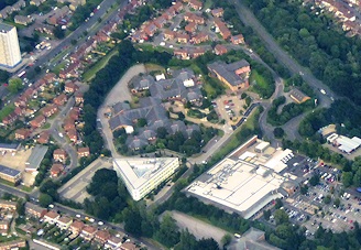
Western Community Hospital
The Western Community Hospital is a health facility in William Macleod Way in the Shirley / Millbrook area of Southampton, Hampshire, England. It is managed...

Maybush
Maybush is a district in the city of Southampton, England. Located in the western side of the city, Maybush is the former location of the Ordnance Survey...
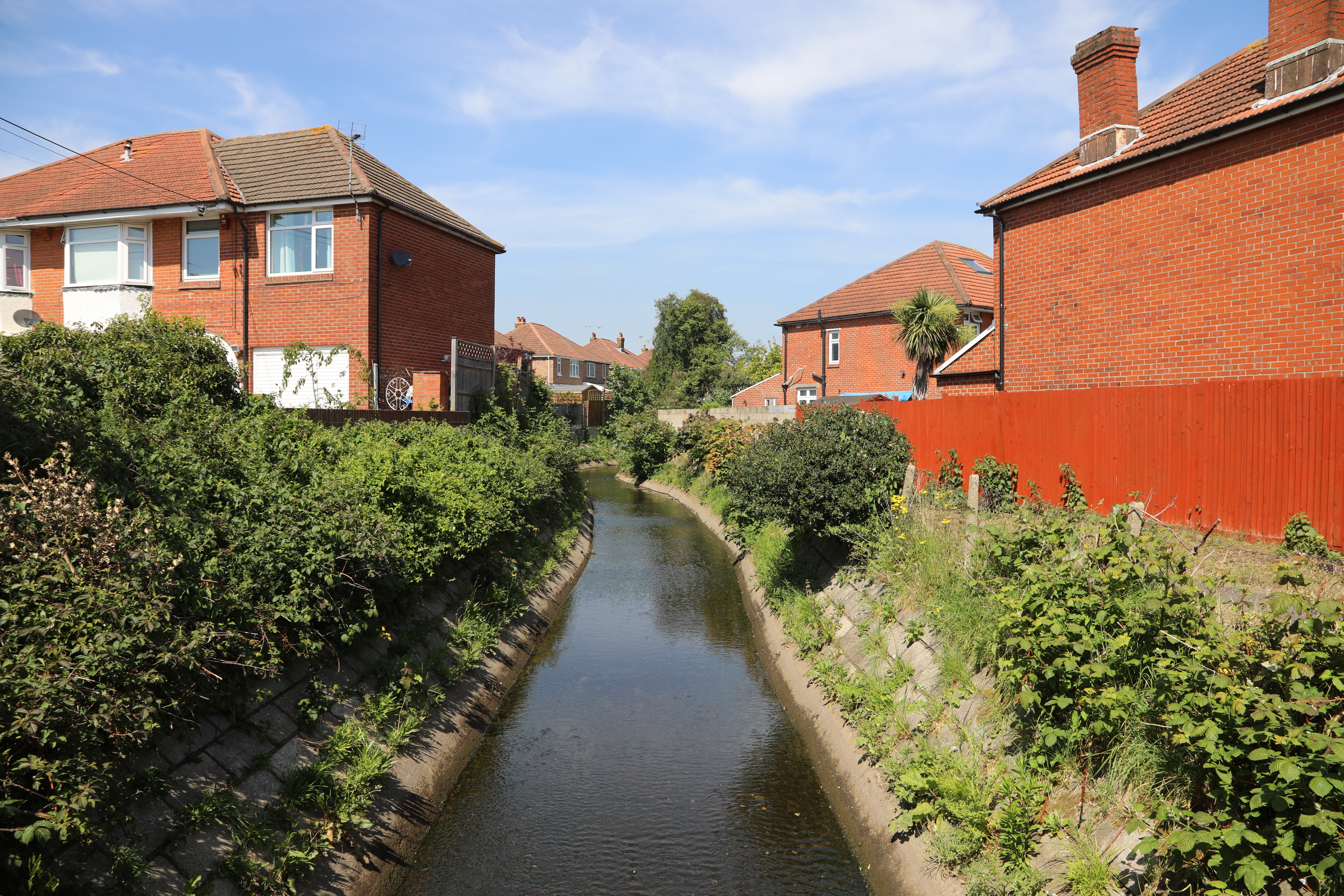
Tanner's Brook
Tanner's Brook is a 7-kilometre (4.3 mi) river that rises in North Baddesley and flows to Southampton Water. The brook's name comes from a 19th-century...
Regents Park Community College
Regents Park Community College is a mixed Comprehensive School in West Southampton, Hampshire, in the south of England. The most recent Ofsted inspection...
Coxford, Southampton
Coxford is an Electoral Ward in the Unitary Authority of Southampton, England. It had a population of 14,232 at the 2001 census. == References ==

University of Southampton School of Medicine
University of Southampton School of Medicine is a medical school in England. It is part of the University of Southampton with a site at Southampton General...
Southampton General Hospital
Southampton General Hospital (SGH) is a large teaching hospital in Southampton, Hampshire, England run by University Hospital Southampton NHS Foundation...
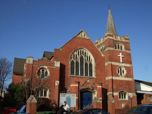
Shirley Baptist Church, Southampton
Shirley Baptist Church is a Baptist church in Southampton. The main church building is situated along Church Street in the district of Shirley. Founded...
Nearby Amenities
Located within 500m of 50.928201,-1.442897Have you been to Shirley, Old?
Leave your review of Shirley, Old below (or comments, questions and feedback).