Shirley Warren

Settlement in Hampshire

England

Shirley Warren

New extension, Southampton General Hospital Seen on a Sunday morning, with that rarest of commodities in the foreground: hospital parking spaces!
New extension, Southampton General Hospital Credit: David Martin

The requested URL returned error: 429 Too Many Requests

If you have any feedback on the listing, please let us know in the comments section below.

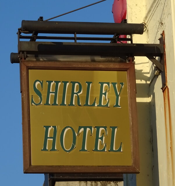
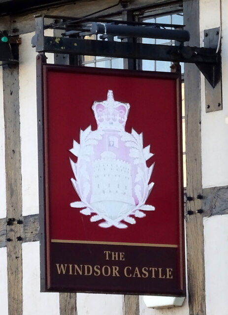
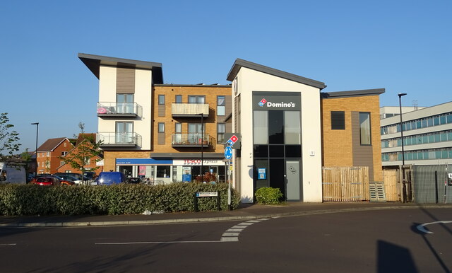
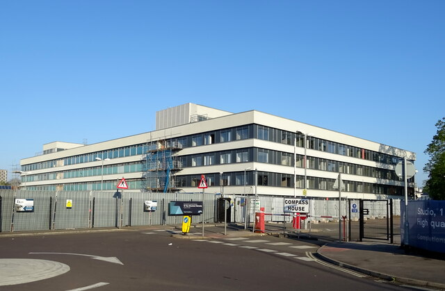
Shirley Warren Images

Images are sourced within 2km of 50.931221/-1.435034 or Grid Reference SU3914. Thanks to Geograph Open Source API. All images are credited.

New extension, Southampton General Hospital Seen on a Sunday morning, with that rarest of commodities in the foreground: hospital parking spaces!
New extension, Southampton General Hospital
Seen on a Sunday morning, with that rarest of commodities in the foreground: hospital parking spaces!
Businesses on Shirley High Street
Shirley High Street (A3057)
The Shirley Hotel On Shirley High Street.
See <a href="https://www.geograph.org.uk/photo/7302356">SU3913 : Sign for the Shirley Hotel</a> for sign.
The Shirley Hotel
On Shirley High Street. See SU3913 : Sign for the Shirley Hotel for sign.
Sign for the Shirley Hotel See <a href="https://www.geograph.org.uk/photo/7302355">SU3913 : The Shirley Hotel</a> for context.
Sign for the Shirley Hotel
See SU3913 : The Shirley Hotel for context.
The Windsor Castle, Shirley On Shirley High Street.
See <a href="https://www.geograph.org.uk/photo/7302360">SU3913 : Sign for the Windsor Castle, Shirley</a> for sign.
The Windsor Castle, Shirley
On Shirley High Street. See SU3913 : Sign for the Windsor Castle, Shirley for sign.
Sign for the Windsor Castle, Shirley See <a href="https://www.geograph.org.uk/photo/7302357">SU3913 : The Windsor Castle, Shirley</a> for context.
Sign for the Windsor Castle, Shirley
Houses on Romsey Road
Romsey Road (A3057)
Romsey Road (A3057)
Businesses and flats, Mercator Close
Compass House A development of 245 contemporary 1 & 2 bedroom apartments.
Compass House
A development of 245 contemporary 1 & 2 bedroom apartments.
Romsey Road (A3057)
Romsey Road (A3057)
Path and underpass under Boniface Crescent
Romsey Road (A3057) approaching roundabout
Elizabeth II postbox on Shirley High Street, Southampton Postbox No. SO15 128.
See <a href="https://www.geograph.org.uk/photo/7305406">SU3913 : Shirley High Street, Southampton</a> for context.
Elizabeth II postbox on Shirley High Street, Southampton
Postbox No. SO15 128. See SU3913 : Shirley High Street, Southampton for context.
Shirley High Street, Southampton Showing position of Postbox No. SO15 128.
See <a href="https://www.geograph.org.uk/photo/7305404">SU3913 : Elizabeth II postbox on Shirley High Street, Southampton</a> for postbox.
Shirley High Street, Southampton
Showing position of Postbox No. SO15 128. See SU3913 : Elizabeth II postbox on Shirley High Street, Southampton for postbox.
A35 heading west, Old Shirley Hill
A35 Tebourba Way Heading west towards Totton.
A35 Tebourba Way
Heading west towards Totton.
Show me another place!

Shirley Warren is located at Grid Ref: SU3914 (Lat: 50.931221, Lng: -1.435034)

Unitary Authority: Southampton

Police Authority: Hampshire

What 3 Words

///sing.index.clocks. Near Southampton, Hampshire

Related Wikis

University of Southampton School of Medicine

University of Southampton School of Medicine is a medical school in England. It is part of the University of Southampton with a site at Southampton General...

Southampton General Hospital

Southampton General Hospital (SGH) is a large teaching hospital in Southampton, Hampshire, England run by University Hospital Southampton NHS Foundation...

Princess Anne Hospital

The Princess Anne Hospital is a maternity hospital in Southampton, England, adjacent to Southampton General Hospital. It is operated by the University...

Coxford, Southampton

Coxford is an Electoral Ward in the Unitary Authority of Southampton, England. It had a population of 14,232 at the 2001 census. == References ==

Nearby Amenities

Located within 500m of 50.931221,-1.435034
Mini Roundabout
Direction: clockwise
Lat/Long: 50.9318923/-1.4321164
Crossing
Button Operated: yes
Crossing: traffic_signals
Crossing Island: yes
Crossing Markings: dots
Kerb: lowered
Tactile Paving: yes
Traffic Signals Sound: no
Traffic Signals Vibration: yes
Lat/Long: 50.9288853/-1.4290308
Mini Roundabout
Direction: clockwise
Lat/Long: 50.9337215/-1.4408706
Mini Roundabout
Lat/Long: 50.9285993/-1.437628
Barrier: bollard
Bollard: fixed
Motor Vehicle: no
Lat/Long: 50.9274489/-1.4314353
Mini Roundabout
Direction: clockwise
Lat/Long: 50.9320709/-1.4319584
Turning Circle
Lat/Long: 50.9316073/-1.4291095
Turning Circle
Turning Circle: square
Lat/Long: 50.9274803/-1.4347469
Shirley Warren
Is In: Southampton
Place: suburb
Lat/Long: 50.931405/-1.4388904
Bus Stop
Warren Crescent
Bench: yes
Bin: yes
Bus: yes
Lit: no
Naptan AtcoCode: 1980SN120213
Naptan NaptanCode: sohajwp
Public Transport: platform
Shelter: yes
Tactile Paving: no
Lat/Long: 50.9281918/-1.4372724
Bus Stop
Warren Crescent
Bench: no
Bin: no
Bus: yes
Lit: yes
Naptan AtcoCode: 1980SN120211
Naptan NaptanCode: sohajwa
Public Transport: platform
Shelter: no
Tactile Paving: no
Lat/Long: 50.9289762/-1.4379336
Bus Stop
Tremona Court
Bench: no
Bin: no
Bus: yes
Lit: no
Naptan AtcoCode: 1980SNA09197
Naptan NaptanCode: sohjptp
Public Transport: platform
Tactile Paving: no
Lat/Long: 50.9287873/-1.4370303
Bus Stop
General Hospital, A&E
Bench: no
Bin: yes
Bus: yes
Lit: yes
Local Ref: H
Naptan AtcoCode: 1980SN120221
Naptan Bearing: NE
Naptan CommonName: General Hospital A&E
Naptan NaptanCode: sohampt
Naptan Street: Tremona Road
Naptan Verified: no
Public Transport: platform
Shelter: no
Tactile Paving: no
Lat/Long: 50.9323276/-1.4318182
Bus Stop
General Hospital, Main Entrance
Bench: yes
Bin: no
Bus: yes
Lit: yes
Local Ref: D
Naptan AtcoCode: 1980SN120082
Naptan Bearing: NW
Naptan CommonName: General Hospital and Cemetery
Naptan NaptanCode: sohamjg
Naptan Street: Tremona Road
Naptan Verified: no
Public Transport: platform
Shelter: yes
Tactile Paving: no
Lat/Long: 50.9345606/-1.4332055
Bus Stop
General Hospital, Main Entrance
Bench: yes
Bin: yes
Bus: yes
Lit: no
Local Ref: C
Naptan AtcoCode: 1980SN120084
Naptan Bearing: SE
Naptan CommonName: General Hospital and Cemetery
Naptan NaptanCode: sohampa
Naptan Street: Tremona Road
Naptan Verified: no
Public Transport: platform
Shelter: no
Tactile Paving: no
Lat/Long: 50.9341307/-1.4320727
Bus Stop
General Hospital, A&E
Bench: yes
Bin: yes
Bus: yes
Lit: yes
Local Ref: G
Naptan AtcoCode: 1980SN120222
Naptan Bearing: S
Naptan CommonName: General Hospital A&E
Naptan NaptanCode: sohampw
Naptan Street: Tremona Road
Naptan Verified: no
Public Transport: platform
Shelter: yes
Tactile Paving: no
Lat/Long: 50.9328694/-1.4314809
Bus Stop
General Hospital
Bench: yes
Bin: yes
Bus: yes
Local Ref: A
Public Transport: platform
Shelter: yes
Tactile Paving: no
Lat/Long: 50.9349019/-1.4340914
Bus Stop
General Hospital
Bench: yes
Bin: yes
Bus: yes
Local Ref: B
Naptan AtcoCode: 1980SN120083
Naptan NaptanCode: sohamjd
Public Transport: platform
Shelter: yes
Tactile Paving: no
Lat/Long: 50.9350615/-1.4334345
Bus Stop
Jessamine Road
Bench: no
Bin: no
Bus: yes
Naptan AtcoCode: 1980SN120209
Naptan NaptanCode: sohajta
Public Transport: platform
Shelter: no
Lat/Long: 50.9313632/-1.4393297
Bus Stop
Laundry Road
Bus: yes
Naptan AtcoCode: 1980SN120080
Naptan NaptanCode: sohajpg
Public Transport: platform
Lat/Long: 50.9328077/-1.4403798
Bus Stop
Laundry Road
Bench: yes
Bus: yes
Naptan AtcoCode: 1980SN120081
Naptan NaptanCode: sohajmw
Public Transport: platform
Shelter: yes
Lat/Long: 50.9333255/-1.4405816
Bus Stop
Warren Avenue
Bench: yes
Bus: yes
Naptan AtcoCode: 1980SN120985
Naptan Bearing: W
Naptan NaptanCode: sohajpm
Public Transport: platform
Shelter: yes
Lat/Long: 50.933804/-1.4399538
Bus Stop
Warren Avenue
Bus: yes
Naptan AtcoCode: 1980SN120986
Naptan Bearing: E
Naptan NaptanCode: sohajpw
Public Transport: platform
Lat/Long: 50.9338928/-1.4396065
Bus Stop
General Hospital (West Wing)
Bench: yes
Bin: yes
Bus: yes
Departures Board: timetable
Lit: yes
Local Ref: F
Public Transport: platform
Shelter: yes
Tactile Paving: yes
Lat/Long: 50.9339111/-1.4359972
Bus Stop
Dale Road
Bench: no
Bin: no
Bus: yes
Naptan AtcoCode: 1980SN120225
Naptan Bearing: NW
Naptan CommonName: Dale Road
Naptan NaptanCode: sohamwp
Naptan Street: Dale Road
Naptan Verified: no
Public Transport: platform
Shelter: yes
Tactile Paving: no
Lat/Long: 50.9296564/-1.4295619
Post Box
Brand: Royal Mail
Brand Wikidata: Q638098
Brand Wikipedia: en:Royal Mail
Collection Plate: CP1D
Collection Times: Mo-Fr 09:00; Sa 07:00
Operator: Royal Mail
Operator Wikidata: Q638098
Post Box Type: pillar
Postal Code: SO16
Ref: SO16 112D
Royal Cypher: GVIR
Royal Cypher Wikidata: Q33102169
Lat/Long: 50.9286039/-1.430432
Crossing
Crossing: uncontrolled
Crossing Island: no
Crossing Markings: zebra
Kerb: lowered
Tactile Paving: yes
Lat/Long: 50.9338833/-1.4346398
Crossing
Crossing: uncontrolled
Crossing Island: no
Crossing Markings: zebra
Lat/Long: 50.9350443/-1.4352096
Crossing
Crossing: unmarked
Crossing Island: no
Crossing Markings: no
Kerb: lowered
Tactile Paving: no
Lat/Long: 50.9273858/-1.4323816
Man Made: chimney
Lat/Long: 50.9332754/-1.43776
WHSmith
Branch: (C Level)
Brand: WHSmith
Brand Wikidata: Q1548712
Brand Wikipedia: en:WHSmith
Check Date: 2024-04-03
Shop: newsagent
Lat/Long: 50.9332213/-1.4344138
Atm
ATM (C level)
Check Date: 2022-09-15
Lat/Long: 50.9330844/-1.4343214
Restaurant
Feast at the Kitchen (Hospital restaurant - B level)
Lat/Long: 50.9329881/-1.4342812
Crossing
Crossing: unmarked
Crossing Island: no
Crossing Markings: no
Tactile Paving: yes
Lat/Long: 50.9350239/-1.4338365
Traffic Calming: table
Lat/Long: 50.933097/-1.4405117
Traffic Calming: hump
Lat/Long: 50.9284804/-1.4388059
Crossing
Crossing: unmarked
Crossing Island: no
Crossing Markings: no
Kerb: lowered
Tactile Paving: yes
Lat/Long: 50.9331184/-1.4404283
Check Date: 2022-06-20
Traffic Calming: choker
Lat/Long: 50.9330221/-1.4394689
Traffic Calming: hump
Lat/Long: 50.9288597/-1.4408358
Turning Circle
Source: Bing
Lat/Long: 50.9321276/-1.4404978
Traffic Calming: table
Lat/Long: 50.931071/-1.4392018
Crossing
Crossing: unmarked
Crossing Island: no
Crossing Markings: no
Kerb: lowered
Tactile Paving: yes
Lat/Long: 50.9310965/-1.4391115
Bus Stop
Jessamine Road
Bench: no
Bin: no
Bus: yes
Naptan AtcoCode: 1980SN120210
Naptan NaptanCode: sohajtg
Public Transport: platform
Shelter: no
Lat/Long: 50.9308348/-1.439118
Bus Stop
Vine Road
Bench: yes
Bin: yes
Bus: yes
Lit: yes
Local Ref: E
Naptan AtcoCode: 1980SN120102
Naptan NaptanCode: sohajwm
Public Transport: platform
Shelter: yes
Tactile Paving: no
Lat/Long: 50.9340686/-1.437493
Turning Circle
Lat/Long: 50.9309833/-1.4294847
Traffic Calming: bump
Lat/Long: 50.9300659/-1.4335309
Cafe
Costa
Brand: Costa
Brand Wikidata: Q608845
Brand Wikipedia: en:Costa Coffee
Check Date: 2024-04-03
Cuisine: coffee_shop
Opening Hours: PH,Mo-Su 00:00-24:00
Takeaway: yes
Lat/Long: 50.9334434/-1.4339823
North Wing
Access: yes
Entrance: yes
Wheelchair: designated
Lat/Long: 50.9328102/-1.4325655
Vending Machine
(B level)
Check Date: 2022-06-25
Indoor: yes
Payment American Express: no
Payment Coins: yes
Payment Diners Club: no
Payment Discover Card: no
Payment Laser: no
Payment Maestro: no
Payment Mastercard: no
Payment Notes: no
Payment Visa: no
Lat/Long: 50.9337295/-1.4358464
Emergency Deptartment
Entrance: yes
Lat/Long: 50.9326226/-1.4327366
Post Box
Brand: Royal Mail
Brand Wikidata: Q638098
Brand Wikipedia: en:Royal Mail
Collection Plate: CP1
Collection Times: Mo-Fr 17:00; Sa 12:00
Operator: Royal Mail
Operator Wikidata: Q638098
Post Box Type: pillar
Ref: SO16 25
Royal Cypher: GR
Royal Cypher Wikidata: Q33102273
Lat/Long: 50.930131/-1.4385091
Fast Food
Rosario's
Check Date: 2024-04-03
Cuisine: pizza
Lat/Long: 50.9333428/-1.4404148
Fast Food
Lucky House
Check Date: 2024-04-03
Cuisine: chinese
Lat/Long: 50.9297366/-1.4381382
Crossing
Crossing: unmarked
Crossing Island: yes
Crossing Markings: no
Kerb: lowered
Tactile Paving: yes
Lat/Long: 50.9319865/-1.432039
Parking Entrance
Lat/Long: 50.9334767/-1.4329001
Stop
Direction: forward
Stop: minor
Lat/Long: 50.9342174/-1.4359142
Dale Road
Bus: yes
Public Transport: stop_position
Lat/Long: 50.929683/-1.4295099
General Hospital, A&E
Bus: yes
Public Transport: stop_position
Lat/Long: 50.9322734/-1.4317494
General Hospital, Main Entrance
Bus: yes
Public Transport: stop_position
Lat/Long: 50.9346024/-1.4331681
General Hospital, A&E
Bus: yes
Public Transport: stop_position
Lat/Long: 50.9329258/-1.4315314
General Hospital, Main Entrance
Bus: yes
Public Transport: stop_position
Lat/Long: 50.9341316/-1.4321765
General Hospital
Bus: yes
Public Transport: stop_position
Lat/Long: 50.9348436/-1.434131
Board Type: nature
Check Date: 2023-03-04
Information: board
Tourism: information
Lat/Long: 50.9307482/-1.4306836
Bicycle Parking
Access: yes
Bicycle Parking: stands
Capacity: 25
Covered: no
Lat/Long: 50.9324935/-1.432199
Bicycle Parking
Access: yes
Capacity: 100
Covered: yes
Lat/Long: 50.9320334/-1.4357347
Crossing
Crossing: unmarked
Crossing Island: no
Crossing Markings: no
Tactile Paving: no
Lat/Long: 50.9273641/-1.4324914
Crossing
Button Operated: yes
Crossing: traffic_signals
Crossing Island: no
Crossing Markings: no
Kerb: lowered
Tactile Paving: yes
Traffic Signals Sound: no
Traffic Signals Vibration: yes
Lat/Long: 50.9274438/-1.4325126
Crossing
Crossing: unmarked
Crossing Island: no
Crossing Markings: no
Kerb: lowered
Tactile Paving: no
Lat/Long: 50.9275764/-1.4323571
Crossing
Crossing: unmarked
Crossing Island: no
Crossing Markings: no
Kerb: lowered
Tactile Paving: no
Lat/Long: 50.9275832/-1.4322107
Crossing
Crossing: unmarked
Crossing Island: no
Crossing Markings: no
Kerb: lowered
Tactile Paving: yes
Lat/Long: 50.927691/-1.431749
Crossing
Crossing: unmarked
Crossing Island: no
Crossing Markings: no
Kerb: lowered
Tactile Paving: yes
Lat/Long: 50.9280705/-1.4313309
Crossing
Crossing: uncontrolled
Crossing Island: no
Crossing Markings: dots
Kerb: lowered
Tactile Paving: yes
Lat/Long: 50.9283312/-1.4302531
Crossing
Button Operated: yes
Crossing: traffic_signals
Crossing Island: no
Crossing Markings: dots
Kerb: lowered
Tactile Paving: yes
Traffic Signals Sound: no
Traffic Signals Vibration: yes
Lat/Long: 50.9283481/-1.4303644
Crossing
Crossing: unmarked
Crossing Island: no
Crossing Markings: no
Kerb: lowered
Tactile Paving: yes
Lat/Long: 50.9284472/-1.4303717
Traffic Signals
Traffic Signals: signal
Traffic Signals Direction: forward
Lat/Long: 50.9284749/-1.4304031
Crossing
Crossing: uncontrolled
Crossing Island: no
Crossing Markings: dots
Kerb: lowered
Tactile Paving: yes
Lat/Long: 50.9282855/-1.4303115
Crossing
Crossing: uncontrolled
Crossing Island: no
Crossing Markings: dots
Kerb: lowered
Tactile Paving: yes
Lat/Long: 50.928359/-1.4301399
Crossing
Crossing: unmarked
Crossing Island: no
Crossing Markings: no
Kerb: lowered
Tactile Paving: yes
Lat/Long: 50.9321328/-1.4320884
Crossing
Crossing: traffic_signals
Crossing Island: no
Crossing Ref: pelican
Kerb: lowered
Tactile Paving: yes
Lat/Long: 50.93469/-1.434581
Crossing
Crossing: uncontrolled
Crossing Island: no
Crossing Markings: zebra
Lat/Long: 50.9347886/-1.434882
Crossing
Crossing: unmarked
Kerb: lowered
Tactile Paving: yes
Lat/Long: 50.9343375/-1.4359569
Vine Road
Bus: yes
Public Transport: stop_position
Lat/Long: 50.9341176/-1.437447
Crossing
Crossing: unmarked
Crossing Island: yes
Crossing Markings: no
Kerb: lowered
Tactile Paving: yes
Lat/Long: 50.9337438/-1.4407183
Traffic Calming: table
Lat/Long: 50.9335183/-1.4408039
Crossing
Crossing: unmarked
Crossing Island: no
Crossing Markings: no
Kerb: lowered
Tactile Paving: yes
Lat/Long: 50.9331676/-1.4405598
Crossing
Crossing: unmarked
Crossing Island: no
Crossing Markings: no
Kerb: lowered
Tactile Paving: yes
Lat/Long: 50.9330475/-1.440479
Crossing
Crossing: unmarked
Crossing Island: no
Crossing Markings: no
Kerb: lowered
Tactile Paving: yes
Lat/Long: 50.9330741/-1.4405931
Traffic Calming: cushion
Lat/Long: 50.9323675/-1.4400297
Traffic Calming: cushion
Lat/Long: 50.9322041/-1.4399231
Check Date: 2022-06-20
Traffic Calming: cushion
Lat/Long: 50.9316776/-1.4395877
Crossing
Crossing: unmarked
Crossing Island: no
Crossing Markings: no
Kerb: lowered
Tactile Paving: yes
Lat/Long: 50.9311473/-1.4392499
Crossing
Crossing: unmarked
Crossing Island: no
Crossing Markings: no
Kerb: lowered
Tactile Paving: yes
Lat/Long: 50.9309611/-1.4391268
Crossing
Crossing: unmarked
Crossing Island: no
Crossing Markings: no
Kerb: lowered
Tactile Paving: yes
Lat/Long: 50.9310411/-1.4393042
Crossing
Crossing: unmarked
Crossing Island: no
Crossing Markings: no
Kerb: lowered
Tactile Paving: yes
Lat/Long: 50.9291793/-1.4381045
Crossing
Crossing: unmarked
Crossing Island: no
Crossing Markings: no
Kerb: lowered
Tactile Paving: yes
Lat/Long: 50.9286333/-1.437455
Crossing
Crossing: unmarked
Crossing Island: no
Crossing Markings: no
Kerb: lowered
Tactile Paving: yes
Lat/Long: 50.9285753/-1.4377647
Traffic Calming: chicane
Lat/Long: 50.9312096/-1.4363797
Traffic Calming: chicane
Lat/Long: 50.9318121/-1.4374233
Traffic Calming: choker
Lat/Long: 50.9325125/-1.4386106
Check Date: 2022-06-25
Traffic Calming: choker
Lat/Long: 50.9306783/-1.4354467
Mini Roundabout
Direction: clockwise
Lat/Long: 50.9308431/-1.4305399
Crossing
Crossing: unmarked
Crossing Markings: no
Kerb: lowered
Tactile Paving: yes
Lat/Long: 50.9322446/-1.4400408
Crossing
Crossing: unmarked
Crossing Island: no
Crossing Markings: no
Kerb: lowered
Tactile Paving: yes
Traffic Calming: table
Lat/Long: 50.9288931/-1.4378318
Bicycle Parking
Bicycle Parking: stands
Capacity: 10
Covered: no
Lat/Long: 50.9337484/-1.4342385
Bicycle Parking
Bicycle Parking: stands
Capacity: 10
Covered: no
Lat/Long: 50.9338144/-1.4342355
Bicycle Parking
Bicycle Parking: stands
Capacity: 10
Covered: yes
Lat/Long: 50.9339508/-1.4341816
Bicycle Parking
Bicycle Parking: stands
Capacity: 10
Covered: yes
Lat/Long: 50.9339611/-1.4340769
Bicycle Parking
Bicycle Parking: stands
Capacity: 10
Covered: no
Lat/Long: 50.9338259/-1.4340962
Bicycle Parking
Bicycle Parking: stands
Capacity: 40
Covered: yes
Lat/Long: 50.933675/-1.4333198
M&S Simply Food
Addr City: Southampton
Addr Housename: Southampton General Hospital
Addr Place: Southampton General Hospital
Addr Postcode: SO16 6YD
Brand: M&S Simply Food
Brand Wikidata: Q714491
Brand Wikipedia: en:Marks & Spencer
Check Date: 2024-04-03
Contact Website: https://www.marksandspencer.com/stores/southampton-nhs-hospital-1943
Operator: Marks & Spencer
Shop: convenience
Source Addr Postcode: code-point_open
Lat/Long: 50.9333447/-1.4344674
Crossing
Crossing: uncontrolled
Crossing Island: no
Crossing Markings: zebra
Kerb: lowered
Tactile Paving: yes
Lat/Long: 50.9331096/-1.4321175
League of Friends (C Level)
Check Date: 2024-04-03
Disused Shop: general
Lat/Long: 50.9333337/-1.4342918
Cafe
Oasis Tea Bar (F Level)
Lat/Long: 50.9334824/-1.4352949
Crossing
Crossing: uncontrolled
Crossing Island: yes
Crossing Markings: zebra
Kerb: lowered
Tactile Paving: yes
Lat/Long: 50.9334536/-1.4329302
Crossing
Crossing: uncontrolled
Crossing Island: no
Crossing Markings: zebra
Tactile Paving: yes
Lat/Long: 50.933812/-1.4336082
Parking Entrance
Lat/Long: 50.9338263/-1.4333866
Crossing
Crossing: uncontrolled
Crossing Island: no
Crossing Markings: zebra
Kerb: lowered
Tactile Paving: yes
Lat/Long: 50.9338781/-1.4339183
Crossing
Button Operated: yes
Crossing: traffic_signals
Crossing Island: no
Crossing Markings: dots
Kerb: lowered
Tactile Paving: yes
Traffic Signals Sound: yes
Traffic Signals Vibration: yes
Lat/Long: 50.9345083/-1.432971
South Academic Block
Access: yes
Entrance: yes
Wheelchair: yes
Lat/Long: 50.9321647/-1.4366299
Doctors
B level MRI
Healthcare: doctor
Healthcare Speciality: radiology
Lat/Long: 50.9323174/-1.434661
Main (C level) MRI
Entrance: yes
Lat/Long: 50.933239/-1.4336441
Bicycle Parking
Blood Donor Centre
Lat/Long: 50.9334471/-1.436607
Crossing
Crossing: uncontrolled
Crossing Markings: yes
Lat/Long: 50.9311774/-1.4342251
Entrance: main
Lat/Long: 50.9336327/-1.434015
Bus Stop
Dale Valley Road
Bench: no
Bin: yes
Bus: yes
Naptan AtcoCode: 1980SN120223
Naptan Bearing: SE
Naptan CommonName: Dale Valley Road
Naptan NaptanCode: sohamtm
Naptan Street: Dale Road
Naptan Verified: no
Public Transport: platform
Shelter: yes
Tactile Paving: no
Lat/Long: 50.9310668/-1.4306449
Post Box
Brand: Royal Mail
Brand Wikidata: Q638098
Brand Wikipedia: en:Royal Mail
Collection Times: Mo-Fr 09:00; Sa 07:00
Drive Through: no
Operator: Royal Mail
Operator Wikidata: Q638098
Post Box Type: pillar
Ref: SO16 188D
Royal Cypher: EIIR
Royal Cypher Wikidata: Q33102113
Lat/Long: 50.9346406/-1.4333528
Post Box
Collection Times: Mo-Fr 09:00; Sa 07:00
Note: Reference not visible
Operator: Royal Mail
Operator Wikidata: Q638098
Post Box Type: pillar
Royal Cypher: EIIR
Lat/Long: 50.9338352/-1.4338805
Childcare
Little Caterpillars Preschool
Check Date: 2024-04-09
Lat/Long: 50.9269695/-1.4363377
Barrier: lift_gate
Lat/Long: 50.9317529/-1.4336099
Barrier: lift_gate
Lat/Long: 50.9309565/-1.4338328
Barrier: lift_gate
Lat/Long: 50.9309817/-1.4337924
Man Made: chimney
Lat/Long: 50.9332779/-1.4377633
Hospital Radio
Check Date: 2024-04-03
Office: telecommunication
Lat/Long: 50.931279/-1.4334127
Barrier: lift_gate
Lat/Long: 50.9309266/-1.4338776
Turning Circle
Lat/Long: 50.9349316/-1.4315927
Entrance: main
Lat/Long: 50.9337864/-1.4358443
Crossing
Crossing: unmarked
Crossing Island: no
Crossing Markings: no
Lat/Long: 50.9283998/-1.4391388
Crossing
Crossing: unmarked
Crossing Markings: no
Lat/Long: 50.9281875/-1.4390646
Crossing
Crossing: unmarked
Crossing Island: no
Crossing Markings: no
Tactile Paving: no
Lat/Long: 50.9286686/-1.4405987
Crossing
Crossing: uncontrolled
Crossing Island: no
Crossing Markings: zebra
Lat/Long: 50.9350183/-1.4357286
Crossing
Crossing: uncontrolled
Crossing Island: no
Crossing Markings: zebra
Lat/Long: 50.9351512/-1.4360077
Crossing
Crossing: unmarked
Crossing Island: no
Crossing Markings: no
Kerb: lowered
Tactile Paving: yes
Lat/Long: 50.9315875/-1.4327023
Crossing
Crossing: unmarked
Crossing Island: no
Crossing Markings: no
Tactile Paving: yes
Lat/Long: 50.9294971/-1.4355506
Dale Valley Road
Bus: yes
Public Transport: stop_position
Lat/Long: 50.9311227/-1.4307554
Cycleway: asl
Direction: forward
Lat/Long: 50.9291003/-1.4289487
Claire's Cutting Room
Check Date: 2024-04-03
Female: yes
Shop: hairdresser
Lat/Long: 50.9294065/-1.4379137
Drinking Water: no
Man Made: water_tap
Lat/Long: 50.9339887/-1.4310779
Board Type: history
Information: board
Tourism: information
Lat/Long: 50.9338679/-1.430988
Cross of Sacrifice
Historic: memorial
Memorial: war_memorial
Lat/Long: 50.9337546/-1.4311624
Post Box
Brand: Royal Mail
Brand Wikidata: Q638098
Brand Wikipedia: en:Royal Mail
Collection Times: Mo-Fr 09:00; Sa 07:00
Operator: Royal Mail
Operator Wikidata: Q638098
Post Box Type: pillar
Ref: SO16 208D
Royal Cypher: EIIR
Royal Cypher Wikidata: Q33102113
Lat/Long: 50.9311535/-1.4331921
Barrier: kerb
Kerb: lowered
Tactile Paving: yes
Lat/Long: 50.9350723/-1.4337207
Crossing
Crossing: unmarked
Crossing Island: no
Lat/Long: 50.9354295/-1.4329515
Crossing
Crossing: unmarked
Crossing Island: no
Crossing Markings: no
Tactile Paving: yes
Lat/Long: 50.934689/-1.4347679
Entrance: yes
Lat/Long: 50.9314491/-1.4359881
General Hospital
Bus: yes
Public Transport: stop_position
Lat/Long: 50.935108/-1.4334298
Traffic Signals
Traffic Signals: pedestrian_crossing
Traffic Signals Direction: backward
Lat/Long: 50.9345237/-1.4330033
Traffic Signals
Traffic Signals: pedestrian_crossing
Traffic Signals Direction: forward
Lat/Long: 50.9344915/-1.4329366
Give Way
Direction: forward
Lat/Long: 50.9349162/-1.433806
Give Way
Direction: backward
Lat/Long: 50.9349953/-1.4338063
General Hospital (West Wing)
Bus: yes
Public Transport: stop_position
Lat/Long: 50.9339627/-1.4358925
Traffic Calming: table
Lat/Long: 50.9303214/-1.4387297
Traffic Signals
Traffic Signals: pedestrian_crossing
Traffic Signals Direction: forward
Lat/Long: 50.9347061/-1.434533
Traffic Signals
Traffic Signals: pedestrian_crossing
Traffic Signals Direction: backward
Lat/Long: 50.9346736/-1.4346341
Traffic Signals
Traffic Signals: signal
Traffic Signals Direction: forward
Lat/Long: 50.9274258/-1.4325536
Traffic Signals
Traffic Signals: signal
Traffic Signals Direction: forward
Lat/Long: 50.927611/-1.4323918
Traffic Signals
Traffic Signals: signal
Traffic Signals Direction: forward
Lat/Long: 50.9273406/-1.4324087
Traffic Signals
Traffic Signals: signal
Traffic Signals Direction: backward
Lat/Long: 50.9276077/-1.4321538
Traffic Signals
Traffic Signals: signal
Traffic Signals Direction: forward
Lat/Long: 50.9283274/-1.4304165
Traffic Signals
Traffic Signals: signal
Traffic Signals Direction: forward
Lat/Long: 50.9283951/-1.4301178
Traffic Signals
Traffic Signals: signal
Traffic Signals Direction: backward
Lat/Long: 50.9284253/-1.4301704
Traffic Signals
Traffic Signals: signal
Traffic Signals Direction: forward
Lat/Long: 50.9282756/-1.4302612
Traffic Signals
Traffic Signals: signal
Traffic Signals Direction: forward
Lat/Long: 50.9283068/-1.4302282
Traffic Signals
Traffic Signals: signal
Traffic Signals Direction: forward
Lat/Long: 50.9291274/-1.4289748
Traffic Signals
Traffic Signals: signal
Traffic Signals Direction: forward
Lat/Long: 50.9288669/-1.4290788
Traffic Calming: hump
Lat/Long: 50.9285355/-1.4398466
Crossing
Crossing: uncontrolled
Crossing Island: no
Crossing Markings: zebra
Kerb: flush
Tactile Paving: yes
Lat/Long: 50.934245/-1.4357575
Crossing
Crossing: uncontrolled
Crossing Island: no
Crossing Markings: zebra
Kerb: flush
Tactile Paving: yes
Lat/Long: 50.93411/-1.4359063
Crossing
Crossing: uncontrolled
Crossing Island: no
Crossing Markings: zebra
Kerb: lowered
Tactile Paving: yes
Lat/Long: 50.9335567/-1.4331895
Crossing
Crossing: uncontrolled
Crossing Island: no
Crossing Markings: zebra
Tactile Paving: yes
Lat/Long: 50.9325999/-1.4324646
Crossing
Crossing: uncontrolled
Crossing Island: no
Crossing Markings: dots
Tactile Paving: yes
Lat/Long: 50.9290476/-1.4288967
Bench
Backrest: yes
Lat/Long: 50.9280699/-1.4306738
Bench
Backrest: yes
Lat/Long: 50.9279551/-1.4309599
Bench
Backrest: yes
Lat/Long: 50.9278359/-1.4312459
Surface: asphalt
Traffic Calming: choker
Lat/Long: 50.9278861/-1.4326892
Traffic Calming: bump
Lat/Long: 50.928372/-1.4324636
Traffic Calming: bump
Lat/Long: 50.9281949/-1.4328634
Turning Circle
Turning Circle: square
Lat/Long: 50.9276927/-1.4329415
Traffic Calming: bump
Lat/Long: 50.9301557/-1.4333036
Parking Entrance
Lat/Long: 50.9334476/-1.4328452
Barrier: lift_gate
Lat/Long: 50.9336993/-1.431947
Barrier: lift_gate
Lat/Long: 50.9337033/-1.4318643
Entrance: yes
Lat/Long: 50.9324554/-1.4349859
Barrier: lift_gate
Lat/Long: 50.9321399/-1.4332717
Children's Emergency Department
Entrance: yes
Lat/Long: 50.9325687/-1.4327526
Entrance: yes
Lat/Long: 50.9319849/-1.4336491
Entrance: yes
Lat/Long: 50.9321108/-1.4335756
Entrance: yes
Lat/Long: 50.9321463/-1.4336808
Entrance: yes
Lat/Long: 50.9322667/-1.4338304
Social Facility
Macmillan Centre (B Level)
Check Date: 2024-04-03
Operator: Macmillan
Social Facility: advice
Website: https://www.macmillan.org.uk/cancer-information-and-support/get-help/centres/southampton
Lat/Long: 50.9322981/-1.4337043
Entrance: yes
Lat/Long: 50.9325151/-1.433598
Barrier: lift_gate
Lat/Long: 50.9320056/-1.4353943
Entrance: yes
Lat/Long: 50.9314951/-1.4344205
Crossing
Crossing: uncontrolled
Crossing Markings: yes
Lat/Long: 50.9316396/-1.4337756
Entrance: yes
Lat/Long: 50.9308445/-1.4341994
Barrier: lift_gate
Lat/Long: 50.9304672/-1.4348804
Crossing
Crossing: uncontrolled
Crossing Markings: yes
Tactile Paving: yes
Lat/Long: 50.932609/-1.4326082
Entrance: yes
Lat/Long: 50.9325398/-1.436107
Barrier: yes
Lat/Long: 50.9326976/-1.4374457
Barrier: lift_gate
Lat/Long: 50.9326764/-1.4374051
Crossing
Crossing: uncontrolled
Crossing Markings: yes
Lat/Long: 50.9327391/-1.4373537
Crossing
Crossing: uncontrolled
Crossing Markings: yes
Lat/Long: 50.9329193/-1.4370275
Crossing
Crossing: uncontrolled
Crossing Markings: yes
Lat/Long: 50.9331585/-1.4367937
Crossing
Crossing: uncontrolled
Crossing Markings: yes
Lat/Long: 50.9333742/-1.4365053
Crossing
Crossing: uncontrolled
Crossing Markings: yes
Lat/Long: 50.9335456/-1.4362784
Crossing
Crossing: uncontrolled
Crossing Markings: yes
Lat/Long: 50.9332526/-1.4365898
Entrance: yes
Ref: '
Lat/Long: 50.9317664/-1.433955
Thompson's (Premier)
Shop: convenience
Lat/Long: 50.9332528/-1.440401
Childcare
Co-operative Childcare
Check Date: 2024-04-03
Lat/Long: 50.9298775/-1.441161
The data included in this document is from www.openstreetmap.org. The data is made available under ODbL.

Have you been to Shirley Warren?

Leave your review of Shirley Warren below (or comments, questions and feedback).