Aberdeen, Old

Settlement in Aberdeenshire

Scotland

Aberdeen, Old

Bridge of Don Library Bridge of Don must be the ultimate 1970s suburb, with unimpressive public buildings to match...
Bridge of Don Library Credit: Bill Harrison

Aberdeen, Old, Aberdeenshire is a historic town located in the northeast of Scotland. Situated on the banks of the River Dee, it is known for its rich heritage and stunning architecture. The town dates back to at least the 12th century and has played a significant role in Scottish history.

One of the most notable landmarks in Aberdeen is the ruins of Old Aberdeen Cathedral, which was built in the 12th century and is often referred to as St. Machar's Cathedral. The cathedral's intricate stonework and stunning medieval design make it a popular attraction for tourists and history enthusiasts.

Another prominent feature of the town is the University of Aberdeen, which was founded in 1495 and is one of the oldest universities in the English-speaking world. The university's beautiful campus is home to several historic buildings, including King's College Chapel, which showcases impressive Gothic architecture.

Aberdeen, Old is also renowned for its charming cobbled streets and quaint houses, which give the town a unique and picturesque atmosphere. Visitors can explore the quaint shops, cafes, and restaurants that line the streets, offering a taste of traditional Scottish culture.

The town is surrounded by breathtaking natural landscapes, with the Cairngorms National Park located just a short drive away. This provides opportunities for outdoor activities such as hiking, mountain biking, and wildlife spotting.

Overall, Aberdeen, Old, Aberdeenshire is a captivating destination that combines history, culture, and natural beauty. Its rich heritage, stunning architecture, and proximity to the Scottish countryside make it a must-visit location for travelers seeking an authentic Scottish experience.

If you have any feedback on the listing, please let us know in the comments section below.

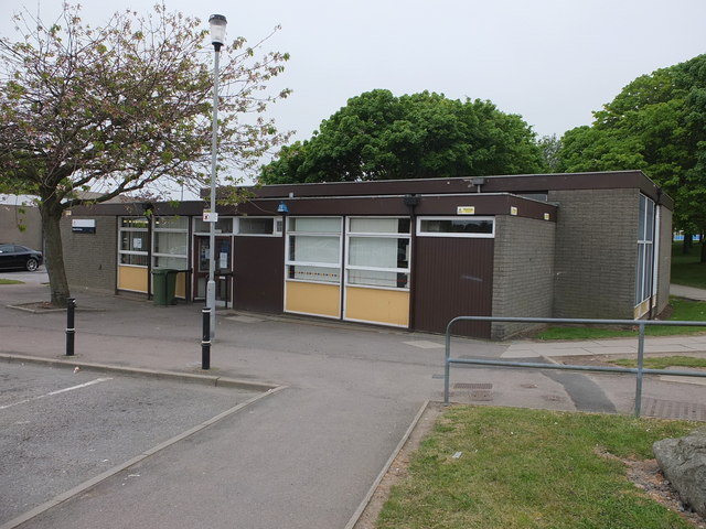
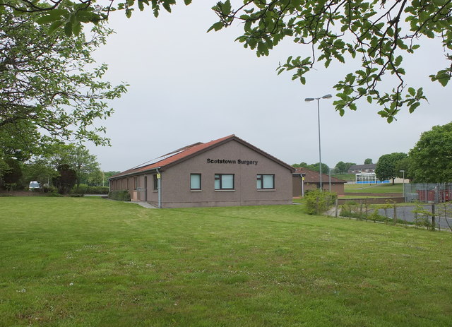
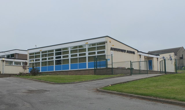
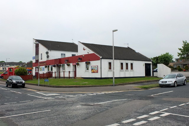
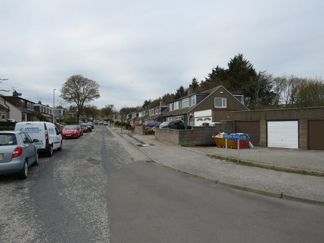
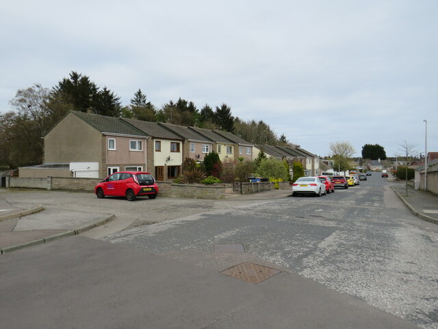
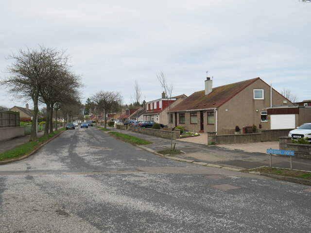
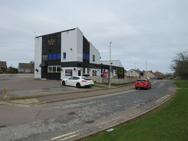
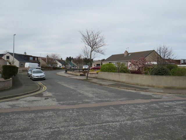
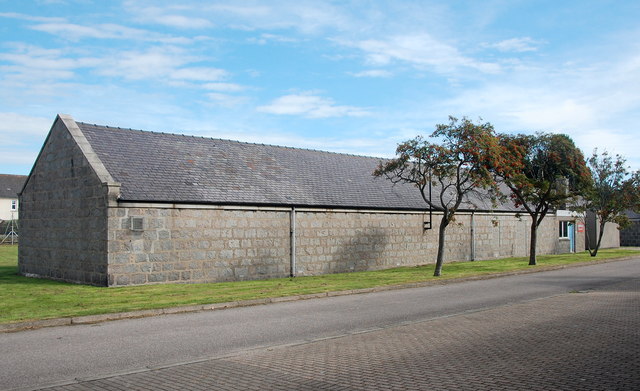
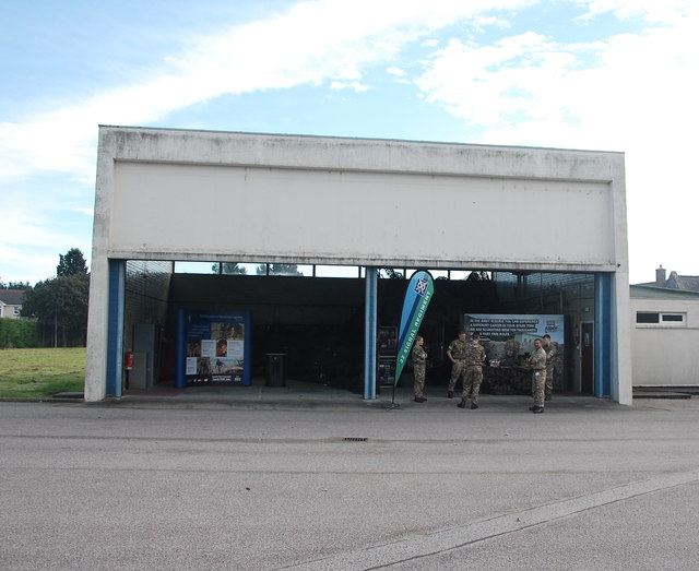
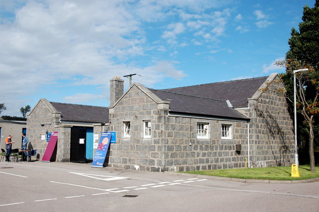
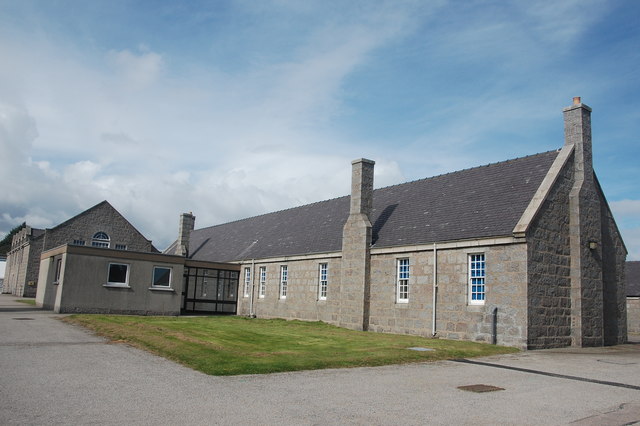
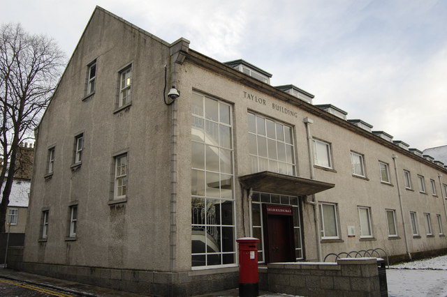
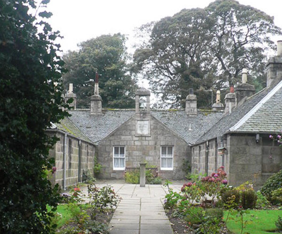
Aberdeen, Old Images

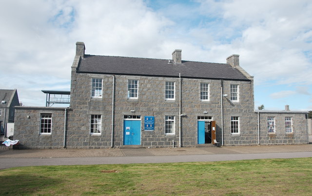
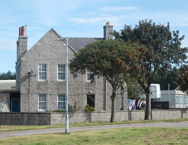
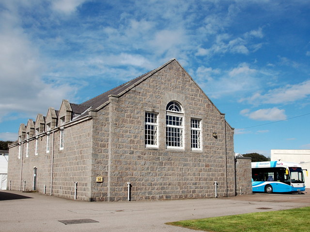
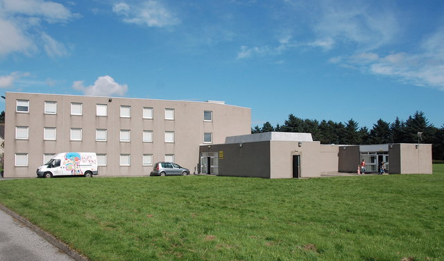
Images are sourced within 2km of 57.166876/-2.1023186 or Grid Reference NJ9308. Thanks to Geograph Open Source API. All images are credited.

Bridge of Don Library Bridge of Don must be the ultimate 1970s suburb, with unimpressive public buildings to match...
Bridge of Don Library
Bridge of Don must be the ultimate 1970s suburb, with unimpressive public buildings to match...
Scotstown Surgery, Bridge of Don
Scotstown School, Bridge of Don, Aberdeen Built in the 1970s with the school name on the end of the building in the Profil typeface.  I thought this typeface was classic (dated) 1970s, but in fact it dates from 1946: <span class="nowrap"><a title="http://ultraboldblog.printweek.com/2009/02/28/profil/" rel="nofollow ugc noopener" href="http://ultraboldblog.printweek.com/2009/02/28/profil/">Link</a><img style="margin-left:2px;" alt="External link" title="External link - shift click to open in new window" src="https://s1.geograph.org.uk/img/external.png" width="10" height="10"/></span> .
Scotstown School, Bridge of Don, Aberdeen
Built in the 1970s with the school name on the end of the building in the Profil typeface. I thought this typeface was classic (dated) 1970s, but in fact it dates from 1946: LinkExternal link .
The Black Dog, Bridge of Don Interesting 1970s architecture..
The Black Dog, Bridge of Don
Interesting 1970s architecture..
Gordon Place, Bridge of Don, Aberdeen Gordon Place is a minor residential road in Bridge of Don, in the northern suburbs of Aberdeen.
Gordon Place, Bridge of Don, Aberdeen
Gordon Place is a minor residential road in Bridge of Don, in the northern suburbs of Aberdeen.
Broadfold Drive, Bridge of Don, Aberdeen Broadfold Drive is a minor residential road in Bridge of Don, in the northern suburbs of Aberdeen.
Broadfold Drive, Bridge of Don, Aberdeen
Broadfold Drive is a minor residential road in Bridge of Don, in the northern suburbs of Aberdeen.
Gordon Road, Bridge of Don, Aberdeen Gordon Road is a minor residential road in Bridge of Don, in the northern suburbs of Aberdeen.
Gordon Road, Bridge of Don, Aberdeen
Gordon Road is a minor residential road in Bridge of Don, in the northern suburbs of Aberdeen.
The Black Dog pub, Bridge of Don, Aberdeen The Black Dog is a pub in Bridge of Don, in the northern suburbs of Aberdeen.
The Black Dog pub, Bridge of Don, Aberdeen
The Black Dog is a pub in Bridge of Don, in the northern suburbs of Aberdeen.
Broadfold Drive, Bridge of Don, Aberdeen Broadfold Drive is a minor residential road in Bridge of Don, in the northern suburbs of Aberdeen.
Broadfold Drive, Bridge of Don, Aberdeen
Broadfold Drive is a minor residential road in Bridge of Don, in the northern suburbs of Aberdeen.
Indoor shooting range, Gordon Barracks North of the main parade ground.  The Gordon Barracks complex was built 1932-35 in finest Aberdeen granite to house the Gordon Highlanders, who moved from the Castlegate in the city centre. The Gordons moved out in the 1990s and the complex is now used by the Territorial Army with parts leased to commercial tenants. Photo taken on an open day with permission.
Indoor shooting range, Gordon Barracks
North of the main parade ground. The Gordon Barracks complex was built 1932-35 in finest Aberdeen granite to house the Gordon Highlanders, who moved from the Castlegate in the city centre. The Gordons moved out in the 1990s and the complex is now used by the Territorial Army with parts leased to commercial tenants. Photo taken on an open day with permission.
Garage, Gordon Barracks A modern garage for military vehicles to the north of the main parade ground. The Gordon Barracks complex was built 1932-35 in finest Aberdeen granite to house the Gordon Highlanders, who moved from the Castlegate in the city centre. The Gordons moved out in the 1990s and the complex is now used by the Territorial Army with parts leased to commercial tenants. Photo taken on an open day with permission.
Garage, Gordon Barracks
A modern garage for military vehicles to the north of the main parade ground. The Gordon Barracks complex was built 1932-35 in finest Aberdeen granite to house the Gordon Highlanders, who moved from the Castlegate in the city centre. The Gordons moved out in the 1990s and the complex is now used by the Territorial Army with parts leased to commercial tenants. Photo taken on an open day with permission.
Auxiliary building, Gordon Barracks Small granite building with courtyard to the north of the main parade ground. The Gordon Barracks complex was built 1932-35 in finest Aberdeen granite to house the Gordon Highlanders, who moved from the Castlegate in the city centre. The Gordons moved out in the 1990s and the complex is now used by the Territorial Army with parts leased to commercial tenants. Photo taken on an open day with permission.
Auxiliary building, Gordon Barracks
Small granite building with courtyard to the north of the main parade ground. The Gordon Barracks complex was built 1932-35 in finest Aberdeen granite to house the Gordon Highlanders, who moved from the Castlegate in the city centre. The Gordons moved out in the 1990s and the complex is now used by the Territorial Army with parts leased to commercial tenants. Photo taken on an open day with permission.
Cadet headquarters, Gordon Barracks This house-like building is the base for a cadet battalion of the Royal Regiment of Scotland.  The Gordon Barracks complex was built 1932-35 in finest Aberdeen granite to house the Gordon Highlanders, who moved from the Castlegate in the city centre. The Gordons moved out in the 1990s and the complex is now used by the Territorial Army with parts leased to commercial tenants. Photo taken on an open day with permission.
Cadet headquarters, Gordon Barracks
This house-like building is the base for a cadet battalion of the Royal Regiment of Scotland. The Gordon Barracks complex was built 1932-35 in finest Aberdeen granite to house the Gordon Highlanders, who moved from the Castlegate in the city centre. The Gordons moved out in the 1990s and the complex is now used by the Territorial Army with parts leased to commercial tenants. Photo taken on an open day with permission.
Hydrogen bus... ...on display at Gordon Barracks at an open-day.  Hydrogen gas is generated in electrolytic cells at Kittybrewster Depot and an on-board fuel cell powers the bus, which is (almost) pollution free and silent.  One charge is enough to power the bus on all its daily services.  Aberdeen is a world leader in developing this technology: <span class="nowrap"><a title="http://www.aberdeencity.gov.uk/council_government/shaping_aberdeen/Shaping_Aberdeen_Hyrdogen_Bus.asp" rel="nofollow ugc noopener" href="http://www.aberdeencity.gov.uk/council_government/shaping_aberdeen/Shaping_Aberdeen_Hyrdogen_Bus.asp">Link</a><img style="margin-left:2px;" alt="External link" title="External link - shift click to open in new window" src="https://s1.geograph.org.uk/img/external.png" width="10" height="10"/></span> .
Hydrogen bus...
...on display at Gordon Barracks at an open-day. Hydrogen gas is generated in electrolytic cells at Kittybrewster Depot and an on-board fuel cell powers the bus, which is (almost) pollution free and silent. One charge is enough to power the bus on all its daily services. Aberdeen is a world leader in developing this technology: LinkExternal link .
Caretaker's house, Gordon Barracks
Gymnasium, Gordon Barracks Note the wall-head dormers paying tribute to earlier Scottish architecture and the fine Venetian end window.  The Gordon Barracks complex was built 1932-35 in finest Aberdeen granite to house the Gordon Highlanders, who moved from the Castlegate in the city centre. The Gordons moved out in the 1990s and the complex is now used by the Territorial Army with parts leased to commercial tenants. Photo taken on an open day with permission.
Gymnasium, Gordon Barracks
Note the wall-head dormers paying tribute to earlier Scottish architecture and the fine Venetian end window. The Gordon Barracks complex was built 1932-35 in finest Aberdeen granite to house the Gordon Highlanders, who moved from the Castlegate in the city centre. The Gordons moved out in the 1990s and the complex is now used by the Territorial Army with parts leased to commercial tenants. Photo taken on an open day with permission.
Dargai Building, Gordon Barracks A none-too-pretty 1970s block at the far end of the site. The rest of the Gordon Barracks complex was built 1932-35 in finest Aberdeen granite to house the Gordon Highlanders, who moved from the Castlegate in the city centre. The Gordons moved out in the 1990s and the complex is now used by the Territorial Army with parts leased to commercial tenants. Photo taken on an open day with permission.  Dargai refers to a famous Indian (now part of Pakistan) battle in 1897 in which the Highlanders played a key role and were awarded four Victoria Crosses: <span class="nowrap"><a title="http://cornemusique.free.fr/ukheightsofdargai.php" rel="nofollow ugc noopener" href="http://cornemusique.free.fr/ukheightsofdargai.php">Link</a><img style="margin-left:2px;" alt="External link" title="External link - shift click to open in new window" src="https://s1.geograph.org.uk/img/external.png" width="10" height="10"/></span> .
Dargai Building, Gordon Barracks
A none-too-pretty 1970s block at the far end of the site. The rest of the Gordon Barracks complex was built 1932-35 in finest Aberdeen granite to house the Gordon Highlanders, who moved from the Castlegate in the city centre. The Gordons moved out in the 1990s and the complex is now used by the Territorial Army with parts leased to commercial tenants. Photo taken on an open day with permission. Dargai refers to a famous Indian (now part of Pakistan) battle in 1897 in which the Highlanders played a key role and were awarded four Victoria Crosses: LinkExternal link .
Barrack block, Gordon Barracks Block to the north of the main parade ground.  The Gordon Barracks complex was built 1932-35 in finest Aberdeen granite to house the Gordon Highlanders, who moved from the Castlegate in the city centre. The Gordons moved out in the 1990s and the complex is now used by the Territorial Army with parts leased to commercial tenants. Photo taken on an open day with permission.
Barrack block, Gordon Barracks
Block to the north of the main parade ground. The Gordon Barracks complex was built 1932-35 in finest Aberdeen granite to house the Gordon Highlanders, who moved from the Castlegate in the city centre. The Gordons moved out in the 1990s and the complex is now used by the Territorial Army with parts leased to commercial tenants. Photo taken on an open day with permission.
Show me another place!

Aberdeen, Old is located at Grid Ref: NJ9308 (Lat: 57.166876, Lng: -2.1023186)

Unitary Authority: City of Aberdeen

Police Authority: North East

What 3 Words

///oasis.blur.undulation. Near Aberdeen

Related Wikis

Nearby Amenities

Located within 500m of 57.166876,-2.1023186
Kerb: raised
Lat/Long: 57.1657274/-2.1021804
Crossing
Button Operated: yes
Crossing: traffic_signals
Crossing Island: no
Kerb: lowered
Tactile Paving: yes
Traffic Signals Sound: no
Traffic Signals Vibration: yes
Lat/Long: 57.1644153/-2.0972584
Crossing
Crossing: unmarked
Crossing Island: no
Crossing Markings: no
Kerb: flush
Tactile Paving: yes
Traffic Calming: table
Lat/Long: 57.1656404/-2.1032654
Stop
Lat/Long: 57.167297/-2.1019542
Traffic Calming: cushion
Lat/Long: 57.1680036/-2.0990371
Turning Circle
Lat/Long: 57.1674329/-2.0985286
Barrier: bollard
Bollard: fixed
Lat/Long: 57.1686355/-2.0962426
Old Aberdeen
Name En: Old Aberdeen
Name Gd: Seann Obar Dheathain
Name Ru: Старый Абердин
Name Sco: Auld Aiberdeen
Place: suburb
Wikidata: Q3350171
Wikipedia: en:Old Aberdeen
Lat/Long: 57.1669196/-2.1022937
Camera Mount: building
Camera Type: dome
Man Made: surveillance
Surveillance: public
Surveillance Type: camera
Lat/Long: 57.1656137/-2.0998203
Camera Mount: building
Camera Type: dome
Man Made: surveillance
Surveillance: public
Surveillance Type: camera
Lat/Long: 57.1656823/-2.1011364
Camera Mount: building
Camera Type: dome
Man Made: surveillance
Surveillance: public
Surveillance Type: camera
Lat/Long: 57.1655908/-2.1021167
Camera Mount: building
Camera Type: dome
Man Made: surveillance
Surveillance: public
Surveillance Type: camera
Lat/Long: 57.1647336/-2.099472
Direction: both
Surface: asphalt
Traffic Calming: hump
Lat/Long: 57.1661405/-2.1012103
Barrier: bollard
Bollard: fixed
Lat/Long: 57.1699027/-2.1035595
Barrier: bollard
Bollard: fixed
Foot: yes
Source: survey
Lat/Long: 57.1687206/-2.0990191
Post Box
Collection Times: Mo-Fr 09:00
Operator: Royal Mail
Operator Wikidata: Q638098
Post Box Type: wall
Ref: AB24 124
Royal Cypher: GR
Royal Cypher Wikidata: Q33102273
Source: survey; Bing
Lat/Long: 57.1690899/-2.1030936
Bear Essentials
Addr City: Aberdeen
Addr Postcode: AB24 3TU
Addr Street: Elphinstone Road
Fhrs Authority: Aberdeen City
Fhrs Id: 1347399
Fhrs Local Authority Id: 1759
Shop: convenience
Source Addr: fhrs
Lat/Long: 57.1666652/-2.104353
Bus Stop
St Machar Drive
Bench: no
Bin: no
Bus: yes
Departures Board: timetable
Lit: yes
Naptan AtcoCode: 639008581
Naptan CommonName: St Machar Drive
Naptan Indicator: at
Naptan NaptanCode: 23236868
Naptan Verified: no
Note: services: 20, N20
Public Transport: platform
Ref: 08581
Shelter: no
Source: bing;gps;survey
Tactile Paving: no
Lat/Long: 57.1666012/-2.103521
Tiki Cafe
Addr Postcode: AB24 3TU
Addr Street: Elphinstone Road
Amenity Disused: cafe
Check Date: 2018-04-15
Fhrs Id: 198296
Source Addr: fhrs
Lat/Long: 57.1682929/-2.1048485
Direction: both
Surface: asphalt
Traffic Calming: table
Lat/Long: 57.1645979/-2.0978725
Entrance: main
Lat/Long: 57.1696519/-2.1024211
Cycleway: asl
Direction: forward
Source: survey
Lat/Long: 57.1645481/-2.0970057
Barrier: bollard
Bollard: fixed
Lat/Long: 57.1657247/-2.1021189
Direction: backward
Surface: asphalt
Traffic Calming: hump
Lat/Long: 57.1657063/-2.1010667
Barrier: bollard
Bicycle: yes
Bollard: fixed
Foot: yes
Source: survey
Lat/Long: 57.1667112/-2.1092514
Direction: both
Traffic Calming: cushion
Lat/Long: 57.1646836/-2.1090016
Direction: both
Traffic Calming: cushion
Lat/Long: 57.1651145/-2.109887
Traffic Calming: cushion
Lat/Long: 57.16422/-2.1083925
Crossing
Button Operated: yes
Crossing: traffic_signals
Crossing Island: yes
Crossing Markings: dots
Tactile Paving: yes
Traffic Signals Sound: no
Traffic Signals Vibration: yes
Lat/Long: 57.1671438/-2.0969079
Crossing
Button Operated: yes
Crossing: traffic_signals
Crossing Island: no
Crossing Ref: pelican
Kerb: flush
Tactile Paving: yes
Traffic Signals Sound: yes
Traffic Signals Vibration: yes
Lat/Long: 57.1687606/-2.0960153
Kerb: raised
Lat/Long: 57.1650992/-2.1021203
Barrier: bollard
Bicycle: yes
Bollard: fixed
Foot: yes
Lat/Long: 57.1651028/-2.1022137
Barrier: bollard
Bicycle: yes
Bollard: fixed
Foot: yes
Lat/Long: 57.1651371/-2.1031032
J.G. Ross - Auld Toon
Addr City: Aberdeen
Addr Housenumber: 61
Addr Postcode: AB24 3EH
Addr Street: High Street
Check Date: 2022-10-18
Fhrs Authority: Aberdeen City
Fhrs Id: 1346713
Fhrs Local Authority Id: 1050
Operator: J.G. Ross
Shop: bakery
Source: survey
Source Addr: fhrs
Lat/Long: 57.1656988/-2.1022892
Cafe
Kilau Coffee
Addr City: Aberdeen
Addr Housenumber: 57
Addr Postcode: AB24 3EH
Addr Street: High Street
Check Date: 2022-10-18
Fhrs Authority: Aberdeen City
Fhrs Id: 50241
Fhrs Local Authority Id: 1119
Source: survey
Source Addr: fhrs
Website: https://kilaucoffee.wordpress.com/
Lat/Long: 57.165639/-2.1022841
Bicycle Parking
Access: permissive
Bicycle Parking: stands
Capacity: 12
Covered: no
Fee: no
Lat/Long: 57.1655836/-2.1020027
Bicycle Parking
Access: permissive
Bicycle Parking: stands
Capacity: 22
Covered: no
Fee: no
Lat/Long: 57.1650251/-2.1011674
Barrier: bollard
Bollard: fixed
Foot: yes
Lat/Long: 57.1639702/-2.1019123
Cycleway: asl
Direction: backward
Lat/Long: 57.1672069/-2.1028337
Mercat Cross
Historic: memorial
Memorial: mercat_cross
Lat/Long: 57.167005/-2.1022666
Disused: yes
Disused Amenity: post_box
Disused Post Box Type: wall
Note: wall post box, now disused (post-office closed?)
Royal Cypher: GR
Lat/Long: 57.1653423/-2.1022245
Source: bing; knowledge
Lat/Long: 57.1636262/-2.1073173
Note: wall changes height somewhere around this node
Lat/Long: 57.1642687/-2.105076
Post Box
Collection Times: Mo-Fr 09:00; Sa 07:00
Operator: Royal Mail
Operator Wikidata: Q638098
Post Box Type: pillar
Ref: AB24 58
Royal Cypher: GVIR
Royal Cypher Wikidata: Q33102169
Source: Bing;survey
Lat/Long: 57.167093/-2.1020505
Barrier: bollard
Bollard: fixed
Source: Bing; survey
Lat/Long: 57.1671085/-2.1020279
Blackwell's University Bookshop
Addr City: Aberdeen
Addr Housenumber: 99
Addr Postcode: AB24 3EN
Addr Street: High Street
Check Date: 2023-07-02
Operator: Blackwell's
Shop: books
Lat/Long: 57.166617/-2.1024225
beCyCle
Addr City: Aberdeen
Addr Country: GB
Addr Housenumber: 21-22
Addr Postcode: AB24 3EB
Addr Street: High Street
Contact Facebook: https://en-gb.facebook.com/groups/becycle.abdn/
Contact Website: http://becycle.org.uk/
Opening Hours: We 15:00-20:00; Sa 13:00-18:00
Service Bicycle Diy: yes
Service Bicycle Pump: yes
Service Bicycle Rental: yes
Shop: bicycle
Lat/Long: 57.1648301/-2.1022442
Direction: both
Surface: asphalt
Traffic Calming: cushion
Lat/Long: 57.164282/-2.1040162
KeyStore
Addr Housenumber: 39
Addr Postcode: AB24 3EH
Addr Street: High Street
Alt Name: McHardy's
Fhrs Id: 94230
Opening Hours: Mo-Fr 07:00-14:00
Shop: convenience
Source: survey
Source Addr: fhrs
Source Alt Name: fhrs
Lat/Long: 57.1653052/-2.102223
Fast Food
Subway
Addr City: Aberdeen
Addr Postcode: AB24 3TU
Addr Street: Elphinstone Road
Brand: Subway
Brand Wikidata: Q244457
Brand Wikipedia: en:Subway (restaurant)
Contact Website: https://restaurants.subway.com/united-kingdom/sc/aberdeen/the-hub-university-of-aberdeen-elphinestone-road
Cuisine: sandwich
Fhrs Authority: Aberdeen City
Fhrs Id: 1347543
Fhrs Local Authority Id: 1901
Source: knowledge
Source Addr: fhrs
Takeaway: yes
Lat/Long: 57.166667/-2.1040131
Cafe
Hardback Cafe
Cuisine: coffee_shop
Lat/Long: 57.1653148/-2.1056909
Bicycle Parking
Access: yes
Bicycle Parking: loops
Capacity: 10
Covered: yes
Fee: no
Lat/Long: 57.166395/-2.1032313
Bus Stop
Meston Walk
Bench: yes
Bin: no
Bus: yes
Lit: yes
Naptan AtcoCode: 639002682
Naptan CommonName: Meston Walk
Naptan Indicator: adj
Naptan NaptanCode: 23235638
Naptan Verified: no
Public Transport: platform
Ref: 02682
Shelter: yes
Source: bing; knowledge
Tactile Paving: no
Wheelchair: yes
Lat/Long: 57.1639181/-2.1069567
Bus Stop
Meston Walk
Bench: no
Bin: no
Bus: yes
Lit: yes
Naptan AtcoCode: 639002681
Naptan CommonName: Meston Walk
Naptan Indicator: opp
Naptan NaptanCode: 23235645
Naptan Verified: no
Public Transport: platform
Ref: 02681
Shelter: no
Source: bing; knowledge
Tactile Paving: no
Lat/Long: 57.1635139/-2.1075201
Bus Stop
Sir Duncan Rice Library
Bench: no
Bin: no
Bus: yes
Departures Board: timetable
Lit: yes
Naptan AtcoCode: 639002691
Naptan CommonName: Sir Duncan Rice Library
Naptan Indicator: opp
Naptan NaptanCode: 23235732
Naptan Verified: no
Public Transport: platform
Ref: 02691
Shelter: no
Source: bing;gps;survey
Tactile Paving: no
Lat/Long: 57.1660808/-2.1065762
Bus Stop
Wingate Road
Bench: no
Bin: yes
Bus: yes
Lit: yes
Naptan AtcoCode: 639002702
Naptan CommonName: Wingate Road
Naptan Indicator: opp
Naptan NaptanCode: 23235782
Naptan Verified: no
Public Transport: platform
Ref: 02702
Shelter: yes
Source: bing; gps; survey
Tactile Paving: no
Lat/Long: 57.1679046/-2.1068741
Bus Stop
Sir Duncan Rice Library
Bench: no
Bin: no
Bus: yes
Departures Board: timetable
Lit: yes
Naptan AtcoCode: 639002692
Naptan CommonName: Sir Duncan Rice Library
Naptan Indicator: adj
Naptan NaptanCode: 23235698
Naptan Verified: no
Public Transport: platform
Ref: 02692
Shelter: no
Source: bing;gps;survey
Tactile Paving: yes
Lat/Long: 57.1651611/-2.1064073
Bus Stop
Wingate Road
Bench: no
Bin: no
Bus: yes
Lit: yes
Naptan AtcoCode: 639002701
Naptan CommonName: Wingate Road
Naptan Indicator: adj
Naptan NaptanCode: 23235793
Naptan Verified: no
Public Transport: platform
Ref: 02701
Shelter: no
Source: bing; gps
Source Name: survey
Source Ref: survey
Tactile Paving: no
Lat/Long: 57.1681715/-2.107258
Bus Stop
Harris Drive
Bench: no
Bin: yes
Bus: yes
Lit: yes
Naptan AtcoCode: 639002712
Naptan CommonName: Harris Drive
Naptan Indicator: opp
Naptan NaptanCode: 23235796
Naptan Verified: no
Public Transport: platform
Ref: 02712
Shelter: no
Source: gps; survey
Tactile Paving: no
Lat/Long: 57.1698823/-2.1078365
Bus Stop
Douglas Lane
Bench: no
Bin: no
Bus: yes
Lit: yes
Naptan AtcoCode: 639008582
Naptan CommonName: Douglas Lane
Naptan Indicator: at
Naptan NaptanCode: 23236874
Naptan Verified: no
Note: services: 20, N20
Public Transport: platform
Ref: 08582
Shelter: no
Source: bing; gps; survey
Tactile Paving: no
Lat/Long: 57.1648754/-2.103493
Bus Stop
Meston Walk
Bench: no
Bin: yes
Bus: yes
Departures Board: timetable
Lit: yes
Naptan AtcoCode: 639005461
Naptan CommonName: Meston Walk
Naptan Indicator: at
Naptan NaptanCode: 23235649
Naptan Verified: no
Note: services: 20, N20
Public Transport: platform
Ref: 05461
Shelter: no
Source: bing;survey
Tactile Paving: no
Lat/Long: 57.1639993/-2.1020947
Bus Stop
University Road
Bench: no
Bin: no
Bus: yes
Departures Board: timetable
Lit: yes
Naptan AtcoCode: 639005462
Naptan CommonName: University Road
Naptan Indicator: at
Naptan NaptanCode: 23235635
Naptan Verified: no
Note: services: 20, N20
Public Transport: platform
Ref: 05462
Shelter: no
Source: bing;survey
Tactile Paving: no
Lat/Long: 57.1638211/-2.1019423
Bus Stop
Wrights' and Coopers' Place
Bench: no
Bin: no
Bus: yes
Lit: yes
Naptan AtcoCode: 639003691
Naptan CommonName: Wrights'& Coopers' Place
Naptan Indicator: opp
Naptan NaptanCode: 23235752
Naptan Verified: no
Note: services: 20, N20
Public Transport: platform
Ref: 03691
Shelter: no
Source: bing; survey
Tactile Paving: no
Lat/Long: 57.1667977/-2.1023788
Barrier: bollard
Bicycle: yes
Bollard: fixed
Foot: yes
Source: survey
Lat/Long: 57.1671777/-2.1020321
Bus Stop
Dunbar Street
Bench: no
Bin: yes
Bus: yes
Lit: yes
Naptan AtcoCode: 639003161
Naptan CommonName: Dunbar Street
Naptan Indicator: W-bound
Naptan NaptanCode: 23235758
Naptan Verified: no
Note: services: 20
Public Transport: platform
Ref: 03161
Shelter: no
Source: survey
Tactile Paving: no
Lat/Long: 57.1670486/-2.1006511
Bus Stop
Dunbar Street
Bench: no
Bin: no
Bus: yes
Lit: yes
Naptan AtcoCode: 639003162
Naptan CommonName: Dunbar Street
Naptan Indicator: E-bound
Naptan NaptanCode: 23235757
Naptan Verified: no
Note: services: 20, N20
Public Transport: platform
Ref: 03162
Shelter: no
Source: survey
Tactile Paving: no
Lat/Long: 57.1671707/-2.1009157
Fast Food
Eastern Feast
Addr City: Aberdeen
Addr Housenumber: 653
Addr Postcode: AB24 1SB
Addr Street: King Street
Contact Facebook: https://www.facebook.com/easternfeastaberdeen/
Contact Tripadvisor: https://www.tripadvisor.co.uk/Restaurant_Review-g186487-d17792868-Reviews-Eastern_Feast-Aberdeen_Aberdeenshire_Scotland.html
Cuisine: chinese
Phone: +44 1224 493558
Source: survey
Website: https://www.easternfeast.co.uk/
Lat/Long: 57.1688989/-2.0961419
Pub
The Rowantree Bar
Addr City: Aberdeen
Addr Housenumber: 654
Addr Postcode: AB24 1SL
Addr Street: King Street
Alt Name: The Rowan Tree
Fhrs Authority: Aberdeen City
Fhrs Id: 1347709
Fhrs Local Authority Id: 2074
Fhrs LocalauthoritybusinessID: EHDC5944
Source: survey;bing
Source Addr: fhrs
Source Alt Name: fhrs
Lat/Long: 57.1687075/-2.0956743
Bus Stop
School Drive
Bench: yes
Bin: yes
Bus: yes
Fixme: SURVEY POSITION RELATIVE TO LANDMARKS?
Lit: yes
Naptan AtcoCode: 639003653
Naptan CommonName: School Drive
Naptan Indicator: opp
Naptan NaptanCode: 23235659
Naptan Verified: no
Note: services: 1,n1,2,x40, 60,x60,61,62, 62a,n62,63,67, x67,68,x68,251
Public Transport: platform
Ref: 03653
Shelter: yes
Source: survey; gps
Tactile Paving: yes
Lat/Long: 57.1650928/-2.097527
Bus Stop
University Road
Bench: yes
Bin: no
Bus: yes
Fixme: SURVEY POSITION RELATIVE TO LANDMARKS?
Lit: yes
Naptan AtcoCode: 639003651
Naptan CommonName: University Road
Naptan Indicator: adj
Naptan NaptanCode: 23235632
Naptan Verified: no
Note: services: 1,n1,2,60, x60,61,62,62a, n62,63,67,x67, 68,x68,251
Public Transport: platform
Ref: 03651
Shelter: yes
Source: survey; gps
Tactile Paving: no
Lat/Long: 57.1635957/-2.0971185
Bus Stop
St. Machar Place
Bench: no
Bin: no
Bus: yes
Lit: yes
Naptan AtcoCode: 639003163
Naptan CommonName: St Machar Place
Naptan Indicator: at
Naptan NaptanCode: 23237249
Naptan Verified: no
Note: services: 20, N20
Public Transport: platform
Ref: 03163
Shelter: no
Source: survey; gps
Tactile Paving: yes
Lat/Long: 57.1670179/-2.0982891
Post Box
Collection Times: Mo-Fr 17:00; Sa 11:15
Operator: Royal Mail
Operator Wikidata: Q638098
Post Box Design: type_k
Post Box Type: pillar
Ref: AB24 106
Royal Cypher: scottish_crown
Source: survey;bing
Lat/Long: 57.1670098/-2.0971893
Atm
Check Date: 2023-06-01
Operator: Link
Source: survey; bing
Lat/Long: 57.1670383/-2.0976019
Fast Food
Shalimar Tandoori
Addr City: Aberdeen
Addr Housenumber: 649
Addr Postcode: AB24 1SB
Addr Street: King Street
Fhrs Authority: Aberdeen City
Fhrs Id: 1278250
Fhrs Local Authority Id: EHDC13492
Fhrs LocalauthoritybusinessID: EHDC8102
Source: survey
Source Addr: fhrs
Lat/Long: 57.1688206/-2.0961726
Bus Stop
St. Machar Drive
Bench: yes
Bin: yes
Bus: yes
Lit: yes
Naptan AtcoCode: 639003661
Naptan CommonName: St Machar Drive
Naptan Indicator: adj
Naptan NaptanCode: 23235765
Naptan Verified: no
Note: services: 1,n1,2,20, n20,x40,60,x60, 61,62,62a,n62, 63,67,x67,68, x68,251
Public Transport: platform
Ref: 03661
Shelter: yes
Source: survey; gps
Tactile Paving: yes
Lat/Long: 57.1674628/-2.0968241
Bus Stop
Seaton Drive
Bench: yes
Bin: yes
Bus: yes
Lit: yes
Naptan AtcoCode: 639003672
Naptan CommonName: Seaton Drive
Naptan Indicator: adj
Naptan NaptanCode: 23235789
Naptan Verified: no
Note: services: 1,2,20,60, x60,61,62,62a, n62,63,67,x67, 68,x68,251
Public Transport: platform
Ref: 03672
Shelter: yes
Source: survey; gps
Tactile Paving: no
Lat/Long: 57.168296/-2.0961175
Bus Stop
School Road
Bench: yes
Bin: no
Bus: yes
Fixme: REF UNCLEAR ON PHOTO
Lit: yes
Naptan AtcoCode: 639003662
Naptan CommonName: School Road
Naptan Indicator: adj
Naptan NaptanCode: 23235728
Naptan Verified: no
Note: services: 1,2,x40,60, x60,61,62,62a, n62,63,67,x67, 68,x68,251
Public Transport: platform
Ref: 03662
Shelter: yes
Source: survey;bing
Tactile Paving: no
Lat/Long: 57.1662929/-2.0971075
Bus Stop
Regent Walk
Bench: yes
Bin: no
Bus: yes
Lit: yes
Naptan AtcoCode: 639003652
Naptan CommonName: Regent Walk
Naptan Indicator: at
Naptan NaptanCode: 23235637
Naptan Verified: no
Note: services: 1,2,x40,60, x60,61,62,62a, n62,63,67,x67, 68,x68,251
Public Transport: platform
Ref: 03652
Shelter: yes
Source: survey; gps
Tactile Paving: no
Lat/Long: 57.1640136/-2.0970484
Barrier: bollard
Bollard: fixed
Foot: yes
Lat/Long: 57.1675093/-2.1095853
Barrier: bollard
Bicycle: yes
Bollard: fixed
Foot: yes
Source: survey
Lat/Long: 57.1656178/-2.1053949
Barrier: cycle_barrier
Cycle Barrier: double
Cycle Barrier Installation: fixed
Foot: yes
Source: survey
Lat/Long: 57.1691762/-2.0956299
Youth with Split Apple
Artist Name: Kenny Hunter
Artwork Type: sculpture
Material: bronze
Source: bing; survey
Start Date: 2005
Tourism: artwork
Lat/Long: 57.1647658/-2.1012498
Cycleway: asl
Direction: forward
Source: gps;survey
Lat/Long: 57.1643496/-2.0972408
Barrier: entrance
Lat/Long: 57.1660902/-2.101439
Bench
Backrest: yes
Check Date: 2021-02-15
Source: survey
Lat/Long: 57.1661391/-2.1014791
Bench
Backrest: yes
Check Date: 2021-02-15
Source: survey
Lat/Long: 57.1661498/-2.1015552
Evolutionary Loop 517
Artist Name: Nasser Azam
Artwork Type: sculpture
Material: bronze
Note: "with the generous support of Dr John Sievwright, MA CA DHC"
Source: gps; survey
Start Date: 2013
Tourism: artwork
Lat/Long: 57.1654991/-2.1035432
Waterlines
Artist Name: Marian Leven; Will Maclean
Artwork Type: sculpture
Source: bing; survey
Tourism: artwork
Lat/Long: 57.1655877/-2.1046456
Speed Camera
Ref: 5003
Lat/Long: 57.1690406/-2.0959794
Cafe
Macrobert Cafe
Addr City: Aberdeen
Addr Postcode: AB24 5UA
Addr Street: St Machar Drive
Addr Unit: Macrobert Building
Alt Name: Tiki @ Macrobert's
Check Date: 2022-10-28
Fhrs Authority: Aberdeen City
Fhrs Id: 593642
Fhrs Local Authority Id: EHDC9632
Level: 0
Source: survey
Lat/Long: 57.1662174/-2.0983718
St Machar Park
Information: board
Source: survey
Tourism: information
Lat/Long: 57.1679083/-2.1087255
Barrier: bollard
Bicycle: yes
Bollard: fixed
Foot: yes
Source: survey
Lat/Long: 57.1682234/-2.1089156
Cycleway: asl
Direction: forward
Source: survey
Lat/Long: 57.1647537/-2.0973447
Crossing
Crossing Ref: zebra
Source: bing
Lat/Long: 57.1632971/-2.106183
Crossing
Crossing Ref: zebra
Lat/Long: 57.1634768/-2.1064782
Bus Stop
Turning Circle
Bench: no
Bin: no
Bus: yes
Covered: no
Lit: yes
Naptan AtcoCode: 639002683
Naptan Bearing: E
Naptan BusStopType: CUS
Naptan CommonName: Turning Circle
Naptan Indicator: at
Naptan NaptanCode: 23237639
Naptan Street: Bedford Road
Naptan Verified: no
Public Transport: platform
Shelter: no
Source: naptan;bing;naptan_compare_tool
Tactile Paving: no
Lat/Long: 57.1649852/-2.1054966
Door: automatic
Entrance: main
Level: 0
Wheelchair: yes
Lat/Long: 57.1662134/-2.098112
Entrance: yes
Fixme: approximate, entrance is actually under a slight overhang of the section of building above
Lat/Long: 57.1656128/-2.0991288
Source: survey; gps
Traffic Calming: hump
Lat/Long: 57.166226/-2.1061422
Source: survey
Traffic Calming: hump
Lat/Long: 57.1662502/-2.1056353
Addr City: Aberdeen
Addr Housename: Edward Wright building Block A
Addr Postcode: AB24 3QY
Addr Street: Dunbar Street
Door: automatic
Entrance: main
Level: 0
Wheelchair: yes
Lat/Long: 57.1656569/-2.1007053
Entrance: main
Source: knowledge
Lat/Long: 57.1654599/-2.1055318
Waste Basket
Check Date: 2021-05-31
Source: survey
Waste: dog_excrement
Lat/Long: 57.1639186/-2.1082937
Barrier: bollard
Bicycle: yes
Bollard: fixed
Foot: yes
Note: position is approximate
Lat/Long: 57.169685/-2.1085986
Waste Basket
Check Date: 2021-02-27
Source: bing; survey
Waste: dog_excrement
Lat/Long: 57.162902/-2.1054885
Artwork Type: sculpture
Tourism: artwork
Lat/Long: 57.1653408/-2.1016797
Entrance: yes
Fixme: approximate, entrance is actually under a slight overhang of the section of building above
Lat/Long: 57.1656078/-2.0994245
Camera Type: dome
Check Date: 2022-01-10
Man Made: surveillance
Surveillance: public
Surveillance Type: camera
Lat/Long: 57.1643622/-2.095661
Camera Type: dome
Man Made: surveillance
Surveillance: public
Surveillance Type: camera
Surveillance Zone: residential
Lat/Long: 57.166478/-2.0969861
Man Made: surveillance
Surveillance: public
Surveillance Type: camera
Surveillance Zone: bank
Lat/Long: 57.1666631/-2.0964551
Man Made: surveillance
Surveillance: public
Surveillance Type: camera
Surveillance Zone: bank
Lat/Long: 57.1666653/-2.0965315
Crossing
Button Operated: yes
Crossing: traffic_signals
Crossing Island: yes
Crossing Markings: dots
Tactile Paving: yes
Traffic Signals Sound: yes
Traffic Signals Vibration: yes
Lat/Long: 57.166582/-2.0970417
Crossing
Button Operated: yes
Crossing: traffic_signals
Crossing Island: yes
Crossing Markings: dots
Tactile Paving: yes
Traffic Signals Sound: no
Traffic Signals Vibration: yes
Lat/Long: 57.1666809/-2.0971441
Crossing
Button Operated: yes
Crossing: traffic_signals
Crossing Island: yes
Crossing Markings: dots
Tactile Paving: yes
Traffic Signals Sound: no
Traffic Signals Vibration: yes
Lat/Long: 57.1668046/-2.0964919
Crossing
Button Operated: yes
Crossing: traffic_signals
Crossing Island: yes
Crossing Markings: dots
Crossing Ref: pelican
Tactile Paving: yes
Traffic Signals Sound: no
Traffic Signals Vibration: yes
Lat/Long: 57.1668656/-2.0974358
Crossing
Button Operated: yes
Crossing: traffic_signals
Crossing Island: yes
Crossing Markings: dots
Tactile Paving: yes
Traffic Signals Sound: no
Traffic Signals Vibration: yes
Lat/Long: 57.1668684/-2.0964294
Crossing
Button Operated: yes
Crossing: traffic_signals
Crossing Island: yes
Crossing Markings: dots
Crossing Ref: pelican
Tactile Paving: yes
Traffic Signals Sound: no
Traffic Signals Vibration: yes
Lat/Long: 57.1669466/-2.0972859
Crossing
Button Operated: yes
Crossing: traffic_signals
Crossing Island: yes
Crossing Markings: dots
Tactile Paving: yes
Traffic Signals Sound: no
Traffic Signals Vibration: yes
Lat/Long: 57.1671083/-2.0967737
Camera Mount: pole
Camera Type: dome
Man Made: surveillance
Note: 'Hanging' dome type; unsure how to tag further
Source: survey
Surveillance: public
Surveillance Type: camera
Lat/Long: 57.1660912/-2.1063398
Camera Mount: pole
Camera Type: dome
Man Made: surveillance
Source: survey
Surveillance: public
Surveillance Type: camera
Lat/Long: 57.1651808/-2.1061531
Waste Basket
Source: survey; bing
Lat/Long: 57.1708208/-2.1020214
Bench
Backrest: yes
Check Date: 2021-02-27
Source: survey; bing
Lat/Long: 57.1707135/-2.1020469
Waste Basket
Source: survey; bing
Lat/Long: 57.1708364/-2.1023415
Bench
Backrest: yes
Check Date: 2021-02-27
Source: survey; bing
Lat/Long: 57.1707235/-2.1023593
Waste Basket
Source: survey; bing
Lat/Long: 57.1710975/-2.1019607
Bench
Backrest: yes
Source: survey; bing
Lat/Long: 57.1711945/-2.1019569
Bench
Backrest: yes
Source: survey; bing
Lat/Long: 57.1712043/-2.1022699
Waste Basket
Source: survey; bing
Lat/Long: 57.1710912/-2.1022982
Bench
Backrest: yes
Check Date: 2021-03-27
Fixme: position is approximate along this section
Material: wood
Note: Made from wooden log
Source: survey; bing
Lat/Long: 57.1701343/-2.1040742
Bench
Backrest: yes
Check Date: 2021-03-27
Fixme: position is approximate along this section
Source: survey; bing
Lat/Long: 57.1703923/-2.1054278
Waste Basket
Check Date: 2021-03-27
Source: survey
Waste: dog_excrement
Lat/Long: 57.1700645/-2.1034423
Information: guidepost
Note: Northwest: Brig O'Balgownie
Source: survey
Tourism: information
Lat/Long: 57.1702611/-2.1037739
Waste Basket
Check Date: 2021-04-21
Source: survey
Waste: dog_excrement
Lat/Long: 57.1707105/-2.1047647
Building: bunker
Bunker Type: pillbox
Military: bunker
Note: At base of embankment, embedded in debris; presumed to be http://canmore.org.uk/site/134464/aberdeen-seaton-park-pillbox
Source: gps;survey
Lat/Long: 57.1702907/-2.0993715
Crossing
Crossing Ref: zebra
Lat/Long: 57.1634648/-2.1062411
Crossing
Crossing: marked
Crossing Markings: yes
Crossing Ref: zebra
Lat/Long: 57.1636584/-2.1066864
Direction: both
Surface: asphalt
Traffic Calming: hump
Lat/Long: 57.1629518/-2.1025839
Parking
King's Hall Carpark
Access: private
Operator: University of Aberdeen
Parking: surface
Lat/Long: 57.1632317/-2.1042959
Bench
Backrest: no
Lat/Long: 57.1655488/-2.1049502
Bench
Backrest: no
Lat/Long: 57.1654503/-2.1049312
Electronics Research Group
Addr City: Aberdeen
Addr Housename: Fraser Noble Building
Addr Postcode: AB24 3UE
Addr Street: Kings College
Level: 2
Office: research
Opening Hours: Mo-Fr 09:00-17:00
Phone: +44 1224 272201
Source: survey,knowledge
Website: https://erg.abdn.ac.uk/
Wheelchair: yes
Lat/Long: 57.1660033/-2.1051656
Priest Gordon Statue
Artwork Type: statue
Tourism: artwork
Lat/Long: 57.1677212/-2.0968478
Entrance: yes
Wheelchair: yes
Lat/Long: 57.1670297/-2.0974641
Restaurant
Bishop's Table
Lat/Long: 57.1637428/-2.1034232
Cafe
Starbucks
Brand: Starbucks
Brand Wikidata: Q37158
Brand Wikipedia: en:Starbucks
Cuisine: coffee_shop
Official Name: Starbucks Coffee
Takeaway: yes
Lat/Long: 57.1637542/-2.1031851
Crossing
Bicycle: yes
Button Operated: yes
Crossing: traffic_signals
Crossing Ref: toucan
Tactile Paving: yes
Traffic Signals Sound: no
Traffic Signals Vibration: yes
Lat/Long: 57.1668492/-2.1072275
Crossing
Bicycle: yes
Button Operated: yes
Crossing: traffic_signals
Crossing Island: yes
Crossing Markings: dots
Crossing Ref: toucan
Tactile Paving: yes
Traffic Signals Vibration: yes
Lat/Long: 57.1669589/-2.1062912
Crossing
Button Operated: yes
Crossing: traffic_signals
Crossing Island: no
Crossing Ref: toucan
Tactile Paving: yes
Traffic Signals Vibration: yes
Lat/Long: 57.16858/-2.1072391
Barrier: entrance
Lat/Long: 57.1674047/-2.1087318
William Wallace Memorial
Description: Circular stone with a five pointed star embedded in the outside wall of the graveyard
Historic: memorial
Memorial: stone
Website: https://canmore.org.uk/site/146541/aberdeen-chanonry-wallace-memorial
Lat/Long: 57.1695027/-2.101323
Traffic Signals
Traffic Signals: signal
Traffic Signals Direction: both
Lat/Long: 57.1672375/-2.1024691
Crossing
Button Operated: yes
Crossing: traffic_signals
Crossing Island: no
Crossing Ref: pelican
Tactile Paving: yes
Traffic: crossing
Traffic Signals Sound: yes
Traffic Signals Vibration: yes
Lat/Long: 57.1671678/-2.1014186
Direction: both
Surface: asphalt
Traffic Calming: bump
Lat/Long: 57.1667674/-2.1009827
Cycleway: asl
Direction: forward
Lat/Long: 57.1672371/-2.1023329
Crossing
Bicycle: yes
Button Operated: yes
Crossing: traffic_signals
Crossing Island: yes
Crossing Markings: dots
Crossing Ref: toucan
Tactile Paving: yes
Traffic Signals: signal
Traffic Signals Sound: no
Traffic Signals Vibration: yes
Lat/Long: 57.1666182/-2.1065957
Traffic Signals
Traffic Signals: signal
Traffic Signals Direction: both
Lat/Long: 57.1669125/-2.1067232
Crossing
Bicycle: yes
Button Operated: yes
Crossing: traffic_signals
Crossing Island: yes
Crossing Markings: dots
Crossing Ref: toucan
Tactile Paving: yes
Traffic Signals: signal
Traffic Signals Sound: no
Traffic Signals Vibration: yes
Lat/Long: 57.1671381/-2.1068128
Barrier: bollard
Bicycle: yes
Bollard: fixed
Colour: white
Foot: yes
Horse: no
Material: concrete
Motor Vehicle: no
Lat/Long: 57.1655202/-2.1005794
Door: hinged
Entrance: main
Level: 0
Lat/Long: 57.1666595/-2.1001134
Door: automatic
Entrance: main
Level: 0
Lat/Long: 57.1647972/-2.0984651
Entrance: main
Lat/Long: 57.1627877/-2.0999202
Entrance: main
Lat/Long: 57.1639643/-2.1009459
Crossing
Crossing: marked
Crossing Markings: yes
Crossing Ref: zebra
Source: bing
Lat/Long: 57.1637683/-2.1067773
Crossing
Crossing Ref: zebra
Lat/Long: 57.1634141/-2.1061523
Bicycle Parking
Access: permissive
Bicycle Parking: stands
Capacity: 6
Covered: no
Fee: no
Lat/Long: 57.1647892/-2.1006719
Bicycle Parking
Access: permissive
Bicycle Parking: stands
Capacity: 20
Covered: no
Fee: no
Lat/Long: 57.1649165/-2.1011272
Entrance: main
Lat/Long: 57.1641181/-2.1014521
Entrance: yes
Lat/Long: 57.1638246/-2.1009911
Entrance: yes
Lat/Long: 57.1638244/-2.1014544
Entrance: main
Lat/Long: 57.1638499/-2.1022278
Camera Mount: building
Camera Type: dome
Man Made: surveillance
Surveillance: public
Surveillance Type: camera
Lat/Long: 57.1634931/-2.1039723
Entrance: yes
Lat/Long: 57.1653905/-2.1044815
Camera Mount: building
Camera Type: dome
Man Made: surveillance
Surveillance: public
Surveillance Type: camera
Lat/Long: 57.164411/-2.1049675
Entrance: yes
Lat/Long: 57.1644401/-2.1043407
Entrance: main
Lat/Long: 57.1656514/-2.1045615
Atm
Brand: NoteMachine
Brand Wikidata: Q104368525
Covered: no
Currency GBP: yes
Drive Through: no
Operator: NoteMachine
Operator Short: NMATM
Operator Wikidata: Q104368525
Lat/Long: 57.1668/-2.1036807
Door: automatic
Entrance: main
Level: 0
Wheelchair: yes
Lat/Long: 57.1668558/-2.1037325
Camera Mount: building
Camera Type: dome
Man Made: surveillance
Surveillance: public
Surveillance Type: camera
Lat/Long: 57.1666208/-2.1037016
Entrance: yes
Lat/Long: 57.1637639/-2.1031023
Entrance: yes
Lat/Long: 57.1641924/-2.1047521
Bicycle Parking
Bicycle Parking: stands
Capacity: 24
Covered: yes
Shelter: yes
Lat/Long: 57.1653539/-2.1049085
Bicycle Parking
Bicycle Parking: stands
Capacity: 20
Covered: yes
Shelter: yes
Lat/Long: 57.165367/-2.1047395
Bench
Backrest: no
Lat/Long: 57.1655539/-2.1047529
Bench
Backrest: no
Lat/Long: 57.1655426/-2.1048494
Bench
Backrest: no
Lat/Long: 57.1654804/-2.1048387
Bench
Backrest: no
Lat/Long: 57.1655335/-2.1038973
Bench
Backrest: no
Lat/Long: 57.1654761/-2.1038912
Bicycle Parking
Bicycle Parking: stands
Capacity: 20
Covered: yes
Shelter: yes
Lat/Long: 57.1653986/-2.1038778
Bicycle Parking
Bicycle Parking: stands
Capacity: 20
Covered: yes
Shelter: yes
Lat/Long: 57.1653928/-2.104205
Entrance: main
Lat/Long: 57.1678791/-2.1065025
Camera Mount: building
Camera Type: dome
Man Made: surveillance
Surveillance: public
Surveillance Type: camera
Lat/Long: 57.1669324/-2.1011452
Historic: memorial
Inscription: IN MEMORY OF LADY MACROBERT whose sons Alasdair Roderic and Iain gave their lives 1938-1941 PER ARDUA AD ASTRA
Memorial: plaque
Lat/Long: 57.1661793/-2.1013985
Barrier: bollard
Bollard: unremovable
Colour: silver
Material: metal
Lat/Long: 57.1656884/-2.1038473
Crossing
Crossing: unmarked
Crossing Island: no
Crossing Markings: no
Tactile Paving: yes
Lat/Long: 57.1697587/-2.107971
Pub
Union Brew
Addr City: Aberdeen
Addr Postcode: AB24 3TU
Addr Street: Elphinstone Road
Fhrs Authority: Aberdeen City
Fhrs Id: 1552984
Fhrs Local Authority Id: EHDC15076
Lat/Long: 57.1668691/-2.1040323
Zoology Museum
Fee: no
Opening Hours: Mo-Fr 10:00-16:00
Operator: University of Aberdeen
Tourism: museum
Website: https://www.abdn.ac.uk/museums/exhibitions/zoology-museum-588.php
Lat/Long: 57.1679831/-2.1063041
Bench
Backrest: yes
Lat/Long: 57.1668086/-2.0940843
Waste Basket
Colour: black
Material: plastic
Waste: trash
Lat/Long: 57.1649456/-2.1051291
Bench: yes
Colour: brown
Covered: no
Leisure: picnic_table
Lit: no
Material: wood
Lat/Long: 57.1649492/-2.1050285
Bench: yes
Colour: brown
Covered: no
Leisure: picnic_table
Lit: no
Material: wood
Lat/Long: 57.1649129/-2.105062
Fixme: stub
Lat/Long: 57.1648351/-2.1047334
Fixme: stub
Lat/Long: 57.1650754/-2.1048836
Bicycle Parking
Bicycle Parking: stands
Capacity: 16
Covered: no
Lat/Long: 57.1645885/-2.1051941
Waste Basket
Waste: trash
Lat/Long: 57.1655091/-2.1054228
Waste Basket
Waste: trash
Lat/Long: 57.1653893/-2.105404
Waste Basket
Lat/Long: 57.1649909/-2.1054593
Historic: memorial
Inscription: Powis Gateway was built in the early 1830s by the Leslie family, using profits from slavery. The Leslies, the lairds of nearby Powis House, owned an estate in Jamaica on which they forced enslaved African people to work. After the 1833 Act for the Aboliti
Material: metal
Memorial: plaque
Openplaques Id: 57676
Lat/Long: 57.1634656/-2.1020499
Clock
Display: sundial
Lat/Long: 57.1661674/-2.1014819
Historic: memorial
Inscription: YEW TREE WALK\nThese trees replace the St. Machar Drive yew hedge planted in 1995 by graduates and friends of the Forestry Department to celebrate the 500th anniversary of the University. May they last another 500 years.
Memorial: plaque
Lat/Long: 57.1646709/-2.1053001
Post Box
Collection Times: Mo-Fr 09:00; Sa 07:00
Operator: Royal Mail
Operator Wikidata: Q638098
Post Box Type: pillar
Ref: AB24 48
Royal Cypher: VR
Royal Cypher Wikidata: Q33102356
Source: survey;Bing
Lat/Long: 57.1655821/-2.1021
Library
Taylor Library
Addr Postcode: AB24 3UB
Check Date: 2022-10-28
Operator: University of Aberdeen
Operator Type: university
Lat/Long: 57.1656283/-2.1012086
Waste Basket
Lat/Long: 57.1663864/-2.10237
Waste Basket
Lat/Long: 57.1662962/-2.1023472
Waste Basket
Lat/Long: 57.1663806/-2.102433
Bench
Backrest: yes
Mapillary: 454043025689550
Survey Date: 2018-11-05
Lat/Long: 57.166385/-2.1024008
Bench
Nicola's Bench
Backrest: yes
Mapillary: 809032120047892
Survey Date: 2018-11-05
Lat/Long: 57.1663399/-2.1024947
Bench
Backrest: yes
Mapillary: 454043025689550
Survey Date: 2018-11-05
Lat/Long: 57.1663021/-2.1024786
Smoking Area
Bench: no
Bin: yes
Check Date: 2022-10-28
Shelter: yes
Lat/Long: 57.165869/-2.100304
Bicycle Parking
Access: permissive
Bicycle Parking: stands
Capacity: 10
Covered: no
Fee: no
Lat/Long: 57.1659072/-2.098053
Bicycle Parking
Access: permissive
Bicycle Parking: stands
Capacity: 8
Covered: no
Fee: no
Lat/Long: 57.1657142/-2.0983323
Entrance: yes
Wheelchair: yes
Lat/Long: 57.1657466/-2.0984437
Entrance: yes
Wheelchair: yes
Lat/Long: 57.1661352/-2.0985957
Charging Station
Capacity: 2
Motorcar: yes
Operator: evolt
Lat/Long: 57.1665235/-2.0988768
Entrance: emergency
Wheelchair: no
Lat/Long: 57.1665359/-2.098481
Aberdeen Leasing & Renovations
Office: estate_agent
Lat/Long: 57.1672259/-2.0971307
Eclipz
Gender: male
Shop: hairdresser
Lat/Long: 57.1671716/-2.0971126
Bicycle Parking
Access: private
Bicycle Parking: shed
Covered: yes
Operator: University of Aberdeen
Operator Type: private
Lat/Long: 57.1663707/-2.1003686
Bicycle Parking
Bicycle Parking: stands
Capacity: 10
Covered: yes
Lat/Long: 57.1659962/-2.1002828
Elphinstone Monument
Alt Name: Elphinstone's Tomb
Fixme: If this inscription is written incorrectly please fix it
Historic: memorial
Inscription: Chell som in chell atehi in drong immot a dalgai Anam i nim nar De fet sund a lecht sa lige l Ige ar n-aigi noib in fer Elphinston eces Goidel Asa mbrucht duinne buaid ngle in sruaim sois co suithe
Memorial: statue
Tomb: chest_tomb
Lat/Long: 57.1641718/-2.1017661
College Well
Access: yes
Drinking Water: no
Man Made: water_well
Pump: no
Lat/Long: 57.1639845/-2.1012095
Fixme: stub
Lat/Long: 57.1650848/-2.1045739
Informal Picnic Area
Tourism: picnic_site
Lat/Long: 57.169986/-2.1059707
Naptan AtcoCode: 639003142
Naptan CommonName: Tedder Road
Naptan Indicator: at
Naptan NaptanCode: 23235743
Note: Please don't delete this node. It represents data from NaPTAN which should be preserved until the bus stop is marked as deleted in their data (preventing the stop from being re-imported).
Physically Present: no
Lat/Long: 57.1666739/-2.1094505
Naptan AtcoCode: 639003141
Naptan CommonName: Bedford Road
Naptan Indicator: at
Naptan NaptanCode: 23235745
Note: Please don't delete this node. It represents data from NaPTAN which should be preserved until the bus stop is marked as deleted in their data (preventing the stop from being re-imported).
Physically Present: no
Lat/Long: 57.1667459/-2.1075381
Vending Machine
Vending: parking_tickets
Lat/Long: 57.1651974/-2.0948436
Vending Machine
Vending: parking_tickets
Lat/Long: 57.165252/-2.0968518
Grit Bin
Lat/Long: 57.165297/-2.0953427
Waste Basket
Waste: dog_excrement
Lat/Long: 57.1653596/-2.0954339
Access: unknown
Barrier: lift_gate
Note: never seen this closed, I imagine it is closed at night
Lat/Long: 57.1644149/-2.095457
Access: unknown
Barrier: lift_gate
Note: never seen this closed, I imagine it is closed at night
Lat/Long: 57.1644135/-2.0955529
Crossing
Crossing: unmarked
Crossing Markings: no
Kerb: lowered
Tactile Paving: yes
Lat/Long: 57.1662152/-2.1063808
Crossing
Crossing: unmarked
Crossing Markings: no
Tactile Paving: no
Lat/Long: 57.1671062/-2.1035392
Barrier: bollard
Bollard: removable
Material: metal
Lat/Long: 57.1667369/-2.1034671
Bench
Backrest: no
Lat/Long: 57.1656558/-2.1039181
Bench
Backrest: no
Lat/Long: 57.1656494/-2.1040602
Bench
Backrest: no
Lat/Long: 57.1656437/-2.1042248
Bench
Backrest: no
Lat/Long: 57.1656389/-2.1043646
Waste Basket
Lat/Long: 57.1656623/-2.1042427
Bench
Backrest: yes
Lat/Long: 57.1654213/-2.1043163
Waste Basket
Lat/Long: 57.1654693/-2.1043201
Bicycle Parking
Bicycle Parking: stands
Capacity: 10
Covered: yes
Lat/Long: 57.1660032/-2.1036664
Bicycle Parking
Bicycle Parking: stands
Capacity: 12
Covered: no
Lat/Long: 57.1661907/-2.1037226
Bicycle Parking
Bicycle Parking: stands
Capacity: 9
Covered: no
Lat/Long: 57.1667349/-2.1036943
Direction: forward
Maxwidth: 4.2
Source Maxwidth: ARCore
Surface: cobblestone
Traffic Calming: choker
Lat/Long: 57.1624436/-2.1016927
Traffic Calming: cushion
Lat/Long: 57.1679797/-2.1098212
Traffic Calming: cushion
Lat/Long: 57.1681456/-2.1096058
Crossing
Crossing: unmarked
Crossing Island: no
Crossing Markings: no
Tactile Paving: yes
Lat/Long: 57.16833/-2.1073019
Crossing
Crossing: unmarked
Crossing Island: no
Crossing Markings: no
Tactile Paving: yes
Lat/Long: 57.1687519/-2.1074337
Barrier: bollard
Bollard: fixed
Lat/Long: 57.1686371/-2.0985163
Traffic Calming: cushion
Lat/Long: 57.1676633/-2.0996169
Traffic Calming: cushion
Lat/Long: 57.1672614/-2.1002928
Traffic Calming: hump
Lat/Long: 57.169/-2.0962081
Traffic Calming: cushion
Lat/Long: 57.1691523/-2.096771
Traffic Calming: cushion
Lat/Long: 57.1693051/-2.0973356
Traffic Calming: hump
Lat/Long: 57.1694569/-2.0978969
Barrier: bollard
Bicycle: yes
Bollard: fixed
Lat/Long: 57.1690886/-2.0986345
Traffic Calming: cushion
Lat/Long: 57.1696563/-2.0981037
Traffic Calming: cushion
Lat/Long: 57.1701292/-2.0974486
Barrier: lift_gate
Lat/Long: 57.1698889/-2.0974955
Barrier: bollard
Bollard: fixed
Lat/Long: 57.1692243/-2.0955995
Waste Basket
Lat/Long: 57.1668769/-2.0953485
Recycling
Recycling Type: container
Lat/Long: 57.1668757/-2.0953205
Waste Basket
Lat/Long: 57.1668409/-2.0947215
Waste Basket
Lat/Long: 57.1668394/-2.0946987
Recycling
Recycling Cans: yes
Recycling Glass Bottles: yes
Recycling Paper: yes
Recycling Plastic: no
Recycling Plastic Packaging: yes
Recycling Type: container
Lat/Long: 57.1668282/-2.0946558
Waste Basket
Lat/Long: 57.1669091/-2.0959186
Waste Basket
Lat/Long: 57.1668931/-2.0958824
Waste Basket
Lat/Long: 57.1669287/-2.0959521
Recycling
Recycling Type: container
Lat/Long: 57.1669425/-2.0959507
Recycling
Recycling Type: container
Lat/Long: 57.1668924/-2.0958615
Waste Basket
Lat/Long: 57.1675309/-2.0941262
Waste Basket
Lat/Long: 57.1685389/-2.0950029
Recycling
Recycling Type: container
Lat/Long: 57.1685262/-2.0950049
Bench
Backrest: yes
Lat/Long: 57.1666098/-2.0967559
Bench
Backrest: yes
Lat/Long: 57.1665851/-2.0967572
Bench
Backrest: yes
Lat/Long: 57.1665987/-2.0941929
Barrier: bollard
Lat/Long: 57.1662511/-2.0971903
Barrier: bollard
Lat/Long: 57.1662257/-2.0972117
Barrier: bollard
Lat/Long: 57.1661958/-2.0972265
Barrier: bollard
Lat/Long: 57.1661668/-2.0972386
Barrier: bollard
Lat/Long: 57.1660919/-2.0972748
Crossing
Button Operated: yes
Crossing: traffic_signals
Crossing Island: no
Kerb: flush
Tactile Paving: yes
Traffic Signals Sound: no
Traffic Signals Vibration: yes
Lat/Long: 57.1647036/-2.0973322
Barrier: bollard
Lat/Long: 57.1677098/-2.0964452
Barrier: bollard
Lat/Long: 57.1677889/-2.0964006
Barrier: bollard
Lat/Long: 57.1678658/-2.0963641
Waste Basket
Waste: dog_excrement
Lat/Long: 57.1693179/-2.0955581
Entrance: yes
Lat/Long: 57.1653793/-2.1019357
Bicycle Parking
Bicycle Parking: loops
Capacity: 6
Covered: no
Lat/Long: 57.1654519/-2.1006063
Direction: both
Surface: asphalt
Traffic Calming: cushion
Lat/Long: 57.1642852/-2.1027059
Direction: both
Surface: asphalt
Traffic Calming: cushion
Lat/Long: 57.1642477/-2.1052279
Direction: forward
Surface: asphalt
Traffic Calming: cushion
Lat/Long: 57.16411/-2.1063326
Waste Basket
Colour: black
Material: plastic
Waste: trash
Lat/Long: 57.1639995/-2.1069399
Grit Bin
Colour: yellow
Material: plastic
Lat/Long: 57.1662833/-2.1033483
Smoking Area
Bench: no
Bin: yes
Shelter: yes
Lat/Long: 57.1664256/-2.1032419
Bicycle Parking
Access: yes
Bicycle Parking: loops
Capacity: 16
Covered: no
Fee: no
Lat/Long: 57.1665096/-2.103254
Direction: both
Surface: asphalt
Traffic Calming: hump
Lat/Long: 57.1663828/-2.101137
Direction: both
Surface: asphalt
Traffic Calming: bump
Lat/Long: 57.164709/-2.1004527
Direction: both
Surface: asphalt
Traffic Calming: bump
Lat/Long: 57.1646996/-2.0998496
Direction: both
Surface: asphalt
Traffic Calming: bump
Lat/Long: 57.1646695/-2.0991056
Door: automatic
Entrance: main
Level: 0
Wheelchair: yes
Lat/Long: 57.1648656/-2.1017928
Door: automatic
Entrance: main
Level: 0
Wheelchair: yes
Lat/Long: 57.1648653/-2.1013624
Door: automatic
Entrance: main
Level: 0
Wheelchair: yes
Lat/Long: 57.1647543/-2.1001006
Door: automatic
Entrance: main
Level: -1
Wheelchair: yes
Lat/Long: 57.1655518/-2.1006213
Door: hinged
Entrance: emergency
Lat/Long: 57.166253/-2.1000425
Camera Mount: pole
Camera Type: dome
Man Made: surveillance
Surveillance: public
Surveillance Type: camera
Lat/Long: 57.1652534/-2.1053762
Camera Mount: building
Camera Type: dome
Man Made: surveillance
Surveillance: public
Surveillance Type: camera
Lat/Long: 57.1657536/-2.1033315
Camera Mount: pole
Camera Type: dome
Man Made: surveillance
Surveillance: public
Surveillance Type: camera
Lat/Long: 57.1647762/-2.1010303
Camera Mount: pole
Camera Type: dome
Man Made: surveillance
Surveillance: public
Surveillance Type: camera
Lat/Long: 57.1653951/-2.0983444
Camera Mount: pole,_building
Camera Type: dome
Man Made: surveillance
Surveillance: public
Surveillance Type: camera
Lat/Long: 57.1667312/-2.0980106
Camera Mount: building
Camera Type: dome
Man Made: surveillance
Surveillance: public
Surveillance Type: camera
Lat/Long: 57.1646208/-2.1021601
Direction: both
Surface: asphalt
Traffic Calming: hump
Lat/Long: 57.1632622/-2.1023491
Direction: both
Surface: asphalt
Traffic Calming: hump
Lat/Long: 57.1634684/-2.1026927
Camera Mount: building
Camera Type: dome
Man Made: surveillance
Surveillance: public
Surveillance Type: camera
Lat/Long: 57.163331/-2.1050155
Grit Bin
Colour: yellow
Material: plastic
Lat/Long: 57.1635728/-2.1036399
Waste Basket
Colour: black
Material: plastic
Waste: trash
Lat/Long: 57.1635733/-2.1036178
Door: yes
Entrance: main
Level: 0
Wheelchair: no
Lat/Long: 57.1654809/-2.1020125
Barrier: bollard
Lat/Long: 57.1639986/-2.1084472
Waste Basket
Lat/Long: 57.1651124/-2.1099308
Waste Basket
Lat/Long: 57.1651183/-2.1099479
Waste Basket
Lat/Long: 57.1648515/-2.1094002
Recycling
Recycling Type: container
Lat/Long: 57.1648626/-2.1094212
Recycling
Recycling Type: container
Lat/Long: 57.1646793/-2.1090575
Waste Basket
Lat/Long: 57.1646889/-2.1090752
Recycling
Recycling Type: container
Lat/Long: 57.1643116/-2.1084802
Waste Basket
Lat/Long: 57.1642941/-2.1084674
Waste Basket
Lat/Long: 57.1642767/-2.1084545
Waste Basket
Lat/Long: 57.163963/-2.1082849
Cycleway: asl
Direction: forward
Lat/Long: 57.1665593/-2.1065794
Vending Machine
Vending: parking_tickets
Lat/Long: 57.1652648/-2.1065767
Vending Machine
Vending: parking_tickets
Lat/Long: 57.1646226/-2.1067752
Barrier: bollard
Bicycle: yes
Foot: yes
Source: survey
Lat/Long: 57.168228/-2.1088605
Barrier: bollard
Bicycle: yes
Foot: yes
Source: survey
Lat/Long: 57.1682245/-2.1088915
Barrier: bollard
Bicycle: yes
Foot: yes
Source: survey
Lat/Long: 57.1682262/-2.1088755
Barrier: bollard
Bicycle: yes
Foot: yes
Source: survey
Lat/Long: 57.1682225/-2.108905
Barrier: bollard
Bicycle: yes
Foot: yes
Source: survey
Lat/Long: 57.1682167/-2.108935
Barrier: bollard
Bicycle: yes
Foot: yes
Source: survey
Lat/Long: 57.1682141/-2.1089495
Grit Bin
Lat/Long: 57.1682241/-2.1087651
Barrier: bollard
Bicycle: yes
Foot: yes
Source: survey
Lat/Long: 57.1682007/-2.109023
Barrier: bollard
Bicycle: yes
Foot: yes
Source: survey
Lat/Long: 57.1682033/-2.1090091
Direction: both
Surface: asphalt
Traffic Calming: cushion
Lat/Long: 57.1631867/-2.1008268
Entrance: yes
Lat/Long: 57.1661148/-2.1102031
Crossing
Crossing: unmarked
Crossing Island: no
Crossing Markings: no
Kerb: lowered
Tactile Paving: yes
Lat/Long: 57.1661715/-2.1034236
Playground: slide
Lat/Long: 57.1627204/-2.1009468
Recycling
Recycling Green Waste: yes
Recycling Type: container
Lat/Long: 57.162596/-2.1008999
William MacGillivray
Historic: memorial
Inscription: William MacGillivray 1796-1852 Ornithologist Lived here
Material: metal
Memorial: plaque
Lat/Long: 57.1668055/-2.1024025
Welcome to Seaton Park
Information: map
Tourism: information
Lat/Long: 57.1700073/-2.103235
Vending Machine
Vending: parking_tickets
Lat/Long: 57.1690698/-2.0962456
Entrance: exit
Lat/Long: 57.1696728/-2.0961988
Entrance: entrance
Lat/Long: 57.1697876/-2.0961329
Vending Machine
Vending: parking_tickets
Lat/Long: 57.1695797/-2.0982316
Bench
Backrest: yes
Material: wood
Seats: 3
Lat/Long: 57.1671317/-2.1000739
Waste Basket
Colour: black
Material: plastic
Waste: trash
Lat/Long: 57.1671288/-2.1000376
Grit Bin
Colour: yellow
Material: plastic
Lat/Long: 57.1672484/-2.1004364
Grit Bin
Access: yes
Colour: yellow
Material: plastic
Lat/Long: 57.1681065/-2.0988655
Access: private
Addr City: Aberdeen
Addr Country: GB
Addr Housenumber: 34
Addr Postcode: AB24 3DS
Addr Street: College Bounds
Entrance: yes
Level: 0
Lat/Long: 57.1626527/-2.1017043
Access: private
Addr City: Aberdeen
Addr Country: GB
Addr Housenumber: 36
Addr Postcode: AB24 3DS
Addr Street: College Bounds
Entrance: home
Level: 0
Lat/Long: 57.1626885/-2.1017191
Access: private
Door: hinged
Entrance: main
Lat/Long: 57.1623774/-2.1021283
Entrance: yes
Lat/Long: 57.1657617/-2.0991319
Bicycle Parking
Bicycle Parking: stands
Capacity: 10
Covered: yes
Lat/Long: 57.1659235/-2.1003154
Addr Housename: St Mary's
Entrance: main
Wheelchair: yes
Lat/Long: 57.1662335/-2.1033073
Entrance: home
Lat/Long: 57.1657067/-2.1036487
Entrance: home
Lat/Long: 57.1657318/-2.1034567
Entrance: home
Level: 0
Lat/Long: 57.1659298/-2.1034095
Entrance: home
Lat/Long: 57.1660969/-2.1034838
Entrance: home
Lat/Long: 57.1662923/-2.1035707
Waste Basket
Colour: black
Waste: trash
Lat/Long: 57.1646333/-2.10196
Waste Basket
Colour: black
Waste: trash
Lat/Long: 57.1645859/-2.10196
Waste Basket
Colour: black
Waste: trash
Lat/Long: 57.1648357/-2.1013809
Waste Basket
Colour: black
Waste: trash
Lat/Long: 57.1648373/-2.1017618
Waste Basket
Colour: black
Waste: trash
Lat/Long: 57.1648453/-2.1006687
Waste Basket
Colour: black
Waste: trash
Lat/Long: 57.1655412/-2.1006409
Waste Basket
Colour: black
Waste: trash
Lat/Long: 57.1657406/-2.1011549
Direction: both
Surface: asphalt
Traffic Calming: cushion
Lat/Long: 57.1629945/-2.0994754
Grit Bin
Access: yes
Colour: yellow
Material: plastic
Lat/Long: 57.1678117/-2.1096466
Crossing
Crossing: uncontrolled
Crossing Island: no
Crossing Markings: zebra
Crossing Ref: zebra
Flashing Lights: no
Kerb: flush
Tactile Paving: no
Lat/Long: 57.1646315/-2.0978739
Crossing
Crossing: uncontrolled
Crossing Island: no
Crossing Markings: zebra
Crossing Ref: zebra
Flashing Lights: no
Kerb: flush
Tactile Paving: no
Lat/Long: 57.1645994/-2.0979205
Entrance: yes
Wheelchair: no
Lat/Long: 57.165191/-2.1014381
Entrance: yes
Lat/Long: 57.1651089/-2.1020169
Camera Mount: wall
Camera Type: dome
Man Made: surveillance
Surveillance: outdoor
Surveillance Type: camera
Lat/Long: 57.1638528/-2.1002741
Camera Mount: building
Camera Type: panning
Lat/Long: 57.1639951/-2.0998532
Access: private
Entrance: main
Wheelchair: no
Lat/Long: 57.1640457/-2.1035277
Grit Bin
Lat/Long: 57.1670932/-2.1019842
Waste Basket
Waste: trash
Lat/Long: 57.1651572/-2.0998069
Bicycle Parking
Access: permissive
Bicycle Parking: stands
Capacity: 16
Covered: yes
Fee: no
Operator: University of Aberdeen
Supervised: no
Lat/Long: 57.1650579/-2.099821
Waste Basket
Waste: dog_excrement
Lat/Long: 57.1646365/-2.0995018
Bicycle Parking
Access: permissive
Bicycle Parking: stands
Capacity: 16
Covered: no
Fee: no
Operator: University of Aberdeen
Lat/Long: 57.1638428/-2.1001616
Traffic Signals
Traffic Signals: signal
Traffic Signals Direction: both
Lat/Long: 57.1668023/-2.1066689
Cycleway: asl
Lat/Long: 57.1668718/-2.1060003
Crossing
Bicycle: yes
Button Operated: yes
Crossing: traffic_signals
Crossing Island: yes
Crossing Markings: dots
Crossing Ref: toucan
Tactile Paving: yes
Traffic Signals Vibration: yes
Lat/Long: 57.1668591/-2.1061228
Note: Bus Gate Sign
Traffic Sign: GB:953
Lat/Long: 57.1637429/-2.1072141
Waste Basket
Waste: trash
Lat/Long: 57.1656614/-2.1007222
Bicycle Parking
Access: yes
Bicycle Parking: stands
Capacity: 4
Covered: no
Lat/Long: 57.1670039/-2.0976873
Waste Basket
Waste: trash
Lat/Long: 57.1666633/-2.1000878
Bicycle Parking
Access: permissive
Bicycle Parking: stands
Capacity: 14
Covered: no
Lat/Long: 57.1662932/-2.1002284
Waste Basket
Waste: trash
Lat/Long: 57.1662365/-2.1000503
Vending Machine
Bin: no
Fee: no
Vending: excrement_bags
Lat/Long: 57.1643087/-2.1081774
Grit Bin
Lat/Long: 57.1698977/-2.1032198
Bicycle Parking
Access: yes
Bicycle Parking: wall_loops
Capacity: 18
Covered: no
Lat/Long: 57.164346/-2.1037815
James Scorgie Meston
Historic: memorial
Inscription: 1st Baron Meston of Agra and Dunnottar 1865-1943 Chancellor 1928-1943
Memorial: plaque
Lat/Long: 57.165391/-2.1044695
Sir Fraser Noble
Historic: memorial
Inscription: 1918-2003 Principal and Vice Chancellor 1976-1981
Memorial: plaque
Lat/Long: 57.1656513/-2.1045644
R.V. Jones
Historic: memorial
Inscription: 1911-1997 Director of Intelligence WWII Professor of Natural Philosophy 1946-1981
Memorial: plaque
Lat/Long: 57.1656515/-2.1045581
Patrick Manson
Historic: memorial
Inscription: Patrick Manson 1844-1922 Father of tropical medicine First to show that insects carry disease Attended the Gym (Chanonry House) School in this building
Material: metal
Memorial: plaque
Lat/Long: 57.1679742/-2.1030819
Francis Masson
Historic: memorial
Inscription: Francis Masson 1741-1805 Botanist and explorer Lived in Old Aberdeen
Memorial: plaque
Lat/Long: 57.167833/-2.1039858
Robert Brown FRS FLS
Historic: memorial
Inscription: Robert Brown FRS FLS 1773-1858 Botanist and Alumnus of this University Discoverer of the Nucleus of the Plant Cell and of Brownian Motion Erected in 2005, Einstein Year, to mark the link between the works of Robert Brown and Albert Einstein
Memorial: plaque
Lat/Long: 57.1678483/-2.1038477
Bench
Backrest: yes
Colour: brown
Inscription: In memory of Dr. Bernard Kenworthy (J.B.K.) Lecturer in the Department of Botany 1963-1994
Material: wood
Lat/Long: 57.1678874/-2.1036724
Bicycle Parking
Bicycle Parking: stands
Capacity: 10
Covered: yes
Lat/Long: 57.167866/-2.1037985
Bench
Backrest: yes
Colour: brown
Inscription: A. U. B. D.
Material: wood
Lat/Long: 57.1678269/-2.1038772
Bench
Backrest: yes
Colour: brown
Material: wood
Lat/Long: 57.1678222/-2.1039688
Bench
Backrest: yes
Colour: Grey
Inscription: In memory of Professor Charles Gimingham Department of Botany and Plant Science Aberdeen University 1945-1998
Material: wood
Lat/Long: 57.1678352/-2.1039258
Traffic Calming: cushion
Lat/Long: 57.1668609/-2.1035311
Cycleway: asl
Direction: forward
Lat/Long: 57.1672582/-2.1068586
Cycleway: asl
Lat/Long: 57.1668369/-2.1073532
Nora Griffith
Historic: memorial
Inscription: Nora Griffith 1870-1937 Worked in this college Egyptologist
Memorial: plaque
Lat/Long: 57.1639715/-2.1015021
Thomas Reid
Historic: memorial
Inscription: Thomas Reid 1710-1796 Enlightenment philosopher Taught in this college
Material: metal
Memorial: plaque
Lat/Long: 57.1639641/-2.1015028
Bishop William Elphinstone
Historic: memorial
Inscription: Bishop William Elphinstone 1431-1514 Bishop of Aberdeen Lord High Chancellor of Scotland Founder of the University 1495
Memorial: plaque
Lat/Long: 57.1639651/-2.1015617
Rapid Prints
Shop: copyshop
Lat/Long: 57.1671249/-2.0971361
Access: private
Addr City: Aberdeen
Addr Housename: Glebe Cottage
Addr Housenumber: 63B
Addr Postcode: AB24 3EH
Addr Street: High Street
Entrance: home
Lat/Long: 57.1656301/-2.1029311
Access: private
Addr City: Aberdeen
Addr Housename: Glebe Cottage
Addr Housenumber: 63A
Addr Postcode: AB24 3EH
Addr Street: High Street
Entrance: home
Lat/Long: 57.1656038/-2.1030934
Access: private
Addr City: Aberdeen
Addr Housenumber: 68
Addr Street: St Machar Drive
Entrance: home
Lat/Long: 57.1671296/-2.1017061
Access: private
Addr City: Aberdeen
Addr Housenumber: 2
Addr Street: Market Lane
Entrance: home
Lat/Long: 57.1670971/-2.1018847
Access: private
Addr City: Aberdeen
Addr Housenumber: 1
Addr Street: Market Lane
Entrance: home
Lat/Long: 57.1671068/-2.101951
Camera Mount: pole
Camera Type: dome
Man Made: surveillance
Surveillance: public
Surveillance Type: camera
Survey Date: 2021-09-21
Lat/Long: 57.1666838/-2.107077
Man Made: antenna
Survey Date: 2021-09-21
Lat/Long: 57.1669013/-2.107539
Colour: green
Man Made: street_cabinet
Ref: AB1-PN308-SN3
Street Cabinet: telecom
Survey Date: 2021-09-21
Utility: communications
Lat/Long: 57.1633592/-2.1074225
Waste Basket
Waste: trash
Lat/Long: 57.1630127/-2.0999316
Waste Basket
Waste: trash
Lat/Long: 57.163016/-2.099947
Barrier: bollard
Bicycle: yes
Bollard: foldable
Foot: yes
Material: steel
Lat/Long: 57.1647517/-2.0995129
Waste Basket
Waste: trash
Lat/Long: 57.1655742/-2.0994817
Bicycle Parking
Access: permissive
Bicycle Parking: stands
Capacity: 16
Covered: no
Lat/Long: 57.1655735/-2.0996051
Bicycle Parking
Access: permissive
Bicycle Parking: stands
Capacity: 14
Covered: no
Fee: no
Lat/Long: 57.1655226/-2.099652
Camera Mount: pole
Camera Type: fixed
Man Made: surveillance
Surveillance: traffic
Surveillance Type: camera
Surveillance Zone: traffic
Survey Date: 2021-10-22
Lat/Long: 57.1632609/-2.1020018
Noexit: yes
Lat/Long: 57.1670588/-2.1018407
Board Type: notice
Information: board
Tourism: information
Lat/Long: 57.1657015/-2.101695
Bench
Backrest: no
Lat/Long: 57.1666286/-2.1057201
Bench
Backrest: no
Lat/Long: 57.1665297/-2.1057013
Bench
Backrest: no
Lat/Long: 57.166441/-2.1056852
Colour: green
Man Made: street_cabinet
Operator: CityFibre
Ref: AB1-PN1-AN12
Utility: telecom
Lat/Long: 57.1687598/-2.1071788
Camera Mount: pole
Camera Type: dome
Man Made: surveillance
Surveillance: outdoor
Surveillance Type: camera
Surveillance Zone: building
Lat/Long: 57.1663149/-2.1045954
Bicycle Parking
Access: yes
Bicycle Parking: stands
Capacity: 10
Covered: no
Fee: no
Survey Date: 2022-02-01
Lat/Long: 57.1669098/-2.0964939
Door: automatic
Entrance: main
Level: 0
Lat/Long: 57.1664088/-2.1055402
Access: private
Entrance: emergency
Level: 0
Lat/Long: 57.1663412/-2.1050758
Waste Basket
Survey Date: 2022-02-24
Waste: dog_excrement
Lat/Long: 57.1673756/-2.0956601
Bench
Backrest: yes
Colour: green
Survey Date: 2022-02-24
Lat/Long: 57.1680302/-2.0952015
Grit Bin
Access: yes
Survey Date: 2022-02-24
Lat/Long: 57.1687415/-2.0949979
Tree of Life
Artist Name: Keiji Nagahiro
Artwork Type: sculpture
Material: metal
Tourism: artwork
Lat/Long: 57.168172/-2.1052504
Bench
Backrest: yes
Material: wood
Lat/Long: 57.1681762/-2.1049371
Bench
Backrest: yes
Material: wood
Lat/Long: 57.1681893/-2.1049176
Bench
Backrest: yes
Material: wood
Lat/Long: 57.1681914/-2.1047645
Bench
Backrest: yes
Material: wood
Lat/Long: 57.1681836/-2.1047343
Bench
Backrest: yes
Material: wood
Lat/Long: 57.1682088/-2.1047399
Bench
Backrest: yes
Material: wood
Lat/Long: 57.1682136/-2.1047008
Waste Basket
Lat/Long: 57.1682411/-2.1044167
Bench
Backrest: yes
Material: wood
Lat/Long: 57.1682063/-2.1043941
Building: shed
Lat/Long: 57.1682508/-2.104454
Bench
Backrest: yes
Material: wood
Lat/Long: 57.1679817/-2.1045302
Bench
Backrest: yes
Material: wood
Lat/Long: 57.1678918/-2.1043212
Bench
Backrest: yes
Material: wood
Lat/Long: 57.1679833/-2.1043486
Bench
Backrest: yes
Material: metal
Lat/Long: 57.167687/-2.1047835
Crocus Ring
Note: Crocus ring roughly 6 or 7 metres in circumference
Tourism: attraction
Lat/Long: 57.1674783/-2.1044925
Bench
Lat/Long: 57.1676168/-2.1051167
Waste Basket
Lat/Long: 57.1676168/-2.1051413
Waste Basket
Lat/Long: 57.1675967/-2.1055644
Bench
Backrest: yes
Lat/Long: 57.1674128/-2.1054893
Bench
Backrest: yes
Lat/Long: 57.1674168/-2.1054002
Bench
Backrest: yes
Lat/Long: 57.1672727/-2.1054627
Bench
Backrest: yes
Material: wood
Lat/Long: 57.1676014/-2.1055884
Historic: memorial
Memorial: plaque
Lat/Long: 57.168115/-2.1057699
Crossing
Crossing: unmarked
Crossing Island: no
Crossing Markings: no
Kerb: lowered
Tactile Paving: no
Lat/Long: 57.1645295/-2.0956377
Crossing
Crossing: unmarked
Crossing Island: no
Crossing Markings: no
Kerb: flush
Tactile Paving: yes
Lat/Long: 57.1644399/-2.0955613
Crossing
Crossing: unmarked
Crossing Island: no
Crossing Markings: no
Kerb: flush
Tactile Paving: yes
Lat/Long: 57.1644339/-2.0954559
Crossing
Crossing: unmarked
Crossing Island: no
Crossing Markings: no
Kerb: flush
Tactile Paving: yes
Lat/Long: 57.1644542/-2.0960408
Crossing
Crossing: unmarked
Crossing Island: no
Crossing Markings: no
Kerb: flush
Tactile Paving: yes
Lat/Long: 57.16446/-2.096158
Crossing
Crossing: unmarked
Crossing Island: no
Crossing Markings: no
Kerb: lowered
Tactile Paving: yes
Lat/Long: 57.1691335/-2.0965407
Crossing
Crossing: unmarked
Crossing Island: no
Crossing Markings: no
Kerb: lowered
Tactile Paving: yes
Lat/Long: 57.1701219/-2.1079789
Crossing
Crossing: unmarked
Crossing Island: no
Crossing Markings: no
Kerb: flush
Tactile Paving: yes
Lat/Long: 57.1657692/-2.1063329
Crossing
Bicycle: yes
Button Operated: yes
Crossing: traffic_signals
Crossing Ref: toucan
Tactile Paving: yes
Traffic Signals Vibration: yes
Lat/Long: 57.1667672/-2.1070621
Information: map
Tourism: information
Lat/Long: 57.1650001/-2.1054603
Bicycle Repair Station
Opening Hours: 24/7
Service Bicycle Pump: yes
Service Bicycle Tools: yes
Lat/Long: 57.1653768/-2.1049212
Crossing
Crossing: unmarked
Crossing Island: no
Crossing Markings: no
Kerb: lowered
Tactile Paving: yes
Lat/Long: 57.1684416/-2.1070543
Crossing
Button Operated: yes
Crossing: traffic_signals
Kerb: lowered
Tactile Paving: yes
Traffic Signals Sound: yes
Traffic Signals Vibration: yes
Lat/Long: 57.1671853/-2.1024612
Traffic Signals
Traffic Signals: signal
Traffic Signals Direction: both
Lat/Long: 57.1645633/-2.0972982
Information: map
Map Size: site
Tourism: information
Lat/Long: 57.1646536/-2.0979944
Crossing
Button Operated: yes
Crossing: traffic_signals
Crossing Island: no
Kerb: flush
Tactile Paving: yes
Traffic Signals Sound: no
Traffic Signals Vibration: yes
Lat/Long: 57.1645561/-2.097159
Bench
Backrest: no
Lat/Long: 57.1653483/-2.1014874
Bench
Backrest: no
Lat/Long: 57.165355/-2.1018884
Bench
Backrest: no
Lat/Long: 57.1653751/-2.1014864
Bench
Backrest: no
Lat/Long: 57.1652384/-2.1016549
Bench
Backrest: no
Lat/Long: 57.1652361/-2.1017225
Bench
Backrest: no
Lat/Long: 57.1653226/-2.1014893
Bench
Backrest: no
Lat/Long: 57.1653215/-2.1018728
Barrier: kerb
Kerb: lowered
Tactile Paving: yes
Lat/Long: 57.1668867/-2.0974263
Barrier: kerb
Kerb: lowered
Tactile Paving: yes
Lat/Long: 57.1668489/-2.0964358
Barrier: kerb
Kerb: lowered
Tactile Paving: yes
Lat/Long: 57.166823/-2.0964876
Barrier: kerb
Kerb: lowered
Tactile Paving: yes
Lat/Long: 57.1666749/-2.0970906
Barrier: kerb
Kerb: lowered
Tactile Paving: yes
Lat/Long: 57.1665951/-2.0970988
Barrier: kerb
Kerb: lowered
Tactile Paving: yes
Lat/Long: 57.166567/-2.0969758
Barrier: kerb
Kerb: flush
Tactile Paving: no
Lat/Long: 57.1668696/-2.0978049
Crossing
Crossing: unmarked
Crossing Island: no
Crossing Markings: no
Tactile Paving: no
Lat/Long: 57.1668664/-2.0977565
Barrier: kerb
Kerb: lowered
Tactile Paving: no
Lat/Long: 57.1668614/-2.0976806
Barrier: kerb
Kerb: lowered
Tactile Paving: yes
Lat/Long: 57.1671144/-2.0968269
Barrier: kerb
Kerb: flush
Tactile Paving: yes
Lat/Long: 57.1671341/-2.0968504
Barrier: kerb
Kerb: lowered
Tactile Paving: yes
Lat/Long: 57.1670984/-2.0966877
Barrier: kerb
Kerb: flush
Tactile Paving: yes
Lat/Long: 57.1671541/-2.0969696
Power: transformer
Lat/Long: 57.1637571/-2.1075835
Power: transformer
Lat/Long: 57.163641/-2.1076625
Barrier: kerb
Kerb: flush
Tactile Paving: no
Lat/Long: 57.1667731/-2.0962664
Crossing
Crossing: unmarked
Crossing Island: no
Crossing Markings: no
Tactile Paving: no
Lat/Long: 57.1667731/-2.0961952
Crossing
Button Operated: yes
Crossing: traffic_signals
Crossing Island: no
Tactile Paving: yes
Traffic Signals Sound: yes
Traffic Signals Vibration: yes
Lat/Long: 57.1672922/-2.10248
Crossing
Crossing: unmarked
Tactile Paving: no
Lat/Long: 57.1671272/-2.1005116
Crossing
Crossing: unmarked
Crossing Island: no
Tactile Paving: no
Lat/Long: 57.1670318/-2.0986091
Noexit: yes
Lat/Long: 57.1673306/-2.1033582
Noexit: yes
Lat/Long: 57.1673719/-2.1027305
Give Way
Direction: forward
Lat/Long: 57.1691226/-2.0985872
Give Way
Direction: backward
Lat/Long: 57.1690714/-2.0986589
Give Way
Direction: forward
Lat/Long: 57.1688814/-2.0982888
Entrance: yes
Lat/Long: 57.1638408/-2.1009457
Entrance: yes
Lat/Long: 57.163849/-2.100806
Bench
Backrest: yes
Lat/Long: 57.1646128/-2.1017373
Bench
Backrest: yes
Lat/Long: 57.1646081/-2.1014704
Bench
Backrest: yes
Lat/Long: 57.164605/-2.1012006
Surface: paving_stones
Traffic Calming: table
Lat/Long: 57.1634199/-2.107372
Addr City: Aberdeen
Addr Country: GB
Addr Housenumber: 19a
Addr Postcode: AB24 3RS
Addr Street: St Machar Drive
Entrance: home
Lat/Long: 57.1672835/-2.1015324
Addr City: Aberdeen
Addr Country: GB
Addr Housenumber: 16a
Addr Postcode: AB24 1UU
Addr Street: Don Street
Entrance: home
Lat/Long: 57.1673883/-2.1017939
Addr City: Aberdeen
Addr Country: GB
Addr Housenumber: 19
Addr Postcode: AB24 3RS
Addr Street: St Machar Drive
Entrance: home
Lat/Long: 57.1672965/-2.1016335
Addr Housenumber: 48
Addr Street: Don Street
Entrance: yes
Lat/Long: 57.1681995/-2.100207
Addr City: Aberdeen
Addr Country: GB
Addr Housenumber: 16
Addr Postcode: AB24 1UU
Addr Street: Don Street
Entrance: home
Lat/Long: 57.167347/-2.1018145
Addr City: Aberdeen
Addr Country: GB
Addr Housenumber: 23a
Addr Postcode: AB24 3RS
Addr Street: St Machar Drive
Entrance: home
Lat/Long: 57.1672285/-2.1010877
Addr City: Aberdeen
Addr Country: GB
Addr Housenumber: 23
Addr Postcode: AB24 3RS
Addr Street: St Machar Drive
Entrance: home
Lat/Long: 57.1672407/-2.101186
Addr City: Aberdeen
Addr Country: GB
Addr Housenumber: 21
Addr Postcode: AB24 3RS
Addr Street: St Machar Drive
Entrance: home
Lat/Long: 57.1672663/-2.1013977
Addr City: Aberdeen
Addr Country: GB
Addr Housenumber: 25
Addr Postcode: AB24 3RS
Addr Street: St Machar Drive
Entrance: home
Lat/Long: 57.1672016/-2.1008914
Addr City: Aberdeen
Addr Country: GB
Addr Housenumber: 8
Addr Postcode: AB24 3UW
Addr Street: St Machar Drive
Entrance: home
Lat/Long: 57.1673666/-2.1006726
Addr City: Aberdeen
Addr Country: GB
Addr Housenumber: 27
Addr Postcode: AB24 3RS
Addr Street: St Machar Drive
Entrance: home
Lat/Long: 57.167178/-2.100636
Addr City: Aberdeen
Addr Country: GB
Addr Housenumber: 27a
Addr Postcode: AB24 3RS
Addr Street: St Machar Drive
Entrance: home
Lat/Long: 57.1671873/-2.1005101
Addr City: Aberdeen
Addr Country: GB
Addr Housenumber: 25a
Addr Postcode: AB24 3RS
Addr Street: St Machar Drive
Entrance: home
Lat/Long: 57.1671952/-2.1008412
Addr City: Aberdeen
Addr Country: GB
Addr Housenumber: 7
Addr Postcode: AB24 3UW
Addr Street: St Machar Drive
Entrance: home
Lat/Long: 57.1674112/-2.1006543
Addr City: Aberdeen
Addr Country: GB
Addr Housenumber: 21a
Addr Postcode: AB24 3RS
Addr Street: St Machar Drive
Entrance: home
Lat/Long: 57.1672581/-2.1013338
Surface: asphalt
Traffic Calming: cushion
Lat/Long: 57.1661914/-2.1034317
Noexit: yes
Lat/Long: 57.1680206/-2.1085294
Baby: yes
Capacity: 4
Playground: swing
Wheelchair: no
Lat/Long: 57.1680546/-2.108577
Playground: roundabout
Lat/Long: 57.1681214/-2.1085398
Playground: slide
Lat/Long: 57.1679932/-2.1083937
Playground: slide
Lat/Long: 57.1681062/-2.1084546
The data included in this document is from www.openstreetmap.org. The data is made available under ODbL.

Have you been to Aberdeen, Old?

Leave your review of Aberdeen, Old below (or comments, questions and feedback).