Kettle Hill

Hill, Mountain in Aberdeenshire

Scotland

Kettle Hill

Bridge of Don Library Bridge of Don must be the ultimate 1970s suburb, with unimpressive public buildings to match...
Bridge of Don Library Credit: Bill Harrison

Kettle Hill is a prominent geological feature located in Aberdeenshire, Scotland. It is classified as a hill rather than a mountain, standing at approximately 265 meters (869 feet) above sea level. The hill is situated near the town of Insch, about 40 kilometers (25 miles) northwest of Aberdeen.

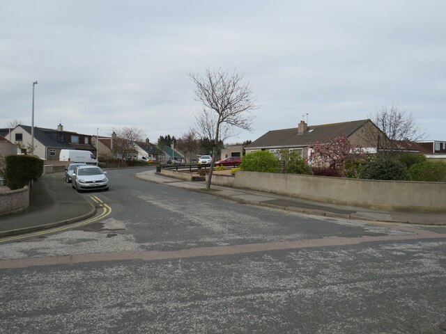
The landscape surrounding Kettle Hill is characterized by rolling hills and lush green fields, typical of the Scottish countryside. The hill itself is relatively small in size but offers breathtaking views of the surrounding area, including the nearby Bennachie range and the River Don.

Kettle Hill is primarily composed of granite, a common rock type found in the region. The hill's geological formation dates back millions of years and is a result of tectonic forces and erosion over time. Its distinctive shape and prominent position make it a recognizable landmark in the area.

The hill is accessible to hikers and outdoor enthusiasts, with a network of trails leading to its summit. The path to the top is moderate in difficulty, suitable for both experienced walkers and beginners. Once at the summit, visitors can enjoy panoramic views of Aberdeenshire's picturesque countryside, dotted with farms, villages, and woodlands.

Kettle Hill is also known for its rich biodiversity, with a variety of plant and animal species calling the area home. The hill provides a habitat for various bird species, including raptors such as buzzards and kestrels. During the summer months, wildflowers adorn the slopes, adding vibrant colors to the landscape.

Overall, Kettle Hill offers an enjoyable outdoor experience for those seeking natural beauty and tranquility in the Aberdeenshire region.

If you have any feedback on the listing, please let us know in the comments section below.

Kettle Hill Images

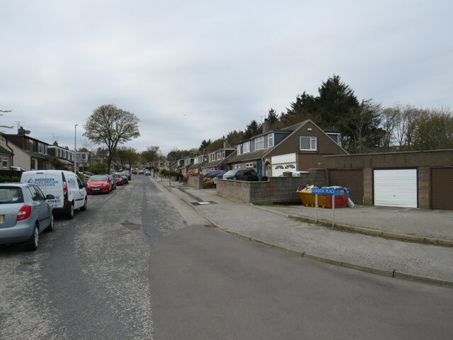
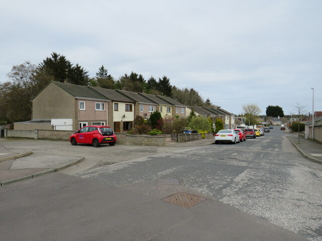
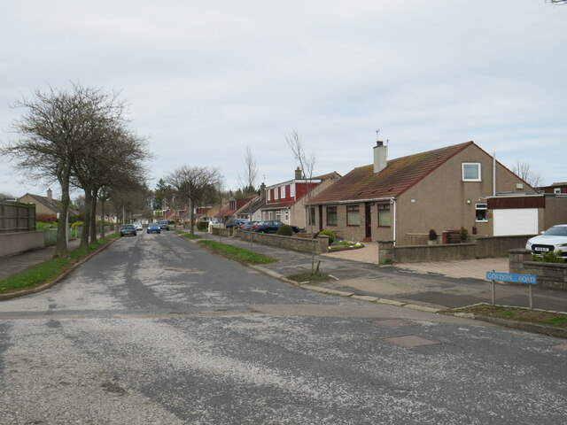
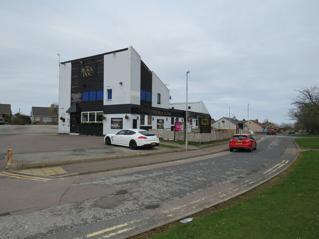
Images are sourced within 2km of 57.170537/-2.1071409 or Grid Reference NJ9308. Thanks to Geograph Open Source API. All images are credited.

Bridge of Don Library Bridge of Don must be the ultimate 1970s suburb, with unimpressive public buildings to match...
Bridge of Don Library
Bridge of Don must be the ultimate 1970s suburb, with unimpressive public buildings to match...
Scotstown Surgery, Bridge of Don
Scotstown School, Bridge of Don, Aberdeen Built in the 1970s with the school name on the end of the building in the Profil typeface.  I thought this typeface was classic (dated) 1970s, but in fact it dates from 1946: <span class="nowrap"><a title="http://ultraboldblog.printweek.com/2009/02/28/profil/" rel="nofollow ugc noopener" href="http://ultraboldblog.printweek.com/2009/02/28/profil/">Link</a><img style="margin-left:2px;" alt="External link" title="External link - shift click to open in new window" src="https://s1.geograph.org.uk/img/external.png" width="10" height="10"/></span> .
Scotstown School, Bridge of Don, Aberdeen
Built in the 1970s with the school name on the end of the building in the Profil typeface. I thought this typeface was classic (dated) 1970s, but in fact it dates from 1946: LinkExternal link .
The Black Dog, Bridge of Don Interesting 1970s architecture..
The Black Dog, Bridge of Don
Interesting 1970s architecture..
The Buckie Farm pub Off the A90.
The Buckie Farm pub
Off the A90.
Scotstown Road, Bridge of Don, Aberdeen Scotstown Road is on the route of the B997 passing through the northern suburbs of Aberdeen
Scotstown Road, Bridge of Don, Aberdeen
Scotstown Road is on the route of the B997 passing through the northern suburbs of Aberdeen
Braehead Way, Bridge of Don, Aberdeen Braehead Way is a minor residential road in Bridge of Don, in the northern suburbs of Aberdeen.
Braehead Way, Bridge of Don, Aberdeen
Braehead Way is a minor residential road in Bridge of Don, in the northern suburbs of Aberdeen.
Broadfold Road, Bridge of Don, Aberdeen Broadfold Road passes through an industrial estate in Bridge of Don, in the northern suburbs of Aberdeen.
Broadfold Road, Bridge of Don, Aberdeen
Broadfold Road passes through an industrial estate in Bridge of Don, in the northern suburbs of Aberdeen.
Silverburn Crescent, Bridge of Don, Aberdeen Silverburn Crescent leads into an industrial estate in Bridge of Don, in the northern suburbs of Aberdeen.

This image was taken on a Saturday afternoon, when most of the businesses were closed for the weekend.  There were very few people around.
Silverburn Crescent, Bridge of Don, Aberdeen
Silverburn Crescent leads into an industrial estate in Bridge of Don, in the northern suburbs of Aberdeen. This image was taken on a Saturday afternoon, when most of the businesses were closed for the weekend. There were very few people around.
Royal Mail depot, Bridge of Don, Aberdeen A Royal Mail depot at Bridge of Don, in the suburbs of Aberdeen.
Royal Mail depot, Bridge of Don, Aberdeen
A Royal Mail depot at Bridge of Don, in the suburbs of Aberdeen.
Gordon Place, Bridge of Don, Aberdeen Gordon Place is a minor residential road in Bridge of Don, in the northern suburbs of Aberdeen.
Gordon Place, Bridge of Don, Aberdeen
Gordon Place is a minor residential road in Bridge of Don, in the northern suburbs of Aberdeen.
Broadfold Drive, Bridge of Don, Aberdeen Broadfold Drive is a minor residential road in Bridge of Don, in the northern suburbs of Aberdeen.
Broadfold Drive, Bridge of Don, Aberdeen
Broadfold Drive is a minor residential road in Bridge of Don, in the northern suburbs of Aberdeen.
Gordon Road, Bridge of Don, Aberdeen Gordon Road is a minor residential road in Bridge of Don, in the northern suburbs of Aberdeen.
Gordon Road, Bridge of Don, Aberdeen
Gordon Road is a minor residential road in Bridge of Don, in the northern suburbs of Aberdeen.
The Black Dog pub, Bridge of Don, Aberdeen The Black Dog is a pub in Bridge of Don, in the northern suburbs of Aberdeen.
The Black Dog pub, Bridge of Don, Aberdeen
The Black Dog is a pub in Bridge of Don, in the northern suburbs of Aberdeen.
Broadfold Drive, Bridge of Don, Aberdeen Broadfold Drive is a minor residential road in Bridge of Don, in the northern suburbs of Aberdeen.
Broadfold Drive, Bridge of Don, Aberdeen
Broadfold Drive is a minor residential road in Bridge of Don, in the northern suburbs of Aberdeen.
Lacrosse pitch, Balgownie Sports Ground The University of Aberdeen sports ground appears to be disused but the grass is immaculately mowed.  Balgownie means 'town of the cattle fold' according to Celtic Place-names in Aberdeenshire by John Milne.
Lacrosse pitch, Balgownie Sports Ground
The University of Aberdeen sports ground appears to be disused but the grass is immaculately mowed. Balgownie means 'town of the cattle fold' according to Celtic Place-names in Aberdeenshire by John Milne.
Indoor shooting range, Gordon Barracks North of the main parade ground.  The Gordon Barracks complex was built 1932-35 in finest Aberdeen granite to house the Gordon Highlanders, who moved from the Castlegate in the city centre. The Gordons moved out in the 1990s and the complex is now used by the Territorial Army with parts leased to commercial tenants. Photo taken on an open day with permission.
Indoor shooting range, Gordon Barracks
North of the main parade ground. The Gordon Barracks complex was built 1932-35 in finest Aberdeen granite to house the Gordon Highlanders, who moved from the Castlegate in the city centre. The Gordons moved out in the 1990s and the complex is now used by the Territorial Army with parts leased to commercial tenants. Photo taken on an open day with permission.
Garage, Gordon Barracks A modern garage for military vehicles to the north of the main parade ground. The Gordon Barracks complex was built 1932-35 in finest Aberdeen granite to house the Gordon Highlanders, who moved from the Castlegate in the city centre. The Gordons moved out in the 1990s and the complex is now used by the Territorial Army with parts leased to commercial tenants. Photo taken on an open day with permission.
Garage, Gordon Barracks
A modern garage for military vehicles to the north of the main parade ground. The Gordon Barracks complex was built 1932-35 in finest Aberdeen granite to house the Gordon Highlanders, who moved from the Castlegate in the city centre. The Gordons moved out in the 1990s and the complex is now used by the Territorial Army with parts leased to commercial tenants. Photo taken on an open day with permission.
Show me another place!

Kettle Hill is located at Grid Ref: NJ9308 (Lat: 57.170537, Lng: -2.1071409)

Unitary Authority: City of Aberdeen

Police Authority: North East

What 3 Words

///exam.teeth.dishes. Near Aberdeen

Related Wikis

Bishop Dunbar's Hospital

Bishop Dunbar's Hospital was founded in 1531 by Bishop Gavin Dunbar, the Elder. The hospital was endowed by a mortification just before his death. Dunbar...

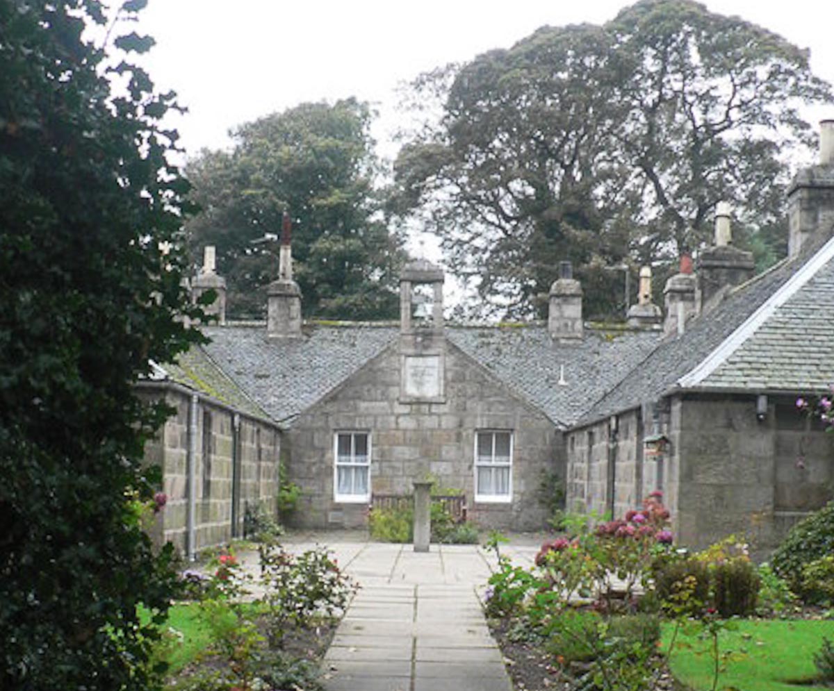
Mitchell's Hospital Old Aberdeen

Mitchell's Hospital, Old Aberdeen, in Old Aberdeen, Scotland, was founded by the philanthropist David Mitchell in 1801 as follows: " .. from a regard...

Zoology Building

The Zoology Building is a facility owned by the University of Aberdeen. It is situated in Tillydrone. == History == During construction, the building collapsed...

St Machar's Cathedral

St Machar's Cathedral is a Church of Scotland church in Aberdeen, Scotland, located to the north of the city centre, in the former burgh of Old Aberdeen...

Nearby Amenities

Located within 500m of 57.170537,-2.1071409
Turning Circle
Turning Circle: circle
Lat/Long: 57.1729405/-2.1071747
Turning Circle
Lat/Long: 57.1685681/-2.1137409
Stop
Lat/Long: 57.167297/-2.1019542
Old Aberdeen
Name En: Old Aberdeen
Name Gd: Seann Obar Dheathain
Name Ru: Старый Абердин
Name Sco: Auld Aiberdeen
Place: suburb
Wikidata: Q3350171
Wikipedia: en:Old Aberdeen
Lat/Long: 57.1669196/-2.1022937
Barrier: bollard
Bollard: fixed
Lat/Long: 57.1699027/-2.1035595
Life Ring
Check Date: 2021-09-06
Emergency: life_ring
Source: survey
Lat/Long: 57.1729995/-2.103566
Post Box
Addr City: Aberdeen
Addr Postcode: AB24 2SS
Addr Street: Tedder Street
Collection Times: Mo-Fr 09:00, Sa 07:00
Operator: Royal Mail
Operator Wikidata: Q638098
Post Box Design: type_b
Post Box Type: pillar
Ref: AB24 83
Royal Cypher: scottish_crown
Source: survey
Source Position: gps distance along road];survey [next to sidewalk]
Lat/Long: 57.1685418/-2.1103173
Post Box
Collection Times: Mo-Fr 09:00
Operator: Royal Mail
Operator Wikidata: Q638098
Post Box Type: wall
Ref: AB24 124
Royal Cypher: GR
Royal Cypher Wikidata: Q33102273
Source: survey; Bing
Lat/Long: 57.1690899/-2.1030936
Bear Essentials
Addr City: Aberdeen
Addr Postcode: AB24 3TU
Addr Street: Elphinstone Road
Fhrs Authority: Aberdeen City
Fhrs Id: 1347399
Fhrs Local Authority Id: 1759
Shop: convenience
Source Addr: fhrs
Lat/Long: 57.1666652/-2.104353
Bus Stop
St Machar Drive
Bench: no
Bin: no
Bus: yes
Departures Board: timetable
Lit: yes
Naptan AtcoCode: 639008581
Naptan CommonName: St Machar Drive
Naptan Indicator: at
Naptan NaptanCode: 23236868
Naptan Verified: no
Note: services: 20, N20
Public Transport: platform
Ref: 08581
Shelter: no
Source: bing;gps;survey
Tactile Paving: no
Lat/Long: 57.1666012/-2.103521
Tiki Cafe
Addr Postcode: AB24 3TU
Addr Street: Elphinstone Road
Amenity Disused: cafe
Check Date: 2018-04-15
Fhrs Id: 198296
Source Addr: fhrs
Lat/Long: 57.1682929/-2.1048485
Fixme: position is approximate (between paved/unpaved sections)
Lat/Long: 57.1714678/-2.1079242
Tillydrone
Is In: Aberdeen, Aberdeen City, Scotland, United Kingdom
Loc Name: Tilly
Name Gd: Tulach an Droighinn
Place: suburb
Population: 3395
Source: OS_OpenData_StreetView
Wikidata: Q7802921
Wikipedia: en:Tillydrone
Lat/Long: 57.1716415/-2.1139352
Entrance: main
Lat/Long: 57.1696519/-2.1024211
Barrier: bollard
Bicycle: yes
Bollard: fixed
Foot: yes
Source: survey
Lat/Long: 57.1667112/-2.1092514
Cycleway: asl
Direction: backward
Lat/Long: 57.1672069/-2.1028337
Mercat Cross
Historic: memorial
Memorial: mercat_cross
Lat/Long: 57.167005/-2.1022666
Post Box
Collection Times: Mo-Fr 09:00; Sa 07:00
Operator: Royal Mail
Operator Wikidata: Q638098
Post Box Type: pillar
Ref: AB24 58
Royal Cypher: GVIR
Royal Cypher Wikidata: Q33102169
Source: Bing;survey
Lat/Long: 57.167093/-2.1020505
Barrier: bollard
Bollard: fixed
Source: Bing; survey
Lat/Long: 57.1671085/-2.1020279
Fast Food
Subway
Addr City: Aberdeen
Addr Postcode: AB24 3TU
Addr Street: Elphinstone Road
Brand: Subway
Brand Wikidata: Q244457
Brand Wikipedia: en:Subway (restaurant)
Contact Website: https://restaurants.subway.com/united-kingdom/sc/aberdeen/the-hub-university-of-aberdeen-elphinestone-road
Cuisine: sandwich
Fhrs Authority: Aberdeen City
Fhrs Id: 1347543
Fhrs Local Authority Id: 1901
Source: knowledge
Source Addr: fhrs
Takeaway: yes
Lat/Long: 57.166667/-2.1040131
Barrier: bollard
Bollard: removable
Colour: black
Height: 1
Material: metal
Wheelchair: yes
Lat/Long: 57.1710514/-2.1087104
Bus Stop
Harris Drive
Bench: yes
Bin: yes
Bus: yes
Lit: yes
Naptan AtcoCode: 639002711
Naptan CommonName: Harris Drive
Naptan Indicator: adj
Naptan NaptanCode: 23235849
Naptan Verified: no
Public Transport: platform
Ref: 02711
Shelter: yes
Source: gps
Source Name: survey
Source Ref: survey
Tactile Paving: no
Lat/Long: 57.170188/-2.10825
Bus Stop
Coningham Terrace
Bench: no
Bin: yes
Bus: yes
Lit: yes
Naptan AtcoCode: 639002721
Naptan CommonName: Coningham Terrace
Naptan Indicator: adj
Naptan NaptanCode: 23235876
Naptan Verified: no
Public Transport: platform
Ref: 02721
Shelter: no
Source: gps; survey
Source Name: survey
Source Ref: survey
Tactile Paving: no
Wheelchair: yes
Lat/Long: 57.1721423/-2.1110633
Bus Stop
Pennan Road
Bench: no
Bin: no
Bus: yes
Lit: no
Naptan AtcoCode: 639002731
Naptan CommonName: St George's Church
Naptan Indicator: at
Naptan NaptanCode: 23235898
Naptan Verified: no
Public Transport: platform
Ref: 02731
Shelter: no
Source: bing; gps; survey
Tactile Paving: no
Wheelchair: yes
Lat/Long: 57.1725291/-2.1143533
Bus Stop
Sir Duncan Rice Library
Bench: no
Bin: no
Bus: yes
Departures Board: timetable
Lit: yes
Naptan AtcoCode: 639002691
Naptan CommonName: Sir Duncan Rice Library
Naptan Indicator: opp
Naptan NaptanCode: 23235732
Naptan Verified: no
Public Transport: platform
Ref: 02691
Shelter: no
Source: bing;gps;survey
Tactile Paving: no
Lat/Long: 57.1660808/-2.1065762
Bus Stop
Wingate Road
Bench: no
Bin: yes
Bus: yes
Lit: yes
Naptan AtcoCode: 639002702
Naptan CommonName: Wingate Road
Naptan Indicator: opp
Naptan NaptanCode: 23235782
Naptan Verified: no
Public Transport: platform
Ref: 02702
Shelter: yes
Source: bing; gps; survey
Tactile Paving: no
Lat/Long: 57.1679046/-2.1068741
Bus Stop
Wingate Road
Bench: no
Bin: no
Bus: yes
Lit: yes
Naptan AtcoCode: 639002701
Naptan CommonName: Wingate Road
Naptan Indicator: adj
Naptan NaptanCode: 23235793
Naptan Verified: no
Public Transport: platform
Ref: 02701
Shelter: no
Source: bing; gps
Source Name: survey
Source Ref: survey
Tactile Paving: no
Lat/Long: 57.1681715/-2.107258
Bus Stop
Harris Drive
Bench: no
Bin: yes
Bus: yes
Lit: yes
Naptan AtcoCode: 639002712
Naptan CommonName: Harris Drive
Naptan Indicator: opp
Naptan NaptanCode: 23235796
Naptan Verified: no
Public Transport: platform
Ref: 02712
Shelter: no
Source: gps; survey
Tactile Paving: no
Lat/Long: 57.1698823/-2.1078365
Bus Stop
Coningham Terrace
Bench: yes
Bin: yes
Bus: yes
Departures Board: timetable
Lit: yes
Naptan AtcoCode: 639002722
Naptan CommonName: Coningham Terrace
Naptan Indicator: opp
Naptan NaptanCode: 23235872
Naptan Verified: no
Operator: nestrans
Public Transport: platform
Ref: 02722
Shelter: yes
Source: bing; gps; survey
Tactile Paving: no
Wheelchair: yes
Lat/Long: 57.1716166/-2.1095558
Pharmacy
Tillydrone Pharmacy
Addr City: Aberdeen
Addr Housenumber: 109
Addr Postcode: AB24 2RN
Addr Street: Hayton Road
Alt Name: Tillydrone Pharmacy and Post Office
Dispensing: yes
Drive Through: no
Fhrs Authority: Aberdeen City
Fhrs Id: 1347753
Fhrs Local Authority Id: 2115
Fhrs LocalauthoritybusinessID: EHDC10761
Healthcare: pharmacy
Opening Hours: Mo-Fr 09:00-17:30; Sa 09:00-12:30
Operator: John Ross (Chemists) Ltd
Source: survey;bing;local knowledge
Source Addr: fhrs
Source Alt Name: fhrs
Wheelchair: limited
Lat/Long: 57.1728281/-2.114208
Barrier: bollard
Bicycle: yes
Bollard: removable
Foot: yes
Source: survey; gps
Lat/Long: 57.1721542/-2.1101819
Barrier: bollard
Bicycle: yes
Bollard: removable
Foot: yes
Source: survey; gps
Lat/Long: 57.1721943/-2.1103945
Direction: both
Surface: asphalt
Traffic Calming: cushion
Lat/Long: 57.172448/-2.1111796
Direction: both
Surface: asphalt
Traffic Calming: cushion
Lat/Long: 57.1727783/-2.1118821
Barrier: bollard
Bicycle: yes
Bollard: fixed
Foot: yes
Source: survey
Lat/Long: 57.1671777/-2.1020321
Fixme: location is approximate
Source: survey
Tourism: picnic_site
Lat/Long: 57.171314/-2.1073522
Barrier: cycle_barrier
Bicycle: dismount
Foot: yes
Source: survey
Lat/Long: 57.1701801/-2.1106257
Crossing
Crossing: unmarked
Crossing Island: no
Crossing Markings: no
Kerb: raised
Tactile Paving: no
Lat/Long: 57.171577/-2.1116042
Bicycle Parking
Bicycle Parking: wall_loops
Capacity: 3
Covered: yes
Source: survey
Lat/Long: 57.1717974/-2.1131499
Telephone
Booth: KX100
Check Date: 2021-06-08
Covered: booth
Source: bing;survey;gps
Lat/Long: 57.1689808/-2.1102945
Barrier: bollard
Bollard: fixed
Foot: yes
Lat/Long: 57.1675093/-2.1095853
St Machar Park
Information: board
Source: survey
Tourism: information
Lat/Long: 57.1679083/-2.1087255
Barrier: bollard
Bicycle: yes
Bollard: fixed
Foot: yes
Source: survey
Lat/Long: 57.1682234/-2.1089156
Source: survey; gps
Traffic Calming: hump
Lat/Long: 57.166226/-2.1061422
Source: survey
Traffic Calming: hump
Lat/Long: 57.1662502/-2.1056353
Barrier: bollard
Bicycle: yes
Bollard: fixed
Foot: yes
Note: position is approximate
Lat/Long: 57.169685/-2.1085986
Camera Mount: pole
Camera Type: dome
Man Made: surveillance
Note: 'Hanging' dome type; unsure how to tag further
Source: survey
Surveillance: public
Surveillance Type: camera
Lat/Long: 57.1660912/-2.1063398
Downies Cairn
Historic: memorial
Inscription: POPULARLY ASSOCIATED WITH THE TALE OF DOWNIE THE SACRIST STOOD FORMERLY AT BERRYDEN AND IN 1926 WAS MOVED TO THIS SITE "I CANNOT TELL HOW THE TRUTH MAY BE I SAY THE TALE AS TWAS SAID TO ME"
Lat/Long: 57.1709173/-2.1085485
Waste Basket
Check Date: 2021-09-21
Source: survey; gps
Waste: dog_excrement
Lat/Long: 57.1721997/-2.1101079
Life Ring
Check Date: 2022-04-25
Emergency: life_ring
Source: survey;gps
Lat/Long: 57.1730705/-2.1099641
Material: wood
Power: pole
Lat/Long: 57.1731869/-2.1101691
Material: wood
Power: pole
Lat/Long: 57.1734805/-2.1091983
Donside Community Association
Board Type: notice
Information: board
Source: gps; survey
Tourism: information
Lat/Long: 57.174293/-2.1113707
Waste Basket
Source: gps; survey
Lat/Long: 57.1719453/-2.1146323
Waste Basket
Source: gps; survey
Lat/Long: 57.1721476/-2.1141083
Fountain
The Fountain
Note: This fountain was erected in 1984 in memory of Malcolm Vivian Hay the last Laird of Seaton Born 21 January 1881 Died 27th December 1962 and of his second wife Alice Ivy Hay or Wigmore Died 21st August 1982
Source: survey
Lat/Long: 57.1731875/-2.1023783
Waste Basket
Source: survey; bing
Lat/Long: 57.1708208/-2.1020214
Bench
Backrest: yes
Check Date: 2021-02-27
Source: survey; bing
Lat/Long: 57.1707135/-2.1020469
Waste Basket
Source: survey; bing
Lat/Long: 57.1708364/-2.1023415
Bench
Backrest: yes
Check Date: 2021-02-27
Source: survey; bing
Lat/Long: 57.1707235/-2.1023593
Waste Basket
Source: survey; bing
Lat/Long: 57.1710975/-2.1019607
Bench
Backrest: yes
Source: survey; bing
Lat/Long: 57.1711945/-2.1019569
Bench
Backrest: yes
Source: survey; bing
Lat/Long: 57.1712043/-2.1022699
Waste Basket
Source: survey; bing
Lat/Long: 57.1710912/-2.1022982
Bench
Backrest: yes
Check Date: 2021-02-27
Source: survey; bing
Lat/Long: 57.1715859/-2.1017987
Bench
Backrest: yes
Check Date: 2021-02-27
Source: survey; bing
Lat/Long: 57.1716065/-2.1023024
Bench
Backrest: yes
Check Date: 2021-05-22
Source: survey; bing
Lat/Long: 57.1719896/-2.1021452
Bench
Backrest: yes
Check Date: 2021-02-27
Source: survey; bing
Lat/Long: 57.172488/-2.1020557
Waste Basket
Check Date: 2021-03-28
Source: survey; bing
Lat/Long: 57.1722156/-2.1017759
Waste Basket
Check Date: 2021-03-28
Source: survey
Lat/Long: 57.1727768/-2.1007341
Waste Basket
Check Date: 2021-03-28
Source: survey
Waste: dog_excrement
Lat/Long: 57.1727854/-2.1005077
Information: guidepost
Note: East: Brig O'Balgownie via Don Street 1/2
Source: survey
Tourism: information
Lat/Long: 57.1733905/-2.1037583
Information: guidepost
Note: North: Brig O'Balgownie via River Don Path 1/2; South: Grandholm Bridge 1 1/4
Source: survey
Tourism: information
Lat/Long: 57.1734962/-2.1040079
Information: guidepost
Note: East: Don Street
Source: survey
Tourism: information
Lat/Long: 57.1735205/-2.1035593
Information: guidepost
Note: Northwest: Grandholm Bridge; Northeast: Brig O'Balgownie
Source: survey
Tourism: information
Lat/Long: 57.1711071/-2.1085446
Bench
Backrest: yes
Check Date: 2021-03-27
Source: survey; bing
Lat/Long: 57.1707269/-2.1072031
Waste Basket
Check Date: 2021-03-27
Source: survey
Lat/Long: 57.1709055/-2.1074105
Bench
Backrest: yes
Check Date: 2021-03-27
Fixme: position is approximate along this section
Material: wood
Note: Made from wooden log
Source: survey; bing
Lat/Long: 57.1701343/-2.1040742
Bench
Backrest: yes
Check Date: 2021-03-27
Fixme: position is approximate along this section
Source: survey; bing
Lat/Long: 57.1703923/-2.1054278
Waste Basket
Check Date: 2021-03-27
Source: survey
Waste: dog_excrement
Lat/Long: 57.1700645/-2.1034423
Information: guidepost
Note: Northwest: Brig O'Balgownie
Source: survey
Tourism: information
Lat/Long: 57.1702611/-2.1037739
Waste Basket
Check Date: 2021-04-21
Source: survey
Waste: dog_excrement
Lat/Long: 57.1707105/-2.1047647
Information: guidepost
Note: Southeast: Brig O'Balgownie; Southwest: Grandholm Bridge
Source: survey
Tourism: information
Lat/Long: 57.1716723/-2.1083039
Waste Basket
Check Date: 2021-04-21
Source: survey
Waste: dog_excrement
Lat/Long: 57.1726852/-2.1030845
Life Ring
Check Date: 2021-12-28
Emergency: life_ring
Source: survey
Lat/Long: 57.1715306/-2.1078475
Information: guidepost
Note: North: River Don Path; South: River Don Path
Source: survey
Tourism: information
Lat/Long: 57.1726345/-2.1035175
Information: guidepost
Note: East: Brig O'Balgownie, Don Mouth; West: Grandholm Bridge; South: St Machar Cathedral
Source: survey
Tourism: information
Lat/Long: 57.1713064/-2.1045162
Building: bunker
Bunker Type: pillbox
Military: bunker
Note: At base of embankment, embedded in debris; presumed to be http://canmore.org.uk/site/134464/aberdeen-seaton-park-pillbox
Source: gps;survey
Lat/Long: 57.1702907/-2.0993715
Crossing
Bicycle: yes
Button Operated: yes
Crossing: traffic_signals
Crossing Ref: toucan
Tactile Paving: yes
Traffic Signals Sound: no
Traffic Signals Vibration: yes
Lat/Long: 57.1668492/-2.1072275
Crossing
Bicycle: yes
Button Operated: yes
Crossing: traffic_signals
Crossing Island: yes
Crossing Markings: dots
Crossing Ref: toucan
Tactile Paving: yes
Traffic Signals Vibration: yes
Lat/Long: 57.1669589/-2.1062912
Crossing
Button Operated: yes
Crossing: traffic_signals
Crossing Island: no
Crossing Ref: toucan
Tactile Paving: yes
Traffic Signals Vibration: yes
Lat/Long: 57.16858/-2.1072391
Crossing
Button Operated: yes
Crossing: traffic_signals
Crossing Island: no
Crossing Ref: toucan
Kerb: lowered
Tactile Paving: yes
Traffic Signals Sound: yes
Traffic Signals Vibration: yes
Lat/Long: 57.1706158/-2.1084698
Crossing
Button Operated: yes
Crossing: traffic_signals
Crossing Island: no
Crossing Ref: toucan
Tactile Paving: yes
Traffic Signals Sound: yes
Traffic Signals Vibration: yes
Lat/Long: 57.1720018/-2.1105765
Barrier: entrance
Lat/Long: 57.1674047/-2.1087318
William Wallace Memorial
Description: Circular stone with a five pointed star embedded in the outside wall of the graveyard
Historic: memorial
Memorial: stone
Website: https://canmore.org.uk/site/146541/aberdeen-chanonry-wallace-memorial
Lat/Long: 57.1695027/-2.101323
Traffic Signals
Traffic Signals: signal
Traffic Signals Direction: both
Lat/Long: 57.1672375/-2.1024691
Cycleway: asl
Direction: forward
Lat/Long: 57.1672371/-2.1023329
Crossing
Bicycle: yes
Button Operated: yes
Crossing: traffic_signals
Crossing Island: yes
Crossing Markings: dots
Crossing Ref: toucan
Tactile Paving: yes
Traffic Signals: signal
Traffic Signals Sound: no
Traffic Signals Vibration: yes
Lat/Long: 57.1666182/-2.1065957
Traffic Signals
Traffic Signals: signal
Traffic Signals Direction: both
Lat/Long: 57.1669125/-2.1067232
Crossing
Bicycle: yes
Button Operated: yes
Crossing: traffic_signals
Crossing Island: yes
Crossing Markings: dots
Crossing Ref: toucan
Tactile Paving: yes
Traffic Signals: signal
Traffic Signals Sound: no
Traffic Signals Vibration: yes
Lat/Long: 57.1671381/-2.1068128
Covered: no
Leisure: picnic_table
Lat/Long: 57.171137/-2.1053839
Atm
Brand: NoteMachine
Brand Wikidata: Q104368525
Covered: no
Currency GBP: yes
Drive Through: no
Operator: NoteMachine
Operator Short: NMATM
Operator Wikidata: Q104368525
Lat/Long: 57.1668/-2.1036807
Door: automatic
Entrance: main
Level: 0
Wheelchair: yes
Lat/Long: 57.1668558/-2.1037325
Camera Mount: building
Camera Type: dome
Man Made: surveillance
Surveillance: public
Surveillance Type: camera
Lat/Long: 57.1666208/-2.1037016
Entrance: main
Lat/Long: 57.1678791/-2.1065025
Crossing
Crossing: unmarked
Crossing Island: no
Crossing Markings: no
Kerb: lowered
Tactile Paving: yes
Lat/Long: 57.1730091/-2.113275
Crossing
Crossing: unmarked
Crossing Island: no
Crossing Markings: no
Tactile Paving: yes
Lat/Long: 57.1717726/-2.110268
Crossing
Crossing: unmarked
Crossing Island: no
Crossing Markings: no
Tactile Paving: yes
Lat/Long: 57.1697587/-2.107971
Pub
Union Brew
Addr City: Aberdeen
Addr Postcode: AB24 3TU
Addr Street: Elphinstone Road
Fhrs Authority: Aberdeen City
Fhrs Id: 1552984
Fhrs Local Authority Id: EHDC15076
Lat/Long: 57.1668691/-2.1040323
Zoology Museum
Fee: no
Opening Hours: Mo-Fr 10:00-16:00
Operator: University of Aberdeen
Tourism: museum
Website: https://www.abdn.ac.uk/museums/exhibitions/zoology-museum-588.php
Lat/Long: 57.1679831/-2.1063041
Life Ring
Emergency: life_ring
Lat/Long: 57.1742694/-2.1052462
Donside Stores
Addr City: Aberdeen
Addr Housenumber: 1
Addr Postcode: AB24 2PJ
Addr Street: Donside Street
Fhrs Authority: Aberdeen City
Fhrs Id: 868004
Fhrs Local Authority Id: EHDC12007
Shop: newsagent
Lat/Long: 57.1739855/-2.1113665
Entrance: main
Lat/Long: 57.1740165/-2.1113241
Covered: no
Leisure: picnic_table
Lat/Long: 57.174348/-2.1113591
Grit Bin
Lat/Long: 57.1726736/-2.1137598
Crossing
Crossing: unmarked
Crossing Island: no
Crossing Markings: no
Kerb: lowered
Tactile Paving: yes
Lat/Long: 57.1715138/-2.1108711
Barrier: bollard
Bollard: fixed
Motor Vehicle: no
Lat/Long: 57.1694029/-2.112448
Covered: no
Leisure: picnic_table
Lat/Long: 57.1743541/-2.1051317
Bench
Backrest: yes
Lat/Long: 57.1738633/-2.1045993
Bench
Backrest: yes
Lat/Long: 57.1736838/-2.1042869
Bench
Backrest: yes
Lat/Long: 57.1734897/-2.1038255
Egress: pier
Whitewater: put_in;egress
Lat/Long: 57.171444/-2.1072398
Informal Picnic Area
Tourism: picnic_site
Lat/Long: 57.169986/-2.1059707
Naptan AtcoCode: 639003142
Naptan CommonName: Tedder Road
Naptan Indicator: at
Naptan NaptanCode: 23235743
Note: Please don't delete this node. It represents data from NaPTAN which should be preserved until the bus stop is marked as deleted in their data (preventing the stop from being re-imported).
Physically Present: no
Lat/Long: 57.1666739/-2.1094505
Naptan AtcoCode: 639003141
Naptan CommonName: Bedford Road
Naptan Indicator: at
Naptan NaptanCode: 23235745
Note: Please don't delete this node. It represents data from NaPTAN which should be preserved until the bus stop is marked as deleted in their data (preventing the stop from being re-imported).
Physically Present: no
Lat/Long: 57.1667459/-2.1075381
Crossing
Crossing: unmarked
Crossing Markings: no
Kerb: lowered
Tactile Paving: yes
Lat/Long: 57.1662152/-2.1063808
Crossing
Crossing: unmarked
Crossing Markings: no
Tactile Paving: no
Lat/Long: 57.1671062/-2.1035392
Crossing
Button Operated: yes
Crossing Island: no
Crossing Signals: yes
Tactile Paving: yes
Traffic Signals Vibration: yes
Lat/Long: 57.1672129/-2.1027666
Barrier: bollard
Bollard: removable
Material: metal
Lat/Long: 57.1667369/-2.1034671
Bicycle Parking
Bicycle Parking: stands
Capacity: 9
Covered: no
Lat/Long: 57.1667349/-2.1036943
Barrier: bollard
Bollard: fixed
Lat/Long: 57.1666375/-2.110645
Traffic Calming: cushion
Lat/Long: 57.1671684/-2.1108664
Traffic Calming: cushion
Lat/Long: 57.1679797/-2.1098212
Direction: both
Surface: asphalt
Traffic Calming: hump
Lat/Long: 57.1692578/-2.1124615
Traffic Calming: cushion
Lat/Long: 57.1681456/-2.1096058
Crossing
Crossing: unmarked
Crossing Island: no
Crossing Markings: no
Tactile Paving: yes
Lat/Long: 57.16833/-2.1073019
Crossing
Crossing: unmarked
Crossing Island: no
Crossing Markings: no
Tactile Paving: yes
Lat/Long: 57.1687519/-2.1074337
Vending Machine
Vending: parking_tickets
Lat/Long: 57.1689888/-2.1100421
Vending Machine
Vending: parking_tickets
Lat/Long: 57.1688354/-2.110207
Door: automatic
Entrance: main
Level: 0
Lat/Long: 57.1718015/-2.1148971
Cycleway: asl
Direction: forward
Lat/Long: 57.1665593/-2.1065794
Traffic Calming: cushion
Lat/Long: 57.1668073/-2.1108869
Barrier: bollard
Lat/Long: 57.1667803/-2.1109292
Barrier: bollard
Lat/Long: 57.1668398/-2.1108598
Barrier: bollard
Bicycle: yes
Foot: yes
Source: survey
Lat/Long: 57.168228/-2.1088605
Barrier: bollard
Bicycle: yes
Foot: yes
Source: survey
Lat/Long: 57.1682245/-2.1088915
Barrier: bollard
Bicycle: yes
Foot: yes
Source: survey
Lat/Long: 57.1682262/-2.1088755
Barrier: bollard
Bicycle: yes
Foot: yes
Source: survey
Lat/Long: 57.1682225/-2.108905
Barrier: bollard
Bicycle: yes
Foot: yes
Source: survey
Lat/Long: 57.1682167/-2.108935
Barrier: bollard
Bicycle: yes
Foot: yes
Source: survey
Lat/Long: 57.1682141/-2.1089495
Grit Bin
Lat/Long: 57.1682241/-2.1087651
Barrier: bollard
Bicycle: yes
Foot: yes
Source: survey
Lat/Long: 57.1682007/-2.109023
Barrier: bollard
Bicycle: yes
Foot: yes
Source: survey
Lat/Long: 57.1682033/-2.1090091
Barrier: bollard
Motor Vehicle: no
Lat/Long: 57.1694325/-2.1124525
Barrier: bollard
Motor Vehicle: no
Lat/Long: 57.1693941/-2.1124466
Barrier: bollard
Motor Vehicle: no
Lat/Long: 57.1693825/-2.1124448
Barrier: bollard
Motor Vehicle: no
Lat/Long: 57.1693699/-2.1124429
Barrier: bollard
Motor Vehicle: no
Lat/Long: 57.1693563/-2.1124408
Barrier: bollard
Motor Vehicle: no
Lat/Long: 57.1693382/-2.112438
Barrier: bollard
Motor Vehicle: no
Lat/Long: 57.1694223/-2.1124509
Barrier: bollard
Motor Vehicle: no
Lat/Long: 57.169413/-2.1124495
Barrier: bollard
Motor Vehicle: no
Lat/Long: 57.1692752/-2.1124177
Recycling
Recycling Type: centre
Lat/Long: 57.1693367/-2.1145361
Waste Basket
Lat/Long: 57.169355/-2.1145504
Grit Bin
Lat/Long: 57.1689604/-2.1114669
Waste Basket
Lat/Long: 57.170642/-2.1143593
Waste Basket
Lat/Long: 57.1706578/-2.1143711
Access: private
Entrance: yes
Lat/Long: 57.1701837/-2.1153274
Access: private
Entrance: yes
Lat/Long: 57.1700908/-2.1152632
Waste Basket
Lat/Long: 57.1700231/-2.1140322
Waste Basket
Lat/Long: 57.1700037/-2.1140171
Access: private
Entrance: yes
Lat/Long: 57.1697707/-2.1144693
Access: private
Entrance: yes
Lat/Long: 57.1698282/-2.1142076
Access: private
Entrance: yes
Lat/Long: 57.169884/-2.1139529
Access: private
Entrance: yes
Lat/Long: 57.1697923/-2.1138853
Access: private
Entrance: yes
Lat/Long: 57.1697368/-2.1141399
Access: private
Entrance: yes
Lat/Long: 57.1696793/-2.1144008
Direction: both
Traffic Calming: cushion
Lat/Long: 57.1696572/-2.1146625
Barrier: bollard
Lat/Long: 57.169688/-2.1146345
Barrier: bollard
Lat/Long: 57.1696324/-2.1147099
Barrier: bollard
Lat/Long: 57.170219/-2.1150169
Barrier: bollard
Lat/Long: 57.1701611/-2.1150907
Direction: both
Traffic Calming: cushion
Lat/Long: 57.1701896/-2.115049
Access: private
Entrance: yes
Lat/Long: 57.1694074/-2.1147674
Access: private
Entrance: yes
Lat/Long: 57.1693513/-2.1150261
Access: private
Entrance: yes
Lat/Long: 57.1694964/-2.1148346
Access: private
Entrance: yes
Lat/Long: 57.1694411/-2.1150908
Barrier: bollard
Motor Vehicle: no
Lat/Long: 57.1692407/-2.1124912
Entrance: yes
Lat/Long: 57.1710238/-2.1130748
Entrance: yes
Lat/Long: 57.171077/-2.1130237
Entrance: yes
Lat/Long: 57.1710107/-2.1123386
Entrance: yes
Lat/Long: 57.1710651/-2.1122904
Entrance: yes
Lat/Long: 57.171005/-2.1116012
Entrance: yes
Lat/Long: 57.1710543/-2.1115342
Entrance: yes
Lat/Long: 57.1711072/-2.1151377
Entrance: yes
Lat/Long: 57.1711631/-2.1148809
Entrance: yes
Lat/Long: 57.1712524/-2.1149445
Entrance: yes
Lat/Long: 57.1711959/-2.1152034
Entrance: yes
Lat/Long: 57.1709114/-2.114692
Entrance: yes
Lat/Long: 57.1708167/-2.1146271
Entrance: yes
Lat/Long: 57.1707605/-2.1148868
Entrance: yes
Lat/Long: 57.1708547/-2.1149542
Entrance: yes
Lat/Long: 57.1707039/-2.1151474
Entrance: yes
Lat/Long: 57.1707984/-2.1152142
Waste Basket
Lat/Long: 57.1708383/-2.1154158
Check Date: 2021-02-08
Disused Amenity: school
Old Name: Tillydrone Infant School
Lat/Long: 57.1699006/-2.1118908
Welcome to Seaton Park
Information: map
Tourism: information
Lat/Long: 57.1700073/-2.103235
Direction: both
Surface: asphalt
Traffic Calming: cushion
Lat/Long: 57.1734964/-2.1132856
Direction: both
Surface: asphalt
Traffic Calming: cushion
Lat/Long: 57.1731317/-2.1125165
Grit Bin
Access: yes
Colour: yellow
Material: plastic
Lat/Long: 57.1678117/-2.1096466
Direction: both
Traffic Calming: hump
Lat/Long: 57.1674175/-2.111335
Direction: both
Surface: asphalt
Traffic Calming: hump
Lat/Long: 57.1680764/-2.1118137
Grit Bin
Lat/Long: 57.1670932/-2.1019842
Traffic Signals
Traffic Signals: signal
Traffic Signals Direction: both
Lat/Long: 57.1668023/-2.1066689
Cycleway: asl
Lat/Long: 57.1668718/-2.1060003
Crossing
Bicycle: yes
Button Operated: yes
Crossing: traffic_signals
Crossing Island: yes
Crossing Markings: dots
Crossing Ref: toucan
Tactile Paving: yes
Traffic Signals Vibration: yes
Lat/Long: 57.1668591/-2.1061228
Bench
Backrest: yes
Colour: brown
Material: wood
Seats: 4
Lat/Long: 57.1719814/-2.1018112
Waste Basket
Check Date: 2021-03-28
Source: survey; bing
Lat/Long: 57.1722348/-2.1020982
Bench
Backrest: yes
Check Date: 2021-02-27
Colour: rainbow
Inscription: This Big Aberdeen Friendly Bench was created by www.rosiesenterprises.com Please be Friendly Project supported by ACVO TSI & Aberdeen City Council For more information log onto www.acvo.org.uk Plaque provided by Recognition Express North Scotland
Material: wood
Source: survey;bing
Lat/Long: 57.1724675/-2.1017374
Grit Bin
Lat/Long: 57.1698977/-2.1032198
Bench
Backrest: yes
Material: wood
Lat/Long: 57.1719803/-2.1027503
Patrick Manson
Historic: memorial
Inscription: Patrick Manson 1844-1922 Father of tropical medicine First to show that insects carry disease Attended the Gym (Chanonry House) School in this building
Material: metal
Memorial: plaque
Lat/Long: 57.1679742/-2.1030819
Francis Masson
Historic: memorial
Inscription: Francis Masson 1741-1805 Botanist and explorer Lived in Old Aberdeen
Memorial: plaque
Lat/Long: 57.167833/-2.1039858
Robert Brown FRS FLS
Historic: memorial
Inscription: Robert Brown FRS FLS 1773-1858 Botanist and Alumnus of this University Discoverer of the Nucleus of the Plant Cell and of Brownian Motion Erected in 2005, Einstein Year, to mark the link between the works of Robert Brown and Albert Einstein
Memorial: plaque
Lat/Long: 57.1678483/-2.1038477
Bench
Backrest: yes
Colour: brown
Inscription: In memory of Dr. Bernard Kenworthy (J.B.K.) Lecturer in the Department of Botany 1963-1994
Material: wood
Lat/Long: 57.1678874/-2.1036724
Bicycle Parking
Bicycle Parking: stands
Capacity: 10
Covered: yes
Lat/Long: 57.167866/-2.1037985
Bench
Backrest: yes
Colour: brown
Inscription: A. U. B. D.
Material: wood
Lat/Long: 57.1678269/-2.1038772
Bench
Backrest: yes
Colour: brown
Material: wood
Lat/Long: 57.1678222/-2.1039688
Bench
Backrest: yes
Colour: Grey
Inscription: In memory of Professor Charles Gimingham Department of Botany and Plant Science Aberdeen University 1945-1998
Material: wood
Lat/Long: 57.1678352/-2.1039258
Grit Bin
Lat/Long: 57.1713373/-2.1146851
Grit Bin
Lat/Long: 57.1715209/-2.1100268
Traffic Calming: cushion
Lat/Long: 57.1668609/-2.1035311
Cycleway: asl
Direction: forward
Lat/Long: 57.1672582/-2.1068586
Cycleway: asl
Lat/Long: 57.1668369/-2.1073532
Access: private
Addr City: Aberdeen
Addr Housenumber: 2
Addr Street: Market Lane
Entrance: home
Lat/Long: 57.1670971/-2.1018847
Access: private
Addr City: Aberdeen
Addr Housenumber: 1
Addr Street: Market Lane
Entrance: home
Lat/Long: 57.1671068/-2.101951
Camera Mount: pole
Camera Type: dome
Man Made: surveillance
Surveillance: public
Surveillance Type: camera
Survey Date: 2021-09-21
Lat/Long: 57.1666838/-2.107077
Man Made: antenna
Survey Date: 2021-09-21
Lat/Long: 57.1669013/-2.107539
Grit Bin
Lat/Long: 57.1721912/-2.1100851
Colour: green
Man Made: street_cabinet
Operator: CityFibre
Ref: AB1-PN6-SN6
Utility: telecom
Lat/Long: 57.172538/-2.1112438
Bench
Backrest: no
Lat/Long: 57.1666286/-2.1057201
Bench
Backrest: no
Lat/Long: 57.1665297/-2.1057013
Bench
Backrest: no
Lat/Long: 57.166441/-2.1056852
Colour: green
Man Made: street_cabinet
Operator: CityFibre
Ref: AB1-PN1-AN12
Utility: telecom
Lat/Long: 57.1687598/-2.1071788
Grit Bin
Access: yes
Material: plastic
Lat/Long: 57.1720097/-2.1124542
Waste Basket
Waste: dog_excrement
Lat/Long: 57.1706156/-2.1106533
Crossing
Crossing: unmarked
Crossing Island: no
Crossing Markings: no
Tactile Paving: yes
Lat/Long: 57.1708283/-2.1106395
Colour: green
Man Made: street_cabinet
Operator: CityFibre
Ref: AB1-PN4-SN7
Utility: telecom
Lat/Long: 57.1714723/-2.1107804
Colour: green
Man Made: street_cabinet
Operator: CityFibre
Ref: AB1-PN6-SN7
Utility: telecom
Lat/Long: 57.1732092/-2.1125383
Camera Mount: pole
Camera Type: dome
Man Made: surveillance
Surveillance: outdoor
Surveillance Type: camera
Surveillance Zone: building
Lat/Long: 57.1663149/-2.1045954
Door: automatic
Entrance: main
Level: 0
Lat/Long: 57.1664088/-2.1055402
Access: private
Entrance: emergency
Level: 0
Lat/Long: 57.1663412/-2.1050758
Bench
Backrest: yes
Lat/Long: 57.1718306/-2.1147234
Bench
Backrest: yes
Lat/Long: 57.1719341/-2.1148563
Sir Robert Benholm Statue
Artwork Type: statue
Description: A statue of Sir Robert Benholm, holding his sword with a dog at his feet.
Tourism: artwork
Lat/Long: 57.1711281/-2.1080917
Bench: yes
Colour: green
Covered: no
Leisure: picnic_table
Lit: no
Material: metal
Lat/Long: 57.1708654/-2.1074752
Barrier: kerb
Kerb: lowered
Tactile Paving: yes
Lat/Long: 57.1715709/-2.1112861
Barrier: kerb
Kerb: lowered
Tactile Paving: yes
Lat/Long: 57.1715711/-2.1111425
Crossing
Crossing: unmarked
Crossing Island: no
Crossing Markings: no
Kerb: lowered
Tactile Paving: yes
Lat/Long: 57.171571/-2.1111697
Tree of Life
Artist Name: Keiji Nagahiro
Artwork Type: sculpture
Material: metal
Tourism: artwork
Lat/Long: 57.168172/-2.1052504
Bench
Backrest: yes
Material: wood
Lat/Long: 57.1681762/-2.1049371
Bench
Backrest: yes
Material: wood
Lat/Long: 57.1681893/-2.1049176
Bench
Backrest: yes
Material: wood
Lat/Long: 57.1681914/-2.1047645
Bench
Backrest: yes
Material: wood
Lat/Long: 57.1681836/-2.1047343
Bench
Backrest: yes
Material: wood
Lat/Long: 57.1682088/-2.1047399
Bench
Backrest: yes
Material: wood
Lat/Long: 57.1682136/-2.1047008
Waste Basket
Lat/Long: 57.1682411/-2.1044167
Bench
Backrest: yes
Material: wood
Lat/Long: 57.1682063/-2.1043941
Building: shed
Lat/Long: 57.1682508/-2.104454
Bench
Backrest: yes
Material: wood
Lat/Long: 57.1679817/-2.1045302
Bench
Backrest: yes
Material: wood
Lat/Long: 57.1678918/-2.1043212
Bench
Backrest: yes
Material: wood
Lat/Long: 57.1679833/-2.1043486
Bench
Backrest: yes
Material: metal
Lat/Long: 57.167687/-2.1047835
Crocus Ring
Note: Crocus ring roughly 6 or 7 metres in circumference
Tourism: attraction
Lat/Long: 57.1674783/-2.1044925
Bench
Lat/Long: 57.1676168/-2.1051167
Waste Basket
Lat/Long: 57.1676168/-2.1051413
Waste Basket
Lat/Long: 57.1675967/-2.1055644
Bench
Backrest: yes
Lat/Long: 57.1674128/-2.1054893
Bench
Backrest: yes
Lat/Long: 57.1674168/-2.1054002
Bench
Backrest: yes
Lat/Long: 57.1672727/-2.1054627
Bench
Backrest: yes
Material: wood
Lat/Long: 57.1676014/-2.1055884
Historic: memorial
Memorial: plaque
Lat/Long: 57.168115/-2.1057699
Life Ring
Colour: red
Emergency: life_ring
Lat/Long: 57.171432/-2.1044056
Fast Food
One Eyed Jacks
Addr City: Aberdeen
Addr Street: Seaton Park
Cuisine: burger
Delivery: no
Diet Halal: no
Diet Kosher: no
Diet Vegetarian: no
Opening Hours Signed: no
Outdoor Seating: no
Quiet Hours Signed: no
Takeaway: only
Wheelchair: yes
Lat/Long: 57.1727941/-2.1007078
Drinking Water: no
Intermittent: yes
Natural: spring
Photo: https://westnordost.de/p/37297.jpg
Lat/Long: 57.1737319/-2.1018229
Crossing
Crossing: unmarked
Crossing Island: no
Crossing Markings: no
Tactile Paving: yes
Lat/Long: 57.1735412/-2.1123388
Crossing
Crossing: unmarked
Crossing Island: no
Crossing Markings: no
Tactile Paving: yes
Lat/Long: 57.1731744/-2.1115661
Crossing
Crossing: unmarked
Crossing Island: no
Crossing Markings: no
Tactile Paving: yes
Lat/Long: 57.1729886/-2.1111629
Crossing
Crossing: unmarked
Crossing Island: no
Crossing Markings: no
Kerb: lowered
Tactile Paving: yes
Lat/Long: 57.1701219/-2.1079789
Power: pole
Lat/Long: 57.1744599/-2.1089912
Material: wood
Power: pole
Lat/Long: 57.1738182/-2.1091337
Crossing
Crossing: unmarked
Crossing Island: no
Crossing Markings: no
Tactile Paving: yes
Lat/Long: 57.1718192/-2.1100172
Crossing
Bicycle: yes
Button Operated: yes
Crossing: traffic_signals
Crossing Ref: toucan
Tactile Paving: yes
Traffic Signals Vibration: yes
Lat/Long: 57.1667672/-2.1070621
Crossing
Crossing: unmarked
Crossing Island: no
Crossing Markings: no
Kerb: lowered
Tactile Paving: yes
Lat/Long: 57.1684416/-2.1070543
Crossing
Button Operated: yes
Crossing: traffic_signals
Kerb: lowered
Tactile Paving: yes
Traffic Signals Sound: yes
Traffic Signals Vibration: yes
Lat/Long: 57.1671853/-2.1024612
Life Ring
Emergency: life_ring
Survey Date: 2022-06-28
Lat/Long: 57.1713866/-2.1043805
Generator Method: photovoltaic
Generator Output Electricity: yes
Generator Source: solar
Generator Type: solar_photovoltaic_panel
Location: roof
Power: generator
Lat/Long: 57.1736823/-2.1077617
Crossing
Button Operated: yes
Crossing: traffic_signals
Crossing Island: no
Tactile Paving: yes
Traffic Signals Sound: yes
Traffic Signals Vibration: yes
Lat/Long: 57.1672922/-2.10248
Crossing: informal
Lat/Long: 57.1672838/-2.1019534
Noexit: yes
Lat/Long: 57.1673306/-2.1033582
Noexit: yes
Lat/Long: 57.1673719/-2.1027305
Addr City: Aberdeen
Addr Country: GB
Addr Housenumber: 19a
Addr Postcode: AB24 3RS
Addr Street: St Machar Drive
Entrance: home
Lat/Long: 57.1672835/-2.1015324
Addr City: Aberdeen
Addr Country: GB
Addr Housenumber: 16a
Addr Postcode: AB24 1UU
Addr Street: Don Street
Entrance: home
Lat/Long: 57.1673883/-2.1017939
Addr City: Aberdeen
Addr Country: GB
Addr Housenumber: 19
Addr Postcode: AB24 3RS
Addr Street: St Machar Drive
Entrance: home
Lat/Long: 57.1672965/-2.1016335
Addr Housenumber: 48
Addr Street: Don Street
Entrance: yes
Lat/Long: 57.1681995/-2.100207
Addr City: Aberdeen
Addr Country: GB
Addr Housenumber: 16
Addr Postcode: AB24 1UU
Addr Street: Don Street
Entrance: home
Lat/Long: 57.167347/-2.1018145
Noexit: yes
Lat/Long: 57.1680206/-2.1085294
Baby: yes
Capacity: 4
Playground: swing
Wheelchair: no
Lat/Long: 57.1680546/-2.108577
Playground: roundabout
Lat/Long: 57.1681214/-2.1085398
Playground: slide
Lat/Long: 57.1679932/-2.1083937
Playground: slide
Lat/Long: 57.1681062/-2.1084546
The data included in this document is from www.openstreetmap.org. The data is made available under ODbL.

Have you been to Kettle Hill?

Leave your review of Kettle Hill below (or comments, questions and feedback).