Bewcastle

Settlement in Cumberland Carlisle

England

Bewcastle

St Cuthbert's Church and cross at Bewcastle View from the south.
St Cuthbert's Church and cross at Bewcastle Credit: Sandy Gerrard

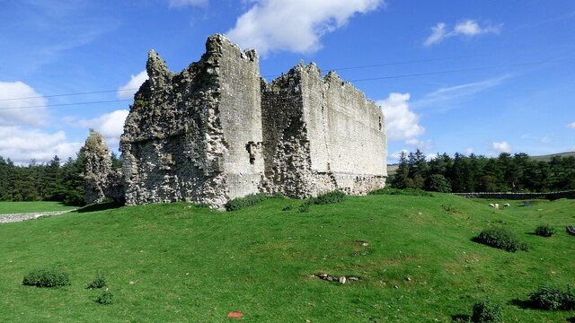
Bewcastle is a small village located in the county of Cumberland, in the northwestern region of England. Situated near the border with Scotland, it lies within the picturesque landscape of the North Pennines Area of Outstanding Natural Beauty. With a population of around 100 people, it is a serene and peaceful community.

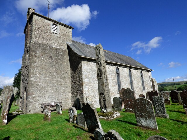
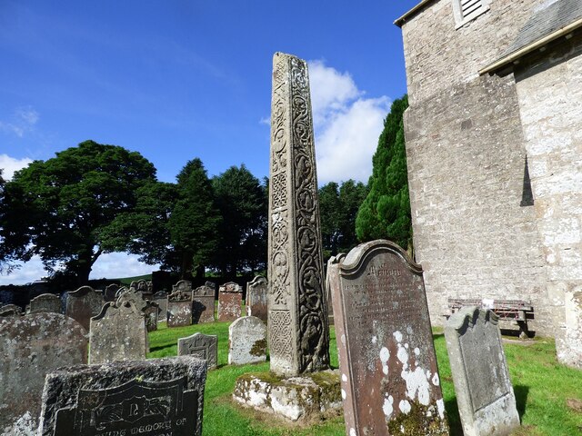
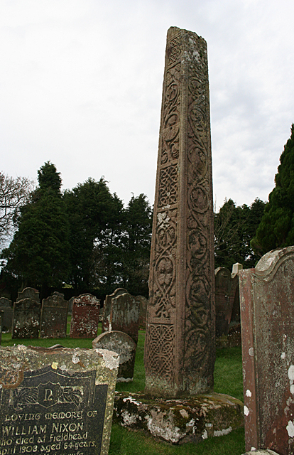
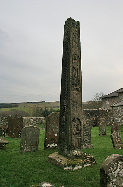
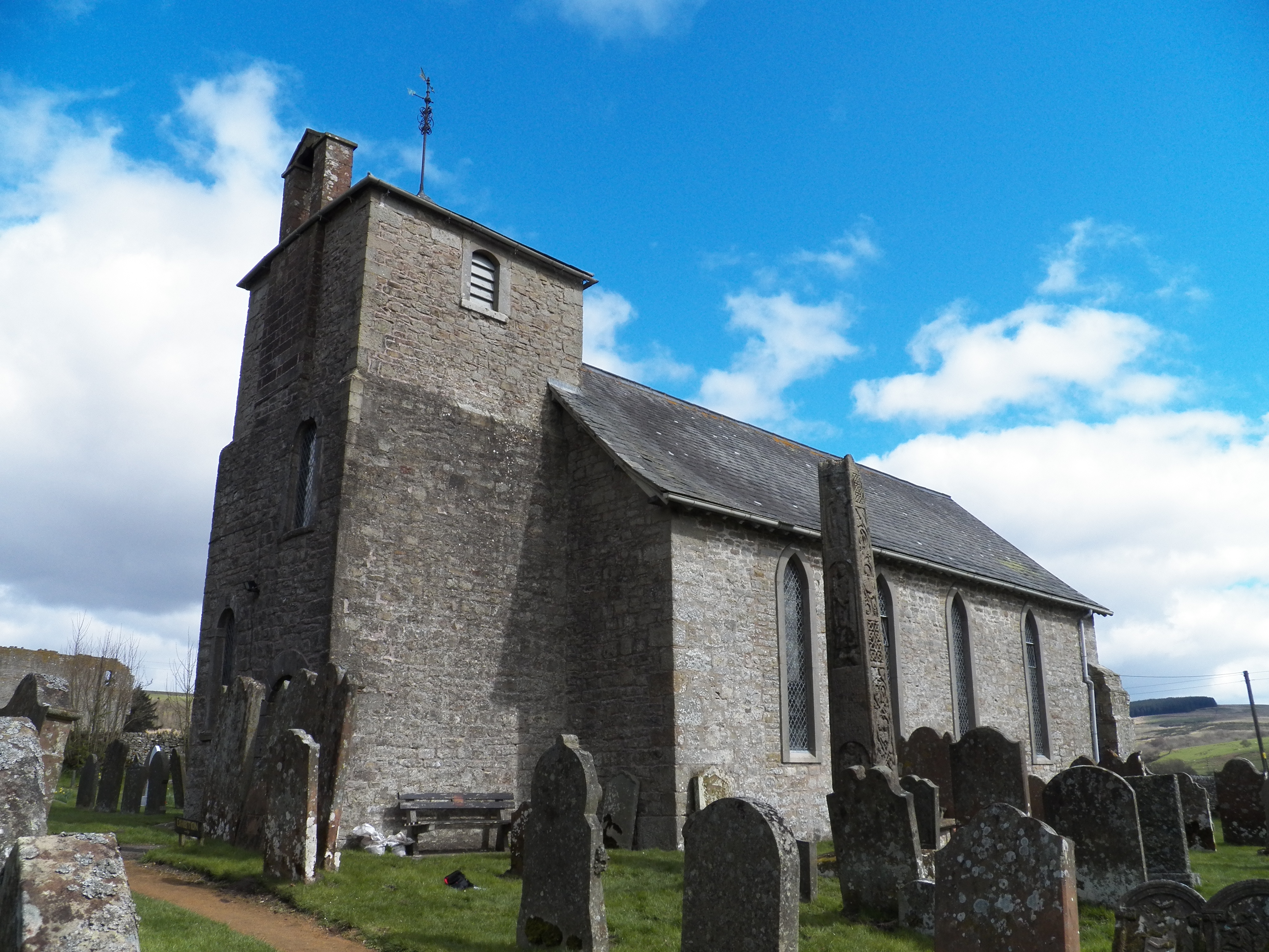
The village is known for its historical significance, particularly Bewcastle Cross, an ancient Anglo-Saxon monument believed to date back to the 7th or 8th century. This tall sandstone cross stands at over 14 feet high and is adorned with intricate carvings depicting biblical scenes and pagan symbols. It is considered one of the finest examples of Anglo-Saxon sculpture in England.

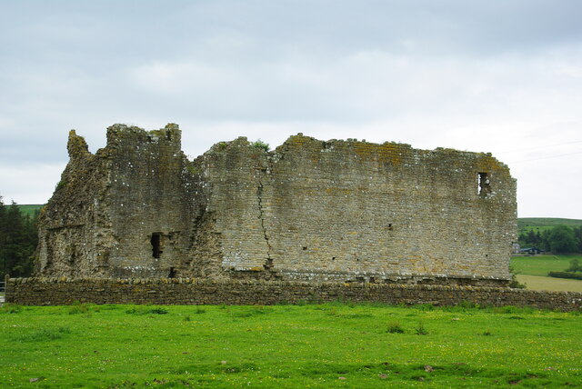
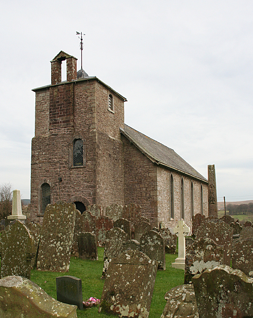
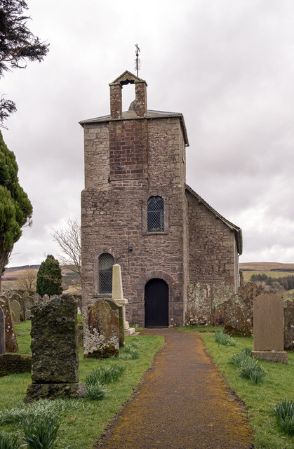
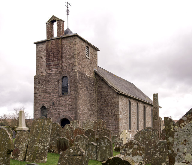
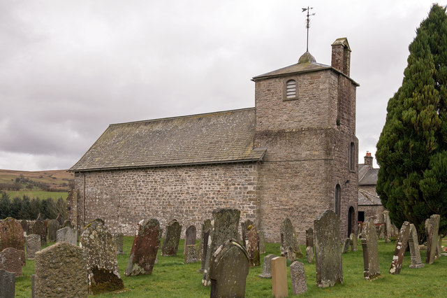
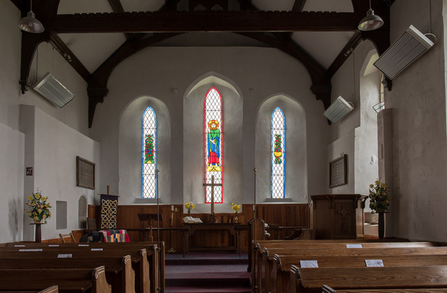
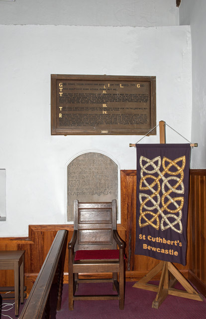
Bewcastle is also home to St. Cuthbert's Church, a Grade I listed building that boasts a rich history. Parts of the church date back to the 12th century, while the tower was added in the 15th century. Inside, visitors can marvel at the stained glass windows and the beautifully preserved medieval choir stalls.

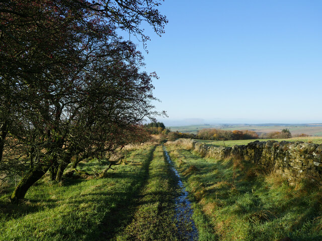
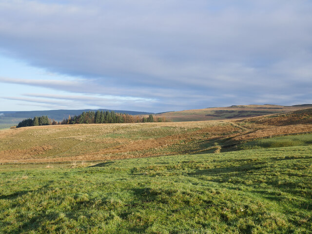
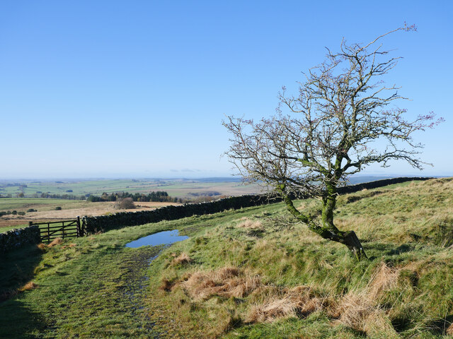
Surrounded by rolling hills and verdant countryside, Bewcastle offers ample opportunities for outdoor activities. The village is a popular starting point for hikers and nature lovers, with numerous walking trails and paths leading to breathtaking viewpoints and hidden gems.

Although Bewcastle is a quiet village with limited amenities, its historical and natural attractions make it a charming destination for those seeking a peaceful retreat or an opportunity to immerse themselves in the region's rich history and stunning landscapes.

If you have any feedback on the listing, please let us know in the comments section below.

Bewcastle Images

Images are sourced within 2km of 55.06477/-2.683355 or Grid Reference NY5674. Thanks to Geograph Open Source API. All images are credited.

St Cuthbert's Church and cross at Bewcastle View from the south.
St Cuthbert's Church and cross at Bewcastle
View from the south.
Bewcastle Cross Southern and eastern faces of the cross.
Bewcastle Cross
Southern and eastern faces of the cross.
Bew Castle View from south west <span class="nowrap"><a title="https://historicengland.org.uk/listing/the-list/list-entry/1015728" rel="nofollow ugc noopener" href="https://historicengland.org.uk/listing/the-list/list-entry/1015728">Link</a><img style="margin-left:2px;" alt="External link" title="External link - shift click to open in new window" src="https://s1.geograph.org.uk/img/external.png" width="10" height="10"/></span>
Bew Castle
View from south west LinkExternal link
Roman fort at Bewcastle The south western ramparts of an unusually shaped hexagonal Roman fort <span class="nowrap"><a title="https://historicengland.org.uk/listing/the-list/list-entry/1015728" rel="nofollow ugc noopener" href="https://historicengland.org.uk/listing/the-list/list-entry/1015728">Link</a><img style="margin-left:2px;" alt="External link" title="External link - shift click to open in new window" src="https://s1.geograph.org.uk/img/external.png" width="10" height="10"/></span>
Roman fort at Bewcastle
The south western ramparts of an unusually shaped hexagonal Roman fort LinkExternal link
On a track near Crossgreens This track links Crossgreens, Bewcastle with Spadeadam Forest crossing rather bleak grazing moorland for the most part.

This photograph was taken during the Coronavirus (COVID-19) pandemic of 2020/21.
On a track near Crossgreens
This track links Crossgreens, Bewcastle with Spadeadam Forest crossing rather bleak grazing moorland for the most part. This photograph was taken during the Coronavirus (COVID-19) pandemic of 2020/21.
Grazings at The Pike Uplands illuminated by November morning sun.

This photograph was taken during the Coronavirus (COVID-19) pandemic of 2020/21.
Grazings at The Pike
Uplands illuminated by November morning sun. This photograph was taken during the Coronavirus (COVID-19) pandemic of 2020/21.
A track on Grey Hill A rough track linking Crossgreens with the Spadeadam Forest.

This photograph was taken during the Coronavirus (COVID-19) pandemic of 2020/21.
A track on Grey Hill
A rough track linking Crossgreens with the Spadeadam Forest. This photograph was taken during the Coronavirus (COVID-19) pandemic of 2020/21.
Hawthorn on the bend An old weather-beaten Hawthorn tree on the track between Crossgreens and Spadeadam Forest. 

This photograph was taken during the Coronavirus (COVID-19) pandemic of 2020/21.
Hawthorn on the bend
An old weather-beaten Hawthorn tree on the track between Crossgreens and Spadeadam Forest. This photograph was taken during the Coronavirus (COVID-19) pandemic of 2020/21.
Bew Castle The remains viewed from St Cuthberts
Bew Castle
The remains viewed from St Cuthberts
St Cuthbert's Church The ancient church at Bewcastle is one of many dedicated to St Cuthbert. To the right (south) of the church is a richly carved cross-shaft.
St Cuthbert's Church
The ancient church at Bewcastle is one of many dedicated to St Cuthbert. To the right (south) of the church is a richly carved cross-shaft.
Bewcastle Cross This is the cross-shaft from the south-east, showing the carvings on the south and east faces of the shaft.
Bewcastle Cross
This is the cross-shaft from the south-east, showing the carvings on the south and east faces of the shaft.
Bewcastle Cross The cross-shaft from the north-west, showing the carvings on the north and west faces.
Bewcastle Cross
The cross-shaft from the north-west, showing the carvings on the north and west faces.
Bew Castle The ruined walls of what must have been a very forbidding fortress in its day.
Bew Castle
The ruined walls of what must have been a very forbidding fortress in its day.
St Cuthbert's Church, Bewcastle - March 2016 (1) The west end of the Church viewed from the entrance gate.
St Cuthbert's Church, Bewcastle - March 2016 (1)
The west end of the Church viewed from the entrance gate.
St Cuthbert's Church, Bewcastle - March 2016 (2) The west and south faces. The Bewcastle Cross can be seen on the right.

Similar views may be found: <a href="https://www.geograph.org.uk/photo/4782578">NY5674 : St Cuthbert's Church</a> and <a href="https://www.geograph.org.uk/photo/1945242">NY5674 : Bewcastle Church</a> .
St Cuthbert's Church, Bewcastle - March 2016 (2)
The west and south faces. The Bewcastle Cross can be seen on the right. Similar views may be found: NY5674 : St Cuthbert's Church and NY5674 : Bewcastle Church .
St Cuthbert's Church, Bewcastle - March 2016 (3) The north face. A similar view may be found: <a href="https://www.geograph.org.uk/photo/239627">NY5674 : Saint Cuthbert's Church, Bewcastle</a> .
St Cuthbert's Church, Bewcastle - March 2016 (3)
The north face. A similar view may be found: NY5674 : Saint Cuthbert's Church, Bewcastle .
St Cuthbert's Church, Bewcastle - March 2016 (4) Interior looking down the nave to the millennium/centenary east window. A similar view may be found: <a href="https://www.geograph.org.uk/photo/1833378">NY5674 : St. Cuthbert's Church Bewcastle - east end</a> with an east window detail at: <a href="https://www.geograph.org.uk/photo/1833387">NY5674 : St. Cuthbert's Church Bewcastle - stained glass window (east end)</a> .
St Cuthbert's Church, Bewcastle - March 2016 (4)
Interior looking down the nave to the millennium/centenary east window. A similar view may be found: NY5674 : St. Cuthbert's Church Bewcastle - east end with an east window detail at: NY5674 : St. Cuthbert's Church Bewcastle - stained glass window (east end) .
St Cuthbert's Church, Bewcastle - March 2016 (5) Left (north) side of the altar. The wooden plaque is No's 1-4 of the Ten Commandments while the stone memorial marks the burial place of Rev Matthew Soulby, Rector of St Cuthbert's who died 28 September 1737.
St Cuthbert's Church, Bewcastle - March 2016 (5)
Left (north) side of the altar. The wooden plaque is No's 1-4 of the Ten Commandments while the stone memorial marks the burial place of Rev Matthew Soulby, Rector of St Cuthbert's who died 28 September 1737.
Show me another place!

Bewcastle is located at Grid Ref: NY5674 (Lat: 55.06477, Lng: -2.683355)

Administrative County: Cumbria

District: Carlisle

Police Authority: Cumbria

What 3 Words

///drip.attic.slipping. Near Brampton, Cumbria

Related Wikis

Nearby Amenities

Located within 500m of 55.06477,-2.683355
Bewcastle
Place: village
Source: NPE
Website: https://www.bewcastle.com/
Lat/Long: 55.0641023/-2.6826239
Fort
Local Ref: AT
Naptan AtcoCode: 090033031330
Naptan Bearing: S
Naptan BusStopType: CUS
Naptan CommonName: Fort
Naptan Indicator: at
Naptan Landmark: entrance to church and Roman fort
Naptan NaptanCode: cumamjgw
Naptan Street: No name
Naptan Verified: no
Source: naptan_import
Lat/Long: 55.0641173/-2.6838376
Bewcastle 7th Century Cross
Source: local knowledge
Tourism: attraction
Wikidata: Q3003309
Wikipedia: en:Bewcastle Cross
Lat/Long: 55.0637441/-2.6819348
Post Box
Ref: CA6 308
Lat/Long: 55.0611152/-2.6815394
Barrier: cattle_grid
Source: survey
Lat/Long: 55.0631937/-2.6828
Barrier: cattle_grid
Source: survey
Lat/Long: 55.0675813/-2.6851529
Hall Hills
Place: locality
Lat/Long: 55.0667399/-2.6879969
Information: guidepost
Tourism: information
Lat/Long: 55.0641545/-2.6839015
Power: pole
Lat/Long: 55.0617225/-2.6871721
Power: pole
Lat/Long: 55.0618034/-2.6855479
Power: pole
Lat/Long: 55.0618651/-2.6842208
Power: pole
Lat/Long: 55.0619392/-2.6826421
Power: pole
Lat/Long: 55.0620188/-2.6809509
Power: pole
Lat/Long: 55.062311/-2.6798753
Power: pole
Lat/Long: 55.0625854/-2.6788452
Power: pole
Lat/Long: 55.0630299/-2.6771492
Power: pole
Lat/Long: 55.06313/-2.6804214
Power: pole
Lat/Long: 55.063912/-2.6810467
Power: pole
Lat/Long: 55.06434/-2.6815977
Power: pole
Lat/Long: 55.0646665/-2.6820288
Power: pole
Lat/Long: 55.0635594/-2.6813485
Power: pole
Lat/Long: 55.0632974/-2.6815761
Power: pole
Lat/Long: 55.0609213/-2.6841345
Power: pole
Lat/Long: 55.0625909/-2.6831571
Power: pole
Lat/Long: 55.0628982/-2.6838039
Power: pole
Lat/Long: 55.0630189/-2.6845561
Power: pole
Lat/Long: 55.0631492/-2.6853754
Power: pole
Lat/Long: 55.0632782/-2.686142
Power: pole
Lat/Long: 55.0634702/-2.6876272
Power: pole
Lat/Long: 55.0635032/-2.6884632
Power: pole
Lat/Long: 55.0635306/-2.6892993
Power: pole
Lat/Long: 55.0635484/-2.6901832
The data included in this document is from www.openstreetmap.org. The data is made available under ODbL.

Have you been to Bewcastle?

Leave your review of Bewcastle below (or comments, questions and feedback).