Bewdley

Settlement in Worcestershire / Shropshire Wyre Forest

England

Bewdley

Bewdley Bridge as seen from Severn Side South
Bewdley Bridge as seen from Severn Side South Credit: Colin Park

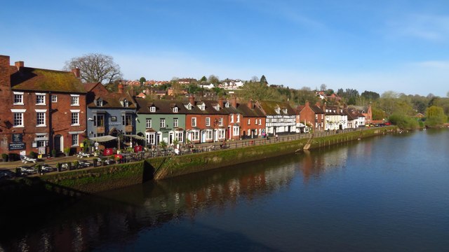
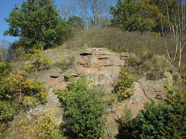
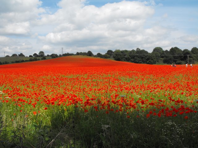
Bewdley is a historic town located in Worcestershire, England, on the banks of the River Severn. Situated near the border of Shropshire, it is often considered a gateway to the Wyre Forest and the picturesque West Midlands countryside. The town is nestled amongst rolling hills and surrounded by lush woodland, providing a stunning natural backdrop.

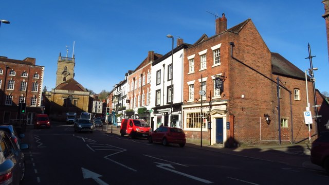
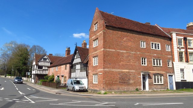
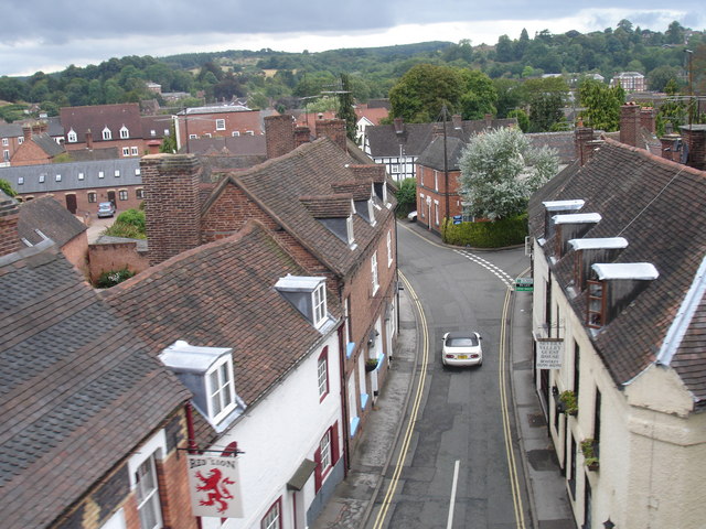
Bewdley has a rich history, dating back to the 13th century, and this is evident in the charming architecture that adorns its streets. The town boasts a number of well-preserved Georgian and Tudor buildings, including the impressive Bewdley Museum and the iconic St. Anne's Church. Visitors can explore the quaint streets and alleyways, lined with independent shops, cafes, and traditional pubs.

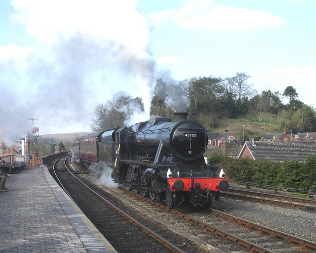
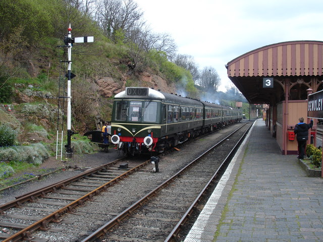
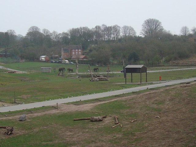
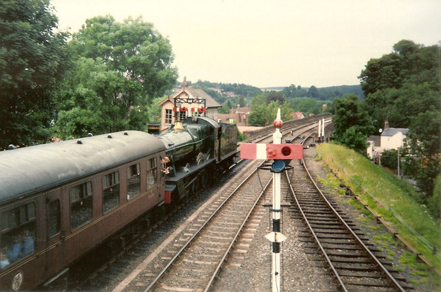
One of Bewdley's main attractions is the Severn Valley Railway, which runs through the town. This heritage steam railway offers scenic journeys through the countryside, providing a nostalgic experience for visitors of all ages. The nearby Bewdley Safari Park is also a popular destination, offering the opportunity to see a variety of wild animals up close.

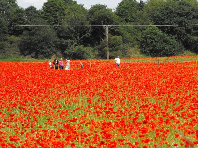
For outdoor enthusiasts, Bewdley offers numerous opportunities for walking, cycling, and watersports along the River Severn. The town is also well-known for its annual events, including the Bewdley Festival, which showcases a diverse range of arts and entertainment.

Overall, Bewdley is a charming and historic town that combines natural beauty with a rich cultural heritage, making it an ideal destination for those seeking a quintessential English experience.

If you have any feedback on the listing, please let us know in the comments section below.

Bewdley Images

Images are sourced within 2km of 52.375802/-2.315063 or Grid Reference SO7875. Thanks to Geograph Open Source API. All images are credited.

Bewdley Bridge as seen from Severn Side South
Bewdley Bridge as seen from Stourport Road
Bewdley - Severn Side North
Bewdley - Load Street & St Anne's Church
Historic buildings at Beales Corner, Bewdley
Bewdley, including Severn Valley Guest House Part of the town of Bewdley taken from 'Bewdley North' railway viaduct looking towards the river. In view is the Severn Valley Guest House and part of the 'Red Lion'
Bewdley, including Severn Valley Guest House
Part of the town of Bewdley taken from 'Bewdley North' railway viaduct looking towards the river. In view is the Severn Valley Guest House and part of the 'Red Lion'
48773 entering Bewdley Station, SVR Stanier 8F 2-8-0 No 48773, owned by the Stanier 8F Locomotive Society who bought the locomotive from British Railways in 1968, enters Bewdley Station with a Severn Valley Railway train from Bridgnorth to Kidderminster Town. The train is crossing Bewdley North Viaduct on its way into the station.
48773 entering Bewdley Station, SVR
Stanier 8F 2-8-0 No 48773, owned by the Stanier 8F Locomotive Society who bought the locomotive from British Railways in 1968, enters Bewdley Station with a Severn Valley Railway train from Bridgnorth to Kidderminster Town. The train is crossing Bewdley North Viaduct on its way into the station.
Rock Siding, Bewdley Station A diesel multiple unit occupies the track known as 'Rock Siding' at Bewdley Station, Severn Valley Railway
Rock Siding, Bewdley Station
A diesel multiple unit occupies the track known as 'Rock Siding' at Bewdley Station, Severn Valley Railway
Elephant Enclosure, West Midlands Safari Park Viewed from the railway line beside the Safari Park, this is the elephant enclosure.
Elephant Enclosure, West Midlands Safari Park
Viewed from the railway line beside the Safari Park, this is the elephant enclosure.
Bewdley Bridge in 1987 The bridge carries the B4195 road over the River Severn. The large red brick house over the bridge on the left hand side stands in Severn Street South. The church tower is that of St Anne's.
Bewdley Bridge in 1987
The bridge carries the B4195 road over the River Severn. The large red brick house over the bridge on the left hand side stands in Severn Street South. The church tower is that of St Anne's.
Rock Outcrop, Bewdley This outcrop of sandstone rock forms the northern boundary of Bewdley station
Rock Outcrop, Bewdley
This outcrop of sandstone rock forms the northern boundary of Bewdley station
Trains Pass at Bewdley BR Standard Pacific No 71000 "Duke of Gloucester" [left] and 'Manor' class 4-6-0 No 7812 "Erlestoke Manor" pass at Bewdley station.
Trains Pass at Bewdley
BR Standard Pacific No 71000 "Duke of Gloucester" [left] and 'Manor' class 4-6-0 No 7812 "Erlestoke Manor" pass at Bewdley station.
Bewdley station on the Severn Valley Railway
Poppies at Blackstone, Worcestershire I was not alone in finding the sight of this field bright red with poppies difficult to drive past, the Blackstone car park opposite was full.

A poster on the fence says,
"This is one of three fields owned by Worcestershire Wildlife Trust. This year it is being left fallow.
Its diverse and colourful weeds are indicative of low input agriculture. By using minimal herbicides we get this beautiful flush of annual wildflowers such as the poppy. We'll leave the field fallow in rotation to help reduce the nutrient levels in the soil. This will allow the land to gradually become heathland, a very threatened habitat in the county.
Several rare arable plants have been recorded in these fields and insects are abundant."
A report on this site from the Worcestershire Wildlife Trust website <span class="nowrap"><a title="https://web.archive.org/web/20110614140450/http://www.worcswildlifetrust.co.uk/index.php?section=news&id=3740" rel="nofollow ugc noopener" href="https://web.archive.org/web/20110614140450/http://www.worcswildlifetrust.co.uk/index.php?section=news&id=3740">Archive Link</a><img style="margin-left:2px;" alt="External link" title="External link - shift click to open in new window" src="https://s1.geograph.org.uk/img/external.png" width="10" height="10"/></span>
Poppies at Blackstone, Worcestershire
I was not alone in finding the sight of this field bright red with poppies difficult to drive past, the Blackstone car park opposite was full. A poster on the fence says, "This is one of three fields owned by Worcestershire Wildlife Trust. This year it is being left fallow. Its diverse and colourful weeds are indicative of low input agriculture. By using minimal herbicides we get this beautiful flush of annual wildflowers such as the poppy. We'll leave the field fallow in rotation to help reduce the nutrient levels in the soil. This will allow the land to gradually become heathland, a very threatened habitat in the county. Several rare arable plants have been recorded in these fields and insects are abundant." A report on this site from the Worcestershire Wildlife Trust website Archive LinkExternal link
Poppies at Blackstone, Worcestershire An area on one side of the field has been roped off for use by visitors so they can feel they are surrounded by the poppies.
Poppies at Blackstone, Worcestershire
An area on one side of the field has been roped off for use by visitors so they can feel they are surrounded by the poppies.
Poppies at Blackstone, Worcestershire I was not alone in finding the sight of this field bright red with poppies difficult to drive past, the Blackstone car park opposite was full.

A poster on the fence says,
"This is one of three fields owned by Worcestershire Wildlife Trust. This year it is being left fallow.
Its diverse and colourful weeds are indicative of low input agriculture. By using minimal herbicides we get this beautiful flush of annual wildflowers such as the poppy. We'll leave the field fallow in rotation to help reduce the nutrient levels in the soil. This will allow the land to gradually become heathland, a very threatened habitat in the county.
Several rare arable plants have been recorded in these fields and insects are abundant."
A report on this site from the Worcestershire Wildlife Trust website <span class="nowrap"><a title="https://web.archive.org/web/20110614140450/http://www.worcswildlifetrust.co.uk/index.php?section=news&id=3740" rel="nofollow ugc noopener" href="https://web.archive.org/web/20110614140450/http://www.worcswildlifetrust.co.uk/index.php?section=news&id=3740">Archive Link</a><img style="margin-left:2px;" alt="External link" title="External link - shift click to open in new window" src="https://s1.geograph.org.uk/img/external.png" width="10" height="10"/></span>
Poppies at Blackstone, Worcestershire
I was not alone in finding the sight of this field bright red with poppies difficult to drive past, the Blackstone car park opposite was full. A poster on the fence says, "This is one of three fields owned by Worcestershire Wildlife Trust. This year it is being left fallow. Its diverse and colourful weeds are indicative of low input agriculture. By using minimal herbicides we get this beautiful flush of annual wildflowers such as the poppy. We'll leave the field fallow in rotation to help reduce the nutrient levels in the soil. This will allow the land to gradually become heathland, a very threatened habitat in the county. Several rare arable plants have been recorded in these fields and insects are abundant." A report on this site from the Worcestershire Wildlife Trust website Archive LinkExternal link
Comfrey by the A456 at Blackstone It wasn't just the poppies <a title="https://www.geograph.org.uk/snippet/5338" href="https://www.geograph.org.uk/snippet/5338">Link</a> which caught my eye.
Comfrey by the A456 at Blackstone
It wasn't just the poppies Link which caught my eye.
Show me another place!

Bewdley is located at Grid Ref: SO7875 (Lat: 52.375802, Lng: -2.315063)

Administrative County: Worcestershire

District: Wyre Forest

Police Authority: West Mercia

What 3 Words

///ground.commuted.conjured. Near Bewdley, Worcestershire

Nearby Locations

Bewdley

Related Wikis

Bewdley

Bewdley ( pronunciation) is a town and civil parish in the Wyre Forest District in Worcestershire, England on the banks of the River Severn. It is in the...

Bewdley Museum

Bewdley Museum is a museum in the town of Bewdley in Worcestershire, England. It is managed by the Wyre Forest District Council. == History == The Bewdley...

Bewdley Guildhall

Bewdley Guildhall is a municipal building in Load Street in Bewdley, Worcestershire, England. The structure, which is the meeting place of Bewdley Town...
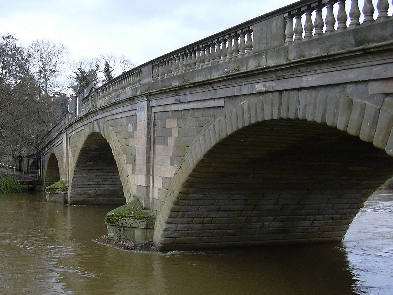
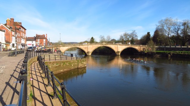
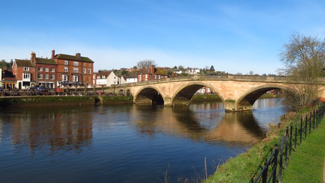
Bewdley Bridge

Bewdley Bridge is a three-span masonry arch bridge over the River Severn at Bewdley, Worcestershire, designed by civil engineer Thomas Telford. The two...

Bewdley Rowing Club

Bewdley Rowing Club is a rowing club on the River Severn, based at Riverside North, Wribbenhall, Bewdley, Wyre Forest District, West Midlands. == Club... ==

Tickenhill Palace

Tickenhill Palace (also known as Tickenhill House or Tickenhall Manor) is a historic building in Bewdley, Worcestershire, England. It is a grade II* listed...

Bewdley railway station

Bewdley railway station serves the town of Bewdley in Worcestershire, England. Until 2014, it was the administrative headquarters of the Severn Valley...

The Bewdley School

The Bewdley School is a senior school and sixth form in Bewdley, serving north-west Worcestershire, England. Its campus is very close to the River Severn...

Nearby Amenities

Located within 500m of 52.375802,-2.315063
Bewdley
Is In County: Worcestershire
Place: town
Wikidata: Q766594
Wikipedia: en:Bewdley
Lat/Long: 52.3754763/-2.3162408
Disused Amenity: post_box
Post Box Type: wall
Lat/Long: 52.3769237/-2.3101054
Pub
The Mug House Inn
Addr Housenumber: 10-12
Addr Postcode: DY12 2EE
Addr Street: Severnside North
Fhrs Id: 686631
Source: survey
Source Addr: FHRS Open Data
Lat/Long: 52.3769871/-2.3154129
Pub
The Woodcolliers
Lat/Long: 52.3752785/-2.3185986
Bus Stop
Load Street (Westbound)
Bus: yes
Naptan AtcoCode: 2000G045900
Naptan Bearing: SW
Naptan CommonName: Load Street (Westbound)
Naptan Indicator: Adj
Naptan Landmark: adj. Post Office
Naptan NaptanCode: wocgmjgm
Naptan PlusbusZoneRef: KDRMNST
Naptan Street: Load Street
Naptan Verified: slightly (location better)
Public Transport: platform
Shelter: yes
Source: naptan_import
Lat/Long: 52.3760236/-2.3145654
Bus Stop
Viaduct
Bus: yes
Naptan AtcoCode: 2000G045997
Naptan Bearing: SW
Naptan CommonName: Viaduct
Naptan Indicator: Adj
Naptan Landmark: Bewdley Viaduct
Naptan NaptanCode: wocgjwam
Naptan PlusbusZoneRef: KDRMNST
Naptan Street: Kidderminster Road
Naptan Verified: no
Public Transport: platform
Source: naptan_import
Lat/Long: 52.3769503/-2.308543
Bus Stop
Load Street (Eastbound)
Bus: yes
Naptan AtcoCode: 2000G045999
Naptan Bearing: NE
Naptan CommonName: Load Street (Eastbound)
Naptan Indicator: Adj
Naptan Landmark: opp. Post Office
Naptan NaptanCode: wocgjwat
Naptan PlusbusZoneRef: KDRMNST
Naptan Street: Load Street
Naptan Verified: no
Public Transport: platform
Shelter: yes
Source: naptan_import
Lat/Long: 52.3761567/-2.3146886
Bus Stop
Severn Valley Railway Station
Bus: yes
Naptan AtcoCode: 2000G047500
Naptan Bearing: NW
Naptan CommonName: Severn Valley Railway Station
Naptan Indicator: opp
Naptan Landmark: Severn Valley Railway Station
Naptan NaptanCode: wocdjmtw
Naptan PlusbusZoneRef: KDRMNST
Naptan Street: Stourport Road
Naptan Verified: no
Public Transport: platform
Source: naptan_import
Lat/Long: 52.3748153/-2.3079135
Bus Stop
Lyttleton Road
Bus: yes
Naptan AtcoCode: 2000G100900
Naptan Bearing: SE
Naptan CommonName: Lyttleton Road
Naptan Crossing: Richmond Road
Naptan Indicator: near
Naptan NaptanCode: wocgjwmd
Naptan PlusbusZoneRef: KDRMNST
Naptan Street: Lyttleton Road
Naptan Verified: no
Public Transport: platform
Source: naptan_import
Lat/Long: 52.3769126/-2.3210989
Bus Stop
Viaduct
Bus: yes
Naptan AtcoCode: 2000G201100
Naptan Bearing: SE
Naptan CommonName: Viaduct
Naptan Indicator: Opp
Naptan NaptanCode: wocdgtgm
Naptan PlusbusZoneRef: KDRMNST
Naptan Street: Kidderminster Road
Naptan Verified: yes
Public Transport: platform
Shelter: no
Source: naptan_import
Lat/Long: 52.3766978/-2.3092122
Bus Stop
Richmond Road
Bus: yes
Naptan AtcoCode: 2000G500651
Naptan Bearing: W
Naptan CommonName: Richmond Road
Naptan Indicator: adj
Naptan NaptanCode: wocdpgpj
Naptan PlusbusZoneRef: KDRMNST
Naptan Street: Richmond Road
Naptan Verified: no
Public Transport: platform
Source: naptan_import
Lat/Long: 52.3758305/-2.3223103
Dowells Road
Naptan AtcoCode: 2000G500656
Naptan Bearing: N
Naptan BusStopType: CUS
Naptan CommonName: Dowells Road
Naptan Indicator: Adj
Naptan NaptanCode: wocdpgpt
Naptan PlusbusZoneRef: KDRMNST
Naptan Street: Dowells Road
Naptan Verified: no
Source: naptan_import
Lat/Long: 52.3760238/-2.3173318
Butt Town Caravan Park
Lat/Long: 52.378473/-2.3134886
Grit Bin
Lat/Long: 52.37969/-2.3138608
Railway: crossing
Lat/Long: 52.3783646/-2.311806
Fuel
Texaco
Brand: Texaco
Brand Wikidata: Q775060
Brand Wikipedia: en:Texaco
Operator: Texaco
Source: GPS Survey
Lat/Long: 52.3769677/-2.3111919
Grit Bin
Access: private
Note: number 040; highway use only
Source: GPS Survey
Lat/Long: 52.3763842/-2.3080393
Pub
The Red Lion
Source: GPS Survey;observation;estimation
Lat/Long: 52.3765179/-2.3092688
Power: substation
Source: GPS Survey
Lat/Long: 52.3757897/-2.3105264
Bark Avenue
Addr City: Bewdley
Addr Country: GB
Addr Housenumber: 11
Addr Street: Load Street
Fixme: signed as optician but probably for sale
Shop: pet_grooming
Was Amenity: pharmacy
Was Dispensing: yes
Was Opening Hours: Mo-Fr 09:00-18:00; Sa 09:00-17:30
Was Phone: +44-1299-403034
Lat/Long: 52.3756863/-2.3150508
Waste Basket
Lat/Long: 52.375018/-2.3118134
Bewdley Museum
Fee: no
Tourism: museum
Wikidata: Q18974884
Wikipedia: en:Bewdley Museum
Lat/Long: 52.3756257/-2.315201
Waste Basket
Waste: dog_excrement
Lat/Long: 52.373818/-2.3105892
Fire Hydrant
Emergency: fire_hydrant
Fire Hydrant Type: underground
Source: survey
Lat/Long: 52.3732554/-2.3131427
Waste Basket
Lat/Long: 52.3739038/-2.3106041
Waste Basket
Lat/Long: 52.3768553/-2.3169344
Pub
Cock & Magpie
Addr Postcode: DY12 2EE
Addr Street: Severnside North
Source: survey
Source Addr: FHRS Open Data
Lat/Long: 52.3766139/-2.3149276
Turning Circle
Source: bing
Lat/Long: 52.3748588/-2.3192703
Operator: Severn Valley Railway
Railway: switch
Lat/Long: 52.37702/-2.3098895
Operator: Severn Valley Railway
Railway: switch
Lat/Long: 52.3762665/-2.3081674
Railway: buffer_stop
Lat/Long: 52.3783017/-2.3117959
Operator: Severn Valley Railway
Railway: switch
Lat/Long: 52.3773095/-2.3103465
Bicycle: yes
Board Type: nature; map
Hiking: yes
Horse: yes
Information: board
Map Size: region
Tourism: information
Lat/Long: 52.3733798/-2.3099755
Crossing
Crossing: traffic_signals
Crossing Ref: pelican
Source: survey
Lat/Long: 52.3756651/-2.3172402
Cafe
Clementine's Coffee
Addr City: Bewdley
Addr Housenumber: 4
Addr Postcode: DY12 2DH
Addr Street: High Street
Cuisine: coffee_shop
Fhrs Id: 840312
Internet Access: no
Opening Hours: Mo-Tu 09:00-16:00;We-Sa 09:00-17:00
Phone: +44 1299 404453
Smoking: no
Wheelchair: limited
Lat/Long: 52.3749074/-2.3156309
Post Office
Bewdley Post Office
Addr Housenumber: 7
Addr Postcode: DY12 2AF
Addr Street: Load Street
Brand: Post Office
Brand Wikidata: Q1783168
Ref Pol Id: 2939
Source: survey
Website: https://www.postoffice.co.uk/branch-finder/1522086/bewdley
Lat/Long: 52.3758207/-2.3148491
Restaurant
Merchants
Cuisine: fish_and_chips
Lat/Long: 52.3763862/-2.3144567
Tesco Express
Addr Housenumber: 76
Addr Postcode: DY12 2AW
Addr Street: Load Street
Brand: Tesco Express
Brand Wikidata: Q98456772
Contact Website: https://www.tesco.com/store-locator/bewdley/76-load-st
Fhrs Id: 734071
Old Name: The Angel
Shop: convenience
Source: survey
Lat/Long: 52.3763241/-2.3148
Fast Food
Merchants
Addr Housenumber: 78-80
Addr Postcode: DY12 2AW
Addr Street: Load Street
Cuisine: fish_and_chips
Fhrs Id: 673438
Lat/Long: 52.3763209/-2.3145371
Grape Tree
Brand: Grape Tree
Brand Wikidata: Q87071497
Shop: health_food
Source: survey
Lat/Long: 52.3755447/-2.3155188
Pub
George Hotel
Addr Housenumber: 64
Addr Postcode: DY12 2AW
Addr Street: Load Street
Bar: yes
Brand: Wetherspoon
Brand Wikidata: Q6109362
Fhrs Id: 673588
Operator: JD Weatherspoon
Real Ale: yes
Source: survey
Source Addr: FHRS Open Data
Tourism: hotel
Website: https://www.jdwetherspoon.com/pubs/all-pubs/england/worcestershire/george-hotel-bewdley
Wikidata: Q26393463
Lat/Long: 52.3757878/-2.3155524
Cafe
Riverside Cafe
Addr Housenumber: 2-3
Addr Postcode: DY12 2EE
Addr Street: Severn Side North
Cuisine: regional
Fhrs Id: 573482
Source: survey
Source Addr: FHRS Open Data
Lat/Long: 52.3764779/-2.3146176
The Co-operative
Addr City: Bewdley
Addr Street: Kidderminster Road
Shop: supermarket
Source: survey
Lat/Long: 52.3770205/-2.3113029
Post Box
Collection Times: Mo-Fr 17:15; Sa 11:15
Operator: Royal Mail
Operator Wikidata: Q638098
Post Box Type: pillar
Ref: DY12 254
Royal Cypher: EIIR
Royal Cypher Wikidata: Q33102113
Source: survey
Lat/Long: 52.3758238/-2.3149158
Pub
White Swan
Source: survey
Lat/Long: 52.3753622/-2.3170248
Bewdley Farm Shop
Shop: farm
Source: survey
Lat/Long: 52.3764117/-2.3168907
Fast Food
Golden Country
Addr Housenumber: 43
Addr Postcode: DY12 2AP
Addr Street: Load Street
Cuisine: chinese
Fhrs Id: 673435
Source: survey
Source Addr: FHRS Open Data
Lat/Long: 52.375543/-2.3170973
Stove Barn
Addr Street: Welch Gate
Shop: stoves
Source: survey
Lat/Long: 52.3753753/-2.3173198
Cafe
Welch Gate Guest House
Addr Housenumber: 1
Addr Postcode: DY12 2AT
Addr Street: Welch Gate
Fhrs Id: 673516
Source: survey
Source Addr: FHRS Open Data
Tourism: guest_house
Lat/Long: 52.3754571/-2.3174512
Phone: +44 1299 409 263
Shop: tattoo
Source: survey
Lat/Long: 52.3753294/-2.3168772
Cafe
Piccolo's
Addr Housenumber: 48
Addr Postcode: DY12 2AP
Addr Street: Load Street
Fhrs Id: 673621
Source: survey
Source Postcode: FHRS Open Data
Lat/Long: 52.3754588/-2.3167914
Bewdley Outdoors
Addr Housenumber: 40
Shop: outdoor
Source: survey
Lat/Long: 52.3753933/-2.317234
Duce & Romao
Shop: yes
Source: survey
Lat/Long: 52.3753/-2.3168048
Pub
Horn and Trumpet
Addr Housenumber: 15-16
Addr Postcode: DY12 2EH
Addr Street: Dog Lane
Fhrs Id: 673889
Note: just possibly closed
Source: survey
Source Addr: FHRS Open Data
Website: http://www.hornandtrumpetbewdley.co.uk/
Lat/Long: 52.3756373/-2.31736
Fixme: continue
Lat/Long: 52.3753949/-2.3189159
Old Amenity: restaurant
Old Name: The Rajput
Shop: vacant
Source: survey
Lat/Long: 52.3755465/-2.3173641
Bedley Beauty
Shop: beauty
Source: survey
Lat/Long: 52.3753916/-2.3171428
Adam & Eves
Addr Housenumber: 47
Addr Street: Load Street
Shop: beauty
Source: survey
Lat/Long: 52.3754743/-2.3168435
Kimmy Loves Cake
Addr Housenumber: 46
Addr Postcode: DY12 2AP
Addr Street: Load Street
Fixme: might be cake/confectionery/patisseries
Shop: bakery
Source: survey
Lat/Long: 52.3754687/-2.3169362
Ashley's Bakery
Addr Housenumber: 50
Addr Street: Load Street
Shop: bakery
Source: survey
Lat/Long: 52.37548/-2.3166493
Bedley Quality Butcher
Addr Housenumber: 49
Addr Postcode: DY12 2AP
Addr Street: Load Street
Fhrs Id: 673555
Shop: butcher
Source: survey
Source Postcode: FHRS Open Data
Lat/Long: 52.3754687/-2.316727
Fresh as a Daisy
Addr Housenumber: 45
Addr Postcode: DY12 2AP
Addr Street: Load Street
Note: also 2nd hand (vintage clothes), dry_cleaning
Shop: laundry
Source: survey
Source Addr: interpolation
Lat/Long: 52.3754915/-2.3169699
Vanilla
Addr Housenumber: 46
Addr Postcode: DY12 2AP
Addr Street: Load Street
Gender: female
Shop: clothes
Source: survey
Source Addr: interpolation
Lat/Long: 52.3755168/-2.3170209
Your Coop Food
Addr Housenumber: 51-52
Addr Postcode: DY12 2AP
Addr Street: Load Street
Brand: Your Coop Food
Brand Wikidata: Q121084548
Fhrs Id: 688575
Operator: Midcounties Co-operative
Operator Wikidata: Q6841138
Shop: convenience
Source: survey
Source Addr: FHRS Open Data
Lat/Long: 52.3755014/-2.3165634
Hayden Estates
Shop: estate_agent
Source: survey
Lat/Long: 52.3752312/-2.316609
Coral
Addr Housenumber: 53
Addr Postcode: DY12 2AP
Addr Street: Load Street
Brand: Coral
Brand Wikidata: Q54621344
Brand Wikipedia: en:Coral (bookmaker)
Shop: bookmaker
Source: survey
Source Addr: interpolation
Lat/Long: 52.3755374/-2.3164508
Cafe
Cafe 54
Addr Housenumber: 54
Addr Postcode: DY12 2AP
Addr Street: Load Street
Alt Name: Bewdley Youth Cafe
Fhrs Id: 686769
Source: survey
Source Postcode: FHRS Open Data
Lat/Long: 52.3755521/-2.3163649
Fast Food
Mei Sum
Addr Housenumber: 27
Addr Postcode: DY12 2AS
Addr Street: Load Street
Cuisine: chinese
Fhrs Id: 673584
Source: survey
Source Addr: FHRS Open Data
Lat/Long: 52.3751444/-2.3162818
Bewdley Cutting Room
Addr Housenumber: 29
Addr Street: Load Street
Gender: male
Shop: hairdresser
Source: survey
Lat/Long: 52.3751623/-2.3163679
Really Patched
Addr Housenumber: 24
Addr Street: Load Street
Shop: craft
Source: survey
Website: https://totallypatched.com/Our_Bewdley_Shop.html
Lat/Long: 52.3752509/-2.3159626
The Zoo
Shop: computer
Source: survey
Lat/Long: 52.3752099/-2.31655
Addr Housenumber: 31
Addr Street: Load Street
Lat/Long: 52.3751968/-2.3164695
Restaurant
Vhujon
Addr Housenumber: 57
Addr Postcode: DY12 2AP
Addr Street: Load Street
Cuisine: indian
Fhrs Id: 673570
Source: survey
Source Postcode: FHRS Open Data
Lat/Long: 52.3756159/-2.316145
Pub
The Talbot
Addr Postcode: DY12 2DJ
Addr Street: High Street
Source: survey
Lat/Long: 52.3750265/-2.3161316
Allan Morris
Shop: estate_agent
Source: survey
Lat/Long: 52.3751198/-2.3162335
Victor's
Addr Housenumber: 23
Addr Street: Load Street
Gender: male
Shop: hairdresser
Source: survey
Lat/Long: 52.3752901/-2.315917
The Meltng Pot
Addr Housenumber: 22
Addr Street: Load Street
Shop: gift
Source: survey
Lat/Long: 52.3753523/-2.3158446
Restaurant
Pomodoro
Addr Housename: The Baliff's House
Addr Housenumber: 68
Addr Postcode: DY12 2DJ
Addr Street: High Street
Cuisine: italian
Fhrs Id: 686808
Source: survey
Source Addr: FHRS Open Data
Lat/Long: 52.3749102/-2.3159116
Pub
The Pack Horse Inn
Addr Postcode: DY12 2DA
Addr Street: High Street
Fhrs Id: 673408
Opening Hours: Mo-Th 17:30-11:00; Fr 12:00-15:00,17:30-24:00; Sa 12:00-24:00; Su 12:00-22:30
Source: survey
Source Postcode: FHRS Open Data
Lat/Long: 52.3734675/-2.3132324
Elbow Room
Addr Housenumber: 19
Shop: antiques
Source: survey
Lat/Long: 52.3754751/-2.3156676
The Co-operative Funeralcare
Shop: funeral_directors
Source: survey
Lat/Long: 52.3756224/-2.316038
Addr Housenumber: 26
Addr Street: Load Street
Lat/Long: 52.3750945/-2.316204
Trousseau Haus
Addr Housenumber: 30
Addr Street: Load Street
Shop: wedding
Source: survey
Lat/Long: 52.3751819/-2.3164189
Abacus
Addr Housenumber: 25
Addr Street: Load Street
Shop: hairdresser
Source: survey
Lat/Long: 52.3751607/-2.3160645
Sue Ryder
Brand: Sue Ryder
Brand Wikidata: Q7634271
Brand Wikipedia: en:Sue Ryder (charity)
Shop: charity
Source: survey
Lat/Long: 52.3757093/-2.315748
Bar
HR's Bar
Addr Housenumber: 55
Addr Postcode: DY12 2AP
Addr Street: Load Street
Source: survey
Source Postcode: FHRS Open Data
Lat/Long: 52.3755751/-2.3162818
St Richard's Hospice
Shop: charity
Source: survey
Lat/Long: 52.3756585/-2.3159387
Restaurant
The Mulberry Restaurant
Addr Housenumber: 63
Addr Postcode: DY12 2AP
Addr Street: Load Street
Fhrs Id: 673436
Fixme: location approximately
Source: survey
Source Postcode: FHRS Open Data
Lat/Long: 52.3757912/-2.3157427
Shop: jewelry
Source: survey
Lat/Long: 52.3755816/-2.3162174
Restaurant
Severn
Addr Housenumber: 61
Addr Postcode: DY12 2AP
Addr Street: Load Street
Cuisine: indian
Fhrs Id: 673267
Source: survey
Source Postcode: FHRS Open Data
Lat/Long: 52.3756945/-2.3158207
The Bewdley Cobbler
Note: also ski servicing
Shop: shoe_repair
Source: survey
Lat/Long: 52.3755161/-2.3155925
Bewdley Tackle & Leisure
Shop: fishing
Source: survey
Lat/Long: 52.3754309/-2.3157507
The Park Royal Collection
Shop: antiques
Source: survey
Lat/Long: 52.3757356/-2.3156971
Kemp Hospice Shop
Opening Hours: Mo-Sa 09:30-17:00; Su 11:00-17:00
Shop: charity
Source: survey
Lat/Long: 52.3755227/-2.315284
Addr Street: Load Street
Shop: gift
Source: survey
Lat/Long: 52.3758337/-2.3154157
Restaurant
Chang Thai River
Addr Housenumber: 78
Addr Postcode: DY12 2AP
Addr Street: Load Street
Building Levels: 1
Entrance: main
Layer: 1
Opening Hours: Tu-Su 18:00-23:00
Source: survey
Source Postcode: FHRS Open Data
Lat/Long: 52.3763315/-2.314482
Restaurant
The Rajah
Addr Housenumber: 8
Addr Postcode: DY12 2AF
Addr Street: Load Street
Cuisine: indian
Fhrs Id: 673437
Source: survey
Source Postcode: FHRS Open Data
Lat/Long: 52.3757356/-2.3149514
O21
Shop: clothes
Source: survey
Lat/Long: 52.3760811/-2.3149246
Pharmacy
Health Point Pharmacy
Dispensing: yes
Healthcare: pharmacy
Lat/Long: 52.3758714/-2.3153162
Tipplers
Shop: alcohol
Source: survey
Lat/Long: 52.3760516/-2.3149809
Nature's Tile and Bath
Shop: tiles
Source: survey
Lat/Long: 52.3760172/-2.3150399
KTs Hairdresser
Addr Housenumber: 72
Addr Street: Load Street
Shop: hairdresser
Source: survey
Lat/Long: 52.3761481/-2.3148254
Cheap & Cheerful
Addr Housenumber: 73
Addr Street: Load Street
Shop: houseware
Source: survey
Lat/Long: 52.3761809/-2.3147824
Cafe
Arches
Source: survey
Lat/Long: 52.3761007/-2.314195
S.R. Lewis
Shop: fishing
Source: survey
Lat/Long: 52.3760663/-2.3141307
Restaurant
Bella Pizza
Addr Housenumber: 3
Addr Postcode: DY12 2AF
Addr Street: Load Street
Fhrs Id: 673259
Source: survey
Source Addr: FHRS Open Data
Lat/Long: 52.3760205/-2.3144364
Cafe
Le Petit Cafe
Addr Housenumber: 2A
Addr Postcode: DY12 2AF
Addr Street: Load Street
Fhrs Id: 673295
Old Name: Fresh Bites
Source: survey
Source Addr: FHRS Open Data
Lat/Long: 52.376063/-2.3143747
Teddy Gray's
Addr Housenumber: 1
Addr Postcode: DY12 2AF
Addr Street: Load Street
Fhrs Id: 673434
Opening Hours: Mo-Su 09:00-18:00
Shop: confectionery
Source: survey
Source Addr: FHRS Open Data
Lat/Long: 52.3761351/-2.3142809
Ice Cream
Scoops
Addr Housenumber: 2
Addr Postcode: DY12 2AF
Addr Street: Load Street
Fhrs Id: 673256
Source: survey
Source Addr: FHRS Open Data
Lat/Long: 52.3760974/-2.3143345
Elemental Gifts
Addr Housenumber: 4
Addr Street: Load Street
Shop: gift
Source: survey
Lat/Long: 52.3759681/-2.3144874
The Garden Salon
Addr Street: Load Street
Entrance: main
Shop: hairdresser
Source: survey
Lat/Long: 52.3759582/-2.3145384
Eden Estates
Shop: estate_agent
Source: survey
Lat/Long: 52.3759321/-2.3145544
Addr Flats: 1-6
Addr Housename: Borough House
Addr Street: Load Street
Entrance: main
Source: survey
Lat/Long: 52.3759222/-2.3146591
Dentist
Bewdley Dental Practice
Building Levels: 1
Healthcare: dentist
Layer: 1
Source: survey
Lat/Long: 52.3755259/-2.3165125
Historic: memorial
Memorial: war_memorial
Source: survey
Lat/Long: 52.3755113/-2.3159156
Telephone
Booth: K6
Check Date: 2022-10-22
Covered: booth
Listed Status: Grade II
Man Made: telephone_box
Operator: BT
Phone: +44 1299 400095
Source: survey
Telephone Kiosk: K6
Lat/Long: 52.3758961/-2.3147968
Bewdley Blooms
Addr Housenumber: 10
Addr Street: Load Street
Shop: florist
Source: survey
Lat/Long: 52.3757126/-2.3150051
Bench
Backrest: yes
Source: survey
Lat/Long: 52.3755947/-2.315402
Bench
Backrest: yes
Source: survey
Lat/Long: 52.3756012/-2.315453
Addr Housenumber: 34
Addr Street: High Street
Source: survey
Lat/Long: 52.3731991/-2.3131597
Addr Housenumber: 35
Addr Street: High Street
Source: survey
Lat/Long: 52.3732433/-2.3132402
Addr Housenumber: 36
Addr Street: High Street
Source: survey
Lat/Long: 52.3732728/-2.3132831
Addr Housenumber: 14
Addr Street: Lower Park
Guest House: bed_and_breakfast
Source: survey
Tourism: guest_house
Lat/Long: 52.3731364/-2.3127475
Bewdley Brewery
Addr City: Bewdley
Addr Housename: Unit 7, Bewdley Craft Centre
Addr Postcode: DY12 2DZ
Addr Street: Lax Lane
Craft: brewery
Opening Hours: Mo-Fr 10:00-16:00; Sa-Su 10:00-15:00
Phone: +44 1299 405148
Product: beer
Source: local_knowledge
Website: https://www.bewdleybrewery.co.uk/
Lat/Long: 52.3740142/-2.3117241
Addr Housenumber: 17
Source: survey
Lat/Long: 52.3756339/-2.317013
Bewdley Pet Supplies
Shop: pet_supplies
Source: survey
Lat/Long: 52.3760064/-2.3169805
Minnies Beauty
Shop: beauty
Source: survey
Lat/Long: 52.3759967/-2.3169432
Historic: memorial
Inscription: On this spot on the thirtieth september nineteen ninety-five absolutlely nothing happened
Memorial: plaque
Source: survey
Lat/Long: 52.3769779/-2.3164313
Archie's Barbers Shop
Alt Name: Archie's Salon
Gender: male
Shop: hairdresser
Source: survey
Lat/Long: 52.3761801/-2.3170156
Marc Alexander Hair
Shop: hairdresser
Source: survey
Lat/Long: 52.3760622/-2.3170854
Veterinary
Severn Edge Veterinary Group
Source: survey
Website: https://www.severnedgevets.co.uk/branches/#toggle-id-2
Lat/Long: 52.3761325/-2.3170425
Captain G.T. Smith-Clarke
Historic: memorial
Memorial: plaque
Openplaques Id: 1948
Source: survey
Lat/Long: 52.3727989/-2.3124044
Addr Housenumber: 64
Source: survey
Lat/Long: 52.3746823/-2.3154621
Bench
Fixme: position approx
Source: survey
Lat/Long: 52.3745218/-2.3144135
Stanley Baldwin
Historic: memorial
Memorial: plaque
Openplaques Id: 3336
Source: survey
Lat/Long: 52.3732004/-2.3129754
Post Box
Post Box Type: lamp
Ref: DY12 102D
Royal Cypher: EIIR
Royal Cypher Wikidata: Q33102113
Lat/Long: 52.3733933/-2.3130118
Pub
The Great Western
Addr City: Bewdley
Addr Street: Kidderminster Road
Lat/Long: 52.3768125/-2.3086139
Fire Hydrant
Emergency: fire_hydrant
Fire Hydrant Type: underground
Source: survey
Lat/Long: 52.3752995/-2.3165897
Fire Hydrant
Emergency: fire_hydrant
Fire Hydrant Diameter: 90
Fire Hydrant Position: sidewalk
Fire Hydrant Type: underground
Source: survey
Lat/Long: 52.375645/-2.3154471
Fire Hydrant
Emergency: fire_hydrant
Fire Hydrant Type: underground
Source: survey
Lat/Long: 52.3765157/-2.3138633
Fire Hydrant
Emergency: fire_hydrant
Fire Hydrant Type: underground
Source: survey
Lat/Long: 52.3757097/-2.3103901
Fire Hydrant
Emergency: fire_hydrant
Fire Hydrant Type: underground
Source: survey
Lat/Long: 52.3756262/-2.3098061
Fire Hydrant
Emergency: fire_hydrant
Fire Hydrant Type: underground
Source: survey
Lat/Long: 52.3753085/-2.3089317
Bench
Backrest: yes
Lat/Long: 52.3776867/-2.3164626
Bench
Backrest: yes
Lat/Long: 52.3764958/-2.3129917
Bench
Backrest: yes
Lat/Long: 52.3766726/-2.3133363
Bench
Backrest: yes
Lat/Long: 52.3764458/-2.3128482
Bench
Backrest: yes
Lat/Long: 52.3763149/-2.3125746
Bench
Backrest: yes
Lat/Long: 52.376278/-2.3125156
Crossing
Crossing: traffic_signals
Crossing Ref: pelican
Lat/Long: 52.3773862/-2.3083773
Bench
Backrest: yes
Lat/Long: 52.3748189/-2.3134334
Bench
Backrest: yes
Lat/Long: 52.3741287/-2.3124638
Bench
Backrest: yes
Lat/Long: 52.3743399/-2.3126864
Bench
Backrest: yes
Lat/Long: 52.3750915/-2.3140651
Bench
Backrest: yes
Lat/Long: 52.3731267/-2.3188765
Bench
Backrest: yes
Lat/Long: 52.3747552/-2.3133253
Bench
Backrest: yes
Lat/Long: 52.3740511/-2.3126319
Bench
Backrest: yes
Lat/Long: 52.3745325/-2.3129994
Bench
Backrest: yes
Lat/Long: 52.3747912/-2.3139784
Herb Garden
Leisure: garden
Lat/Long: 52.3745227/-2.31356
Tourism: artwork
Lat/Long: 52.3747618/-2.3138134
Overspoke Bikes
Shop: bicycle
Lat/Long: 52.3739502/-2.3118161
Fire Hydrant
Emergency: fire_hydrant
Fire Hydrant Type: underground
Source: survey
Lat/Long: 52.3742221/-2.3145881
Fire Hydrant
Emergency: fire_hydrant
Fire Hydrant Type: underground
Source: survey
Lat/Long: 52.3738635/-2.3121527
Fire Hydrant
Emergency: fire_hydrant
Fire Hydrant Type: underground
Source: survey
Lat/Long: 52.3744775/-2.3112595
Toilets
Male: yes
Lat/Long: 52.3761466/-2.3154043
Toilets
Female: yes
Lat/Long: 52.376127/-2.3155223
Community Orchard
Tourism: attraction
Lat/Long: 52.3740227/-2.3130132
Crossing
Button Operated: yes
Crossing: traffic_signals
Crossing Island: no
Source: survey
Tactile Paving: yes
Traffic Signals Sound: yes
Traffic Signals Vibration: yes
Lat/Long: 52.375742/-2.3152828
Stanley Baldwin
Artwork Type: statue
Source: survey
Tourism: artwork
Lat/Long: 52.3756123/-2.3153861
Source: survey
Traffic Calming: chicane
Lat/Long: 52.3749499/-2.3117906
Generator Method: photovoltaic
Generator Output Electricity: yes
Generator Source: solar
Generator Type: solar_photovoltaic_panel
Location: roof
Power: generator
Lat/Long: 52.3780364/-2.3186155
Generator Method: photovoltaic
Generator Output Electricity: yes
Generator Source: solar
Generator Type: solar_photovoltaic_panel
Location: roof
Power: generator
Lat/Long: 52.3767912/-2.3217604
Generator Method: photovoltaic
Generator Output Electricity: yes
Generator Source: solar
Generator Type: solar_photovoltaic_panel
Location: roof
Power: generator
Lat/Long: 52.3767814/-2.3216718
Generator Method: photovoltaic
Generator Output Electricity: yes
Generator Source: solar
Generator Type: solar_photovoltaic_panel
Location: roof
Power: generator
Lat/Long: 52.3767298/-2.3213875
Generator Method: photovoltaic
Generator Output Electricity: yes
Generator Source: solar
Generator Type: solar_photovoltaic_panel
Location: roof
Power: generator
Lat/Long: 52.3761428/-2.3159762
Generator Method: photovoltaic
Generator Output Electricity: yes
Generator Source: solar
Generator Type: solar_photovoltaic_panel
Location: roof
Power: generator
Lat/Long: 52.3736784/-2.3209852
Generator Method: photovoltaic
Generator Output Electricity: yes
Generator Source: solar
Generator Type: solar_photovoltaic_panel
Location: roof
Power: generator
Lat/Long: 52.3775862/-2.3117463
Bewdley North Junction
Railway: junction
Lat/Long: 52.3770361/-2.3098904
Bench
Lat/Long: 52.3744874/-2.3083837
Bench
Lat/Long: 52.3744645/-2.3084135
Pub
The Real Ale Tavern
Addr City: Bewdley
Addr Housename: The Real Ale Tavern
Addr Housenumber: 67
Addr Postcode: DY12 2AW
Addr Street: Load St
Lat/Long: 52.3759099/-2.3152294
Generator Method: photovoltaic
Generator Output Electricity: yes
Generator Source: solar
Generator Type: solar_photovoltaic_panel
Location: roof
Power: generator
Lat/Long: 52.3758481/-2.318244
Generator Method: photovoltaic
Generator Output Electricity: yes
Generator Source: solar
Generator Type: solar_photovoltaic_panel
Location: roof
Power: generator
Lat/Long: 52.3739683/-2.3168921
Generator Method: photovoltaic
Generator Output Electricity: yes
Generator Source: solar
Generator Type: solar_photovoltaic_panel
Location: roof
Power: generator
Lat/Long: 52.3740239/-2.3168224
Generator Method: photovoltaic
Generator Output Electricity: yes
Generator Source: solar
Generator Type: solar_photovoltaic_panel
Location: roof
Power: generator
Lat/Long: 52.3741156/-2.3203602
Generator Method: photovoltaic
Generator Output Electricity: yes
Generator Source: solar
Generator Type: solar_photovoltaic_panel
Location: roof
Power: generator
Lat/Long: 52.3740714/-2.3203254
Generator Method: photovoltaic
Generator Output Electricity: yes
Generator Source: solar
Generator Type: solar_photovoltaic_panel
Location: roof
Power: generator
Lat/Long: 52.3761117/-2.3221117
Generator Method: photovoltaic
Generator Output Electricity: yes
Generator Source: solar
Generator Type: solar_photovoltaic_panel
Location: roof
Power: generator
Lat/Long: 52.3760871/-2.3222968
McColl's @ Bewdley
Addr City: Bewdley
Addr Housenumber: 7
Addr Postcode: DY12 2AF
Addr Street: Lode Street
Brand: McColl's
Brand Wikidata: Q16997477
Fhrs Id: 686722
Shop: convenience
Source Addr: FHRS Open Data
Website: https://my.morrisons.com/storefinder/66138/mccolls-bewdley-load-street
Lat/Long: 52.3757701/-2.3148298
Pub
Bewdley Brewery Tap Room
Addr City: Bewdley
Addr Housename: Unit 7, Bewdley Craft Centre
Addr Postcode: DY12 2DZ
Addr Street: Lax Lane
Brewery: yes;bewdley_brewery
Opening Hours: Tuesday - Thursday: 4pm - 9pm Friday & Saturday: 12pm - 9pm Sunday: 12pm - 3pm Bank Holiday Mondays: 12pm - 9pm
Lat/Long: 52.3739876/-2.3116967
The data included in this document is from www.openstreetmap.org. The data is made available under ODbL.

Have you been to Bewdley?

Leave your review of Bewdley below (or comments, questions and feedback).