Bewbush

Settlement in Sussex Crawley

England

Bewbush

Bewbush Barn Church An old barn conversion. The barn predates the surrounding housing by several decade. Money was raised by the local church community over several years with the church opening in the late 1990s, and making one of the more interesting parish churches around
Bewbush Barn Church Credit: Michael of Crawley

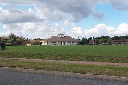
Bewbush is a small residential area located in the town of Crawley, West Sussex, England. Situated to the north of the town center, Bewbush is a relatively new development that was built during the 1970s and 1980s. The neighborhood is primarily made up of housing estates, offering a mix of privately-owned and council properties.

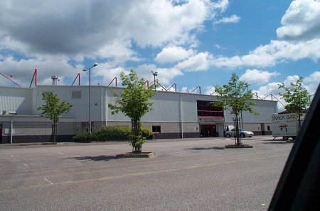
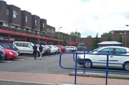
Bewbush is known for its family-friendly atmosphere, with a range of amenities catering to residents' needs. The area features a local shopping parade, including a supermarket, convenience stores, and a few small independent shops. There are also several primary schools within walking distance, making it a popular choice for families with young children.

Green spaces are abundant in Bewbush, with a number of parks and open areas scattered throughout the neighborhood. Tilgate Park, a large and popular park in Crawley, is also nearby, offering extensive recreational facilities, such as a nature center, lakes, and walking trails.

Transportation options in Bewbush are convenient, with several bus routes connecting the area to the town center and other surrounding areas. For those commuting by car, the neighborhood benefits from its proximity to the A23, a major road providing easy access to London and Brighton.

Overall, Bewbush is a peaceful residential area with a strong sense of community. Its affordable housing options, proximity to amenities, and green spaces make it an attractive place to live for families and individuals seeking a quiet suburban lifestyle within easy reach of Crawley's town center.

If you have any feedback on the listing, please let us know in the comments section below.
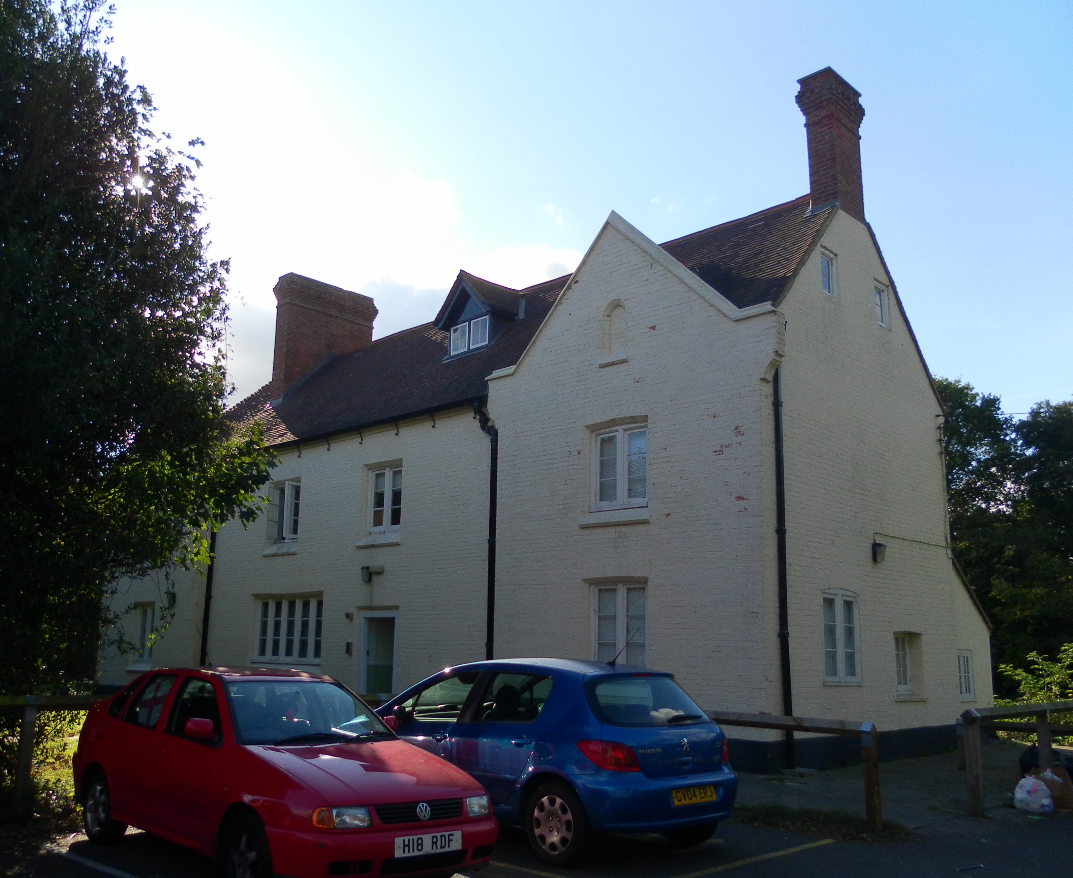
Bewbush Images

Images are sourced within 2km of 51.102947/-0.220999 or Grid Reference TQ2435. Thanks to Geograph Open Source API. All images are credited.

Bewbush Barn Church An old barn conversion. The barn predates the surrounding housing by several decade. Money was raised by the local church community over several years with the church opening in the late 1990s, and making one of the more interesting parish churches around
Bewbush Barn Church
An old barn conversion. The barn predates the surrounding housing by several decade. Money was raised by the local church community over several years with the church opening in the late 1990s, and making one of the more interesting parish churches around
Bewbush Leisure Centre Crawley's second leisure Centre, opened in 1984, demolished in 2009.
Bewbush Leisure Centre
Crawley's second leisure Centre, opened in 1984, demolished in 2009.
Bewbush Playing Fields Cricket Pavilion on the playing fields on the former plot of Gasson Wood.
Bewbush Playing Fields
Cricket Pavilion on the playing fields on the former plot of Gasson Wood.
Bewbush Water Gardens Council-owned water gardens, based around the western end of the Ifield Mill Pond
Bewbush Water Gardens
Council-owned water gardens, based around the western end of the Ifield Mill Pond
Broadfield Stadium Built by Crawley Council in the early 1990s to re-home Crawley Town Football Club. One of the best non-league stadia in the UK
Broadfield Stadium
Built by Crawley Council in the early 1990s to re-home Crawley Town Football Club. One of the best non-league stadia in the UK
Holy Trinity School Opened in the late 1960s, the main Church of England Secondary School in North Sussex
Holy Trinity School
Opened in the late 1960s, the main Church of England Secondary School in North Sussex
Ifield Mill House Preserved working Water Mill
Ifield Mill House
Preserved working Water Mill
Ifield Mill Pond Pond connected to Ifield Water Mill
Ifield Mill Pond
Pond connected to Ifield Water Mill
Ifield Station Formerly Ifield Halt, now serves the west of Crawley New Town
Ifield Station
Formerly Ifield Halt, now serves the west of Crawley New Town
St Wilfrid's RC School Catholic Comprehensive School, Crawley
St Wilfrid's RC School
Catholic Comprehensive School, Crawley
Broadfield Barton Local shopping parade for the neighbourhood of Broadfield in South-west Crawley
Broadfield Barton
Local shopping parade for the neighbourhood of Broadfield in South-west Crawley
Holmbush Potteries Industrial Estate, Crawley. Conveniently situated off the main A264 road between Crawley and Horsham. Features a large builders merchants premises and several smaller trading and industrial units.
Holmbush Potteries Industrial Estate, Crawley.
Conveniently situated off the main A264 road between Crawley and Horsham. Features a large builders merchants premises and several smaller trading and industrial units.
Cottesmore School, Buchan Hill, near Pease Pottage, West Sussex A full boarding co-educational prep school (the only one in the UK - according to their website <span class="nowrap"><a title="http://www.cottesmoreschool.com" rel="nofollow ugc noopener" href="http://www.cottesmoreschool.com">Link</a><img style="margin-left:2px;" alt="External link" title="External link - shift click to open in new window" src="https://s1.geograph.org.uk/img/external.png" width="10" height="10"/></span> ). A couple of sand traps of the Cottesmore Country Club golf course can also be seen.
Cottesmore School, Buchan Hill, near Pease Pottage, West Sussex
A full boarding co-educational prep school (the only one in the UK - according to their website LinkExternal link ). A couple of sand traps of the Cottesmore Country Club golf course can also be seen.
Bridleway through Cottesmore Country Club and School. The sign indicates a bend in the route of the bridleway that cuts through the country club and school grounds between Pease Pottage and the Broadfield neighbourhood of Crawley. At this point the public right of way is following the drive to the school. Behind the sign can be seen the flag of one of the golf greens.
Bridleway through Cottesmore Country Club and School.
The sign indicates a bend in the route of the bridleway that cuts through the country club and school grounds between Pease Pottage and the Broadfield neighbourhood of Crawley. At this point the public right of way is following the drive to the school. Behind the sign can be seen the flag of one of the golf greens.
Bridleway crossing the Crawley - Horsham Railway line, Ifield West, Crawley, West Sussex A small level crossing to cater for bridleway traffic (pedestrians, horses, bicycles, but no motor vehicles). Access to the line via gates. Users are left to check that the line is clear for themselves. This bridleway from Ifield West ultimately ends up at Colgate (3km south) and is on the same route as the one shown for grid square TQ2333
Bridleway crossing the Crawley - Horsham Railway line, Ifield West, Crawley, West Sussex
A small level crossing to cater for bridleway traffic (pedestrians, horses, bicycles, but no motor vehicles). Access to the line via gates. Users are left to check that the line is clear for themselves. This bridleway from Ifield West ultimately ends up at Colgate (3km south) and is on the same route as the one shown for grid square TQ2333
Bridleway through trees from Ifield West (Crawley) to Carylls Lea Junction (Faygate). This bridleway has several different surfaces, starting from a wide earth track (here) through two parallel concrete strips (near Kilnwood End) and finishing with a fully metalled road (Kilnwood to Carylls Lea). At this point the bridleway passes through a long thin strip of woodland (mature deciduous trees), with fields on either side. The bridleway joins on to the one that crosses the railway line shown on one of the other photos.
Bridleway through trees from Ifield West (Crawley) to Carylls Lea Junction (Faygate).
This bridleway has several different surfaces, starting from a wide earth track (here) through two parallel concrete strips (near Kilnwood End) and finishing with a fully metalled road (Kilnwood to Carylls Lea). At this point the bridleway passes through a long thin strip of woodland (mature deciduous trees), with fields on either side. The bridleway joins on to the one that crosses the railway line shown on one of the other photos.
Tern Road, Ifield West, Crawley, West Sussex - 1980/90 housing. Ifield West was one of the later neighbourhoods to be built in Crawley, on its extreme western side. Of typically modern style the packing density of the houses appears to be greater than many of the original neighbourhoods.
Tern Road, Ifield West, Crawley, West Sussex - 1980/90 housing.
Ifield West was one of the later neighbourhoods to be built in Crawley, on its extreme western side. Of typically modern style the packing density of the houses appears to be greater than many of the original neighbourhoods.
Birkdale Drive, Ifield West, Crawley, West Sussex - 1980/90 housing. Close to Tern Road. Another view of this housing development.
Birkdale Drive, Ifield West, Crawley, West Sussex - 1980/90 housing.
Close to Tern Road. Another view of this housing development.
Show me another place!

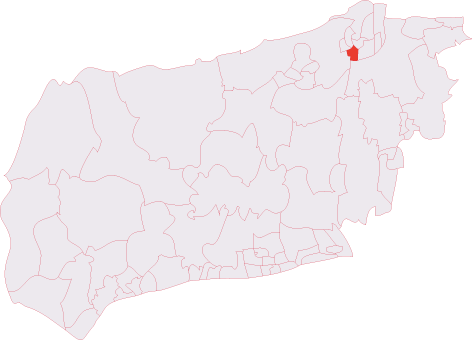
Bewbush is located at Grid Ref: TQ2435 (Lat: 51.102947, Lng: -0.220999)

Administrative County: West Sussex

District: Crawley

Police Authority: Sussex

What 3 Words

///fries.hungry.lined. Near Bewbush, West Sussex

Nearby Locations

Bewbush

Related Wikis

Bewbush

Bewbush is one of 14 neighbourhoods in Crawley in West Sussex, England. Bewbush is located in south west Crawley and is bordered by Broadfield to the...

Bewbush & Ifield West (electoral division)

Bewbush & Ifield West is an electoral division of West Sussex in the United Kingdom and returns one member to sit on West Sussex County Council. ��2�...

Target Hill Park

Target Hill Park is a 9-hectare (22-acre) Local Nature Reserve in Crawley in West Sussex. It is owned by Crawley Borough Council and managed by the council...

Holy Trinity School, Crawley

The Holy Trinity Church of England Secondary School is a voluntary-aided comprehensive school in Crawley, West Sussex, England. The school has a roll of...

Buchan Hill Ponds

Buchan Hill Ponds is a 19.5-hectare (48-acre) biological Site of Special Scientific Interest on the south-west outskirts of Crawley in West Sussex.This...

Ifield Water Mill

Ifield Water Mill is a 19th-century weatherboarded watermill in the Ifield neighbourhood of Crawley, a town and borough in West Sussex, England. Built...

Kilnwood Vale railway station

Kilnwood Vale is a proposed railway station in Kilnwood Vale, Horsham, West Sussex which would serve the neighbourhoods of Kilnwood Vale and Bewbush. The...

Broadfield (electoral division)

Broadfield also known as Lowest Pease Pottage is an electoral division of West Sussex in the United Kingdom, and returns one member to sit on West Sussex...

Nearby Amenities

Located within 500m of 51.102947,-0.220999
Mini Roundabout
Direction: clockwise
Lat/Long: 51.1050668/-0.2159793
Bewbush
Created By: Potlatch 0.5d
Is In: Crawley
Place: village
Wikidata: Q4899736
Lat/Long: 51.1023286/-0.2227992
Noexit: yes
Lat/Long: 51.1040242/-0.2216811
Bus Stop
Dorsten Square
Bus: yes
Naptan AtcoCode: 4400CY0073
Naptan Bearing: S
Naptan CommonName: Dorsten Square
Naptan Indicator: o/s
Naptan Landmark: The Dorsten
Naptan NaptanCode: wsxajpdt
Naptan PlusbusZoneRef: CRAWLEY
Naptan ShortCommonName: Bewbush Dorsten Sq
Naptan Street: Bewbush Drive
Naptan Verified: no
Public Transport: platform
Source: naptan_import
Lat/Long: 51.1035742/-0.2228574
Post Box
Operator: Royal Mail
Operator Wikidata: Q638098
Ref: RH10 154
Lat/Long: 51.1021161/-0.2174866
Crossing
Crossing: traffic_signals
Crossing Ref: pelican
Lat/Long: 51.1049476/-0.2216864
Doctors
Bewbush Medical Centre
Addr Postcode: RH11 8XT
Addr Street: Goodwin Close
Healthcare: doctor
Opening Hours: Mo-Fr 08:30-12:30, 13:30-18:30
Phone: +44 1293 592230
Website: https://bewbushmedicalcentre.co.uk/
Lat/Long: 51.104268/-0.2231932
Recycling
Recycling Cans: yes
Recycling Glass: yes
Recycling Paper: yes
Lat/Long: 51.1039364/-0.2234856
Post Box
Collection Plate: CP7D
Collection Times: Mo-Fr 09:00; Sa 07:00
Operator: Royal Mail
Post Box Type: lamp
Ref: RH10 16D
Royal Cypher: EIIR
Royal Cypher Wikidata: Q33102113
Lat/Long: 51.1013094/-0.2262346
Post Box
Operator: Royal Mail
Operator Wikidata: Q638098
Post Box Type: pillar
Ref: RH11 139
Royal Cypher: GVIR
Royal Cypher Wikidata: Q33102169
Lat/Long: 51.1053644/-0.2194043
Bus Stop
Breezehurst Drive East
Bus: yes
Naptan AtcoCode: 4400CY0015
Naptan Bearing: SE
Naptan CommonName: Breezehurst Drive East
Naptan Indicator: Scory Close
Naptan Landmark: Scory Close
Naptan NaptanCode: wsxajmdj
Naptan PlusbusZoneRef: CRAWLEY
Naptan ShortCommonName: Breezehurst Dr East
Naptan Street: Breezehurst Drive
Naptan Verified: no
Public Transport: platform
Source: naptan_import
Lat/Long: 51.1019668/-0.2149276
Bus Stop
Breezehurst Drive East
Bus: yes
Naptan AtcoCode: 4400CY0016
Naptan Bearing: W
Naptan CommonName: Breezehurst Drive East
Naptan Indicator: opp. Cuckfield Close
Naptan Landmark: Cuckfield Close
Naptan NaptanCode: wsxajmdm
Naptan PlusbusZoneRef: CRAWLEY
Naptan Street: Breezehurst Drive
Naptan Verified: no
Public Transport: platform
Source: naptan_import
Lat/Long: 51.1021684/-0.2164167
Bus Stop
Breezehurst Drive Central
Bus: yes
Naptan AtcoCode: 4400CY0018
Naptan Bearing: E
Naptan CommonName: Breezehurst Drive Central
Naptan Indicator: opp. Purcell Road
Naptan Landmark: Purcell Road
Naptan NaptanCode: wsxajmdt
Naptan PlusbusZoneRef: CRAWLEY
Naptan Street: Breezehurst Drive
Naptan Verified: no
Public Transport: platform
Source: naptan_import
Lat/Long: 51.101679/-0.2188818
Bus Stop
Breezehurst Drive Central
Bus: yes
Naptan AtcoCode: 4400CY0019
Naptan Bearing: E
Naptan CommonName: Breezehurst Drive Central
Naptan Indicator: Purcell Road
Naptan Landmark: Purcell Road
Naptan NaptanCode: wsxajmdw
Naptan PlusbusZoneRef: CRAWLEY
Naptan Street: Breezehurst Drive
Naptan Verified: no
Public Transport: platform
Source: naptan_import
Lat/Long: 51.1015691/-0.2200847
Bus Stop
Breezehurst Drive West
Naptan AtcoCode: 4400CY0020
Naptan Bearing: N
Naptan CommonName: Breezehurst Drive West
Naptan Indicator: Stevenage Road
Naptan Landmark: Stevenage Road
Naptan NaptanCode: wsxajmga
Naptan PlusbusZoneRef: CRAWLEY
Naptan Street: Breezehurst Drive
Naptan Verified: no
Public Transport: platform
Source: naptan_import
Lat/Long: 51.1022433/-0.2237165
Bus Stop
Colwyn Close
Bus: yes
Naptan AtcoCode: 4400CY0022
Naptan Bearing: W
Naptan CommonName: Colwyn Close
Naptan Indicator: opp
Naptan Landmark: Colwyn Close
Naptan NaptanCode: wsxajmgj
Naptan PlusbusZoneRef: CRAWLEY
Naptan Street: Bewbush Drive
Naptan Verified: no
Public Transport: platform
Source: naptan_import
Lat/Long: 51.1048352/-0.222246
Bus Stop
Colwyn Close
Bus: yes
Naptan AtcoCode: 4400CY0023
Naptan Bearing: E
Naptan CommonName: Colwyn Close
Naptan Indicator: adj
Naptan Landmark: Colwyn Close
Naptan NaptanCode: wsxajmgm
Naptan PlusbusZoneRef: CRAWLEY
Naptan Street: Bewbush Drive
Naptan Verified: no
Public Transport: platform
Source: naptan_import
Lat/Long: 51.1050469/-0.2211794
Bus Stop
Ellman Road
Bus: yes
Naptan AtcoCode: 4400CY0024
Naptan Bearing: E
Naptan CommonName: Ellman Road
Naptan Indicator: opp
Naptan Landmark: Ellman Road
Naptan NaptanCode: wsxajmgp
Naptan PlusbusZoneRef: CRAWLEY
Naptan Street: Bewbush Drive
Naptan Verified: no
Public Transport: platform
Source: naptan_import
Lat/Long: 51.1051277/-0.2186099
Bus Stop
Ellman Road
Bus: yes
Naptan AtcoCode: 4400CY0025
Naptan Bearing: E
Naptan CommonName: Ellman Road
Naptan Indicator: adj
Naptan Landmark: Ellman Road
Naptan NaptanCode: wsxajmgt
Naptan PlusbusZoneRef: CRAWLEY
Naptan Street: Bewbush Drive
Naptan Verified: no
Public Transport: platform
Source: naptan_import
Lat/Long: 51.1052323/-0.2182288
Bus Stop
Brettingham Close
Naptan AtcoCode: 4400CY0037
Naptan Bearing: N
Naptan CommonName: Brettingham Close
Naptan Indicator: opp. Brettingham Close
Naptan Landmark: Brettingham Close
Naptan NaptanCode: wsxajmpj
Naptan PlusbusZoneRef: CRAWLEY
Naptan Street: Gasson Wood Road
Naptan Verified: no
Public Transport: platform
Source: naptan_import
Lat/Long: 51.1048063/-0.2259185
Bus Stop
Sullivan Drive
Naptan AtcoCode: 4400CY0040
Naptan Bearing: S
Naptan CommonName: Sullivan Drive
Naptan Indicator: opp. Sullivan Drive
Naptan Landmark: Sullivan Drive
Naptan NaptanCode: wsxajmpw
Naptan PlusbusZoneRef: CRAWLEY
Naptan Street: Barlow Road
Naptan Verified: no
Public Transport: platform
Source: naptan_import
Lat/Long: 51.1018667/-0.2272053
Bus Stop
Bewbush Roundabout
Naptan AtcoCode: 4400CY0042
Naptan Bearing: NE
Naptan CommonName: Bewbush Roundabout
Naptan Indicator: opp. Roundabout and Shops
Naptan Landmark: roundabout
Naptan NaptanCode: wsxajmtd
Naptan PlusbusZoneRef: CRAWLEY
Naptan Street: Sullivan Drive
Naptan Verified: no
Public Transport: platform
Source: naptan_import
Lat/Long: 51.1025389/-0.2247002
Bus Stop
Henshaw Close
Naptan AtcoCode: 4400CY0046
Naptan Bearing: SE
Naptan CommonName: Henshaw Close
Naptan Indicator: opp. Henshaw Close
Naptan Landmark: Henshaw Close
Naptan NaptanCode: wsxajmtg
Naptan PlusbusZoneRef: CRAWLEY
Naptan Street: Mowbray Drive
Naptan Verified: no
Public Transport: platform
Source: naptan_import
Lat/Long: 51.1061657/-0.2163941
Bus Stop
Barlow Road
Naptan AtcoCode: 4400CY0149
Naptan Bearing: E
Naptan CommonName: Barlow Rd
Naptan Indicator: adj
Naptan Landmark: Barlow Road
Naptan NaptanCode: wsxajtmt
Naptan PlusbusZoneRef: CRAWLEY
Naptan Street: Sullivan Drive
Naptan Verified: no
Public Transport: platform
Source: naptan_import
Lat/Long: 51.1013679/-0.2276425
Bus Stop
Wesley Close
Bus: yes
Naptan AtcoCode: 4400CY0535
Naptan Bearing: SW
Naptan CommonName: Wesley Close
Naptan Indicator: Opp
Naptan Landmark: wesley Close
Naptan NaptanCode: wsxgdtam
Naptan PlusbusZoneRef: CRAWLEY
Naptan Street: Sullivan Dr
Naptan Verified: no
Public Transport: platform
Source: naptan_import
Lat/Long: 51.0998156/-0.2188119
The Co-operative Food
Brand: The Co-operative Food
Brand Wikidata: Q107617274
Operator: The Co-operative Group
Operator Wikidata: Q117202
Shop: supermarket
Website: https://www.coop.co.uk/store-finder/RH11-8XW/bewbush-neighbourhood-centre
Lat/Long: 51.103592/-0.2226413
Pharmacy
Manning Pharmacy
Addr Housenumber: 9
Addr Postcode: RH11 8XW
Addr Street: Dorsten Place
Healthcare: pharmacy
Opening Hours: Mo-Fr 09:00-13:00, 14:15-18:00; Sa 09:00-13:00
Phone: +44 1293 517346
Lat/Long: 51.1036459/-0.2221183
Parking
Playing Fields Car Park
Access: yes
Fee: no
Parking: surface
Lat/Long: 51.1003541/-0.2233247
Parking
Dorsten Square Car Park
Access: yes
Fee: no
Parking: surface
Lat/Long: 51.103395/-0.2223587
Post Box
Collection Times: Mo-Fr 17:15; Sa 12:00; Su off
Drive Through: no
Note: Per photo 25/5/15 this is definitely RH10 not RH11, but the Royal Mail database (and all logic!) would suggest it should be RH11.
Operator: Royal Mail
Operator Wikidata: Q638098
Post Box Type: pillar
Ref: RH10 142
Source: survey
Lat/Long: 51.1034623/-0.2220159
Post Office
Bewbush Post Office
Addr City: Bewbush
Addr Housenumber: 7-8
Addr Postcode: RH11 8XW
Addr Street: Dorsten Square
Opening Hours: Mo-Sa 06:00-19:30; Su 07:00-15:00
Operator: Martin's
Ref Pol Id: 326
Shop: convenience
Source: streetlevel imagery;local knowledge
Lat/Long: 51.1036526/-0.2222332
Washout Hydrant
Fire Hydrant
Emergency: fire_hydrant
Fire Hydrant Type: underground
Survey Date: 2018-11-11
Water Source: main
Lat/Long: 51.104146/-0.217714
Washout Hydrant
Fire Hydrant
Emergency: fire_hydrant
Fire Hydrant Type: underground
Survey Date: 2018-11-11
Water Source: main
Lat/Long: 51.105646/-0.2258986
Washout Hydrant
Fire Hydrant
Emergency: fire_hydrant
Fire Hydrant Type: underground
Survey Date: 2018-11-11
Water Source: main
Lat/Long: 51.099673/-0.2257273
Barrier: bollard
Lat/Long: 51.1000742/-0.2246483
Barrier: bollard
Lat/Long: 51.1001082/-0.2244227
Leisure: playground
Lat/Long: 51.105312/-0.2214228
Dentist
Bewbush Dental Practice
Addr Housenumber: 3
Addr Postcode: RH11 8XU
Addr Street: Goodwin Close
Contact Facebook: https://facebook.com/pages/biz/RH11%208/Bewbush-Dental-Practice-1646539222250450
Email: info@bewbushdental.co.uk
Healthcare: dentist
Opening Hours: Tu-Fr 08:30-17:00; Mo 08:30-19:30
Operator: Bewbush Dental Practice
Phone: +441293536097
Website: https://bewbushdental.co.uk/
Lat/Long: 51.1045401/-0.2228309
The data included in this document is from www.openstreetmap.org. The data is made available under ODbL.

Have you been to Bewbush?

Leave your review of Bewbush below (or comments, questions and feedback).