Newport Pagnell

Settlement in Buckinghamshire

England

Newport Pagnell

The Rose and Crown, Newport Pagnell The Rose and Crown in Newport Pagnell, run by Charles Wells
The Rose and Crown, Newport Pagnell Credit: Ryan Griffiths

Newport Pagnell is a historic market town located in the district of Milton Keynes, Buckinghamshire, England. Situated on the River Ouzel, it is approximately 50 miles northwest of London and has a population of around 15,000 residents.

The town has a rich history dating back to Roman times, with evidence of settlements and a Roman villa discovered in the area. Newport Pagnell became a significant coaching town in the 18th century, serving as a stop for travelers on the London to Birmingham route. As a result, it developed a thriving market and trade economy.

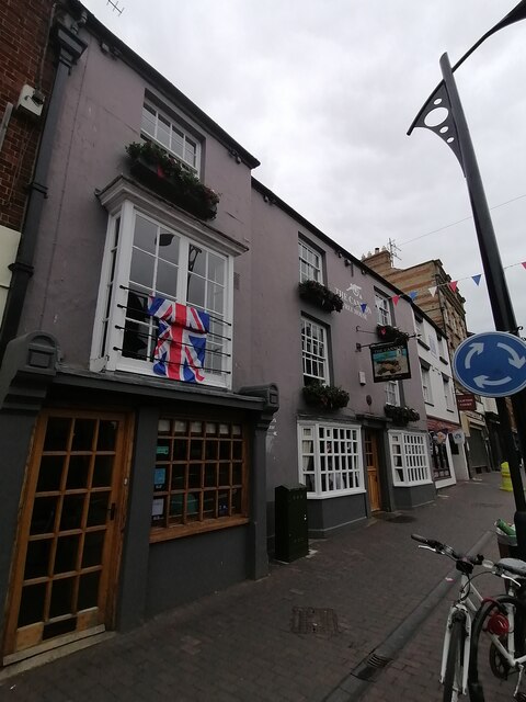
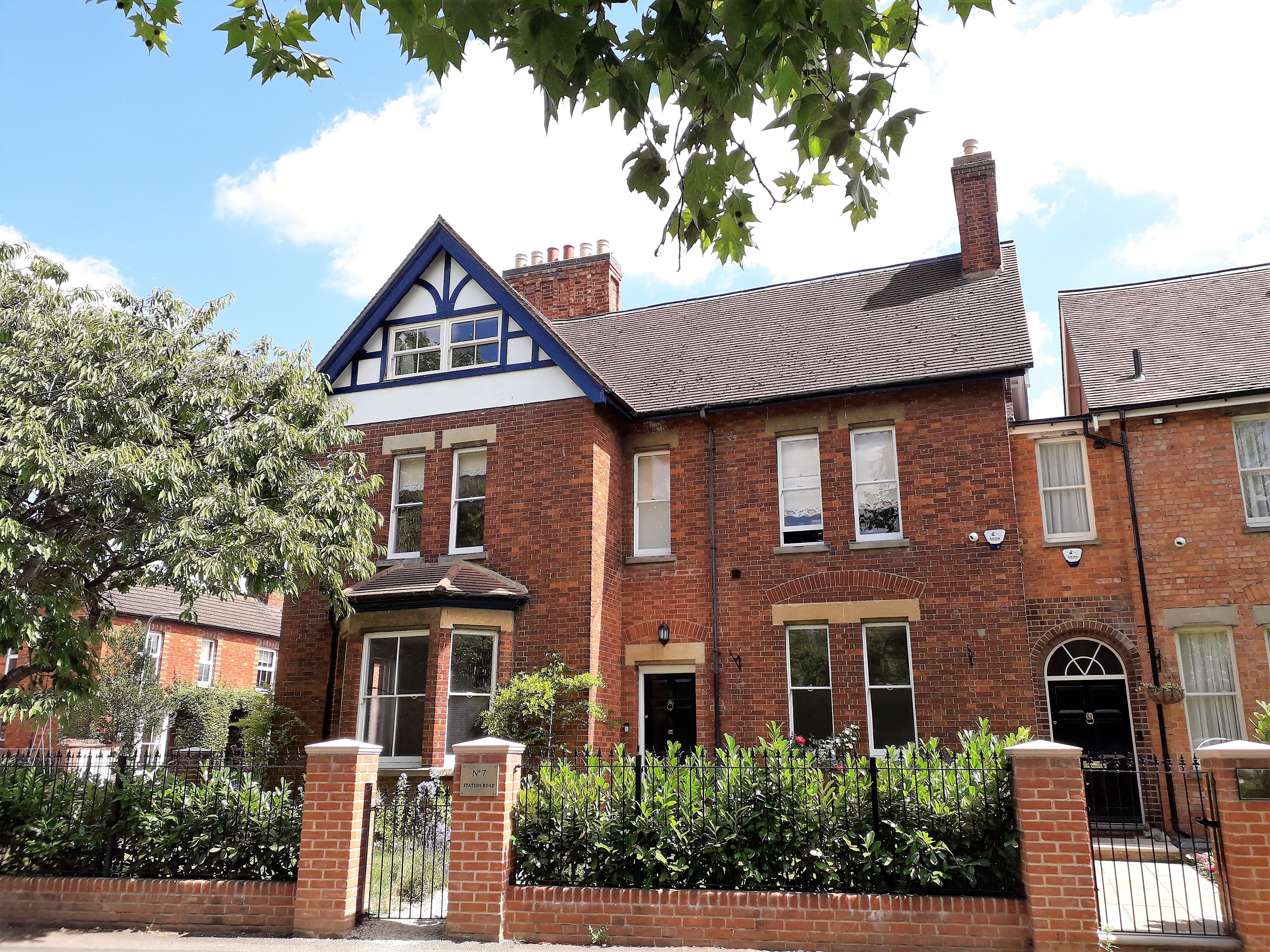
Today, Newport Pagnell retains much of its historic charm, with notable buildings such as the Parish Church of St. Peter and St. Paul, dating back to the 12th century. The town also features a mix of architectural styles, including Georgian and Victorian houses, reflecting its diverse heritage.

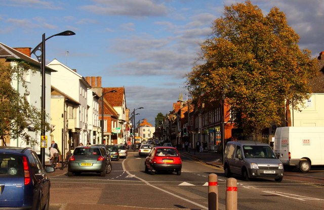
The High Street is the main commercial hub, offering a range of independent shops, cafes, and restaurants, as well as a weekly market. The town is also home to several schools, including the renowned Ousedale School.

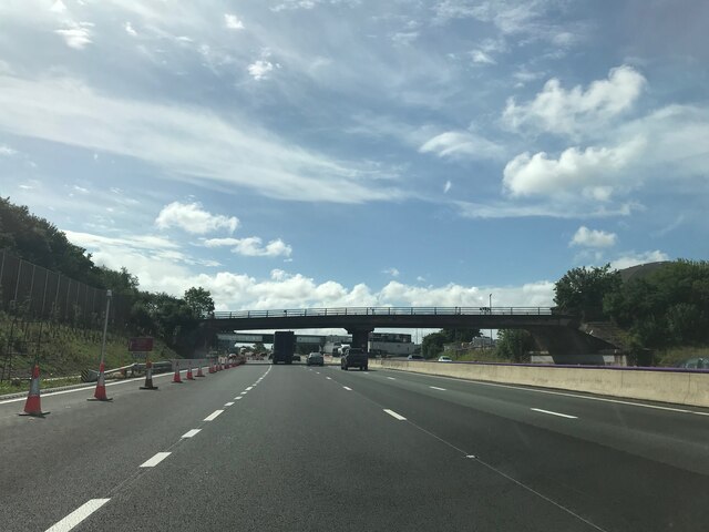
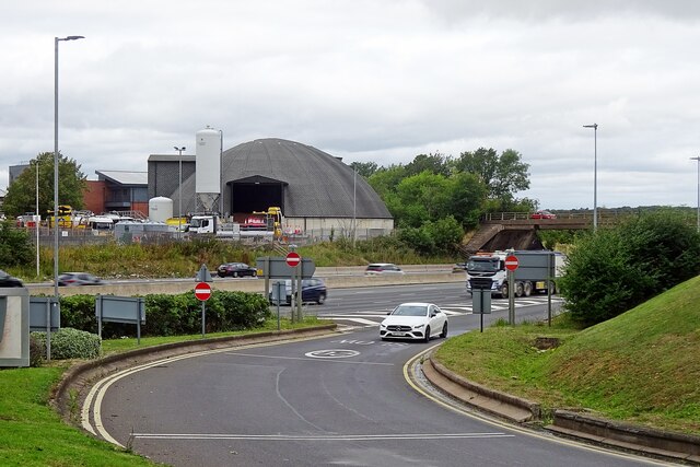
Newport Pagnell is well-connected, with easy access to the M1 motorway and nearby Milton Keynes. It also benefits from beautiful countryside surroundings, with nearby parks and green spaces providing opportunities for recreation and leisure activities.

In recent years, Newport Pagnell has been recognized for its commitment to sustainability and community initiatives, aiming to enhance the quality of life for its residents and preserve its unique heritage.

If you have any feedback on the listing, please let us know in the comments section below.

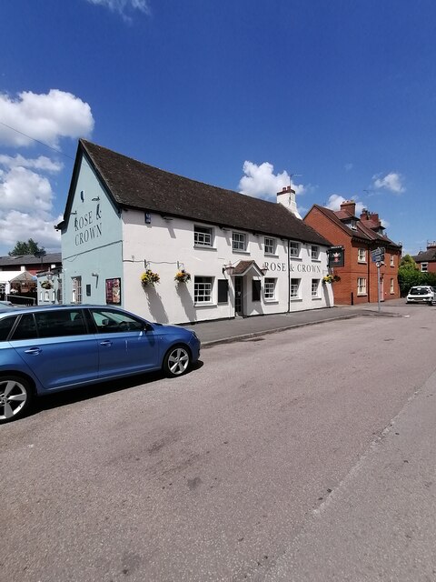
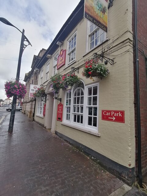
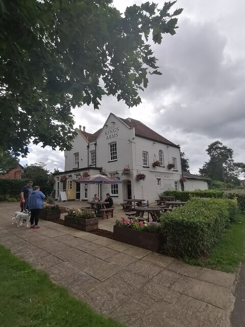
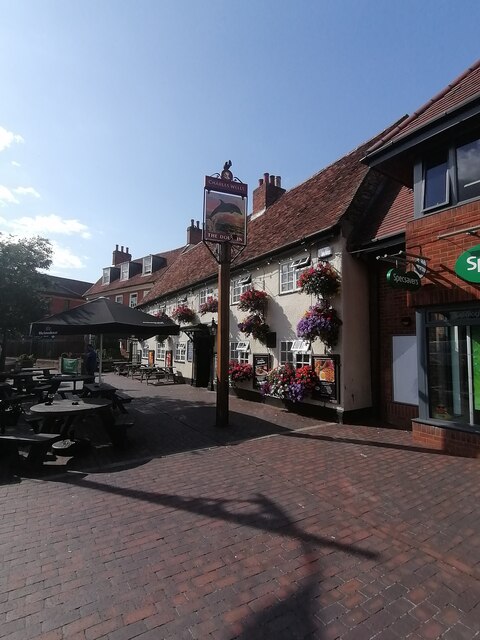
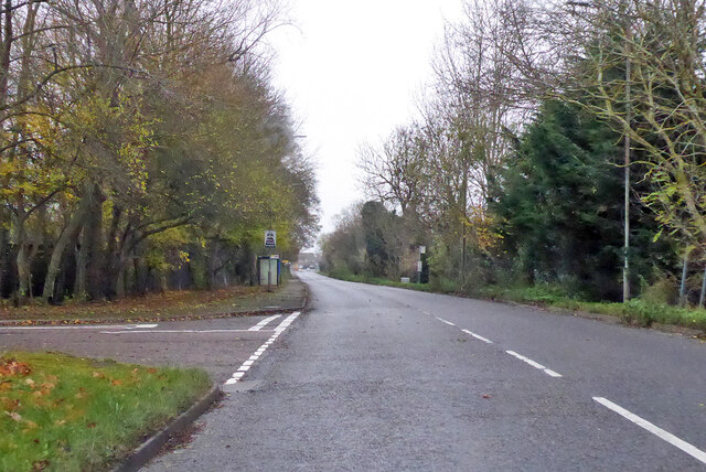
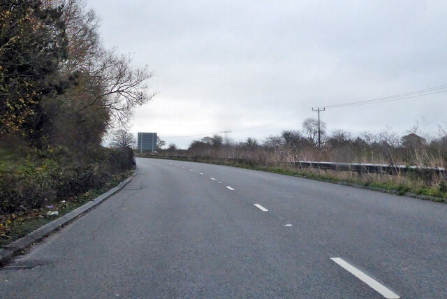
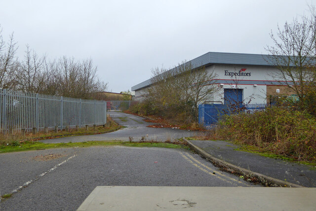
Newport Pagnell Images

Images are sourced within 2km of 52.08677/-0.72224 or Grid Reference SP8743. Thanks to Geograph Open Source API. All images are credited.

The Rose and Crown, Newport Pagnell The Rose and Crown in Newport Pagnell, run by Charles Wells
The Rose and Crown, Newport Pagnell
The Rose and Crown in Newport Pagnell, run by Charles Wells
The Plough, Newport Pagnell The Plough in Newport Pagnell, now run by new management
The Plough, Newport Pagnell
The Plough in Newport Pagnell, now run by new management
The Kings Arms, Newport Pagnell The Kings Arms in Newport Pagnell, run by Charles Wells
The Kings Arms, Newport Pagnell
The Kings Arms in Newport Pagnell, run by Charles Wells
The Dolphin, Newport Pagnell The Dolphin in Newport Pagnell, run by Charles Wells
The Dolphin, Newport Pagnell
The Dolphin in Newport Pagnell, run by Charles Wells
North Crawley Road Entering the industrial fringes of  Newport Pagnell.
North Crawley Road
Entering the industrial fringes of Newport Pagnell.
A509 heading north from Newport Pagnell
Blocked turning off Renny Park Road There seem to be alternative ways of access on the industrial estate.
Blocked turning off Renny Park Road
There seem to be alternative ways of access on the industrial estate.
The Cannon Freehouse Newport Pagnell
Road crossing M1 southbound
Matrix Board - M1 southbound
Footbridge over M1 southbound
Matrix Board - M1 southbound
Leah Williamson mural Painted to celebrate England's win in the Euro 2022 competition
Leah Williamson mural
Painted to celebrate England's win in the Euro 2022 competition
Evening on Tongwell Lake
Trees on the ridge at Bury Field
Flood plain field by the Great Ouse
Newport Pagnell Services Looking from southbound side across to northbound on the M1 motorway.
Newport Pagnell Services
Looking from southbound side across to northbound on the M1 motorway.
Lathbury: 1, Church Lane
Show me another place!

Newport Pagnell is located at Grid Ref: SP8743 (Lat: 52.08677, Lng: -0.72224)

Unitary Authority: Milton Keynes

Police Authority: Thames Valley

What 3 Words

///shed.juggles.cookery. Near Newport Pagnell, Buckinghamshire

Related Wikis

Wolverton Urban District

Wolverton Urban District was a local government district in Buckinghamshire, England, from 1920 to 1974, covering the town of Wolverton and its environs...

Newport Pagnell Urban District

Newport Pagnell Urban District was a local government district in the administrative county of Buckinghamshire, England, from 1897 to 1974. == Origins... ==

Newport Pagnell Rural District

Newport Pagnell was a rural district in the administrative county of Buckinghamshire, England, from 1894 to 1974, covering an area in the north-east of...

Newport Pagnell

Newport Pagnell is a town and civil parish in the City of Milton Keynes, Buckinghamshire, England. The Office for National Statistics records Newport...

Nearby Amenities

Located within 500m of 52.08677,-0.72224
Mini Roundabout
Direction: clockwise
Lat/Long: 52.0868211/-0.7222444
Crossing
Crossing: uncontrolled
Lat/Long: 52.0870573/-0.7210925
Mini Roundabout
Direction: clockwise
Lat/Long: 52.0851679/-0.728716
Mini Roundabout
Direction: clockwise
Lat/Long: 52.0849397/-0.7177966
Traffic Calming: cushion
Lat/Long: 52.0854194/-0.7188883
Crossing
Crossing Ref: zebra
Lat/Long: 52.0866365/-0.7221892
Newport Pagnell
Is In: Milton Keynes, Buckinghamshire, England, UK
Name Ru: Ньюпорт-Пагнелл
Place: town
Population: 15118
Wikidata: Q1020231
Wikipedia: en:Newport Pagnell
Lat/Long: 52.0863864/-0.7237341
Check Date: 2021-06-22
Traffic Calming: hump
Lat/Long: 52.0863889/-0.7246426
Crossing
Crossing: unmarked
Crossing Island: no
Crossing Markings: no
Tactile Paving: no
Traffic Calming: table
Lat/Long: 52.0862949/-0.7215558
Pub
The Bull Inn
Addr City: Milton Keynes
Addr Country: GB
Addr Housenumber: 33
Addr Postcode: MK16 9AE
Addr Street: Tickford Street
Addr Suburb: Newport Pagnell
Fhrs Authority: Milton Keynes
Fhrs Id: 113760
Fhrs Local Authority Id: 42760
Operator: free_house
Wikidata: Q26596378
Lat/Long: 52.0851573/-0.7181195
Turning Circle
Turning Circle: y-head
Lat/Long: 52.0864825/-0.7159779
Post Box
Ref: MK16 151
Lat/Long: 52.0850877/-0.717922
Bus Stop
Bus: yes
Public Transport: platform
Shelter: no
Lat/Long: 52.0852111/-0.7183867
Pub
The Dolphin
Addr City: Milton Keynes
Addr Country: GB
Addr Housenumber: 82
Addr Postcode: MK16 8AQ
Addr Street: High Street
Addr Suburb: Newport Pagnell
Fhrs Authority: Milton Keynes
Fhrs Id: 75893
Fhrs Local Authority Id: 1781
Wikidata: Q26617038
Lat/Long: 52.0865724/-0.7247006
Barrier: bollard
Lat/Long: 52.0842558/-0.7278997
Traffic Signals
Bicycle: yes
Button Operated: yes
Tactile Paving: yes
Traffic Signals: signal
Lat/Long: 52.0841272/-0.728132
Pub
The Coachmakers Arms
Addr City: Milton Keynes
Addr Country: GB
Addr Housenumber: 117
Addr Postcode: MK16 8EN
Addr Street: High Street
Addr Suburb: Newport Pagnell
Fhrs Authority: Milton Keynes
Fhrs Id: 129471
Fhrs Local Authority Id: 60270
Wikidata: Q26617034
Lat/Long: 52.0854976/-0.7260892
Mini Roundabout
Direction: clockwise
Source: bing
Lat/Long: 52.0879056/-0.7202978
Bus Stop
Market Hill
Bench: yes
Bus: yes
Naptan AtcoCode: 049003695708
Naptan Bearing: NE
Naptan CommonName: Market Hill
Naptan Indicator: eastbound
Naptan Landmark: Newport Pagnell Market Hill
Naptan NaptanCode: mltdmpt
Naptan PlusbusZoneRef: MKNSCEN
Naptan Street: High Street
Naptan Verified: no
Public Transport: platform
Shelter: yes
Source: naptan_import
Lat/Long: 52.0863609/-0.7250768
Bus Stop
Market Hill
Bench: yes
Bus: yes
Naptan AtcoCode: 049003695725
Naptan Bearing: SW
Naptan CommonName: Market Hill
Naptan Indicator: westbound
Naptan Landmark: Newport Pagnell Market Hill
Naptan NaptanCode: mltdmpw
Naptan PlusbusZoneRef: MKNSCEN
Naptan Street: High Street
Naptan Verified: no
Passenger Information Display: yes
Public Transport: platform
Shelter: yes
Source: naptan_import
Tactile Paving: yes
Lat/Long: 52.085962/-0.725599
Bus Stop
Ousebank
Alt Name: St. Peter and St. Paul Church
Bus: yes
Naptan AltCommonName: St. Peter and St. Paul Church
Naptan AltStreet: Not Specified
Naptan AtcoCode: 049003705709
Naptan Bearing: N
Naptan CommonName: Ousebank
Naptan Indicator: opp Royal British Legion Club
Naptan Landmark: St. Peter's and St. Paul's Church OR Ouse Bank
Naptan NaptanCode: mltdmta
Naptan PlusbusZoneRef: MKNSCEN
Naptan Street: High Street
Naptan Verified: no
Public Transport: platform
Source: naptan_import
Lat/Long: 52.0872758/-0.7207158
Bus Stop
Ousebank
Alt Name: St. Peter and St. Paul Church
Bus: yes
Naptan AltCommonName: St. Peter and St. Paul Church
Naptan AltStreet: Not Specified
Naptan AtcoCode: 049003705724
Naptan Bearing: S
Naptan CommonName: Ousebank
Naptan Indicator: o/s Royal British Legion Club
Naptan Landmark: St. Peter's and St. Paul's Church OR Ouse Bank
Naptan NaptanCode: mltdmtd
Naptan PlusbusZoneRef: MKNSCEN
Naptan Street: High Street
Naptan Verified: no
Public Transport: platform
Source: naptan_import
Lat/Long: 52.0877113/-0.7202508
Bus Stop
Newport Pagnell Medical Centre
Bus: yes
Naptan AtcoCode: 049003715749
Naptan Bearing: S
Naptan CommonName: Newport Pagnell Medical Centre
Naptan Indicator: opp
Naptan Landmark: Newport Pagnell Fire Station
Naptan NaptanCode: mltatg
Naptan PlusbusZoneRef: MKNSCEN
Naptan Street: Marsh End Road
Naptan Verified: no
Public Transport: platform
Shelter: yes
Source: naptan_import
Lat/Long: 52.084694/-0.7284955
Bus Stop
Newport Pagnell Medical Centre
Bus: yes
Naptan AtcoCode: 049003715750
Naptan Bearing: N
Naptan CommonName: Newport Pagnell Medical Centre
Naptan Indicator: o/s
Naptan Landmark: Newport Pagnell Fire Station
Naptan NaptanCode: mltatj
Naptan PlusbusZoneRef: MKNSCEN
Naptan Street: Marsh End Road
Naptan Verified: no
Public Transport: platform
Shelter: yes
Source: naptan_import
Lat/Long: 52.0846891/-0.7286265
Bus Stop
Tickford End Works
Bus: yes
Naptan AtcoCode: 049003745728
Naptan Bearing: SE
Naptan CommonName: Tickford End Works
Naptan Indicator: o/s
Naptan Landmark: Tickford End Works
Naptan NaptanCode: mltdmwa
Naptan PlusbusZoneRef: MKNSCEN
Naptan Street: Tickford Street
Naptan Verified: no
Public Transport: platform
Source: naptan_import
Lat/Long: 52.0846372/-0.7162669
Bus Stop
Newport Pagnell library
Bus: yes
Naptan AtcoCode: 049003745731
Naptan Bearing: NW
Naptan CommonName: Newport Pagnell library
Naptan Indicator: opp
Naptan Landmark: Newport Pagnell Library
Naptan NaptanCode: mltdmwd
Naptan PlusbusZoneRef: MKNSCEN
Naptan Street: St. John Street
Naptan Verified: no
Public Transport: platform
Source: naptan_import
Lat/Long: 52.0864273/-0.7220682
Bus Stop
Newport Pagnell library
Bus: yes
Naptan AtcoCode: 049003745739
Naptan Bearing: SE
Naptan CommonName: Newport Pagnell library
Naptan Indicator: o/s
Naptan Landmark: Newport Pagnell Library
Naptan NaptanCode: mltdmwj
Naptan PlusbusZoneRef: MKNSCEN
Naptan Street: St. John Street
Naptan Verified: no
Public Transport: platform
Shelter: no
Source: naptan_import
Lat/Long: 52.0861637/-0.7209811
Bus Stop
Severn Drive
Bus: yes
Naptan AtcoCode: 049003745740
Naptan Bearing: NW
Naptan CommonName: Severn Drive
Naptan Indicator: opp
Naptan Landmark: N
Naptan NaptanCode: mltdmwm
Naptan PlusbusZoneRef: MKNSCEN
Naptan Street: Tickford Street
Naptan Verified: no
Public Transport: platform
Source: naptan_import
Lat/Long: 52.0851472/-0.718456
Traffic Calming: island
Lat/Long: 52.0852182/-0.7285757
Crossing
Crossing: unmarked
Crossing Island: yes
Lat/Long: 52.0851624/-0.7289198
Turning Circle
Source: bing
Lat/Long: 52.0865252/-0.7271469
Traffic Calming: table
Lat/Long: 52.0869914/-0.7236925
Mini Roundabout
Direction: clockwise
Source: bing
Lat/Long: 52.0861438/-0.7254378
Source: bing
Waterway: weir
Lat/Long: 52.083561/-0.7222063
Post Office
Newport Pagnell Post Office
Addr City: Newport Pagnell
Addr Country: GB
Addr Housenumber: 30-32
Addr Postcode: MK16 8AQ
Addr Street: High Street
Brand: Post Office
Brand Wikidata: Q1783168
Ref Pol Id: 1556
Source: OS_OpenData_StreetView
Website: https://www.postoffice.co.uk/branch-finder/1091093/newport-pagnell
Lat/Long: 52.0870983/-0.7213102
Pub
The Cannon
Addr City: Newport Pagnell
Addr Country: GB
Addr Housenumber: 50
Addr Postcode: MK16 8AQ
Addr Street: High Street
Fhrs Authority: Milton Keynes
Fhrs Id: 112847
Fhrs Local Authority Id: 41996
Source Addr Postcode: FHRS Open Data
Wikidata: Q26617036
Lat/Long: 52.0868783/-0.7224475
Barrier: kissing_gate
Lat/Long: 52.0871895/-0.7256123
Giant
Addr Housenumber: 19
Addr Postcode: MK16 8HE
Addr Street: St John Street
Brand: Giant
Brand Wikidata: Q703557
Brand Wikipedia: en:Giant Bicycles
Shop: bicycle
Website: http://www.roypinkcycles.co.uk
Lat/Long: 52.0863248/-0.7213987
Atm
Fee: no
Operator: Co-op Bank
Lat/Long: 52.0864636/-0.7238692
Bank
Nationwide
Atm: no
Brand: Nationwide
Brand Wikidata: Q846735
Brand Wikipedia: en:Nationwide Building Society
Contact Website: https://locations.nationwidebranches.co.uk/newport-pagnell/68-high-street
Lat/Long: 52.086683/-0.7235418
Fast Food
The Golden Fry
Addr City: Newport Pagnell
Addr Country: GB
Addr Housenumber: 1
Addr Postcode: MK16 8HE
Addr Street: St John Street
Cuisine: fish_and_chips
Fhrs Authority: Milton Keynes
Fhrs Id: 93338
Fhrs Local Authority Id: 2677
Source Addr: FHRS Open Data
Lat/Long: 52.0867117/-0.7220629
Restaurant
The Cheeky Bhaji
Addr City: Newport Pagnell
Addr Country: GB
Addr Housenumber: 5
Addr Postcode: MK16 8HE
Addr Street: St John Street
Cuisine: indian
Fhrs Authority: Milton Keynes
Opening Hours: Mo off; Tu-Su 17:00-22:30
Phone: +44 1908617877
Lat/Long: 52.0865815/-0.7219796
Addr Housenumber: 7-9
Addr Postcode: MK16 8HE
Addr Street: St John Street
Disused Shop: yes
Note: Lloyds Bank has closed this branch
Lat/Long: 52.0865118/-0.7218524
Restaurant
Capadocia
Addr City: Newport Pagnell
Addr Country: GB
Addr Housenumber: 8
Addr Postcode: MK16 8HN
Addr Street: St John Street
Cuisine: turkish
Fhrs Authority: Milton Keynes
Fhrs Id: 134062
Fhrs Local Authority Id: 67181
Source Addr: FHRS Open Data
Wikidata: Q26418473
Lat/Long: 52.0864952/-0.7222771
Restaurant
Robinsons
Addr City: Newport Pagnell
Addr Country: GB
Addr Housenumber: 18-20
Addr Postcode: MK16 8HJ
Addr Street: St John Street
Lat/Long: 52.0862323/-0.721689
Cafe
Costa
Addr City: Newport Pagnell
Addr Country: GB
Addr Housenumber: 44
Addr Postcode: MK16 8AQ
Addr Street: High Street
Brand: Costa
Brand Wikidata: Q608845
Brand Wikipedia: en:Costa Coffee
Cuisine: coffee_shop
Fhrs Authority: Milton Keynes
Fhrs Id: 139035
Fhrs Local Authority Id: 74395
Source Addr: FHRS Open Data
Takeaway: yes
Lat/Long: 52.0869423/-0.7221235
Barrier: kissing_gate
Lat/Long: 52.0885056/-0.7231464
Pub
The Plough
Addr City: Milton Keynes
Addr Country: GB
Addr Housenumber: 57
Addr Postcode: MK16 8AT
Addr Street: High Street
Addr Suburb: Newport Pagnell
Fhrs Authority: Milton Keynes
Fhrs Id: 75480
Fhrs Local Authority Id: 1764
Lat/Long: 52.0866924/-0.7226327
Cafe
Picnic's
Addr City: Newport Pagnell
Addr Country: GB
Addr Housenumber: 63
Addr Postcode: MK16 8AT
Addr Street: High Street
Fhrs Authority: Milton Keynes
Fhrs Id: 432892
Fhrs Local Authority Id: 81284
Source Addr: FHRS Open Data
Lat/Long: 52.0866375/-0.7229175
The Swan Revived
Addr City: Newport Pagnell
Addr Country: GB
Addr Housenumber: 33
Addr Postcode: MK16 8AR
Addr Street: High Street
Fhrs Authority: Milton Keynes
Fhrs Id: 112766
Fhrs Local Authority Id: 41929
Source Addr: FHRS Open Data
Tourism: hotel
Wikidata: Q26418487
Lat/Long: 52.0869265/-0.7212902
Onkaar - Home Solutions Ltd
Addr City: Milton Keynes
Addr Country: GB
Addr Housenumber: 22-24
Addr Postcode: MK16 8YX
Addr Street: High Street
Addr Suburb: Newport Pagnell
Shop: doityourself
Lat/Long: 52.0871809/-0.7210099
Restaurant
The Pin Petch Thai Restaurant
Addr City: Milton Keynes
Addr Country: GB
Addr Housenumber: 13
Addr Postcode: MK16 8AR
Addr Street: High Street
Addr Suburb: Newport Pagnell
Cuisine: thai
Fhrs Authority: Milton Keynes
Fhrs Id: 88933
Fhrs Local Authority Id: 23565
Opening Hours: Mo-Sa 16:30-22:00; Su 12:00-20:00
Phone: +44 1908 211211
Lat/Long: 52.0871836/-0.7204696
Post Box
Brand: Royal Mail
Brand Wikidata: Q638098
Brand Wikipedia: en:Royal Mail
Collection Times: Mo-Fr 17:15; Sa 12:00
Operator: Royal Mail
Operator Wikidata: Q638098
Post Box Type: lamp
Ref: MK16 277
Royal Cypher: EIIR
Royal Cypher Wikidata: Q33102113
Source: survey
Lat/Long: 52.0879232/-0.7201893
Barrier: stile
Lat/Long: 52.0901803/-0.7250644
Leisure: playground
Lat/Long: 52.0880365/-0.7199414
Barrier: kissing_gate
Lat/Long: 52.0872438/-0.7254006
Bicycle Parking
Bicycle Parking: stands
Covered: no
Lat/Long: 52.0870368/-0.7213911
Leisure: picnic_table
Lat/Long: 52.0863595/-0.7199105
Toilets
Access: yes
Fee: no
Toilets Handwashing: yes
Toilets Paper Supplied: yes
Toilets Position: seated;urinal
Lat/Long: 52.0863378/-0.725106
Post Box
Brand: Royal Mail
Brand Wikidata: Q638098
Brand Wikipedia: en:Royal Mail
Collection Times: Mo-Fr 17:15; Sa 12:00
Operator: Royal Mail
Operator Wikidata: Q638098
Post Box Type: wall
Ref: MK16 150
Royal Cypher: EIIR
Royal Cypher Wikidata: Q33102113
Source: survey
Lat/Long: 52.0861012/-0.7257735
Check Date: 2021-06-24
Traffic Calming: table
Lat/Long: 52.0852635/-0.72835
Traffic Calming: hump
Lat/Long: 52.0854517/-0.7272799
Check Date: 2021-06-22
Traffic Calming: table
Lat/Long: 52.0862884/-0.7255873
Crossing
Crossing: traffic_signals
Crossing Island: no
Tactile Paving: yes
Lat/Long: 52.0856627/-0.7265076
Traffic Calming: hump
Lat/Long: 52.0865003/-0.7241089
Crossing Island: yes
Direction: backward
Traffic Calming: table
Traffic Island: yes
Lat/Long: 52.0861942/-0.7252465
Direction: forward
Traffic Calming: table
Lat/Long: 52.0860584/-0.7256041
Crossing
Crossing Island: yes
Crossing Markings: no
Tactile Paving: yes
Lat/Long: 52.085051/-0.7180891
Bench
Lat/Long: 52.0883326/-0.7259643
Barrier: bollard
Motor Vehicle: no
Lat/Long: 52.0849381/-0.7267616
G.J. Douglas
Addr City: Newport Pagnell
Addr Country: GB
Addr Housenumber: 34
Addr Postcode: MK16 8AQ
Addr Street: High Street
Fhrs Authority: Milton Keynes
Fhrs Id: 199030
Fhrs Local Authority Id: 747
Shop: butcher
Source Addr: FHRS Open Data
Lat/Long: 52.0870459/-0.7216077
Fast Food
East Ocean Chinese Take Away
Addr City: Milton Keynes
Addr Country: GB
Addr Housenumber: 89a
Addr Postcode: MK16 8AB
Addr Street: High Street
Addr Suburb: Newport Pagnell
Cuisine: chinese
Fhrs Authority: Milton Keynes
Fhrs Id: 112913
Fhrs Local Authority Id: 42037
Lat/Long: 52.0862157/-0.7248172
Simply Sweets
Addr City: Milton Keynes
Addr Country: GB
Addr Housenumber: 48
Addr Postcode: MK16 8AQ
Addr Street: High Street
Addr Suburb: Newport Pagnell
Fhrs Authority: Milton Keynes
Fhrs Id: 199309
Fhrs Local Authority Id: 64128
Shop: confectionery
Lat/Long: 52.0869014/-0.722304
Restaurant
Kakori Restaurant
Addr City: Milton Keynes
Addr Country: GB
Addr Housenumber: 101
Addr Postcode: MK16 8EN
Addr Street: High Street
Addr Suburb: Newport Pagnell
Cuisine: indian
Fhrs Authority: Milton Keynes
Fhrs Id: 112925
Fhrs Local Authority Id: 42045
Lat/Long: 52.0858885/-0.7254609
Restaurant
Imperial Garden Chinese Restaurant
Addr City: Milton Keynes
Addr Country: GB
Addr Housenumber: 85
Addr Postcode: MK16 8AB
Addr Street: High Street
Addr Suburb: Newport Pagnell
Cuisine: chinese
Fhrs Authority: Milton Keynes
Fhrs Id: 93294
Fhrs Local Authority Id: 2674
Lat/Long: 52.0863171/-0.7244564
Youngs
Office: estate_agent
Lat/Long: 52.0861902/-0.7248869
Zig Zag
Shop: hairdresser
Lat/Long: 52.0869656/-0.7219942
Age UK
Brand: Age UK
Brand Wikidata: Q4691850
Brand Wikipedia: en:Age UK
Shop: charity
Lat/Long: 52.0868124/-0.7228069
Fast Food
Papa John's
Addr City: Milton Keynes
Addr Country: GB
Addr Housenumber: 93
Addr Postcode: MK16 8EN
Addr Street: High Street
Addr Suburb: Newport Pagnell
Brand: Papa John's
Brand Wikidata: Q2759586
Brand Wikipedia: en:Papa John's Pizza
Cuisine: pizza
Fhrs Authority: Milton Keynes
Fhrs Id: 136293
Fhrs Local Authority Id: 70562
Takeaway: yes
Website: https://www.papajohns.co.uk/stores/milton-keynes-newport-pagnell
Lat/Long: 52.0860435/-0.7252517
Heron Opticians
Shop: optician
Lat/Long: 52.0868313/-0.7227117
Fast Food
Quality Fish n Chips
Addr City: Milton Keynes
Addr Country: GB
Addr Housenumber: 95
Addr Postcode: MK16 8EN
Addr Street: High Street
Addr Suburb: Newport Pagnell
Cuisine: fish_and_chips
Fhrs Authority: Milton Keynes
Fhrs Id: 129381
Fhrs Local Authority Id: 60047
Lat/Long: 52.0859999/-0.7253322
Connells
Brand: Connells
Brand Wikidata: Q5161738
Brand Wikipedia: en:Connells Group
Office: estate_agent
Lat/Long: 52.0860781/-0.7251418
Oxfam
Brand: Oxfam
Brand Wikidata: Q267941
Brand Wikipedia: en:Oxfam
Contact Website: https://www.oxfam.org.uk/shops/oxfam-shop-newport-pagnell/
Shop: charity
Lat/Long: 52.0866755/-0.7236853
Olivier Adams
Shop: bakery
Lat/Long: 52.0857386/-0.7256071
Superdrug
Addr City: Milton Keynes
Addr Country: GB
Addr Housenumber: 66
Addr Postcode: MK16 8AQ
Addr Street: High Street
Addr Suburb: Newport Pagnell
Brand: Superdrug
Brand Wikidata: Q7643261
Brand Wikipedia: en:Superdrug
Fhrs Authority: Milton Keynes
Fhrs Id: 198754
Fhrs Local Authority Id: 66527
Note: This is a shop=chemist (aka drugstore) and *not* a pharmacy, as they do not dispense prescriptions.
Shop: chemist
Survey Date: 2019-04-23
Lat/Long: 52.0867077/-0.7234077
Martin's
Brand: Martin's
Brand Wikidata: Q116779207
Brand Wikipedia: en:McColl's
Shop: newsagent
Lat/Long: 52.0867341/-0.7232468
Taylors
Brand: Taylors
Brand Wikidata: Q94579182
Office: estate_agent
Lat/Long: 52.0862775/-0.7246214
Brinnick Locksmith and Security Ltd
Craft: locksmith
Shop: locksmith
Lat/Long: 52.0868008/-0.7228793
Market Hill Greengrocers
Addr City: Milton Keynes
Addr Country: GB
Addr Housenumber: 107
Addr Postcode: MK16 8EN
Addr Street: High Street
Addr Suburb: Newport Pagnell
Fhrs Authority: Milton Keynes
Fhrs Id: 199193
Fhrs Local Authority Id: 417
Shop: greengrocer
Lat/Long: 52.0858078/-0.7256299
Cambourne Travel td
Shop: travel_agency
Lat/Long: 52.0868536/-0.7225668
Andrew Charles
Shop: jewelry
Lat/Long: 52.0869236/-0.7221913
Cafe
Cafe Latte
Addr City: Newport Pagnell
Addr Country: GB
Addr Housenumber: 54
Addr Postcode: MK16 8AQ
Addr Street: High Street
Cuisine: sandwich;burger
Fhrs Authority: Milton Keynes
Fhrs Id: 139379
Fhrs Local Authority Id: 75008
Source Addr: FHRS Open Data
Lat/Long: 52.086842/-0.7226352
Vintage No. 38 Emporium
Clothes: wedding
Shop: houseware
Lat/Long: 52.0869912/-0.7218413
Cafe
Kilning Me Softly - Pottery Painting Cafe
Addr City: Milton Keynes
Addr Country: GB
Addr Housenumber: 32a
Addr Postcode: MK16 8AQ
Addr Street: High Street
Addr Suburb: Newport Pagnell
Fhrs Authority: Milton Keynes
Fhrs Id: 680435
Fhrs Local Authority Id: 57774
Tourism: artwork
Lat/Long: 52.087053/-0.7215503
Willen Hospice
Shop: charity
Lat/Long: 52.0870217/-0.7216991
Bench
Lat/Long: 52.0878508/-0.7194487
Bench
Lat/Long: 52.087822/-0.7190612
Leisure: picnic_table
Lat/Long: 52.0881895/-0.7197853
Bench
Lat/Long: 52.0879118/-0.7183249
Bench
Lat/Long: 52.0879489/-0.7200013
Bench
Lat/Long: 52.0879248/-0.7183799
Leisure: picnic_table
Lat/Long: 52.0880857/-0.7189136
Waste Basket
Lat/Long: 52.0879539/-0.7200428
Waste Basket
Lat/Long: 52.0880107/-0.7190196
Bench
Lat/Long: 52.0872953/-0.7255346
Bench
Lat/Long: 52.0879068/-0.7291529
Post Box
Collection Times: Mo-Fr 17:45
Post Box Type: meter
Ref: MK16 628
Royal Cypher: EIIR
Royal Cypher Wikidata: Q33102113
Source: survey
Lat/Long: 52.0864075/-0.7250717
Post Box
Brand: Royal Mail
Brand Wikidata: Q638098
Brand Wikipedia: en:Royal Mail
Collection Times: Mo-Fr 17:30; Sa 12:00
Operator: Royal Mail
Operator Wikidata: Q638098
Post Box Type: pillar
Ref: MK16 510
Royal Cypher: EIIR
Royal Cypher Wikidata: Q33102113
Source: survey
Lat/Long: 52.0870578/-0.721321
Post Box
Brand: Royal Mail
Brand Wikidata: Q638098
Brand Wikipedia: en:Royal Mail
Collection Times: Mo-Fr 17:30; Sa 12:00
Operator: Royal Mail
Operator Wikidata: Q638098
Post Box Type: pillar
Ref: MK16 444
Royal Cypher: EIIR
Royal Cypher Wikidata: Q33102113
Source: survey
Lat/Long: 52.0870598/-0.7212823
Post Box
Brand: Royal Mail
Brand Wikidata: Q638098
Brand Wikipedia: en:Royal Mail
Collection Times: Mo-Fr 17:00; Sa 12:00
Operator: Royal Mail
Operator Wikidata: Q638098
Post Box Type: pillar
Ref: MK16 301
Royal Cypher: EIIR
Royal Cypher Wikidata: Q33102113
Source: survey
Lat/Long: 52.0833779/-0.7177855
Post Box
Brand: Royal Mail
Brand Wikidata: Q638098
Brand Wikipedia: en:Royal Mail
Collection Times: Mo-Fr 17:15; Sa 11:30
Operator: Royal Mail
Operator Wikidata: Q638098
Post Box Type: pillar
Ref: MK16 146
Royal Cypher: EIIR
Royal Cypher Wikidata: Q33102113
Source: survey
Lat/Long: 52.0842336/-0.7234014
Information: board
Tourism: information
Lat/Long: 52.0874791/-0.7261268
Entrance: main
Lat/Long: 52.0860495/-0.7222441
Entrance: yes
Lat/Long: 52.086416/-0.7220946
Christos Hair
Addr City: Milton Keynes
Addr Country: GB
Addr Housenumber: 74c
Addr Postcode: MK16 8AQ
Addr Street: High Street
Addr Suburb: Newport Pagnell
Fhrs Authority: Milton Keynes
Fhrs Id: 198689
Fhrs Local Authority Id: 42020
Shop: hairdresser
Lat/Long: 52.0866325/-0.7239182
War Memorial
Historic: memorial
Inscription: TO THE GLORY OF GOD AND IN MEMORY OF THE MEN OF THIS PARISH WHO FELL IN THE WAR 1914-1918
Listed Status: Grade II
Memorial: war_memorial
Wikidata: Q26660341
Lat/Long: 52.0870936/-0.7205328
Historic: memorial
Inscription: This monument is erected in pround and loving memory of the men connected with this church who gave their lives for us in the GREAT WAR 1914-1919
Memorial: war_memorial
Lat/Long: 52.0863791/-0.723281
Bench
Lat/Long: 52.0892217/-0.7247004
Bench
Lat/Long: 52.0882855/-0.7195514
Waste Basket
Lat/Long: 52.0877013/-0.7202254
Bench
Lat/Long: 52.0880677/-0.719052
Bench
Lat/Long: 52.0882069/-0.7197312
The Wool Shop
Shop: fabric
Lat/Long: 52.087595/-0.7201967
Interiorbase
Addr City: Newport Pagnell
Addr Housenumber: 3
Addr Postcode: MK16 8AR
Addr Street: High Street
Phone: +44 1908 211088
Shop: interior_decoration
Website: https://interiorbase.co.uk/
Lat/Long: 52.0875589/-0.7202088
H.W. Mason & Sons
Shop: funeral_directors
Lat/Long: 52.0872702/-0.7204089
Angel Nails
Beauty: nails
Shop: beauty
Lat/Long: 52.0870836/-0.7206458
Coopers Hair
Shop: hairdresser
Lat/Long: 52.0870734/-0.7206941
Scarlet Rose
Shop: tattoo
Lat/Long: 52.0870457/-0.7207724
The Barber Shop
Shop: hairdresser
Lat/Long: 52.0870312/-0.7208198
Fast Food
Newport Kebab & Pizza
Addr City: Newport Pagnell
Addr Country: GB
Addr Housenumber: 25
Addr Postcode: MK16 8AR
Addr Street: High Street
Cuisine: burger;kebab;pizza
Fhrs Authority: Milton Keynes
Fhrs Id: 132250
Fhrs Local Authority Id: 64030
Fhrs Name: Newport Pagnell Kebab
Source Addr: FHRS Open Data
Lat/Long: 52.087011/-0.7208898
Cafe
The Sandwich Shack
Addr City: Newport Pagnell
Addr Country: GB
Addr Housenumber: 27
Addr Postcode: MK16 8AR
Addr Street: High Street
Cuisine: sandwich;coffee_shop
Fhrs Authority: Milton Keynes
Fhrs Id: 137721
Fhrs Local Authority Id: 72741
Source Addr: FHRS Open Data
Lat/Long: 52.0870024/-0.7209372
Kens - Vintage Magazines
Shop: antiques
Lat/Long: 52.0869896/-0.7210288
Urban & Rural
Office: estate_agent
Lat/Long: 52.0869778/-0.7210964
D.E. Turneys Bakery
Addr City: Newport Pagnell
Addr Country: GB
Addr Housenumber: 35
Addr Postcode: MK16 8AR
Addr Street: High Street
Fhrs Authority: Milton Keynes
Fhrs Id: 1002458
Fhrs Local Authority Id: 88481
Shop: bakery
Source Addr: FHRS Open Data
Lat/Long: 52.0868812/-0.7214962
Quickfix3 Computing
Shop: computer
Lat/Long: 52.0868686/-0.7215718
VapeTown
Shop: e-cigarette
Lat/Long: 52.0868534/-0.721661
Cafe
Out Of Office Coffee House
Addr City: Newport Pagnell
Addr Country: GB
Addr Housenumber: 45
Addr Postcode: MK16 8AR
Addr Street: High Street
Cuisine: coffee_shop
Fhrs Authority: Milton Keynes
Fhrs Id: 1005663
Fhrs Local Authority Id: 65753
Source Addr: FHRS Open Data
Lat/Long: 52.0868453/-0.7217542
Bluebell Flowers
Shop: florist
Lat/Long: 52.0868407/-0.7218215
Timpson
Brand: Timpson
Brand Wikidata: Q7807658
Craft: key_cutter
Lat/Long: 52.086832/-0.7219058
Natural Lifestyles
Addr City: Newport Pagnell
Addr Country: GB
Addr Housenumber: 47
Addr Postcode: MK16 8AR
Addr Street: High Street
Shop: health_food
Lat/Long: 52.0868182/-0.7219932
Restaurant
Moza
Addr City: Newport Pagnell
Addr Country: GB
Addr Housenumber: 53
Addr Postcode: MK16 8AU
Addr Street: High Street
Contact Website: https://mozaonline.co.uk/
Cuisine: indian
Fhrs Authority: Milton Keynes
Fhrs Id: 1024704
Fhrs Local Authority Id: 41998
Source: https://data.food.gov.uk/catalog/datasets/38dd8d6a-5ab1-4f50-b753-ab33288e3200
Lat/Long: 52.0867181/-0.7224291
Smart Gents
Shop: hairdresser
Lat/Long: 52.086655/-0.7228135
RSPCA
Brand: RSPCA
Brand Wikidata: Q584819
Brand Wikipedia: en:Royal Society for the Prevention of Cruelty to Animals
Shop: charity
Lat/Long: 52.0866206/-0.7230088
Diamond Flooring
Shop: interior_decoration
Lat/Long: 52.0866046/-0.7230803
Pharmacy
Jardines
Addr City: Newport Pagnell
Addr Country: GB
Addr Housenumber: 65
Addr Postcode: MK16 8AB
Addr Street: High Street
Dispensing: yes
Fhrs Authority: Milton Keynes
Fhrs Id: 199274
Fhrs Local Authority Id: 42011
Healthcare: pharmacy
Operator: Jardines (U.K.) Ltd
Source Addr: FHRS Open Data
Lat/Long: 52.0865708/-0.7232345
DW Roberts
Addr Housenumber: 3
Addr Postcode: MK16 8HE
Addr Street: St John Street
Shop: optician
Lat/Long: 52.0866574/-0.7220417
Mr Clean Dry Cleaner
Shop: dry_cleaning
Lat/Long: 52.086638/-0.7223383
Shed 37
Shop: hairdresser
Lat/Long: 52.0866074/-0.7223204
Wyrdos
Addr City: Newport Pagnell
Addr Housenumber: 6a
Addr Postcode: MK16 8HN
Addr Street: St John Street
Shop: tattoo
Lat/Long: 52.0865711/-0.7223
Newport Music
Shop: music
Lat/Long: 52.0864288/-0.7221613
Car Rental
Yellow Car
Addr Housenumber: 15
Addr Postcode: MK16 8HE
Addr Street: St John Street
Lat/Long: 52.0863919/-0.7216062
Addr City: Newport Pagnell
Addr Country: GB
Addr Housenumber: 11-13
Addr Postcode: MK16 8HE
Addr Street: St John Street
Disused Shop: bookmaker
Fhrs Authority: Milton Keynes
Note: Willam Hill has closed this shop
Lat/Long: 52.0864399/-0.7217289
Pub
Newport Pagnell Working Mens Club
Addr City: Milton Keynes
Addr Country: GB
Addr Housenumber: 28-30
Addr Postcode: MK16 0EN
Addr Street: Silver Street
Addr Suburb: Newport Pagnell
Fhrs Authority: Milton Keynes
Fhrs Id: 113502
Fhrs Local Authority Id: 42538
Lat/Long: 52.0853805/-0.7228392
Lovat Hall (Bethany Luncheon Club)
Addr City: Milton Keynes
Addr Country: GB
Addr Postcode: MK16 0EJ
Addr Street: Silver Street
Addr Suburb: Newport Pagnell
Club: yes
Fhrs Authority: Milton Keynes
Fhrs Id: 113486
Fhrs Local Authority Id: 42521
Lat/Long: 52.083804/-0.7235661
Kindergarten
Lovat Hall Playgroup
Addr City: Milton Keynes
Addr Country: GB
Addr Postcode: MK16 0EJ
Addr Street: Silver Street
Addr Suburb: Newport Pagnell
Fhrs Authority: Milton Keynes
Fhrs Id: 139224
Fhrs Local Authority Id: 74742
Lat/Long: 52.0838427/-0.723487
Defibrillator
Emergency: defibrillator
Lat/Long: 52.083773/-0.7236516
Fast Food
Subway
Addr City: Milton Keynes
Addr Country: GB
Addr Housenumber: 1
Addr Postcode: MK16 0AG
Addr Street: Station Road
Addr Suburb: Newport Pagnell
Brand: Subway
Brand Wikidata: Q244457
Brand Wikipedia: en:Subway (restaurant)
Contact Website: https://restaurants.subway.com/united-kingdom/en/newport-pagnell/1-station-road
Cuisine: sandwich
Fhrs Authority: Milton Keynes
Fhrs Id: 199234
Fhrs Local Authority Id: 15510
Takeaway: yes
Lat/Long: 52.0852173/-0.7273132
Restaurant
The Brooklands Centre
Addr City: Milton Keynes
Addr Country: GB
Addr Postcode: MK16 8AN
Addr Street: Ousebank Street
Addr Suburb: Newport Pagnell
Fhrs Authority: Milton Keynes
Fhrs Id: 680437
Fhrs Local Authority Id: 78129
Lat/Long: 52.0876195/-0.7192639
Fast Food
Sunats Kebab House
Addr City: Newport Pagnell
Addr Country: GB
Addr Housenumber: 127
Addr Postcode: MK16 8EH
Addr Street: High Street
Lat/Long: 52.0853195/-0.727226
Nothing Wasted Ltd
Addr City: Milton Keynes
Addr Country: GB
Addr Housenumber: 105
Addr Postcode: MK16 8EN
Addr Street: High Street
Addr Suburb: Newport Pagnell
Fhrs Authority: Milton Keynes
Opening Hours: Mo,Tu 09:00-16:00; We 09:00-19:00; Fr,Sa 09:00-17:00
Phone: +44 1908 614190
Shop: grocery
Website: https://nothingwasted.co.uk/
Zero Waste: only
Lat/Long: 52.0858453/-0.725567
All Tax Accountans
Office: accountant
Lat/Long: 52.0861692/-0.7249542
The Harris Partnership
Office: architect
Lat/Long: 52.086357/-0.7240342
Ecig Wizard
Shop: tobacco
Lat/Long: 52.0864988/-0.7236037
BG Bet
Shop: bookmaker
Lat/Long: 52.0865458/-0.7233663
Inspirations
Shop: hairdresser
Lat/Long: 52.0873542/-0.7203542
Abillity Matters
Addr Housenumber: 26
Addr Postcode: MK16 8AQ
Addr Street: High Street
Shop: medical_supply
Lat/Long: 52.0871391/-0.7211159
Keech Hospice Care
Shop: charity
Lat/Long: 52.0871234/-0.7211883
Brown & Merry
Brand: Brown & Merry
Brand Wikidata: Q81859714
Office: estate_agent
Lat/Long: 52.086624/-0.7240355
Specsavers
Brand: Specsavers
Brand Wikidata: Q2000610
Brand Wikipedia: en:Specsavers
Contact Website: https://www.specsavers.co.uk/stores/newportpagnell
Shop: optician
Lat/Long: 52.0865754/-0.7245196
Rushford & McCarville
Office: lawyer
Wheelchair: no
Lat/Long: 52.0865565/-0.7249407
The Little Laundrette
Shop: laundry
Lat/Long: 52.0858247/-0.7263288
Bailry Weber Kitchens
Shop: kitchen
Lat/Long: 52.0857868/-0.726416
Smarts Trophys
Shop: gift
Lat/Long: 52.0857538/-0.7265031
The Print Shop
Shop: copyshop
Lat/Long: 52.0857233/-0.726589
Central Barbers
Shop: hairdresser
Lat/Long: 52.0857068/-0.7266399
Lifestyle Hair and Beauty
Shop: hairdresser
Lat/Long: 52.0856772/-0.7267445
Newport News
Addr City: Milton Keynes
Addr Country: GB
Addr Housenumber: 114
Addr Postcode: MK16 8EH
Addr Street: High Street
Addr Suburb: Newport Pagnell
Fhrs Authority: Milton Keynes
Fhrs Id: 199249
Fhrs Local Authority Id: 55241
Shop: newsagent
Lat/Long: 52.0856014/-0.7270235
iTECH MK
Shop: mobile_phone
Lat/Long: 52.0855799/-0.72712
Fast Food
Kolkata
Addr City: Milton Keynes
Addr Country: GB
Addr Housenumber: 118-120
Addr Postcode: MK16 8EH
Addr Street: High Street
Addr Suburb: Newport Pagnell
Fhrs Authority: Milton Keynes
Fhrs Id: 140998
Fhrs Local Authority Id: 77215
Lat/Long: 52.0855618/-0.7272059
Restaurant
Nevaeh lounge
Addr City: Milton Keynes
Addr Country: GB
Addr Housenumber: 122
Addr Postcode: MK16 8EH
Addr Street: High Street
Addr Suburb: Newport Pagnell
Fhrs Authority: Milton Keynes
Fhrs Id: 134216
Fhrs Local Authority Id: 67473
Lat/Long: 52.0855354/-0.7273722
Northwood
Addr Housenumber: 17
Addr Street: St John Street
Office: estate_agent
Lat/Long: 52.0863661/-0.7215343
Restaurant
Muratis Pizzeria
Addr City: Newport Pagnell
Addr Country: GB
Addr Housenumber: 28
Addr Postcode: MK16 8HJ
Addr Street: St John Street
Fhrs Authority: Milton Keynes
Fhrs Id: 142300
Fhrs Local Authority Id: 78936
Lat/Long: 52.0861181/-0.7213734
Astons
Office: estate_agent
Lat/Long: 52.0861543/-0.7214525
Michael Graham
Office: estate_agent
Lat/Long: 52.0861725/-0.7214968
Michael J Emery
Office: accountant
Lat/Long: 52.0861996/-0.7216014
Picture This
Shop: frame
Lat/Long: 52.0862755/-0.7218455
Laura Lloyd
Shop: beauty
Lat/Long: 52.0862969/-0.7218951
Aston Design
Shop: kitchen
Lat/Long: 52.0863175/-0.7219648
Cafe
Picture House Cafe
Addr City: Newport Pagnell
Addr Country: GB
Addr Postcode: MK16 8AY
Addr Street: St John Street
Fhrs Authority: Milton Keynes
Fhrs Id: 113667
Fhrs Local Authority Id: 42684
Lat/Long: 52.0864024/-0.7220922
Kinki
Shop: hairdresser
Lat/Long: 52.0864172/-0.7221231
Sugarsmiths
Addr City: Milton Keynes
Addr Country: GB
Addr Housenumber: 61
Addr Postcode: MK16 8ET
Addr Street: Union Street
Addr Suburb: Newport Pagnell
Fhrs Authority: Milton Keynes
Fhrs Id: 199025
Fhrs Local Authority Id: 42792
Shop: pastry
Lat/Long: 52.086854/-0.7238612
Bar
Newport Pagnell Bowling Club
Addr City: Milton Keynes
Addr Country: GB
Addr Postcode: MK16 9AB
Addr Street: Tickford Street
Addr Suburb: Newport Pagnell
Fhrs Authority: Milton Keynes
Fhrs Id: 113726
Fhrs Local Authority Id: 42721
Lat/Long: 52.0858502/-0.7186496
Ash, Percy & Jackson
Addr City: Newport Pagnell
Addr Housenumber: 127
Addr Street: High Street
Office: estate_agent
Lat/Long: 52.0854223/-0.7269143
Wheldon's Plumbing Services
Craft: plumber
Lat/Long: 52.0854404/-0.7268258
Dentist
Teeth-in-Line Orthodontics
Healthcare: dentist
Lat/Long: 52.0853531/-0.7267104
Alchemise Yoga Studio
Leisure: fitness_centre
Lat/Long: 52.0840916/-0.7233284
Crossing
Crossing: unmarked
Crossing Island: no
Crossing Markings: no
Tactile Paving: yes
Lat/Long: 52.0848353/-0.7178894
The Green Way Solar
Addr City: Newport Pagnell
Addr Housenumber: 15
Addr Postcode: MK16 8HE
Addr Street: St John Street
Contact Website: https://www.thegreenwaysolar.co.uk/
Note: Operating from an office above the Yellow Car Shop
Office: yes
Opening Hours: Mo-Fr 08:00-17:00
Opening Hours Covid19: off
Phone: +441908915565
Lat/Long: 52.0864264/-0.7215681
Crossing
Crossing: unmarked
Crossing Island: yes
Tactile Paving: yes
Lat/Long: 52.0850453/-0.7286812
Crossing
Crossing: unmarked
Crossing Island: yes
Lat/Long: 52.0853251/-0.7275882
Give Way
Direction: backward
Lat/Long: 52.0834423/-0.718125
Traffic Calming: island
Lat/Long: 52.0852729/-0.7282891
Traffic Calming: island
Lat/Long: 52.0852553/-0.7284066
Direction: 245
Generator Method: photovoltaic
Generator Output Electricity: yes
Generator Solar Modules: 8
Generator Source: solar
Generator Type: solar_photovoltaic_panel
Location: roof
Power: generator
Lat/Long: 52.0831095/-0.725239
Direction: 155
Generator Method: photovoltaic
Generator Output Electricity: yes
Generator Solar Modules: 8
Generator Source: solar
Generator Type: solar_photovoltaic_panel
Location: roof
Power: generator
Lat/Long: 52.0831659/-0.7251833
Direction: 205
Generator Method: photovoltaic
Generator Output Electricity: yes
Generator Solar Modules: 13
Generator Source: solar
Generator Type: solar_photovoltaic_panel
Location: roof
Power: generator
Lat/Long: 52.0837436/-0.7273609
Turning Circle
Turning Circle: knuckle
Lat/Long: 52.0850076/-0.7219564
Crossing
Crossing: uncontrolled
Crossing Island: no
Traffic Calming: table
Lat/Long: 52.0865984/-0.7235769
Traffic Calming: table
Lat/Long: 52.0867065/-0.7229417
Traffic Calming: table
Lat/Long: 52.0856168/-0.7193026
Fixme: solar panels?
Lat/Long: 52.0845698/-0.7250601
Traffic Calming: island
Lat/Long: 52.0860768/-0.7255682
Turning Circle
Turning Circle: knuckle
Lat/Long: 52.0859491/-0.7288345
Turning Circle
Turning Circle: knuckle
Lat/Long: 52.0859491/-0.7288345
Traffic Calming: hump
Lat/Long: 52.0876007/-0.722573
Traffic Calming: hump
Lat/Long: 52.0874779/-0.7230262
Traffic Calming: hump
Lat/Long: 52.0878238/-0.7214403
Parking Space
Capacity: 8
Lat/Long: 52.0854138/-0.7194653
Turning Circle
Turning Circle: knuckle
Lat/Long: 52.0841867/-0.7197389
Turning Circle
Turning Circle: knuckle
Lat/Long: 52.0835553/-0.7194407
Turning Circle
Turning Circle: knuckle
Lat/Long: 52.0829865/-0.7201058
Turning Circle
Turning Circle: knuckle
Lat/Long: 52.0829771/-0.7191816
Turning Circle
Turning Circle: knuckle
Lat/Long: 52.0860384/-0.7167551
The data included in this document is from www.openstreetmap.org. The data is made available under ODbL.

Have you been to Newport Pagnell?

Leave your review of Newport Pagnell below (or comments, questions and feedback).