Bernards Heath

Settlement in Hertfordshire St. Albans

England

Bernards Heath

Over to Menswear, St Albans A bridge over the south end of Drovers Way takes customers from the main M&S store to a windowless satellite store (right) devoted to menswear.
Photo number 7667276.
Over to Menswear, St Albans Credit: Robin Stott

Bernards Heath is a historic area located in St Albans, Hertfordshire, England. This open space covers approximately 14 hectares and is known for its natural beauty, ecological importance, and historical significance.

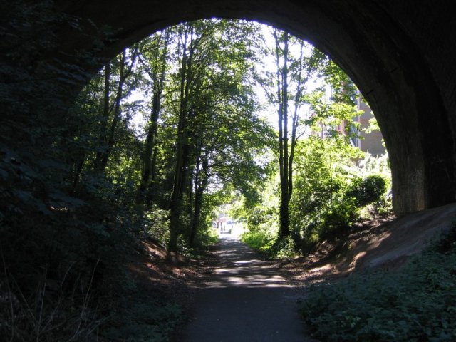
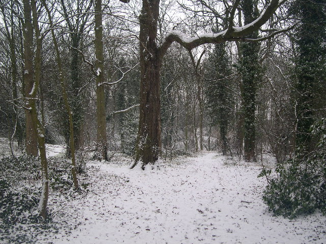
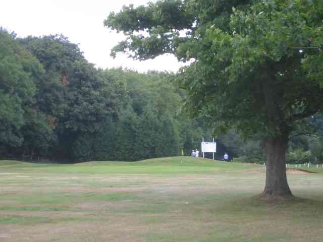
The heath is characterized by its rolling landscape, with a mix of grassland, woodland, and small ponds, providing a diverse habitat for various plant and animal species. It is particularly renowned for its ancient oak trees, some of which are over 400 years old, adding to the area's charm and heritage.

Bernards Heath has a rich history dating back thousands of years. It was once part of the ancient Verulamium, a Roman town that was one of the largest and most important settlements in Roman Britain. Today, remnants of this history can still be seen, with archaeological evidence of Roman buildings and artifacts discovered in the area.

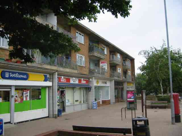
In addition to its natural beauty and historical value, Bernards Heath is also a popular recreational area for locals and visitors. It offers a peaceful environment for walking, jogging, picnicking, and enjoying nature. The heath also hosts various community events throughout the year, including fairs and festivals.

Overall, Bernards Heath is a treasured part of Hertfordshire's landscape, combining its natural splendor, historical significance, and recreational opportunities, making it a beloved destination for residents and tourists alike.

If you have any feedback on the listing, please let us know in the comments section below.

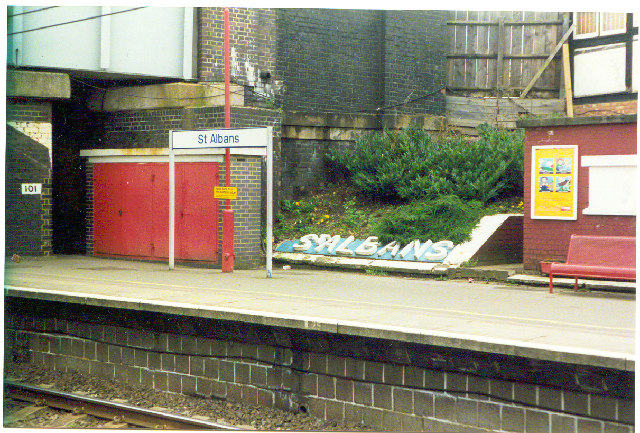
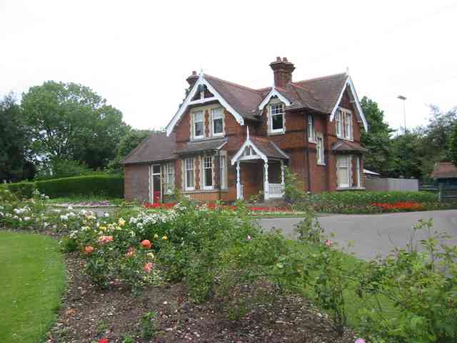
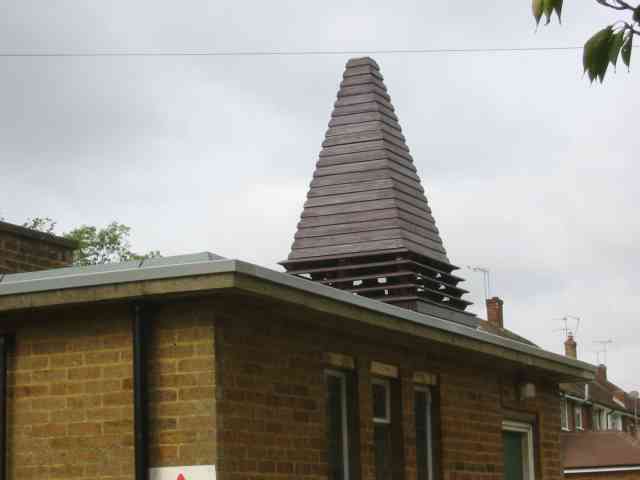
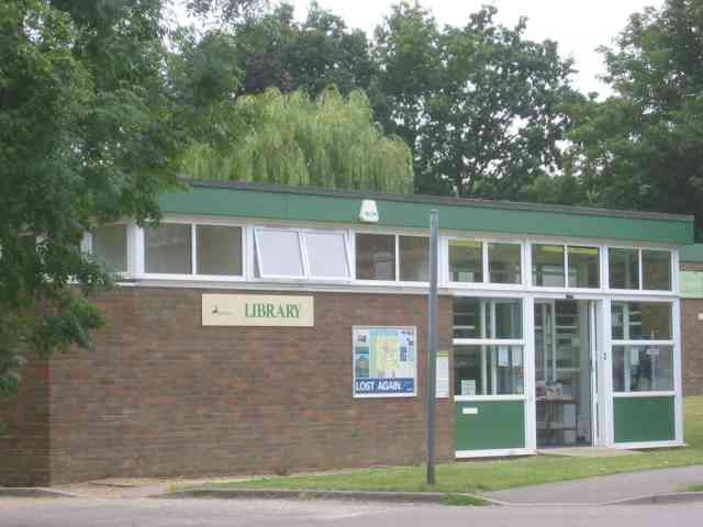
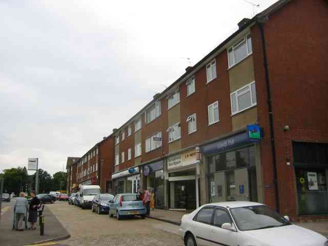
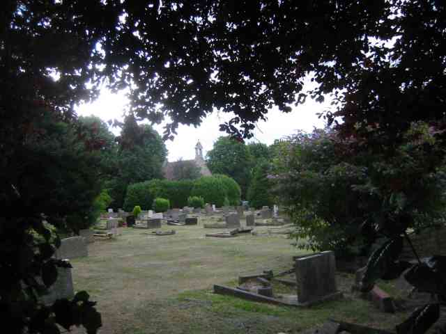
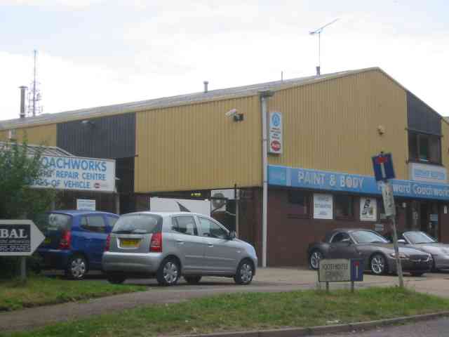
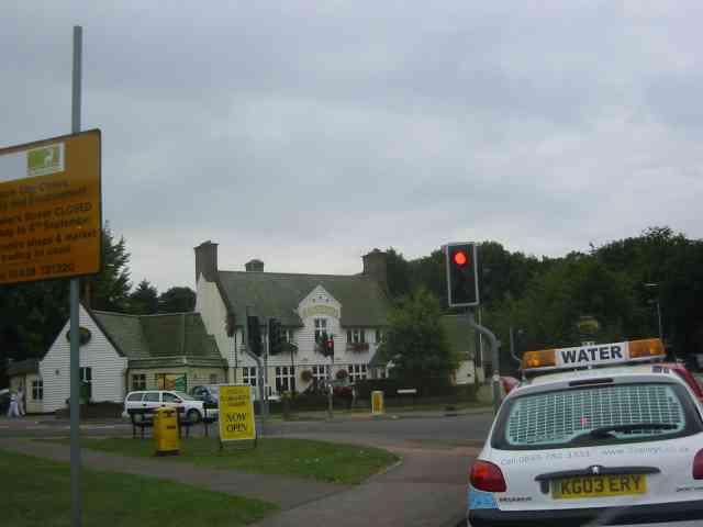
Bernards Heath Images

Images are sourced within 2km of 51.762752/-0.32672226 or Grid Reference TL1508. Thanks to Geograph Open Source API. All images are credited.

Over to Menswear, St Albans A bridge over the south end of Drovers Way takes customers from the main M&S store to a windowless satellite store (right) devoted to menswear.
Photo number 7667276.
Over to Menswear, St Albans
A bridge over the south end of Drovers Way takes customers from the main M&S store to a windowless satellite store (right) devoted to menswear. Photo number 7667276.
St Alban's cathedral The west front as rebuilt in the late C19 by a benefactor, Lord Grimthorpe, to his own specification. From TL143071, looking East
St Alban's cathedral
The west front as rebuilt in the late C19 by a benefactor, Lord Grimthorpe, to his own specification. From TL143071, looking East
St Albans cathedral Looking West from TL146070
St Albans cathedral
Looking West from TL146070
Beech Bottom Dyke Iron Age earthwork in the middle of an urban area.
Beech Bottom Dyke
Iron Age earthwork in the middle of an urban area.
Railway Bridge over the Alban Way Just near London Road is a pedestrian route from St.Albans to Hatfield.
Railway Bridge over the Alban Way
Just near London Road is a pedestrian route from St.Albans to Hatfield.
RUPP through Bentsley spinney, Marshalswick (Road Used as a Public Path) TL1609 has changed dramatically since the 30s. Post war housing now dominates land use in the SE of the square, newer housing to the SW and W, schools and community open space to the north.

Happily there remain several green spaces, including Bentsley Spinney at the west edge of the square. Bentsey Spinney used to be used for gravel extraction, deressions due to gravel pit existing in the Spinney.

TL1609.. a nice place to live...
RUPP through Bentsley spinney, Marshalswick
(Road Used as a Public Path) TL1609 has changed dramatically since the 30s. Post war housing now dominates land use in the SE of the square, newer housing to the SW and W, schools and community open space to the north. Happily there remain several green spaces, including Bentsley Spinney at the west edge of the square. Bentsey Spinney used to be used for gravel extraction, deressions due to gravel pit existing in the Spinney. TL1609.. a nice place to live...
Where are we? St. Albans Railway Station is not shy in proclaiming its identity.  See Stacey Harris's photo <a href="https://www.geograph.org.uk/photo/788654">TL1507 : St Albans Station</a> for the context of this close-up.
Where are we?
St. Albans Railway Station is not shy in proclaiming its identity. See Stacey Harris's photo TL1507 : St Albans Station for the context of this close-up.
Clarence Park Cafe  St Albans This cafe used to be the public lavatories until 
using a toilet went out of fashion.
Clarence Park Cafe St Albans
This cafe used to be the public lavatories until using a toilet went out of fashion.
The Lodge  Clarence Park St Albans A tied cottage provided for the Parks Superintendent. His office is the small room to the left
The Lodge Clarence Park St Albans
A tied cottage provided for the Parks Superintendent. His office is the small room to the left
Church Tower at Marshalswick St Albans I am still trying to ascertain what is hidden inside this unusual structure. Bell or air conditioner?
Church Tower at Marshalswick St Albans
I am still trying to ascertain what is hidden inside this unusual structure. Bell or air conditioner?
The library at Marshalswick The library complements the large collection of shops on the other side of The Ridgeway
The library at Marshalswick
The library complements the large collection of shops on the other side of The Ridgeway
Shopping Parade in The Ridgeway, Marshalswick This line of shops continues around the corner and is provided with a large car park. So is a busy area.
Shopping Parade in The Ridgeway, Marshalswick
This line of shops continues around the corner and is provided with a large car park. So is a busy area.
The Cemetery in Hatfield Road St Albans Despite having been in existence for almost a century there are still open spaces as in the photograph.
The Cemetery in Hatfield Road St Albans
Despite having been in existence for almost a century there are still open spaces as in the photograph.
Warehouses in Valley Road St Albans This business park is in complete contrast to the rural look of the beech bottom
Warehouses in Valley Road St Albans
This business park is in complete contrast to the rural look of the beech bottom
Harvester Pub on Harpenden Road crossing The pub has been refurbished and enlarged
Harvester Pub on Harpenden Road crossing
The pub has been refurbished and enlarged
Parade of shops on High Oaks in New Greens The group of shops includes the Co-op mini market and a post office.
Parade of shops on High Oaks in New Greens
The group of shops includes the Co-op mini market and a post office.
Changing rooms for football  and tennis  New Greens The appearance is rather grim but the buildings suffer rough treatment
Changing rooms for football and tennis New Greens
The appearance is rather grim but the buildings suffer rough treatment
Golf links at Batchwood Hall The golf links surround the hall and the woods have been adapted to provide the clearways.
Golf links at Batchwood Hall
The golf links surround the hall and the woods have been adapted to provide the clearways.
Show me another place!

Bernards Heath is located at Grid Ref: TL1508 (Lat: 51.762752, Lng: -0.32672226)

Administrative County: Hertfordshire

District: St. Albans

Police Authority: Hertfordshire

What 3 Words

///little.noise.apple. Near St Albans, Hertfordshire

Related Wikis

Bernards Heath

Bernards Heath is a heathland in St Albans, Hertfordshire, the site of the Second Battle of St Albans in 1461 during the Wars of the Roses. In the 19th...
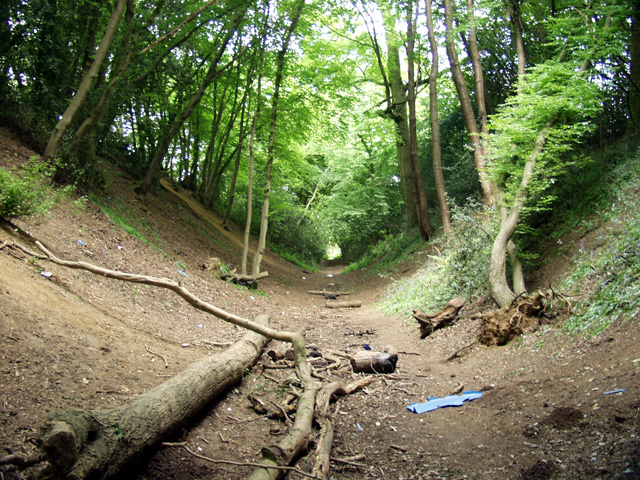
Beech Bottom Dyke

Beech Bottom Dyke, is a large ditch running for almost a mile at the northern edge of St Albans, Hertfordshire flanked by banks on both sides. It is up...

St Albans High School for Girls

St Albans High School for Girls is a selective, private day school for girls aged 4 – 18 years, which is affiliated to the Church of England and takes...

St Albans Girls' School

St Albans Girls' School, usually referred to as STAGS, is a girls' secondary school in St Albans, Hertfordshire. It was formerly known as "St Albans Girls...

St Peter, Hertfordshire

St Peter was an ancient parish in Hertfordshire, England that was abolished for civil purposes in 1894. It was also known as St Albans St Peter. The parish...

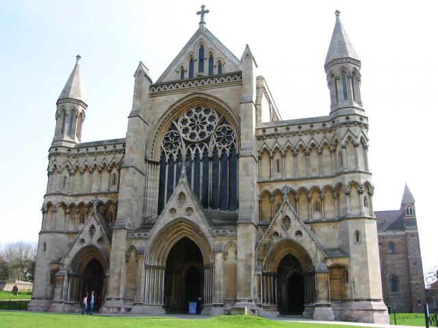
Church of St Peter, St Albans

St Peter's Church is a Church of England parish church. It is located in St Albans, England, at the northern end of the town centre. == Background == It...

Oaklands College

Oaklands College is a further education college in Hertfordshire, United Kingdom. It was established in 1991 when further education was reorganised. The...

Mix 92.6

Mix 92.6 (formerly Radio Verulam) is a Hertfordshire based non-profit community radio station run by Verulam Community Radio Ltd (VCRL).The station is...

Nearby Amenities

Located within 500m of 51.762752,-0.32672226
Crossing
Crossing: marked
Crossing Island: no
Tactile Paving: yes
Lat/Long: 51.7585738/-0.3246462
Created By: Merkaartor 0.12
Lat/Long: 51.7600021/-0.3221372
Created By: Merkaartor 0.12
Lat/Long: 51.7647103/-0.3213884
Created By: Merkaartor 0.12
Lat/Long: 51.7621322/-0.3214509
Post Box
Brand: Royal Mail
Brand Wikidata: Q638098
Brand Wikipedia: en:Royal Mail
Check Date: 2023-05-27
Collection Times: Mo-Fr 09:00, Sa 07:00
Operator: Royal Mail
Operator Wikidata: Q638098
Post Box Type: pillar
Ref: AL1 188D
Royal Cypher: GR
Royal Cypher Wikidata: Q33102273
Lat/Long: 51.763326/-0.3260767
Bus Stop
Lancaster Road
Bench: yes
Bin: yes
Bus: yes
Lit: yes
Naptan AtcoCode: 210021502280
Naptan Bearing: SW
Naptan CommonName: Lancaster Road
Naptan Crossing: opp Marshall Avenue
Naptan Indicator: adj
Naptan Landmark: opp Marshall Avenue
Naptan NaptanCode: hrtdadgt
Naptan PlusbusZoneRef: STALBCY
Naptan ShortCommonName: NA
Naptan Street: Sandridge Road
Naptan Verified: no
Public Transport: platform
Shelter: yes
Source: naptan_import
Tactile Paving: yes
Lat/Long: 51.7651224/-0.3236204
Bus Stop
Seymour Road
Bench: yes
Bin: no
Bus: yes
Lit: yes
Naptan AtcoCode: 210021502300
Naptan Bearing: SW
Naptan CommonName: Seymour Road
Naptan Crossing: Archers Fields
Naptan Indicator: opp
Naptan Landmark: Archers Fields
Naptan NaptanCode: hrtdadja
Naptan PlusbusZoneRef: STALBCY
Naptan ShortCommonName: NA
Naptan Street: Sandridge Road
Naptan Verified: no
Public Transport: platform
Shelter: yes
Source: naptan_import
Tactile Paving: no
Lat/Long: 51.7629631/-0.3263875
Bus Stop
Boundary Road
Bench: yes
Bin: yes
Bus: yes
Check Date Shelter: 2023-05-27
Lit: yes
Naptan AtcoCode: 210021502320
Naptan Bearing: SW
Naptan CommonName: Boundary Road
Naptan Crossing: opp Recreation Ground
Naptan Indicator: adj
Naptan Landmark: opp Recreation Ground
Naptan NaptanCode: hrtdadjd
Naptan PlusbusZoneRef: STALBCY
Naptan ShortCommonName: NA
Naptan Street: Sandridge Road
Naptan Verified: no
Public Transport: platform
Shelter: yes
Source: naptan_import
Tactile Paving: no
Lat/Long: 51.7607662/-0.3290275
Bus Stop
Boundary Road
Bench: no
Bin: no
Bus: yes
Lit: yes
Naptan AtcoCode: 210021509480
Naptan Bearing: NE
Naptan CommonName: Boundary Road
Naptan Crossing: Recreation Ground
Naptan Indicator: opp
Naptan Landmark: Recreation Ground
Naptan NaptanCode: hrtatpmd
Naptan PlusbusZoneRef: STALBCY
Naptan ShortCommonName: NA
Naptan Street: Sandridge Road
Naptan Verified: no
Public Transport: platform
Shelter: no
Source: naptan_import
Tactile Paving: no
Lat/Long: 51.7602639/-0.3298238
Bus Stop
Seymour Road
Bench: yes
Bin: no
Bus: yes
Lit: yes
Local Ref: NR
Naptan AtcoCode: 210021509500
Naptan Bearing: NE
Naptan CommonName: Seymour Road
Naptan Crossing: Marshall Avenue
Naptan Indicator: nr
Naptan Landmark: Marshall Avenue
Naptan NaptanCode: hrtatpdm
Naptan PlusbusZoneRef: STALBCY
Naptan ShortCommonName: NA
Naptan Street: Sandridge Road
Naptan Verified: no
Public Transport: platform
Shelter: no
Source: naptan_import
Tactile Paving: no
Lat/Long: 51.7633261/-0.3260598
Bus Stop
Lancaster Road
Bench: yes
Bin: yes
Bus: yes
Lit: yes
Naptan AtcoCode: 210021509520
Naptan Bearing: NE
Naptan CommonName: Lancaster Road
Naptan Crossing: Beech Road
Naptan Indicator: opp
Naptan Landmark: Beech Road
Naptan NaptanCode: hrtatpdp
Naptan PlusbusZoneRef: STALBCY
Naptan ShortCommonName: NA
Naptan Street: Sandridge Road
Naptan Verified: no
Public Transport: platform
Shelter: no
Source: naptan_import
Tactile Paving: no
Lat/Long: 51.7656277/-0.3231089
Bus Stop
Walton Street
Bench: no
Bus: yes
Naptan AtcoCode: 210021509560
Naptan Bearing: E
Naptan CommonName: Walton Street
Naptan Crossing: St Saviour's Church
Naptan Indicator: adj
Naptan Landmark: St Saviour's Church
Naptan NaptanCode: hrtatpga
Naptan PlusbusZoneRef: STALBCY
Naptan ShortCommonName: NA
Naptan Street: Sandpit Lane
Naptan Verified: no
Public Transport: platform
Shelter: no
Source: naptan_import
Tactile Paving: no
Lat/Long: 51.7583897/-0.3275793
Addr Housenumber: 9
Lat/Long: 51.7602545/-0.3323184
Crossing
Crossing: unmarked
Lat/Long: 51.7584505/-0.3255719
Crossing
Crossing: unmarked
Lat/Long: 51.7584172/-0.3279969
Addr Housenumber: 2
Addr Street: Boundary Road
Lat/Long: 51.760383/-0.3292088
Addr Housenumber: 1
Lat/Long: 51.7601331/-0.3317889
Addr Housenumber: 24
Addr Postcode: AL1 4AD
Lat/Long: 51.7604476/-0.3312272
Crossing
Button Operated: yes
Crossing: traffic_signals
Crossing Island: no
Tactile Paving: yes
Traffic Signals Vibration: yes
Lat/Long: 51.7618449/-0.3278467
Londis
Addr City: St Albans
Addr County: Hertfordshire
Addr Housenumber: 92
Addr Postcode: AL1 4AP
Addr Street: Sandridge Road
Brand: Londis
Brand Wikidata: Q21008564
Brand Wikipedia: en:Londis (United Kingdom)
Fhrs Id: 305864
Opening Hours: Mo-Sa 07:30-21:00; Su 09:00-21:00
Shop: convenience
Source Addr: FHRS Open Data
Lat/Long: 51.7605252/-0.3291014
Addr Housenumber: 152
Addr Street: Sandridge Road
Lat/Long: 51.761442/-0.3278871
Addr Housenumber: 128
Addr Postcode: AL1 4AP
Addr Street: Sandridge Road
Lat/Long: 51.7610241/-0.3284511
Addr Housenumber: 94
Addr Postcode: AL1 4AP
Addr Street: Sandridge Road
Lat/Long: 51.7605764/-0.3289912
Addr Housenumber: 21
Lat/Long: 51.7618438/-0.3259363
Addr Housenumber: 14
Lat/Long: 51.7617235/-0.3255239
Addr Housenumber: 13
Addr Postcode: AL1 4EL
Lat/Long: 51.762009/-0.3257599
Addr Housenumber: 22
Lat/Long: 51.7618264/-0.326342
Addr Housenumber: 27
Lat/Long: 51.7620787/-0.3261938
Addr Housenumber: 9
Addr Postcode: AL1 4EL
Lat/Long: 51.7622265/-0.3256365
Traffic Calming: island
Lat/Long: 51.7653282/-0.3232464
Addr Housenumber: 11
Addr Street: Fontmell Close
Lat/Long: 51.7625105/-0.3285986
Addr Housenumber: 8
Lat/Long: 51.7626001/-0.3294991
Addr Housenumber: 39
Lat/Long: 51.7641081/-0.3299714
Post Box
Brand: Royal Mail
Brand Wikidata: Q638098
Brand Wikipedia: en:Royal Mail
Drive Through: no
Operator: Royal Mail
Operator Wikidata: Q638098
Post Box Type: lamp
Ref: AL3 391
Royal Cypher: EIIR
Royal Cypher Wikidata: Q33102113
Lat/Long: 51.7664573/-0.3302528
Addr Housenumber: 21
Addr Postcode: AL1 4BA
Lat/Long: 51.7597782/-0.3307911
Crossing
Crossing: marked
Crossing Island: no
Crossing Ref: zebra
Kerb: lowered
Tactile Paving: yes
Lat/Long: 51.764832/-0.3241022
Give Way
Direction: backward
Lat/Long: 51.7584774/-0.3251226
Bench
Backrest: yes
Lat/Long: 51.7583889/-0.3253267
Waste Basket
Waste: trash
Lat/Long: 51.7651294/-0.323592
Board Type: history
Check Date: 2023-03-08
Information: board
Tourism: information
Lat/Long: 51.7653654/-0.3235238
Crossing
Button Operated: yes
Crossing: traffic_signals
Crossing Island: no
Tactile Paving: yes
Traffic Signals Sound: yes
Traffic Signals Vibration: yes
Lat/Long: 51.7583532/-0.3282481
Board Type: history
Check Date: 2023-05-27
Direction: 125
Information: board
Tourism: information
Lat/Long: 51.7625032/-0.3271732
Traffic Calming: island
Lat/Long: 51.7584513/-0.3251025
Direction: 180
Generator Method: photovoltaic
Generator Output Electricity: yes
Generator Solar Modules: 11
Generator Source: solar
Generator Type: solar_photovoltaic_panel
Location: roof
Power: generator
Lat/Long: 51.7625998/-0.3226773
Direction: 90
Generator Method: photovoltaic
Generator Output Electricity: yes
Generator Solar Modules: 16
Generator Source: solar
Generator Type: solar_photovoltaic_panel
Location: roof
Power: generator
Lat/Long: 51.7644402/-0.3227676
Direction: 200
Generator Method: photovoltaic
Generator Output Electricity: yes
Generator Solar Modules: 7
Generator Source: solar
Generator Type: solar_photovoltaic_panel
Location: roof
Power: generator
Lat/Long: 51.7644602/-0.3239514
Direction: 20
Generator Method: photovoltaic
Generator Output Electricity: yes
Generator Solar Modules: 7
Generator Source: solar
Generator Type: solar_photovoltaic_panel
Location: roof
Power: generator
Lat/Long: 51.7644861/-0.3239371
Direction: 110
Generator Method: photovoltaic
Generator Output Electricity: yes
Generator Solar Modules: 8
Generator Source: solar
Generator Type: solar_photovoltaic_panel
Location: roof
Power: generator
Lat/Long: 51.7632873/-0.3253772
Direction: 200
Fixme: survey for panel count
Generator Method: photovoltaic
Generator Output Electricity: yes
Generator Solar Modules: 7
Generator Source: solar
Generator Type: solar_photovoltaic_panel
Location: roof
Power: generator
Lat/Long: 51.763269/-0.325435
Crossing
Crossing: unmarked
Crossing Island: yes
Tactile Paving: no
Lat/Long: 51.7626483/-0.3268541
Direction: 195
Generator Method: photovoltaic
Generator Output Electricity: yes
Generator Solar Modules: 8
Generator Source: solar
Generator Type: solar_photovoltaic_panel
Location: roof
Power: generator
Lat/Long: 51.7611322/-0.3205224
Direction: 105
Generator Method: photovoltaic
Generator Output Electricity: yes
Generator Solar Modules: 7
Generator Source: solar
Generator Type: solar_photovoltaic_panel
Location: roof
Power: generator
Lat/Long: 51.7611741/-0.3204968
Direction: 180
Generator Method: photovoltaic
Generator Output Electricity: yes
Generator Solar Modules: 7
Generator Source: solar
Generator Type: solar_photovoltaic_panel
Location: roof
Power: generator
Lat/Long: 51.7636159/-0.3205813
Direction: 225
Generator Method: photovoltaic
Generator Output Electricity: yes
Generator Solar Modules: 9
Generator Source: solar
Generator Type: solar_photovoltaic_panel
Location: roof
Power: generator
Lat/Long: 51.7648583/-0.3315372
Direction: 135
Generator Method: photovoltaic
Generator Output Electricity: yes
Generator Solar Modules: 9
Generator Source: solar
Generator Type: solar_photovoltaic_panel
Location: roof
Power: generator
Lat/Long: 51.7648501/-0.3314888
Direction: 225
Generator Method: photovoltaic
Generator Output Electricity: yes
Generator Solar Modules: 10
Generator Source: solar
Generator Type: solar_photovoltaic_panel
Location: roof
Power: generator
Lat/Long: 51.7633001/-0.3282682
Direction: 220
Generator Method: photovoltaic
Generator Output Electricity: yes
Generator Solar Modules: 5
Generator Source: solar
Generator Type: solar_photovoltaic_panel
Location: roof
Power: generator
Lat/Long: 51.7643544/-0.3272486
Direction: 165
Generator Method: photovoltaic
Generator Output Electricity: yes
Generator Solar Modules: 33
Generator Source: solar
Generator Type: solar_photovoltaic_panel
Location: roof
Power: generator
Tilt: 20
Lat/Long: 51.7649059/-0.3282618
Direction: 225
Generator Method: photovoltaic
Generator Output Electricity: yes
Generator Solar Modules: 12
Generator Source: solar
Generator Type: solar_photovoltaic_panel
Location: roof
Power: generator
Lat/Long: 51.760284/-0.3324134
Direction: 225
Generator Method: photovoltaic
Generator Output Electricity: yes
Generator Solar Modules: 8
Generator Source: solar
Generator Type: solar_photovoltaic_panel
Location: roof
Power: generator
Lat/Long: 51.7608167/-0.3308303
Crossing
Crossing: unmarked
Crossing Island: yes
Tactile Paving: yes
Lat/Long: 51.7604463/-0.3294713
Traffic Calming: island
Lat/Long: 51.7615445/-0.3281877
Direction: 215
Generator Method: photovoltaic
Generator Output Electricity: yes
Generator Solar Modules: 20
Generator Source: solar
Generator Type: solar_photovoltaic_panel
Location: roof
Power: generator
Lat/Long: 51.762149/-0.3285844
Direction: 125
Generator Method: photovoltaic
Generator Output Electricity: yes
Generator Solar Modules: 16
Generator Source: solar
Generator Type: solar_photovoltaic_panel
Location: roof
Power: generator
Lat/Long: 51.7623259/-0.3292501
Direction: 125
Generator Method: photovoltaic
Generator Output Electricity: yes
Generator Solar Modules: 18
Generator Source: solar
Generator Type: solar_photovoltaic_panel
Location: roof
Power: generator
Lat/Long: 51.7626617/-0.3279009
Direction: 220
Generator Method: photovoltaic
Generator Output Electricity: yes
Generator Solar Modules: 10
Generator Source: solar
Generator Type: solar_photovoltaic_panel
Location: roof
Power: generator
Lat/Long: 51.7629687/-0.3288993
Direction: 240
Generator Method: photovoltaic
Generator Output Electricity: yes
Generator Solar Modules: 14
Generator Source: solar
Generator Type: solar_photovoltaic_panel
Location: roof
Power: generator
Lat/Long: 51.7627277/-0.3299637
Direction: 215
Generator Method: photovoltaic
Generator Output Electricity: yes
Generator Solar Modules: 8
Generator Source: solar
Generator Type: solar_photovoltaic_panel
Location: roof
Power: generator
Lat/Long: 51.7668831/-0.3243901
Direction: 225
Generator Method: photovoltaic
Generator Output Electricity: yes
Generator Solar Modules: 6
Generator Source: solar
Generator Type: solar_photovoltaic_panel
Location: roof
Power: generator
Lat/Long: 51.7658531/-0.3275601
Give Way
Lat/Long: 51.7584045/-0.3279968
The data included in this document is from www.openstreetmap.org. The data is made available under ODbL.

Have you been to Bernards Heath?

Leave your review of Bernards Heath below (or comments, questions and feedback).