Bernard's Heath

Wood, Forest in Hertfordshire St. Albans

England

Bernard's Heath

Barber, St Albans Round the corner from Barclays Bank in St Peter's Street, on the way to the civic centre and council offices, is a barber doubling as a coffee shop. 'Barber & Barista' says the A-board (on castors), aka 'Picasso Cut & Coffee'. The connection with Picasso is unclear.
Photo number 7688897.
Barber, St Albans Credit: Robin Stott

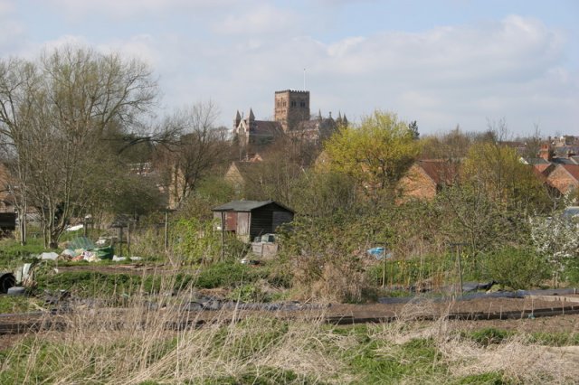
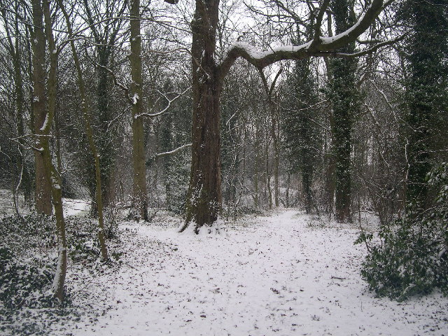
Bernard's Heath, located in Hertfordshire, England, is a charming woodland area known for its natural beauty and historical significance. This ancient forest is situated just north of the city of St Albans and covers an area of approximately 63 acres.

The woodland is named after St Bernard's Monastery, which was established in the 12th century by the Order of St Bernard. Although the monastery is no longer standing, the forest still bears its name as a testament to its past.

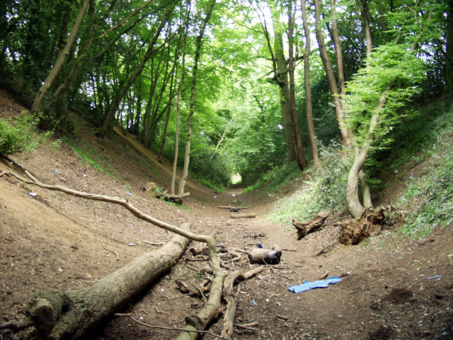
Bernard's Heath is predominantly composed of oak and birch trees, creating a dense and lush canopy. It is home to a variety of wildlife, including birds, squirrels, and deer. The forest is also known for its vibrant wildflowers, which bloom in abundance during the spring and summer months.

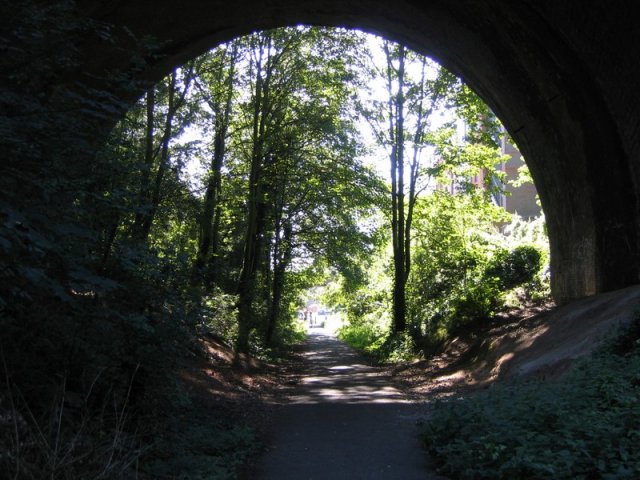
This natural oasis offers numerous walking trails, making it a popular destination for outdoor enthusiasts. Visitors can explore the forest's winding paths, immersing themselves in the peaceful ambiance and enjoying the sights and sounds of nature. The area is also equipped with picnic benches and open spaces, providing the perfect setting for a leisurely outdoor meal or gathering.

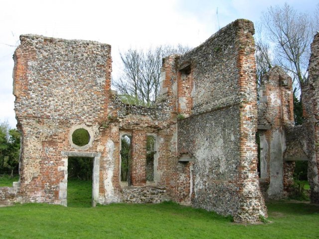
In addition to its natural beauty, Bernard's Heath holds historical significance. The remains of an Iron Age hillfort can be found within the woodland, offering a glimpse into the area's ancient past. Archaeological discoveries have also uncovered artifacts from Roman and Saxon settlements, further adding to its historical value.

Overall, Bernard's Heath is a picturesque woodland retreat, offering a tranquil escape from the hustle and bustle of everyday life. With its rich history and stunning natural surroundings, it is a place of both beauty and intrigue for visitors to explore and enjoy.

If you have any feedback on the listing, please let us know in the comments section below.

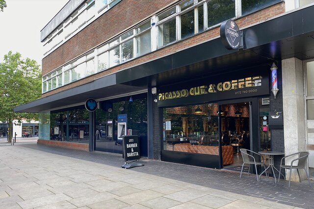
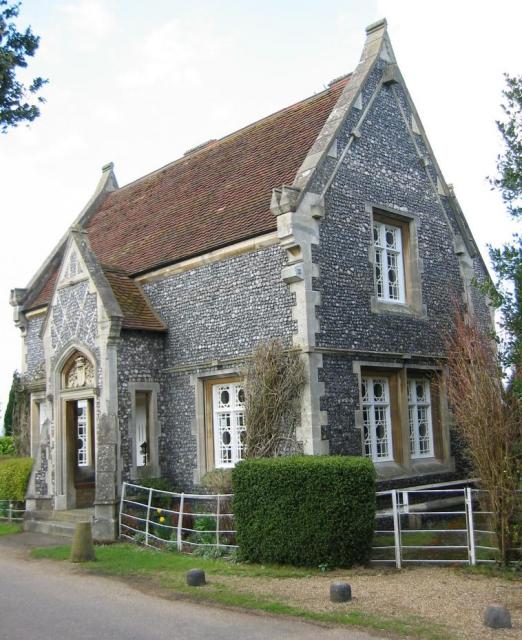
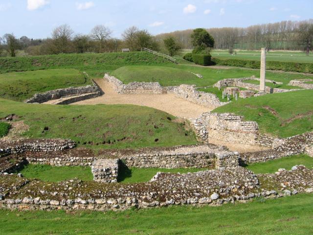
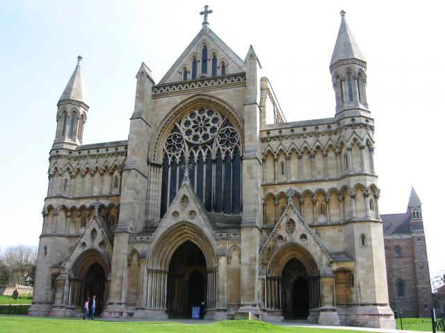
Bernard's Heath Images

Images are sourced within 2km of 51.762229/-0.33482752 or Grid Reference TL1508. Thanks to Geograph Open Source API. All images are credited.

Barber, St Albans Round the corner from Barclays Bank in St Peter's Street, on the way to the civic centre and council offices, is a barber doubling as a coffee shop. 'Barber & Barista' says the A-board (on castors), aka 'Picasso Cut & Coffee'. The connection with Picasso is unclear.
Photo number 7688897.
Barber, St Albans
Round the corner from Barclays Bank in St Peter's Street, on the way to the civic centre and council offices, is a barber doubling as a coffee shop. 'Barber & Barista' says the A-board (on castors), aka 'Picasso Cut & Coffee'. The connection with Picasso is unclear. Photo number 7688897.
Stone house House by the entrance to Verulamium Roman Theatre, on the left hand side coming into St Albans along the A4147 (TL135074).
Stone house
House by the entrance to Verulamium Roman Theatre, on the left hand side coming into St Albans along the A4147 (TL135074).
Roman theatre at Verulamium Remains of the theatre at the Roman city of Verulamium (Saint Albans), TL134074.
Roman theatre at Verulamium
Remains of the theatre at the Roman city of Verulamium (Saint Albans), TL134074.
St Alban's cathedral The west front as rebuilt in the late C19 by a benefactor, Lord Grimthorpe, to his own specification. From TL143071, looking East
St Alban's cathedral
The west front as rebuilt in the late C19 by a benefactor, Lord Grimthorpe, to his own specification. From TL143071, looking East
St Albans cathedral Looking West from TL146070
St Albans cathedral
Looking West from TL146070
Beech Bottom Dyke Iron Age earthwork in the middle of an urban area.
Beech Bottom Dyke
Iron Age earthwork in the middle of an urban area.
Ruined nunnery The ruined nunnery at TL151064
Ruined nunnery
The ruined nunnery at TL151064
The Allotments Near the River Ver are the Allotments just off Cottonmill Lane.
The Allotments
Near the River Ver are the Allotments just off Cottonmill Lane.
Railway Bridge over the Alban Way Just near London Road is a pedestrian route from St.Albans to Hatfield.
Railway Bridge over the Alban Way
Just near London Road is a pedestrian route from St.Albans to Hatfield.
RUPP through Bentsley spinney, Marshalswick (Road Used as a Public Path) TL1609 has changed dramatically since the 30s. Post war housing now dominates land use in the SE of the square, newer housing to the SW and W, schools and community open space to the north.

Happily there remain several green spaces, including Bentsley Spinney at the west edge of the square. Bentsey Spinney used to be used for gravel extraction, deressions due to gravel pit existing in the Spinney.

TL1609.. a nice place to live...
RUPP through Bentsley spinney, Marshalswick
(Road Used as a Public Path) TL1609 has changed dramatically since the 30s. Post war housing now dominates land use in the SE of the square, newer housing to the SW and W, schools and community open space to the north. Happily there remain several green spaces, including Bentsley Spinney at the west edge of the square. Bentsey Spinney used to be used for gravel extraction, deressions due to gravel pit existing in the Spinney. TL1609.. a nice place to live...
Where are we? St. Albans Railway Station is not shy in proclaiming its identity.  See Stacey Harris's photo <a href="https://www.geograph.org.uk/photo/788654">TL1507 : St Albans Station</a> for the context of this close-up.
Where are we?
St. Albans Railway Station is not shy in proclaiming its identity. See Stacey Harris's photo TL1507 : St Albans Station for the context of this close-up.
Clarence Park Cafe  St Albans This cafe used to be the public lavatories until 
using a toilet went out of fashion.
Clarence Park Cafe St Albans
This cafe used to be the public lavatories until using a toilet went out of fashion.
The Lodge  Clarence Park St Albans A tied cottage provided for the Parks Superintendent. His office is the small room to the left
The Lodge Clarence Park St Albans
A tied cottage provided for the Parks Superintendent. His office is the small room to the left
The King Harry Pub St Albans This is an awkward junction with a double mini roundabout. Best avoided if possible. {see note re St Stephens Church}
The King Harry Pub St Albans
This is an awkward junction with a double mini roundabout. Best avoided if possible. {see note re St Stephens Church}
Church Tower at Marshalswick St Albans I am still trying to ascertain what is hidden inside this unusual structure. Bell or air conditioner?
Church Tower at Marshalswick St Albans
I am still trying to ascertain what is hidden inside this unusual structure. Bell or air conditioner?
The Parish Church of St Michael, St Albans This church is on the edge of Verulamium park, close to the Roman museum. It was probably originally created to receive pilgrims on their way to the shrine of St Alban at the Abbey.
The Parish Church of St Michael, St Albans
This church is on the edge of Verulamium park, close to the Roman museum. It was probably originally created to receive pilgrims on their way to the shrine of St Alban at the Abbey.
View of the Abbey This was the view from my bedroom window in Riverside Close before the trees grew higher
View of the Abbey
This was the view from my bedroom window in Riverside Close before the trees grew higher
The library at Marshalswick The library complements the large collection of shops on the other side of The Ridgeway
The library at Marshalswick
The library complements the large collection of shops on the other side of The Ridgeway
Show me another place!

Bernard's Heath is located at Grid Ref: TL1508 (Lat: 51.762229, Lng: -0.33482752)

Administrative County: Hertfordshire

District: St. Albans

Police Authority: Hertfordshire

What 3 Words

///amber.table.sticks. Near St Albans, Hertfordshire

Related Wikis

Bernards Heath

Bernards Heath is a heathland in St Albans, Hertfordshire, the site of the Second Battle of St Albans in 1461 during the Wars of the Roses. In the 19th...

St Albans City Hospital

St Albans City Hospital is an acute District General Hospital in St Albans, Hertfordshire operated by the West Hertfordshire Hospitals NHS Trust. ��2...

St Albans High School for Girls

St Albans High School for Girls is a selective, private day school for girls aged 4 – 18 years, which is affiliated to the Church of England and takes...

St Peter, Hertfordshire

St Peter was an ancient parish in Hertfordshire, England that was abolished for civil purposes in 1894. It was also known as St Albans St Peter. The parish...

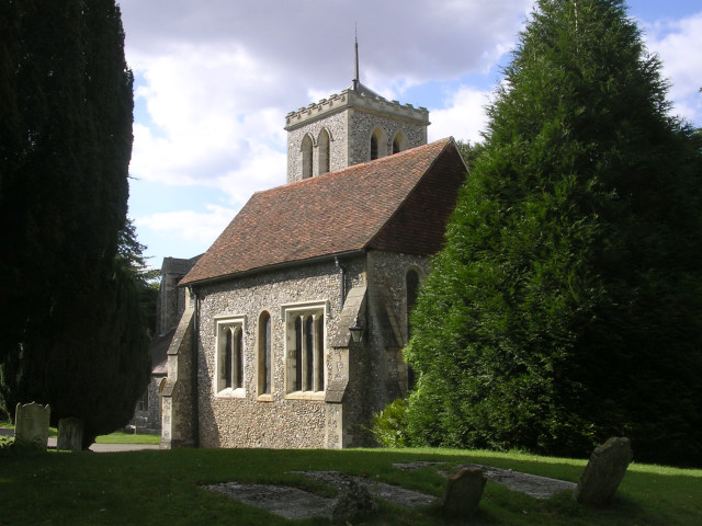
Church of St Peter, St Albans

St Peter's Church is a Church of England parish church. It is located in St Albans, England, at the northern end of the town centre. == Background == It...

St Albans

St Albans () is a cathedral city in Hertfordshire, England, east of Hemel Hempstead and west of Hatfield, 20 miles (32 km) north-west of London, 8 miles...

Second Battle of St Albans

The Second Battle of St Albans was fought on 17 February 1461 during the Wars of the Roses in St Albans, Hertfordshire, England (the First Battle of St...
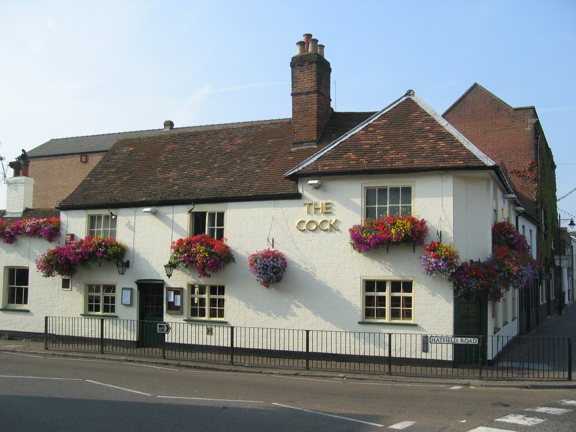
The Cock, St Albans

The Cock is a public house in St Albans, Hertfordshire, England. The grade II listed building dates back to around 1600 and has some timber framing....

Nearby Amenities

Located within 500m of 51.762229,-0.33482752
Traffic Signals
Ancient Briton Junction
Crossing: traffic_signals
Layer: 1
Traffic Signals: traffic_lights
Traffic Signals Direction: both
Lat/Long: 51.7658694/-0.3355033
Pub
Jolly Sailor
Addr City: St Albans
Addr County: Hertfordshire
Addr Postcode: AL1 4AA
Addr Street: Stonecross
Fhrs Id: 306301
Source Addr: FHRS Open Data
Wikidata: Q83559701
Lat/Long: 51.7585478/-0.3321066
Mini Roundabout
Direction: clockwise
Lat/Long: 51.760092/-0.34112
Crossing
Button Operated: yes
Crossing: traffic_signals
Crossing Island: yes
Tactile Paving: yes
Lat/Long: 51.7657565/-0.3355222
Restaurant
Amrit
Addr City: St Albans
Addr County: Hertfordshire
Addr Housenumber: 80
Addr Postcode: AL1 3DQ
Addr Street: St Peter's Street
Cuisine: indian
Fhrs Id: 1302227
Note: Formerlay the Cricketer's Inn
Source Addr: FHRS Open Data
Website: https://v2.amritstalbans.com/
Lat/Long: 51.7579464/-0.3330842
Crossing
Crossing: unmarked
Crossing Island: yes
Tactile Paving: yes
Lat/Long: 51.7600251/-0.3411594
Bus Stop
Heath Farm Lane
Bus: yes
Naptan AtcoCode: 210021501080
Naptan Bearing: S
Naptan CommonName: Heath Farm Lane
Naptan Crossing: Fire and Ambulance Station
Naptan Indicator: nr
Naptan Landmark: Fire and Ambulance Station
Naptan NaptanCode: hrtdajdm
Naptan PlusbusZoneRef: STALBCY
Naptan ShortCommonName: NA
Naptan Street: Harpenden Road
Naptan Verified: no
Public Transport: platform
Source: naptan_import
Lat/Long: 51.7609453/-0.3338272
Bus Stop
Stonecross
Bench: no
Bin: no
Bus: yes
Check Date Shelter: 2023-05-27
Naptan AtcoCode: 210021502260
Naptan Bearing: NW
Naptan CommonName: Stonecross
Naptan Crossing: Sandridge Road
Naptan Indicator: W-bound
Naptan Landmark: Sandridge Road
Naptan NaptanCode: hrtdadpt
Naptan PlusbusZoneRef: STALBCY
Naptan ShortCommonName: NA
Naptan Street: Sandpit Lane
Naptan Verified: no
Public Transport: platform
Shelter: no
Source: naptan_import
Tactile Paving: no
Lat/Long: 51.7585366/-0.3315876
Bus Stop
Boundary Road
Bench: yes
Bin: yes
Bus: yes
Check Date Shelter: 2023-05-27
Lit: yes
Naptan AtcoCode: 210021502320
Naptan Bearing: SW
Naptan CommonName: Boundary Road
Naptan Crossing: opp Recreation Ground
Naptan Indicator: adj
Naptan Landmark: opp Recreation Ground
Naptan NaptanCode: hrtdadjd
Naptan PlusbusZoneRef: STALBCY
Naptan ShortCommonName: NA
Naptan Street: Sandridge Road
Naptan Verified: no
Public Transport: platform
Shelter: yes
Source: naptan_import
Tactile Paving: no
Lat/Long: 51.7607662/-0.3290275
Bus Stop
Sheppards Close
Bus: yes
Naptan AtcoCode: 210021503010
Naptan Bearing: W
Naptan BusStopType: CUS
Naptan CommonName: Sheppards Close
Naptan Crossing: Seymour Road
Naptan Indicator: adj
Naptan Landmark: Seymour Road
Naptan NaptanCode: hrtawtjm
Naptan PlusbusZoneRef: STALBCY
Naptan ShortCommonName: NA
Naptan Street: Beech Road
Naptan Verified: no
Public Transport: platform
Source: naptan_import
Lat/Long: 51.76574/-0.3329017
Bus Stop
Boundary Road
Bench: no
Bin: no
Bus: yes
Lit: yes
Naptan AtcoCode: 210021509480
Naptan Bearing: NE
Naptan CommonName: Boundary Road
Naptan Crossing: Recreation Ground
Naptan Indicator: opp
Naptan Landmark: Recreation Ground
Naptan NaptanCode: hrtatpmd
Naptan PlusbusZoneRef: STALBCY
Naptan ShortCommonName: NA
Naptan Street: Sandridge Road
Naptan Verified: no
Public Transport: platform
Shelter: no
Source: naptan_import
Tactile Paving: no
Lat/Long: 51.7602639/-0.3298238
Bus Stop
Stonecross
Bench: no
Bus: yes
Naptan AtcoCode: 210021509540
Naptan Bearing: SE
Naptan CommonName: Stonecross
Naptan Crossing: Culver Road
Naptan Indicator: E-bound
Naptan Landmark: Culver Road
Naptan NaptanCode: hrtatpdw
Naptan PlusbusZoneRef: STALBCY
Naptan ShortCommonName: NA
Naptan Street: Sandpit Lane
Naptan Verified: no
Public Transport: platform
Shelter: no
Source: naptan_import
Tactile Paving: no
Lat/Long: 51.7584938/-0.331111
Bus Stop
Heath Farm Lane
Bus: yes
Naptan AtcoCode: 210021510680
Naptan Bearing: N
Naptan CommonName: Heath Farm Lane
Naptan Crossing: Townsend Drive
Naptan Indicator: opp
Naptan Landmark: Townsend Drive
Naptan NaptanCode: hrtatmam
Naptan PlusbusZoneRef: STALBCY
Naptan ShortCommonName: NA
Naptan Street: Harpenden Road
Naptan Verified: no
Public Transport: platform
Shelter: no
Source: naptan_import
Lat/Long: 51.7603871/-0.3338981
Bus Stop
Sheppards Close
Bus: yes
Naptan AtcoCode: 210021510690
Naptan Bearing: E
Naptan BusStopType: CUS
Naptan CommonName: Sheppards Close
Naptan Crossing: opp Seymour Road
Naptan Indicator: opp
Naptan Landmark: opp Seymour Road
Naptan NaptanCode: hrtatjpm
Naptan PlusbusZoneRef: STALBCY
Naptan ShortCommonName: NA
Naptan Street: Beech Road
Naptan Verified: no
Public Transport: platform
Source: naptan_import
Lat/Long: 51.7658119/-0.332899
Bus Stop
The Ancient Briton
Bus: yes
Naptan AtcoCode: 210021510700
Naptan Bearing: NE
Naptan CommonName: The Ancient Briton
Naptan Crossing: Batchwood Drive
Naptan Indicator: opp
Naptan Landmark: Batchwood Drive
Naptan NaptanCode: hrtatjpt
Naptan PlusbusZoneRef: STALBCY
Naptan ShortCommonName: NA
Naptan Street: Harpenden Road
Naptan Verified: no
Public Transport: platform
Source: naptan_import
Lat/Long: 51.766371/-0.3354702
Townsend
Place: suburb
Lat/Long: 51.7635507/-0.3409183
Crossing
Crossing: unmarked
Crossing Island: yes
Tactile Paving: no
Lat/Long: 51.7578401/-0.333542
Pharmacy
Normandy Pharmacy
Addr City: St Albans
Addr Housenumber: 52
Addr Postcode: AL3 5PE
Addr Street: Waverley Road
Dispensing: yes
Drive Through: no
Healthcare: pharmacy
Opening Hours: Mo-Fr 09:00-18:30; Sa 09:00-13:00
Phone: +44 1727 851 448
Lat/Long: 51.7602063/-0.3407191
Waverley Sports and Social Club
Leisure: sports_centre
Lat/Long: 51.7604471/-0.3410087
Addr Housenumber: 101
Lat/Long: 51.7584927/-0.3384727
Addr Housenumber: 38
Lat/Long: 51.7583533/-0.3381978
Addr Housenumber: 28
Lat/Long: 51.7602619/-0.3336018
Addr Housenumber: 9
Lat/Long: 51.7602545/-0.3323184
Addr Housenumber: 4
Addr Street: Sandridge Road
Lat/Long: 51.7587972/-0.3314518
Traffic Calming: island
Lat/Long: 51.7585968/-0.3316335
Addr Housenumber: 2
Addr Street: Boundary Road
Lat/Long: 51.760383/-0.3292088
Addr Housenumber: 1
Lat/Long: 51.7601331/-0.3317889
Addr Housenumber: 24
Addr Postcode: AL1 4AD
Lat/Long: 51.7604476/-0.3312272
Crossing
Button Operated: yes
Crossing: traffic_signals
Crossing Island: no
Tactile Paving: yes
Traffic Signals Vibration: yes
Lat/Long: 51.7618449/-0.3278467
Londis
Addr City: St Albans
Addr County: Hertfordshire
Addr Housenumber: 92
Addr Postcode: AL1 4AP
Addr Street: Sandridge Road
Brand: Londis
Brand Wikidata: Q21008564
Brand Wikipedia: en:Londis (United Kingdom)
Fhrs Id: 305864
Opening Hours: Mo-Sa 07:30-21:00; Su 09:00-21:00
Shop: convenience
Source Addr: FHRS Open Data
Lat/Long: 51.7605252/-0.3291014
Addr Housenumber: 152
Addr Street: Sandridge Road
Lat/Long: 51.761442/-0.3278871
Addr Housenumber: 128
Addr Postcode: AL1 4AP
Addr Street: Sandridge Road
Lat/Long: 51.7610241/-0.3284511
Addr Housenumber: 94
Addr Postcode: AL1 4AP
Addr Street: Sandridge Road
Lat/Long: 51.7605764/-0.3289912
Addr Housenumber: 11
Addr Street: Fontmell Close
Lat/Long: 51.7625105/-0.3285986
Addr Housenumber: 8
Lat/Long: 51.7626001/-0.3294991
Addr Housenumber: 39
Lat/Long: 51.7641081/-0.3299714
Addr Housenumber: 1
Lat/Long: 51.7652004/-0.3334314
Addr Housenumber: 2
Lat/Long: 51.7651353/-0.3334536
Crossing
Button Operated: yes
Crossing: traffic_signals
Crossing Island: yes
Tactile Paving: yes
Lat/Long: 51.7659869/-0.3354765
Addr Housenumber: 16
Lat/Long: 51.7646969/-0.3348957
Crossing
Button Operated: yes
Crossing: traffic_signals
Crossing Island: yes
Tactile Paving: yes
Lat/Long: 51.7658423/-0.3352346
Traffic Calming: island
Lat/Long: 51.7604663/-0.3364333
Crossing
Crossing: traffic_signals
Kerb: lowered
Tactile Paving: yes
Lat/Long: 51.7610842/-0.3339224
Addr Housename: Wilton Court
Lat/Long: 51.758223/-0.3354074
Addr Housenumber: 42
Lat/Long: 51.7580684/-0.3373528
Addr Housenumber: 80
Lat/Long: 51.7587/-0.3383798
Addr Housenumber: 61
Addr Postcode: AL3 5LZ
Lat/Long: 51.7587083/-0.3388452
Addr Housenumber: 59
Lat/Long: 51.7592907/-0.3383617
Addr Housenumber: 22
Addr Postcode: AL3 5LU
Addr Street: Carlisle Avenue
Lat/Long: 51.758443/-0.3361134
Addr Housenumber: 29
Lat/Long: 51.7595575/-0.3371801
Addr Housenumber: 1
Lat/Long: 51.7586228/-0.3352845
Addr Housenumber: 2
Lat/Long: 51.7588594/-0.3352055
Addr Housenumber: 36
Lat/Long: 51.7597187/-0.3392455
Addr Housenumber: 1
Lat/Long: 51.7606133/-0.3415071
Addr Housenumber: 1
Lat/Long: 51.7619638/-0.3403256
Addr Housenumber: 4
Lat/Long: 51.7621688/-0.3405697
Addr Housenumber: 9
Lat/Long: 51.7625357/-0.3409975
Addr Housenumber: 1
Lat/Long: 51.7633883/-0.3411663
Addr Housenumber: 10
Lat/Long: 51.7631833/-0.341623
Post Box
Brand: Royal Mail
Brand Wikidata: Q638098
Brand Wikipedia: en:Royal Mail
Operator: Royal Mail
Operator Wikidata: Q638098
Post Box Type: pillar
Ref: AL3 108
Royal Cypher: GR
Royal Cypher Wikidata: Q33102273
Lat/Long: 51.7605179/-0.3362842
Addr Housenumber: 21
Addr Postcode: AL1 4BA
Lat/Long: 51.7597782/-0.3307911
Bench
Backrest: yes
Lat/Long: 51.7605597/-0.3362934
Post Box
Brand: Royal Mail
Brand Wikidata: Q638098
Brand Wikipedia: en:Royal Mail
Collection Times: Mo-Fr 16:30; Sa 12:29
Operator: Royal Mail
Operator Wikidata: Q638098
Post Box Type: pillar
Ref: AL3 160
Royal Cypher: EIIR
Royal Cypher Wikidata: Q33102113
Lat/Long: 51.7601882/-0.34101
Crossing
Crossing: traffic_signals
Crossing Ref: toucan
Lat/Long: 51.7614167/-0.3340508
Direction: 240
Generator Method: photovoltaic
Generator Output Electricity: yes
Generator Solar Modules: 6
Generator Source: solar
Generator Type: solar_photovoltaic_panel
Location: roof
Power: generator
Lat/Long: 51.7638576/-0.340209
Direction: 150
Generator Method: photovoltaic
Generator Output Electricity: yes
Generator Solar Modules: 6
Generator Source: solar
Generator Type: solar_photovoltaic_panel
Location: roof
Power: generator
Lat/Long: 51.763847/-0.3401431
Direction: 225
Generator Method: photovoltaic
Generator Output Electricity: yes
Generator Solar Modules: 6
Generator Source: solar
Generator Type: solar_photovoltaic_panel
Location: roof
Power: generator
Lat/Long: 51.7603662/-0.3369452
Direction: 235
Generator Method: photovoltaic
Generator Output Electricity: yes
Generator Solar Modules: 14
Generator Source: solar
Generator Type: solar_photovoltaic_panel
Location: roof
Power: generator
Lat/Long: 51.7601482/-0.3376669
Direction: 145
Generator Method: photovoltaic
Generator Output Electricity: yes
Generator Solar Modules: 6
Generator Source: solar
Generator Type: solar_photovoltaic_panel
Location: roof
Power: generator
Lat/Long: 51.7601467/-0.3376351
Direction: 230
Generator Method: photovoltaic
Generator Output Electricity: yes
Generator Solar Modules: 16
Generator Source: solar
Generator Type: solar_photovoltaic_panel
Location: roof
Power: generator
Lat/Long: 51.7624383/-0.3419261
Crossing
Button Operated: yes
Crossing: traffic_signals
Crossing Island: yes
Tactile Paving: yes
Lat/Long: 51.7659215/-0.3356987
Direction: 220
Generator Method: photovoltaic
Generator Output Electricity: yes
Generator Solar Modules: 16
Generator Source: solar
Generator Type: solar_photovoltaic_panel
Location: roof
Power: generator
Lat/Long: 51.7586141/-0.3352873
Direction: 225
Fixme: survey: additional panel types? themal?
Generator Method: photovoltaic
Generator Output Electricity: yes
Generator Solar Modules: 7
Generator Source: solar
Generator Type: solar_photovoltaic_panel
Location: roof
Power: generator
Lat/Long: 51.7592604/-0.3349097
Traffic Calming: choker
Lat/Long: 51.7587154/-0.3371238
Direction: 225
Generator Method: photovoltaic
Generator Output Electricity: yes
Generator Solar Modules: 9
Generator Source: solar
Generator Type: solar_photovoltaic_panel
Location: roof
Power: generator
Lat/Long: 51.7648583/-0.3315372
Direction: 135
Generator Method: photovoltaic
Generator Output Electricity: yes
Generator Solar Modules: 9
Generator Source: solar
Generator Type: solar_photovoltaic_panel
Location: roof
Power: generator
Lat/Long: 51.7648501/-0.3314888
Direction: 225
Generator Method: photovoltaic
Generator Output Electricity: yes
Generator Solar Modules: 10
Generator Source: solar
Generator Type: solar_photovoltaic_panel
Location: roof
Power: generator
Lat/Long: 51.7633001/-0.3282682
Direction: 175
Generator Method: photovoltaic
Generator Output Electricity: yes
Generator Solar Modules: 10
Generator Source: solar
Generator Type: solar_photovoltaic_panel
Location: roof
Power: generator
Lat/Long: 51.7655408/-0.3330213
Direction: 155
Generator Method: photovoltaic
Generator Output Electricity: yes
Generator Solar Modules: 12
Generator Source: solar
Generator Type: solar_photovoltaic_panel
Location: roof
Power: generator
Lat/Long: 51.7649318/-0.3345652
Direction: 180
Generator Method: photovoltaic
Generator Output Electricity: yes
Generator Solar Modules: 10
Generator Source: solar
Generator Type: solar_photovoltaic_panel
Location: roof
Power: generator
Lat/Long: 51.7603724/-0.3340302
Direction: 180
Generator Method: photovoltaic
Generator Output Electricity: yes
Generator Solar Modules: 10
Generator Source: solar
Generator Type: solar_photovoltaic_panel
Location: roof
Power: generator
Lat/Long: 51.7600529/-0.3335706
Fixme: survey: solar panels?
Lat/Long: 51.7592208/-0.3336484
Direction: 225
Generator Method: photovoltaic
Generator Output Electricity: yes
Generator Solar Modules: 12
Generator Source: solar
Generator Type: solar_photovoltaic_panel
Location: roof
Power: generator
Lat/Long: 51.760284/-0.3324134
Direction: 225
Generator Method: photovoltaic
Generator Output Electricity: yes
Generator Solar Modules: 8
Generator Source: solar
Generator Type: solar_photovoltaic_panel
Location: roof
Power: generator
Lat/Long: 51.7608167/-0.3308303
Crossing
Crossing: unmarked
Crossing Island: yes
Tactile Paving: yes
Lat/Long: 51.7604463/-0.3294713
Traffic Calming: island
Lat/Long: 51.7615445/-0.3281877
Direction: 215
Generator Method: photovoltaic
Generator Output Electricity: yes
Generator Solar Modules: 20
Generator Source: solar
Generator Type: solar_photovoltaic_panel
Location: roof
Power: generator
Lat/Long: 51.762149/-0.3285844
Direction: 125
Generator Method: photovoltaic
Generator Output Electricity: yes
Generator Solar Modules: 16
Generator Source: solar
Generator Type: solar_photovoltaic_panel
Location: roof
Power: generator
Lat/Long: 51.7623259/-0.3292501
Direction: 125
Generator Method: photovoltaic
Generator Output Electricity: yes
Generator Solar Modules: 18
Generator Source: solar
Generator Type: solar_photovoltaic_panel
Location: roof
Power: generator
Lat/Long: 51.7626617/-0.3279009
Direction: 220
Generator Method: photovoltaic
Generator Output Electricity: yes
Generator Solar Modules: 10
Generator Source: solar
Generator Type: solar_photovoltaic_panel
Location: roof
Power: generator
Lat/Long: 51.7629687/-0.3288993
Direction: 240
Generator Method: photovoltaic
Generator Output Electricity: yes
Generator Solar Modules: 14
Generator Source: solar
Generator Type: solar_photovoltaic_panel
Location: roof
Power: generator
Lat/Long: 51.7627277/-0.3299637
Direction: 240
Generator Method: photovoltaic
Generator Output Electricity: yes
Generator Solar Modules: 11
Generator Source: solar
Generator Type: solar_photovoltaic_panel
Location: roof
Power: generator
Lat/Long: 51.7612758/-0.3416711
Direction: 235
Generator Method: photovoltaic
Generator Output Electricity: yes
Generator Solar Modules: 11
Generator Source: solar
Generator Type: solar_photovoltaic_panel
Location: roof
Power: generator
Lat/Long: 51.7620404/-0.3409754
Direction: 230
Generator Method: photovoltaic
Generator Output Electricity: yes
Generator Solar Modules: 5
Generator Source: solar
Generator Type: solar_photovoltaic_panel
Location: roof
Power: generator
Lat/Long: 51.7595454/-0.3384871
Direction: 230
Generator Method: photovoltaic
Generator Output Electricity: yes
Generator Solar Modules: 12
Generator Source: solar
Generator Type: solar_photovoltaic_panel
Location: roof
Power: generator
Lat/Long: 51.7596268/-0.3383515
Direction: 135
Generator Method: photovoltaic
Generator Output Electricity: yes
Generator Solar Modules: 6
Generator Source: solar
Generator Type: solar_photovoltaic_panel
Location: roof
Power: generator
Lat/Long: 51.7608582/-0.3386333
Direction: 225
Generator Method: photovoltaic
Generator Output Electricity: yes
Generator Solar Modules: 6
Generator Source: solar
Generator Type: solar_photovoltaic_panel
Location: roof
Power: generator
Lat/Long: 51.760858/-0.3387032
Direction: 195
Generator Method: photovoltaic
Generator Output Electricity: yes
Generator Solar Modules: 7
Generator Source: solar
Generator Type: solar_photovoltaic_panel
Location: roof
Power: generator
Lat/Long: 51.7640161/-0.3366393
Fixme: survey: solar panels?
Lat/Long: 51.7641211/-0.3366979
Direction: 180
Generator Method: photovoltaic
Generator Output Electricity: yes
Generator Solar Modules: 17
Generator Source: solar
Generator Type: solar_photovoltaic_panel
Location: roof
Power: generator
Lat/Long: 51.7640781/-0.3362052
Crossing
Crossing: unmarked
Crossing Island: no
Tactile Paving: yes
Lat/Long: 51.7600974/-0.3409519
Crossing
Crossing: uncontrolled
Crossing Markings: yes
Lat/Long: 51.764477/-0.3386031
Crossing
Crossing: uncontrolled
Crossing Markings: yes
Lat/Long: 51.76454/-0.33871
Crossing
Crossing: unmarked
Tactile Paving: yes
Lat/Long: 51.7579201/-0.3332097
The data included in this document is from www.openstreetmap.org. The data is made available under ODbL.

Have you been to Bernard's Heath?

Leave your review of Bernard's Heath below (or comments, questions and feedback).