Mount Pleasant

Settlement in Derbyshire South Derbyshire

England

Mount Pleasant

A house by the road A well paved entrance to the house.
A house by the road Credit: Malcolm Neal

Mount Pleasant is a small village located in Derbyshire, England. Situated in the district of Amber Valley, it lies approximately 2 miles southeast of the town of Ripley and 12 miles north of the city of Derby. The village is nestled in a picturesque countryside setting, surrounded by rolling hills and lush green fields.

The origin of the village's name can be attributed to the pleasant views that can be enjoyed from its elevated position. Mount Pleasant is primarily a residential area with a close-knit community. The village features a mix of traditional and modern houses, with some dating back to the 18th century.

Despite its small size, Mount Pleasant offers a range of amenities to its residents. These include a primary school, a local convenience store, and a village hall that serves as a hub for community events and gatherings. The village is also in close proximity to the larger towns of Ripley and Derby, providing access to a wider range of services and facilities.

For those seeking outdoor activities, Mount Pleasant is surrounded by scenic countryside, offering numerous walking and cycling routes. The nearby Peak District National Park provides opportunities for hiking, climbing, and exploring the stunning natural landscapes. Additionally, the village is well-connected to major road networks, making it convenient for residents to travel to nearby cities or further afield.

In summary, Mount Pleasant is a charming village in Derbyshire that offers a peaceful, rural lifestyle while still providing easy access to essential amenities and nearby towns and cities.

If you have any feedback on the listing, please let us know in the comments section below.

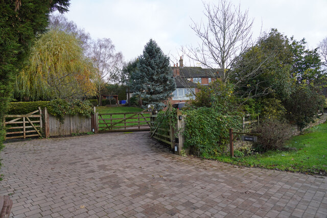
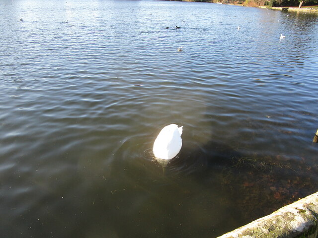
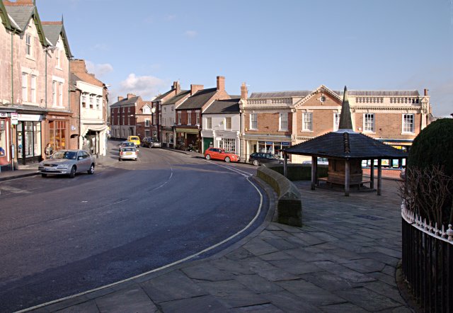
Mount Pleasant Images

Images are sourced within 2km of 52.82468/-1.4355476 or Grid Reference SK3825. Thanks to Geograph Open Source API. All images are credited.

A house by the road A well paved entrance to the house.
A house by the road
A well paved entrance to the house.
Royal Observer Corps Monitoring Post Entrance to the ROC bunker. It was featured in BBC news back in 2012.
Royal Observer Corps Monitoring Post
Entrance to the ROC bunker. It was featured in BBC news back in 2012.
Cottages, Main Street, King's Newton That on the left is a much altered sixteenth century cottage <span class="nowrap"><a title="https://historicengland.org.uk/listing/the-list/list-entry/1204785?section=official-listing" rel="nofollow ugc noopener" href="https://historicengland.org.uk/listing/the-list/list-entry/1204785?section=official-listing">Link</a><img style="margin-left:2px;" alt="External link" title="External link - shift click to open in new window" src="https://s1.geograph.org.uk/img/external.png" width="10" height="10"/></span> That on the right is slightly older <span class="nowrap"><a title="https://historicengland.org.uk/listing/the-list/list-entry/1334625?section=official-listing" rel="nofollow ugc noopener" href="https://historicengland.org.uk/listing/the-list/list-entry/1334625?section=official-listing">Link</a><img style="margin-left:2px;" alt="External link" title="External link - shift click to open in new window" src="https://s1.geograph.org.uk/img/external.png" width="10" height="10"/></span>
Cottages, Main Street, King's Newton
That on the left is a much altered sixteenth century cottage LinkExternal link That on the right is slightly older LinkExternal link
Cross House, King's Newton Dates from the early nineteenth century <span class="nowrap"><a title="https://historicengland.org.uk/listing/the-list/list-entry/1096370?section=official-listing" rel="nofollow ugc noopener" href="https://historicengland.org.uk/listing/the-list/list-entry/1096370?section=official-listing">Link</a><img style="margin-left:2px;" alt="External link" title="External link - shift click to open in new window" src="https://s1.geograph.org.uk/img/external.png" width="10" height="10"/></span>
Cross House, King's Newton
Dates from the early nineteenth century LinkExternal link
Station Road Bridge, Melbourne Crosses the former Derby to Ashby de la Zouch railway line, now the Cloud Trail.
Station Road Bridge, Melbourne
Crosses the former Derby to Ashby de la Zouch railway line, now the Cloud Trail.
Thatched Cottage, Castle Street, Melbourne Has sixteenth century origins <span class="nowrap"><a title="https://historicengland.org.uk/listing/the-list/list-entry/1204966?section=official-listing" rel="nofollow ugc noopener" href="https://historicengland.org.uk/listing/the-list/list-entry/1204966?section=official-listing">Link</a><img style="margin-left:2px;" alt="External link" title="External link - shift click to open in new window" src="https://s1.geograph.org.uk/img/external.png" width="10" height="10"/></span>
Thatched Cottage, Castle Street, Melbourne
Has sixteenth century origins LinkExternal link
The Tithe Cottage, Melbourne Largely of the seventeenth century <span class="nowrap"><a title="https://historicengland.org.uk/listing/the-list/list-entry/1096383?section=official-listing" rel="nofollow ugc noopener" href="https://historicengland.org.uk/listing/the-list/list-entry/1096383?section=official-listing">Link</a><img style="margin-left:2px;" alt="External link" title="External link - shift click to open in new window" src="https://s1.geograph.org.uk/img/external.png" width="10" height="10"/></span>
The Tithe Cottage, Melbourne
Largely of the seventeenth century LinkExternal link
Sluice and Weir. Melbourne Pond Control the flow of water into Carr Brook. Date from the nineteenth century <span class="nowrap"><a title="https://historicengland.org.uk/listing/the-list/list-entry/1204954?section=official-listing" rel="nofollow ugc noopener" href="https://historicengland.org.uk/listing/the-list/list-entry/1204954?section=official-listing">Link</a><img style="margin-left:2px;" alt="External link" title="External link - shift click to open in new window" src="https://s1.geograph.org.uk/img/external.png" width="10" height="10"/></span>
Sluice and Weir. Melbourne Pond
Control the flow of water into Carr Brook. Date from the nineteenth century LinkExternal link
Melbourne Senior Citizens Community Centre
Smithy, Melbourne Listed <span class="nowrap"><a title="https://historicengland.org.uk/listing/the-list/list-entry/1204658?section=official-listing" rel="nofollow ugc noopener" href="https://historicengland.org.uk/listing/the-list/list-entry/1204658?section=official-listing">Link</a><img style="margin-left:2px;" alt="External link" title="External link - shift click to open in new window" src="https://s1.geograph.org.uk/img/external.png" width="10" height="10"/></span>
Smithy, Melbourne
Listed LinkExternal link
War memorial, Melbourne
The north side of the church, Melbourne Melbourne has a 'close' without an adjacent burial ground which is unusual for a parish church in England.
The north side of the church, Melbourne
Melbourne has a 'close' without an adjacent burial ground which is unusual for a parish church in England.
Alleyway to Church Street, Melbourne
Footpath to Penn Lane, Melbourne
Roadway by the Pool, Melbourne
Muddying the waters Mute Swan at the Pool, Melbourne.
Muddying the waters
Mute Swan at the Pool, Melbourne.
The Pool, Melbourne A former mill pond extended as an ornament to Melbourne Hall.
The Pool, Melbourne
A former mill pond extended as an ornament to Melbourne Hall.
The Pool, Melbourne A former mill pond extended as an ornament to Melbourne Hall.
The Pool, Melbourne
A former mill pond extended as an ornament to Melbourne Hall.
Show me another place!

Mount Pleasant is located at Grid Ref: SK3825 (Lat: 52.82468, Lng: -1.4355476)

Administrative County: Derbyshire

District: South Derbyshire

Police Authority: Derbyshire

What 3 Words

///paramedic.page.hurricane. Near Melbourne, Derbyshire

Related Wikis

Melbourne, Derbyshire

Melbourne () is a market town and civil parish in South Derbyshire, England. It was home to Thomas Cook, and has a street named after him. It is 8 miles...

Melbourne Castle

Melbourne Castle was a medieval castle in Melbourne, Derbyshire. It was built on the site of an earlier royal manor house that had provided accommodation...

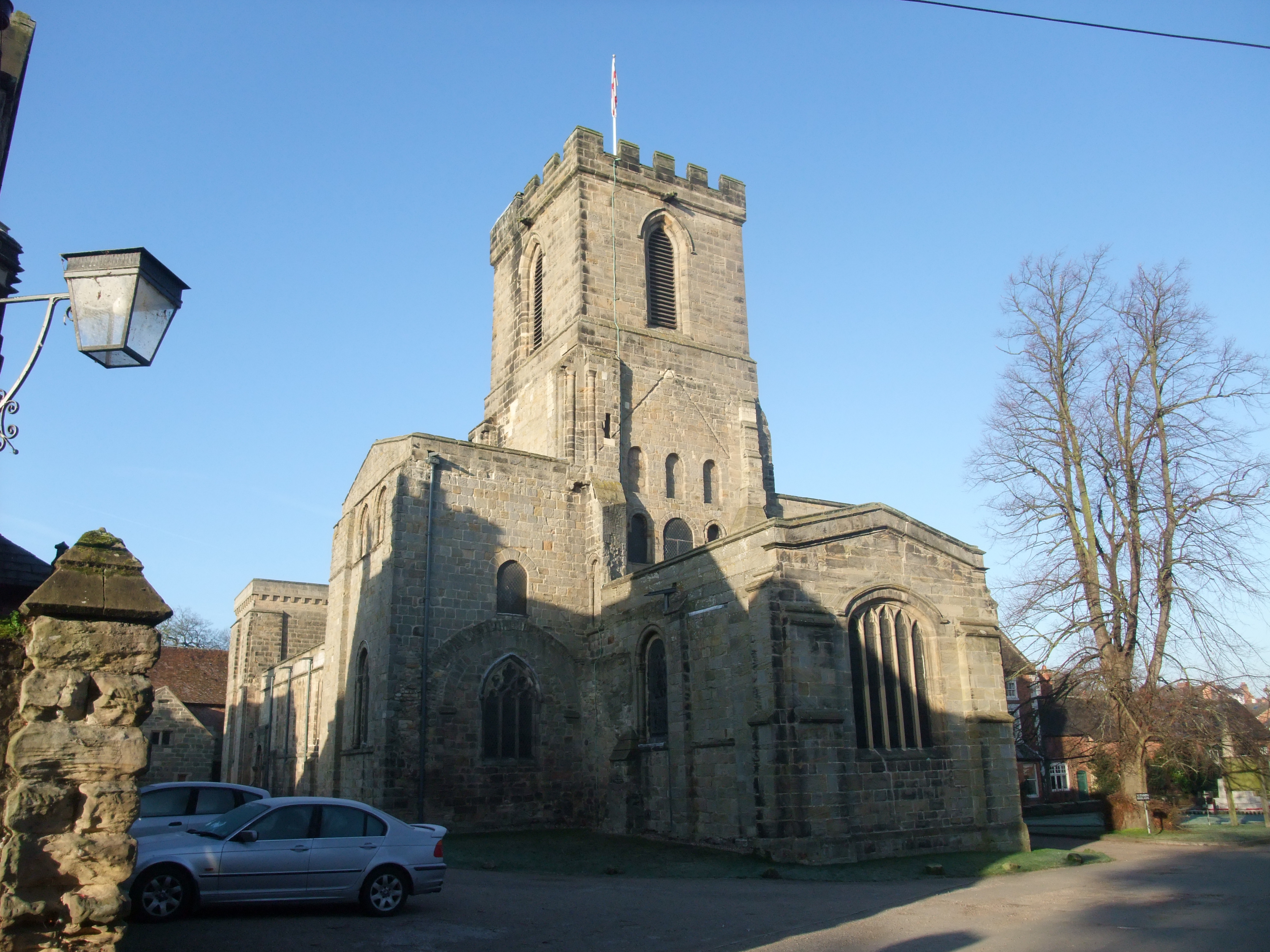
St Michael with St Mary's Church, Melbourne

St Michael and St Mary's Church, Melbourne is a Grade I listed parish church in the Church of England in Melbourne, Derbyshire. == History == The church...

Melbourne Hall

Melbourne Hall is a Georgian style country house in Melbourne, Derbyshire, previously owned by William Lamb, 2nd Viscount Melbourne, British Prime Minister...

Kings Newton

Kings Newton is a village in South Derbyshire. The population of the village is included in Melbourne. The Holy well (pictured) was constructed around...

Melbourne railway station (United Kingdom)

Melbourne railway station was a station at Kings Newton that served the adjacent town of Melbourne, Derbyshire, England. == History == It was opened in...

Melbourne line

The Melbourne Line was a railway line which ran from Derby to Ashby de la Zouch. It was used by the British Army and Allied engineers during the Second...

Staunton Harold Reservoir

Staunton Harold Reservoir is a large reservoir under the management of Severn Trent Water, located between Melbourne and Ticknall in Derbyshire, England...

Nearby Amenities

Located within 500m of 52.82468,-1.4355476
Exit To: Town Centre;Ind. Est.
Lat/Long: 52.8290442/-1.4346197
Pub
Melbourne Inn
Addr City: Derby
Addr Housenumber: 20
Addr Postcode: DE73 8GJ
Addr Street: High Street
Addr Village: Melbourne
Contact Facebook: https://www.facebook.com/TheMelbourneInn
Fhrs Id: 499207
Old Name: The Lamb Inn
Real Ale: yes
Lat/Long: 52.8227665/-1.4293791
Coach House
Addr City: Derby
Addr Housenumber: 69
Addr Postcode: DE73 8FE
Addr Street: Derby Road
Addr Village: Melbourne
Fhrs Id: 151834
Source: survey
Tourism: guest_house
Lat/Long: 52.825613/-1.4301223
Post Box
Operator: Royal Mail
Ref: DE73 128
Lat/Long: 52.8218029/-1.432279
Post Box
Operator: Royal Mail
Ref: DE73 127
Lat/Long: 52.823909/-1.4337228
Post Box
Brand: Royal Mail
Brand Wikidata: Q638098
Operator: Royal Mail
Operator Wikidata: Q638098
Post Box Mounting: pier
Post Box Type: lamp
Ref: DE73 192
Lat/Long: 52.8263976/-1.4307504
Cottage Antiques
Addr City: Derby
Addr Village: Melbourne
Shop: antiques
Source: survey
Lat/Long: 52.8250243/-1.4291638
Jilly Clarks
Addr City: Derby
Addr Postcode: DE73 8FE
Addr Street: Derby Road
Addr Village: Melbourne
Shop: shoes
Source: survey
Lat/Long: 52.8241806/-1.4288605
L. Ward
Shop: hardware
Source: survey
Lat/Long: 52.8256669/-1.4297571
Place Of Worship
Melbourne Baptist Church
Addr City: Derby
Addr Postcode: DE73 8EH
Addr Street: Chapel Street
Addr Village: Melbourne
Denomination: baptist
Religion: christian
Source: survey
Wikidata: Q26619279
Lat/Long: 52.824498/-1.4281902
Bank
NatWest
Addr City: Derby
Addr Postcode: DE73 8DT
Addr Street: Market Place
Addr Village: Melbourne
Brand: NatWest
Brand Wikidata: Q2740021
Brand Wikipedia: en:NatWest
Source: survey
Lat/Long: 52.8233009/-1.428542
Turning Circle
Lat/Long: 52.8263234/-1.4362409
Library
Assembly Rooms Library
Addr City: Derby
Addr Postcode: DE73 8GF
Addr Village: Melbourne
Lat/Long: 52.8222086/-1.4295233
Post Office
Melbourne Post Office
Addr City: Derby
Addr Housenumber: 1-3
Addr Postcode: DE73 8JJ
Addr Street: Derby Road
Addr Village: Melbourne
Brand: Post Office
Brand Wikidata: Q1783168
Ref Pol Id: 9691
Source: OS_OpenData_StreetView
Lat/Long: 52.8234464/-1.4285318
Turning Circle
Lat/Long: 52.8250925/-1.4347042
Thomas Cook Memorial Hall
Historic: memorial
Lat/Long: 52.8221132/-1.4313939
Post Box
Collection Times: Mo-Fr 17:00; Sa 10:30
Operator: Royal Mail
Post Box Type: wall
Ref: DE73 239
Royal Cypher: EIIR
Royal Cypher Wikidata: Q33102113
Lat/Long: 52.8234717/-1.428473
Cafe
The Welcome Cafe
Addr City: Derby
Addr Housenumber: 7-9
Addr Postcode: DE73 8FE
Addr Street: Derby Road
Addr Village: Melbourne
Contact Facebook: https://www.facebook.com/theposhofflicense/
Note: The Posh Off License may be here
Old Fhrs Id: 152192;1297432
Lat/Long: 52.8235311/-1.4285839
Cafe
Jack's of Melbourne
Addr City: Derby
Addr Housenumber: 14
Addr Postcode: DE73 8FE
Addr Street: Derby Road
Addr Village: Melbourne
Fhrs Id: 509056
Lat/Long: 52.8242361/-1.4286348
Restaurant
Amalfi White Bar and Restaurant
Addr City: Derby
Addr Housenumber: 50
Addr Postcode: DE73 8FE
Addr Street: Derby Road
Addr Village: Melbourne
Fhrs Id: 621045
Lat/Long: 52.8253667/-1.4294194
Restaurant
Zeerah
Addr City: Derby
Addr Housenumber: 61
Addr Postcode: DE73 8FE
Addr Street: Derby Road
Addr Village: Melbourne
Fhrs Id: 734913
Lat/Long: 52.8253517/-1.4297413
Melbourbe Deli
Addr City: Derby
Addr Housenumber: 37
Addr Postcode: DE73 8FE
Addr Street: Derby Road
Addr Village: Melbourne
Fhrs Id: 802233
Shop: deli
Lat/Long: 52.8245148/-1.4290478
Wayne Spiers Butchers
Addr City: Derby
Addr Housenumber: 38
Addr Postcode: DE73 8DS
Addr Street: Market Place
Addr Village: Melbourne
Fhrs Id: 157641
Shop: butcher
Lat/Long: 52.8231502/-1.4285543
Bus Stop
Ashby Road
Naptan AtcoCode: 1000DMHS5036
Naptan NaptanCode: dbsatgwg
Public Transport: platform
Lat/Long: 52.8222547/-1.4314628
Bus Stop
Ashby Road
Naptan AtcoCode: 1000DMAR5035
Naptan NaptanCode: dbsdtmag
Public Transport: platform
Lat/Long: 52.821847/-1.4322352
Generator Method: photovoltaic
Generator Output Electricity: yes
Generator Source: solar
Generator Type: solar_photovoltaic_panel
Location: roof
Power: generator
Lat/Long: 52.8275502/-1.4347204
Generator Method: photovoltaic
Generator Output Electricity: yes
Generator Source: solar
Generator Type: solar_photovoltaic_panel
Location: roof
Power: generator
Lat/Long: 52.8273395/-1.435163
Generator Method: photovoltaic
Generator Output Electricity: yes
Generator Source: solar
Generator Type: solar_photovoltaic_panel
Location: roof
Power: generator
Lat/Long: 52.8272585/-1.4352461
Generator Method: photovoltaic
Generator Output Electricity: yes
Generator Source: solar
Generator Type: solar_photovoltaic_panel
Location: roof
Power: generator
Lat/Long: 52.8268744/-1.4356297
Generator Method: photovoltaic
Generator Output Electricity: yes
Generator Source: solar
Generator Type: solar_photovoltaic_panel
Location: roof
Power: generator
Lat/Long: 52.8261986/-1.4363673
Generator Method: photovoltaic
Generator Output Electricity: yes
Generator Source: solar
Generator Type: solar_photovoltaic_panel
Location: roof
Power: generator
Lat/Long: 52.8269409/-1.4336636
Generator Method: photovoltaic
Generator Output Electricity: yes
Generator Source: solar
Generator Type: solar_photovoltaic_panel
Location: roof
Power: generator
Lat/Long: 52.8268857/-1.4308044
Generator Method: photovoltaic
Generator Output Electricity: yes
Generator Source: solar
Generator Type: solar_photovoltaic_panel
Location: roof
Power: generator
Lat/Long: 52.8270754/-1.4308124
Generator Method: photovoltaic
Generator Output Electricity: yes
Generator Source: solar
Generator Type: solar_photovoltaic_panel
Location: roof
Power: generator
Lat/Long: 52.8272488/-1.4315125
Generator Method: photovoltaic
Generator Output Electricity: yes
Generator Source: solar
Generator Type: solar_photovoltaic_panel
Location: roof
Power: generator
Lat/Long: 52.826282/-1.4289593
Generator Method: photovoltaic
Generator Output Electricity: yes
Generator Source: solar
Generator Type: solar_photovoltaic_panel
Location: roof
Power: generator
Lat/Long: 52.8268116/-1.4361083
Generator Method: photovoltaic
Generator Output Electricity: yes
Generator Source: solar
Generator Type: solar_photovoltaic_panel
Location: roof
Power: generator
Lat/Long: 52.8259471/-1.4369492
Generator Method: photovoltaic
Generator Output Electricity: yes
Generator Source: solar
Generator Type: solar_photovoltaic_panel
Location: roof
Power: generator
Lat/Long: 52.8241787/-1.4358938
Generator Method: photovoltaic
Generator Output Electricity: yes
Generator Source: solar
Generator Type: solar_photovoltaic_panel
Location: roof
Power: generator
Lat/Long: 52.8216477/-1.4317257
Generator Method: photovoltaic
Generator Output Electricity: yes
Generator Source: solar
Generator Type: solar_photovoltaic_panel
Location: roof
Power: generator
Lat/Long: 52.8215099/-1.4308755
Bus Stop
Cockshut Lane
Bench: no
Public Transport: platform
Shelter: no
Lat/Long: 52.8253751/-1.4378645
Bus Stop
Quaker Close
Bench: yes
Bin: yes
Lit: no
Public Transport: platform
Shelter: yes
Tactile Paving: no
Lat/Long: 52.8288597/-1.4342935
Bus Stop
Lampad Close
Naptan AtcoCode: 1000DMDR5067
Naptan NaptanCode: dbsdtdag
Public Transport: platform
Shelter: yes
Lat/Long: 52.8271659/-1.4317591
Bus Stop
Coach House
Naptan AtcoCode: 1000DMDR5066
Naptan NaptanCode: dbsdtdad
Public Transport: platform
Lat/Long: 52.8256733/-1.4299963
Barrier: bollard
Bollard: fixed
Material: concrete
Lat/Long: 52.8282703/-1.4344873
Fuel
Lat/Long: 52.8224621/-1.4310859
Waste Basket
Colour: black
Material: metal
Operator: South Derbyshire District Council
Waste: trash
Lat/Long: 52.8245146/-1.4340669
Waste Basket
Colour: green
Material: plastic
Operator: South Derbyshire District Council
Waste: trash
Lat/Long: 52.8237111/-1.4324957
Waste Basket
Colour: black
Material: plastic
Operator: South Derbyshire District Council
Waste: trash
Lat/Long: 52.8232153/-1.4318923
Waste Basket
Colour: black
Material: metal
Operator: South Derbyshire District Council
Waste: trash
Lat/Long: 52.8227646/-1.4326931
Waste Basket
Colour: black
Material: metal
Operator: South Derbyshire District Council
Waste: trash
Lat/Long: 52.8218101/-1.4322443
Waste Basket
Colour: black
Material: metal
Operator: South Derbyshire District Council
Waste: trash
Lat/Long: 52.8216638/-1.4302835
Waste Basket
Colour: black
Material: metal
Operator: South Derbyshire District Council
Waste: trash
Lat/Long: 52.8225274/-1.4294339
Waste Basket
Colour: grey
Material: plastic
Operator: South Derbyshire District Council
Waste: trash
Lat/Long: 52.8226094/-1.4289581
Waste Basket
Operator: South Derbyshire District Council
Waste: trash
Lat/Long: 52.8237014/-1.4289293
Waste Basket
Colour: yellow
Material: plastic
Operator: South Derbyshire District Council
Waste: trash
Lat/Long: 52.8272213/-1.4294955
Waste Basket
Colour: black
Material: metal
Operator: South Derbyshire District Council
Waste: trash
Lat/Long: 52.8248602/-1.4290884
Waste Basket
Colour: black
Material: metal
Operator: South Derbyshire District Council
Waste: trash
Lat/Long: 52.8261804/-1.4301265
Waste Basket
Colour: black
Material: metal
Operator: South Derbyshire District Council
Waste: trash
Lat/Long: 52.8256781/-1.429982
Waste Basket
Colour: black
Material: metal
Operator: South Derbyshire District Council
Waste: trash
Lat/Long: 52.8271824/-1.4317795
Waste Basket
Colour: black
Material: plastic
Operator: South Derbyshire District Council
Waste: trash
Lat/Long: 52.8277313/-1.4324165
Waste Basket
Colour: black
Material: metal
Operator: South Derbyshire District Council
Waste: trash
Lat/Long: 52.8288497/-1.4342683
Waste Basket
Colour: black
Material: metal
Operator: South Derbyshire District Council
Waste: trash
Lat/Long: 52.8271136/-1.4360928
Waste Basket
Colour: red
Operator: South Derbyshire District Council
Waste: dog_excrement
Lat/Long: 52.8230616/-1.4394618
Bicycle Parking
Access: yes
Bicycle Parking: wall_loops
Capacity: 4
Covered: no
Fee: no
Lat/Long: 52.8260411/-1.4304001
The data included in this document is from www.openstreetmap.org. The data is made available under ODbL.

Have you been to Mount Pleasant?

Leave your review of Mount Pleasant below (or comments, questions and feedback).