Belluton
Settlement in Somerset
England
Belluton

Belluton is a small village located in the county of Somerset, in southwestern England. Situated approximately 8 miles south of Bristol, Belluton is part of the unitary authority of Bath and North East Somerset. The village is nestled in a picturesque rural setting, surrounded by rolling countryside and farmland.
With a population of around 400 residents, Belluton maintains a close-knit community feel. The village itself is characterized by a collection of charming stone cottages, many of which date back several centuries. The architecture in Belluton reflects its rich history, with some buildings displaying traditional thatched roofs and timber frames.
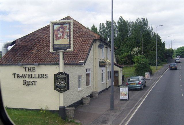
Despite its small size, Belluton offers a range of amenities for its residents. These include a local pub, a village hall, and a primary school. Additionally, Belluton benefits from its proximity to nearby towns and cities, such as Bristol and Bath, which provide residents with a wider array of services and entertainment options.
The surrounding countryside provides ample opportunities for outdoor activities, including hiking, cycling, and horse riding. Belluton is also in close proximity to a number of nature reserves and country parks, offering opportunities for wildlife spotting and leisurely walks.
Overall, Belluton offers a tranquil and idyllic setting for those seeking a rural lifestyle, while still being within reach of larger towns and cities. Its historic charm, strong sense of community, and beautiful natural surroundings make it an attractive place to live or visit.
If you have any feedback on the listing, please let us know in the comments section below.
Belluton Images
Images are sourced within 2km of 51.377441/-2.560033 or Grid Reference ST6164. Thanks to Geograph Open Source API. All images are credited.


Belluton is located at Grid Ref: ST6164 (Lat: 51.377441, Lng: -2.560033)
Unitary Authority: Bath and North East Somerset
Police Authority: Avon and Somerset
What 3 Words
///poetic.sector.adopt. Near Publow, Somerset
Nearby Locations
Related Wikis
Belluton
Belluton is a village in Somerset, England. It is in the district of Bath and North East Somerset and is located due south of the city of Bristol and due...
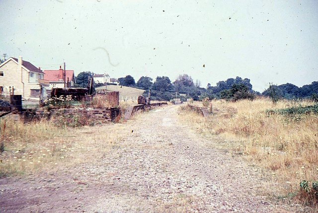
Pensford railway station
Pensford railway station served the village of Pensford, Somerset, England from 1873 to 1964 on the Bristol and North Somerset Railway. == History == The...

Pensford Viaduct
Pensford Viaduct is a disused railway bridge in the village of Pensford, within the historic English county of Somerset, now unitary authority Bath and...
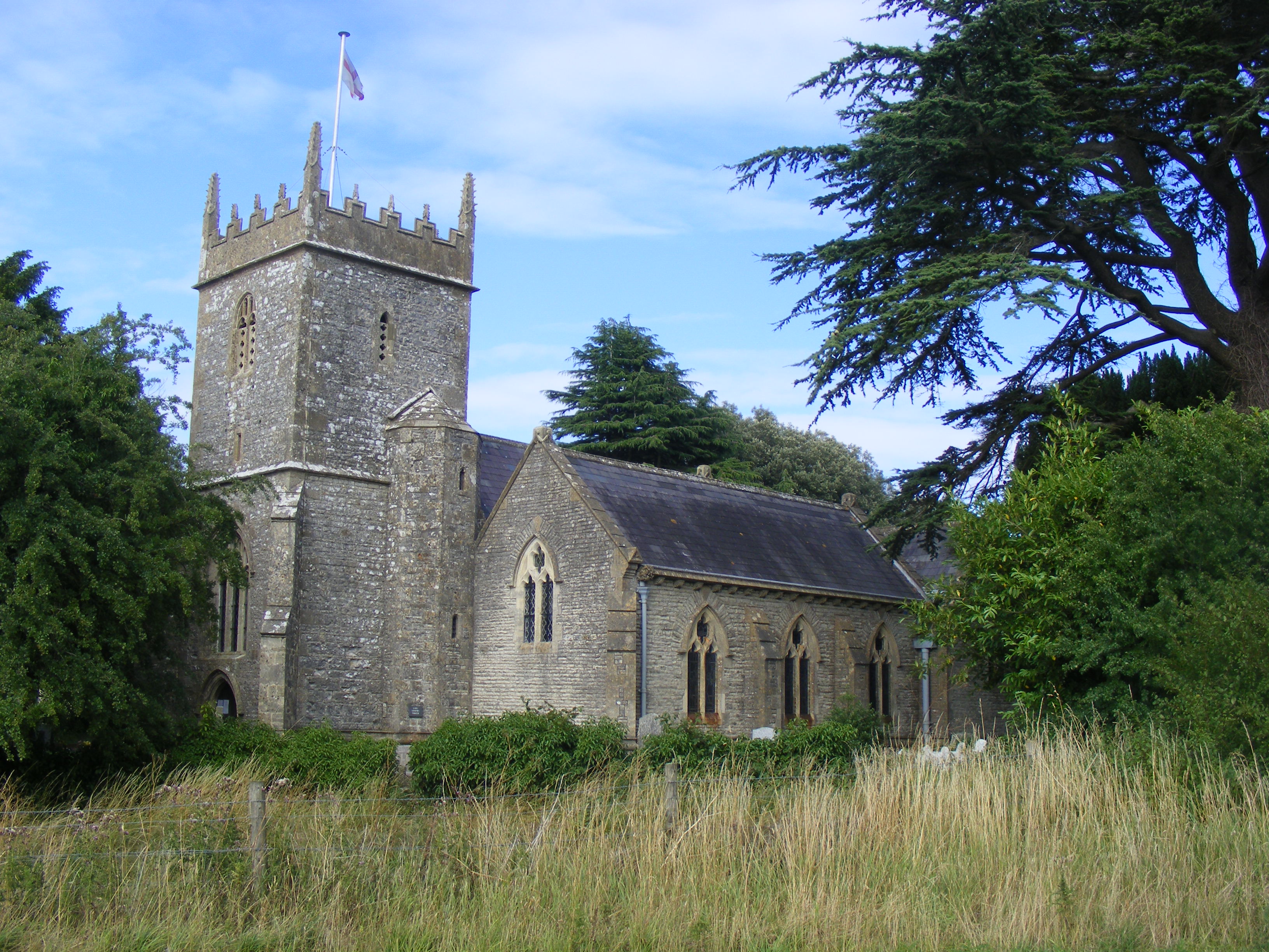
Holy Trinity Church, Norton Malreward
The Anglican Holy Trinity Church in Norton Malreward, Somerset, England dates from the late 12th century. It has been designated as a Grade II listed building...
Nearby Amenities
Located within 500m of 51.377441,-2.560033Have you been to Belluton?
Leave your review of Belluton below (or comments, questions and feedback).