Culvery Wood
Wood, Forest in Somerset
England
Culvery Wood

Culvery Wood is a picturesque forest located in Somerset, England. Covering an area of approximately 50 acres, this wood offers a tranquil and serene escape from the hustle and bustle of everyday life.
The wood is characterized by its dense vegetation, consisting primarily of oak, beech, and ash trees. The towering canopies of these majestic trees provide a beautiful and shady environment, perfect for leisurely walks or quiet contemplation. In the springtime, the forest floor comes alive with a vibrant display of bluebells, adding a touch of color to the otherwise green landscape.
Nature enthusiasts will delight in the diverse wildlife that calls Culvery Wood home. The wood is home to a wide range of bird species, including woodpeckers, owls, and songbirds. Visitors may also be lucky enough to spot small mammals such as squirrels and rabbits darting amongst the trees.
Culvery Wood is not only a haven for wildlife but also a popular recreational spot. There are well-maintained paths and trails that wind through the forest, making it an ideal location for hiking and cycling. Additionally, there are picnic areas scattered throughout the wood, providing the perfect opportunity to enjoy a scenic outdoor lunch.
The wood is easily accessible, with a car park located nearby for visitors' convenience. Whether seeking solitude and tranquility or a family day out in nature, Culvery Wood offers a captivating and enchanting experience for all who venture into its leafy embrace.
If you have any feedback on the listing, please let us know in the comments section below.
Culvery Wood Images
Images are sourced within 2km of 51.374032/-2.5539426 or Grid Reference ST6164. Thanks to Geograph Open Source API. All images are credited.


![South west circle of standing stones [1] Around 5,000 years old, and related to the two circles to the north-east.](https://s1.geograph.org.uk/geophotos/01/79/50/1795041_cb89be10.jpg)
![South west circle of standing stones [2] English Heritage has not yet done a geophysical survey of this circle, so it remains even more of an enigma than the two others nearby.](https://s2.geograph.org.uk/geophotos/01/79/50/1795050_42a3e9f2.jpg)

![Approaching the Great Circle, Stanton Drew To quote English Heritage: &#039;There are three stone circles at Stanton Drew: the great circle being one of the largest in the country... A magnetomometer [geophys] survey has produced astonishing results which demonstrate that the megalithic remains at Stanton Drew are but the ruins of a much more elaborate and important site.... There are nine concentric rings of buried pits and a very large buried enclosure ditch.... The circles are the largest and most numerous yet recorded at any site and surely indicate the investment of immense effort and enterprise in the service of prehistoric beliefs as yet dimly perceived.&#039;](https://s3.geograph.org.uk/geophotos/01/80/05/1800519_5e3cc179.jpg)
![Standing stone, Great Circle, Stanton Drew To quote English Heritage: &#039;There are three stone circles at Stanton Drew: the great circle being one of the largest in the country... A magnetomometer [geophys] survey has produced astonishing results which demonstrate that the megalithic remains at Stanton Drew are but the ruins of a much more elaborate and important site.... There are nine concentric rings of buried pits and a very large buried enclosure ditch.... The circles are the largest and most numerous yet recorded at any site and surely indicate the investment of immense effort and enterprise in the service of prehistoric beliefs as yet dimly perceived.&#039;](https://s2.geograph.org.uk/geophotos/01/80/05/1800522_29b9e1bf.jpg)
![Standing stone above the valley of the Chew To quote English Heritage: &#039;There are three stone circles at Stanton Drew: the great circle being one of the largest in the country... A magnetomometer [geophys] survey has produced astonishing results which demonstrate that the megalithic remains at Stanton Drew are but the ruins of a much more elaborate and important site.... There are nine concentric rings of buried pits and a very large buried enclosure ditch.... The circles are the largest and most numerous yet recorded at any site and surely indicate the investment of immense effort and enterprise in the service of prehistoric beliefs as yet dimly perceived.&#039;](https://s0.geograph.org.uk/geophotos/01/80/05/1800524_42b2fd53.jpg)
Culvery Wood is located at Grid Ref: ST6164 (Lat: 51.374032, Lng: -2.5539426)
Unitary Authority: Bath and North East Somerset
Police Authority: Avon and Somerset
What 3 Words
///dunes.sharper.gracing. Near Publow, Somerset
Nearby Locations
Related Wikis
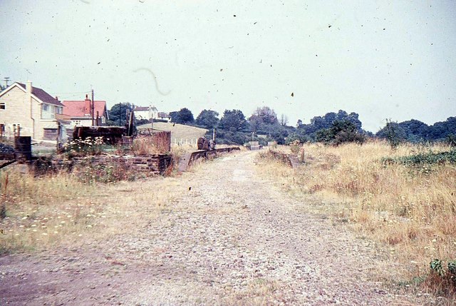
Pensford railway station
Pensford railway station served the village of Pensford, Somerset, England from 1873 to 1964 on the Bristol and North Somerset Railway. == History == The...
Belluton
Belluton is a village in Somerset, England. It is in the district of Bath and North East Somerset and is located due south of the city of Bristol and due...

Pensford Viaduct
Pensford Viaduct is a disused railway bridge in the village of Pensford, within the historic English county of Somerset, now unitary authority Bath and...
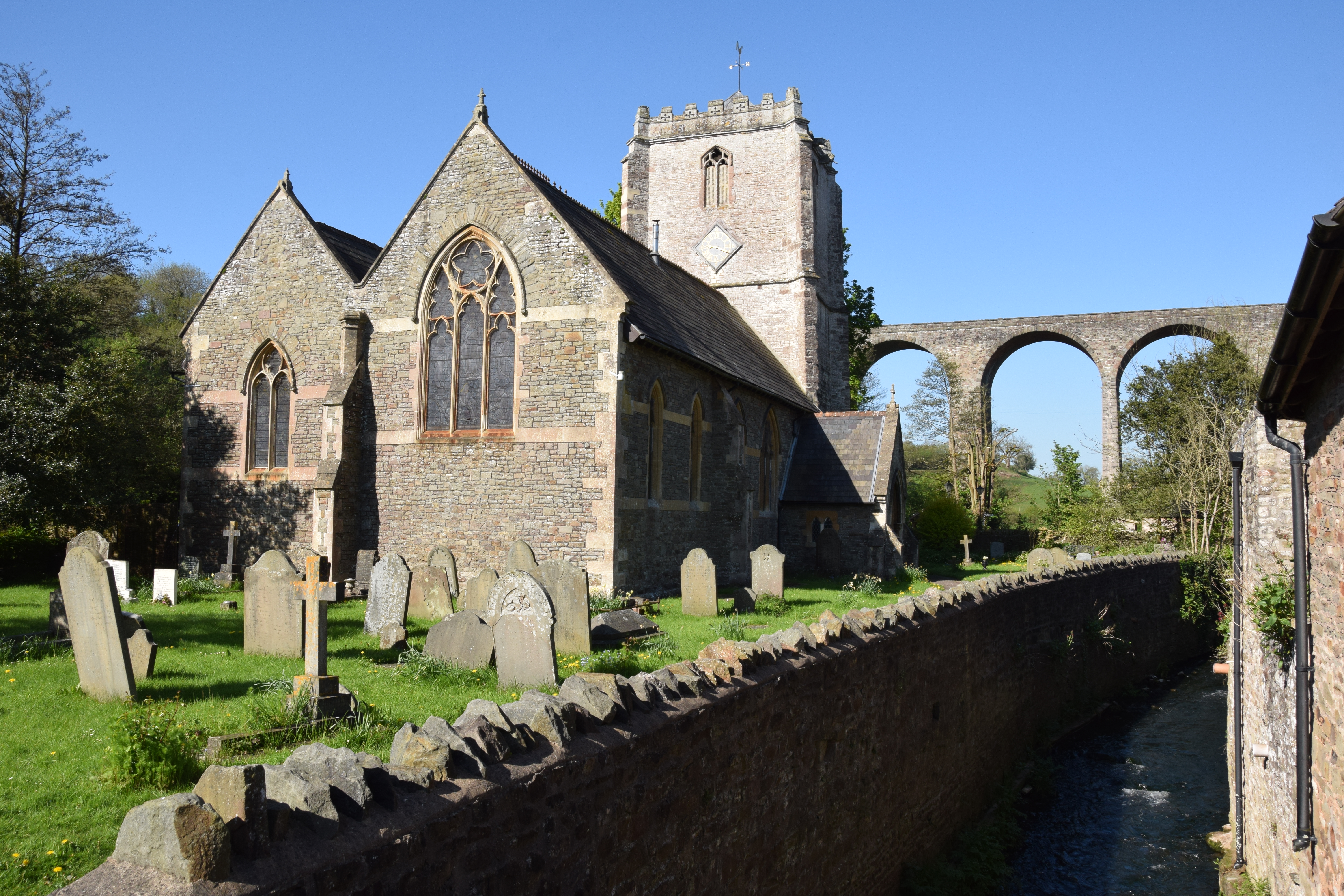
St Thomas à Becket Church, Pensford
St Thomas à Becket Church in Pensford, Somerset southwest England, dates from the 14th century, active in 1341, although only the tower remains from that...
Nearby Amenities
Located within 500m of 51.374032,-2.5539426Have you been to Culvery Wood?
Leave your review of Culvery Wood below (or comments, questions and feedback).