Lanchards Plantation

Wood, Forest in Dorset

England

Lanchards Plantation

Frampton The A356 to Crewkerne heading west through the village.
Frampton Credit: Trevor Harris

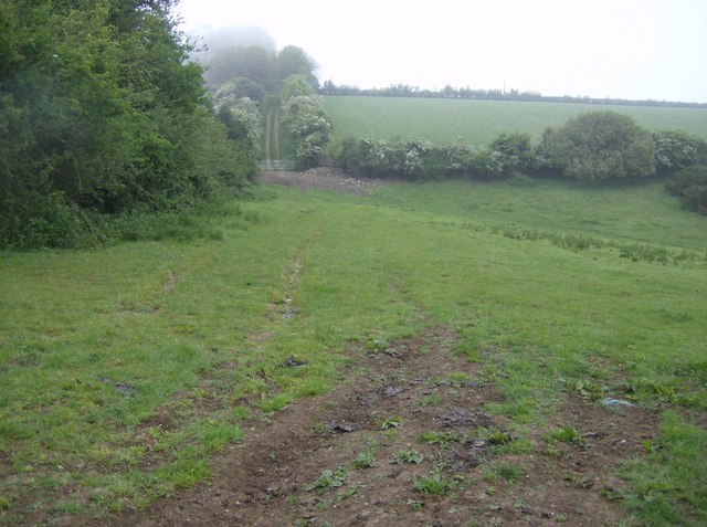
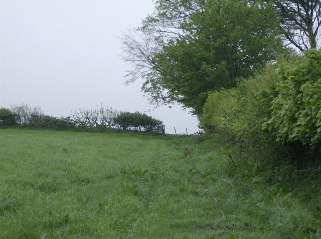
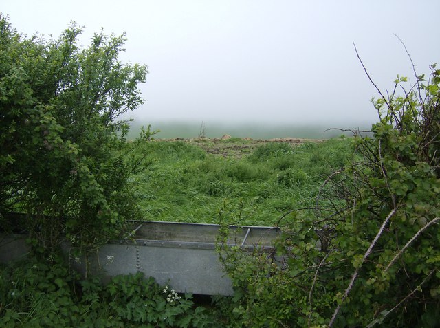
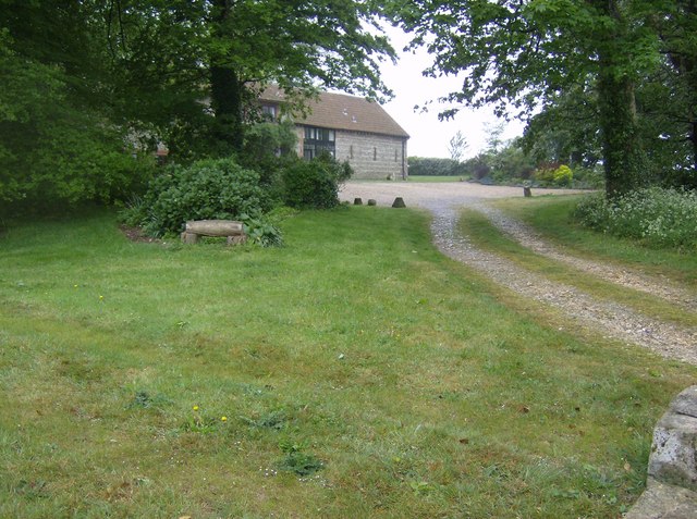
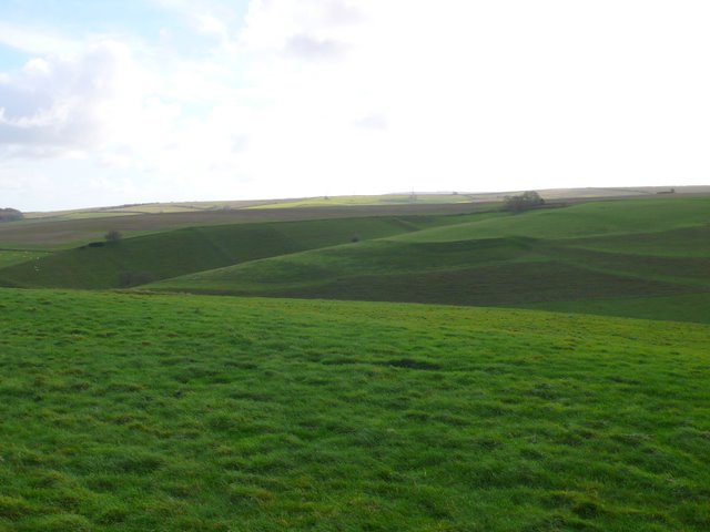
Lanchards Plantation is a picturesque woodland located in Dorset, England. Situated in the heart of the county, the plantation is known for its tranquil surroundings and diverse flora and fauna. The woodland covers a vast area, making it an ideal destination for nature enthusiasts and avid hikers.

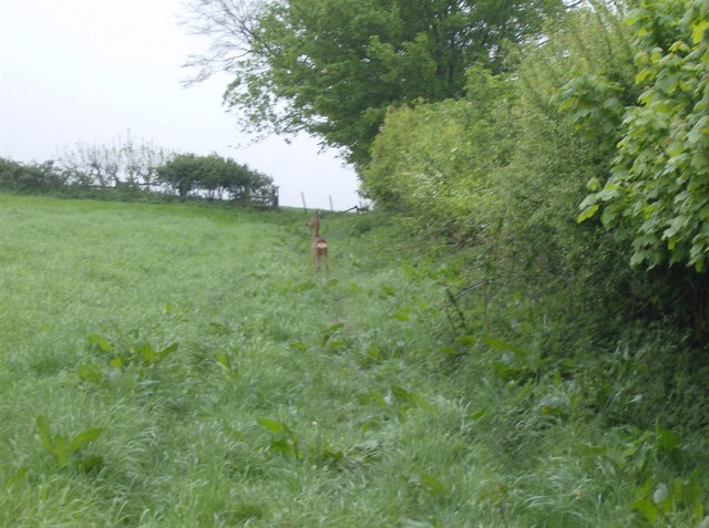
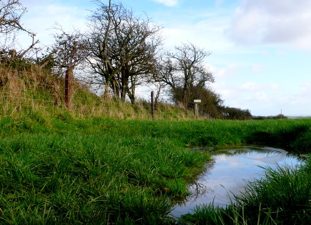
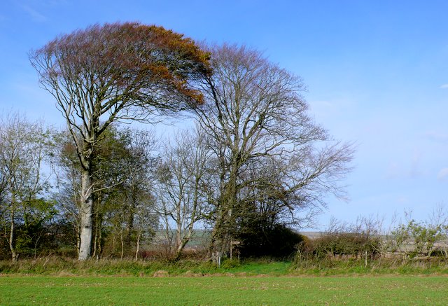
The plantation is characterized by its dense canopy of deciduous and coniferous trees, creating a unique ecosystem that supports a wide range of wildlife. Visitors can expect to encounter various species of birds, including owls, woodpeckers, and songbirds, as well as small mammals like squirrels and rabbits.

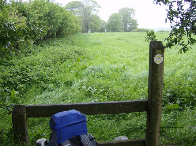
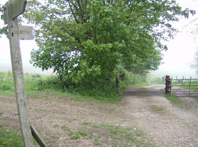
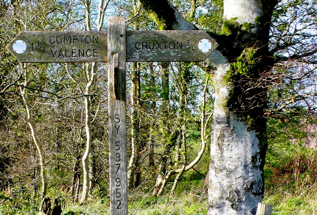
One of the highlights of Lanchards Plantation is its well-maintained network of trails and footpaths, allowing visitors to explore the woodland at their own pace. These paths wind through the trees, offering stunning vistas of the surrounding landscape and providing opportunities for peaceful walks or invigorating hikes.

Additionally, the plantation serves as an important conservation site, with ongoing efforts to protect and preserve its natural beauty. Conservationists work tirelessly to maintain the delicate balance of the ecosystem, ensuring the sustainability of the woodland for generations to come.

Lanchards Plantation also offers recreational activities for visitors, such as cycling and horse riding trails. These activities provide an alternative way to explore the woodland while enjoying the fresh air and scenic views.

Overall, Lanchards Plantation in Dorset is a haven for nature lovers, offering an enchanting escape from the hustle and bustle of everyday life. With its diverse wildlife, well-maintained trails, and commitment to conservation, it is a must-visit destination for anyone seeking a connection with nature in the heart of England.

If you have any feedback on the listing, please let us know in the comments section below.

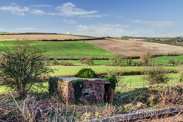
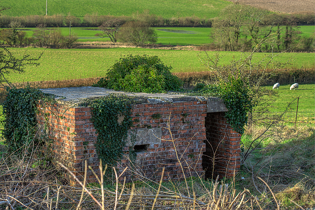
Lanchards Plantation Images

Images are sourced within 2km of 50.750087/-2.5465566 or Grid Reference SY6194. Thanks to Geograph Open Source API. All images are credited.

Frampton The A356 to Crewkerne heading west through the village.
Frampton
The A356 to Crewkerne heading west through the village.
St Mary's Frampton Taken at the end of Church Lane.
St Mary's Frampton
Taken at the end of Church Lane.
Direction Sign – Signpost on the A356 Dorchester Road in Frampton Located on the southwest side of the T junction of the A356 Dorchester Road and a minor road to Southover in Frampton parish. The annulus & bar finial has been reused from an older fingerpost. See also <a title="https://www.geograph.org.uk/photo/1785096" href="https://www.geograph.org.uk/photo/1785096">Link</a>.

Milestone Society National ID: DO_SY6295
Direction Sign – Signpost on the A356 Dorchester Road in Frampton
Located on the southwest side of the T junction of the A356 Dorchester Road and a minor road to Southover in Frampton parish. The annulus & bar finial has been reused from an older fingerpost. See also Link. Milestone Society National ID: DO_SY6295
Old Milestone by the A356, Frampton Carved stone post by the A356, in parish of FRAMPTON (WEST DORSET District), Frampton Road, 'Milestone', No. 4., Part of the wall, on North side of road. Dorset 3 (limestone), erected by the Maiden Newton turnpike trust in the 19th century.

Inscription reads:-
3
Maiden Newton
5
Dorchester

Milestone Society National ID: DO_MNDO03.
Old Milestone by the A356, Frampton
Carved stone post by the A356, in parish of FRAMPTON (WEST DORSET District), Frampton Road, 'Milestone', No. 4., Part of the wall, on North side of road. Dorset 3 (limestone), erected by the Maiden Newton turnpike trust in the 19th century. Inscription reads:- 3 Maiden Newton 5 Dorchester Milestone Society National ID: DO_MNDO03.
Footpath towards Notton Hill Barn Looking north, this footpath crosses the eastern part of the square.  Here looking north across an east-west dry valley to the right where another footpath comes up to join us.  Notton Hill Barn is about 200 metres further along the track in the distance.
Footpath towards Notton Hill Barn
Looking north, this footpath crosses the eastern part of the square. Here looking north across an east-west dry valley to the right where another footpath comes up to join us. Notton Hill Barn is about 200 metres further along the track in the distance.
Signpost at SY599948 Dorset County footpath signposts have the grid reference marked on them.  Useful to confirm where you are, in this case easy to position on Geograph at SY599948.
Signpost at SY599948
Dorset County footpath signposts have the grid reference marked on them. Useful to confirm where you are, in this case easy to position on Geograph at SY599948.
Deer on the Macmillan Way As I was heading into the strong south-westerly wind these deer lying in the long grass had not heard me coming.  Nor had I seen them until I was about 20 feet away as only their heads were showing.  Then all action - me getting the camera out, them running.  On the Macmillan Way above Cruxton.
Deer on the Macmillan Way
As I was heading into the strong south-westerly wind these deer lying in the long grass had not heard me coming. Nor had I seen them until I was about 20 feet away as only their heads were showing. Then all action - me getting the camera out, them running. On the Macmillan Way above Cruxton.
Water trough above Cruxton A wet and misty day hides all the extensive views from the top of the climb out of Cruxton.  So instead all one can see are the immediate things; hedgerows, water troughs, the remains of some animal feed.
Water trough above Cruxton
A wet and misty day hides all the extensive views from the top of the climb out of Cruxton. So instead all one can see are the immediate things; hedgerows, water troughs, the remains of some animal feed.
Deer on the Macmillan Way After the previous picture, one deer had already bolted.  This one was still weighing up its options, before choosing to follow the first one, directly through the hedge on the right.
Deer on the Macmillan Way
After the previous picture, one deer had already bolted. This one was still weighing up its options, before choosing to follow the first one, directly through the hedge on the right.
Tea stop in the rain Walking through the long pasture grass was not pleasant in the rain and the strong south-westerly wind.  This stile in the field corner provided some protection for a tea stop.
Tea stop in the rain
Walking through the long pasture grass was not pleasant in the rain and the strong south-westerly wind. This stile in the field corner provided some protection for a tea stop.
View from SY599948 The signpost helpfully displays a grid reference on the other side.  This would be a view in better weather.  Choice of paths here.
View from SY599948
The signpost helpfully displays a grid reference on the other side. This would be a view in better weather. Choice of paths here.
Notton Hill Barn Now converted into a private residence.
Notton Hill Barn
Now converted into a private residence.
Countryside Near Compton Valence View southeast from the edge of the chalk downland plateau on the Northern side of Compton Bottom. There are extensive ancient field systems in this area. The ones visible in the distance are in SY 5993 and SY6093.
Countryside Near Compton Valence
View southeast from the edge of the chalk downland plateau on the Northern side of Compton Bottom. There are extensive ancient field systems in this area. The ones visible in the distance are in SY 5993 and SY6093.
No Way Through This puddle is on the south side of a hedgerow on the chalk downland plateau close to the intersection of the Macmillan Way with another bridle path running east west. The minor bridle path dog-legs across the hedge at this point and the land owner has erected the sign in the middle distance which says NO FOOTPATH to make sure walkers follow the path on the north side of the hedge.
No Way Through
This puddle is on the south side of a hedgerow on the chalk downland plateau close to the intersection of the Macmillan Way with another bridle path running east west. The minor bridle path dog-legs across the hedge at this point and the land owner has erected the sign in the middle distance which says NO FOOTPATH to make sure walkers follow the path on the north side of the hedge.
Small copse near Wynford Eagle This clump of beech trees marks the point where the Macmillan Way turns north after running north west for a short distance from Notton Barn
Small copse near Wynford Eagle
This clump of beech trees marks the point where the Macmillan Way turns north after running north west for a short distance from Notton Barn
Sign Post near Notton Hill Barn This sign post shows the ways where a footpath to Greenford Lane  meets the Macmillan way bridle path between Notton Hill Barn  and Cruxton
Sign Post near Notton Hill Barn
This sign post shows the ways where a footpath to Greenford Lane meets the Macmillan way bridle path between Notton Hill Barn and Cruxton
Defending Dorset in 1940: the Maiden Newton - Poole Harbour Stop Line (27) -
Pillbox (type FW3/23): DoB ID: S0000074

Cruxton - Chalkhams Plantation - Type 23 Pillbox.  This pillbox is about 200 yards further down the line from the one at Lower Maiden Newton Farm. This is unfortunately on railway property, but whose exterior is visible from the opposite side of the railway embankment. It's of standard brick and concrete construction having 4 embrasures.

<a href="https://www.geograph.org.uk/photo/4841938">SY6096 : Defending Dorset in 1940: the Maiden Newton - Poole Harbour Stop Line (28)</a>
Defending Dorset in 1940: the Maiden Newton - Poole Harbour Stop Line (27)
- Pillbox (type FW3/23): DoB ID: S0000074 Cruxton - Chalkhams Plantation - Type 23 Pillbox. This pillbox is about 200 yards further down the line from the one at Lower Maiden Newton Farm. This is unfortunately on railway property, but whose exterior is visible from the opposite side of the railway embankment. It's of standard brick and concrete construction having 4 embrasures. SY6096 : Defending Dorset in 1940: the Maiden Newton - Poole Harbour Stop Line (28)
Defending Dorset in 1940: the Maiden Newton - Poole Harbour Stop Line (28) -
Pillbox (type FW3/23): DoB ID: S0000074

Cruxton - Chalkhams Plantation - Type 23 Pillbox. A telephoto view of this pillbox 200 yards further down the railway line from the one at Lower Maiden Newton Farm.

<a href="https://www.geograph.org.uk/photo/4841947">SY6195 : Defending Dorset in 1940: the Maiden Newton - Poole Harbour Stop Line (29)</a>
Defending Dorset in 1940: the Maiden Newton - Poole Harbour Stop Line (28)
- Pillbox (type FW3/23): DoB ID: S0000074 Cruxton - Chalkhams Plantation - Type 23 Pillbox. A telephoto view of this pillbox 200 yards further down the railway line from the one at Lower Maiden Newton Farm. SY6195 : Defending Dorset in 1940: the Maiden Newton - Poole Harbour Stop Line (29)
Show me another place!

Lanchards Plantation is located at Grid Ref: SY6194 (Lat: 50.750087, Lng: -2.5465566)

Unitary Authority: Dorset

Police Authority: Dorset

What 3 Words

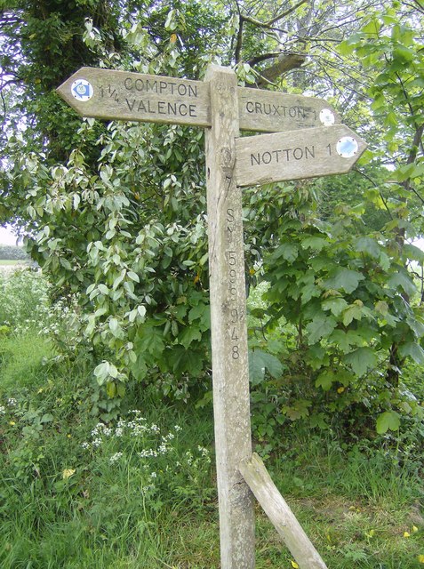
///jars.ribcage.lightbulb. Near Maiden Newton, Dorset

Related Wikis

Nunnery Mead

Nunnery Mead is a nature reserve of the Dorset Wildlife Trust, near Frampton and about 2 miles south-east of Maiden Newton, in Dorset, England. It is a...
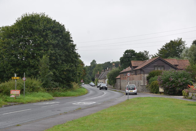
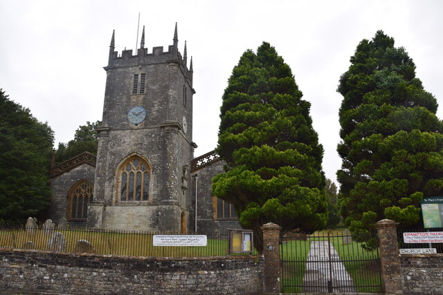
Frampton, Dorset

Frampton is a village and civil parish in the county of Dorset in southern England, situated approximately 5 miles (8.0 km) northwest of the county town...

Frampton (liberty)

Frampton Liberty was a liberty in the county of Dorset, England, which contained the following parishes: Bettiscombe Bincombe Burton Bradstock Compton...

Frampton Priory

Frampton Priory was a Benedictine priory in England, near the village of Frampton in Dorset and mentioned in the Domesday Book. The priory was subordinate...

Cruxton

Cruxton is a hamlet in the English county of Dorset. It lies eight miles north-west of the county town of Dorchester, and one mile south-east of the village...
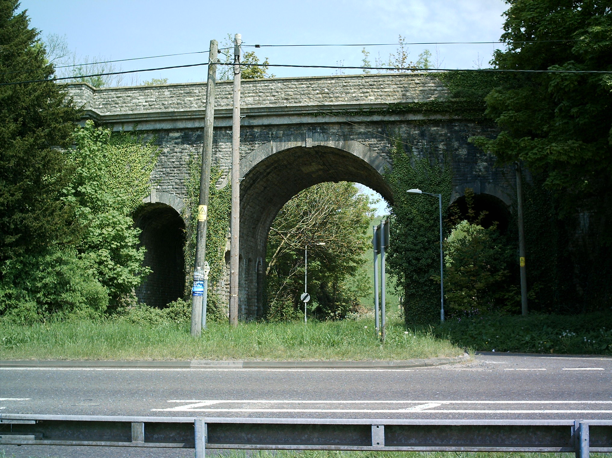
Grimstone Viaduct

The Grimstone Viaduct is a railway bridge on the Castle Cary-Weymouth "Heart of Wessex" line in Dorset, England. It is directly north of the site of Grimstone...

Grimstone and Frampton railway station

Grimstone and Frampton railway station was a station on the Wiltshire, Somerset & Weymouth Railway, part of the Great Western Railway between Maiden Newton...

Compton Valence

Compton Valence is a small village and civil parish in the county of Dorset in southern England. It lies approximately 7 miles (11 km) west of the county...

Nearby Amenities

Located within 500m of 50.750087,-2.5465566
Bench
Lat/Long: 50.748322/-2.5407541
Material: wood
Power: pole
Source: bing
Lat/Long: 50.7478018/-2.5413601
Material: wood
Power: pole
Source: bing
Lat/Long: 50.7485324/-2.5416196
Material: wood
Power: pole
Source: bing
Lat/Long: 50.7493426/-2.5418935
Material: wood
Power: pole
Source: bing
Lat/Long: 50.7499083/-2.5397396
Material: wood
Power: pole
Source: bing
Lat/Long: 50.7500907/-2.5421622
Material: wood
Power: pole
Source: bing
Lat/Long: 50.7503918/-2.5412777
Material: wood
Power: pole
Source: bing
Lat/Long: 50.7507293/-2.5423099
Material: wood
Power: pole
Source: bing
Lat/Long: 50.7508323/-2.5424219
Material: wood
Power: pole
Source: bing
Lat/Long: 50.7511393/-2.5431251
Material: wood
Power: pole
Source: bing
Lat/Long: 50.7515312/-2.5439391
Material: wood
Power: pole
Source: bing
Lat/Long: 50.7519175/-2.5427992
Material: wood
Power: pole
Source: bing
Lat/Long: 50.7520154/-2.5444009
Material: wood
Power: pole
Source: bing
Lat/Long: 50.7530029/-2.5431665
Material: wood
Power: pole
Source: bing
Lat/Long: 50.7530396/-2.5453994
Material: wood
Power: pole
Source: bing
Lat/Long: 50.7537532/-2.5434358
Material: wood
Power: pole
Source: bing
Lat/Long: 50.7541772/-2.5465285
Notton Down
Place: locality
Lat/Long: 50.7531156/-2.5511248
Southover Bottom
Place: locality
Lat/Long: 50.7494223/-2.5514896
Direction: 215
Generator Method: photovoltaic
Generator Output Electricity: yes
Generator Solar Modules: 16
Generator Source: solar
Generator Type: solar_photovoltaic_panel
Location: roof
Power: generator
Lat/Long: 50.7529737/-2.5422909
Direction: 215
Generator Method: photovoltaic
Generator Output Electricity: yes
Generator Solar Modules: 10
Generator Source: solar
Generator Type: solar_photovoltaic_panel
Location: roof
Power: generator
Lat/Long: 50.7530166/-2.5423858
Direction: SSW
Generator Method: photovoltaic
Generator Output Electricity: yes
Generator Solar Modules: 10
Generator Source: solar
Generator Type: solar_photovoltaic_panel
Location: roof
Power: generator
Lat/Long: 50.7525185/-2.5408583
Generator Method: photovoltaic
Generator Output Electricity: yes
Generator Solar Modules: lots
Generator Source: solar
Generator Type: solar_photovoltaic_panel
Location: roof
Power: generator
Lat/Long: 50.7464254/-2.548914
The data included in this document is from www.openstreetmap.org. The data is made available under ODbL.

Have you been to Lanchards Plantation?

Leave your review of Lanchards Plantation below (or comments, questions and feedback).