Bellsquarry

Settlement in Midlothian

Scotland

Bellsquarry

Platform, Livingston South Railway Station On the line from Glasgow Central to Edinburgh Waverley via Shotts.
Platform, Livingston South Railway Station Credit: JThomas

Bellsquarry is a small village situated in the county of Midlothian, Scotland. It is located approximately 13 miles southwest of the capital city of Edinburgh. The village is nestled amidst picturesque countryside, offering residents and visitors a tranquil and scenic environment.

Bellsquarry is primarily a residential area, characterized by a mix of traditional stone-built houses and modern developments. The village has a close-knit community, with a population of around 2,000 people. The residents of Bellsquarry enjoy a peaceful lifestyle, away from the hustle and bustle of city living.

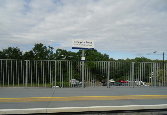
Despite its rural setting, Bellsquarry benefits from excellent transport links. The nearby Livingston South railway station provides regular services to Edinburgh and Glasgow, making it an ideal location for commuters. Additionally, the village is well-connected by road, with the nearby A71 and M8 motorway offering convenient access to surrounding areas.

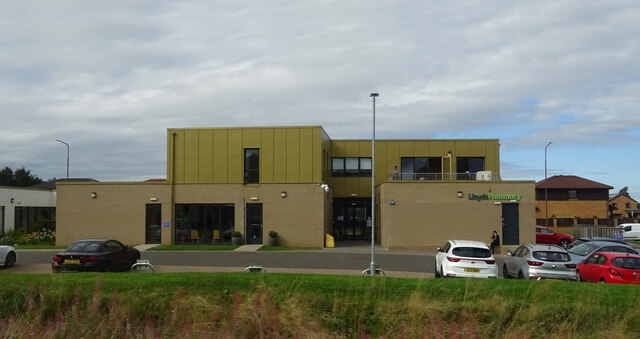
Within the village, there are several amenities to cater to residents' needs. These include a local convenience store, a primary school, and a community center. The nearby Livingston town center offers a wider range of shopping and leisure facilities, including a large shopping mall, cinemas, and restaurants.

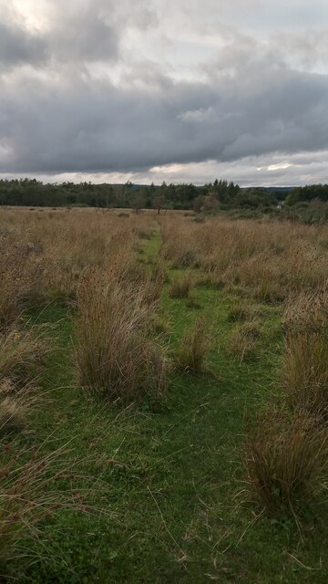
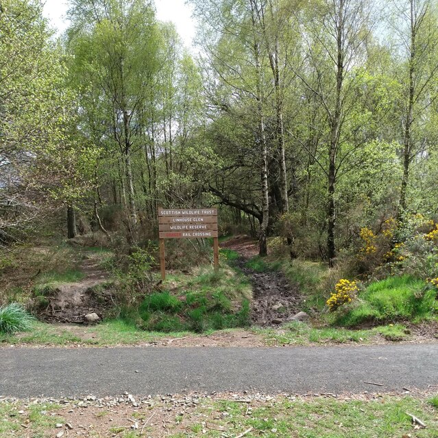
Nature enthusiasts can take advantage of the beautiful surrounding countryside, with various walking and cycling routes available. The nearby Pentland Hills Regional Park offers stunning views and outdoor recreational opportunities, including hillwalking and birdwatching.

In conclusion, Bellsquarry is a charming village in Midlothian, Scotland, offering a peaceful and scenic setting for its residents. With good transport links and a range of amenities nearby, it strikes a balance between rural living and accessibility to larger towns and cities.

If you have any feedback on the listing, please let us know in the comments section below.
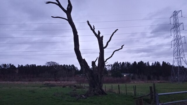
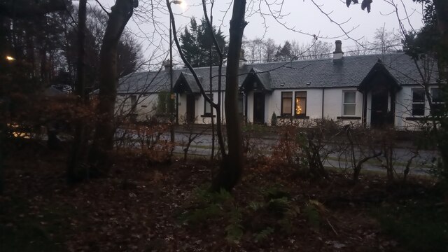
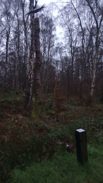
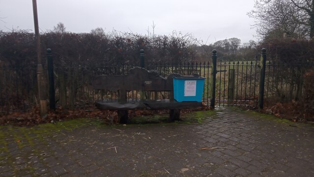
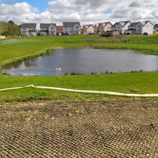
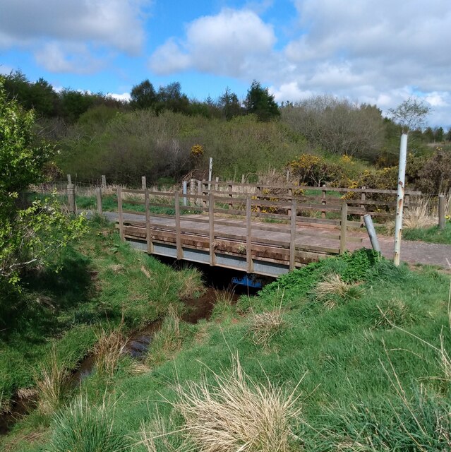
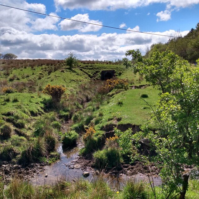
Bellsquarry Images

Images are sourced within 2km of 55.86632/-3.519681 or Grid Reference NT0464. Thanks to Geograph Open Source API. All images are credited.

Platform, Livingston South Railway Station On the line from Glasgow Central to Edinburgh Waverley via Shotts.
Platform, Livingston South Railway Station
On the line from Glasgow Central to Edinburgh Waverley via Shotts.
Murieston Medical Practice
Bus stop on the B7015
An Accidental Path? While the tramlines shown to the right of here on the large scale map don't any longer seem to represent anything on the ground, bushes and small trees  - some of which are showing at the top right of the picture - occupy the land in the middle of the lines for their entire length. The ground they occupy was part of a road a very long time ago, appearing on late 1700s and early 1800s maps, but no longer in use by the time of the first OS map from the 1850s - by then it is just shown as grass in the middle of two walls or fences.
The short grass path is presumably completely unrelated to the old road. It may just be a random coincidence, but may also have been formed by sheep and cattle on their way to get round to the other side of the bushes.
The land here is part of a very large untended field in the centre of a circular hard path route. There is a sign when entering the field from the North, warning of the dangers of livestock. I usually find these kinds of signs both bossy and unnecessary (unless warning of the presence of a bull of course). But in this case it is justified. There are often cattle in the field; combine this with the large number of people from nearby Murieston, an area of Livingston, that regularly walk their dogs round the path that circles the field - a lot of whom will not have had that much experience of walking in the country - and you have a potential problem. It must be at least a two minute jog from the centre of the field to the nearest section of path.
An Accidental Path?
While the tramlines shown to the right of here on the large scale map don't any longer seem to represent anything on the ground, bushes and small trees - some of which are showing at the top right of the picture - occupy the land in the middle of the lines for their entire length. The ground they occupy was part of a road a very long time ago, appearing on late 1700s and early 1800s maps, but no longer in use by the time of the first OS map from the 1850s - by then it is just shown as grass in the middle of two walls or fences. The short grass path is presumably completely unrelated to the old road. It may just be a random coincidence, but may also have been formed by sheep and cattle on their way to get round to the other side of the bushes. The land here is part of a very large untended field in the centre of a circular hard path route. There is a sign when entering the field from the North, warning of the dangers of livestock. I usually find these kinds of signs both bossy and unnecessary (unless warning of the presence of a bull of course). But in this case it is justified. There are often cattle in the field; combine this with the large number of people from nearby Murieston, an area of Livingston, that regularly walk their dogs round the path that circles the field - a lot of whom will not have had that much experience of walking in the country - and you have a potential problem. It must be at least a two minute jog from the centre of the field to the nearest section of path.
A Dead Tree The tree is rather like the one you get on hazardous chemical warning labels which I think usually have a dead fish somewhere near the tree too, to ram the point home.
There are a few middling-sized fields in between the houses at Linhouse (which is spelt differently from map to map) and the railway line just North of here. I presume they are, or were, used for horses, though there was no real evidence around save for a muddy path running across one of the fields which looked like it might have been used for walking horses. It certainly didn't look either sheep or cow related anyhow.
A Dead Tree
The tree is rather like the one you get on hazardous chemical warning labels which I think usually have a dead fish somewhere near the tree too, to ram the point home. There are a few middling-sized fields in between the houses at Linhouse (which is spelt differently from map to map) and the railway line just North of here. I presume they are, or were, used for horses, though there was no real evidence around save for a muddy path running across one of the fields which looked like it might have been used for walking horses. It certainly didn't look either sheep or cow related anyhow.
40-44 Newpark Road, Bellsquarry These three old terraced cottages were once simply called Newpark Cottages - No 40 is on the right. Above the door of the middle cottage is a fancy placque which says 'ARP 1870', with the 'R' written slightly larger and in front of the other two letters. If they are the original occupier's initials it seems strange to have accented the middle letter.
The new park used to be SouthEast of here, close to the road junction. The parkland is now Stromness Gardens, a cul-de-sac containing just two houses, both of such a size that they could probably be called mansions.
40-44 Newpark Road, Bellsquarry
These three old terraced cottages were once simply called Newpark Cottages - No 40 is on the right. Above the door of the middle cottage is a fancy placque which says 'ARP 1870', with the 'R' written slightly larger and in front of the other two letters. If they are the original occupier's initials it seems strange to have accented the middle letter. The new park used to be SouthEast of here, close to the road junction. The parkland is now Stromness Gardens, a cul-de-sac containing just two houses, both of such a size that they could probably be called mansions.
Some Comedy Art up a Tree This was very unexpected. And due to having become conditioned to reading so much high-minded impenetrable bullsh*t alongside artworks, I have to admit it took me a little longer than it should have to realise that the accompanying write-up on the plaque below was a joke!
It reads as follows:
The Oozlum Bird - When startled this creature will take off and fly around in ever-decreasing circles until it manages to disappear completely, which adds to its rarity. Other sources state that the bird flies backwards so that it can admire its own beautiful tail feathers, or because while it does not know where it is going, it likes to know where it has been.
David Evan Mackay, Duncan of Jordanstone College of Art and Design 2014
Some Comedy Art up a Tree
This was very unexpected. And due to having become conditioned to reading so much high-minded impenetrable bullsh*t alongside artworks, I have to admit it took me a little longer than it should have to realise that the accompanying write-up on the plaque below was a joke! It reads as follows: The Oozlum Bird - When startled this creature will take off and fly around in ever-decreasing circles until it manages to disappear completely, which adds to its rarity. Other sources state that the bird flies backwards so that it can admire its own beautiful tail feathers, or because while it does not know where it is going, it likes to know where it has been. David Evan Mackay, Duncan of Jordanstone College of Art and Design 2014
Elm Tree Bench, Bellsquarry The wood on the bench, according to the plaque, came from an old elm tree that stood at this spot for over 150 years.
The pub on the opposite side of the road near here used to be called The Elm Tree Inn. Although this is still written somewhere above the door, the place has had a refit within the last few years, and now goes by the name of Stones (or Stones at The Elmtree, it's hard to know for sure). It looks like a vast improvement on what was there before - occasionally I still have flashbacks to stuffed fish staring out at me from picture frames positioned behind and alongside the bar in the 1990s!
Elm Tree Bench, Bellsquarry
The wood on the bench, according to the plaque, came from an old elm tree that stood at this spot for over 150 years. The pub on the opposite side of the road near here used to be called The Elm Tree Inn. Although this is still written somewhere above the door, the place has had a refit within the last few years, and now goes by the name of Stones (or Stones at The Elmtree, it's hard to know for sure). It looks like a vast improvement on what was there before - occasionally I still have flashbacks to stuffed fish staring out at me from picture frames positioned behind and alongside the bar in the 1990s!
Army Reserve Centre The centre is tucked away at the end of Beveridge Square, a non-residential street which isn't a square at all, though it does boast a not-very-pretty office building set out in a square around some open ground.
To the untrained eye it looks like there is far more going on than there actually is. The sign on the right for the air cadets could have come down years ago, as they have now moved to the Craigshill area of Livingston. And regiments are actually umbrella groups subdivided into smaller units, which is why the bigger signs have two names on them.
The 278 (Lowland) Battery is part of the 105th Regiment Royal Artillery, which is the section of the Army Reserves covering Scotland and Northern Ireland. The regiment's headquarters are in Edinburgh, and they have surprisingly few bases - just one in Northern Ireland and seven in Scotland (including one in the Shetlands). They must have been even smaller until fairly recently as this unit was only formed, along with a sister detachment in Edinburgh, in 2014. It is viewed, by Wikipedia anyway, as a continuation of the Edinburgh City Artillery, which ran for around a century until the early 1960s and was involved in operations in both world wars.
In a similar vein the 243 Provost Company is part of the 1st Regiment Royal Military Police. I've never been too sure exactly how the military police while away the hours, but was pleased to read that they only have jurisdiction over military personnel, or people they believe to be military personnel. The only time they have powers over the general public is if they are on military property or encroaching onto land getting used by the military for training manoeuvres. This means there is no need to keep a close eye on your speedo when you notice one of their cars behind you in the mirror.
Army Reserve Centre
The centre is tucked away at the end of Beveridge Square, a non-residential street which isn't a square at all, though it does boast a not-very-pretty office building set out in a square around some open ground. To the untrained eye it looks like there is far more going on than there actually is. The sign on the right for the air cadets could have come down years ago, as they have now moved to the Craigshill area of Livingston. And regiments are actually umbrella groups subdivided into smaller units, which is why the bigger signs have two names on them. The 278 (Lowland) Battery is part of the 105th Regiment Royal Artillery, which is the section of the Army Reserves covering Scotland and Northern Ireland. The regiment's headquarters are in Edinburgh, and they have surprisingly few bases - just one in Northern Ireland and seven in Scotland (including one in the Shetlands). They must have been even smaller until fairly recently as this unit was only formed, along with a sister detachment in Edinburgh, in 2014. It is viewed, by Wikipedia anyway, as a continuation of the Edinburgh City Artillery, which ran for around a century until the early 1960s and was involved in operations in both world wars. In a similar vein the 243 Provost Company is part of the 1st Regiment Royal Military Police. I've never been too sure exactly how the military police while away the hours, but was pleased to read that they only have jurisdiction over military personnel, or people they believe to be military personnel. The only time they have powers over the general public is if they are on military property or encroaching onto land getting used by the military for training manoeuvres. This means there is no need to keep a close eye on your speedo when you notice one of their cars behind you in the mirror.
Old milestone The milestone on Beresford Rise in Dedridge near to the A71 has been moved away from the hedge and set into its own paved area.  This style of milestone was set up by the Calder District Turnpike Trust.  The original legend, probably painted on, would have been Edinburgh 13 Carnwath 15.
Old milestone
The milestone on Beresford Rise in Dedridge near to the A71 has been moved away from the hedge and set into its own paved area. This style of milestone was set up by the Calder District Turnpike Trust. The original legend, probably painted on, would have been Edinburgh 13 Carnwath 15.
Old milestone This Calder District Trust milestone had been at the Klondyke Garden Centre for a number of years after being found buried in a field about 2005.  At sometime it had been knocked over.  Now it is back by the roadside on Hunter Road in Howden, set firmly upright with an information board nearby.
Old milestone
This Calder District Trust milestone had been at the Klondyke Garden Centre for a number of years after being found buried in a field about 2005. At sometime it had been knocked over. Now it is back by the roadside on Hunter Road in Howden, set firmly upright with an information board nearby.
Old milestone plaque The informative plaque by the milestone taken from its recent home at the Klondyke Garden Centre and reset on Hunter Road in Livingston.
Old milestone plaque
The informative plaque by the milestone taken from its recent home at the Klondyke Garden Centre and reset on Hunter Road in Livingston.
Access to Linhouse Glen There is a designated access point over the nearby railway
Access to Linhouse Glen
There is a designated access point over the nearby railway
Drainage pond Beside new housing estate on edge of Livingston
Drainage pond
Beside new housing estate on edge of Livingston
Bridge: Linhouse Circular path Over a small stream/drainage ditch
Bridge: Linhouse Circular path
Over a small stream/drainage ditch
Postbox beside path Beside Murieston Road
Postbox beside path
Beside Murieston Road
Small stream beside Linhouse Circular path Appearing from underground
Small stream beside Linhouse Circular path
Appearing from underground
Power cable passing through wood Route being used as path
Power cable passing through wood
Route being used as path
Show me another place!

Bellsquarry is located at Grid Ref: NT0464 (Lat: 55.86632, Lng: -3.519681)

Unitary Authority: West Lothian

Police Authority: The Lothians and Scottish Borders

What 3 Words

///supply.photo.input. Near Polbeth, West Lothian

Related Wikis

Newpark railway station

Newpark railway station was a railway station serving Newpark near Bellsquarry in West Lothian, then called Linlithgowshire. It was on the Cleland and...

Bellsquarry

Bellsquarry is a suburban area located in the south-west of Livingston, West Lothian, Scotland. Bellsquarry is located to the west of the Murieston area...

Adambrae

Adambrae is a residential area and small river (burn) in Livingston, consisting primarily of privately owned housing. There is a small nature area and...

Murieston

Murieston (From Muir (moor) of Houstoun) is a primarily residential district on the southern edge of Livingston, West Lothian, Scotland. It lies to the...

Nearby Amenities

Located within 500m of 55.86632,-3.519681
Direction: forward
Traffic Calming: choker
Lat/Long: 55.8651215/-3.5129492
Barrier: bollard
Bicycle: yes
Foot: yes
Horse: yes
Lat/Long: 55.8642155/-3.5250162
Addr Housenumber: 16
Addr Street: Newpark Road
Lat/Long: 55.8680039/-3.5268001
Post Box
Collection Times: Mo-Fr 16:30; Sa 11:00
Operator: Royal Mail
Post Box Type: lamp
Ref: EH54 99
Royal Cypher: scottish_crown
Lat/Long: 55.8621192/-3.5192111
Barrier: kissing_gate
Bicycle: no
Foot: yes
Lat/Long: 55.8682181/-3.519796
Noexit: yes
Lat/Long: 55.8665672/-3.5252048
Bus Stop
Shelter: no
Lat/Long: 55.8627887/-3.5193685
Crossing
Crossing: unmarked
Crossing Island: no
Kerb: lowered
Tactile Paving: no
Lat/Long: 55.8676866/-3.5164695
Crossing
Crossing: unmarked
Crossing Island: yes
Tactile Paving: no
Lat/Long: 55.8688093/-3.514518
Bus Stop
Dunvegan Gardens
Bench: yes
Bin: no
Check Date Shelter: 2023-02-12
Lit: yes
Naptan AtcoCode: 6290LM07
Naptan NaptanCode: 95625278
Shelter: yes
Tactile Paving: no
Lat/Long: 55.8675944/-3.5167163
Addr Housenumber: 5
Addr Street: Calder Road
Addr Suburb: Bellsquarry
Lat/Long: 55.8695455/-3.5252101
Addr Housenumber: 1
Addr Street: Calder Road
Addr Suburb: Bellsquarry
Lat/Long: 55.8697379/-3.5247619
Crossing
Crossing: unmarked
Crossing Island: no
Kerb: lowered
Tactile Paving: no
Lat/Long: 55.8668097/-3.5180606
Crossing
Crossing: unmarked
Crossing Island: no
Kerb: lowered
Tactile Paving: no
Lat/Long: 55.8661853/-3.5195405
Addr City: Livingston
Addr Housenumber: 27
Addr Postcode: EH54 9HA
Addr Street: Bervie Drive
Lat/Long: 55.864377/-3.5158434
Addr City: Livingston
Addr Housenumber: 26
Addr Postcode: EH54 9HA
Addr Street: Bervie Drive
Lat/Long: 55.8643046/-3.5159739
Addr City: Livingston
Addr Housenumber: 20
Addr Postcode: EH54 9HA
Addr Street: Bervie Drive
Lat/Long: 55.8646351/-3.5171853
Addr City: Livingston
Addr Housenumber: 19
Addr Postcode: EH54 9HA
Addr Street: Bervie Drive
Lat/Long: 55.8647221/-3.5173423
Addr City: Livingston
Addr Housenumber: 11
Addr Postcode: EH54 9HA
Addr Street: Bervie Drive
Lat/Long: 55.8642393/-3.5168247
Addr City: Livingston
Addr Housenumber: 10
Addr Postcode: EH54 9HA
Addr Street: Bervie Drive
Lat/Long: 55.8641946/-3.5167056
Addr City: Livingston
Addr Housenumber: 9
Addr Postcode: EH54 9HA
Addr Street: Bervie Drive
Lat/Long: 55.8641452/-3.5165595
Addr City: Livingston
Addr Housenumber: 8
Addr Postcode: EH54 9HA
Addr Street: Bervie Drive
Lat/Long: 55.8638993/-3.516814
Addr City: Livingston
Addr Housenumber: 6
Addr Postcode: EH54 9HA
Addr Street: Bervie Drive
Lat/Long: 55.8639534/-3.5171911
Addr City: Livingston
Addr Housenumber: 5
Addr Postcode: EH54 9HA
Addr Street: Bervie Drive
Lat/Long: 55.8639308/-3.5174015
Addr City: Livingston
Addr Housenumber: 4
Addr Postcode: EH54 9HA
Addr Street: Bervie Drive
Lat/Long: 55.8637157/-3.5172555
Addr City: Livingston
Addr Housenumber: 1
Addr Postcode: EH54 9HA
Addr Street: Bervie Drive
Lat/Long: 55.8634507/-3.5168359
Addr City: Livingston
Addr Housenumber: 44
Addr Postcode: EH54 9HA
Addr Street: Bervie Drive
Lat/Long: 55.8643397/-3.5155053
Addr City: Livingston
Addr Housenumber: 50
Addr Postcode: EH54 9HA
Addr Street: Bervie Drive
Lat/Long: 55.8635569/-3.5164182
Addr City: Livingston
Addr Housenumber: 9
Addr Street: Murieston Valley
Lat/Long: 55.8641231/-3.5150978
Addr City: Livingston
Addr Housenumber: 3
Addr Street: Murieston Valley
Lat/Long: 55.8638897/-3.5154463
Addr City: Livingston
Addr Housenumber: 28
Addr Postcode: EH54 9HA
Addr Street: Bervie Drive
Lat/Long: 55.8646314/-3.5160781
Addr City: Livingston
Addr Housenumber: 29
Addr Postcode: EH54 9HA
Addr Street: Bervie Drive
Lat/Long: 55.864697/-3.5162214
Addr City: Livingston
Addr Housenumber: 32
Addr Postcode: EH54 9HA
Addr Street: Bervie Drive
Lat/Long: 55.8648405/-3.5167163
Addr City: Livingston
Addr Housenumber: 35
Addr Postcode: EH54 9HA
Addr Street: Bervie Drive
Lat/Long: 55.8651563/-3.5164035
Addr City: Livingston
Addr Housenumber: 36
Addr Postcode: EH54 9HA
Addr Street: Bervie Drive
Lat/Long: 55.8651479/-3.5162185
Addr City: Livingston
Addr Housenumber: 49A
Addr Postcode: EH54 9HA
Addr Street: Bervie Drive
Lat/Long: 55.8636608/-3.516433
Addr City: Livingston
Addr Housenumber: 48A
Addr Postcode: EH54 9HA
Addr Street: Bervie Drive
Lat/Long: 55.8638479/-3.5163988
Addr City: Livingston
Addr Housenumber: 48
Addr Postcode: EH54 9HA
Addr Street: Bervie Drive
Lat/Long: 55.8639438/-3.5162722
Addr City: Livingston
Addr Housenumber: 47A
Addr Postcode: EH54 9HA
Addr Street: Bervie Drive
Lat/Long: 55.8639948/-3.5160539
Addr City: Livingston
Addr Housenumber: 47
Addr Postcode: EH54 9HA
Addr Street: Bervie Drive
Lat/Long: 55.8640767/-3.5159252
Addr City: Livingston
Addr Housenumber: 46
Addr Postcode: EH54 9HA
Addr Street: Bervie Drive
Lat/Long: 55.864158/-3.5157516
Addr City: Livingston
Addr Housenumber: 45
Addr Postcode: EH54 9HA
Addr Street: Bervie Drive
Lat/Long: 55.8642334/-3.5156271
Addr City: Livingston
Addr Housenumber: 43
Addr Postcode: EH54 9HA
Addr Street: Bervie Drive
Lat/Long: 55.8644545/-3.5155131
Addr City: Livingston
Addr Housenumber: 42
Addr Postcode: EH54 9HA
Addr Street: Bervie Drive
Lat/Long: 55.8646132/-3.5156348
Addr City: Livingston
Addr Housenumber: 41
Addr Postcode: EH54 9HA
Addr Street: Bervie Drive
Lat/Long: 55.8646902/-3.5157378
Addr City: Livingston
Addr Housenumber: 40
Addr Postcode: EH54 9HA
Addr Street: Bervie Drive
Lat/Long: 55.8647546/-3.5158486
Addr City: Livingston
Addr Housenumber: 39
Addr Postcode: EH54 9HA
Addr Street: Bervie Drive
Lat/Long: 55.8648668/-3.5159739
Addr City: Livingston
Addr Housenumber: 38
Addr Postcode: EH54 9HA
Addr Street: Bervie Drive
Lat/Long: 55.8650023/-3.5160682
Addr City: Livingston
Addr Housenumber: 37
Addr Postcode: EH54 9HA
Addr Street: Bervie Drive
Lat/Long: 55.8650193/-3.5161109
Addr City: Livingston
Addr Housenumber: 34
Addr Postcode: EH54 9HA
Addr Street: Bervie Drive
Lat/Long: 55.8650592/-3.5165388
Addr City: Livingston
Addr Housenumber: 33
Addr Postcode: EH54 9HA
Addr Street: Bervie Drive
Lat/Long: 55.864942/-3.5167404
Addr City: Livingston
Addr Housenumber: 31
Addr Postcode: EH54 9HA
Addr Street: Bervie Drive
Lat/Long: 55.8647966/-3.5165314
Addr City: Livingston
Addr Housenumber: 30
Addr Postcode: EH54 9HA
Addr Street: Bervie Drive
Lat/Long: 55.864748/-3.5163848
Addr City: Livingston
Addr Housenumber: 25
Addr Postcode: EH54 9HA
Addr Street: Bervie Drive
Lat/Long: 55.8642252/-3.5160776
Addr City: Livingston
Addr Housenumber: 24
Addr Postcode: EH54 9HA
Addr Street: Bervie Drive
Lat/Long: 55.8643498/-3.5164482
Addr City: Livingston
Addr Housenumber: 23
Addr Postcode: EH54 9HA
Addr Street: Bervie Drive
Lat/Long: 55.8644044/-3.5165972
Addr City: Livingston
Addr Housenumber: 22
Addr Postcode: EH54 9HA
Addr Street: Bervie Drive
Lat/Long: 55.8644442/-3.5167684
Addr City: Livingston
Addr Housenumber: 21
Addr Postcode: EH54 9HA
Addr Street: Bervie Drive
Lat/Long: 55.8644993/-3.5169587
Addr City: Livingston
Addr Housenumber: 18
Addr Postcode: EH54 9HA
Addr Street: Bervie Drive
Lat/Long: 55.8646281/-3.5176499
Addr City: Livingston
Addr Housenumber: 17
Addr Postcode: EH54 9HA
Addr Street: Bervie Drive
Lat/Long: 55.8645287/-3.5178333
Addr City: Livingston
Addr Housenumber: 16
Addr Postcode: EH54 9HA
Addr Street: Bervie Drive
Lat/Long: 55.864438/-3.517809
Addr City: Livingston
Addr Housenumber: 15
Addr Postcode: EH54 9HA
Addr Street: Bervie Drive
Lat/Long: 55.8643397/-3.517608
Addr City: Livingston
Addr Housenumber: 14
Addr Postcode: EH54 9HA
Addr Street: Bervie Drive
Lat/Long: 55.8643123/-3.5174044
Addr City: Livingston
Addr Housenumber: 13
Addr Postcode: EH54 9HA
Addr Street: Bervie Drive
Lat/Long: 55.86432/-3.5171973
Addr City: Livingston
Addr Housenumber: 12
Addr Postcode: EH54 9HA
Addr Street: Bervie Drive
Lat/Long: 55.8642832/-3.5169455
Addr City: Livingston
Addr Housenumber: 7
Addr Postcode: EH54 9HA
Addr Street: Bervie Drive
Lat/Long: 55.8639096/-3.5170267
Addr City: Livingston
Addr Housenumber: 2
Addr Postcode: EH54 9HA
Addr Street: Bervie Drive
Lat/Long: 55.8635931/-3.5168516
Addr City: Livingston
Addr Housenumber: 3
Addr Postcode: EH54 9HA
Addr Street: Bervie Drive
Lat/Long: 55.8636882/-3.5168548
Addr City: Livingston
Addr Housenumber: 11
Addr Street: Murieston Valley
Lat/Long: 55.8641905/-3.5149833
Addr City: Livingston
Addr Housenumber: 7
Addr Street: Murieston Valley
Lat/Long: 55.8640246/-3.5151757
Addr City: Livingston
Addr Housenumber: 5
Addr Street: Murieston Valley
Lat/Long: 55.8639293/-3.5152965
Addr City: Livingston
Addr Housenumber: 1
Addr Street: Murieston Valley
Lat/Long: 55.8637219/-3.5156922
Addr City: Livingston
Addr Housenumber: 10
Addr Street: Murieston Valley
Lat/Long: 55.8645348/-3.5140619
Addr City: Livingston
Addr Housenumber: 8
Addr Street: Murieston Valley
Lat/Long: 55.8644408/-3.5142142
Addr City: Livingston
Addr Housenumber: 6
Addr Street: Murieston Valley
Lat/Long: 55.8643994/-3.5142617
Addr City: Livingston
Addr Housenumber: 4
Addr Street: Murieston Valley
Lat/Long: 55.8638749/-3.5148862
Addr City: Livingston
Addr Housenumber: 2
Addr Street: Murieston Valley
Lat/Long: 55.863817/-3.5149493
Addr City: Livingston
Addr Housenumber: 15
Addr Postcode: EH54 9HD
Addr Street: Clova Drive
Lat/Long: 55.8630205/-3.5153367
Addr City: Livingston
Addr Housenumber: 14
Addr Postcode: EH54 9HD
Addr Street: Clova Drive
Lat/Long: 55.862925/-3.51573
Addr City: Livingston
Addr Housenumber: 13
Addr Postcode: EH54 9HD
Addr Street: Clova Drive
Lat/Long: 55.8629029/-3.5160448
Addr City: Livingston
Addr Housenumber: 12
Addr Postcode: EH54 9HD
Addr Street: Clova Drive
Lat/Long: 55.8626787/-3.5158267
Addr City: Livingston
Addr Housenumber: 11
Addr Postcode: EH54 9HD
Addr Street: Clova Drive
Lat/Long: 55.862743/-3.5151645
Addr City: Livingston
Addr Housenumber: 4
Addr Postcode: EH54 9HD
Addr Street: Clova Drive
Lat/Long: 55.8628698/-3.5148062
Addr City: Livingston
Addr Housenumber: 3
Addr Postcode: EH54 9HD
Addr Street: Clova Drive
Lat/Long: 55.8630705/-3.5148952
Addr City: Livingston
Addr Housenumber: 2
Addr Postcode: EH54 9HD
Addr Street: Clova Drive
Lat/Long: 55.8632583/-3.5150355
Addr City: Livingston
Addr Housenumber: 16
Addr Postcode: EH54 9HD
Addr Street: Clova Drive
Lat/Long: 55.8633451/-3.515569
Addr City: Livingston
Addr Housenumber: 1
Addr Postcode: EH54 9HD
Addr Street: Clova Drive
Lat/Long: 55.8634771/-3.5152762
Addr City: Livingston
Addr Housenumber: 47
Addr Postcode: EH54 9HG
Addr Street: Fiddich Drive
Lat/Long: 55.8640518/-3.5146106
Addr City: Livingston
Addr Housenumber: 46
Addr Postcode: EH54 9HG
Addr Street: Fiddich Drive
Lat/Long: 55.8639708/-3.5145089
Addr City: Livingston
Addr Housenumber: 45
Addr Postcode: EH54 9HG
Addr Street: Fiddich Drive
Lat/Long: 55.8639554/-3.5144251
Addr City: Livingston
Addr Housenumber: 44
Addr Postcode: EH54 9HG
Addr Street: Fiddich Drive
Lat/Long: 55.8638779/-3.5142349
Addr City: Livingston
Addr Housenumber: 43
Addr Postcode: EH54 9HG
Addr Street: Fiddich Drive
Lat/Long: 55.8638036/-3.5141344
Addr City: Livingston
Addr Housenumber: 42
Addr Postcode: EH54 9HG
Addr Street: Fiddich Drive
Lat/Long: 55.8637138/-3.5139759
Addr City: Livingston
Addr Housenumber: 41
Addr Postcode: EH54 9HG
Addr Street: Fiddich Drive
Lat/Long: 55.8635418/-3.5143208
Addr City: Livingston
Addr Housenumber: 40
Addr Postcode: EH54 9HG
Addr Street: Fiddich Drive
Lat/Long: 55.8634921/-3.5142645
Addr City: Livingston
Addr Housenumber: 39
Addr Postcode: EH54 9HG
Addr Street: Fiddich Drive
Lat/Long: 55.863379/-3.5140984
Addr City: Livingston
Addr Housenumber: 38
Addr Postcode: EH54 9HG
Addr Street: Fiddich Drive
Lat/Long: 55.8633017/-3.5140025
Addr City: Livingston
Addr Housenumber: 37
Addr Postcode: EH54 9HG
Addr Street: Fiddich Drive
Lat/Long: 55.8632115/-3.5138955
Addr City: Livingston
Addr Housenumber: 7
Addr Postcode: EH54 9HG
Addr Street: Fiddich Drive
Lat/Long: 55.8638411/-3.513693
Addr City: Livingston
Addr Housenumber: 3
Addr Postcode: EH54 9HG
Addr Street: Fiddich Drive
Lat/Long: 55.8641457/-3.5142084
Addr City: Livingston
Addr Housenumber: 2
Addr Postcode: EH54 9HG
Addr Street: Fiddich Drive
Lat/Long: 55.8641748/-3.5142762
Addr City: Livingston
Addr Housenumber: 1
Addr Postcode: EH54 9HG
Addr Street: Fiddich Drive
Lat/Long: 55.8642169/-3.5144452
Addr City: Livingston
Addr Housenumber: 6
Addr Postcode: EH54 9HG
Addr Street: Fiddich Drive
Lat/Long: 55.8639465/-3.5137894
Addr City: Livingston
Addr Housenumber: 5
Addr Postcode: EH54 9HG
Addr Street: Fiddich Drive
Lat/Long: 55.86405/-3.5138865
Addr City: Livingston
Addr Housenumber: 4
Addr Postcode: EH54 9HG
Addr Street: Fiddich Drive
Lat/Long: 55.8641299/-3.5139817
Addr City: Livingston
Addr Housenumber: 8
Addr Postcode: EH54 9HG
Addr Street: Fiddich Drive
Lat/Long: 55.8639187/-3.5132779
Addr City: Livingston
Addr Housenumber: 9
Addr Postcode: EH54 9HG
Addr Street: Fiddich Drive
Lat/Long: 55.8639452/-3.5131401
Addr City: Livingston
Addr Housenumber: 25
Addr Postcode: EH54 9HG
Addr Street: Fiddich Drive
Lat/Long: 55.8634363/-3.513635
Addr City: Livingston
Addr Housenumber: 15
Addr Postcode: EH54 9JN
Addr Street: Albyn Drive
Lat/Long: 55.8628234/-3.5166822
Addr City: Livingston
Addr Housenumber: 14
Addr Postcode: EH54 9JN
Addr Street: Albyn Drive
Lat/Long: 55.8627589/-3.5168464
Addr City: Livingston
Addr Housenumber: 32
Addr Postcode: EH54 9JN
Addr Street: Albyn Drive
Lat/Long: 55.8620824/-3.5170281
Addr City: Livingston
Addr Housenumber: 17
Addr Postcode: EH54 9JN
Addr Street: Albyn Drive
Lat/Long: 55.8625745/-3.5167574
Addr City: Livingston
Addr Housenumber: 16
Addr Postcode: EH54 9JN
Addr Street: Albyn Drive
Lat/Long: 55.8626258/-3.5163714
Addr City: Livingston
Addr Housenumber: 5
Addr Postcode: EH54 9JN
Addr Street: Albyn Drive
Lat/Long: 55.861996/-3.5180727
Barrier: kissing_gate
Lat/Long: 55.8698297/-3.5157386
Bench
Backrest: yes
Material: wood
Lat/Long: 55.8655896/-3.5272872
Bench
Backrest: yes
Material: wood
Lat/Long: 55.8656091/-3.5273221
Barrier: bollard
Bicycle: yes
Foot: yes
Horse: yes
Lat/Long: 55.8644263/-3.5248834
Bench
Backrest: no
Lat/Long: 55.8685737/-3.5206434
Bench
Lat/Long: 55.8683434/-3.52547
Barrier: cycle_barrier
Cycle Barrier: double
Lat/Long: 55.8648393/-3.5137125
Barrier: bollard
Bollard: fixed
Lat/Long: 55.8651397/-3.5129664
Waste Basket
Waste: trash;dog_excrement
Lat/Long: 55.8665241/-3.5151315
Bench
Backrest: no
Material: wood
Lat/Long: 55.8698953/-3.5228994
Man Made: street_cabinet
Operator: Scotland Gas Networks
Ref: Harburn Road DG
Utility: gas
Lat/Long: 55.8650648/-3.5220782
Man Made: street_cabinet
Operator: Scotland Gas Networks
Ref: Murieston Farm DG
Utility: gas
Lat/Long: 55.8630419/-3.5192043
Addr Housenumber: 17
Addr Street: Pitcaple Gardens
Lat/Long: 55.867249/-3.5221885
Addr Housenumber: 16
Addr Street: Pitcaple Gardens
Lat/Long: 55.8673619/-3.5221141
Addr Housenumber: 15
Addr Street: Pitcaple Gardens
Lat/Long: 55.8675086/-3.5220396
Addr Housenumber: 14
Addr Street: Pitcaple Gardens
Lat/Long: 55.8676671/-3.5221283
Addr Housenumber: 13
Addr Street: Pitcaple Gardens
Lat/Long: 55.8677984/-3.5222897
Noexit: yes
Lat/Long: 55.8680018/-3.5221092
Addr Housenumber: 12
Addr Street: Pitcaple Gardens
Lat/Long: 55.8678877/-3.5224569
Addr Housenumber: 11
Addr Street: Pitcaple Gardens
Lat/Long: 55.8677405/-3.5227318
Addr Housenumber: 10
Addr Street: Pitcaple Gardens
Lat/Long: 55.8676684/-3.5229645
Addr Housenumber: 9
Addr Street: Pitcaple Gardens
Lat/Long: 55.8675822/-3.522809
Addr City: Livingston
Addr Housenumber: 8
Addr Postcode: EH54 9HW
Addr Street: Pitcaple Gardens
Lat/Long: 55.8674727/-3.5226558
Addr Housenumber: 6
Addr Street: Pitcaple Gardens
Lat/Long: 55.8673439/-3.5235359
Addr Housenumber: 5
Addr Street: Pitcaple Gardens
Lat/Long: 55.8672438/-3.5237354
Addr Housenumber: 4
Addr Street: Pitcaple Gardens
Lat/Long: 55.8671041/-3.5237558
Addr Housenumber: 3
Addr Street: Pitcaple Gardens
Lat/Long: 55.8669907/-3.5236052
Addr Housenumber: 2
Addr Street: Pitcaple Gardens
Lat/Long: 55.8669103/-3.5234331
Addr Housenumber: 7
Addr Street: Pitcaple Gardens
Lat/Long: 55.8672701/-3.5232697
Addr Housenumber: 1
Addr Street: Pitcaple Gardens
Lat/Long: 55.8668985/-3.5232055
Addr City: Livingston
Addr Housename: Blythfield
Addr Housenumber: 48
Addr Postcode: EH54 9AF
Addr Street: Newpark Road
Lat/Long: 55.8653464/-3.5226227
Addr Housenumber: 46
Addr Street: Newpark Road
Lat/Long: 55.8655701/-3.5229182
Addr Housenumber: 44
Addr Street: Newpark Road
Lat/Long: 55.8666579/-3.5243199
Addr Housenumber: 42
Addr Street: Newpark Road
Lat/Long: 55.8667408/-3.5244287
Addr Housenumber: 40
Addr Street: Newpark Road
Lat/Long: 55.8668104/-3.52452
Addr City: Livingston
Addr Housenumber: 38
Addr Postcode: EH54 9AE
Addr Street: Newpark Road
Lat/Long: 55.8669636/-3.5247756
Addr Housenumber: 36
Addr Street: Newpark Road
Lat/Long: 55.8670741/-3.5251009
Addr Housename: Woodlea
Addr Housenumber: 30
Addr Street: Newpark Road
Lat/Long: 55.8672038/-3.5249951
Addr City: Livingston
Addr Housenumber: 26
Addr Postcode: EH54 9AE
Addr Street: Newpark Road
Lat/Long: 55.8674039/-3.5254394
Addr City: Livingston
Addr Housenumber: 24
Addr Postcode: EH54 9AE
Addr Street: Newpark Road
Lat/Long: 55.8674718/-3.5255925
Addr City: Livingston
Addr Housenumber: 20
Addr Postcode: EH54 9AE
Addr Street: Newpark Road
Lat/Long: 55.867692/-3.5261273
Addr Housenumber: 18
Addr Street: Newpark Road
Lat/Long: 55.8678559/-3.5265837
Addr Housenumber: 14
Addr Street: Newpark Road
Lat/Long: 55.8680482/-3.5268617
Material: wood
Power: pole
Transformer: distribution
Lat/Long: 55.8689702/-3.5254043
Material: wood
Power: pole
Transformer: distribution
Lat/Long: 55.8683682/-3.5268199
Tourism: artwork
Lat/Long: 55.8698048/-3.5214256
Tourism: artwork
Lat/Long: 55.8694316/-3.5194354
Oozlum Bird
Artwork Type: sculpture
Tourism: artwork
Lat/Long: 55.8687092/-3.520004
Waste Basket
Waste: dog_excrement
Lat/Long: 55.8650831/-3.522019
Waste Basket
Waste: dog_excrement
Lat/Long: 55.8671885/-3.5247639
Waste Basket
Waste: dog_excrement
Lat/Long: 55.867427/-3.5168318
Newpark
Historic Railway: station
Railway: site
Wikidata: Q7018672
Wikipedia: en:Newpark railway station
Lat/Long: 55.864841/-3.5197117
Bench
Lat/Long: 55.8676322/-3.5135427
Waste Basket
Waste: trash;dog_excrement
Lat/Long: 55.8676219/-3.5135765
Waste Basket
Lat/Long: 55.8646453/-3.5131962
The data included in this document is from www.openstreetmap.org. The data is made available under ODbL.

Have you been to Bellsquarry?

Leave your review of Bellsquarry below (or comments, questions and feedback).