Mill Hill

Settlement in Surrey

England

Mill Hill

Orchids at the London Wetland Centre These pyramidal orchids were near the turnaround for buses at the entrance to the London Wetland Centre.
Orchids at the London Wetland Centre Credit: Marathon

Mill Hill is a suburban neighborhood located in the county of Surrey, England. Situated approximately 15 miles northwest of central London, it falls within the London Borough of Barnet. The area is known for its leafy residential streets, open green spaces, and excellent transport links.

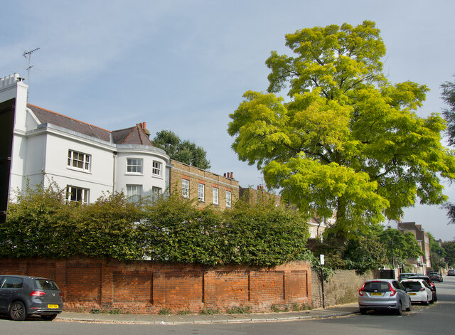
One of the defining features of Mill Hill is its diverse housing options. The neighborhood offers a mix of period properties, modern developments, and spacious mansions, catering to a variety of tastes and budgets. The area is particularly attractive to families, thanks to its selection of reputable schools and abundance of parks and playgrounds.

Mill Hill boasts a strong sense of community, with local amenities and services catering to the needs of its residents. The Broadway, the main commercial area, offers a range of shops, restaurants, and cafes, providing ample opportunities for retail therapy and socializing. The neighborhood is also home to several sports clubs, including golf, cricket, and rugby, as well as a leisure center and numerous fitness facilities.

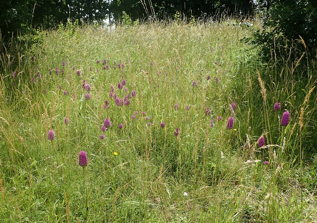
Nature enthusiasts are well catered for in Mill Hill, with several green spaces to explore. The nearby Dollis Valley Greenwalk and Mill Hill Park provide picturesque walking and cycling routes, while the stunning Moat Mount Open Space offers panoramic views of the city skyline.

Transportation options in Mill Hill are plentiful, with excellent road and rail connections. The neighborhood benefits from easy access to the M1 motorway, providing convenient links to the rest of the country. Additionally, Mill Hill Broadway station offers regular train services to central London, making it an attractive location for commuters.

Overall, Mill Hill offers a tranquil suburban lifestyle, with a range of amenities and easy access to both the city and countryside.

If you have any feedback on the listing, please let us know in the comments section below.
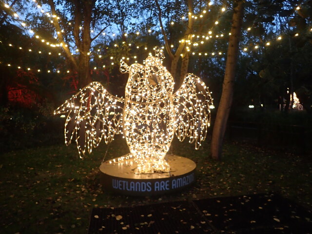
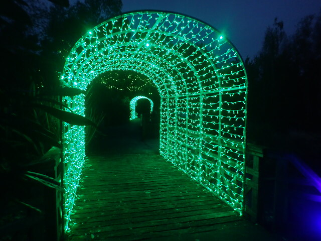
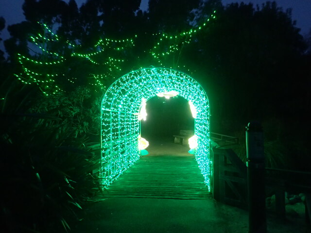
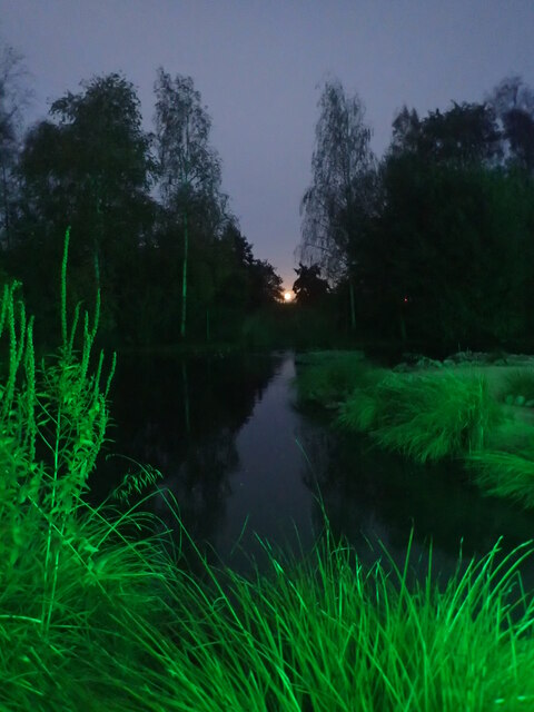
Mill Hill Images

Images are sourced within 2km of 51.470154/-0.240587 or Grid Reference TQ2276. Thanks to Geograph Open Source API. All images are credited.

Orchids at the London Wetland Centre These pyramidal orchids were near the turnaround for buses at the entrance to the London Wetland Centre.
Orchids at the London Wetland Centre
These pyramidal orchids were near the turnaround for buses at the entrance to the London Wetland Centre.
Fulham riverside seen from the Barnes towpath Photo taken by evening light from a point close to the old Harrods depository.   The tide was high, and just turning.
Fulham riverside seen from the Barnes towpath
Photo taken by evening light from a point close to the old Harrods depository. The tide was high, and just turning.
Corney Reach, Chiswick Seen from the Thames Path at low tide, with Chiswick Lifeboat Station <span class="nowrap"><a title="https://rnli.org/find-my-nearest/lifeboat-stations/chiswick-lifeboat-station" rel="nofollow ugc noopener" href="https://rnli.org/find-my-nearest/lifeboat-stations/chiswick-lifeboat-station">Link</a><img style="margin-left:2px;" alt="External link" title="External link - shift click to open in new window" src="https://s1.geograph.org.uk/img/external.png" width="10" height="10"/></span> to the right
Corney Reach, Chiswick
Seen from the Thames Path at low tide, with Chiswick Lifeboat Station LinkExternal link to the right
Chiswick Mall/Church Street Looking along the riverside street which carries the Thames Path towards Hammersmith
Chiswick Mall/Church Street
Looking along the riverside street which carries the Thames Path towards Hammersmith
Illuminature at the London Wetland Centre Illuminature at the London Wetland Centre was due to run through the winter months of 2021/2022. It is a light trail - this view is near the start.
Illuminature at the London Wetland Centre
Illuminature at the London Wetland Centre was due to run through the winter months of 2021/2022. It is a light trail - this view is near the start.
Illuminature at the London Wetland Centre Illuminature is a light trail at the London Wetland Centre and was due to run through the winter months of 2021/2022.
Illuminature at the London Wetland Centre
Illuminature is a light trail at the London Wetland Centre and was due to run through the winter months of 2021/2022.
Full moon rising over the London Wetland Centre This was taken during Illuminature which is a light trail at the London Wetland Centre and was due to run through the winter months of 2021/2022.
Full moon rising over the London Wetland Centre
This was taken during Illuminature which is a light trail at the London Wetland Centre and was due to run through the winter months of 2021/2022.
Illuminature at the London Wetland Centre Illuminature is a light trail at the London Wetland Centre and was due to run through the winter months of 2021/2022.
Illuminature at the London Wetland Centre
Illuminature is a light trail at the London Wetland Centre and was due to run through the winter months of 2021/2022.
Fulham Football Club : Riverside Stand re-development
Show me another place!

Mill Hill is located at Grid Ref: TQ2276 (Lat: 51.470154, Lng: -0.240587)

Unitary Authority: Richmond upon Thames

Police Authority: Metropolitan

What 3 Words

///people.civil.closes. Near Wandsworth, London

Nearby Locations

Barnes Mill Hill

Related Wikis

Mill Hill, Barnes

Mill Hill is a street in Barnes, London, England. Mill Hill is effectively an enclave of eleven large houses on the site of a former windmill, surrounded...

Barnes Common

Barnes Common is a local nature reserve on common land in the south east of Barnes, London, England, adjoining Putney Lower Common to the east and bounded...

Putney Lower Common

Putney Lower Common is an open parkland space in the London Borough of Wandsworth between the town centres of Putney and Barnes. It is part of Wimbledon...

Barnes railway station

Barnes railway station is a Grade II listed station in the London Borough of Richmond upon Thames, in southwest London, and is in Travelcard Zone 3. It...

Barnes Cemetery

Barnes Cemetery, also known as Barnes Old Cemetery, is a disused cemetery in Barnes, in the London Borough of Richmond upon Thames. It is located off Rocks...

Barnes rail crash

The Barnes rail crash, in which 13 people were killed and 41 were injured, occurred at Barnes railway station late in the evening of Friday 2 December...

Barnes Methodist Church

Barnes Methodist Church is a Methodist church in Station Road, Barnes, London. It is affiliated with the Churches Together in Barnes and Churches Together...

OSO Arts Centre

The OSO Arts Centre is a theatre and arts centre located in Barnes in the London Borough of Richmond upon Thames. The building was previously the postal...

Nearby Amenities

Located within 500m of 51.470154,-0.240587
Mini Roundabout
Direction: clockwise
Lat/Long: 51.4702781/-0.2445792
Mini Roundabout
Lat/Long: 51.4667222/-0.2362211
Railway: switch
Lat/Long: 51.4669201/-0.2422613
Crossing
Crossing: unmarked
Crossing Island: no
Crossing Markings: no
Kerb: flush
Tactile Paving: no
Lat/Long: 51.4702485/-0.2474302
Crossing Barrier: double_half
Railway: level_crossing
Lat/Long: 51.4681239/-0.2459976
Barnes
Is In: Richmond, London, UK
Is In District: Richmond upon Thames
Place: suburb
Wikidata: Q668140
Wikipedia: en:Barnes, London
Lat/Long: 51.4718962/-0.2387441
Crossing Barrier: double_half
Railway: level_crossing
Lat/Long: 51.4676705/-0.2465749
Crossing
Bicycle: yes
Button Operated: yes
Crossing: traffic_signals
Crossing Island: yes
Crossing Ref: toucan
Tactile Paving: yes
Traffic Signals Sound: yes
Traffic Signals Vibration: no
Lat/Long: 51.4717469/-0.2368896
Post Box
Brand: Royal Mail
Brand Wikidata: Q638098
Collection Times: Mo-Fr 17:30; Sa 12:00
Drive Through: no
Operator: Royal Mail
Operator Wikidata: Q638098
Post Box Type: pillar
Ref: SW13 25
Royal Cypher: no
Lat/Long: 51.4712947/-0.2463097
Bicycle Parking
Capacity: 24
Covered: yes
Lat/Long: 51.467231/-0.2416384
Bus Stop
Barnes Station
Bench: yes
Bin: yes
Bus: yes
Local Ref: A
Naptan AtcoCode: 490001014A
Naptan Bearing: N
Naptan CommonName: Barnes
Naptan Indicator: A
Naptan Street: ROCKS LANE
Public Transport: platform
Ref: 55951
Shelter: yes
Tactile Paving: no
Lat/Long: 51.4674067/-0.241197
Bus Stop
Barnes Station
Bench: yes
Bin: yes
Bus: yes
Local Ref: B
Naptan AtcoCode: 490001014B
Naptan Bearing: S
Naptan CommonName: Barnes
Naptan Indicator: B
Naptan Street: ROCKS LANE
Public Transport: platform
Ref: 72331
Shelter: yes
Tactile Paving: no
Lat/Long: 51.4666418/-0.2419921
Bus Stop
Glebe Road
Bench: yes
Bin: yes
Bus: yes
Lit: yes
Local Ref: BB
Naptan AtcoCode: 490007216BB
Naptan Bearing: W
Naptan CommonName: Glebe Road Church Road
Naptan Indicator: Stop BB
Naptan Street: CHURCH ROAD
Naptan Verified: no
Network: London Buses
Network Wikidata: Q1192411
Public Transport: platform
Ref: 50703
Shelter: yes
Tactile Paving: no
Lat/Long: 51.4740613/-0.2441671
Bus Stop
Ranelagh Avenue
Bench: yes
Bin: yes
Bus: yes
Lit: no
Local Ref: WT
Naptan AtcoCode: 490011420WT
Naptan Bearing: S
Naptan CommonName: Ranelagh Avenue
Naptan Indicator: WT
Naptan Street: ROCKS LANE
Naptan Verified: no
Network: London Buses
Network Wikidata: Q1192411
Public Transport: platform
Ref: 56731
Shelter: yes
Tactile Paving: no
Lat/Long: 51.4727886/-0.2374368
Bus Stop
Ranelagh Avenue
Bench: yes
Bin: yes
Bus: yes
Lit: yes
Local Ref: WX
Naptan AtcoCode: 490011420WX
Naptan Bearing: N
Naptan CommonName: Ranelagh Avenue
Naptan Indicator: WX
Naptan Street: ROCKS LANE
Naptan Verified: no
Network: London Buses
Network Wikidata: Q1192411
Public Transport: platform
Ref: 75855
Shelter: yes
Tactile Paving: no
Lat/Long: 51.4724956/-0.2374261
Bus Stop
Beverley Road
Bench: no
Bus: yes
Naptan AtcoCode: 490018231N
Naptan Bearing: N
Naptan CommonName: Beverley Road Station Road
Naptan Indicator: Stop
Naptan Verified: no
Network: London Buses
Network Wikidata: Q1192411
Public Transport: platform
Ref: 49599
Shelter: no
Tactile Paving: no
Lat/Long: 51.4705423/-0.2451296
Bus Stop
Beverley Road
Bench: no
Bus: yes
Naptan AtcoCode: 490018231S
Naptan Bearing: S
Naptan CommonName: Beverley Road Station Road
Naptan Indicator: Stop
Naptan Verified: no
Network: London Buses
Network Wikidata: Q1192411
Public Transport: platform
Ref: 59012
Shelter: no
Tactile Paving: no
Lat/Long: 51.4705015/-0.2448937
Mill Hill
Natural: peak
Source: OS 1:25k
Lat/Long: 51.4686516/-0.2385855
Post Box
Collection Times: Mo-Fr 17:30, Sa 12:00
Operator: Royal Mail
Operator Wikidata: Q638098
Post Box Type: pillar
Ref: SW13 3
Royal Cypher: EVIIR
Royal Cypher Wikidata: Q33102324
Lat/Long: 51.4696754/-0.2437834
Post Box
Brand: Royal Mail
Brand Wikidata: Q638098
Collection Times: Mo-Fr 17:30; Sa 12:00
Operator: Royal Mail
Operator Wikidata: Q638098
Post Box Type: pillar
Ref: SW13 20
Royal Cypher: EVIIR
Royal Cypher Wikidata: Q33102324
Lat/Long: 51.4724932/-0.2420455
Post Box
Brand: Royal Mail
Brand Wikidata: Q638098
Collection Times: Mo-Fr 17:30; Sa 12:00
Operator: Royal Mail
Operator Wikidata: Q638098
Post Box Type: pillar
Ref: SW13 16
Royal Cypher: VR
Royal Cypher Wikidata: Q33102356
Lat/Long: 51.4718172/-0.2370469
Railway: railway_crossing
Lat/Long: 51.4673745/-0.2439444
Marc Bolan's Rock Shrine
Historic: memorial
Memorial: sculpture
Wikidata: Q15202817
Lat/Long: 51.4659494/-0.2385603
Railway: switch
Lat/Long: 51.4662137/-0.238246
Railway: switch
Lat/Long: 51.4662464/-0.2381609
Railway: switch
Lat/Long: 51.466296/-0.2388795
Railway: switch
Lat/Long: 51.4664136/-0.2388907
Barnes
Public Transport: stop_position
Railway: stop
Ref: 2
Train: yes
Lat/Long: 51.4665763/-0.2398752
Barnes
Public Transport: stop_position
Railway: stop
Ref: 1
Train: yes
Lat/Long: 51.4666062/-0.2398629
Railway: switch
Lat/Long: 51.467078/-0.2428527
Railway: switch
Lat/Long: 51.4670629/-0.242331
Railway: switch
Lat/Long: 51.4671481/-0.243184
Railway: switch
Lat/Long: 51.4671899/-0.2427964
Railway: switch
Lat/Long: 51.4672618/-0.2432081
Railway: railway_crossing
Lat/Long: 51.4673102/-0.2437365
Railway: switch
Lat/Long: 51.467575/-0.2457388
Railway: switch
Lat/Long: 51.4676439/-0.2459651
Crossing Barrier: double_half
Railway: level_crossing
Lat/Long: 51.4677022/-0.2465384
Crossing Barrier: double_half
Railway: level_crossing
Lat/Long: 51.468153/-0.245957
Bicycle Parking
Capacity: 20
Covered: yes
Fee: no
Lat/Long: 51.4667388/-0.2416256
Crossing
Crossing: uncontrolled
Crossing Ref: island
Lat/Long: 51.4667262/-0.2360859
Traffic Calming: hump
Lat/Long: 51.4678487/-0.2379637
Ref GB Tflcid: RWG230187
Traffic Calming: hump
Lat/Long: 51.4686572/-0.2377416
Traffic Calming: hump
Lat/Long: 51.4691918/-0.2376179
Crossing
Crossing: traffic_signals
Crossing Island: no
Lat/Long: 51.467114/-0.2414665
Barnes
Addr Street: Station Road
Naptan AtcoCode: 9100BARNES
Network: National Rail
Network Website: https://www.nationalrail.co.uk/stations/bns/
Network Wikidata: Q26334
Operator: South Western Railway
Public Transport: station
Railway: station
Ref Crs: BNS
Source Ref: http://en.wikipedia.org/wiki/List_of_London_railway_stations
Wheelchair: limited
Wheelchair Description: Level access to Platforms 1 and 4 from separate entrances. Steps to Platforms 2/3.
Wikidata: Q1973974
Wikipedia: en:Barnes railway station
Lat/Long: 51.466783/-0.2411817
Traffic Signals
Traffic Signals: signal
Traffic Signals Direction: backward
Lat/Long: 51.4700288/-0.2376685
Bicycle Parking
Bicycle Parking: stands
Capacity: 10
Covered: no
Lat/Long: 51.4742602/-0.2432238
Barrier: bollard
Bollard: fixed
Lat/Long: 51.4724711/-0.24545
Community Centre
OSO Arts Centre
Addr City: London
Addr Housenumber: 49
Addr Postcode: SW13 0LF
Addr Street: Station Road
Wikidata: Q47012672
Wikipedia: en:OSO Arts Centre
Lat/Long: 51.4722797/-0.2466172
Cafe
OSO Arts Centre
Addr City: London
Addr Housenumber: 49
Addr Postcode: SW13 0LF
Addr Street: Station Road
Fhrs Id: 353543
Not Addr Postcode: SW13 0LY
Lat/Long: 51.4723925/-0.2466661
Barnes
Public Transport: stop_position
Railway: stop
Ref: 3
Train: yes
Lat/Long: 51.4669184/-0.2421064
Barnes
Public Transport: stop_position
Railway: stop
Ref: 4
Train: yes
Lat/Long: 51.4668894/-0.2421128
Toilets
Access: yes
Male: yes
Lat/Long: 51.4679829/-0.2467934
Toilets
Access: yes
Female: yes
Wheelchair: yes
Lat/Long: 51.4680728/-0.2466516
Drinking Water
Access: yes
Wheelchair: yes
Lat/Long: 51.4680214/-0.2467552
Torchlight
Addr City: London
Addr Housename: Suite 4, The Mews
Addr Housenumber: 46-52
Addr Postcode: SW13 0DQ
Addr Street: Church Road
Consulting: education
Level: 1
Office: consulting
Opening Hours: Mo-Sa 08:00-18:00
Lat/Long: 51.4745263/-0.2408647
Barnes Junction
Railway: junction
Lat/Long: 51.4671573/-0.2430081
Barrier: cycle_barrier
Cycle Barrier: double
Lat/Long: 51.470248/-0.2474911
Barrier: cycle_barrier
Cycle Barrier: double
Lat/Long: 51.4702526/-0.2473218
Give Way
Direction: forward
Lat/Long: 51.4718375/-0.2382063
Give Way
Direction: forward
Lat/Long: 51.4716601/-0.2405278
Give Way
Direction: backward
Lat/Long: 51.4723329/-0.2421055
Give Way
Direction: backward
Lat/Long: 51.4703098/-0.2441632
Herbert Howells
Historic: memorial
Inscription: Herbert Howells (1892-1983) Composer and teacher lived here 1946-1983
Memorial: blue_plaque
Openplaques Id: 5496
Subject Wikidata: Q963107
Lat/Long: 51.4719927/-0.2447084
Barrier: cycle_barrier
Foot: yes
Lat/Long: 51.4703902/-0.2437687
Bench
Backrest: yes
Lat/Long: 51.4712272/-0.2391078
Bench
Backrest: yes
Lat/Long: 51.4709057/-0.2406771
Bench
Backrest: yes
Lat/Long: 51.4711469/-0.2438616
Bench
Backrest: yes
Lat/Long: 51.4714248/-0.2374874
Bench
Backrest: yes
Lat/Long: 51.4713905/-0.2378879
Bench
Backrest: yes
Lat/Long: 51.4710611/-0.2402736
Bench
Backrest: yes
Lat/Long: 51.4707911/-0.2414706
Bench
Backrest: yes
Lat/Long: 51.4702077/-0.2348368
Bench
Backrest: yes
Lat/Long: 51.4712781/-0.2386313
Bench
Backrest: yes
Lat/Long: 51.4708608/-0.2411161
Bench
Backrest: yes
Lat/Long: 51.4709198/-0.2426692
Bench
Backrest: yes
Lat/Long: 51.4713612/-0.2381462
Traffic Signals
Traffic Signals: signal
Traffic Signals Direction: backward
Lat/Long: 51.4698858/-0.2376676
Traffic Signals
Traffic Signals: signal
Traffic Signals Direction: forward
Lat/Long: 51.4699749/-0.2380037
Traffic Signals
Traffic Signals: signal
Traffic Signals Direction: forward
Lat/Long: 51.4697918/-0.2379763
Parking Entrance
Lat/Long: 51.4704717/-0.2455921
Noexit: yes
Lat/Long: 51.4702759/-0.2469202
Noexit: yes
Lat/Long: 51.4703054/-0.2468234
Waste Basket
Covered: no
Indoor: no
Waste: trash
Lat/Long: 51.4716976/-0.2386851
Waste Basket
Covered: no
Indoor: no
Waste: trash
Lat/Long: 51.4722521/-0.2372739
Waste Basket
Covered: no
Indoor: no
Waste: trash
Lat/Long: 51.4727938/-0.2374346
Waste Basket
Covered: no
Indoor: no
Waste: trash
Lat/Long: 51.4716024/-0.2394061
Waste Basket
Covered: no
Indoor: no
Waste: trash
Lat/Long: 51.4717502/-0.2367777
Waste Basket
Covered: no
Indoor: no
Waste: trash
Lat/Long: 51.4713766/-0.2405325
Telephone
Booth: KXPlus
Covered: booth
Lat/Long: 51.4717193/-0.2367447
Bicycle Parking
Access: yes
Bicycle Parking: stands
Capacity: 6
Covered: no
Fee: no
Indoor: no
Lat/Long: 51.4668396/-0.2421913
Waste Basket
Covered: no
Indoor: no
Waste: trash
Lat/Long: 51.4667506/-0.2424394
Waste Basket
Covered: no
Indoor: no
Waste: trash
Lat/Long: 51.4704629/-0.2407612
Waste Basket
Covered: no
Indoor: no
Waste: trash
Lat/Long: 51.4674275/-0.2417686
Waste Basket
Covered: no
Indoor: no
Waste: trash
Lat/Long: 51.4667204/-0.2423677
Bench
Backrest: no
Lat/Long: 51.467354/-0.2419472
Waste Basket
Covered: no
Indoor: no
Waste: trash
Lat/Long: 51.4658141/-0.2418809
Telephone
Booth: KX200
Covered: booth
Lat/Long: 51.467115/-0.2418156
Vending Machine
Vending: public_transport_tickets
Lat/Long: 51.4669379/-0.2420279
Re:form
Leisure: fitness_centre
Sport: pilates
Lat/Long: 51.4722585/-0.2468612
Dentist
Seyf Dental
Healthcare: dentist
Lat/Long: 51.4721631/-0.2468042
Artwork Type: sculpture
Tourism: artwork
Lat/Long: 51.4730138/-0.2457023
Artwork Type: sculpture
Tourism: artwork
Lat/Long: 51.4726453/-0.2463992
Give Way
Direction: forward
Lat/Long: 51.4666805/-0.2363063
Give Way
Direction: forward
Lat/Long: 51.4667654/-0.2362839
Give Way
Direction: backward
Lat/Long: 51.466725/-0.2361213
Give Way
Direction: backward
Lat/Long: 51.466695/-0.2359911
Give Way
Direction: forward
Lat/Long: 51.4667711/-0.2360874
Give Way
Direction: forward
Lat/Long: 51.4666384/-0.2362793
Railway: switch
Lat/Long: 51.4661591/-0.2374672
Crossing
Crossing: unmarked
Lat/Long: 51.4660444/-0.2381282
Stop
Direction: backward
Lat/Long: 51.466075/-0.2381553
Stop
Direction: backward
Lat/Long: 51.4682993/-0.2400714
Noexit: yes
Lat/Long: 51.4661985/-0.2378222
Barrier: cycle_barrier
Lat/Long: 51.4704094/-0.239331
Barrier: cycle_barrier
Lat/Long: 51.4717431/-0.2386969
Bench
Backrest: yes
Lat/Long: 51.4698213/-0.234332
Waste Basket
Waste: trash
Lat/Long: 51.4710814/-0.2358155
Bicycle Parking
Bicycle Parking: stands
Capacity: 4
Ref GB Tflcid: RWG232869
Lat/Long: 51.4680332/-0.2467893
Bicycle Parking
Bicycle Parking: upright_stands
Capacity: 6
Ref GB Tflcid: RWG232417
Lat/Long: 51.47395/-0.2428402
Bicycle Parking
Bicycle Parking: stands
Capacity: 26
Covered: yes
Ref GB Tflcid: RWG232597
Lat/Long: 51.467117/-0.2420813
Ref GB Tflcid: RWG229376
Traffic Calming: cushion
Lat/Long: 51.4673884/-0.2374845
Ref GB Tflcid: RWG229402
Traffic Calming: cushion
Lat/Long: 51.4664295/-0.2371827
Ref GB Tflcid: RWG230185
Traffic Calming: hump
Lat/Long: 51.4695423/-0.2375388
Bench
Backrest: yes
Material: wood
Lat/Long: 51.4685624/-0.234519
Waste Basket
Colour: black
Waste: trash
Lat/Long: 51.4685309/-0.2345236
Addr Housename: 56-63
Entrance: yes
Lat/Long: 51.47243/-0.2375398
Addr Housename: 64-71
Entrance: yes
Lat/Long: 51.4722718/-0.2374317
Crossing
Lat/Long: 51.4714858/-0.2364937
Crossing
Lat/Long: 51.4714918/-0.2464285
The data included in this document is from www.openstreetmap.org. The data is made available under ODbL.

Have you been to Mill Hill?

Leave your review of Mill Hill below (or comments, questions and feedback).