Barnes

Settlement in Surrey

England

Barnes

Orchids at the London Wetland Centre These pyramidal orchids were near the turnaround for buses at the entrance to the London Wetland Centre.
Orchids at the London Wetland Centre Credit: Marathon

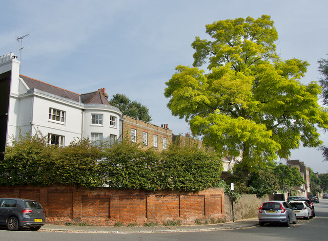
Barnes is a picturesque suburban area located in the southwest of London, within the London Borough of Richmond upon Thames. Known for its charming village-like atmosphere and stunning riverside location, Barnes attracts residents and visitors alike with its unique blend of tranquility and convenience.

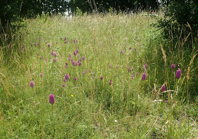
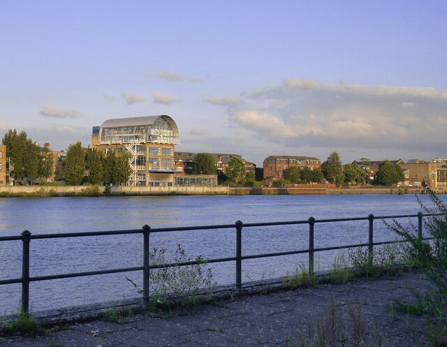
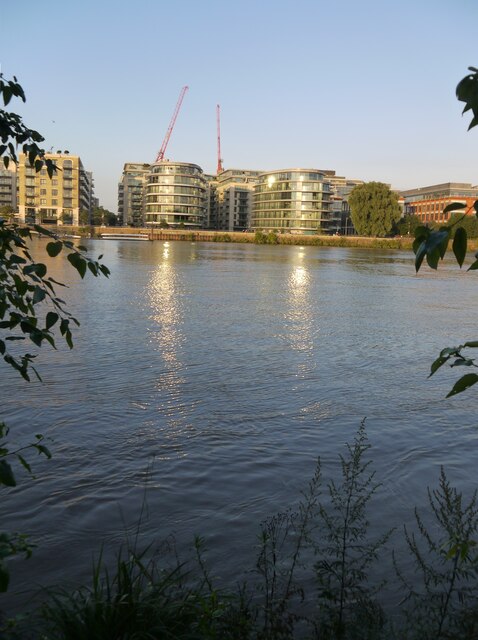
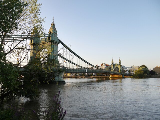
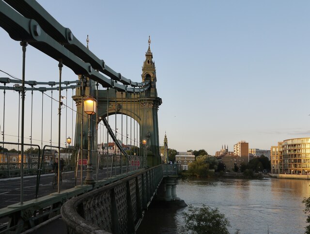
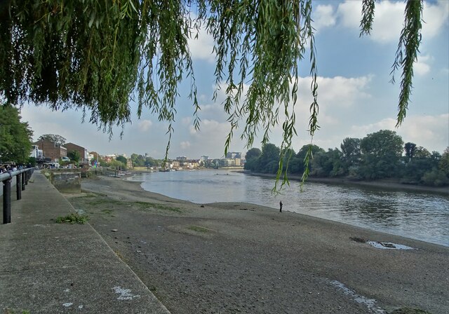
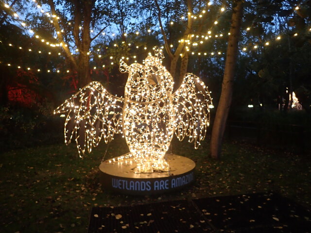
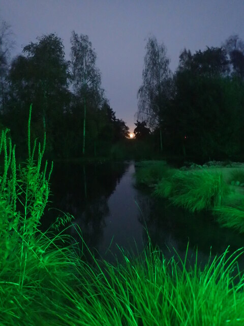
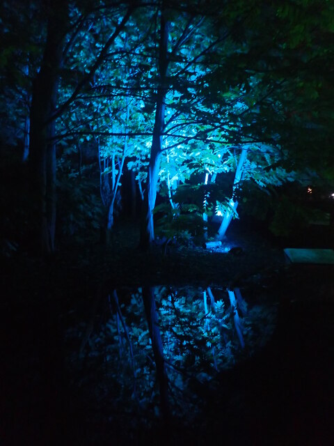
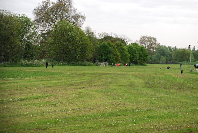
Situated on a loop of the River Thames, Barnes offers breathtaking views of the water and lush greenery. The area is renowned for its conservation areas, which aim to preserve the architectural and natural beauty of the region. The Barnes Common, a large open space, provides a peaceful retreat for locals and visitors, with its sprawling green fields and diverse wildlife.

The heart of Barnes is its High Street, where a variety of independent shops, cafes, and pubs can be found. This bustling hub is a popular meeting place for locals, who enjoy the friendly community spirit that defines the area. Barnes also boasts a weekly farmers' market, showcasing the best of local produce and artisanal crafts.

Transport links are excellent, with Barnes benefiting from its own railway station providing frequent services to central London, as well as convenient bus connections. The area is also well-connected by road, with the A3 and M4 motorway nearby.

Barnes has a rich cultural heritage, with notable landmarks such as the Olympic Studios, a historic cinema turned recording studio that has hosted famous musicians. The area also hosts a range of festivals and events throughout the year, including the annual Barnes Fair, which attracts thousands of visitors with its traditional stalls, entertainment, and community activities.

Overall, Barnes offers a peaceful and picturesque retreat just a stone's throw away from the hustle and bustle of central London, making it a highly desirable place to live and visit.

If you have any feedback on the listing, please let us know in the comments section below.

Barnes Images

Images are sourced within 2km of 51.475054/-0.237519 or Grid Reference TQ2276. Thanks to Geograph Open Source API. All images are credited.

Orchids at the London Wetland Centre These pyramidal orchids were near the turnaround for buses at the entrance to the London Wetland Centre.
Orchids at the London Wetland Centre
These pyramidal orchids were near the turnaround for buses at the entrance to the London Wetland Centre.
Fulham riverside seen from the Barnes towpath Photo taken by evening light from a point close to the old Harrods depository.   The tide was high, and just turning.
Fulham riverside seen from the Barnes towpath
Photo taken by evening light from a point close to the old Harrods depository. The tide was high, and just turning.
Fulham riverside developments, August 2021 Seen from the Barnes towpath by Riverview Gardens.
Fulham riverside developments, August 2021
Seen from the Barnes towpath by Riverview Gardens.
Hammersmith Bridge at sunset (1) Photo taken from the towpath by Riverview Gardens.
Hammersmith Bridge at sunset (1)
Photo taken from the towpath by Riverview Gardens.
Hammersmith Bridge at sunset (2) Taken at a time when the bridge was closed to motor traffic because of structural problems.
Hammersmith Bridge at sunset (2)
Taken at a time when the bridge was closed to motor traffic because of structural problems.
Corney Reach, Chiswick Seen from the Thames Path at low tide, with Chiswick Lifeboat Station <span class="nowrap"><a title="https://rnli.org/find-my-nearest/lifeboat-stations/chiswick-lifeboat-station" rel="nofollow ugc noopener" href="https://rnli.org/find-my-nearest/lifeboat-stations/chiswick-lifeboat-station">Link</a><img style="margin-left:2px;" alt="External link" title="External link - shift click to open in new window" src="https://s1.geograph.org.uk/img/external.png" width="10" height="10"/></span> to the right
Corney Reach, Chiswick
Seen from the Thames Path at low tide, with Chiswick Lifeboat Station LinkExternal link to the right
Chiswick Mall/Church Street Looking along the riverside street which carries the Thames Path towards Hammersmith
Chiswick Mall/Church Street
Looking along the riverside street which carries the Thames Path towards Hammersmith
St Paul's Church, Hammersmith
The Thames at Chiswick Opposite St Paul's School. The river is pictured at low tide with "The Ship Inn" further along the north bank.
The Thames at Chiswick
Opposite St Paul's School. The river is pictured at low tide with "The Ship Inn" further along the north bank.
Illuminature at the London Wetland Centre Illuminature at the London Wetland Centre was due to run through the winter months of 2021/2022. It is a light trail - this view is near the start.
Illuminature at the London Wetland Centre
Illuminature at the London Wetland Centre was due to run through the winter months of 2021/2022. It is a light trail - this view is near the start.
Illuminature at the London Wetland Centre Illuminature is a light trail at the London Wetland Centre and was due to run through the winter months of 2021/2022.
Illuminature at the London Wetland Centre
Illuminature is a light trail at the London Wetland Centre and was due to run through the winter months of 2021/2022.
Full moon rising over the London Wetland Centre This was taken during Illuminature which is a light trail at the London Wetland Centre and was due to run through the winter months of 2021/2022.
Full moon rising over the London Wetland Centre
This was taken during Illuminature which is a light trail at the London Wetland Centre and was due to run through the winter months of 2021/2022.
Illuminature at the London Wetland Centre Illuminature is a light trail at the London Wetland Centre and was due to run through the winter months of 2021/2022.
Illuminature at the London Wetland Centre
Illuminature is a light trail at the London Wetland Centre and was due to run through the winter months of 2021/2022.
Show me another place!

Barnes is located at Grid Ref: TQ2276 (Lat: 51.475054, Lng: -0.237519)

Unitary Authority: Richmond upon Thames

Police Authority: Metropolitan

What 3 Words

///resist.inspector.export. Near Hammersmith, London

Nearby Locations

Mill Hill Barnes

Related Wikis

Barnes Football Club

Barnes Football Club is an association football club in Barnes, London. The club had great importance in the development of the game in the nineteenth...

Barnes RFC

Barnes Rugby Football Club (formerly Harrodians Rugby Football Club) is a rugby union club based in Barnes, London. The club currently play in the fourth...

Barnes, London

Barnes () is a district in south London, England, part of the London Borough of Richmond upon Thames. It takes up the extreme north-east of the borough...

Olympic Studios

Olympic Studios was a renowned British independent commercial recording studio based in Barnes, London. It is best known for its recordings of many artists...

St Mary's Church, Barnes

St Mary's Church, Barnes, is the parish church of Barnes, formerly in Surrey and now in the London Borough of Richmond upon Thames. It is a Grade II*...

The Homestead, Barnes

The Homestead is a Grade II listed house at Church Road, Barnes, London SW13, built in about 1720. == Notable residents == The Scottish physician, librarian...

Ranelagh Club

The Ranelagh Club was a polo club located at Barn Elms in south west London, England. It was founded in 1878 as a split-off from the Hurlingham Club and...

Barn Elms

Barn Elms is an open space in Barnes in the London Borough of Richmond upon Thames, located on the northerly loop of the River Thames between Barnes and...

Nearby Amenities

Located within 500m of 51.475054,-0.237519
Ref GB Tflcid: RWG229280
Traffic Calming: cushion
Lat/Long: 51.4756049/-0.2371953
Ref GB Tflcid: RWG229279
Traffic Calming: cushion
Lat/Long: 51.4755264/-0.2378823
Barnes
Is In: Richmond, London, UK
Is In District: Richmond upon Thames
Place: suburb
Wikidata: Q668140
Wikipedia: en:Barnes, London
Lat/Long: 51.4718962/-0.2387441
Crossing
Bicycle: yes
Button Operated: yes
Crossing: traffic_signals
Crossing Island: yes
Crossing Ref: toucan
Tactile Paving: yes
Traffic Signals Sound: yes
Traffic Signals Vibration: no
Lat/Long: 51.4717469/-0.2368896
Car Sharing
Capacity: 1
Operator: Streetcar
Operator Wikidata: Q1069924
Source: WebSite
Lat/Long: 51.475904/-0.240326
Door: automatic
Entrance: yes
Lat/Long: 51.4770112/-0.2352492
Post Box
Brand: Royal Mail
Brand Wikidata: Q638098
Collection Times: Mo-Fr 17:30; Sa 12:00
Operator: Royal Mail
Operator Wikidata: Q638098
Post Box Type: pillar
Ref: SW13 22
Royal Cypher: EVIIR
Royal Cypher Wikidata: Q33102324
Lat/Long: 51.47696/-0.240813
Bus Stop
Barnes / Red Lion
Bench: yes
Bin: yes
Bus: yes
Lit: yes
Local Ref: BA
Naptan AtcoCode: 490003628BA
Naptan Bearing: W
Naptan CommonName: Barnes Red Lion
Naptan Indicator: BA
Naptan Street: CHURCH ROAD
Naptan Verified: no
Network: London Buses
Network Wikidata: Q1192411
Public Transport: platform
Ref: 49455
Shelter: yes
Tactile Paving: no
Lat/Long: 51.4750268/-0.2404024
Bus Stop
Barnes / Red Lion
Bench: yes
Bin: yes
Bus: yes
Local Ref: WR
Naptan AtcoCode: 490003628WR
Naptan Bearing: N
Naptan CommonName: Barnes Red Lion
Naptan Indicator: WR
Naptan Street: CASTELNAU
Naptan Verified: no
Network: London Buses
Network Wikidata: Q1192411
Public Transport: platform
Ref: 51369
Shelter: yes
Tactile Paving: no
Lat/Long: 51.4756513/-0.2392876
Bus Stop
Church Road / Red Lion
Bench: no
Bin: yes
Bus: yes
Lit: yes
Local Ref: WS
Naptan AtcoCode: 490005298WS
Naptan Bearing: S
Naptan CommonName: Church Road Red Lion
Naptan Indicator: WS
Naptan Street: ROCKS LANE
Naptan Verified: no
Network: London Buses
Network Wikidata: Q1192411
Public Transport: platform
Ref: 50637
Shelter: no
Tactile Paving: no
Lat/Long: 51.4746648/-0.2386718
Bus Stop
Glebe Road
Bench: yes
Bin: yes
Bus: yes
Lit: yes
Local Ref: BB
Naptan AtcoCode: 490007216BB
Naptan Bearing: W
Naptan CommonName: Glebe Road Church Road
Naptan Indicator: Stop BB
Naptan Street: CHURCH ROAD
Naptan Verified: no
Network: London Buses
Network Wikidata: Q1192411
Public Transport: platform
Ref: 50703
Shelter: yes
Tactile Paving: no
Lat/Long: 51.4740613/-0.2441671
Bus Stop
Glebe Road
Bench: yes
Bin: yes
Bus: yes
Lit: yes
Local Ref: BE
Naptan AtcoCode: 490007216BE
Naptan Bearing: E
Naptan CommonName: Glebe Road Church Road
Naptan Indicator: Stop BE
Naptan Street: CHURCH ROAD
Naptan Verified: no
Network: London Buses
Network Wikidata: Q1192411
Public Transport: platform
Ref: 52507
Shelter: yes
Tactile Paving: yes
Lat/Long: 51.4744796/-0.2430113
Bus Stop
Newport Road
Bench: no
Bin: yes
Lit: no
Local Ref: WN
Naptan AtcoCode: 490010246WN
Naptan Bearing: S
Naptan CommonName: Newport Road Castelnau
Naptan Indicator: WN
Naptan Street: CASTELNAU
Naptan Verified: no
Public Transport: platform
Ref: 71471
Shelter: no
Tactile Paving: no
Lat/Long: 51.4774874/-0.2382535
Bus Stop
Newport Road
Bench: yes
Bin: yes
Local Ref: WP
Naptan AtcoCode: 490010246WP
Naptan Bearing: N
Naptan CommonName: Newport Road Castelnau
Naptan Indicator: WP
Naptan Street: CASTELNAU
Naptan Verified: no
Public Transport: platform
Ref: 75330
Shelter: yes
Tactile Paving: no
Lat/Long: 51.478318/-0.238085
Bus Stop
Queen Elizabeth Walk
Bus: yes
Local Ref: WQ
Naptan AtcoCode: 490011313WQ
Naptan Bearing: E
Naptan CommonName: Queen Elizabeth Walk
Naptan Indicator: WQ
Naptan Street: QUEEN ELIZABETH WALK
Naptan Verified: no
Public Transport: platform
Ref: 74897
Lat/Long: 51.4754716/-0.2384256
Bus Stop
Ranelagh Avenue
Bench: yes
Bin: yes
Bus: yes
Lit: no
Local Ref: WT
Naptan AtcoCode: 490011420WT
Naptan Bearing: S
Naptan CommonName: Ranelagh Avenue
Naptan Indicator: WT
Naptan Street: ROCKS LANE
Naptan Verified: no
Network: London Buses
Network Wikidata: Q1192411
Public Transport: platform
Ref: 56731
Shelter: yes
Tactile Paving: no
Lat/Long: 51.4727886/-0.2374368
Bus Stop
Ranelagh Avenue
Bench: yes
Bin: yes
Bus: yes
Lit: yes
Local Ref: WX
Naptan AtcoCode: 490011420WX
Naptan Bearing: N
Naptan CommonName: Ranelagh Avenue
Naptan Indicator: WX
Naptan Street: ROCKS LANE
Naptan Verified: no
Network: London Buses
Network Wikidata: Q1192411
Public Transport: platform
Ref: 75855
Shelter: yes
Tactile Paving: no
Lat/Long: 51.4724956/-0.2374261
Bus Stop
The Wetlands Centre
Bus: yes
Local Ref: WL
Naptan AtcoCode: 490013593WL
Naptan Bearing: N
Naptan CommonName: Barnes Wetlands Centre
Naptan Indicator: WL
Naptan Street: THE WETLANDS CENTRE
Naptan Verified: no
Network: London Buses
Network Wikidata: Q1192411
Public Transport: platform
Ref: 77483
Lat/Long: 51.4762557/-0.2354122
Post Box
Brand: Royal Mail
Brand Wikidata: Q638098
Collection Times: Mo-Fr 17:30; Sa 12:00
Operator: Royal Mail
Operator Wikidata: Q638098
Post Box Type: pillar
Ref: SW13 23
Royal Cypher: EVIIR
Royal Cypher Wikidata: Q33102324
Lat/Long: 51.4758568/-0.2431211
Post Box
Collection Times: Mo-Fr 17:30; Sa 12:00
Operator: Royal Mail
Operator Wikidata: Q638098
Post Box Type: wall
Ref: SW13 10
Royal Cypher: VR
Royal Cypher Wikidata: Q33102356
Lat/Long: 51.4792/-0.2375238
Post Box
Brand: Royal Mail
Brand Wikidata: Q638098
Collection Times: Mo-Fr 17:30; Sa 12:00
Operator: Royal Mail
Operator Wikidata: Q638098
Post Box Type: pillar
Ref: SW13 20
Royal Cypher: EVIIR
Royal Cypher Wikidata: Q33102324
Lat/Long: 51.4724932/-0.2420455
Post Box
Brand: Royal Mail
Brand Wikidata: Q638098
Collection Times: Mo-Fr 17:30; Sa 12:00
Operator: Royal Mail
Operator Wikidata: Q638098
Post Box Type: pillar
Ref: SW13 16
Royal Cypher: VR
Royal Cypher Wikidata: Q33102356
Lat/Long: 51.4718172/-0.2370469
Post Box
Collection Times: Mo-Fr 17:30; Sa 12:00
Operator: Royal Mail
Operator Wikidata: Q638098
Post Box Type: pillar
Ref: SW13 27
Royal Cypher: GR
Royal Cypher Wikidata: Q33102273
Lat/Long: 51.4793103/-0.239229
Door: automatic
Entrance: yes
Lat/Long: 51.476817/-0.2356577
Cafe
Kingfisher Kitchen
Addr City: London
Addr Postcode: SW13 9WT
Addr Street: Queen Elizabeth Walk
Lat/Long: 51.4770419/-0.2351928
Toilets
Lat/Long: 51.4771152/-0.2353267
Toilets
Check Date: 2022-10-01
Fee: no
Lat/Long: 51.4764062/-0.2348862
Toilets
Lat/Long: 51.4770568/-0.2363064
Bicycle Parking
Bicycle Parking: stands
Capacity: 12
Covered: no
Lat/Long: 51.4753395/-0.2394956
Bicycle Parking
Bicycle Parking: lockers
Covered: yes
Lat/Long: 51.4762693/-0.2348006
Bank
NatWest
Brand: NatWest
Brand Wikidata: Q2740021
Lat/Long: 51.4755745/-0.2395054
Post Box
Brand: Royal Mail
Brand Wikidata: Q638098
Collection Times: Mo-Fr 17:30; Sa 12:00
Operator: Royal Mail
Operator Wikidata: Q638098
Post Box Type: pillar
Ref: SW13 4
Royal Cypher: GR
Royal Cypher Wikidata: Q33102273
Lat/Long: 51.4751356/-0.2397969
Bicycle Parking
Bicycle Parking: stands
Capacity: 10
Covered: no
Lat/Long: 51.4742602/-0.2432238
Torchlight
Addr City: London
Addr Housename: Suite 4, The Mews
Addr Housenumber: 46-52
Addr Postcode: SW13 0DQ
Addr Street: Church Road
Consulting: education
Level: 1
Office: consulting
Opening Hours: Mo-Sa 08:00-18:00
Lat/Long: 51.4745263/-0.2408647
Give Way
Direction: backward
Lat/Long: 51.4757713/-0.2354619
Give Way
Direction: forward
Lat/Long: 51.4756575/-0.2367989
Give Way
Direction: forward
Lat/Long: 51.4718375/-0.2382063
Give Way
Direction: forward
Lat/Long: 51.4716601/-0.2405278
Give Way
Direction: backward
Lat/Long: 51.4723329/-0.2421055
Kurt Schwitters
Historic: memorial
Inscription: Kurt Schwitters (1887-1948) Artist lived here
Memorial: blue_plaque
Openplaques Id: 598
Subject Wikidata: Q155158
Lat/Long: 51.4768608/-0.243358
Bench
Backrest: yes
Lat/Long: 51.4748903/-0.2411903
Bench
Backrest: yes
Lat/Long: 51.4749053/-0.2411542
Telephone
Defibrillator
Booth: K6
Colour: red
Covered: booth
Defibrillator Location: inside red phone box, Church Road, Barnes - by Olympic Cinema/Studios
Emergency: defibrillator
Indoor: no
Listed Status: Grade II
Man Made: telephone_box
Not Ref GB The Circuit: 37B5A6D8-67EC-407C-AD19-AFF700B4D960
Lat/Long: 51.4750389/-0.2407927
Crossing
Crossing: marked
Crossing Island: yes
Tactile Paving: yes
Lat/Long: 51.4777959/-0.2382058
Roof Orientation: across
Lat/Long: 51.4748945/-0.2407047
Bench
Backrest: yes
Lat/Long: 51.4712272/-0.2391078
Bench
Backrest: yes
Lat/Long: 51.4714248/-0.2374874
Bench
Backrest: yes
Lat/Long: 51.4713905/-0.2378879
Bench
Backrest: yes
Lat/Long: 51.4710611/-0.2402736
Bench
Backrest: yes
Lat/Long: 51.4712781/-0.2386313
Bench
Backrest: yes
Lat/Long: 51.4713612/-0.2381462
Traffic Signals
Traffic Signals: signal
Traffic Signals Direction: backward
Lat/Long: 51.4750605/-0.2393801
Traffic Signals
Traffic Signals: signal
Traffic Signals Direction: forward
Lat/Long: 51.4752075/-0.2396221
Cycleway: asl
Direction: backward
Lat/Long: 51.4754079/-0.2392771
Traffic Signals
Traffic Signals: signal
Traffic Signals Direction: backward
Lat/Long: 51.4752902/-0.2389808
Traffic Signals
Traffic Signals: signal
Traffic Signals Direction: forward
Lat/Long: 51.4751293/-0.2391206
Bicycle Parking
Bicycle Parking: stands
Capacity: 10
Covered: yes
Lat/Long: 51.4750723/-0.240804
Bicycle Parking
Bicycle Parking: stands
Capacity: 4
Covered: no
Lat/Long: 51.4744624/-0.2432425
Bicycle Parking
Bicycle Parking: stands
Capacity: 4
Covered: no
Lat/Long: 51.474434/-0.2433726
Bench
Backrest: yes
Lat/Long: 51.4744615/-0.2433484
Bench
Backrest: yes
Lat/Long: 51.4744715/-0.2433095
Bicycle Parking
Bicycle Parking: stands
Capacity: 6
Covered: no
Lat/Long: 51.4757967/-0.2393458
Telephone
Booth: KXPlus
Covered: booth
Lat/Long: 51.4757934/-0.2392781
Bicycle Parking
Bicycle Parking: stands
Capacity: 8
Covered: no
Lat/Long: 51.4757382/-0.2393619
Colour: green
Man Made: street_cabinet
Lat/Long: 51.4757641/-0.2393035
Bench
Backrest: yes
Lat/Long: 51.4756994/-0.2393672
Bench
Backrest: yes
Lat/Long: 51.4755668/-0.2394226
Bench
Backrest: yes
Lat/Long: 51.4755325/-0.2394371
Bench
Backrest: yes
Lat/Long: 51.4730936/-0.2313842
Waste Basket
Covered: no
Indoor: no
Waste: trash
Lat/Long: 51.4716976/-0.2386851
Waste Basket
Covered: no
Indoor: no
Waste: trash
Lat/Long: 51.4722521/-0.2372739
Waste Basket
Covered: no
Indoor: no
Waste: trash
Lat/Long: 51.4727938/-0.2374346
Waste Basket
Covered: no
Indoor: no
Waste: trash
Lat/Long: 51.4716024/-0.2394061
Waste Basket
Covered: no
Indoor: no
Waste: trash
Lat/Long: 51.4717502/-0.2367777
Waste Basket
Covered: no
Indoor: no
Waste: trash
Lat/Long: 51.4713766/-0.2405325
Telephone
Booth: KXPlus
Covered: booth
Lat/Long: 51.4717193/-0.2367447
Barrier: cycle_barrier
Lat/Long: 51.4717431/-0.2386969
Childcare
The Ark Nursery
Addr City: London
Addr Housename: Kitson Hall
Addr Postcode: SW13 9HJ
Addr Street: Kitson Road
Fhrs Id: 1575639
Source: FHRS Open Data
Source Addr: FHRS Open Data
Website: http://thearknurserybarnes.co.uk/
Lat/Long: 51.4753429/-0.2427386
Traffic Calming: choker
Lat/Long: 51.4782243/-0.2412206
Waste Basket
Waste: trash
Lat/Long: 51.4710814/-0.2358155
Defibrillator
Emergency: defibrillator
Lat/Long: 51.4771476/-0.2354607
Cafe
Olympic Studios
Check Date: 2024-04-14
Diet Vegetarian: yes
Outdoor Seating: yes
Payment Cash: yes
Payment Mastercard: yes
Payment Visa: yes
Payment Visa Debit: yes
Lat/Long: 51.4752008/-0.2405476
Bicycle Parking
Bicycle Parking: stands
Capacity: 2
Covered: no
Ref GB Tflcid: RWG232403
Lat/Long: 51.4741283/-0.2443819
Bicycle Parking
Bicycle Parking: upright_stands
Capacity: 6
Ref GB Tflcid: RWG232417
Lat/Long: 51.47395/-0.2428402
Bicycle Parking
Bicycle Parking: stands
Capacity: 2
Covered: no
Ref GB Tflcid: RWG232478
Lat/Long: 51.4749236/-0.2390569
Bicycle Parking
Bicycle Parking: stands
Capacity: 2
Covered: no
Ref GB Tflcid: RWG232479
Lat/Long: 51.4748896/-0.239032
Bicycle Parking
Bicycle Parking: stands
Capacity: 2
Covered: no
Ref GB Tflcid: RWG232420
Lat/Long: 51.4750885/-0.2401974
Ref GB Tflcid: RWG229285
Traffic Calming: cushion
Lat/Long: 51.4758231/-0.2329757
Ref GB Tflcid: RWG229282
Traffic Calming: cushion
Lat/Long: 51.4757676/-0.2352848
Ref GB Tflcid: RWG229276
Traffic Calming: cushion
Lat/Long: 51.4773847/-0.2408543
Addr Housename: 56-63
Entrance: yes
Lat/Long: 51.47243/-0.2375398
Addr Housename: 64-71
Entrance: yes
Lat/Long: 51.4722718/-0.2374317
Bench
Lat/Long: 51.476365/-0.2358651
Sir Peter Scott
Artist Name: Nicola Godden
Artwork Type: statue
Material: bronze
Start Date: 2000
Tourism: artwork
Lat/Long: 51.4766684/-0.2356191
Entrance: yes
Lat/Long: 51.4769867/-0.2349096
Door: hinged
Entrance: yes
Lat/Long: 51.4770024/-0.2322174
Waste Basket
Lat/Long: 51.4767744/-0.2320166
Crossing
Lat/Long: 51.4714858/-0.2364937
Post Office
Barnes Post Office
Addr City: London
Addr Housenumber: 96
Addr Postcode: SW13 0DQ
Addr Street: Church Road
Brand: Post Office
Brand Wikidata: Q1783168
Check Date: 2018-02
Opening Hours: Mo-Sa 06:30-18:00; Su 07:00-15:00
Operator: McColl's
Operator Wikidata: Q16997477
Ref Pol Id: 18066
Website: https://www.postoffice.co.uk/branch-finder/057001x/church-road
Lat/Long: 51.4750275/-0.2397686
Traffic Signals
Traffic Signals Direction: backward
Lat/Long: 51.4754595/-0.2392491
Toilets
Wheelchair: yes
Lat/Long: 51.4748422/-0.2352363
Toilets
Wheelchair: no
Lat/Long: 51.4753902/-0.2304368
The data included in this document is from www.openstreetmap.org. The data is made available under ODbL.

Have you been to Barnes?

Leave your review of Barnes below (or comments, questions and feedback).