West Bexington and Cogden

Heritage Site in Dorset

England

West Bexington and Cogden

On Abbotsbury Hill From the road junction looking up the lane which passes by the hillfort of Abbotsbury Castle.
On Abbotsbury Hill Credit: Trevor Harris

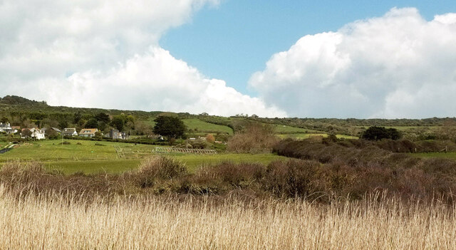
West Bexington and Cogden are two charming villages located on the Jurassic Coast in Dorset, England. These villages are considered a heritage site due to their historical significance, natural beauty, and unique cultural attractions.

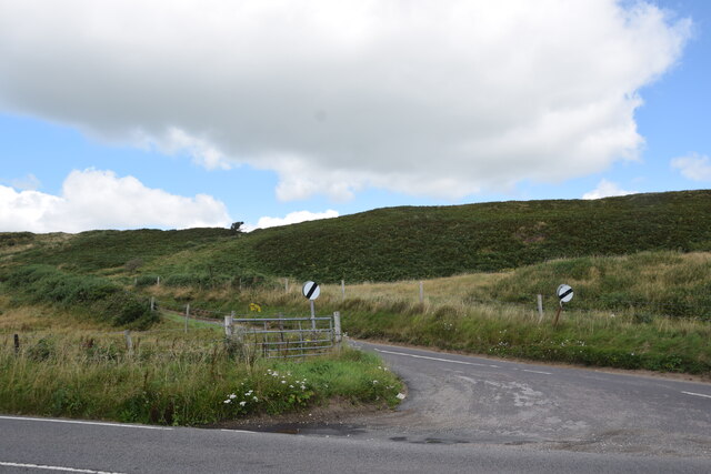
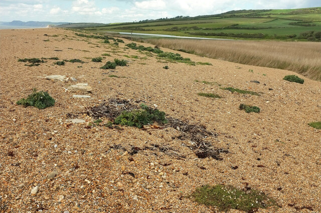
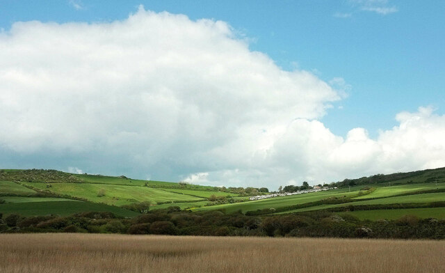
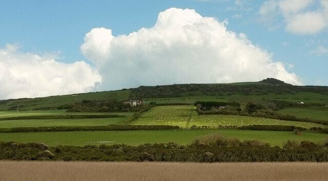
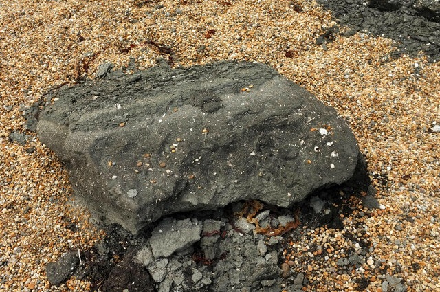
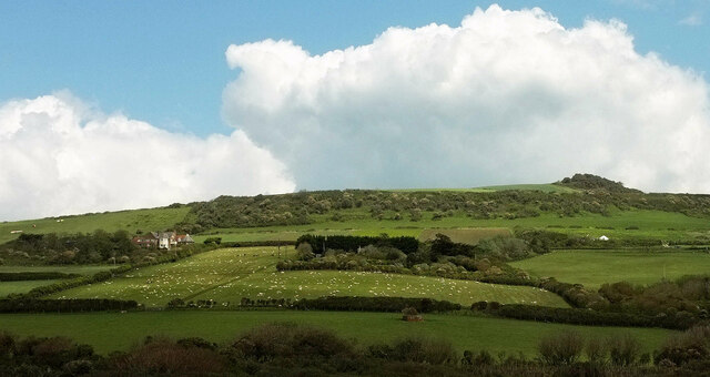
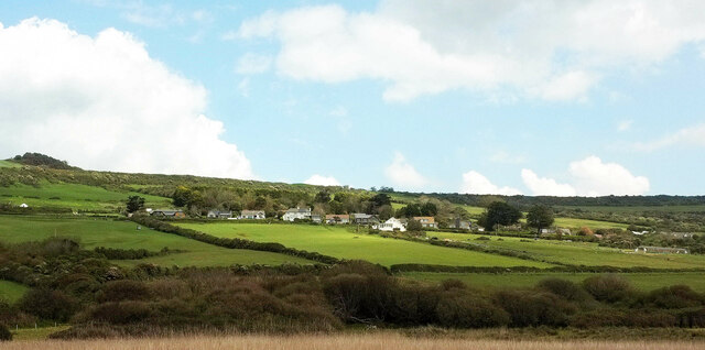
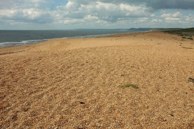
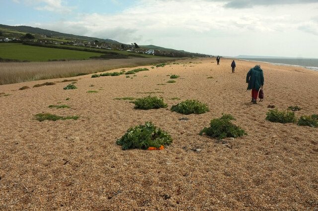
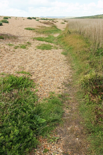
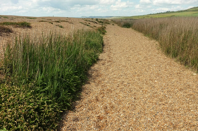
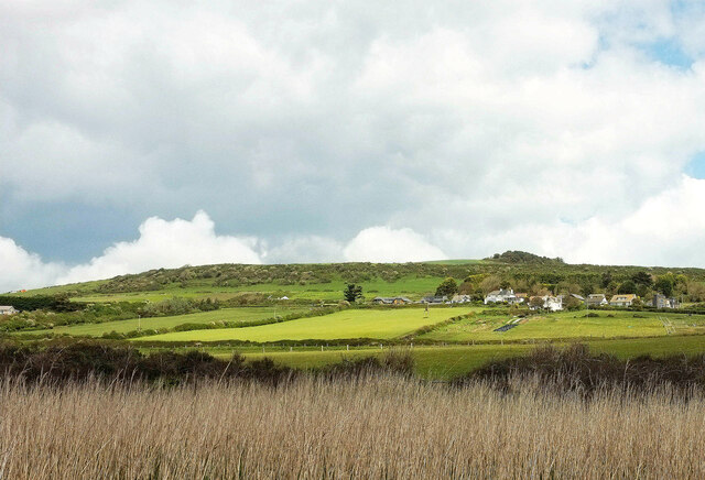
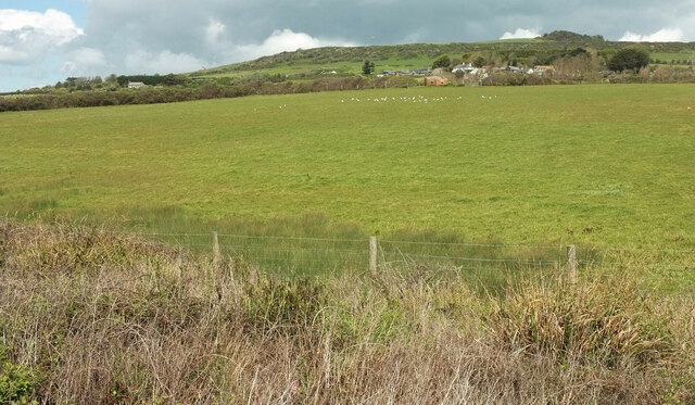
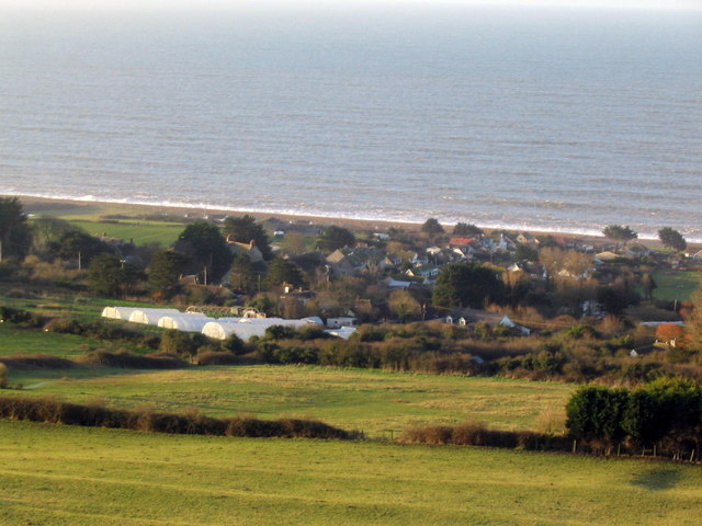
Situated within the county of Dorset, West Bexington and Cogden offer breathtaking views of the English Channel and are surrounded by picturesque countryside. The area is renowned for its stunning coastline, which is a part of the Jurassic Coast World Heritage Site, known for its rich geological and fossil record.

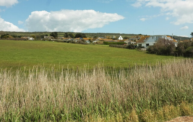
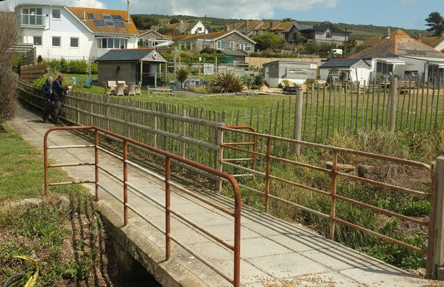
The villages themselves possess a tranquil and idyllic charm, with traditional thatched cottages and historic buildings dotting the landscape. West Bexington and Cogden are home to a close-knit community that takes pride in preserving their heritage and sharing the area's unique history with visitors.

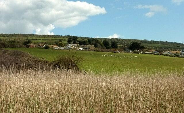
Visitors to West Bexington and Cogden can explore the stunning beaches and take leisurely walks along the coastal paths, enjoying the fresh sea air and spectacular views. The area is also a haven for wildlife, with numerous bird species and marine life found in the surrounding waters.

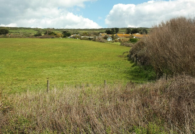
For those interested in history, the villages offer a glimpse into the past. The nearby Abbotsbury Castle is an Iron Age hillfort that dates back over 2,000 years, providing an insight into the area's ancient history. Additionally, the Abbotsbury Swannery, located close by, is the only managed colony of nesting mute swans in the world, attracting visitors from far and wide.

With its natural beauty, rich history, and unique cultural attractions, West Bexington and Cogden in Dorset are truly a heritage site worth exploring. Whether it is to enjoy the stunning coastal scenery, learn about the area's history, or simply unwind in a peaceful and picturesque setting, visitors are sure to be captivated by the charm and beauty of these villages.

If you have any feedback on the listing, please let us know in the comments section below.

West Bexington and Cogden Images

Images are sourced within 2km of 50.676/-2.648 or Grid Reference SY5486. Thanks to Geograph Open Source API. All images are credited.

On Abbotsbury Hill From the road junction looking up the lane which passes by the hillfort of Abbotsbury Castle.
On Abbotsbury Hill
From the road junction looking up the lane which passes by the hillfort of Abbotsbury Castle.
Chesil Beach near West Bexington Nature Reserve The top of the beach, looking towards Cogden Beach.
Chesil Beach near West Bexington Nature Reserve
The top of the beach, looking towards Cogden Beach.
Towards Swyre Looking right from <a href="https://www.geograph.org.uk/photo/7059268">SY5286 : Chesil Beach near West Bexington Nature Reserve</a> across the reed beds of West Bexington Nature Reserve. To the right is Gorselands Caravan Park.
Towards Swyre
Looking right from SY5286 : Chesil Beach near West Bexington Nature Reserve across the reed beds of West Bexington Nature Reserve. To the right is Gorselands Caravan Park.
Fields by Swyre Road Looking right from <a href="https://www.geograph.org.uk/photo/7059281">SY5287 : Towards Swyre</a>, again with the reed beds of West Bexington Nature Reserve in the foreground. The houses are along Swyre Road between Swyre and West Bexington. Behind rises The Knoll.
Fields by Swyre Road
Looking right from SY5287 : Towards Swyre, again with the reed beds of West Bexington Nature Reserve in the foreground. The houses are along Swyre Road between Swyre and West Bexington. Behind rises The Knoll.
Oil shale on Chesil Beach A further lump of what seems to be oil shale, further along the beach towards West Bexington from the examples at <a href="https://www.geograph.org.uk/photo/7059248">SY5286 : Oil shale on Chesil Beach</a> and <a href="https://www.geograph.org.uk/photo/7059225">SY5286 : Oil shale on Chesil Beach</a>.
Oil shale on Chesil Beach
A further lump of what seems to be oil shale, further along the beach towards West Bexington from the examples at SY5286 : Oil shale on Chesil Beach and SY5286 : Oil shale on Chesil Beach.
Hillside below The Knoll A patch of sunlight crosses the hillside shown in <a href="https://www.geograph.org.uk/photo/7059387">SY5287 : Fields by Swyre Road</a> which was taken a little to the west along the coast path and Hardy Way.
Hillside below The Knoll
A patch of sunlight crosses the hillside shown in SY5287 : Fields by Swyre Road which was taken a little to the west along the coast path and Hardy Way.
Field, West Bexington Looking right from <a href="https://www.geograph.org.uk/photo/7059437">SY5287 : Hillside below The Knoll</a> with overlap, with houses along Swyre Road at the upper end of the village.
Field, West Bexington
Looking right from SY5287 : Hillside below The Knoll with overlap, with houses along Swyre Road at the upper end of the village.
Chesil Beach west of West Bexington Sunshine returns after a gloomy hour or so. This looks roughly westwards along the shingle ridge with the dark headland of Golden Cap in the distance, still in shadow.
Chesil Beach west of West Bexington
Sunshine returns after a gloomy hour or so. This looks roughly westwards along the shingle ridge with the dark headland of Golden Cap in the distance, still in shadow.
Approaching West Bexington Looking the other way from <a href="https://www.geograph.org.uk/photo/7059532">SY5286 : Chesil Beach west of West Bexington</a>, with the sun still to fully emerge. It's been a bit of a slog along the shingle, with the inland route too waterlogged, and there's still over half a kilometre to go. Faint in the distance is the escarpment outline of Portland.
Approaching West Bexington
Looking the other way from SY5286 : Chesil Beach west of West Bexington, with the sun still to fully emerge. It's been a bit of a slog along the shingle, with the inland route too waterlogged, and there's still over half a kilometre to go. Faint in the distance is the escarpment outline of Portland.
Behind Chesil Beach At the rear of the shingle ridge, with reed beds near West Bexington Nature Reserve. The coast path is following footpath W14 24.
Behind Chesil Beach
At the rear of the shingle ridge, with reed beds near West Bexington Nature Reserve. The coast path is following footpath W14 24.
Coast path near West Bexington Nature Reserve With the Hardy Way, following footpath W14 24 between the shine ridge of Chesil Beach and reed beds.
Coast path near West Bexington Nature Reserve
With the Hardy Way, following footpath W14 24 between the shine ridge of Chesil Beach and reed beds.
Fields, West Bexington A different angle on the hillside and some of the houses seen in <a href="https://www.geograph.org.uk/photo/7059475">SY5387 : Field, West Bexington</a>, with The Knoll behind. This looks right from <a href="https://www.geograph.org.uk/photo/6852602">SY5286 : Coast path near West Bexington</a>.
Fields, West Bexington
A different angle on the hillside and some of the houses seen in SY5387 : Field, West Bexington, with The Knoll behind. This looks right from SY5286 : Coast path near West Bexington.
Fields, West Bexington Looking right from <a href="https://www.geograph.org.uk/photo/7059785">SY5386 : Fields, West Bexington</a> across the reed beds.
Fields, West Bexington
Looking right from SY5386 : Fields, West Bexington across the reed beds.
Gulls at West Bexington Looking right from <a href="https://www.geograph.org.uk/photo/7060084">SY5386 : Fields, West Bexington</a>. The houses are on Beach Road.
Gulls at West Bexington
Looking right from SY5386 : Fields, West Bexington. The houses are on Beach Road.
West Bexington from the coast path Across reeds lining a drainage channel <a href="https://www.geograph.org.uk/photo/6852710">SY5386 : Watercress, West Bexington</a>. The gulls are further left across the field shown in <a href="https://www.geograph.org.uk/photo/7060093">SY5386 : Gulls at West Bexington</a>. Again, the houses line Beach Road. <a href="https://www.geograph.org.uk/photo/6852628">SY5286 : Coast path near West Bexington</a> looks back to the left from the same spot.
West Bexington from the coast path
Across reeds lining a drainage channel SY5386 : Watercress, West Bexington. The gulls are further left across the field shown in SY5386 : Gulls at West Bexington. Again, the houses line Beach Road. SY5286 : Coast path near West Bexington looks back to the left from the same spot.
Field, West Bexington Taken a little east from <a href="https://www.geograph.org.uk/photo/7060107">SY5386 : West Bexington from the coast path</a> looking up the rear of gardens backing onto the field.
Field, West Bexington
Taken a little east from SY5386 : West Bexington from the coast path looking up the rear of gardens backing onto the field.
Field, West Bexington Another view across the field shown in <a href="https://www.geograph.org.uk/photo/7060093">SY5386 : Gulls at West Bexington</a> and <a href="https://www.geograph.org.uk/photo/7060107">SY5386 : West Bexington from the coast path</a>, showing the gulls again.
Field, West Bexington
Another view across the field shown in SY5386 : Gulls at West Bexington and SY5386 : West Bexington from the coast path, showing the gulls again.
Path, West Bexington Leading from the beach across the drainage channel shown in <a href="https://www.geograph.org.uk/photo/6852710">SY5386 : Watercress, West Bexington</a>, to public conveniences.
Path, West Bexington
Leading from the beach across the drainage channel shown in SY5386 : Watercress, West Bexington, to public conveniences.
Show me another place!

West Bexington and Cogden is located at Grid Ref: SY5486 (Lat: 50.676, Lng: -2.648)

Unitary Authority: Dorset

Police Authority: Dorset

What 3 Words

///opened.choice.swimsuits. Near Bridport, Dorset

Related Wikis

West Bexington

West Bexington is a village in south-west Dorset, England, sited just behind the Chesil Beach about 6 miles (10 km) southeast of Bridport. It forms part...

Abbotsbury Castle

Abbotsbury Castle is an Iron Age hillfort in south west Dorset, England, situated on Wears Hill above the village of Abbotsbury, seven miles west of Dorchester...

Puncknowle

Puncknowle ( PUN-əl) is a village and civil parish in the county of Dorset in southwest England, situated on the southern slopes of the Bride Valley approximately...

Holy Trinity Church, Swyre

Holy Trinity Church is a Church of England church in Swyre, Dorset, England. The oldest part of the church has been dated to the early 15th century, with...

Nearby Amenities

Located within 500m of 50.676,-2.648
Barrier: stile
Foot: yes
Lat/Long: 50.6737345/-2.6432944
Barrier: stile
Foot: yes
Lat/Long: 50.6749379/-2.642397
Labour-In-Vain Farm
Place: farm
Lat/Long: 50.6748047/-2.6461547
Tulk's Hill
Place: locality
Lat/Long: 50.6777102/-2.6418942
Barrier: stile
Material: wood
Source: survey;gps
Stile: stepover
Lat/Long: 50.6786251/-2.6425948
Barrier: stile
Material: wood
Source: survey;gps
Stile: stepover
Lat/Long: 50.6785051/-2.6424985
The data included in this document is from www.openstreetmap.org. The data is made available under ODbL.

Have you been to West Bexington and Cogden?

Leave your review of West Bexington and Cogden below (or comments, questions and feedback).