Tulk's Hill

Hill, Mountain in Dorset

England

Tulk's Hill

On Abbotsbury Hill From the road junction looking up the lane which passes by the hillfort of Abbotsbury Castle.
On Abbotsbury Hill Credit: Trevor Harris

Tulk's Hill is a prominent hill located in the county of Dorset, England. Situated in the southern part of the county, this hill offers a stunning landscape and presents itself as a popular destination for outdoor enthusiasts and nature lovers alike.

Rising to an elevation of approximately 194 meters (636 feet), Tulk's Hill is considered a significant landmark in the region. It is part of the larger chalk ridge known as the South Dorset Downs, which stretches across several miles of beautiful countryside. The hill is covered in lush green grass and is adorned with patches of colorful wildflowers during the spring and summer months.

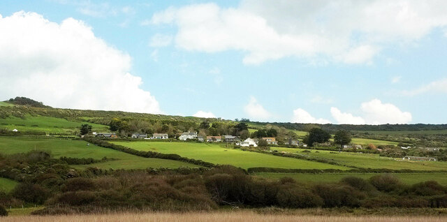
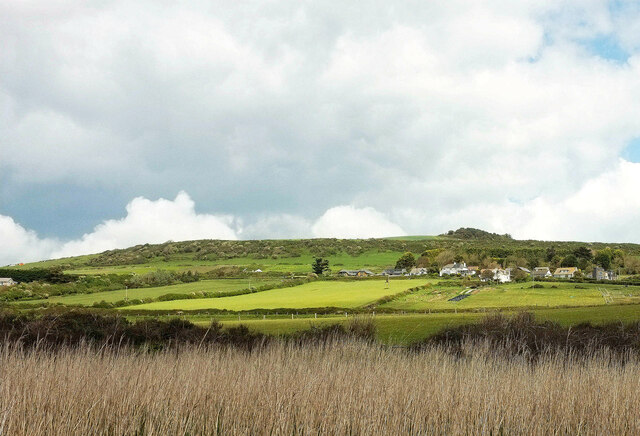
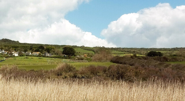
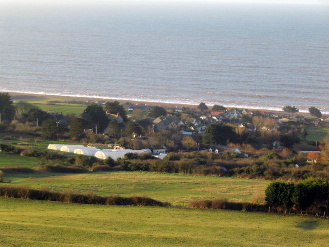
One of the main attractions of Tulk's Hill is its panoramic views. From the summit, visitors can enjoy breathtaking vistas of the surrounding countryside, including the rolling hills, meandering rivers, and scattered villages. On clear days, it is even possible to catch a glimpse of the distant English Channel.

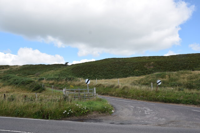
The hill is accessible via a network of well-maintained footpaths, making it a popular spot for hiking and walking enthusiasts. These paths allow visitors to explore the hill's diverse flora and fauna, including rare species of birds, butterflies, and wildflowers.

For those interested in history, Tulk's Hill also holds archaeological significance. It is home to the remains of ancient earthworks, believed to have been constructed during the Iron Age. These earthworks add to the hill's charm and provide a glimpse into its rich past.

Overall, Tulk's Hill in Dorset offers a perfect blend of natural beauty, recreational opportunities, and historical significance, making it a must-visit destination for both locals and tourists.

If you have any feedback on the listing, please let us know in the comments section below.
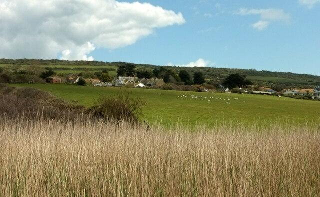
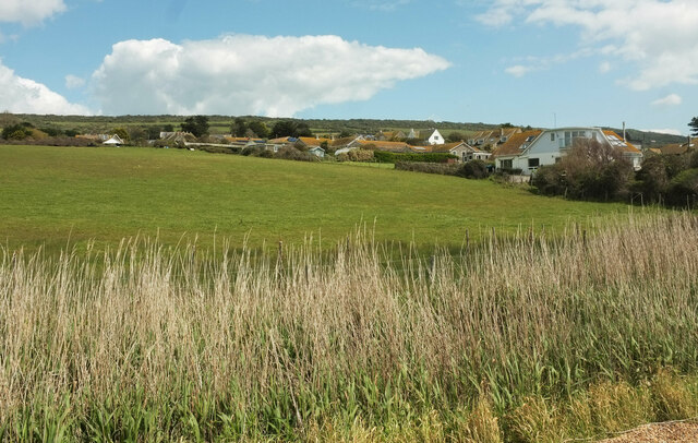
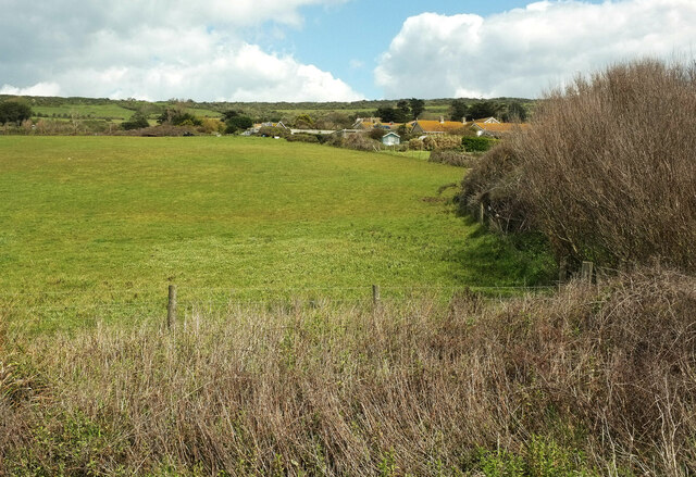
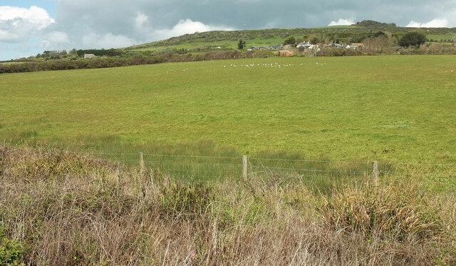
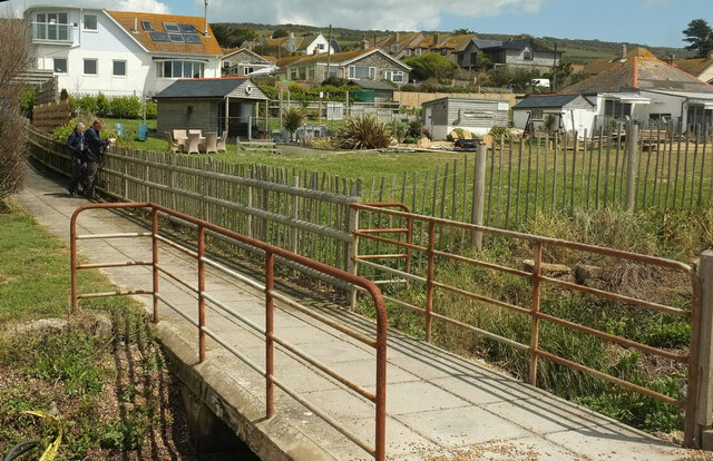
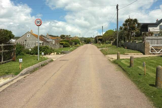
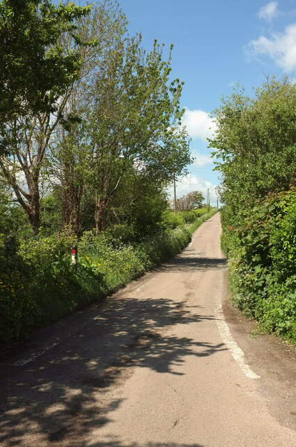
Tulk's Hill Images

Images are sourced within 2km of 50.677865/-2.6387031 or Grid Reference SY5486. Thanks to Geograph Open Source API. All images are credited.

On Abbotsbury Hill From the road junction looking up the lane which passes by the hillfort of Abbotsbury Castle.
On Abbotsbury Hill
From the road junction looking up the lane which passes by the hillfort of Abbotsbury Castle.
Field, West Bexington Looking right from <a href="https://www.geograph.org.uk/photo/7059437">SY5287 : Hillside below The Knoll</a> with overlap, with houses along Swyre Road at the upper end of the village.
Field, West Bexington
Looking right from SY5287 : Hillside below The Knoll with overlap, with houses along Swyre Road at the upper end of the village.
Fields, West Bexington A different angle on the hillside and some of the houses seen in <a href="https://www.geograph.org.uk/photo/7059475">SY5387 : Field, West Bexington</a>, with The Knoll behind. This looks right from <a href="https://www.geograph.org.uk/photo/6852602">SY5286 : Coast path near West Bexington</a>.
Fields, West Bexington
A different angle on the hillside and some of the houses seen in SY5387 : Field, West Bexington, with The Knoll behind. This looks right from SY5286 : Coast path near West Bexington.
Fields, West Bexington Looking right from <a href="https://www.geograph.org.uk/photo/7059785">SY5386 : Fields, West Bexington</a> across the reed beds.
Fields, West Bexington
Looking right from SY5386 : Fields, West Bexington across the reed beds.
Gulls at West Bexington Looking right from <a href="https://www.geograph.org.uk/photo/7060084">SY5386 : Fields, West Bexington</a>. The houses are on Beach Road.
Gulls at West Bexington
Looking right from SY5386 : Fields, West Bexington. The houses are on Beach Road.
West Bexington from the coast path Across reeds lining a drainage channel <a href="https://www.geograph.org.uk/photo/6852710">SY5386 : Watercress, West Bexington</a>. The gulls are further left across the field shown in <a href="https://www.geograph.org.uk/photo/7060093">SY5386 : Gulls at West Bexington</a>. Again, the houses line Beach Road. <a href="https://www.geograph.org.uk/photo/6852628">SY5286 : Coast path near West Bexington</a> looks back to the left from the same spot.
West Bexington from the coast path
Across reeds lining a drainage channel SY5386 : Watercress, West Bexington. The gulls are further left across the field shown in SY5386 : Gulls at West Bexington. Again, the houses line Beach Road. SY5286 : Coast path near West Bexington looks back to the left from the same spot.
Field, West Bexington Taken a little east from <a href="https://www.geograph.org.uk/photo/7060107">SY5386 : West Bexington from the coast path</a> looking up the rear of gardens backing onto the field.
Field, West Bexington
Taken a little east from SY5386 : West Bexington from the coast path looking up the rear of gardens backing onto the field.
Field, West Bexington Another view across the field shown in <a href="https://www.geograph.org.uk/photo/7060093">SY5386 : Gulls at West Bexington</a> and <a href="https://www.geograph.org.uk/photo/7060107">SY5386 : West Bexington from the coast path</a>, showing the gulls again.
Field, West Bexington
Another view across the field shown in SY5386 : Gulls at West Bexington and SY5386 : West Bexington from the coast path, showing the gulls again.
Path, West Bexington Leading from the beach across the drainage channel shown in <a href="https://www.geograph.org.uk/photo/6852710">SY5386 : Watercress, West Bexington</a>, to public conveniences.
Path, West Bexington
Leading from the beach across the drainage channel shown in SY5386 : Watercress, West Bexington, to public conveniences.
West Bexington A view from the car park on Chesil Beach, looking across a small compound and up Beach Road. This becomes Swyre Road, together forming the only road in the village. On the left is the Club House restaurant.
West Bexington
A view from the car park on Chesil Beach, looking across a small compound and up Beach Road. This becomes Swyre Road, together forming the only road in the village. On the left is the Club House restaurant.
Coast path at West Bexington The stone, which marks the start of the Dorset Ridgeway inland as well as the distances to West Bay and Abbotsbury along the coast path, is beside the eastern corner of the beach car park at West Bexington. The Hardy Way follows the coast path to West Bay, and the Ridgeway inland.
Coast path at West Bexington
The stone, which marks the start of the Dorset Ridgeway inland as well as the distances to West Bay and Abbotsbury along the coast path, is beside the eastern corner of the beach car park at West Bexington. The Hardy Way follows the coast path to West Bay, and the Ridgeway inland.
Car park, West Bexington The beach car park, where the coast path is joined by the Hardy Way and passes the start of the South Dorset Ridgeway.
Car park, West Bexington
The beach car park, where the coast path is joined by the Hardy Way and passes the start of the South Dorset Ridgeway.
Beach Road, West Bexington A no through road seen a little way up from the beach car park. It carries the Hardy Way and the South Dorset Ridgeway.
Beach Road, West Bexington
A no through road seen a little way up from the beach car park. It carries the Hardy Way and the South Dorset Ridgeway.
Houses, West Bexington On Beach Road which is followed by the Hardy Way and the South Dorset Ridgeway.
Houses, West Bexington
On Beach Road which is followed by the Hardy Way and the South Dorset Ridgeway.
House and hotel, West Bexington The Manor Hotel (left centre) also appears in <a href="https://www.geograph.org.uk/photo/6852848">SY5386 : Manor Hotel, West Bexington</a>.
House and hotel, West Bexington
The Manor Hotel (left centre) also appears in SY5386 : Manor Hotel, West Bexington.
Farm buildings, West Bexington Listed as a "Range of Farmbuildings (Stables, Saddlery and Forge) at Tamarisk Farm" and described at <span class="nowrap"><a title="https://historicengland.org.uk/listing/the-list/list-entry/1215778?section=official-listing" rel="nofollow ugc noopener" href="https://historicengland.org.uk/listing/the-list/list-entry/1215778?section=official-listing">Link</a><img style="margin-left:2px;" alt="External link" title="External link - shift click to open in new window" src="https://s1.geograph.org.uk/img/external.png" width="10" height="10"/></span> . See also <a href="https://www.geograph.org.uk/photo/6852863">SY5386 : Listed farm building, West Bexington</a> and <a href="https://www.geograph.org.uk/photo/6853050">SY5386 : Former forge, West Bexington</a>.
Farm buildings, West Bexington
Listed as a "Range of Farmbuildings (Stables, Saddlery and Forge) at Tamarisk Farm" and described at LinkExternal link . See also SY5386 : Listed farm building, West Bexington and SY5386 : Former forge, West Bexington.
Horticulture at West Bexington A view towards Chesil Beach from Swyre Road across crops at Tamarisk Farm.
Horticulture at West Bexington
A view towards Chesil Beach from Swyre Road across crops at Tamarisk Farm.
Swyre Road The road climbs away from West Bexington.
Swyre Road
The road climbs away from West Bexington.
Show me another place!

Tulk's Hill is located at Grid Ref: SY5486 (Lat: 50.677865, Lng: -2.6387031)

Unitary Authority: Dorset

Police Authority: Dorset

What 3 Words

///leotard.dislodge.listings. Near Bridport, Dorset

Related Wikis

Abbotsbury Castle

Abbotsbury Castle is an Iron Age hillfort in south west Dorset, England, situated on Wears Hill above the village of Abbotsbury, seven miles west of Dorchester...

West Bexington

West Bexington is a village in south-west Dorset, England, sited just behind the Chesil Beach about 6 miles (10 km) southeast of Bridport. It forms part...

Abbotsbury Subtropical Gardens

The Abbotsbury Subtropical Gardens is a visitor attraction near the village of Abbotsbury, Dorset, southern England. They are Grade I listed in the National...

Puncknowle

Puncknowle ( PUN-əl) is a village and civil parish in the county of Dorset in southwest England, situated on the southern slopes of the Bride Valley approximately...

Nearby Amenities

Located within 500m of 50.677865,-2.6387031
Barrier: stile
Foot: yes
Lat/Long: 50.6749379/-2.642397
Barrier: kissing_gate
Foot: yes
Lat/Long: 50.6771638/-2.63728
Barrier: stile
Foot: yes
Material: wood
Stile: stepover
Lat/Long: 50.6772146/-2.636962
Tulk's Hill
Place: locality
Lat/Long: 50.6777102/-2.6418942
Tulk's Hill
Place: locality
Lat/Long: 50.6771621/-2.637345
Barrier: stile
Material: wood
Source: survey;gps
Stile: stepover
Lat/Long: 50.6786251/-2.6425948
Barrier: stile
Material: wood
Source: survey;gps
Stile: stepover
Lat/Long: 50.6785051/-2.6424985
The data included in this document is from www.openstreetmap.org. The data is made available under ODbL.

Have you been to Tulk's Hill?

Leave your review of Tulk's Hill below (or comments, questions and feedback).