Strome Castle

Heritage Site in Ross-shire

Scotland

Strome Castle

Stromemore from Strome Ferry In 1966 the A890, used this route, via the ferry to continue its way North.
Stromemore from Strome Ferry Credit: Peter Jeffery

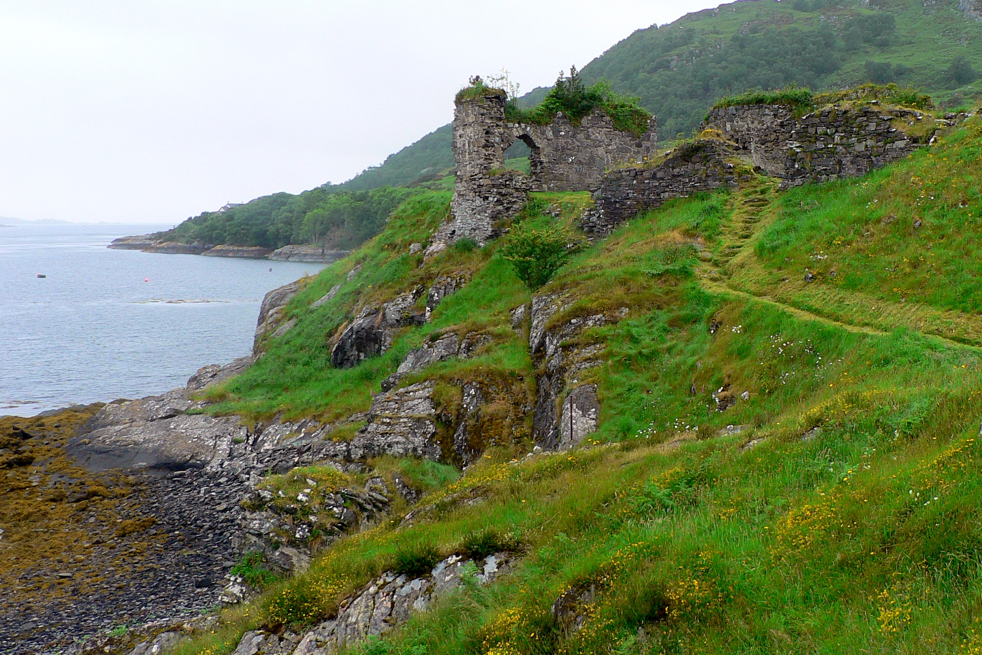
Strome Castle is a historic site located in Ross-shire, Scotland. The castle dates back to the 15th century and was originally built by the Macdonald clan. It is situated on a rocky promontory overlooking the waters of Loch Carron, providing stunning views of the surrounding landscape.

The castle was once a strategic stronghold, controlling access to the sea route along the west coast of Scotland. It played a significant role in the region's history, witnessing various battles and conflicts over the centuries.

Today, Strome Castle stands in ruins, with only a few walls and towers remaining. Despite its dilapidated state, the castle's imposing presence and picturesque setting make it a popular destination for history enthusiasts and tourists alike. Visitors can explore the site, taking in the breathtaking views and imagining what life was like for the inhabitants of this ancient fortress.

Strome Castle is a protected heritage site, managed by Historic Environment Scotland. It offers a glimpse into Scotland's rich history and serves as a reminder of the country's turbulent past.

If you have any feedback on the listing, please let us know in the comments section below.

Strome Castle Images

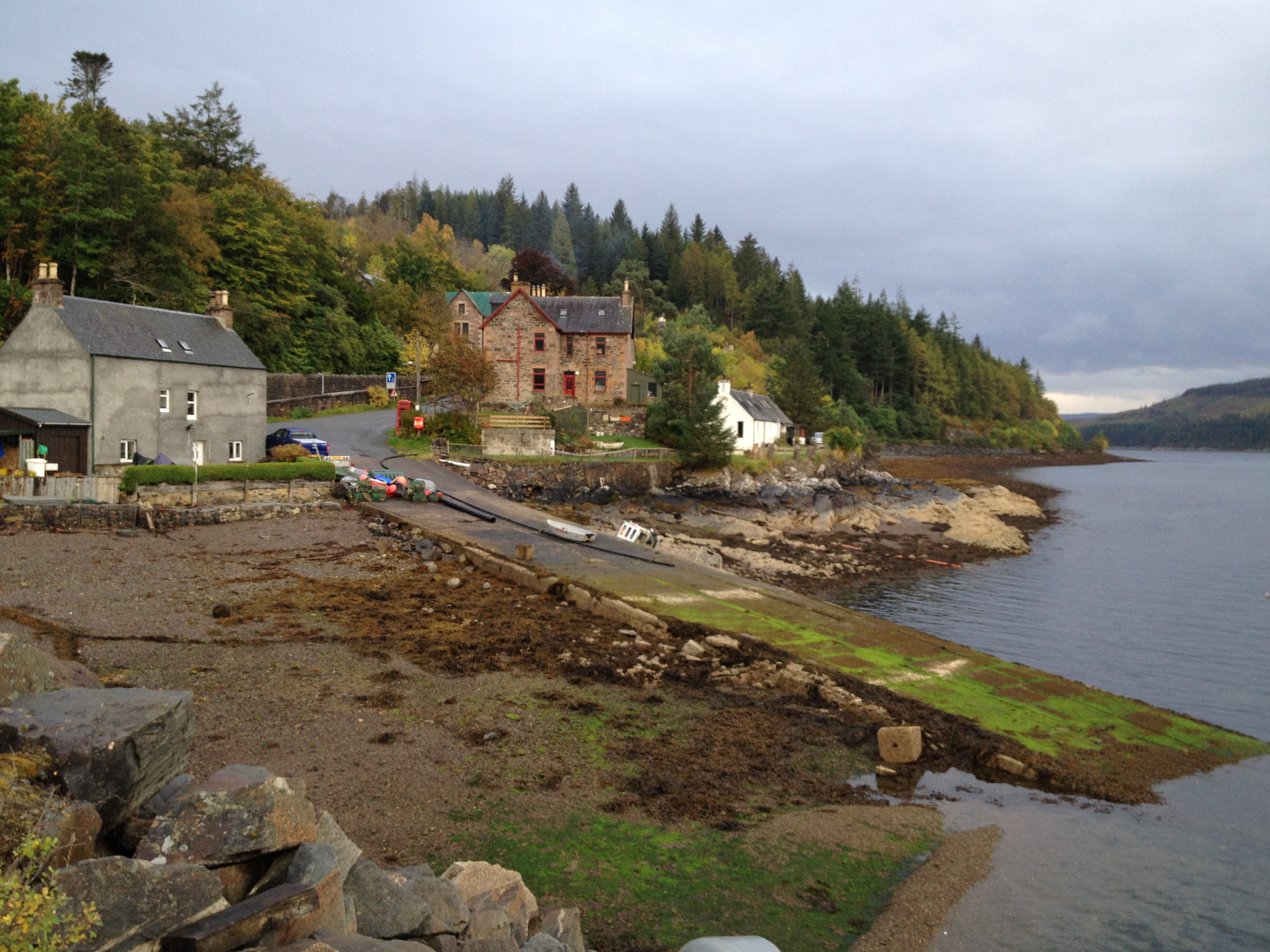
Images are sourced within 2km of 57.359/-5.556 or Grid Reference NG8635. Thanks to Geograph Open Source API. All images are credited.

Stromemore from Strome Ferry In 1966 the A890, used this route, via the ferry to continue its way North.
Stromemore from Strome Ferry
In 1966 the A890, used this route, via the ferry to continue its way North.
Roadworks near Stromeferry
Old Stromeferry Hotel This hotel dates from 1874, but has been disused for a number of years. It was damaged by a fire in 1993. Since then there have been several proposals for renovating the building, and some repair work was done. But that seems to have stopped, and it is now derelict.

The hotel features in Iain Banks' novel 'Complicity'.

It is listed on the Buildings at Risk Register for Scotland. <span class="nowrap"><a title="http://www.buildingsatrisk.org.uk/details/895926" rel="nofollow ugc noopener" href="http://www.buildingsatrisk.org.uk/details/895926">Link</a><img style="margin-left:2px;" alt="External link" title="External link - shift click to open in new window" src="https://s1.geograph.org.uk/img/external.png" width="10" height="10"/></span>
Old Stromeferry Hotel
This hotel dates from 1874, but has been disused for a number of years. It was damaged by a fire in 1993. Since then there have been several proposals for renovating the building, and some repair work was done. But that seems to have stopped, and it is now derelict. The hotel features in Iain Banks' novel 'Complicity'. It is listed on the Buildings at Risk Register for Scotland. LinkExternal link
View over Loch Carron A view along the length of Loch Carron, from beside the A890 road, near Stromeferry. With a mixture of trees growing on the slopes below, including plenty of birch and larch.
View over Loch Carron
A view along the length of Loch Carron, from beside the A890 road, near Stromeferry. With a mixture of trees growing on the slopes below, including plenty of birch and larch.
Stromeferry railway station Quite a long platform, for what is now a not very busy station. Looking west along the line, towards Plockton and Kyle of Lochalsh. With a boat on a trailer just beside the station.

Stromeferry station has been much busier in the past, with several platforms, sidings, a goods shed and connections for ships at the pier.
Stromeferry railway station
Quite a long platform, for what is now a not very busy station. Looking west along the line, towards Plockton and Kyle of Lochalsh. With a boat on a trailer just beside the station. Stromeferry station has been much busier in the past, with several platforms, sidings, a goods shed and connections for ships at the pier.
Sign for Port an t-Sròim / Stromeferry (No ferry) A road sign on the A890, for the junction to Stromeferry, or Port an t-Sròim in Gaelic.
The "No ferry" message has reappeared - it wasn't on the sign last year. I'm not sure if that is an 'official' modification. <a href="https://www.geograph.org.uk/photo/4417841">NG8634 : Stromeferry No "No Ferry"</a>
Sign for Port an t-Sròim / Stromeferry (No ferry)
A road sign on the A890, for the junction to Stromeferry, or Port an t-Sròim in Gaelic. The "No ferry" message has reappeared - it wasn't on the sign last year. I'm not sure if that is an 'official' modification. NG8634 : Stromeferry No "No Ferry"
Beinn Bhan from Bad a' Chreamha View over Loch Kishorn to the Applecross Hills
Beinn Bhan from Bad a' Chreamha
View over Loch Kishorn to the Applecross Hills
Station at Stromeferry I always liked the road signs to this tiny place which always point to "Stromeferry (no ferry)".  The last car-ferry across Loch Carron ceased in 1970.  However, in 2012 a landslide closed the main A890 and a passenger ferry and a car ferry were briefly re-introduced to help alleviate the serious transport problems caused.
Station at Stromeferry
I always liked the road signs to this tiny place which always point to "Stromeferry (no ferry)". The last car-ferry across Loch Carron ceased in 1970. However, in 2012 a landslide closed the main A890 and a passenger ferry and a car ferry were briefly re-introduced to help alleviate the serious transport problems caused.
North Strome slipway
Loch Carron shore at Stromeferry
Strome Castle, Loch Carron
Stromeferry and Loch Carron
Strome Castle, Loch Carron Not a lot left, but the history is here; <span class="nowrap"><a title="https://en.wikipedia.org/wiki/Strome_Castle" rel="nofollow ugc noopener" href="https://en.wikipedia.org/wiki/Strome_Castle">Link</a><img style="margin-left:2px;" alt="External link" title="External link - shift click to open in new window" src="https://s1.geograph.org.uk/img/external.png" width="10" height="10"/></span>
Strome Castle, Loch Carron
Not a lot left, but the history is here; LinkExternal link
The old slipway, North Strome Before the road from Strome Ferry to Strathcarron was opened in 1970, this was the ferry crossing on the road north.
The old slipway, North Strome
Before the road from Strome Ferry to Strathcarron was opened in 1970, this was the ferry crossing on the road north.
Strome Castle In the late 16th century the castle was held by the Macdonalds of Glengarry but the neighbouring Mackenzies disputed possession and in 1602 laid siege. By accident, water was poured into the gunpowder casks. Learning of this, the  Mackenzies allowed the Macdonalds to surrender and evacuate the castle which was then blown up. (Source: information board nearby - also see <span class="nowrap"><a title="http://www.undiscoveredscotland.co.uk/lochcarron/stromecastle/" rel="nofollow ugc noopener" href="http://www.undiscoveredscotland.co.uk/lochcarron/stromecastle/">Link</a><img style="margin-left:2px;" alt="External link" title="External link - shift click to open in new window" src="https://s1.geograph.org.uk/img/external.png" width="10" height="10"/></span> )
Strome Castle
In the late 16th century the castle was held by the Macdonalds of Glengarry but the neighbouring Mackenzies disputed possession and in 1602 laid siege. By accident, water was poured into the gunpowder casks. Learning of this, the Mackenzies allowed the Macdonalds to surrender and evacuate the castle which was then blown up. (Source: information board nearby - also see LinkExternal link )
Port a' Mheirlich A small bay on the N side of the narrows in Loch Carron. Across the water is Creag an t-Sroilleachan.
Port a' Mheirlich
A small bay on the N side of the narrows in Loch Carron. Across the water is Creag an t-Sroilleachan.
Road to Ardaneaskan The road out to the small village on the headland north of Loch Carron.
Road to Ardaneaskan
The road out to the small village on the headland north of Loch Carron.
End of the forest track, Leacanasigh The path down to the road continues to the left from this turning circle.
End of the forest track, Leacanasigh
The path down to the road continues to the left from this turning circle.
Show me another place!

Strome Castle is located at Grid Ref: NG8635 (Lat: 57.359, Lng: -5.556)

Unitary Authority: Highland

Police Authority: Highlands and Islands

What 3 Words

///dozen.pixel.clings. Near Lochcarron, Highland

Related Wikis

Strome Castle

Strome Castle is a ruined castle on the shore of Loch Carron in Stromemore, 3.5 miles south-west of the village of Lochcarron, on the headland between...

Stromeferry railway station

Stromeferry railway station is a station on the Kyle of Lochalsh Line, serving the village of Stromeferry in the Highlands, northern Scotland. Stromeferry...

Stromeferry

Stromeferry (Scottish Gaelic: Port an t-Sròim) is a village, located on the south shore of the west coast sea loch, Loch Carron, in western Ross-shire...

Bad a' Chreamha

Bad a' Chreamha is a small hill in Scotland, occupying the broad peninsula between Loch Carron and Loch Kishorn. It consists of a long low ridge; the northwestern...

Nearby Amenities

Located within 500m of 57.359,-5.556
Created By: almien_coastlines
Source: PGS
Lat/Long: 57.358267/-5.563792
Source: PGS
Lat/Long: 57.3584654/-5.5623992
Source: PGS
Lat/Long: 57.3587156/-5.56136
Created By: almien_coastlines
Source: PGS
Lat/Long: 57.359102/-5.560533
Source: PGS
Lat/Long: 57.3594488/-5.559604
Source: PGS
Lat/Long: 57.3595802/-5.5582895
Created By: almien_coastlines
Source: PGS
Lat/Long: 57.359819/-5.556791
Source: PGS
Lat/Long: 57.3583307/-5.5526614
Source: PGS
Lat/Long: 57.358186/-5.5518818
North Strome
Place: hamlet
Source: survey
Lat/Long: 57.3627686/-5.5528379
Post Box
Ref: IV54 332
Source: survey
Source Ref: dracos
Lat/Long: 57.3608936/-5.5549419
Leisure: slipway
Source: survey
Lat/Long: 57.358309/-5.5539578
Druim a Chaoruinn
Addr City: Strathcarron
Addr Housename: Druim a Chaoruinn
Addr Housenumber: North Strome
Addr Postcode: IV54 8YJ
Addr Street: Lochcarron
Website: https://picasaweb.google.com/101567632500778470634
Lat/Long: 57.3601539/-5.5604409
Castle Bay
Natural: bay
Lat/Long: 57.3583768/-5.558923
Power: pole
Lat/Long: 57.3590597/-5.5550345
Power: pole
Lat/Long: 57.3596775/-5.5641246
Power: pole
Lat/Long: 57.3600424/-5.5624164
Power: pole
Lat/Long: 57.3603669/-5.5605132
Power: pole
Lat/Long: 57.3606292/-5.5586558
Power: pole
Lat/Long: 57.3608472/-5.5569348
Power: pole
Lat/Long: 57.3609162/-5.5561676
Power: pole
Lat/Long: 57.3616214/-5.5547473
Power: pole
Lat/Long: 57.3622082/-5.5535842
Power: pole
Lat/Long: 57.3627733/-5.5524329
Power: pole
Lat/Long: 57.3616658/-5.5551831
Power: pole
Lat/Long: 57.3606355/-5.5549329
Power: pole
Lat/Long: 57.3610119/-5.5540976
Power: pole
Lat/Long: 57.3601415/-5.5547616
Power: pole
Lat/Long: 57.3596601/-5.5546197
Power: pole
Lat/Long: 57.3591451/-5.5544671
The data included in this document is from www.openstreetmap.org. The data is made available under ODbL.

Have you been to Strome Castle?

Leave your review of Strome Castle below (or comments, questions and feedback).