Stromemore
Settlement in Ross-shire
Scotland
Stromemore

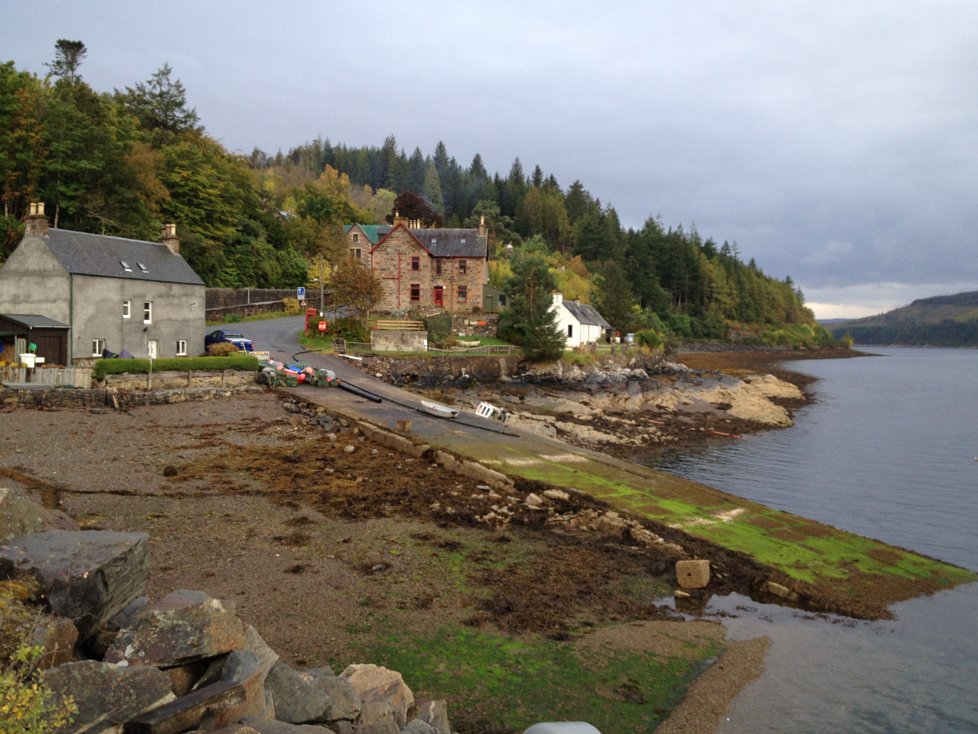
Stromemore is a small village located in the Ross-shire region of the Scottish Highlands. Situated approximately 10 miles west of the town of Dingwall, it is nestled amidst picturesque countryside and offers a serene and peaceful environment.
With a population of around 500 residents, Stromemore maintains a close-knit community atmosphere. The village primarily consists of traditional stone-built cottages, many of which date back several centuries, giving it a charming and historic feel. The stunning natural beauty of the surrounding landscape, including rolling hills, forests, and rivers, is a major attraction for residents and visitors alike.
Despite its small size, Stromemore boasts a few amenities to cater to the needs of its residents. These include a village shop, a primary school, and a community hall that serves as a hub for various social and recreational activities. The village also has good transport links, with regular bus services connecting it to neighboring towns and villages.
Stromemore's location within the Scottish Highlands makes it an ideal base for outdoor enthusiasts. The nearby Strathconon Glen offers plenty of opportunities for hiking, fishing, and wildlife spotting. Additionally, the village is within driving distance of several popular tourist destinations, such as Loch Ness and the Isle of Skye, making it a convenient starting point for exploring the wider region.
Overall, Stromemore is a tranquil village with a strong sense of community, surrounded by breathtaking natural beauty, and offering a peaceful retreat for those seeking a slower pace of life.
If you have any feedback on the listing, please let us know in the comments section below.
Stromemore Images
Images are sourced within 2km of 57.361022/-5.5550986 or Grid Reference NG8635. Thanks to Geograph Open Source API. All images are credited.


Stromemore is located at Grid Ref: NG8635 (Lat: 57.361022, Lng: -5.5550986)
Unitary Authority: Highland
Police Authority: Highlands and Islands
What 3 Words
///scramble.beaters.perfumed. Near Lochcarron, Highland
Nearby Locations
Related Wikis
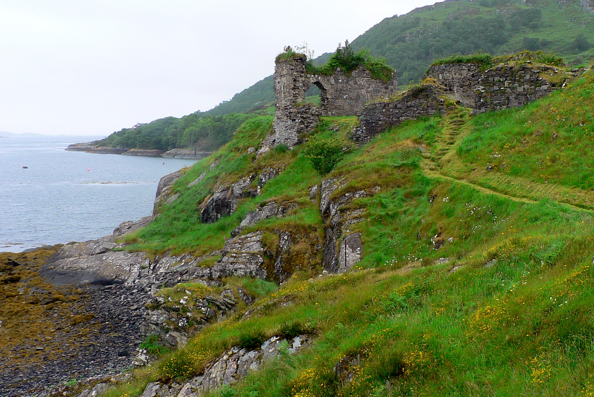
Strome Castle
Strome Castle is a ruined castle on the shore of Loch Carron in Stromemore, 3.5 miles south-west of the village of Lochcarron, on the headland between...

Stromeferry railway station
Stromeferry railway station is a station on the Kyle of Lochalsh Line, serving the village of Stromeferry in the Highlands, northern Scotland. Stromeferry...
Stromeferry
Stromeferry (Scottish Gaelic: Port an t-Sròim) is a village, located on the south shore of the west coast sea loch, Loch Carron, in western Ross-shire...

Bad a' Chreamha
Bad a' Chreamha is a small hill in Scotland, occupying the broad peninsula between Loch Carron and Loch Kishorn. It consists of a long low ridge; the northwestern...
Related Videos

Dorloch-skye🏴 strome, ferry, deer & views lakeside #nc500 #strome #cooking #wildlife #stags
Many places to free camp enroute, The port of darloch very nice gardens, community shop, lovely locals , be careful of fires, ...

Loch Carron On Visit To West Coast Of Ross And Cromarty Highlands Scotland
Tour Scotland travel video, with Scottish music, of Loch Carron, Scottish Gaelic: Loch Carrann, a sea loch on visit to West Coast of ...

Ness Divers - Lochcarron 14.04.19
Great drift dive from Conservation Bay to Strome Castle, Lochcarron.

Ness Divers - Drift dive Strome at Lochcarron 18th April 2021 #djimini2
Short video of our first club dive after lock-down - Fantastic getting back in the water - Also added drone footage showing flight ...
Nearby Amenities
Located within 500m of 57.361022,-5.5550986Have you been to Stromemore?
Leave your review of Stromemore below (or comments, questions and feedback).