Castle Bay
Bay in Ross-shire
Scotland
Castle Bay

Castle Bay is a picturesque coastal village located in the region of Ross-shire, in the Scottish Highlands. Situated on the eastern shore of the stunning Dornoch Firth, the bay offers breathtaking views of the North Sea and the surrounding hills and cliffs. The village is named after the historic Castle Bay House, which overlooks the bay and adds to the charm of the area.
The bay itself is a small sandy beach, perfect for leisurely walks or picnics while enjoying the tranquil atmosphere. The crystal-clear waters are ideal for swimming during the warmer months, and the bay's sheltered position makes it a popular spot for water sports such as kayaking and paddleboarding.
Castle Bay is a haven for nature lovers, with a diverse range of wildlife inhabiting the area. Seals can often be spotted lounging on the rocks, while dolphins and porpoises occasionally make appearances in the bay. The surrounding countryside offers ample opportunities for hiking and birdwatching, with a variety of species to be spotted in the nearby forests and wetlands.
The village itself is small but charming, with a handful of traditional cottages and a local pub serving hearty meals and refreshing drinks. Visitors can also explore the nearby historic ruins of Castle Varich, a medieval stronghold that offers a glimpse into the area's rich history.
Overall, Castle Bay in Ross-shire is a peaceful and idyllic coastal haven, perfect for those seeking a tranquil getaway surrounded by natural beauty.
If you have any feedback on the listing, please let us know in the comments section below.
Castle Bay Images
Images are sourced within 2km of 57.35879/-5.5577437 or Grid Reference NG8635. Thanks to Geograph Open Source API. All images are credited.


Castle Bay is located at Grid Ref: NG8635 (Lat: 57.35879, Lng: -5.5577437)
Unitary Authority: Highland
Police Authority: Highlands and Islands
What 3 Words
///freshen.retailing.rotate. Near Lochcarron, Highland
Nearby Locations
Related Wikis
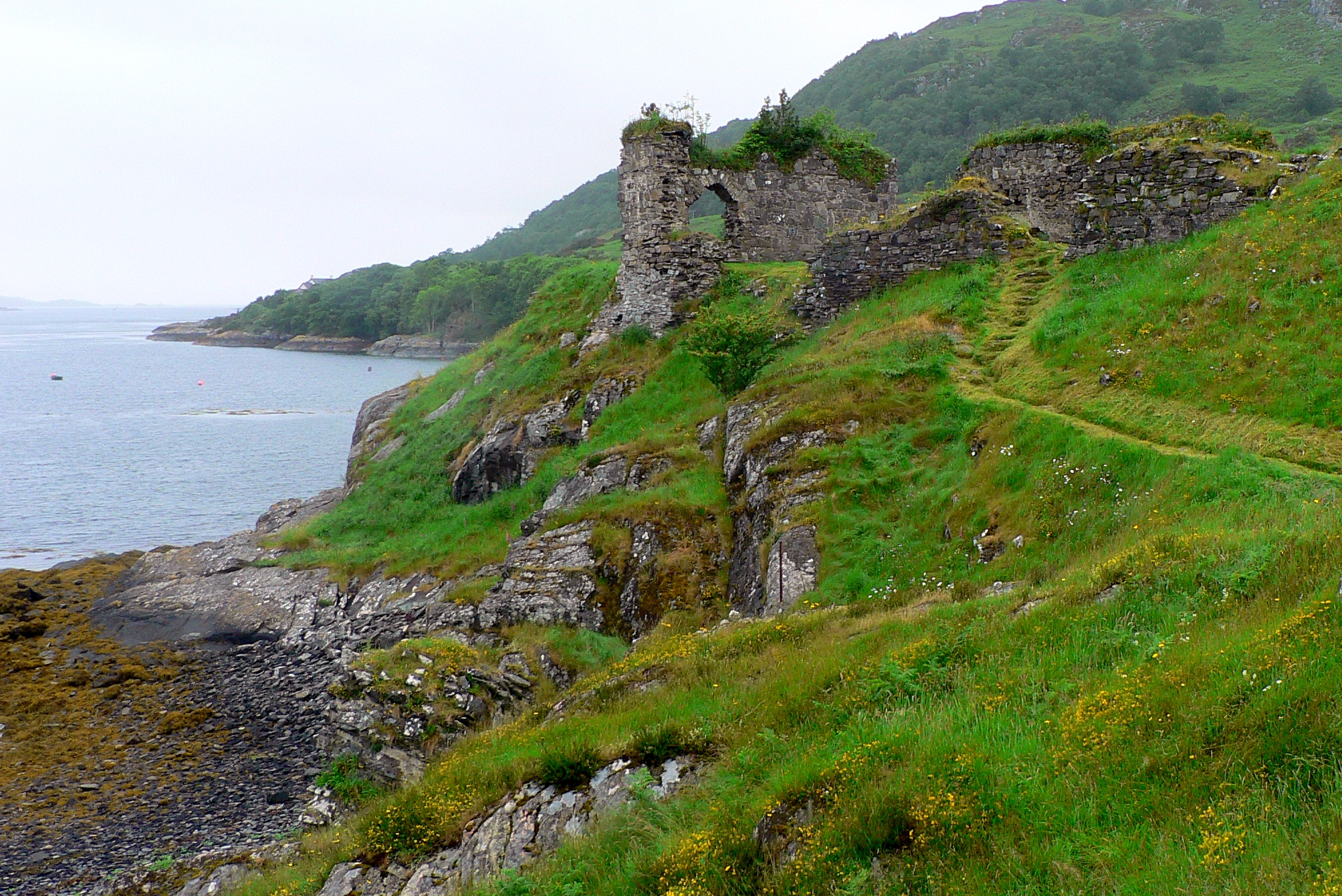
Strome Castle
Strome Castle is a ruined castle on the shore of Loch Carron in Stromemore, 3.5 miles south-west of the village of Lochcarron, on the headland between...

Stromeferry railway station
Stromeferry railway station is a station on the Kyle of Lochalsh Line, serving the village of Stromeferry in the Highlands, northern Scotland. Stromeferry...
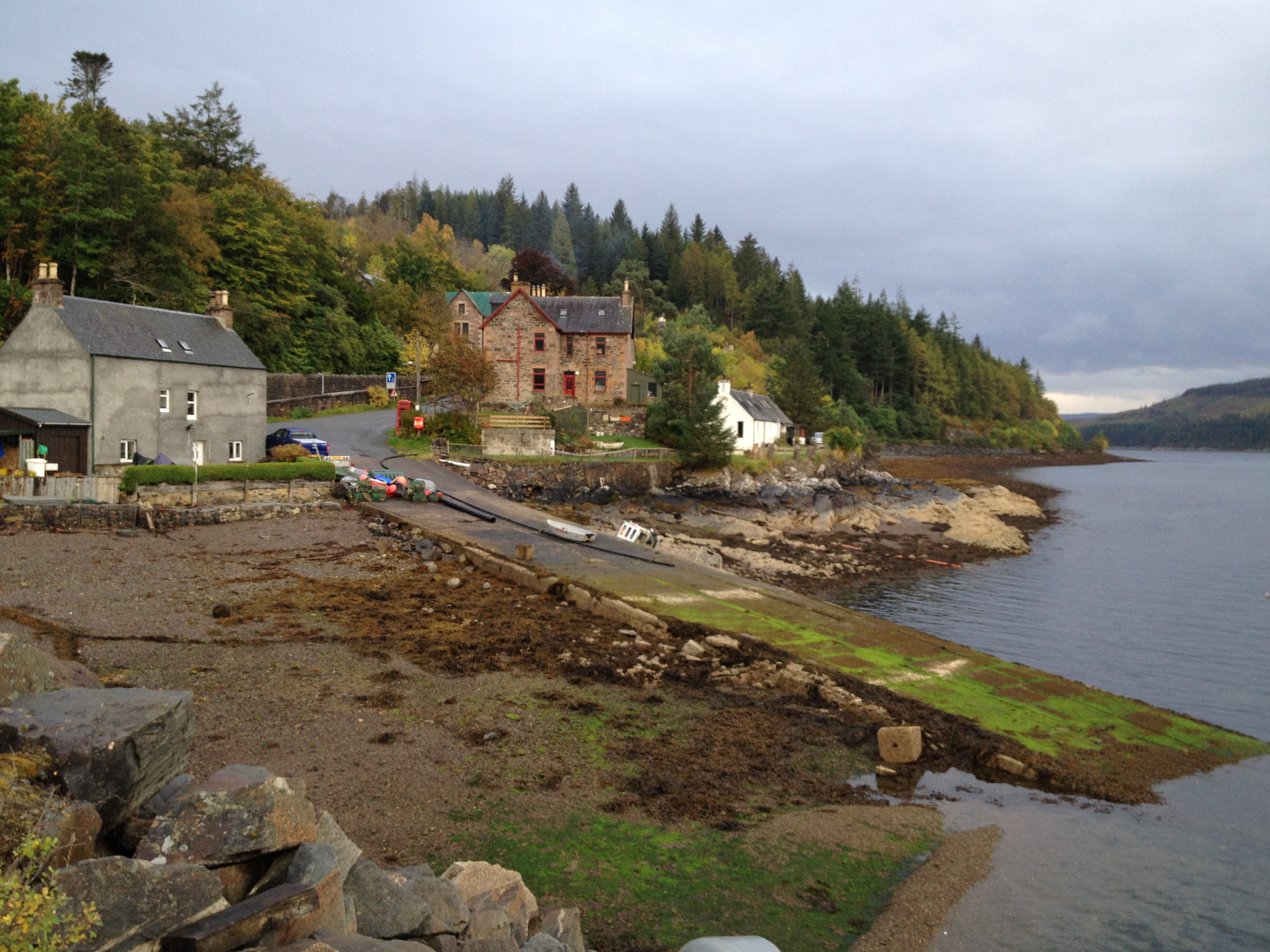
Stromeferry
Stromeferry (Scottish Gaelic: Port an t-Sròim) is a village, located on the south shore of the west coast sea loch, Loch Carron, in western Ross-shire...

Bad a' Chreamha
Bad a' Chreamha is a small hill in Scotland, occupying the broad peninsula between Loch Carron and Loch Kishorn. It consists of a long low ridge; the northwestern...
Related Videos
A mindful walk in Ardaneaskan and strome
Come with me on my day off A lovely walk amongst the trees just being at one with nature.... relax.

Dorloch-skye🏴 strome, ferry, deer & views lakeside #nc500 #strome #cooking #wildlife #stags
Many places to free camp enroute, The port of darloch very nice gardens, community shop, lovely locals , be careful of fires, ...

Loch Carron On Visit To West Coast Of Ross And Cromarty Highlands Scotland
Tour Scotland travel video, with Scottish music, of Loch Carron, Scottish Gaelic: Loch Carrann, a sea loch on visit to West Coast of ...
Nearby Amenities
Located within 500m of 57.35879,-5.5577437Have you been to Castle Bay?
Leave your review of Castle Bay below (or comments, questions and feedback).