Plas Teg

Heritage Site in Flintshire

Wales

Plas Teg

Rivet benchmark on the Afon Alun bridge, Fagl Lane, Hope Ordnance Survey rivet benchmark on the north parapet of the Fagl Lane bridge over the Afon Alun/River Alyn. The bridge was built in 1933/4 to straighten the road and replaced the earlier Pont y Delyn, which still exists to the south. Levelled at 82.802m above Newlyn Datum, verified 1959. For a wider view see <a href="https://www.geograph.org.uk/photo/7516282">SJ3058 : Bridge over Afon Alun/River Alyn, Fagl Lane, Hope</a>                                                                                        
<span class="nowrap"><a title="https://www.bench-marks.org.uk/bm195082" rel="nofollow ugc noopener" href="https://www.bench-marks.org.uk/bm195082">Link</a><img style="margin-left:2px;" alt="External link" title="External link - shift click to open in new window" src="https://s1.geograph.org.uk/img/external.png" width="10" height="10"/></span>
Rivet benchmark on the Afon Alun bridge, Fagl Lane, Hope Credit: John S Turner

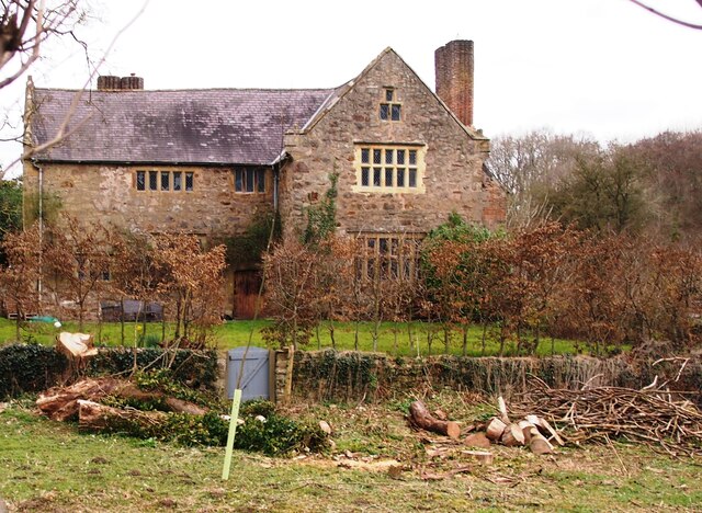
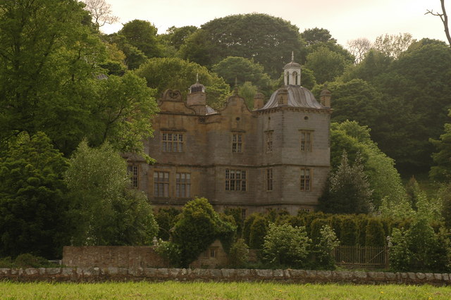
Plas Teg is a historic mansion located in Flintshire, Wales. It is considered to be one of the finest examples of Jacobean architecture in the country and is designated as a Grade I listed building. The house was built in 1610 for Sir John Trevor I, a prominent lawyer and politician of the time.

The mansion is constructed of local red brick with white sandstone dressings, creating an impressive and elegant exterior. Plas Teg features a symmetrical design, with a central three-story main block flanked by two projecting wings. The intricate stone carvings, ornate gables, and decorative chimneys add to its grandeur.

Inside, Plas Teg boasts a stunning collection of period features and architectural details. The Great Hall is particularly notable, with its oak paneling, decorative plasterwork, and a magnificent fireplace. The house also showcases a beautiful Long Gallery, adorned with original Elizabethan oak paneling.

The mansion underwent a meticulous restoration in the late 20th century, which aimed to preserve its historical integrity. Today, Plas Teg serves as a popular heritage site, offering guided tours to visitors who are eager to explore its rich history. The estate also hosts various events, including historical reenactments and ghost tours, adding to its allure.

Plas Teg is not only cherished for its architectural significance but also for its place in Welsh history. It stands as a testament to the opulence and grandeur of the Jacobean era, providing a glimpse into the lives of the wealthy and influential families of the past.

If you have any feedback on the listing, please let us know in the comments section below.

Plas Teg Images

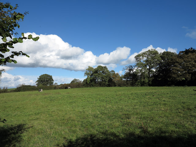
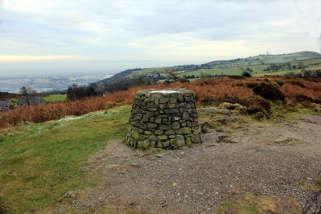
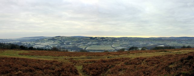
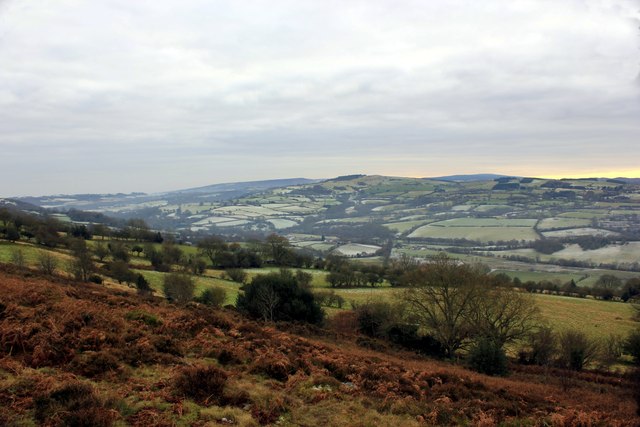
Images are sourced within 2km of 53.13/-3.067 or Grid Reference SJ2859. Thanks to Geograph Open Source API. All images are credited.

Rivet benchmark on the Afon Alun bridge, Fagl Lane, Hope Ordnance Survey rivet benchmark on the north parapet of the Fagl Lane bridge over the Afon Alun/River Alyn. The bridge was built in 1933/4 to straighten the road and replaced the earlier Pont y Delyn, which still exists to the south. Levelled at 82.802m above Newlyn Datum, verified 1959. For a wider view see <a href="https://www.geograph.org.uk/photo/7516282">SJ3058 : Bridge over Afon Alun/River Alyn, Fagl Lane, Hope</a>                                                                                        
<span class="nowrap"><a title="https://www.bench-marks.org.uk/bm195082" rel="nofollow ugc noopener" href="https://www.bench-marks.org.uk/bm195082">Link</a><img style="margin-left:2px;" alt="External link" title="External link - shift click to open in new window" src="https://s1.geograph.org.uk/img/external.png" width="10" height="10"/></span>
Rivet benchmark on the Afon Alun bridge, Fagl Lane, Hope
Ordnance Survey rivet benchmark on the north parapet of the Fagl Lane bridge over the Afon Alun/River Alyn. The bridge was built in 1933/4 to straighten the road and replaced the earlier Pont y Delyn, which still exists to the south. Levelled at 82.802m above Newlyn Datum, verified 1959. For a wider view see SJ3058 : Bridge over Afon Alun/River Alyn, Fagl Lane, Hope LinkExternal link
Bridge over Afon Alun/River Alyn, Fagl Lane, Hope Looking east along Fagl Lane over the bridge that was built in 1933/4 to straighten the road and replace Pont y Delyn, which is out of sight on the right. There is an Ordnance Survey rivet benchmark on top of the left hand/north parapet <a href="https://www.geograph.org.uk/photo/7516156">SJ3058 : Rivet benchmark on the Afon Alun bridge, Fagl Lane, Hope</a>.
Bridge over Afon Alun/River Alyn, Fagl Lane, Hope
Looking east along Fagl Lane over the bridge that was built in 1933/4 to straighten the road and replace Pont y Delyn, which is out of sight on the right. There is an Ordnance Survey rivet benchmark on top of the left hand/north parapet SJ3058 : Rivet benchmark on the Afon Alun bridge, Fagl Lane, Hope.
Corwen Road at Pontybodkin
Site of Coed Talon station, 1986 View NE on A5104, at the former crossing of the LNW & GW Joint line from Mold (left) to Brymbo (right). Nothing whatever is to be seen now relating to the railway, the line having been closed finally on 22/7/63, to passengers from 27/3/50.
Site of Coed Talon station, 1986
View NE on A5104, at the former crossing of the LNW & GW Joint line from Mold (left) to Brymbo (right). Nothing whatever is to be seen now relating to the railway, the line having been closed finally on 22/7/63, to passengers from 27/3/50.
Field east of Coed-talon The field is passed by a minor road descending to Coed-talon; it also lies south-east of the delightfully named village, Pontybodkin.
Field east of Coed-talon
The field is passed by a minor road descending to Coed-talon; it also lies south-east of the delightfully named village, Pontybodkin.
Waen y Llyn Country Park Viewpoint & Toposcope The viewpoint at Waen y Llyn Country Park has a toposcope indicating the surrounding area.
Waen y Llyn Country Park Viewpoint & Toposcope
The viewpoint at Waen y Llyn Country Park has a toposcope indicating the surrounding area.
View from Waen y Llyn Looking east from the viewpoint.
View from Waen y Llyn
Looking east from the viewpoint.
View from Waen y Llyn Country Park
Pathway at Waen y Llyn Country Park Waen y Llyn Country Park near Hope Mountain.
Pathway at Waen y Llyn Country Park
Waen y Llyn Country Park near Hope Mountain.
Stile and Gate at Waen y Llyn Country Park One of the entrances to Waen y Llyn Country Park at its northern end.
Stile and Gate at Waen y Llyn Country Park
One of the entrances to Waen y Llyn Country Park at its northern end.
Lane at Berth Lane at Berth leading to Waen y Llyn Country Park.
Lane at Berth
Lane at Berth leading to Waen y Llyn Country Park.
Country Lane at Berth Lane at Berth heading east.
Country Lane at Berth
Lane at Berth heading east.
Lane to Pontybodkin Lane heading west from Berth to Pontybodkin.
Lane to Pontybodkin
Lane heading west from Berth to Pontybodkin.
The A5104 in Nant Wood
Fferm, Pontblyddyn An Elizabethan manor house.
Fferm, Pontblyddyn
An Elizabethan manor house.
Penyffordd Station - looking north
View from below Mount Farm, Bryn Common, A stunning view towards the north coast from the track from Mount Farm, Bryn Common, near Llanfynydd through my horse's ears!
View from below Mount Farm, Bryn Common,
A stunning view towards the north coast from the track from Mount Farm, Bryn Common, near Llanfynydd through my horse's ears!
Buttercup meadow West of Waun-y-Llyn Country Park.
Buttercup meadow
West of Waun-y-Llyn Country Park.
Show me another place!

Plas Teg is located at Grid Ref: SJ2859 (Lat: 53.13, Lng: -3.067)

Unitary Authority: Flintshire

Police Authority: North Wales

What 3 Words

///giants.empty.sailed. Near Leeswood, Flintshire

Related Wikis

Plas Teg

Plas Teg is a Grade I listed Jacobean house in Wales. It is near the village of Pontblyddyn in Flintshire, between Wrexham and Mold. It is considered to...

Fferm

Fferm (Welsh for "farm") Farmhouse is a small Elizabethan manor house, located to the east of Pontblyddyn in the county of Flintshire, Wales. It is listed...

Pontblyddyn

Pontblyddyn is a small village outside Leeswood, in Flintshire, Wales and is situated around 8 miles from Wrexham. Plas Teg, one of the most important...

Penyffordd railway station

Penyffordd railway station serves the village of Penyffordd in Flintshire, Wales. The station is 7ΒΌ miles (12 km) north of Wrexham Central on the Borderlands...

Nearby Amenities

Located within 500m of 53.13,-3.067
Barrier: stile
Lat/Long: 53.1322397/-3.0680662
The data included in this document is from www.openstreetmap.org. The data is made available under ODbL.

Have you been to Plas Teg?

Leave your review of Plas Teg below (or comments, questions and feedback).