Mewith Head

Settlement in Yorkshire Craven

England

Mewith Head

River Wenning at Greystonegill Bridge Looking north-eastward upstream.
River Wenning at Greystonegill Bridge Credit: Peter Wood

Mewith Head is a small village located in the Craven district of North Yorkshire, England. It is situated approximately 4 miles northwest of the market town of Settle. The village is nestled within the picturesque setting of the Yorkshire Dales National Park, offering stunning views of the surrounding countryside.

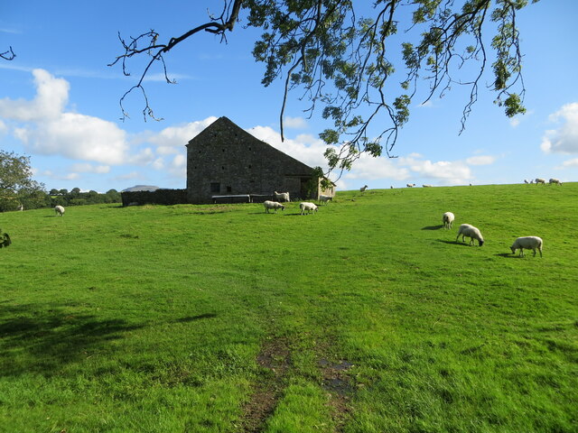
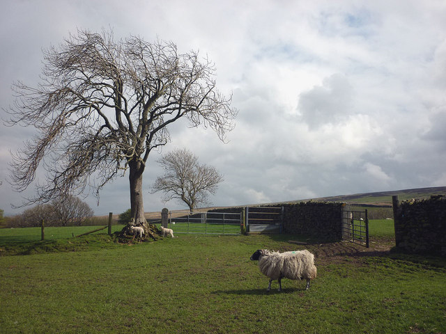
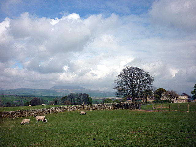
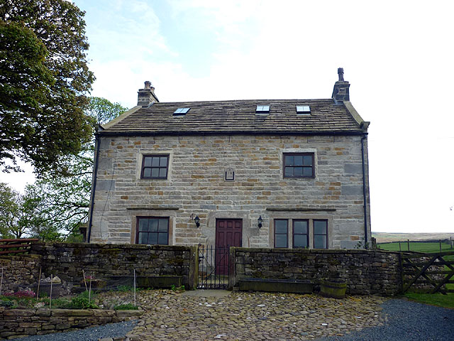
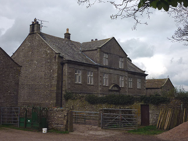
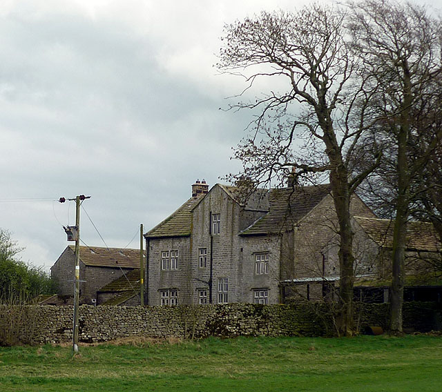
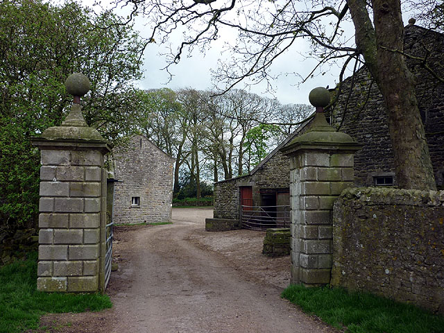
The village itself is known for its quaint and traditional charm. It consists of a cluster of stone-built houses and cottages, many of which date back to the 18th and 19th centuries. The architecture reflects the region's rich history and heritage.

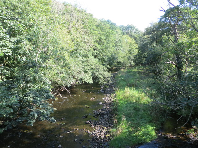
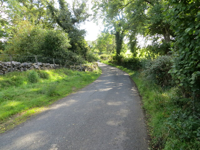
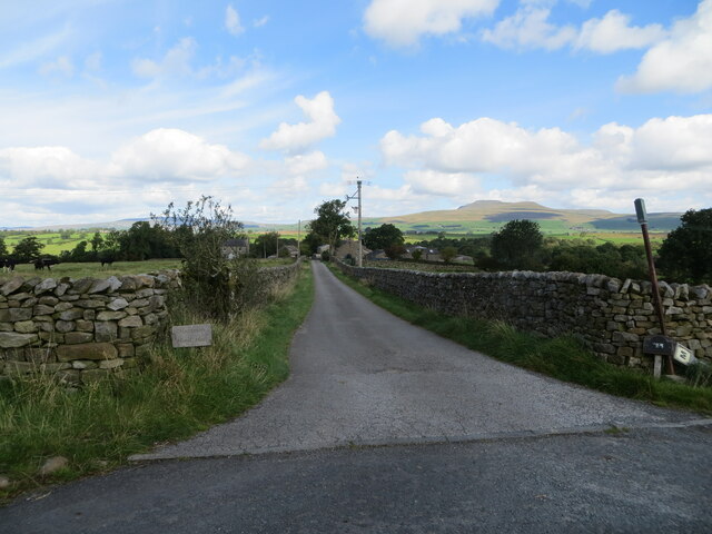
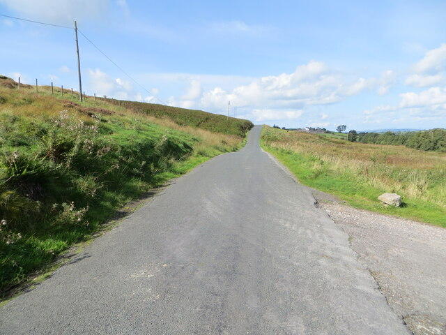
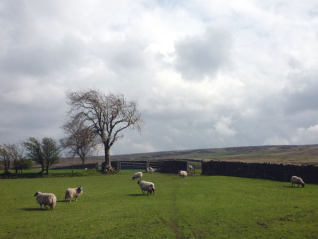
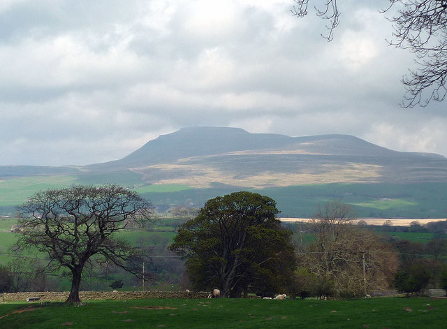
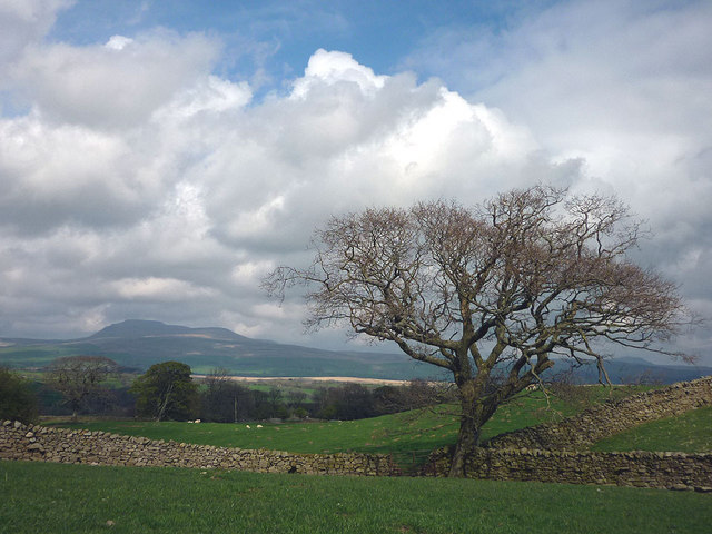
Mewith Head is surrounded by rolling hills, lush green meadows, and scenic walking trails, making it a haven for nature enthusiasts and hikers. The nearby River Ribble adds to the beauty of the area, offering opportunities for fishing and riverside walks.

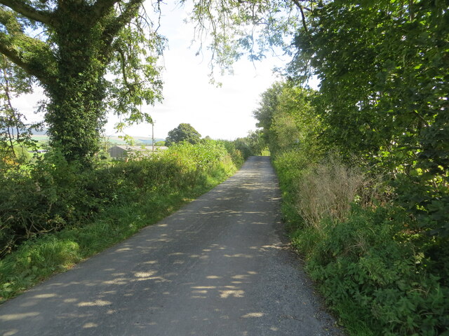
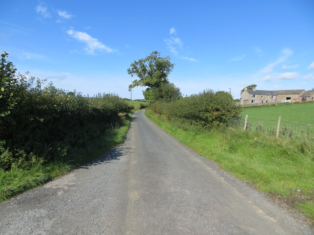
Despite its small size, Mewith Head is well-connected to nearby towns and villages. Settle, with its range of amenities including shops, schools, and healthcare facilities, is easily accessible. The village also benefits from good transport links, with regular bus services connecting it to the wider region.

For those seeking a peaceful and tranquil retreat, Mewith Head provides an idyllic setting. The village offers a sense of community and a slower pace of life, allowing residents and visitors to enjoy the natural beauty of the Yorkshire Dales.

If you have any feedback on the listing, please let us know in the comments section below.

Mewith Head Images

Images are sourced within 2km of 54.099177/-2.455819 or Grid Reference SD7067. Thanks to Geograph Open Source API. All images are credited.

River Wenning at Greystonegill Bridge Looking north-eastward upstream.
River Wenning at Greystonegill Bridge
Looking north-eastward upstream.
Pastureland and field barn on Buffet Hill Looking north-eastward.
Pastureland and field barn on Buffet Hill
Looking north-eastward.
Mewith Lane approaching New House Looking eastward.
Mewith Lane approaching New House
Looking eastward.
Hedge and fence enclosed lane at Chesters Looking westward.
Hedge and fence enclosed lane at Chesters
Looking westward.
Hollin Lane at Ratton Syke Bridge Looking south-eastward.
Hollin Lane at Ratton Syke Bridge
Looking south-eastward.
Access to Hammon Head Hall Looking northward from Bloe Beck Lane. Ingleborough is visible on the skyline.
Access to Hammon Head Hall
Looking northward from Bloe Beck Lane. Ingleborough is visible on the skyline.
Mewith Lane beside Cinder Hill Looking north-westward.
Mewith Lane beside Cinder Hill
Looking north-westward.
Sheep at Gruskham There is one more intake field of improved pasture then the open wastes of Burn Moor.
Sheep at Gruskham
There is one more intake field of improved pasture then the open wastes of Burn Moor.
Sheep and lambs at Gruskham Mother keeps an eye on the children while they get on with the important job of checking out the tree.
Sheep and lambs at Gruskham
Mother keeps an eye on the children while they get on with the important job of checking out the tree.
Approaching Crow Trees The footpath from Gruskham heads through sheep pastures with a good view of Ingleborough.
Approaching Crow Trees
The footpath from Gruskham heads through sheep pastures with a good view of Ingleborough.
Crow Trees farmhouse Most of the farmhouses up here in the Forest of Mewith seem to be converted. This one has a 1770 date stone with initials IR. It is Grade II listed <span class="nowrap"><a title="http://www.britishlistedbuildings.co.uk/en-324049-crow-trees-farmhouse-bentham" rel="nofollow ugc noopener" href="http://www.britishlistedbuildings.co.uk/en-324049-crow-trees-farmhouse-bentham">Link</a><img style="margin-left:2px;" alt="External link" title="External link - shift click to open in new window" src="https://s1.geograph.org.uk/img/external.png" width="10" height="10"/></span>
Crow Trees farmhouse
Most of the farmhouses up here in the Forest of Mewith seem to be converted. This one has a 1770 date stone with initials IR. It is Grade II listed LinkExternal link
Looking towards Ingleborough Once the cloud has cleared Ingleborough becomes the object that draws the eye.
Looking towards Ingleborough
Once the cloud has cleared Ingleborough becomes the object that draws the eye.
Walls and Ingleborough Encountered on the path east of Crow Trees.
Walls and Ingleborough
Encountered on the path east of Crow Trees.
Mewith Head Hall An unexpected sight up here almost at the upper edge of the pasture land of Mewith Forest. The hall is 18th Century although the owner(?) told me that he thought it once belonged to a standard bearer of Henry VIII. It is Grade II* listed <span class="nowrap"><a title="http://www.britishlistedbuildings.co.uk/en-324095-mewith-head-hall-wall-to-garden-and-gate" rel="nofollow ugc noopener" href="http://www.britishlistedbuildings.co.uk/en-324095-mewith-head-hall-wall-to-garden-and-gate">Link</a><img style="margin-left:2px;" alt="External link" title="External link - shift click to open in new window" src="https://s1.geograph.org.uk/img/external.png" width="10" height="10"/></span> along with the wall of the garden and the gatepiers.
Mewith Head Hall
An unexpected sight up here almost at the upper edge of the pasture land of Mewith Forest. The hall is 18th Century although the owner(?) told me that he thought it once belonged to a standard bearer of Henry VIII. It is Grade II* listed LinkExternal link along with the wall of the garden and the gatepiers.
Mewith Head Hall - north aspect An unexpected sight up here almost at the upper edge of the pasture land of Mewith Forest. The hall is 18th Century although the owner(?) told me that he thought it once belonged to a standard bearer of Henry VIII. It is Grade II* listed <span class="nowrap"><a title="http://www.britishlistedbuildings.co.uk/en-324095-mewith-head-hall-wall-to-garden-and-gate" rel="nofollow ugc noopener" href="http://www.britishlistedbuildings.co.uk/en-324095-mewith-head-hall-wall-to-garden-and-gate">Link</a><img style="margin-left:2px;" alt="External link" title="External link - shift click to open in new window" src="https://s1.geograph.org.uk/img/external.png" width="10" height="10"/></span> along with the wall of the garden and the gatepiers.
Mewith Head Hall - north aspect
An unexpected sight up here almost at the upper edge of the pasture land of Mewith Forest. The hall is 18th Century although the owner(?) told me that he thought it once belonged to a standard bearer of Henry VIII. It is Grade II* listed LinkExternal link along with the wall of the garden and the gatepiers.
Gate, Mewith Head Hall The hall is Grade II* listed <span class="nowrap"><a title="http://www.britishlistedbuildings.co.uk/en-324095-mewith-head-hall-wall-to-garden-and-gate" rel="nofollow ugc noopener" href="http://www.britishlistedbuildings.co.uk/en-324095-mewith-head-hall-wall-to-garden-and-gate">Link</a><img style="margin-left:2px;" alt="External link" title="External link - shift click to open in new window" src="https://s1.geograph.org.uk/img/external.png" width="10" height="10"/></span> along with the wall of the garden and the gatepiers.
Gate, Mewith Head Hall
The hall is Grade II* listed LinkExternal link along with the wall of the garden and the gatepiers.
Greystonegill Bridge near High Bentham Carrying a minor road over the River Wenning.
Greystonegill Bridge near High Bentham
Carrying a minor road over the River Wenning.
Hello! This young lamb ran over as I passed, seemingly desperate to be fed. As its fleece didn't match any of the other sheep in the fields I thought it may be an orphan which the farmer might have fostered out to another mother?
Hello!
This young lamb ran over as I passed, seemingly desperate to be fed. As its fleece didn't match any of the other sheep in the fields I thought it may be an orphan which the farmer might have fostered out to another mother?
Show me another place!

Mewith Head is located at Grid Ref: SD7067 (Lat: 54.099177, Lng: -2.455819)

Division: West Riding

Administrative County: North Yorkshire

District: Craven

Police Authority: North Yorkshire

What 3 Words

///adopters.elevate.tedious. Near High Bentham, North Yorkshire

Related Wikis

Keasden Beck

Keasden Beck is a stream in Yorkshire (formerly the West Riding) rising near Keasden Head, joining the River Wenning south west of Clapham. == References... ==

Keasden

Keasden is a hamlet in the civil parish of Clapham-cum-Newby, in the Craven district of the county of North Yorkshire, in the north-western England. It...

Clapham railway station

Clapham is a railway station on the Bentham Line, which runs between Leeds and Morecambe via Skipton. The station, situated 48 miles (77 km) north-west...

Great Stone of Fourstones

The Great Stone of Fourstones, or the Big Stone as it is known locally, is a glacial deposit on the moorlands of Tatham Fells, England, straddling the...

St Margaret's Church, High Bentham

St Margaret's Church is in Station Road, High Bentham, North Yorkshire, England. It is an Anglican parish church in the deanery of Ewecross, the archdeaconry...

Bentham railway station

Bentham is a railway station on the Bentham Line, which runs between Leeds and Morecambe via Skipton. The station, situated 19 miles (31 km) east of Lancaster...

Bentham, North Yorkshire

Bentham is a civil parish in North Yorkshire, England, with a population of 3,027 at the 2011 Census. The parish includes the town of High Bentham, occasionally...

Clapham cum Newby

Clapham cum Newby is a civil parish in the Craven district of North Yorkshire, England. It was formerly in the Settle Rural District. It contains the villages...

Nearby Amenities

Located within 500m of 54.099177,-2.455819
Mewith Head
Is In: Craven, North Yorkshire, Yorkshire, England, UK
Place: locality
Source: npe
Lat/Long: 54.0973848/-2.4559875
Barrier: stile
Material: wood
Source: survey;gps
Stile: stepover
Lat/Long: 54.0984007/-2.4516222
Power: pole
Lat/Long: 54.0992229/-2.4482242
Power: pole
Lat/Long: 54.0993451/-2.4498968
Power: pole
Lat/Long: 54.0994774/-2.4515051
Power: pole
Lat/Long: 54.0995945/-2.4531055
Power: pole
Lat/Long: 54.0997314/-2.4547475
Power: pole
Lat/Long: 54.0998562/-2.4563142
Power: pole
Lat/Long: 54.099952/-2.4575282
Power: pole
Lat/Long: 54.1000569/-2.4589963
Power: pole
Lat/Long: 54.1001832/-2.4605683
Power: pole
Lat/Long: 54.1003109/-2.4621635
Power: pole
Lat/Long: 54.0990508/-2.4586449
The data included in this document is from www.openstreetmap.org. The data is made available under ODbL.

Have you been to Mewith Head?

Leave your review of Mewith Head below (or comments, questions and feedback).