Meyrick Park

Settlement in Hampshire

England

Meyrick Park

Bournemouth Pier The beach and pier at Bournemouth, taken on a sunny afternoon in August 2021.
Bournemouth Pier Credit: Malc McDonald

Meyrick Park is a picturesque area located in Hampshire, England. Situated near Bournemouth, this park covers around 120 acres of land, making it a popular destination for both locals and tourists alike. The park is named after its former owner, Sir George Meyrick, who was a prominent figure in the local community during the 19th century.

One of the notable features of Meyrick Park is its beautiful landscape, consisting of lush green lawns, mature trees, and vibrant flower beds. The park also boasts a large golf course, which attracts golf enthusiasts from far and wide. The course provides a challenging yet enjoyable experience, with its hilly terrain and well-maintained fairways.

Additionally, Meyrick Park offers a range of recreational facilities to cater to various interests and activities. There are tennis courts, a bowling green, and a mini-golf course, providing opportunities for visitors to engage in sports and leisurely pursuits. The park also includes a children's playground, ensuring that it is a family-friendly destination.

For those seeking tranquility and natural beauty, Meyrick Park features a tranquil lake surrounded by picturesque paths, where visitors can take leisurely strolls or enjoy a picnic by the water. The park is also home to an abundance of wildlife, including ducks, swans, and various bird species, providing nature enthusiasts with ample opportunities for birdwatching and wildlife observation.

Overall, Meyrick Park offers a serene and idyllic escape from the hustle and bustle of city life. Its well-maintained grounds, diverse recreational facilities, and natural beauty make it a cherished destination for both relaxation and outdoor activities.

If you have any feedback on the listing, please let us know in the comments section below.
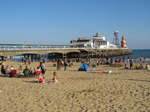
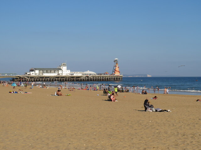
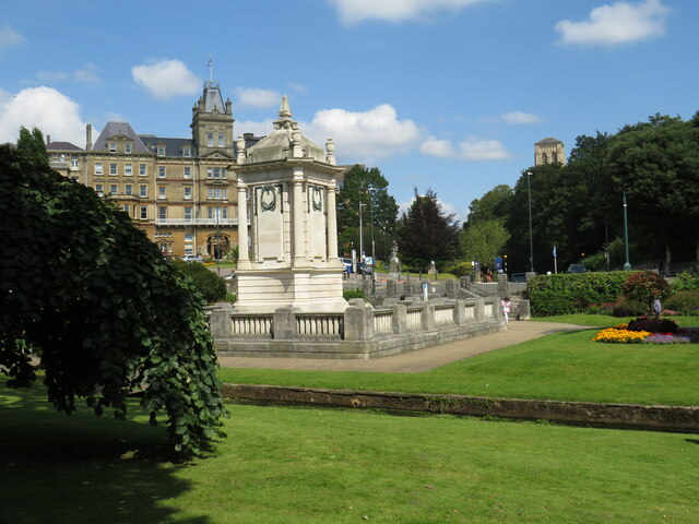
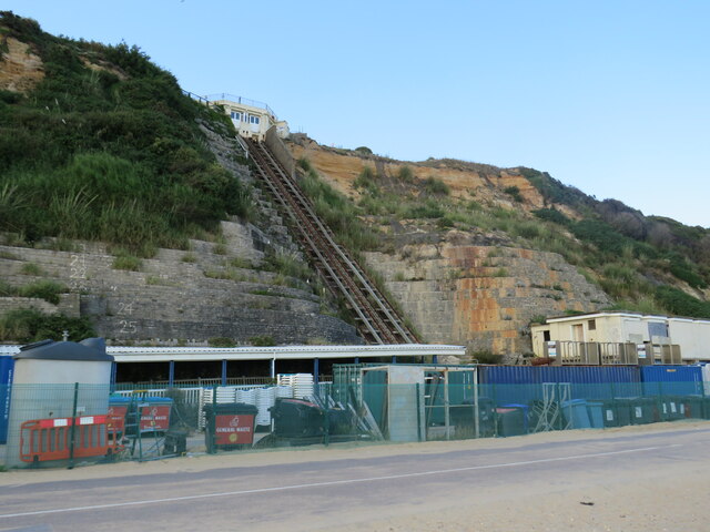
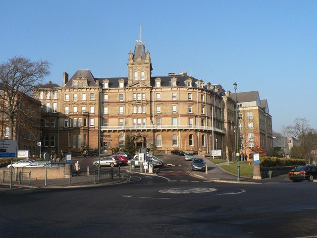
Meyrick Park Images

Images are sourced within 2km of 50.727566/-1.8880209 or Grid Reference SZ0892. Thanks to Geograph Open Source API. All images are credited.

Bournemouth Pier The beach and pier at Bournemouth, taken on a sunny afternoon in August 2021.
Bournemouth Pier
The beach and pier at Bournemouth, taken on a sunny afternoon in August 2021.
Bournemouth beach and pier A view of Bournemouth beach and pier, taken on a sunny afternoon in August 2021.

In the distance, the chalk cliffs of The Needles on the Isle of Wight are visible.
Bournemouth beach and pier
A view of Bournemouth beach and pier, taken on a sunny afternoon in August 2021. In the distance, the chalk cliffs of The Needles on the Isle of Wight are visible.
James Road, Branksome, Poole James Road is a residential road in Branksome, a suburb of Poole.  A sign indicates that a 20mph speed limit applies on this road.
James Road, Branksome, Poole
James Road is a residential road in Branksome, a suburb of Poole. A sign indicates that a 20mph speed limit applies on this road.
Railway bridge over Bourne Valley Road, Branksome, Poole An arch bridge carries the London to Weymouth railway line over Bourne Valley Road in Branksome, a suburb of Poole.  Yellow and black markings on the bridge warn drivers that the bridge is low, the triangular sign on the bridge indicates that the maximum vehicle height to pass under the bridge is 11 feet 6 inches.  Some of the markers have been dislodged, indicating that overheight vehicles have attempted to pass but have struck the bridge.

A train operated by South Western Railway crosses the bridge.  The train guard, travelling in the rear cab, is looking out of the cab window.
Railway bridge over Bourne Valley Road, Branksome, Poole
An arch bridge carries the London to Weymouth railway line over Bourne Valley Road in Branksome, a suburb of Poole. Yellow and black markings on the bridge warn drivers that the bridge is low, the triangular sign on the bridge indicates that the maximum vehicle height to pass under the bridge is 11 feet 6 inches. Some of the markers have been dislodged, indicating that overheight vehicles have attempted to pass but have struck the bridge. A train operated by South Western Railway crosses the bridge. The train guard, travelling in the rear cab, is looking out of the cab window.
Railway bridge over Bourne Valley Road, Branksome, Poole An arch bridge carrying the London to Weymouth railway line over Bourne Valley Road in Branksome, a suburb of Poole.  Yellow and black markers have been fitted to the bridge as an added warning to drivers that the bridge is low.  The triangular sign in the centre of the arch advises that the maximum height for vehicles passing beneath the bridge is 11 feet 6 inches.
Railway bridge over Bourne Valley Road, Branksome, Poole
An arch bridge carrying the London to Weymouth railway line over Bourne Valley Road in Branksome, a suburb of Poole. Yellow and black markers have been fitted to the bridge as an added warning to drivers that the bridge is low. The triangular sign in the centre of the arch advises that the maximum height for vehicles passing beneath the bridge is 11 feet 6 inches.
Arches over Surrey Road, Branksome, near Poole Surrey Road passes beneath two railway viaduct in quick succession.  The viaduct in the foreground is disused.  It used to carry trains into Bournemouth West station, which closed in 1965.  The viaduct in the background carries the main line between London and Weymouth.
Arches over Surrey Road, Branksome, near Poole
Surrey Road passes beneath two railway viaduct in quick succession. The viaduct in the foreground is disused. It used to carry trains into Bournemouth West station, which closed in 1965. The viaduct in the background carries the main line between London and Weymouth.
Path in Coy Pond Gardens, Branksome, near Bournemouth A path in Coy Pond Gardens in Branksome, near Bournemouth, with a bridge over The Bourne.  From this point, a series of gardens follows the course of The Bourne down to the centre of Bournemouth and to the seafront.
Path in Coy Pond Gardens, Branksome, near Bournemouth
A path in Coy Pond Gardens in Branksome, near Bournemouth, with a bridge over The Bourne. From this point, a series of gardens follows the course of The Bourne down to the centre of Bournemouth and to the seafront.
Coy Pond Gardens and Coy Pond Road, near Bournemouth A path in Coy Pond Gardens, with a view onto Coy Pond Road.  Although this location is close to Bournemouth, it lies within the neighbouring Borough of Poole.
Coy Pond Gardens and Coy Pond Road, near Bournemouth
A path in Coy Pond Gardens, with a view onto Coy Pond Road. Although this location is close to Bournemouth, it lies within the neighbouring Borough of Poole.
Coy Pond, near Bournemouth Coy Pond is an artificial pond created in 1888.  More information can be found on the websites of Friends of Coy Pond: <span class="nowrap"><a title="https://www.friendsofcoypond.co.uk/" rel="nofollow ugc noopener" href="https://www.friendsofcoypond.co.uk/">Link</a><img style="margin-left:2px;" alt="External link" title="External link - shift click to open in new window" src="https://s1.geograph.org.uk/img/external.png" width="10" height="10"/></span> and Visit Bournemouth: <span class="nowrap"><a title="https://www.visitbournemouth.com/attractions/coy-pond" rel="nofollow ugc noopener" href="https://www.visitbournemouth.com/attractions/coy-pond">Link</a><img style="margin-left:2px;" alt="External link" title="External link - shift click to open in new window" src="https://s1.geograph.org.uk/img/external.png" width="10" height="10"/></span>
Coy Pond, near Bournemouth
Coy Pond is an artificial pond created in 1888. More information can be found on the websites of Friends of Coy Pond: LinkExternal link and Visit Bournemouth: LinkExternal link
Path in Coy Pond Gardens, near Bournemouth A path in Coy Pond Gardens, near Bournemouth.
Path in Coy Pond Gardens, near Bournemouth
A path in Coy Pond Gardens, near Bournemouth.
Bridge over The Bourne, near Bournemouth A wooden bridge carrying a footpath over The Bourne in Coy Pond Gardens, near Bournemouth.
Bridge over The Bourne, near Bournemouth
A wooden bridge carrying a footpath over The Bourne in Coy Pond Gardens, near Bournemouth.
Bourne Valley Greenway, near Bournemouth The Bourne Valley Greenway entering Bournemouth's Upper Gardens.

The road in the foreground marks the boundary between the boroughs of Bournemouth and Poole.
Bourne Valley Greenway, near Bournemouth
The Bourne Valley Greenway entering Bournemouth's Upper Gardens. The road in the foreground marks the boundary between the boroughs of Bournemouth and Poole.
Bourne Valley Greenway, near Bournemouth A view of the Bourne Valley Greenway passing through Bournemouth's Upper Gardens.
Bourne Valley Greenway, near Bournemouth
A view of the Bourne Valley Greenway passing through Bournemouth's Upper Gardens.
Footbridge over The Bourne, near Bournemouth A wooden footbridge taking a path across The Bourne, in Bournemouth's Upper Gardens.
Footbridge over The Bourne, near Bournemouth
A wooden footbridge taking a path across The Bourne, in Bournemouth's Upper Gardens.
Prince of Wales Road, Bournemouth Prince of Wales Road is a one-way road which crosses the Bourne Valley in the suburbs of Bournemouth.
Prince of Wales Road, Bournemouth
Prince of Wales Road is a one-way road which crosses the Bourne Valley in the suburbs of Bournemouth.
Bench and water tower, Bournemouth Upper Gardens A bench and a water tower in Bournemouth's Upper Gardens.  The water tower was built between 1883 and 1903, to provide water for drinking fountains.
Bench and water tower, Bournemouth Upper Gardens
A bench and a water tower in Bournemouth's Upper Gardens. The water tower was built between 1883 and 1903, to provide water for drinking fountains.
Cenotaph and Town Hall, Bournemouth The cenotaph in Bournemouth's Central Gardens, with Bournemouth's town hall in the background.  The Bourne flows in front of the cenotaph.
Cenotaph and Town Hall, Bournemouth
The cenotaph in Bournemouth's Central Gardens, with Bournemouth's town hall in the background. The Bourne flows in front of the cenotaph.
Cliff lift at East Cliff, Bournemouth In August 2021, the cliff lift at East Cliff was still closed following a landslip which had occurred in April 2016.  The landslip caused serious damage but, thankfully, nobody was injured.
Cliff lift at East Cliff, Bournemouth
In August 2021, the cliff lift at East Cliff was still closed following a landslip which had occurred in April 2016. The landslip caused serious damage but, thankfully, nobody was injured.
Show me another place!

Meyrick Park is located at Grid Ref: SZ0892 (Lat: 50.727566, Lng: -1.8880209)

Unitary Authority: Bournemouth, Christchurch and Poole

Police Authority: Dorset

What 3 Words

///slimy.cope.gently. Near Bournemouth, Dorset

Nearby Locations

Meyrick Park Meyrick Park

Related Wikis

Meyrick Park, Bournemouth

Meyrick Park () is a suburb and area of Bournemouth, Dorset. The park itself features a main field with rugby pitches, surrounded by elevated woodland...

Bournemouth, Christchurch and Poole

Bournemouth, Christchurch and Poole (BCP) is a unitary authority area in the ceremonial county of Dorset, England. It was created on 1 April 2019 by the...

Bournemouth Town Hall

Bournemouth Town Hall (formerly known as Mont Dore Hotel) is a municipal facility in Bourne Road, Bournemouth, England. The town hall, which is the meeting...

St Stephen's Church, Bournemouth

St Stephen's Church is an Anglican parish church in Bournemouth, Dorset (formerly in Hampshire), England. The liturgical life of the church is rooted in...

Nearby Amenities

Located within 500m of 50.727566,-1.8880209
Check Date: 2022-03-01
Source: survey
Traffic Calming: hump
Lat/Long: 50.7244496/-1.8915898
Crossing
Crossing: unmarked
Kerb: lowered
Tactile Paving: yes
Lat/Long: 50.7248375/-1.8916604
Post Box
Brand: Royal Mail
Brand Wikidata: Q638098
Collection Times: Mo-Fr 09:00, Sa 07:00
Operator: Royal Mail
Operator Wikidata: Q638098
Post Box Design: type_b
Post Box Type: pillar
Ref: BH2 16
Ref GB Uprn: 10015445936
Royal Cypher: VR
Royal Cypher Wikidata: Q33102356
Source: survey
Lat/Long: 50.7250925/-1.8893088
Noexit: yes
Lat/Long: 50.7257256/-1.889772
Check Date: 2022-03-10
Source: survey
Traffic Calming: cushion
Lat/Long: 50.724733/-1.8916128
Post Box
Collection Times: Mo-Fr 17:30; Sa 12:00
Description: Outside 15 Surrey Road. Victorian anonymous
Operator: Royal Mail
Operator Wikidata: Q638098
Post Box Type: pillar
Ref: BH4 24
Ref GB Uprn: 10015389681
Lat/Long: 50.7240391/-1.8923741
Bench
Backrest: yes
Source: survey
Lat/Long: 50.7288913/-1.8819541
Bench
Backrest: yes
Source: survey
Lat/Long: 50.7233209/-1.8858143
Addr Full: 1 Bourne Banks, 20 Branksome Wood Road, Bournemouth, Dorset, United Kingdom
Addr Housenumber: 1
Addr Street: Bourne Banks
Lat/Long: 50.7254167/-1.8939994
Bus Stop
St Josephs Home
Bench: no
Bin: no
Bus: yes
Lit: no
Naptan AtcoCode: 1290BOB20502
Naptan Bearing: SE
Naptan CommonName: St Josephs Home
Naptan Indicator: SE-bound
Naptan NaptanCode: bouatwd
Naptan PlusbusZoneRef: BOMO
Naptan Street: Branksome Wood Road
Naptan Verified: no
Public Transport: platform
Ref: 20502
Shelter: no
Tactile Paving: no
Lat/Long: 50.7243293/-1.8872515
Addr City: Bournemouth
Addr Country: GB
Addr Housenumber: 18
Addr Street: Benellen Avenue
Source: survey
Lat/Long: 50.7272308/-1.8947107
Bus Stop
St Josephs Home
Bench: no
Bin: no
Bus: yes
Lit: no
Naptan AtcoCode: 1290BOB20501
Naptan Bearing: NW
Naptan CommonName: St Josephs Home
Naptan Indicator: NW-bound
Naptan NaptanCode: bouatwg
Naptan PlusbusZoneRef: BOMO
Naptan Street: Branksome Wood Road
Naptan Verified: no
Public Transport: platform
Ref: 20501
Shelter: no
Source: survey
Tactile Paving: no
Lat/Long: 50.7240695/-1.8870996
Bus Stop
Queens Road
Bench: yes
Bin: no
Bus: yes
Lit: no
Naptan AtcoCode: 1290BOB20503
Naptan Bearing: W
Naptan CommonName: Queens Road
Naptan Indicator: W-bound
Naptan NaptanCode: bouatgd
Naptan PlusbusZoneRef: BOMO
Naptan Street: Branksome Wood Road
Naptan Verified: no
Public Transport: platform
Ref: 20503
Shelter: no
Source: survey
Tactile Paving: no
Lat/Long: 50.7252687/-1.8909361
Check Date: 2022-03-01
Source: survey
Traffic Calming: cushion
Lat/Long: 50.7250298/-1.8919097
Check Date: 2022-03-10
Source: survey
Traffic Calming: cushion
Lat/Long: 50.724899/-1.8917402
Generator Method: photovoltaic
Generator Output Electricity: yes
Generator Source: solar
Generator Type: solar_photovoltaic_panel
Location: roof
Power: generator
Lat/Long: 50.725266/-1.8936424
Generator Method: photovoltaic
Generator Output Electricity: yes
Generator Source: solar
Generator Type: solar_photovoltaic_panel
Location: roof
Power: generator
Lat/Long: 50.7257635/-1.8926674
Generator Method: photovoltaic
Generator Output Electricity: yes
Generator Source: solar
Generator Type: solar_photovoltaic_panel
Location: roof
Power: generator
Lat/Long: 50.7267603/-1.8932207
Golf: pin
Lat/Long: 50.7265436/-1.8850142
Golf: pin
Lat/Long: 50.7268594/-1.8883314
Golf: pin
Lat/Long: 50.7290269/-1.8928542
Golf: pin
Lat/Long: 50.7303544/-1.8911286
Golf: pin
Lat/Long: 50.7287427/-1.8883634
Golf: pin
Lat/Long: 50.7266959/-1.8843871
Golf: pin
Lat/Long: 50.7284832/-1.887521
Golf: pin
Lat/Long: 50.7291666/-1.8851898
Golf: pin
Lat/Long: 50.7301253/-1.8865377
Golf: pin
Lat/Long: 50.7312577/-1.8912996
Golf: pin
Lat/Long: 50.7287878/-1.8942456
Golf: pin
Lat/Long: 50.7274457/-1.8908562
Golf: pin
Lat/Long: 50.7258283/-1.8867283
Golf: pin
Lat/Long: 50.7247359/-1.883546
Bus Stop
Queens Road
Bench: yes
Bin: yes
Bus: yes
Lit: no
Naptan AtcoCode: 1290BOB20504
Naptan Bearing: E
Naptan CommonName: Queens Road
Naptan Indicator: E-bound
Naptan NaptanCode: bouatgj
Naptan PlusbusZoneRef: BOMO
Naptan Street: Branksome Wood Road
Naptan Verified: no
Public Transport: platform
Shelter: no
Tactile Paving: no
Lat/Long: 50.7253859/-1.8910888
Bench
Backrest: yes
Material: wood
Lat/Long: 50.7236871/-1.8871574
Bench
Backrest: yes
Material: wood
Lat/Long: 50.7240991/-1.8888205
Bench
Backrest: yes
Material: wood
Lat/Long: 50.7239766/-1.8884245
Bench
Backrest: yes
Material: wood
Lat/Long: 50.7237931/-1.8876589
Bench
Backrest: yes
Material: wood
Lat/Long: 50.7237158/-1.8888141
Bench
Backrest: yes
Material: wood
Lat/Long: 50.7236243/-1.8883825
Bench
Backrest: yes
Material: wood
Lat/Long: 50.7233593/-1.8873161
Waste Basket
Lat/Long: 50.7236949/-1.8872237
Waste Basket
Lat/Long: 50.7236232/-1.8883431
Waste Basket
Lat/Long: 50.72381/-1.887738
Bench
Lat/Long: 50.7288858/-1.8934263
Crossing
Lat/Long: 50.7289862/-1.8867476
The data included in this document is from www.openstreetmap.org. The data is made available under ODbL.

Have you been to Meyrick Park?

Leave your review of Meyrick Park below (or comments, questions and feedback).