Miabhaig

Settlement in Ross-shire

Scotland

Miabhaig

A slipway in Loch Miabhaig
A slipway in Loch Miabhaig Credit: Alan Reid

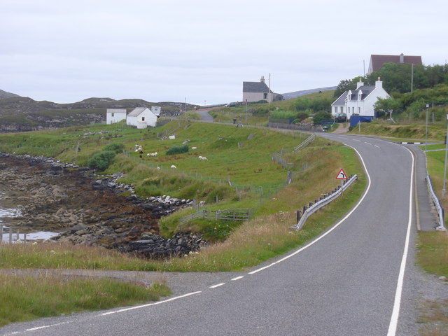
Miabhaig is a small village located in the county of Ross-shire, in the Scottish Highlands. Situated on the western coast of Scotland, Miabhaig is nestled within the picturesque landscape, offering stunning views of the Atlantic Ocean and the surrounding rugged hills.

With a population of approximately 300 residents, Miabhaig is known for its tranquility and close-knit community. The village is characterized by its charming traditional stone cottages, which add to its unique and timeless atmosphere.

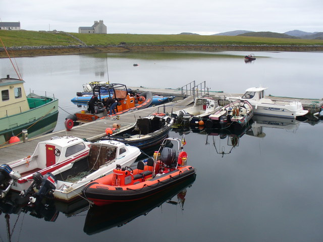
The economy of Miabhaig is mainly centered around agriculture and tourism. The fertile lands surrounding the village are used for farming, with crops such as barley, oats, and potatoes being cultivated. Additionally, the village is home to a few small businesses, including local shops, pubs, and bed and breakfast accommodations, catering to the needs of both residents and visitors.

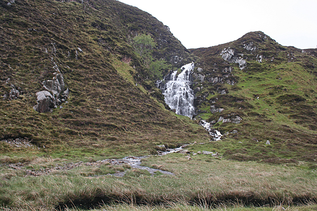
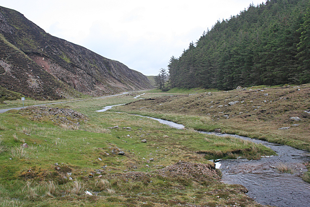
For nature enthusiasts, Miabhaig provides ample opportunities for outdoor activities. The scenic countryside offers numerous hiking trails, allowing visitors to explore the stunning Highland scenery. The coastline is popular for fishing and birdwatching, with a variety of bird species, including puffins, gannets, and eagles, being frequently spotted.

Miabhaig also holds cultural significance, with its Gaelic heritage being celebrated through various events and festivals throughout the year. Traditional music and dance performances are commonly organized, providing an insight into the local culture and traditions.

In conclusion, Miabhaig is a quaint village in Ross-shire, Scotland, offering a peaceful retreat in the heart of the Highlands. Its natural beauty, strong sense of community, and cultural heritage make it an appealing destination for both residents and visitors seeking a tranquil and authentic Scottish experience.

If you have any feedback on the listing, please let us know in the comments section below.
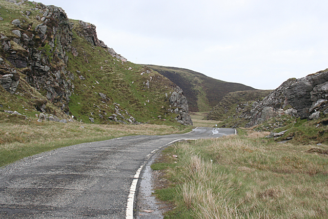
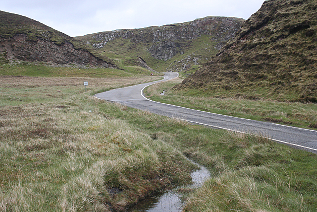
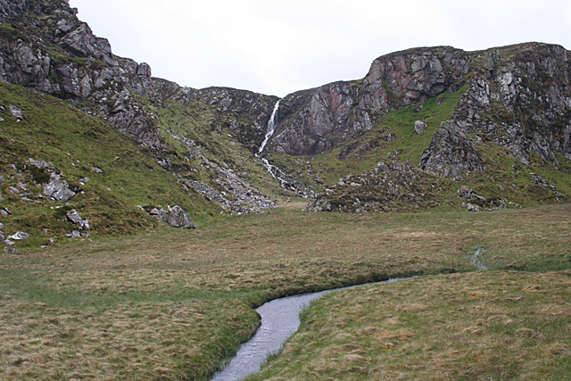
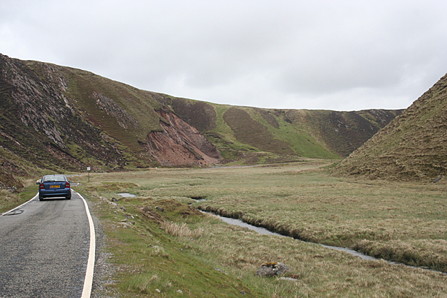
Miabhaig Images

Images are sourced within 2km of 58.197772/-6.9717475 or Grid Reference NB0834. Thanks to Geograph Open Source API. All images are credited.

A slipway in Loch Miabhaig
Gleann Bhaltois (Glen Valtos) 1 Gleann Bhaltois is a spectacular example of a glacial meltwater channel. At the end of the last Ice Age, about 10,000 years ago, there is thought to have been a lake where Uig Bay now lies, dammed by ice to the west. The outlet from the lake was at the head of what is now Gleann Bhaltois, and carved a deep steep-sided glen, exploiting a fault line in the rocks. This is taken from the col at the top of the glen, looking down along the B8011 road which now occupies it.
Gleann Bhaltois (Glen Valtos) 1
Gleann Bhaltois is a spectacular example of a glacial meltwater channel. At the end of the last Ice Age, about 10,000 years ago, there is thought to have been a lake where Uig Bay now lies, dammed by ice to the west. The outlet from the lake was at the head of what is now Gleann Bhaltois, and carved a deep steep-sided glen, exploiting a fault line in the rocks. This is taken from the col at the top of the glen, looking down along the B8011 road which now occupies it.
Gleann Bhaltois (Glen Valtos) 2 Gleann Bhaltois is a spectacular example of a glacial meltwater channel. At the end of the last Ice Age, about 10,000 years ago, there is thought to have been a lake where Uig Bay now lies, dammed by ice to the west. The outlet from the lake was at the head of what is now Gleann Bhaltois, and carved a deep steep-sided glen, exploiting a fault line in the rocks. However the upper part of the glen follows a more sinuous course. The single-track B8011 road with passing places now winds through the glen.
Gleann Bhaltois (Glen Valtos) 2
Gleann Bhaltois is a spectacular example of a glacial meltwater channel. At the end of the last Ice Age, about 10,000 years ago, there is thought to have been a lake where Uig Bay now lies, dammed by ice to the west. The outlet from the lake was at the head of what is now Gleann Bhaltois, and carved a deep steep-sided glen, exploiting a fault line in the rocks. However the upper part of the glen follows a more sinuous course. The single-track B8011 road with passing places now winds through the glen.
Gleann Bhaltois (Glen Valtos) 3 Gleann Bhaltois is a spectacular example of a glacial meltwater channel. At the end of the last Ice Age, about 10,000 years ago, there is thought to have been a lake where Uig Bay now lies, dammed by ice to the west. The outlet from the lake was at the head of what is now Gleann Bhaltois, and carved a deep steep-sided glen, exploiting a fault line in the rocks. A classic and diagnostic feature of a meltwater channels is that it contains a stream much too small to have carved it in the first place.
Gleann Bhaltois (Glen Valtos) 3
Gleann Bhaltois is a spectacular example of a glacial meltwater channel. At the end of the last Ice Age, about 10,000 years ago, there is thought to have been a lake where Uig Bay now lies, dammed by ice to the west. The outlet from the lake was at the head of what is now Gleann Bhaltois, and carved a deep steep-sided glen, exploiting a fault line in the rocks. A classic and diagnostic feature of a meltwater channels is that it contains a stream much too small to have carved it in the first place.
Gleann Bhaltois (Glen Valtos) 4 Gleann Bhaltois is a spectacular example of a glacial meltwater channel. At the end of the last Ice Age, about 10,000 years ago, there is thought to have been a lake where Uig Bay now lies, dammed by ice to the west. The outlet from the lake was at the head of what is now Gleann Bhaltois, and carved a deep steep-sided glen, exploiting a fault line in the rocks.
Gleann Bhaltois (Glen Valtos) 4
Gleann Bhaltois is a spectacular example of a glacial meltwater channel. At the end of the last Ice Age, about 10,000 years ago, there is thought to have been a lake where Uig Bay now lies, dammed by ice to the west. The outlet from the lake was at the head of what is now Gleann Bhaltois, and carved a deep steep-sided glen, exploiting a fault line in the rocks.
Gleann Bhaltois (Glen Valtos) 5 Gleann Bhaltois is a spectacular example of a glacial meltwater channel. At the end of the last Ice Age, about 10,000 years ago, there is thought to have been a lake where Uig Bay now lies, dammed by ice to the west. The outlet from the lake was at the head of what is now Gleann Bhaltois, and carved a deep steep-sided glen, exploiting a fault line in the rocks. Following several wet days, a waterfall is draining the moor above.
Gleann Bhaltois (Glen Valtos) 5
Gleann Bhaltois is a spectacular example of a glacial meltwater channel. At the end of the last Ice Age, about 10,000 years ago, there is thought to have been a lake where Uig Bay now lies, dammed by ice to the west. The outlet from the lake was at the head of what is now Gleann Bhaltois, and carved a deep steep-sided glen, exploiting a fault line in the rocks. Following several wet days, a waterfall is draining the moor above.
Gleann Bhaltois (Glen Valtos) 6 Gleann Bhaltois is a spectacular example of a glacial meltwater channel. At the end of the last Ice Age, about 10,000 years ago, there is thought to have been a lake where Uig Bay now lies, dammed by ice to the west. The outlet from the lake was at the head of what is now Gleann Bhaltois, and carved a deep steep-sided glen, exploiting a fault line in the rocks. At this point, the glen steps down from its winding upper course through a rock fall to the much straighter lower course.
Gleann Bhaltois (Glen Valtos) 6
Gleann Bhaltois is a spectacular example of a glacial meltwater channel. At the end of the last Ice Age, about 10,000 years ago, there is thought to have been a lake where Uig Bay now lies, dammed by ice to the west. The outlet from the lake was at the head of what is now Gleann Bhaltois, and carved a deep steep-sided glen, exploiting a fault line in the rocks. At this point, the glen steps down from its winding upper course through a rock fall to the much straighter lower course.
Gleann Bhaltois (Glen Valtos) 7 Gleann Bhaltois is a spectacular example of a glacial meltwater channel. At the end of the last Ice Age, about 10,000 years ago, there is thought to have been a lake where Uig Bay now lies, dammed by ice to the west. The outlet from the lake was at the head of what is now Gleann Bhaltois, and carved a deep steep-sided glen, exploiting a fault line in the rocks. From this point, the glen follows the straight line of the fault. The classic and diagnostic feature of a meltwater channel, well seen in this view, is that the stream it contains is too small to have carved it in the first place.
Gleann Bhaltois (Glen Valtos) 7
Gleann Bhaltois is a spectacular example of a glacial meltwater channel. At the end of the last Ice Age, about 10,000 years ago, there is thought to have been a lake where Uig Bay now lies, dammed by ice to the west. The outlet from the lake was at the head of what is now Gleann Bhaltois, and carved a deep steep-sided glen, exploiting a fault line in the rocks. From this point, the glen follows the straight line of the fault. The classic and diagnostic feature of a meltwater channel, well seen in this view, is that the stream it contains is too small to have carved it in the first place.
Gleann Bhaltois (Glen Valtos) 7 Gleann Bhaltois is a spectacular example of a glacial meltwater channel. At the end of the last Ice Age, about 10,000 years ago, there is thought to have been a lake where Uig Bay now lies, dammed by ice to the west. The outlet from the lake was at the head of what is now Gleann Bhaltois, and carved a deep steep-sided glen, exploiting a fault line in the rocks.
Gleann Bhaltois (Glen Valtos) 7
Gleann Bhaltois is a spectacular example of a glacial meltwater channel. At the end of the last Ice Age, about 10,000 years ago, there is thought to have been a lake where Uig Bay now lies, dammed by ice to the west. The outlet from the lake was at the head of what is now Gleann Bhaltois, and carved a deep steep-sided glen, exploiting a fault line in the rocks.
Name That Tune This cheerful accordionist stands just inside a field by the cattle grid on the B8011 north of Cairisiadar. The label at his feet reads 'Name That Tune'.
Name That Tune
This cheerful accordionist stands just inside a field by the cattle grid on the B8011 north of Cairisiadar. The label at his feet reads 'Name That Tune'.
Cairisiadar (Carishader) Though the B8011 has been much improved, there are still some single-track stretches, notably where it crosses narrow bridges which have not been rebuilt, as here at Cairisiadar.
Cairisiadar (Carishader)
Though the B8011 has been much improved, there are still some single-track stretches, notably where it crosses narrow bridges which have not been rebuilt, as here at Cairisiadar.
Miabhaig harbour pontoon View from RIB afloat to pontoon at Miabhaig, Ceann A Tuath Na Hearadh (North Harris).  Compare to <a href="https://www.geograph.org.uk/photo/575251">NB0934 : Miabhaig Jetty</a> taken by Dave Fergusson on 1 Oct 2007.
Miabhaig harbour pontoon
View from RIB afloat to pontoon at Miabhaig, Ceann A Tuath Na Hearadh (North Harris). Compare to NB0934 : Miabhaig Jetty taken by Dave Fergusson on 1 Oct 2007.
If you are ever up this way... RIB moored alongside Miabhaig pontoon <a href="https://www.geograph.org.uk/photo/2429707">NB0934 : Miabhaig harbour pontoon</a> on Ceann A Tuath Na Hearadah (North Harris) from which we enjoyed a great trip.  (No financial benefit in anyway to me from posting this; simply a community service.)
If you are ever up this way...
RIB moored alongside Miabhaig pontoon NB0934 : Miabhaig harbour pontoon on Ceann A Tuath Na Hearadah (North Harris) from which we enjoyed a great trip. (No financial benefit in anyway to me from posting this; simply a community service.)
Join the Band Name That Tune and take a seat to have your photograph taken with the band at Carishader / Cairisiadar. Maybe it's Heather and Pete playing the field.
Join the Band
Name That Tune and take a seat to have your photograph taken with the band at Carishader / Cairisiadar. Maybe it's Heather and Pete playing the field.
Sheep Pens at Carishader One of many roadside pens on Lewis where sheep farming is a major agricultural industry.
Sheep Pens at Carishader
One of many roadside pens on Lewis where sheep farming is a major agricultural industry.
Carishader / Cairisiadar Elongated roadside crofting community on the shore of Loch Rog.
Carishader / Cairisiadar
Elongated roadside crofting community on the shore of Loch Rog.
Pontoon at Miabhaig Where Seatrek offer a variety of adventurous seaborne trips around Lewis and Harris as well as to distant St Kilda.
 <span class="nowrap"><a title="http://www.seatrek.co.uk/" rel="nofollow ugc noopener" href="http://www.seatrek.co.uk/">Link</a><img style="margin-left:2px;" alt="External link" title="External link - shift click to open in new window" src="https://s1.geograph.org.uk/img/external.png" width="10" height="10"/></span>
Pontoon at Miabhaig
Where Seatrek offer a variety of adventurous seaborne trips around Lewis and Harris as well as to distant St Kilda. LinkExternal link
Show me another place!

Miabhaig is located at Grid Ref: NB0834 (Lat: 58.197772, Lng: -6.9717475)

Unitary Authority: Na h-Eileanan an Iar

Police Authority: Highlands and Islands

Also known as: Miavaig

What 3 Words

///aspect.reputable.decimals. Near Carloway, Na h-Eileanan Siar

Related Wikis

Cliff, Lewis

Cliff (Scottish Gaelic: Cliobh) is a small settlement on the Isle of Lewis, in the Outer Hebrides, Scotland. Cliff is within the parish of Uig. The settlement...

Flodaigh, Lewis

Flodaigh is a small island in Loch Roag on the west coast of Lewis in the Outer Hebrides of Scotland. It is about 33 hectares (82 acres) in extent and...

Camas Uig

Camas Uig (Uig Bay) is a bay on the west coast of the Isle of Lewis, in the Outer Hebrides of Scotland. The Lewis Chessmen were discovered in the dunes...

Loch na Berie

Loch Na Berie is a broch in the Outer Hebrides of Scotland, located approximately 400 yards from the shore, and is thought to have been located on an island...

Nearby Amenities

Located within 500m of 58.197772,-6.9717475
Beinn Miabhaig
Ele: 142
Name En: Ben Miavaig
Name Gd: Beinn Miabhaig
Natural: peak
Source: OS7
Lat/Long: 58.1971418/-6.9731194
The data included in this document is from www.openstreetmap.org. The data is made available under ODbL.

Have you been to Miabhaig?

Leave your review of Miabhaig below (or comments, questions and feedback).