Creag na h-Iolaire

Cliff, Slope in Ross-shire

Scotland

Creag na h-Iolaire

A slipway in Loch Miabhaig
A slipway in Loch Miabhaig Credit: Alan Reid

Creag na h-Iolaire is a prominent cliff located in Ross-shire, Scotland. Translated as "Cliff of the Eagle" in English, it stands as a remarkable natural formation that holds historical significance. The cliff sits on the eastern shore of the Isle of Lewis, near the village of Uig.

Rising to an impressive height of approximately 245 meters (800 feet), Creag na h-Iolaire offers breathtaking panoramic views of the surrounding landscape. It overlooks the rugged coastline, providing visitors with a majestic sight of the Atlantic Ocean and the vast expanse of the Hebrides. The cliff's steep slope and rugged terrain make it an ideal spot for birdwatching, as it offers a sanctuary for various species, including eagles, falcons, and other seabirds.

Creag na h-Iolaire also holds historical significance due to its association with the tragic Iolaire disaster in 1919. On New Year's Day, the HMY Iolaire, a naval yacht, struck the rocks near the cliff while bringing home soldiers who had fought in World War I. The incident resulted in the loss of 201 lives, making it one of the worst maritime disasters in Scottish history. A memorial has been erected near the cliff to honor the victims of the Iolaire tragedy.

Accessible by foot or by taking a boat tour, Creag na h-Iolaire offers visitors a unique opportunity to admire Scotland's natural beauty, observe diverse bird species, and reflect on the area's historical significance. It serves as a reminder of the intertwined relationship between nature and human history.

If you have any feedback on the listing, please let us know in the comments section below.

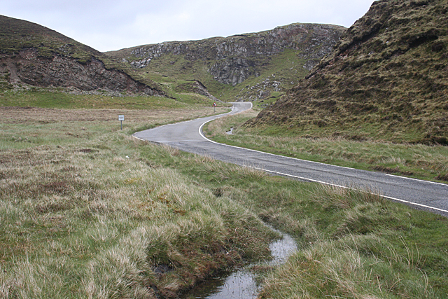
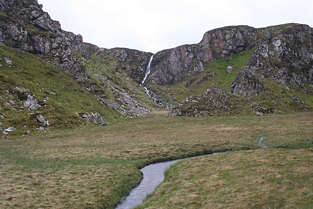
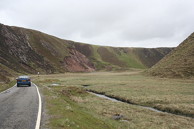
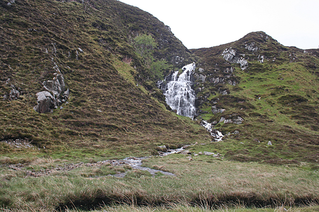
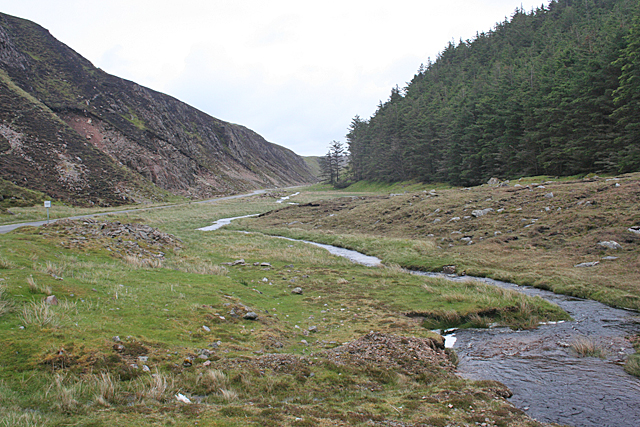
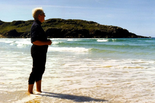
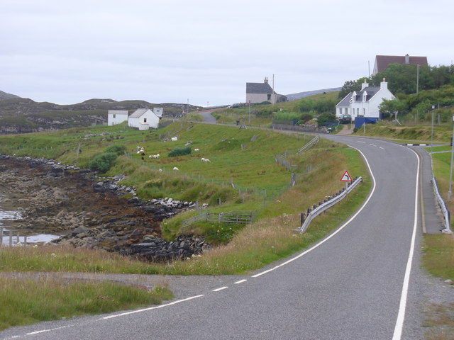
Creag na h-Iolaire Images

Images are sourced within 2km of 58.202886/-6.9695497 or Grid Reference NB0834. Thanks to Geograph Open Source API. All images are credited.

A slipway in Loch Miabhaig
Lochan at Cragavig An old boundary wall snakes across the moorland
Lochan at Cragavig
An old boundary wall snakes across the moorland
Gleann Bhaltois (Glen Valtos) 2 Gleann Bhaltois is a spectacular example of a glacial meltwater channel. At the end of the last Ice Age, about 10,000 years ago, there is thought to have been a lake where Uig Bay now lies, dammed by ice to the west. The outlet from the lake was at the head of what is now Gleann Bhaltois, and carved a deep steep-sided glen, exploiting a fault line in the rocks. However the upper part of the glen follows a more sinuous course. The single-track B8011 road with passing places now winds through the glen.
Gleann Bhaltois (Glen Valtos) 2
Gleann Bhaltois is a spectacular example of a glacial meltwater channel. At the end of the last Ice Age, about 10,000 years ago, there is thought to have been a lake where Uig Bay now lies, dammed by ice to the west. The outlet from the lake was at the head of what is now Gleann Bhaltois, and carved a deep steep-sided glen, exploiting a fault line in the rocks. However the upper part of the glen follows a more sinuous course. The single-track B8011 road with passing places now winds through the glen.
Gleann Bhaltois (Glen Valtos) 3 Gleann Bhaltois is a spectacular example of a glacial meltwater channel. At the end of the last Ice Age, about 10,000 years ago, there is thought to have been a lake where Uig Bay now lies, dammed by ice to the west. The outlet from the lake was at the head of what is now Gleann Bhaltois, and carved a deep steep-sided glen, exploiting a fault line in the rocks. A classic and diagnostic feature of a meltwater channels is that it contains a stream much too small to have carved it in the first place.
Gleann Bhaltois (Glen Valtos) 3
Gleann Bhaltois is a spectacular example of a glacial meltwater channel. At the end of the last Ice Age, about 10,000 years ago, there is thought to have been a lake where Uig Bay now lies, dammed by ice to the west. The outlet from the lake was at the head of what is now Gleann Bhaltois, and carved a deep steep-sided glen, exploiting a fault line in the rocks. A classic and diagnostic feature of a meltwater channels is that it contains a stream much too small to have carved it in the first place.
Gleann Bhaltois (Glen Valtos) 4 Gleann Bhaltois is a spectacular example of a glacial meltwater channel. At the end of the last Ice Age, about 10,000 years ago, there is thought to have been a lake where Uig Bay now lies, dammed by ice to the west. The outlet from the lake was at the head of what is now Gleann Bhaltois, and carved a deep steep-sided glen, exploiting a fault line in the rocks.
Gleann Bhaltois (Glen Valtos) 4
Gleann Bhaltois is a spectacular example of a glacial meltwater channel. At the end of the last Ice Age, about 10,000 years ago, there is thought to have been a lake where Uig Bay now lies, dammed by ice to the west. The outlet from the lake was at the head of what is now Gleann Bhaltois, and carved a deep steep-sided glen, exploiting a fault line in the rocks.
Gleann Bhaltois (Glen Valtos) 5 Gleann Bhaltois is a spectacular example of a glacial meltwater channel. At the end of the last Ice Age, about 10,000 years ago, there is thought to have been a lake where Uig Bay now lies, dammed by ice to the west. The outlet from the lake was at the head of what is now Gleann Bhaltois, and carved a deep steep-sided glen, exploiting a fault line in the rocks. Following several wet days, a waterfall is draining the moor above.
Gleann Bhaltois (Glen Valtos) 5
Gleann Bhaltois is a spectacular example of a glacial meltwater channel. At the end of the last Ice Age, about 10,000 years ago, there is thought to have been a lake where Uig Bay now lies, dammed by ice to the west. The outlet from the lake was at the head of what is now Gleann Bhaltois, and carved a deep steep-sided glen, exploiting a fault line in the rocks. Following several wet days, a waterfall is draining the moor above.
Gleann Bhaltois (Glen Valtos) 6 Gleann Bhaltois is a spectacular example of a glacial meltwater channel. At the end of the last Ice Age, about 10,000 years ago, there is thought to have been a lake where Uig Bay now lies, dammed by ice to the west. The outlet from the lake was at the head of what is now Gleann Bhaltois, and carved a deep steep-sided glen, exploiting a fault line in the rocks. At this point, the glen steps down from its winding upper course through a rock fall to the much straighter lower course.
Gleann Bhaltois (Glen Valtos) 6
Gleann Bhaltois is a spectacular example of a glacial meltwater channel. At the end of the last Ice Age, about 10,000 years ago, there is thought to have been a lake where Uig Bay now lies, dammed by ice to the west. The outlet from the lake was at the head of what is now Gleann Bhaltois, and carved a deep steep-sided glen, exploiting a fault line in the rocks. At this point, the glen steps down from its winding upper course through a rock fall to the much straighter lower course.
Gleann Bhaltois (Glen Valtos) 7 Gleann Bhaltois is a spectacular example of a glacial meltwater channel. At the end of the last Ice Age, about 10,000 years ago, there is thought to have been a lake where Uig Bay now lies, dammed by ice to the west. The outlet from the lake was at the head of what is now Gleann Bhaltois, and carved a deep steep-sided glen, exploiting a fault line in the rocks. From this point, the glen follows the straight line of the fault. The classic and diagnostic feature of a meltwater channel, well seen in this view, is that the stream it contains is too small to have carved it in the first place.
Gleann Bhaltois (Glen Valtos) 7
Gleann Bhaltois is a spectacular example of a glacial meltwater channel. At the end of the last Ice Age, about 10,000 years ago, there is thought to have been a lake where Uig Bay now lies, dammed by ice to the west. The outlet from the lake was at the head of what is now Gleann Bhaltois, and carved a deep steep-sided glen, exploiting a fault line in the rocks. From this point, the glen follows the straight line of the fault. The classic and diagnostic feature of a meltwater channel, well seen in this view, is that the stream it contains is too small to have carved it in the first place.
Gleann Bhaltois (Glen Valtos) 7 Gleann Bhaltois is a spectacular example of a glacial meltwater channel. At the end of the last Ice Age, about 10,000 years ago, there is thought to have been a lake where Uig Bay now lies, dammed by ice to the west. The outlet from the lake was at the head of what is now Gleann Bhaltois, and carved a deep steep-sided glen, exploiting a fault line in the rocks.
Gleann Bhaltois (Glen Valtos) 7
Gleann Bhaltois is a spectacular example of a glacial meltwater channel. At the end of the last Ice Age, about 10,000 years ago, there is thought to have been a lake where Uig Bay now lies, dammed by ice to the west. The outlet from the lake was at the head of what is now Gleann Bhaltois, and carved a deep steep-sided glen, exploiting a fault line in the rocks.
Name That Tune This cheerful accordionist stands just inside a field by the cattle grid on the B8011 north of Cairisiadar. The label at his feet reads 'Name That Tune'.
Name That Tune
This cheerful accordionist stands just inside a field by the cattle grid on the B8011 north of Cairisiadar. The label at his feet reads 'Name That Tune'.
Cairisiadar (Carishader) Though the B8011 has been much improved, there are still some single-track stretches, notably where it crosses narrow bridges which have not been rebuilt, as here at Cairisiadar.
Cairisiadar (Carishader)
Though the B8011 has been much improved, there are still some single-track stretches, notably where it crosses narrow bridges which have not been rebuilt, as here at Cairisiadar.
Miabhaig harbour pontoon View from RIB afloat to pontoon at Miabhaig, Ceann A Tuath Na Hearadh (North Harris).  Compare to <a href="https://www.geograph.org.uk/photo/575251">NB0934 : Miabhaig Jetty</a> taken by Dave Fergusson on 1 Oct 2007.
Miabhaig harbour pontoon
View from RIB afloat to pontoon at Miabhaig, Ceann A Tuath Na Hearadh (North Harris). Compare to NB0934 : Miabhaig Jetty taken by Dave Fergusson on 1 Oct 2007.
If you are ever up this way... RIB moored alongside Miabhaig pontoon <a href="https://www.geograph.org.uk/photo/2429707">NB0934 : Miabhaig harbour pontoon</a> on Ceann A Tuath Na Hearadah (North Harris) from which we enjoyed a great trip.  (No financial benefit in anyway to me from posting this; simply a community service.)
If you are ever up this way...
RIB moored alongside Miabhaig pontoon NB0934 : Miabhaig harbour pontoon on Ceann A Tuath Na Hearadah (North Harris) from which we enjoyed a great trip. (No financial benefit in anyway to me from posting this; simply a community service.)
Tràigh na Clibhe On the skyline is the low headland which marks the left edge of Tràigh na Clibhe beach. This north-facing beach is also protected on both sides by 50 foot high cliffs (not in view here, but see <a title="https://www.geograph.org.uk/photo/1618866" href="https://www.geograph.org.uk/photo/1618866">Link</a> ). In the hinterland is the village of Cliobh (Cliff) to the south and the town of Bhaltos (Valtos) to the east, providing several alternative names for this popular beach.
Tràigh na Clibhe
On the skyline is the low headland which marks the left edge of Tràigh na Clibhe beach. This north-facing beach is also protected on both sides by 50 foot high cliffs (not in view here, but see Link ). In the hinterland is the village of Cliobh (Cliff) to the south and the town of Bhaltos (Valtos) to the east, providing several alternative names for this popular beach.
Join the Band Name That Tune and take a seat to have your photograph taken with the band at Carishader / Cairisiadar. Maybe it's Heather and Pete playing the field.
Join the Band
Name That Tune and take a seat to have your photograph taken with the band at Carishader / Cairisiadar. Maybe it's Heather and Pete playing the field.
Sheep Pens at Carishader One of many roadside pens on Lewis where sheep farming is a major agricultural industry.
Sheep Pens at Carishader
One of many roadside pens on Lewis where sheep farming is a major agricultural industry.
Carishader / Cairisiadar Elongated roadside crofting community on the shore of Loch Rog.
Carishader / Cairisiadar
Elongated roadside crofting community on the shore of Loch Rog.
Show me another place!

Creag na h-Iolaire is located at Grid Ref: NB0834 (Lat: 58.202886, Lng: -6.9695497)

Unitary Authority: Na h-Eileanan an Iar

Police Authority: Highlands and Islands

What 3 Words

///composed.decorated.leaky. Near Carloway, Na h-Eileanan Siar

Related Wikis

Cliff, Lewis

Cliff (Scottish Gaelic: Cliobh) is a small settlement on the Isle of Lewis, in the Outer Hebrides, Scotland. Cliff is within the parish of Uig. The settlement...

Loch na Berie

Loch Na Berie is a broch in the Outer Hebrides of Scotland, located approximately 400 yards from the shore, and is thought to have been located on an island...

Kneep

Kneep (Scottish Gaelic: Cnìp) is a village on the Isle of Lewis, in the Outer Hebrides, Scotland. Kneep is within the parish of Uig.Various archaeological...

Flodaigh, Lewis

Flodaigh is a small island in Loch Roag on the west coast of Lewis in the Outer Hebrides of Scotland. It is about 33 hectares (82 acres) in extent and...

Nearby Amenities

Located within 500m of 58.202886,-6.9695497
Passing Place
Lat/Long: 58.2033644/-6.9658394
Barrier: cattle_grid
Lat/Long: 58.2045289/-6.9616805
Bus Stop
Miavaig (Lewis)
Naptan AtcoCode: 6010731756
Naptan Bearing: W
Naptan CommonName: Miavaig (Lewis)
Naptan Indicator: B8011 Junction
Naptan Landmark: B8011 Junction
Naptan NaptanCode: 94723873
Naptan Street: B8011 Junction
Naptan Verified: no
Source: naptan_import
Lat/Long: 58.20326/-6.9629188
Bus Stop
Miavaig Turn
Naptan AtcoCode: 6010731868
Naptan Bearing: NW
Naptan CommonName: Miavaig Turn
Naptan Indicator: Miavaig Turn
Naptan Landmark: Miavaig Turn
Naptan NaptanCode: 94723945
Naptan Street: Miavaig Turn
Naptan Verified: no
Source: naptan_import
Lat/Long: 58.2032589/-6.9627141
Power: pole
Lat/Long: 58.2021642/-6.9614727
Power: pole
Lat/Long: 58.2029096/-6.9624099
Power: pole
Lat/Long: 58.2031059/-6.9626604
Power: pole
Lat/Long: 58.2039517/-6.9629706
Power: pole
Lat/Long: 58.2044893/-6.9629631
Power: pole
Lat/Long: 58.2050887/-6.9640405
Power: pole
Lat/Long: 58.2049454/-6.9653848
Power: pole
Lat/Long: 58.2047795/-6.9667779
Power: pole
Lat/Long: 58.2046291/-6.9681226
Power: pole
Lat/Long: 58.2044981/-6.9692183
Power: pole
Lat/Long: 58.2043407/-6.9705446
Power: pole
Lat/Long: 58.2042999/-6.9716545
Power: pole
Lat/Long: 58.2042472/-6.9727393
Power: pole
Lat/Long: 58.2041755/-6.974202
Power: pole
Lat/Long: 58.2041172/-6.9752505
Power: pole
Lat/Long: 58.2040034/-6.9774588
Passing Place
Lat/Long: 58.2033734/-6.9676989
The data included in this document is from www.openstreetmap.org. The data is made available under ODbL.

Have you been to Creag na h-Iolaire?

Leave your review of Creag na h-Iolaire below (or comments, questions and feedback).