Creag Reidhmoil

Cliff, Slope in Ross-shire

Scotland

Creag Reidhmoil

Baile-na-Cille, Lewis, 1989
Baile-na-Cille, Lewis, 1989 Credit: Nigel Thompson

Creag Reidhmoil, located in Ross-shire, Scotland, is a picturesque and notable cliff that offers stunning views and natural beauty. Rising majestically from the surrounding landscape, it stands as a prominent feature and a popular destination for nature enthusiasts and hikers alike.

Situated near the village of Gairloch, Creag Reidhmoil is characterized by its steep slope and rugged terrain. The cliff is formed by layers of sedimentary rock, creating a striking geological formation that attracts geologists from around the world.

The cliff's height provides breathtaking vistas of the surrounding landscape, including the nearby Loch Maree and the Torridon Mountains. Its exposed position also offers an ideal vantage point for birdwatching, with various species of seabirds, raptors, and other avian creatures often seen soaring above.

Hiking enthusiasts are drawn to Creag Reidhmoil due to its challenging ascent, which rewards climbers with panoramic views at the summit. The cliff's slopes also provide opportunities for rock climbing and abseiling for those seeking more adventurous activities.

Beyond its natural beauty, Creag Reidhmoil holds historical significance as well. It is said to have been a site of ancient gatherings and rituals, and it is not uncommon to find remnants of past human activity scattered around the area.

In conclusion, Creag Reidhmoil is a remarkable cliff in Ross-shire, Scotland, offering unrivaled natural beauty, geological interest, and recreational opportunities. Whether one seeks to admire its breathtaking views, explore its challenging slopes, or delve into its historical significance, this stunning location is sure to captivate all who visit.

If you have any feedback on the listing, please let us know in the comments section below.

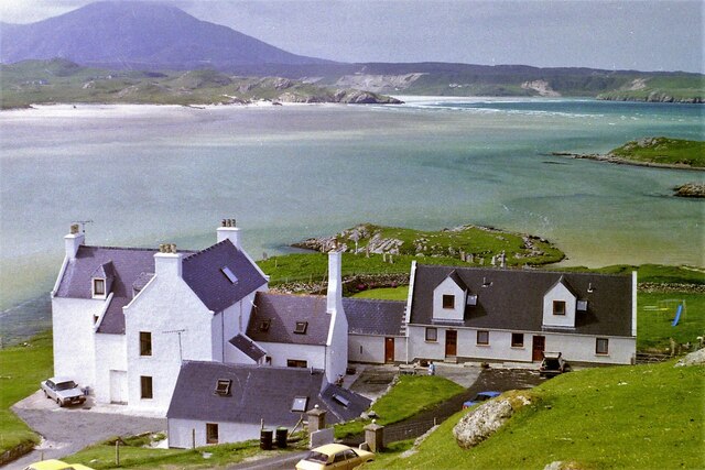
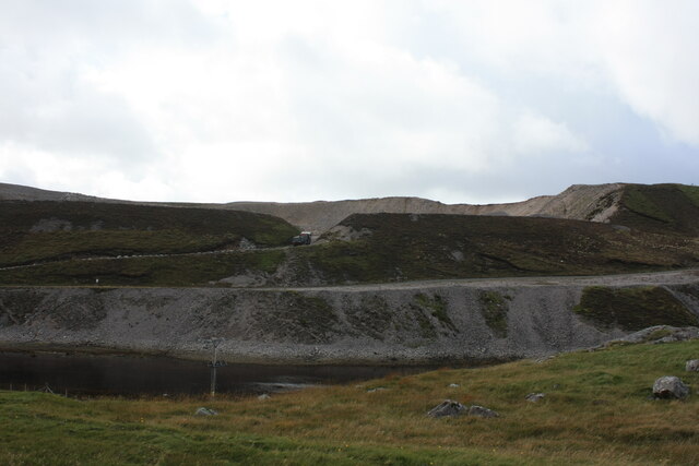
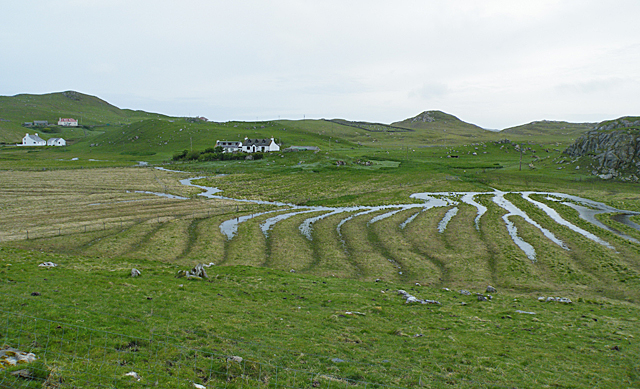
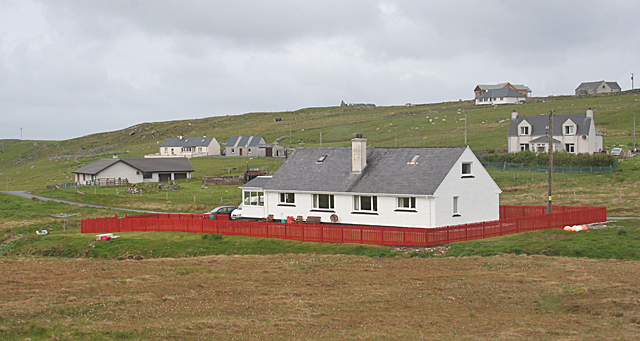
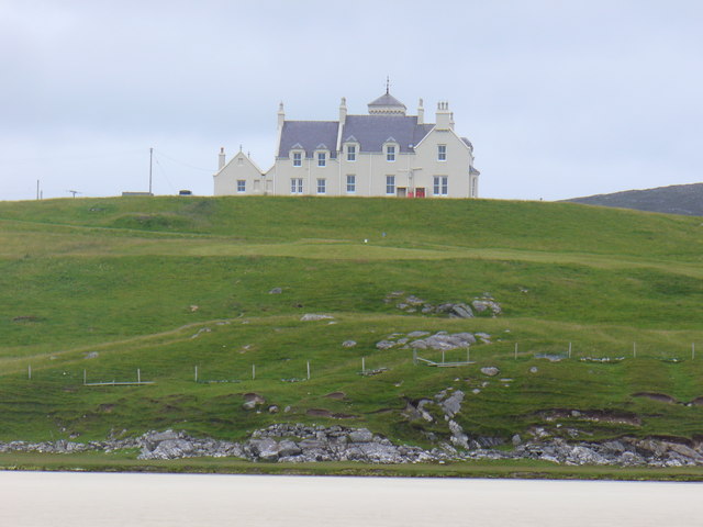
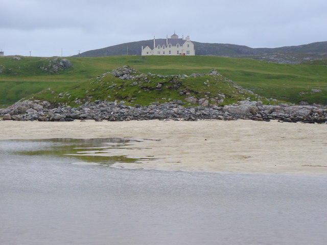
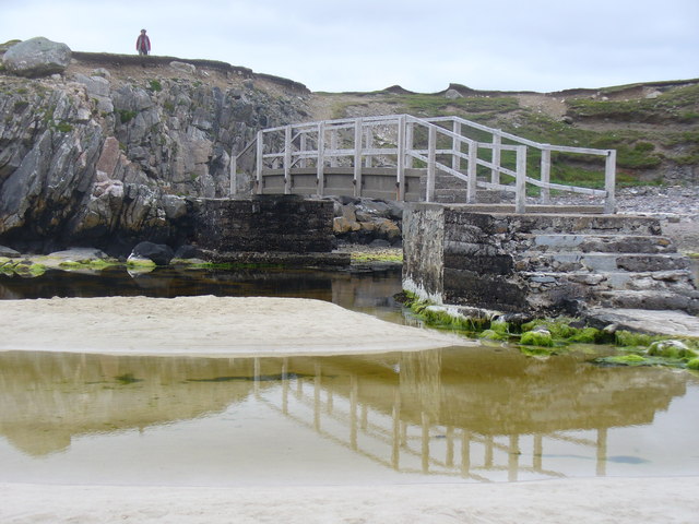
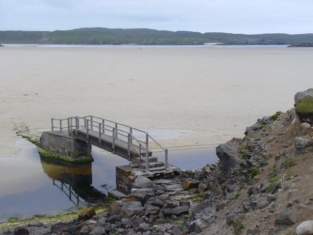
Creag Reidhmoil Images

Images are sourced within 2km of 58.19023/-7.039792 or Grid Reference NB0333. Thanks to Geograph Open Source API. All images are credited.

Baile-na-Cille, Lewis, 1989
Cappadale Sands
Cappadale Sands
Beach and headland at Carnais
Beach at Carnais
Beach at Carnais
Tom A small tidal island near Carnais.
Tom
A small tidal island near Carnais.
The Gravel Pits at Carnais, on the Red River, Uig, Lewis The Abhainn Dearg Distillery lies to the left of the picture. The Red River - Ahbainn Dearg flows to the sea at the foot of the scree slope, but is shown on the OS Sheet as Abhainn Caslabhat.
The Gravel Pits at Carnais, on the Red River, Uig, Lewis
The Abhainn Dearg Distillery lies to the left of the picture. The Red River - Ahbainn Dearg flows to the sea at the foot of the scree slope, but is shown on the OS Sheet as Abhainn Caslabhat.
Waterlogged Lazybeds After a day of torrential rain, the old lazybeds at Eadar Dha Fhadail (Ardroil) are almost submerged by flooding.
Waterlogged Lazybeds
After a day of torrential rain, the old lazybeds at Eadar Dha Fhadail (Ardroil) are almost submerged by flooding.
Cappadale Sands The map names this arm of Tràigh Uige as Cappadale Sands. As the tide is in, the sand is only visible through the water, giving it that characteristic Hebridean turquoise colour. It would have been even better in sunshine. The hill on the skyline is Forsnabhal (205 metres), and the houses at the far side of the bay are at Timsgearraidh.
Cappadale Sands
The map names this arm of Tràigh Uige as Cappadale Sands. As the tide is in, the sand is only visible through the water, giving it that characteristic Hebridean turquoise colour. It would have been even better in sunshine. The hill on the skyline is Forsnabhal (205 metres), and the houses at the far side of the bay are at Timsgearraidh.
Càrnais (Carinish) Two cottages overlooking Tràigh Lèire at the head of Cappadale Sands in Uig Bay.
Càrnais (Carinish)
Two cottages overlooking Tràigh Lèire at the head of Cappadale Sands in Uig Bay.
Timsgearraidh (Timsgarry) Most of the older cottages at Timsgearraidh have being replaced by modern houses. They may be less picturesque, but they're much more comfortable for the occupants.
Timsgearraidh (Timsgarry)
Most of the older cottages at Timsgearraidh have being replaced by modern houses. They may be less picturesque, but they're much more comfortable for the occupants.
Wooden King, Uig Sculpture based on one of the famous Lewis chessmen, sited close to the cemetery at Uig.
<span class="nowrap"><a title="http://www.uigandbernera.com/" rel="nofollow ugc noopener" href="http://www.uigandbernera.com/">Link</a><img style="margin-left:2px;" alt="External link" title="External link - shift click to open in new window" src="https://s1.geograph.org.uk/img/external.png" width="10" height="10"/></span>
Wooden King, Uig
Sculpture based on one of the famous Lewis chessmen, sited close to the cemetery at Uig. LinkExternal link
Track to Uig Sands Paralleled by a grassy footpath across the machair.
<span class="nowrap"><a title="http://www.uigandbernera.com/" rel="nofollow ugc noopener" href="http://www.uigandbernera.com/">Link</a><img style="margin-left:2px;" alt="External link" title="External link - shift click to open in new window" src="https://s1.geograph.org.uk/img/external.png" width="10" height="10"/></span>
Track to Uig Sands
Paralleled by a grassy footpath across the machair. LinkExternal link
Sand Dunes at Uig Flanking the wide expanses of sand flats at Uig Bay.
<span class="nowrap"><a title="http://www.uigandbernera.com/" rel="nofollow ugc noopener" href="http://www.uigandbernera.com/">Link</a><img style="margin-left:2px;" alt="External link" title="External link - shift click to open in new window" src="https://s1.geograph.org.uk/img/external.png" width="10" height="10"/></span>
Sand Dunes at Uig
Flanking the wide expanses of sand flats at Uig Bay. LinkExternal link
Outflow at Tràigh Ùige Rivermouth where the outflow is hemmed beneath rocky crags.
<span class="nowrap"><a title="http://www.uigandbernera.com/" rel="nofollow ugc noopener" href="http://www.uigandbernera.com/">Link</a><img style="margin-left:2px;" alt="External link" title="External link - shift click to open in new window" src="https://s1.geograph.org.uk/img/external.png" width="10" height="10"/></span>
Outflow at Tràigh Ùige
Rivermouth where the outflow is hemmed beneath rocky crags. LinkExternal link
Loidse Uig Uig Lodge, large hilltop mansion overlooking the expanses of Tràigh Ùige.
<span class="nowrap"><a title="http://www.uigandbernera.com/" rel="nofollow ugc noopener" href="http://www.uigandbernera.com/">Link</a><img style="margin-left:2px;" alt="External link" title="External link - shift click to open in new window" src="https://s1.geograph.org.uk/img/external.png" width="10" height="10"/></span>
Loidse Uig
Uig Lodge, large hilltop mansion overlooking the expanses of Tràigh Ùige. LinkExternal link
Dun Borrainais Remains of an Early Iron Age fort below a rocky promontory at Uig Sands.
<span class="nowrap"><a title="http://www.uigandbernera.com/" rel="nofollow ugc noopener" href="http://www.uigandbernera.com/">Link</a><img style="margin-left:2px;" alt="External link" title="External link - shift click to open in new window" src="https://s1.geograph.org.uk/img/external.png" width="10" height="10"/></span>
Dun Borrainais
Remains of an Early Iron Age fort below a rocky promontory at Uig Sands. LinkExternal link
Footbridge at Uig Sands 1980 wooden footbridge connecting Traigh Uige with the rocky promontory above Dun Borranais.
<span class="nowrap"><a title="http://www.uigandbernera.com/" rel="nofollow ugc noopener" href="http://www.uigandbernera.com/">Link</a><img style="margin-left:2px;" alt="External link" title="External link - shift click to open in new window" src="https://s1.geograph.org.uk/img/external.png" width="10" height="10"/></span>
Footbridge at Uig Sands
1980 wooden footbridge connecting Traigh Uige with the rocky promontory above Dun Borranais. LinkExternal link
Borranais a Muigh The northern end of Traigh Uige's expanses of sand flats with the 1980 footbridge across the river close to Dun Borranais.
<span class="nowrap"><a title="http://www.uigandbernera.com/" rel="nofollow ugc noopener" href="http://www.uigandbernera.com/">Link</a><img style="margin-left:2px;" alt="External link" title="External link - shift click to open in new window" src="https://s1.geograph.org.uk/img/external.png" width="10" height="10"/></span>
Borranais a Muigh
The northern end of Traigh Uige's expanses of sand flats with the 1980 footbridge across the river close to Dun Borranais. LinkExternal link
Show me another place!

Creag Reidhmoil is located at Grid Ref: NB0333 (Lat: 58.19023, Lng: -7.039792)

Unitary Authority: Na h-Eileanan an Iar

Police Authority: Highlands and Islands

What 3 Words

///ideals.populate.dusty. Near Carloway, Na h-Eileanan Siar

Related Wikis

Timsgarry

Timsgarry (Scottish Gaelic: Tuimisgearraidh) is a village on the Isle of Lewis, in the Outer Hebrides, Scotland. Timsgarry is home to the Baile na Cille...

Ardroil

Ardroil (Scottish Gaelic: Eadar Dhà Fhadhail) is a village on the Isle of Lewis in the Outer Hebrides, Scotland. Ardroil is within the parish of Uig....

Uig, Lewis

Uig (Scottish Gaelic: Ùig [uːkʲ]), also known as Sgìr' Ùig, is a civil parish and community in the west of the Isle of Lewis in the Outer Hebrides, Scotland...

Camas Uig

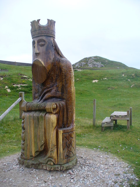
Camas Uig (Uig Bay) is a bay on the west coast of the Isle of Lewis, in the Outer Hebrides of Scotland. The Lewis Chessmen were discovered in the dunes...

Nearby Amenities

Located within 500m of 58.19023,-7.039792
Bus Stop
Crowlista
Naptan AtcoCode: 6010731626
Naptan Bearing: N
Naptan CommonName: Crowlista
Naptan Indicator: Crowlista
Naptan Landmark: Crowlista
Naptan NaptanCode: 94723854
Naptan Street: Crowlista
Naptan Verified: no
Source: naptan_import
Lat/Long: 58.1930831/-7.037658
Passing Place
Lat/Long: 58.191094/-7.038386
Passing Place
Source: Bing
Lat/Long: 58.194035/-7.0371487
Power: pole
Lat/Long: 58.1929229/-7.0346321
Power: pole
Lat/Long: 58.1930609/-7.0359668
Power: pole
Lat/Long: 58.1932181/-7.0372596
Power: pole
Lat/Long: 58.1933846/-7.0379365
Cradhlastadh
Alt Name Gd: Crabhlasta;Cròlasta
Name En: Crowlista
Name Gd: Cradhlastadh
Place: village
Lat/Long: 58.1932438/-7.0379282
Power: pole
Lat/Long: 58.1925244/-7.0334419
Power: pole
Lat/Long: 58.1903737/-7.0412459
Power: pole
Lat/Long: 58.1905448/-7.0406893
Power: pole
Lat/Long: 58.1906741/-7.0401784
Power: pole
Lat/Long: 58.1908848/-7.0394287
Power: pole
Lat/Long: 58.191094/-7.0386844
Power: pole
Lat/Long: 58.1912142/-7.0380755
Power: pole
Lat/Long: 58.1916182/-7.0387648
Power: pole
Lat/Long: 58.192828/-7.037824
Power: pole
Lat/Long: 58.1923149/-7.0379783
Barrier: cattle_grid
Lat/Long: 58.1916921/-7.0347312
Generator Method: photovoltaic
Generator Output Electricity: small_installation
Generator Source: solar
Generator Type: solar_photovoltaic_panel
Power: generator
Lat/Long: 58.1924619/-7.0362973
The data included in this document is from www.openstreetmap.org. The data is made available under ODbL.

Have you been to Creag Reidhmoil?

Leave your review of Creag Reidhmoil below (or comments, questions and feedback).