Sìdhean Dubh

Hill, Mountain in Ross-shire

Scotland

Sìdhean Dubh

Lazy Beds at Tràigh na Beirigh Ridges formed by hand digging of fields.  These one are unusual in that some of the ridges are lined with small stones.
Lazy Beds at Tràigh na Beirigh Credit: Sandy Gerrard

Sìdhean Dubh, located in Ross-shire, Scotland, is a prominent hill/mountain that stands at an approximate height of 1,457 feet (444 meters) above sea level. The name Sìdhean Dubh translates to "Black Fairy Hill" in English, reflecting the rich folklore and mystical legends surrounding the area.

Situated in a picturesque landscape, Sìdhean Dubh offers breathtaking panoramic views of the surrounding countryside, including the nearby village of Contin and the River Blackwater flowing through the valley. Its distinctive shape and dark heather-covered slopes make it a recognizable landmark in the area.

The hill/mountain is a popular destination for outdoor enthusiasts, hikers, and nature lovers who are drawn to its natural beauty and tranquil surroundings. Several well-marked trails cater to a range of abilities, allowing visitors to explore the hill at their own pace. The ascent to the summit is relatively moderate, making it accessible to a wide range of fitness levels.

While reaching the top, visitors may spot a diverse array of flora and fauna, including heather, mosses, and lichens, as well as birds such as red grouse and peregrine falcons. The hill is also home to various species of small mammals, such as rabbits and voles.

Sìdhean Dubh's deep-rooted folklore adds an extra layer of fascination to the mountain. According to local legends, the hill is said to be inhabited by fairies and other supernatural beings, making it a place of intrigue and mysticism.

Overall, Sìdhean Dubh offers a captivating blend of natural beauty, stunning views, and cultural significance, making it a must-visit destination for those exploring the Ross-shire region of Scotland.

If you have any feedback on the listing, please let us know in the comments section below.
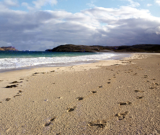
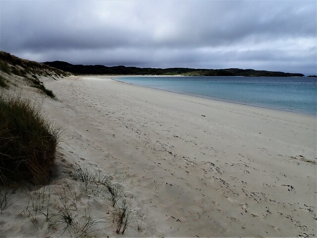
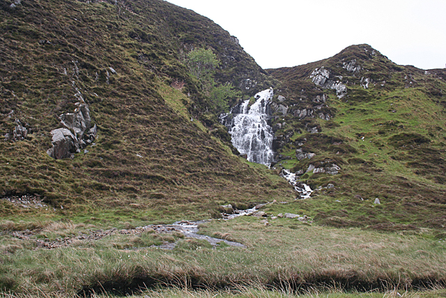
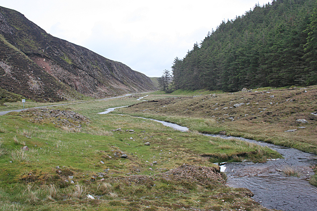
Sìdhean Dubh Images

Images are sourced within 2km of 58.204464/-6.9570053 or Grid Reference NB0834. Thanks to Geograph Open Source API. All images are credited.

Lazy Beds at Tràigh na Beirigh Ridges formed by hand digging of fields.  These one are unusual in that some of the ridges are lined with small stones.
Lazy Beds at Tràigh na Beirigh
Ridges formed by hand digging of fields. These one are unusual in that some of the ridges are lined with small stones.
An Sùileachan Monument A monument to the Lewis land clearances <span class="nowrap"><a title="https://bhaltostrust.co.uk/suileachan-project/" rel="nofollow ugc noopener" href="https://bhaltostrust.co.uk/suileachan-project/">Link</a><img style="margin-left:2px;" alt="External link" title="External link - shift click to open in new window" src="https://s1.geograph.org.uk/img/external.png" width="10" height="10"/></span>
An Sùileachan Monument
A monument to the Lewis land clearances LinkExternal link
A slipway in Loch Miabhaig
Berie Sands Caravan Park Busy site at Traigh na Beirigh with many caravans parked on the machair above the extensive sands.
Berie Sands Caravan Park
Busy site at Traigh na Beirigh with many caravans parked on the machair above the extensive sands.
A' Bheirigh from Suaineabhal
Lochan at Cragavig An old boundary wall snakes across the moorland
Lochan at Cragavig
An old boundary wall snakes across the moorland
Tràigh na Beirigh In the 1960's this was a deserted beach.  Now it has to be shared with caravanners.
Tràigh na Beirigh
In the 1960's this was a deserted beach. Now it has to be shared with caravanners.
Cerishader: postbox № HS2 158 A small postbox on the B8011, with its back to Loch Ròg. It is emptied at 9 o'clock each morning, except Sunday.
Cerishader: postbox № HS2 158
A small postbox on the B8011, with its back to Loch Ròg. It is emptied at 9 o'clock each morning, except Sunday.
A' Bheirigh
A' Bheirigh
Carishader postbox The sea inlet is part of Loch Ròg.
Carishader postbox
The sea inlet is part of Loch Ròg.
Tràigh na Beirigh and Pabaigh Mòr
Tràigh na Beirigh
Tràigh na Beirigh
Traigh na Beirigh beach Lewis Looking down the length of the beach towards Kneep.
Traigh na Beirigh beach Lewis
Looking down the length of the beach towards Kneep.
Gleann Bhaltois (Glen Valtos) 5 Gleann Bhaltois is a spectacular example of a glacial meltwater channel. At the end of the last Ice Age, about 10,000 years ago, there is thought to have been a lake where Uig Bay now lies, dammed by ice to the west. The outlet from the lake was at the head of what is now Gleann Bhaltois, and carved a deep steep-sided glen, exploiting a fault line in the rocks. Following several wet days, a waterfall is draining the moor above.
Gleann Bhaltois (Glen Valtos) 5
Gleann Bhaltois is a spectacular example of a glacial meltwater channel. At the end of the last Ice Age, about 10,000 years ago, there is thought to have been a lake where Uig Bay now lies, dammed by ice to the west. The outlet from the lake was at the head of what is now Gleann Bhaltois, and carved a deep steep-sided glen, exploiting a fault line in the rocks. Following several wet days, a waterfall is draining the moor above.
Gleann Bhaltois (Glen Valtos) 6 Gleann Bhaltois is a spectacular example of a glacial meltwater channel. At the end of the last Ice Age, about 10,000 years ago, there is thought to have been a lake where Uig Bay now lies, dammed by ice to the west. The outlet from the lake was at the head of what is now Gleann Bhaltois, and carved a deep steep-sided glen, exploiting a fault line in the rocks. At this point, the glen steps down from its winding upper course through a rock fall to the much straighter lower course.
Gleann Bhaltois (Glen Valtos) 6
Gleann Bhaltois is a spectacular example of a glacial meltwater channel. At the end of the last Ice Age, about 10,000 years ago, there is thought to have been a lake where Uig Bay now lies, dammed by ice to the west. The outlet from the lake was at the head of what is now Gleann Bhaltois, and carved a deep steep-sided glen, exploiting a fault line in the rocks. At this point, the glen steps down from its winding upper course through a rock fall to the much straighter lower course.
Gleann Bhaltois (Glen Valtos) 7 Gleann Bhaltois is a spectacular example of a glacial meltwater channel. At the end of the last Ice Age, about 10,000 years ago, there is thought to have been a lake where Uig Bay now lies, dammed by ice to the west. The outlet from the lake was at the head of what is now Gleann Bhaltois, and carved a deep steep-sided glen, exploiting a fault line in the rocks. From this point, the glen follows the straight line of the fault. The classic and diagnostic feature of a meltwater channel, well seen in this view, is that the stream it contains is too small to have carved it in the first place.
Gleann Bhaltois (Glen Valtos) 7
Gleann Bhaltois is a spectacular example of a glacial meltwater channel. At the end of the last Ice Age, about 10,000 years ago, there is thought to have been a lake where Uig Bay now lies, dammed by ice to the west. The outlet from the lake was at the head of what is now Gleann Bhaltois, and carved a deep steep-sided glen, exploiting a fault line in the rocks. From this point, the glen follows the straight line of the fault. The classic and diagnostic feature of a meltwater channel, well seen in this view, is that the stream it contains is too small to have carved it in the first place.
Show me another place!

Sìdhean Dubh is located at Grid Ref: NB0834 (Lat: 58.204464, Lng: -6.9570053)

Unitary Authority: Na h-Eileanan an Iar

Police Authority: Highlands and Islands

What 3 Words

///cherished.mega.trombone. Near Carloway, Na h-Eileanan Siar

Related Wikis

Cliff, Lewis

Cliff (Scottish Gaelic: Cliobh) is a small settlement on the Isle of Lewis, in the Outer Hebrides, Scotland. Cliff is within the parish of Uig. The settlement...

Loch na Berie

Loch Na Berie is a broch in the Outer Hebrides of Scotland, located approximately 400 yards from the shore, and is thought to have been located on an island...

Kneep

Kneep (Scottish Gaelic: Cnìp) is a village on the Isle of Lewis, in the Outer Hebrides, Scotland. Kneep is within the parish of Uig.Various archaeological...

Flodaigh, Lewis

Flodaigh is a small island in Loch Roag on the west coast of Lewis in the Outer Hebrides of Scotland. It is about 33 hectares (82 acres) in extent and...

Nearby Amenities

Located within 500m of 58.204464,-6.9570053
Barrier: cattle_grid
Lat/Long: 58.2045289/-6.9616805
Passing Place
Lat/Long: 58.2036172/-6.9536011
Bus Stop
Miavaig (Lewis)
Naptan AtcoCode: 6010731756
Naptan Bearing: W
Naptan CommonName: Miavaig (Lewis)
Naptan Indicator: B8011 Junction
Naptan Landmark: B8011 Junction
Naptan NaptanCode: 94723873
Naptan Street: B8011 Junction
Naptan Verified: no
Source: naptan_import
Lat/Long: 58.20326/-6.9629188
Bus Stop
Miavaig Turn
Naptan AtcoCode: 6010731868
Naptan Bearing: NW
Naptan CommonName: Miavaig Turn
Naptan Indicator: Miavaig Turn
Naptan Landmark: Miavaig Turn
Naptan NaptanCode: 94723945
Naptan Street: Miavaig Turn
Naptan Verified: no
Source: naptan_import
Lat/Long: 58.2032589/-6.9627141
Passing Place
Lat/Long: 58.2066195/-6.9581839
Barrier: cattle_grid
Lat/Long: 58.2013388/-6.9546299
Leisure: slipway
Lat/Long: 58.2020107/-6.953176
Leisure: slipway
Lat/Long: 58.2034502/-6.9543832
Telephone
Booth: K6
Covered: booth
Operator: BT
Phone: +44 1851 672259
Source: survey
Lat/Long: 58.2052977/-6.9615857
Post Box
Collection Times: Mo-Fr 10:15; Sa 10:15
Operator: Royal Mail
Post Box Type: lamp
Ref: HS2 160
Royal Cypher: scottish_crown
Source: survey
Lat/Long: 58.2053065/-6.9616145
Give Way
Direction: forward
Lat/Long: 58.206815/-6.9601592
Restaurant
Scallop
Lat/Long: 58.2017993/-6.9530219
Miabhaig
Name En: Miavaig
Name Gd: Miabhaig
Place: village
Lat/Long: 58.2029652/-6.9596178
Passing Place
Lat/Long: 58.2013676/-6.9572234
Power: pole
Lat/Long: 58.2007166/-6.9539865
Power: pole
Lat/Long: 58.2010722/-6.956996
Power: pole
Lat/Long: 58.2017695/-6.9539218
Power: pole
Lat/Long: 58.2011631/-6.9582835
Power: pole
Lat/Long: 58.2012137/-6.9590604
Power: pole
Lat/Long: 58.2013231/-6.9603582
Power: pole
Lat/Long: 58.2016505/-6.9607994
Power: pole
Lat/Long: 58.2021642/-6.9614727
Power: pole
Lat/Long: 58.2029096/-6.9624099
Power: pole
Lat/Long: 58.2031059/-6.9626604
Power: pole
Lat/Long: 58.2039517/-6.9629706
Power: pole
Lat/Long: 58.2044893/-6.9629631
Power: pole
Lat/Long: 58.2050887/-6.9640405
Power: pole
Lat/Long: 58.2049454/-6.9653848
Power: pole
Lat/Long: 58.2082527/-6.961489
Power: pole
Lat/Long: 58.2077342/-6.9606155
Power: pole
Lat/Long: 58.2073416/-6.9599963
Power: pole
Lat/Long: 58.2071755/-6.9591937
Power: pole
Lat/Long: 58.2069034/-6.9578236
Power: pole
Lat/Long: 58.2063167/-6.9569103
Power: pole
Lat/Long: 58.2060398/-6.9564833
Power: pole
Lat/Long: 58.2054097/-6.9555191
Power: pole
Lat/Long: 58.2050127/-6.9539989
Power: pole
Lat/Long: 58.2046651/-6.9526775
Power: pole
Lat/Long: 58.2042204/-6.9515696
Power: pole
Lat/Long: 58.2037116/-6.950312
Power: pole
Lat/Long: 58.2036499/-6.9492602
Power: pole
Lat/Long: 58.203111/-6.950273
Power: pole
Lat/Long: 58.2031656/-6.9494458
Power: pole
Lat/Long: 58.2059043/-6.9625916
Power: pole
Lat/Long: 58.2064553/-6.9616155
Power: pole
Lat/Long: 58.2069769/-6.9606516
Passing Place
Lat/Long: 58.2041045/-6.9543398
Passing Place
Lat/Long: 58.2045401/-6.9549891
Passing Place
Lat/Long: 58.2058038/-6.9569789
Passing Place
Lat/Long: 58.2052424/-6.9560949
Barrier: cattle_grid
Lat/Long: 58.2014886/-6.9560943
Power: pole
Lat/Long: 58.2013561/-6.954735
Power: pole
Lat/Long: 58.2009226/-6.9556832
Power: pole
Lat/Long: 58.2012302/-6.9555702
Power: pole
Lat/Long: 58.2011515/-6.9561351
Power: pole
Lat/Long: 58.2011093/-6.9569539
Power: pole
Lat/Long: 58.200842/-6.9550196
Power: pole
Lat/Long: 58.2012624/-6.9576926
Power: pole
Lat/Long: 58.2014127/-6.9583933
Power: pole
Lat/Long: 58.2016481/-6.9586921
The data included in this document is from www.openstreetmap.org. The data is made available under ODbL.

Have you been to Sìdhean Dubh?

Leave your review of Sìdhean Dubh below (or comments, questions and feedback).