Cnoc Chàrnach

Hill, Mountain in Ross-shire

Scotland

Cnoc Chàrnach

Gob Geòdha nam Bradan
Gob Geòdha nam Bradan Credit: Sandy Gerrard

Cnoc Chàrnach is a prominent hill located in the county of Ross-shire, Scotland. It is situated near the village of Achnasheen, approximately 20 miles northwest of the town of Dingwall. With an elevation of 1,174 feet (358 meters), the hill is considered a relatively modest mountain.

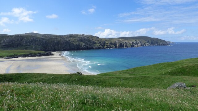
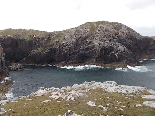
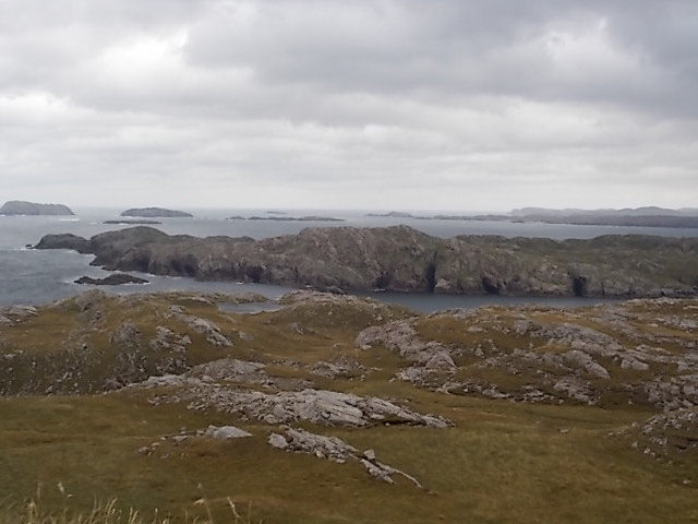
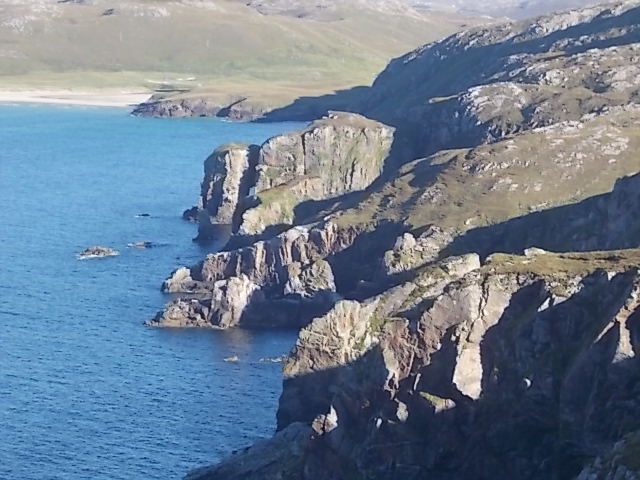
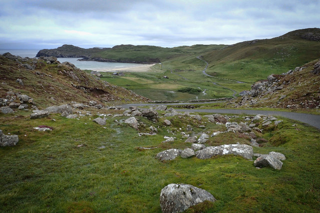
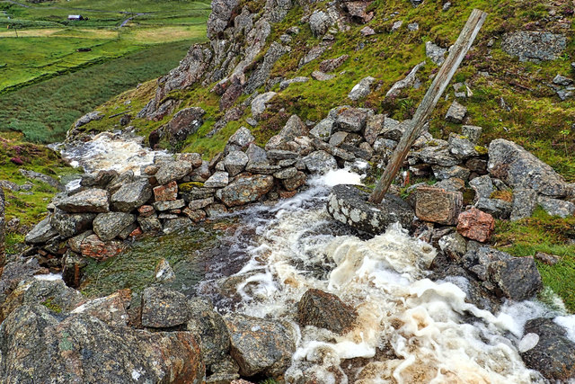
The landscape surrounding Cnoc Chàrnach is characterized by rugged and picturesque beauty, typical of the Scottish Highlands. The hill is composed of rocky terrain, covered in heather and scattered with patches of grass. Its slopes are steep in some sections, offering a challenging climb for outdoor enthusiasts.

The summit of Cnoc Chàrnach provides breathtaking panoramic views of the surrounding countryside. On a clear day, one can see the peaks of nearby mountains, such as Beinn Liath Mhòr and Slioch, as well as the expansive Loch Maree shimmering in the distance.

The hill is a popular destination for hikers and hillwalkers, offering various routes to the summit. One of the most commonly used trails begins near the village of Achnasheen, following a well-marked path that gradually ascends the slopes of Cnoc Chàrnach. The hike typically takes a few hours to complete, depending on the individual's fitness level and pace.

Cnoc Chàrnach is not only a place of natural beauty but also holds historical significance. The hill is believed to have been inhabited by ancient settlements, with remnants of stone structures still visible in certain areas.

Overall, Cnoc Chàrnach offers a rewarding outdoor experience, combining stunning scenery, challenging terrain, and a touch of history, making it a noteworthy destination for visitors to Ross-shire.

If you have any feedback on the listing, please let us know in the comments section below.

Cnoc Chàrnach Images

Images are sourced within 2km of 58.228445/-6.9603231 or Grid Reference NB0837. Thanks to Geograph Open Source API. All images are credited.

Gob Geòdha nam Bradan
Sheepfold at Tobha Mòr
Sheepfold and boundary wall near Tobha Mòr
Rocky surface at Eala Sheadha
Eastern side of the Eala Sheadha Headland
Crystal clear seas off North West coast of Na h-Eileanan an Iar View to about 3 metres depth from RIB floating in lagoon between Pabaigh Mor and Pabaigh Beag.  See also <a href="https://www.geograph.org.uk/photo/1120209">NB1038 : Lagoon on Pabbay Mor</a>
Crystal clear seas off North West coast of Na h-Eileanan an Iar
View to about 3 metres depth from RIB floating in lagoon between Pabaigh Mor and Pabaigh Beag. See also NB1038 : Lagoon on Pabbay Mor
Berie Sands Caravan Park Busy site at Traigh na Beirigh with many caravans parked on the machair above the extensive sands.
Berie Sands Caravan Park
Busy site at Traigh na Beirigh with many caravans parked on the machair above the extensive sands.
Tràigh na Beirigh In the 1960's this was a deserted beach.  Now it has to be shared with caravanners.
Tràigh na Beirigh
In the 1960's this was a deserted beach. Now it has to be shared with caravanners.
Sunrise, Gridig
Sunrise, Gridig
Beach at Pabaigh Mor
Geodh'an Tuill penetrates Pabaigh Mor Pabaigh More has a tidally flooded low-lying area in the middle of the island (at one time used for buffering lobsters) which connects to the open sea over a reef to the northwest, and through a couple of rocky channels heading northeast. It's clear that those channels must have started the same way as this cave, which has penetrated right to the lagoon (from which it is separated only by a storm beach thrown up by waves entering the cave) and, on a geological timescale, is just about at the end of its life. Although one of our group walked over the arch, and once we'd paddled round the island several of us entered the cave from the sea, it is not the most confidence-inspiring roof, especially at this landward end.
Geodh'an Tuill penetrates Pabaigh Mor
Pabaigh More has a tidally flooded low-lying area in the middle of the island (at one time used for buffering lobsters) which connects to the open sea over a reef to the northwest, and through a couple of rocky channels heading northeast. It's clear that those channels must have started the same way as this cave, which has penetrated right to the lagoon (from which it is separated only by a storm beach thrown up by waves entering the cave) and, on a geological timescale, is just about at the end of its life. Although one of our group walked over the arch, and once we'd paddled round the island several of us entered the cave from the sea, it is not the most confidence-inspiring roof, especially at this landward end.
Tràigh na Beirigh and Pabaigh Mòr
Traigh na Beirigh beach Lewis Looking out from the beach just in front of the Caravan site towards the headland at Kneep on the left and Pabaigh Mor on the right.
Traigh na Beirigh beach Lewis
Looking out from the beach just in front of the Caravan site towards the headland at Kneep on the left and Pabaigh Mor on the right.
Geodha Maladail
Geodha Maladail
Pabaigh Mor Numerous caves on the south west side of the island
Pabaigh Mor
Numerous caves on the south west side of the island
South west edge of Camas na Clibhe Looking back to Clibhe beach and coastline from Rubha Brataig
South west edge of Camas na Clibhe
Looking back to Clibhe beach and coastline from Rubha Brataig
Re-entrant between Druim an Rathaid and Bide Ruadh
Remains of a mill, Allt Tota Pallair A small dry stone wall built across the burn, with an old millstone.
Remains of a mill, Allt Tota Pallair
A small dry stone wall built across the burn, with an old millstone.
Show me another place!

Cnoc Chàrnach is located at Grid Ref: NB0837 (Lat: 58.228445, Lng: -6.9603231)

Unitary Authority: Na h-Eileanan an Iar

Police Authority: Highlands and Islands

What 3 Words

///petulant.slap.binder. Near Carloway, Na h-Eileanan Siar

Related Wikis

Kneep

Kneep (Scottish Gaelic: Cnìp) is a village on the Isle of Lewis, in the Outer Hebrides, Scotland. Kneep is within the parish of Uig. Various archaeological...

Cliff, Lewis

Cliff (Scottish Gaelic: Cliobh) is a small settlement on the Isle of Lewis, in the Outer Hebrides, Scotland. Cliff is within the parish of Uig. The settlement...

Pabaigh Mòr

Pabay Mòr or Pabaigh Mòr is an uninhabited island in the Outer Hebrides of Scotland. == History == The island's name comes from papey, an Old Norse name...

Vacsay

Vacsay (Scottish Gaelic: Bhacsaigh from Old Norse "bakkiey" meaning "peat bank island") is one of the Outer Hebrides. It is off the west coast of Lewis...

Nearby Amenities

Located within 500m of 58.228445,-6.9603231
Passing Place
Lat/Long: 58.2244545/-6.9585468
Bhaltos
Name En: Valtos
Name Gd: Bhaltos
Place: village
Lat/Long: 58.2253584/-6.9546379
Barrier: cattle_grid
Lat/Long: 58.2256516/-6.9553346
Barrier: cattle_grid
Lat/Long: 58.2255227/-6.9584607
Post Box
Collection Times: Mo-Fr 10:00; Sa 10:00
Operator: Royal Mail
Post Box Type: lamp
Ref: HS2 163
Royal Cypher: scottish_crown
Source: survey
Lat/Long: 58.2249569/-6.9568269
Barrier: cattle_grid
Lat/Long: 58.2250136/-6.958102
Power: pole
Lat/Long: 58.2249521/-6.9568957
Power: pole
Lat/Long: 58.2247398/-6.9562057
Power: pole
Lat/Long: 58.2257038/-6.954306
Power: pole
Lat/Long: 58.2257651/-6.9579919
Power: pole
Lat/Long: 58.2255964/-6.9575976
Power: pole
Lat/Long: 58.2253986/-6.9571188
Power: pole
Lat/Long: 58.225292/-6.9561344
Power: pole
Lat/Long: 58.2253322/-6.9560419
Power: pole
Lat/Long: 58.2255144/-6.9556637
Power: pole
Lat/Long: 58.2258775/-6.9557031
Power: pole
Lat/Long: 58.225768/-6.9550964
Barrier: cattle_grid
Lat/Long: 58.2257268/-6.9544215
Passing Place
Lat/Long: 58.2255472/-6.955256
Barrier: cattle_grid
Lat/Long: 58.2246243/-6.9565776
Passing Place
Lat/Long: 58.224038/-6.9595267
The data included in this document is from www.openstreetmap.org. The data is made available under ODbL.

Have you been to Cnoc Chàrnach?

Leave your review of Cnoc Chàrnach below (or comments, questions and feedback).