Castle Hill

Heritage Site in Yorkshire

England

Castle Hill

St Lucius, Farnley Tyas The church was completed in 1840.
St Lucius, Farnley Tyas Credit: John Illingworth

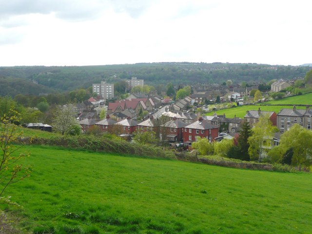
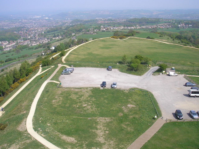
Castle Hill is a prominent heritage site located in Yorkshire, England. Situated near the town of Huddersfield, it is a prominent landmark that holds significant historical and cultural importance. The site is known for its ancient castle, which dates back to the late 11th century and is believed to have been built by the Normans.

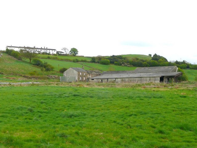
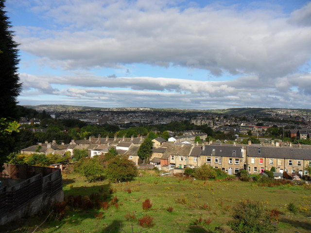
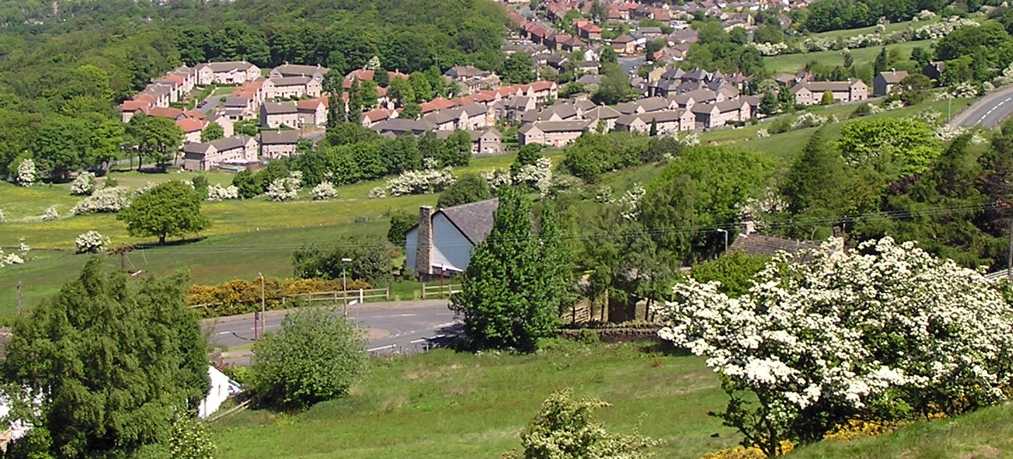
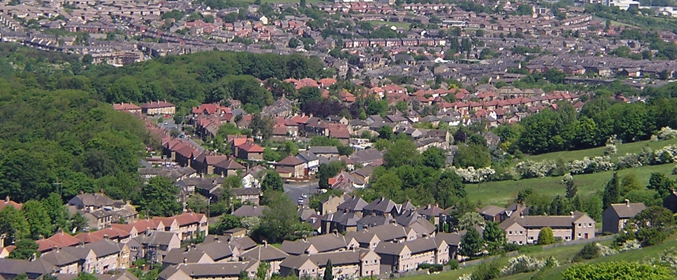
The castle itself is perched on a large hill that offers panoramic views of the surrounding countryside. It is a testament to the region's medieval past and stands as a reminder of the area's rich heritage. The ruins of the castle are well-preserved, allowing visitors to explore and appreciate its architectural grandeur.

In addition to the castle ruins, Castle Hill boasts a variety of other attractions. The most notable is the Victoria Tower, a striking monument erected in honor of Queen Victoria's diamond jubilee. Standing at an impressive 106 feet tall, the tower serves as a symbol of the area's civic pride and offers breathtaking views from the top.

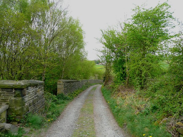
Castle Hill is also home to a vibrant community, with numerous events and festivals taking place throughout the year. These events celebrate the site's history and bring together locals and tourists alike. The hill itself is a popular spot for outdoor activities such as walking, picnicking, and even paragliding.

Overall, Castle Hill is a cherished heritage site that encapsulates the charm and history of Yorkshire. Its ancient castle, stunning views, and lively community make it a must-visit destination for history enthusiasts, nature lovers, and anyone seeking a glimpse into the region's past.

If you have any feedback on the listing, please let us know in the comments section below.

Castle Hill Images

Images are sourced within 2km of 53.627/-1.765 or Grid Reference SE1514. Thanks to Geograph Open Source API. All images are credited.

St Lucius, Farnley Tyas The church was completed in 1840.
St Lucius, Farnley Tyas
The church was completed in 1840.
Cliffe Lane A walled lane out of Farnley Tyas.
Cliffe Lane
A walled lane out of Farnley Tyas.
View from Lady House Lane, Almondbury The Berry Brow primary and infants school can be seen in the distance, still in its 19C Huddersfield Board Elementary School buildings. In the middle, the houses are along Newsome Road South.
View from Lady House Lane, Almondbury
The Berry Brow primary and infants school can be seen in the distance, still in its 19C Huddersfield Board Elementary School buildings. In the middle, the houses are along Newsome Road South.
Cold Hill Lane, Almondbury The wall on the left surrounds an area that once contained a circular reservoir belonging to Huddersfield County Borough (maybe the structure is still in there).
Cold Hill Lane, Almondbury
The wall on the left surrounds an area that once contained a circular reservoir belonging to Huddersfield County Borough (maybe the structure is still in there).
Stirley Farm, Almondbury This farm looks disused, or at least the house is boarded up.
Stirley Farm, Almondbury
This farm looks disused, or at least the house is boarded up.
Direction indicator on Jubilee Tower Taken on one of the occasions when the tower was open to the public.
Direction indicator on Jubilee Tower
Taken on one of the occasions when the tower was open to the public.
Castle Hill car park Taken from the top of Jubilee Tower when it was open to the public.
Castle Hill car park
Taken from the top of Jubilee Tower when it was open to the public.
Queen Street South This bridge carries Queen Street South over the Huddersfield Narrow Canal. the canal proceeds in a tunnel under Fairfield Mills which are seen in the centre of the picture.
Queen Street South
This bridge carries Queen Street South over the Huddersfield Narrow Canal. the canal proceeds in a tunnel under Fairfield Mills which are seen in the centre of the picture.
Huddersfield Narrow Canal behind Firth Street The restored canal with evidence of some serious modern civil engineering. The mill in the distance has been reused by Huddersfield University (an ex-polytechnic).
Huddersfield Narrow Canal behind Firth Street
The restored canal with evidence of some serious modern civil engineering. The mill in the distance has been reused by Huddersfield University (an ex-polytechnic).
Wakefield Road, Huddersfield
Old Wakefield Road, Mouldgreen
Access road to Lower Common Farm
Footpath to Close Hill Lane
Across the fields towards Newsome Road
Lumb Dike near Almondbury Lumb Dike from footbridge, North-East of Molly Carr Wood.
Lumb Dike near Almondbury
Lumb Dike from footbridge, North-East of Molly Carr Wood.
Felcote Avenue Looking down Felcote Avenue to the tiny wood at the bottom.
Felcote Avenue
Looking down Felcote Avenue to the tiny wood at the bottom.
Cat-Steps, near Felcote Avenue Looking down the 'cat-steps'(public right-of-way) towards Ravensknowle Park (trees in the park are visible in the background).
Cat-Steps, near Felcote Avenue
Looking down the 'cat-steps'(public right-of-way) towards Ravensknowle Park (trees in the park are visible in the background).
Field adjacent to Forest Road Taken from Forest Road looking down to terrace houses on Ravensknowle Road.
Field adjacent to Forest Road
Taken from Forest Road looking down to terrace houses on Ravensknowle Road.
Show me another place!

Castle Hill is located at Grid Ref: SE1514 (Lat: 53.627, Lng: -1.765)

Division: West Riding

Unitary Authority: Kirklees

Police Authority: West Yorkshire

What 3 Words

///large.stored.sizes. Near Huddersfield, West Yorkshire

Related Wikis

Longley, Huddersfield

Longley is a small district in Huddersfield, West Yorkshire, England between Newsome and Lowerhouses. The area is mainly made up of woodland and a 9-hole...

Castle Hill, Huddersfield

Castle Hill is a scheduled ancient monument in Almondbury overlooking Huddersfield in the Metropolitan Borough of Kirklees, West Yorkshire, England. The...

Lowerhouses

Lowerhouses is a residential district in the town of Huddersfield, Kirklees, West Yorkshire, England. Lowerhouses is a residential district situated in...

Hall Bower

Hall Bower is a small hamlet lying 2 miles (3.5 km) south of Huddersfield, West Yorkshire, England.It sits in the shadow of Castle Hill, just above the...

Nearby Amenities

Located within 500m of 53.627,-1.765
Bus Stop
Kaye Lane Wheatroyd Lane
Local Ref: 45021116
Naptan AtcoCode: 450021116
Naptan Bearing: W
Naptan CommonName: Kaye Lane Wheatroyd Lane
Naptan Crossing: Wheatroyd Lane
Naptan Indicator: Stop 45021116
Naptan PlusbusZoneRef: LEEDS
Naptan ShortCommonName: Cricket Ground
Naptan Street: Kaye Lane
Naptan Verified: no
Source: naptan_import
Lat/Long: 53.6290263/-1.7590388
Bus Stop
Kaye Lane Wheatroyd Lane
Local Ref: 45021117
Naptan AtcoCode: 450021117
Naptan Bearing: E
Naptan CommonName: Kaye Lane Wheatroyd Lane
Naptan Crossing: Wheatroyd Lane
Naptan Indicator: Stop 45021117
Naptan PlusbusZoneRef: LEEDS
Naptan ShortCommonName: Cricket Ground
Naptan Street: Kaye Lane
Naptan Verified: no
Source: naptan_import
Lat/Long: 53.6291076/-1.7592349
Bus Stop
Kaye Lane Longley Lane
Lit: yes
Local Ref: 45021118
Naptan AtcoCode: 450021118
Naptan Bearing: W
Naptan CommonName: Kaye Lane Longley Lane
Naptan Crossing: Longley Lane
Naptan Indicator: Stop 45021118
Naptan PlusbusZoneRef: LEEDS
Naptan ShortCommonName: Longley Lane
Naptan Street: Kaye Lane
Naptan Verified: no
Source: naptan_import
Lat/Long: 53.6285517/-1.7644549
Bus Stop
Ashes Lane Longley Lane
Local Ref: 45021119
Naptan AtcoCode: 450021119
Naptan Bearing: NE
Naptan CommonName: Ashes Lane Longley Lane
Naptan Crossing: Longley Lane
Naptan Indicator: Stop 45021119
Naptan PlusbusZoneRef: LEEDS
Naptan ShortCommonName: Longley Lane
Naptan Street: Ashes Lane
Naptan Verified: no
Source: naptan_import
Lat/Long: 53.6285981/-1.7651956
Bus Stop
Ashes Lane High Lane
Local Ref: 45021120
Naptan AtcoCode: 450021120
Naptan Bearing: NE
Naptan CommonName: Ashes Lane High Lane
Naptan Crossing: High Lane
Naptan Indicator: Stop 45021120
Naptan PlusbusZoneRef: LEEDS
Naptan ShortCommonName: High Lane
Naptan Street: Ashes Lane
Naptan Verified: no
Source: naptan_import
Lat/Long: 53.6252912/-1.7702793
Bus Stop
Ashes Lane High Lane
Local Ref: 45022048
Naptan AtcoCode: 450022048
Naptan Bearing: NE
Naptan CommonName: Ashes Lane High Lane
Naptan Crossing: High Lane
Naptan Indicator: Stop 45022048
Naptan PlusbusZoneRef: LEEDS
Naptan ShortCommonName: High Lane
Naptan Street: Ashes Lane
Naptan Verified: no
Source: naptan_import
Lat/Long: 53.6254704/-1.7699759
Bus Stop
Fanny Moor Lane Wood Lane
Bench: no
Bin: yes
Lit: yes
Local Ref: 45022408
Naptan AtcoCode: 450022408
Naptan Bearing: N
Naptan CommonName: Fanny Moor Lane Wood Lane
Naptan Crossing: Wood Lane
Naptan Indicator: Stop 45022408
Naptan Notes: Advert panels fitted 040907
Naptan PlusbusZoneRef: LEEDS
Naptan ShortCommonName: Fanny Moor Lane
Naptan Street: Fanny Moor Lane
Naptan Verified: no
Shelter: yes
Source: naptan_import
Tactile Paving: no
Lat/Long: 53.6310034/-1.7679648
Bus Stop
Fanny Moor Lane Longley Lane
Bench: no
Bin: yes
Lit: yes
Local Ref: 45026871
Naptan AtcoCode: 450026871
Naptan Bearing: SW
Naptan CommonName: Fanny Moor Lane Longley Lane
Naptan Crossing: Longley Lane
Naptan Indicator: Stop 45026871
Naptan PlusbusZoneRef: LEEDS
Naptan ShortCommonName: Longley Lane
Naptan Street: Fanny Moor Lane
Naptan Verified: no
Shelter: yes
Source: naptan_import
Tactile Paving: no
Lat/Long: 53.6306356/-1.7683297
Ashes Lane High Lane
Local Ref: 45051068
Naptan AtcoCode: 450051068
Naptan Bearing: SW
Naptan BusStopType: CUS
Naptan CommonName: Ashes Lane High Lane
Naptan Crossing: High Lane
Naptan Indicator: Stop 45051068
Naptan PlusbusZoneRef: LEEDS
Naptan ShortCommonName: High Lane
Naptan Street: Ashes Lane
Naptan Verified: no
Source: naptan_import
Lat/Long: 53.6252011/-1.7701739
Leisure: picnic_table
Lat/Long: 53.6290144/-1.7709114
Barrier: stile
Lat/Long: 53.6290909/-1.7709999
Bench
Backrest: yes
Material: wood
Seats: 4
Source: survey; recording
Lat/Long: 53.6239911/-1.7704342
Board Type: board
Information: board
Source: survey; recording
Tourism: information
Lat/Long: 53.6239982/-1.7697054
Waste Basket
Source: survey; recording
Lat/Long: 53.6240221/-1.7696647
Board Type: history
Information: board
Source: survey; recording
Tourism: information
Lat/Long: 53.6240046/-1.7703849
Barrier: stile
Foot: yes
Lat/Long: 53.6271195/-1.769858
Bench
Backrest: yes
Check Date: 2023-10-14
Material: metal
Seats: 4
Source: survey
Lat/Long: 53.6310365/-1.7654359
Turning Circle
Lat/Long: 53.629535/-1.7687467
Leisure: playground
Lat/Long: 53.6297664/-1.7685495
Barrier: cycle_barrier
Foot: yes
Lat/Long: 53.6286503/-1.7590609
Longley Hill
Place: locality
Lat/Long: 53.6298905/-1.764539
Access: yes
Leisure: playground
Source: survey
Lat/Long: 53.628525/-1.7706824
Leisure: picnic_table
Source: survey
Lat/Long: 53.6289758/-1.770948
Barrier: kissing_gate
Lat/Long: 53.6257867/-1.7666204
Power: pole
Lat/Long: 53.6226576/-1.7631957
Power: pole
Lat/Long: 53.6233329/-1.7637938
Power: pole
Lat/Long: 53.624122/-1.7644925
Power: pole
Lat/Long: 53.6248123/-1.7651014
Power: pole
Lat/Long: 53.6250756/-1.7663258
Power: pole
Lat/Long: 53.6253246/-1.7675288
Barrier: stile
Step Count: 2
Stile: stepover
Lat/Long: 53.6240944/-1.7644355
Barrier: kissing_gate
Lat/Long: 53.6261273/-1.76584
Bench
Backrest: yes
Lat/Long: 53.6245661/-1.7692326
Barrier: kissing_gate
Lat/Long: 53.6250675/-1.7684912
Barrier: kissing_gate
Lat/Long: 53.6267053/-1.764467
Barrier: stile
Step Count: 1
Stile: stepover
Lat/Long: 53.6243529/-1.7592521
The data included in this document is from www.openstreetmap.org. The data is made available under ODbL.

Have you been to Castle Hill ?

Leave your review of Castle Hill below (or comments, questions and feedback).