Castle Hills

Heritage Site in Huntingdonshire

England

Castle Hills

St Neots : Church of St Mary Grade II* listed - <span class="nowrap"><a title="https://historicengland.org.uk/listing/the-list/list-entry/1127993?section=official-list-entry" rel="nofollow ugc noopener" href="https://historicengland.org.uk/listing/the-list/list-entry/1127993?section=official-list-entry">Link</a><img style="margin-left:2px;" alt="External link" title="External link - shift click to open in new window" src="https://s1.geograph.org.uk/img/external.png" width="10" height="10"/></span>.
St Neots : Church of St Mary Credit: Jim Osley

Castle Hills, located in Huntingdonshire, is a remarkable heritage site that holds great historical significance. This ancient site dates back to the Iron Age and is believed to have been occupied continuously for over 2,000 years. Situated on a prominent hilltop, Castle Hills offers breathtaking views of the surrounding countryside.

The site itself covers an impressive area of approximately 40 acres and is surrounded by a series of earthworks and ditches, indicative of its defensive nature. The main feature of Castle Hills is the Iron Age hillfort, which is believed to have been constructed around 500 BC. The fortifications consist of a double rampart and ditch system, showcasing the skilled engineering of the period.

Excavations conducted in the 19th and 20th centuries revealed the remains of roundhouses, storage pits, and various artifacts, providing valuable insights into Iron Age life. The site was also inhabited during the Roman period, as evidenced by the discovery of Roman coins and pottery.

Castle Hills is not only a significant archaeological site but also a place of natural beauty. The hilltop location offers panoramic views of the surrounding landscape, making it a popular destination for both locals and tourists. The site is well-preserved and maintained, with designated walking paths and informative signage for visitors to explore and learn about its rich history.

With its historical importance, stunning views, and educational value, Castle Hills in Huntingdonshire is a must-visit destination for history enthusiasts and nature lovers alike.

If you have any feedback on the listing, please let us know in the comments section below.

Castle Hills Images

Images are sourced within 2km of 52.2157/-0.2839 or Grid Reference TL1758. Thanks to Geograph Open Source API. All images are credited.

St Neots : Church of St Mary Grade II* listed - <span class="nowrap"><a title="https://historicengland.org.uk/listing/the-list/list-entry/1127993?section=official-list-entry" rel="nofollow ugc noopener" href="https://historicengland.org.uk/listing/the-list/list-entry/1127993?section=official-list-entry">Link</a><img style="margin-left:2px;" alt="External link" title="External link - shift click to open in new window" src="https://s1.geograph.org.uk/img/external.png" width="10" height="10"/></span>.
St Neots : Church of St Mary
Grade II* listed - LinkExternal link.
Barford Road Roundabout
Electricity Pylon at Wyboston
Hen Brook, St Neots
Hen Brook, St Neots
Bridge over Hen Brook, St Neots
Henbrook Park, St Neots
Marston Business Park, St Neots
Barford Road Seen from the Barford Road Roundabout on the A428, with the Little Barford Power Station in the next square south
Barford Road
Seen from the Barford Road Roundabout on the A428, with the Little Barford Power Station in the next square south
Roundabout exit at Eaton Socon The A428 meets the A1 [entering from the immediate left], and the left leads to a small commercial area, which is a cul-de-sac, and includes The Crown.
Roundabout exit at Eaton Socon
The A428 meets the A1 [entering from the immediate left], and the left leads to a small commercial area, which is a cul-de-sac, and includes The Crown.
The turn off to Cambridge
The Riverside Park, St Neots
Footbridge over Great Ouse
Ouse Valley Way
Ouse Valley Way
Weir on River Great Ouse
Eynesbury Manor Moorings Footbridge This bridge, and the development opposite, all looks very new; not shown on my 1999 Explorer map. The lifting bridge is hydraulically operated from a control panel nearby.
Eynesbury Manor Moorings Footbridge
This bridge, and the development opposite, all looks very new; not shown on my 1999 Explorer map. The lifting bridge is hydraulically operated from a control panel nearby.
The A1. Looking north up the A1 from the Bushmead Road bridge.
The A1.
Looking north up the A1 from the Bushmead Road bridge.
Eynesbury, St. Neots Thatchers try to get a roof done in the brief sunny spells between rain showers, close to the junction of Howitt's Lane and Berkley Street, Eynesbury.
Eynesbury, St. Neots
Thatchers try to get a roof done in the brief sunny spells between rain showers, close to the junction of Howitt's Lane and Berkley Street, Eynesbury.
Little Barford Power Station Little Barford Power Station at Gallow Hill, south of St. Neots.
Little Barford Power Station
Little Barford Power Station at Gallow Hill, south of St. Neots.
Show me another place!

Castle Hills is located at Grid Ref: TL1758 (Lat: 52.2157, Lng: -0.2839)

What 3 Words

///flush.audio.mops. Near Eaton Socon, Cambridgeshire

Nearby Locations

Castle Hills

Related Wikis

Eaton Socon Castle

Eaton Socon Castle was a Norman fortification. It was constructed next to the River Great Ouse in what is now Eaton Socon, Cambridgeshire, England. It...
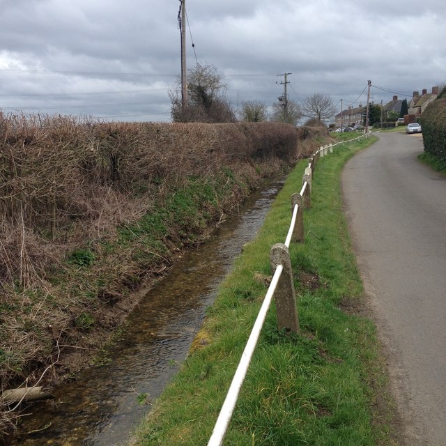
Duloe Brook

Duloe Brook is a minor, roughly 9 km (5.59 mi) long river (or brook) in Bedfordshire that is a tributary to the River Great Ouse. The brook rises in the...

Eaton Socon Rural District

Eaton Socon was a rural district in Bedfordshire, England from 1894 to 1934. The district had its origins in the St Neots Rural Sanitary District. This...

Eaton Socon

Eaton Socon is a community in the civil parish of St Neots, in the Huntingdonshire district, in the county of Cambridgeshire, England. Eaton Socon is...

Nearby Amenities

Located within 500m of 52.2157,-0.2839
Mini Roundabout
Direction: clockwise
Lat/Long: 52.2138377/-0.2903425
Eaton Socon
Is In: Cambridgeshire
Place: suburb
Source: https://en.wikipedia.org/wiki/Eaton_Socon
Lat/Long: 52.2153864/-0.2890057
Barrier: bollard
Bicycle: yes
Foot: yes
Lat/Long: 52.2181631/-0.2886636
Post Office
Eaton Socon Post Office
Addr City: St Neots
Addr Country: GB
Addr Postcode: PE19 8EF
Brand: Post Office
Brand Wikidata: Q1783168
Contact Website: https://www.postoffice.co.uk/branch-finder/2812304/eaton-socon
Ref Pol Id: 11266
Lat/Long: 52.2176314/-0.2891675
Turning Circle
Lat/Long: 52.2135521/-0.2850339
Traffic Calming: table
Lat/Long: 52.2128164/-0.2857775
Maxwidth: 3.3
Seamark Gate Category: lock
Seamark Gate Clearance Width: 3.3
Seamark Type: gate
Source: survey
Type: wooden-double-leaf
Waterway: lock_gate
Lat/Long: 52.2137611/-0.2824848
Eynesbury Weir
Source: survey
Type: automatic_closing
Waterway: weir
Lat/Long: 52.2134197/-0.2819372
Bus Stop
Bus: yes
Public Transport: platform
Lat/Long: 52.2185211/-0.2889635
Barrier: chain
Lat/Long: 52.2125066/-0.2830444
Historic: memorial
Type: war_memorial
Lat/Long: 52.2152105/-0.2892843
Barrier: lift_gate
Note: automatic barrier
Source: survey
Lat/Long: 52.2145416/-0.2841493
Eaton Socon Cage
Historic: monument
Inscription: The Eaton Socon Cage. This ancient lock-up was built in 1826 for the confinement of local malefactors. Restored in 1963, it is now in the care of the Bedfordshire and Huntingdonshire Naturalists Trust.
Note: former prison cell
Openplaques Id: 30662
Wikidata: Q26615602
Lat/Long: 52.2150507/-0.2877899
Crossing
Crossing: traffic_signals
Crossing Ref: pelican
Source: survey
Lat/Long: 52.2157701/-0.2894173
Post Box
Post Box Type: pillar
Royal Cypher: EIIR
Royal Cypher Wikidata: Q33102113
Lat/Long: 52.2145745/-0.289523
Power: transformer
Source: survey
Lat/Long: 52.2129472/-0.2839134
Source: survey
Traffic Calming: table
Lat/Long: 52.2129245/-0.2848016
Barrier: bollard
Source: survey
Lat/Long: 52.2122188/-0.2880655
Barrier: entrance
Source: survey
Lat/Long: 52.2139046/-0.2859274
Post Box
Post Box Type: lamp
Source: survey
Lat/Long: 52.2146045/-0.2836033
Bus Stop
St Mary's Church
Bus: yes
Naptan AtcoCode: 0500HSTNS005
Naptan Bearing: S
Naptan CommonName: St Mary's Church
Naptan Indicator: o/s
Naptan Landmark: School Lane
Naptan NaptanCode: cmbdtatm
Naptan ShortCommonName: St Mary's Church
Naptan Street: Great North Road
Naptan Verified: no
Public Transport: platform
Source: naptan_import
Lat/Long: 52.2155252/-0.2892735
Bus Stop
Wilkinson Close
Bus: yes
Naptan AtcoCode: 0500HSTNS035
Naptan Bearing: S
Naptan CommonName: Wilkinson Close
Naptan Indicator: opp
Naptan Landmark: Wilkinson Close
Naptan NaptanCode: cmbdtdjw
Naptan ShortCommonName: Wilkinson Close
Naptan Street: Great North Road
Naptan Verified: no
Public Transport: platform
Source: naptan_import
Lat/Long: 52.2183822/-0.2889339
Bus Stop
St Mary's Church
Bus: yes
Naptan AtcoCode: 0500HSTNS081
Naptan Bearing: N
Naptan CommonName: St Mary's Church
Naptan Indicator: opp
Naptan Landmark: Peppercorns Lane
Naptan NaptanCode: cmbdtgjm
Naptan ShortCommonName: St Mary's Church
Naptan Street: Great North Road
Naptan Verified: no
Public Transport: platform
Source: naptan_import
Lat/Long: 52.2165202/-0.2895031
Crossing
Crossing: unmarked
Crossing Island: no
Tactile Paving: no
Lat/Long: 52.2163683/-0.2868955
Power: pole
Source: bing
Lat/Long: 52.2117855/-0.2817137
Power: pole
Source: bing
Lat/Long: 52.2129548/-0.2837468
Power: pole
Source: bing
Lat/Long: 52.2117016/-0.2807012
Power: pole
Source: bing
Lat/Long: 52.2118717/-0.282678
Seamark Gate Category: lock
Seamark Type: gate
Waterway: lock_gate
Lat/Long: 52.2134214/-0.2824221
Recycling
Lat/Long: 52.2155473/-0.2900057
Atm
Lat/Long: 52.2156788/-0.2898528
Turning Circle
Lat/Long: 52.2194041/-0.2850209
Turning Circle
Lat/Long: 52.2133238/-0.2842203
Barrier: stile
Lat/Long: 52.2193441/-0.2845795
Bench
Lat/Long: 52.2191618/-0.2844934
Bench
Lat/Long: 52.21915/-0.2841463
Entrance: main
Lat/Long: 52.2156838/-0.2897683
Generator Method: photovoltaic
Generator Output Electricity: yes
Generator Source: solar
Generator Type: solar_photovoltaic_panel
Location: roof
Power: generator
Lat/Long: 52.2142186/-0.2907836
Generator Method: photovoltaic
Generator Output Electricity: yes
Generator Source: solar
Generator Type: solar_photovoltaic_panel
Location: roof
Power: generator
Lat/Long: 52.2153855/-0.2907005
Generator Method: photovoltaic
Generator Output Electricity: yes
Generator Source: solar
Generator Type: solar_photovoltaic_panel
Location: roof
Power: generator
Lat/Long: 52.2134199/-0.2844188
Generator Method: photovoltaic
Generator Output Electricity: yes
Generator Source: solar
Generator Type: solar_photovoltaic_panel
Location: roof
Power: generator
Lat/Long: 52.2133838/-0.286881
Generator Method: photovoltaic
Generator Output Electricity: yes
Generator Source: solar
Generator Type: solar_photovoltaic_panel
Location: roof
Power: generator
Lat/Long: 52.2180296/-0.2857733
Generator Method: photovoltaic
Generator Output Electricity: yes
Generator Source: solar
Generator Type: solar_photovoltaic_panel
Location: roof
Power: generator
Lat/Long: 52.2186803/-0.2862802
Generator Method: photovoltaic
Generator Output Electricity: yes
Generator Source: solar
Generator Type: solar_photovoltaic_panel
Location: roof
Power: generator
Lat/Long: 52.218677/-0.2862158
Generator Method: photovoltaic
Generator Output Electricity: yes
Generator Source: solar
Generator Type: solar_photovoltaic_panel
Location: roof
Power: generator
Lat/Long: 52.2188233/-0.2858457
Generator Method: photovoltaic
Generator Output Electricity: yes
Generator Source: solar
Generator Type: solar_photovoltaic_panel
Location: roof
Power: generator
Lat/Long: 52.218815/-0.2858001
Generator Method: photovoltaic
Generator Output Electricity: yes
Generator Source: solar
Generator Type: solar_photovoltaic_panel
Location: roof
Power: generator
Lat/Long: 52.2190714/-0.2879459
Generator Method: photovoltaic
Generator Output Electricity: yes
Generator Source: solar
Generator Type: solar_photovoltaic_panel
Location: roof
Power: generator
Lat/Long: 52.219382/-0.2880666
Barrier: yes
Boat: no
Lat/Long: 52.2131904/-0.2818212
Cricket Bat Willow Island
Place: island
Lat/Long: 52.2121791/-0.2796149
Barrier: cycle_barrier
Lat/Long: 52.2159629/-0.2872186
John Cecil Paget
Historic: memorial
Inscription: Inventor of the yellow oiled skin cycling cape lived here 1928-1941 J. C. Paget, a keen cyclist, designed and manufactured a range of wet weather clothing from special Pagetsilk and Pagetskin material. An old London bus was kept on the track alongside thi
Memorial: plaque
Openplaques Id: 59572
Lat/Long: 52.2139137/-0.2881471
Eaton Socon Shop
Historic: memorial
Inscription: There has been a shop on this site for centuries. From the 1790s up to the 1870s the Flawn family had a blacksmiths shop. The Peck family then built a butchers shop and, in the 1960s, the Anderson family took over the butchers.
Memorial: plaque
Openplaques Id: 59504
Lat/Long: 52.2168725/-0.2895759
Ingles Coachbuilders
Historic: memorial
Inscription: A farmhouse in 1800 and a bakery by the 1840s, this cottage has seen many changes. In the latter part of the nineteenth century a plumber and painter lived here followed by a coal dealer. In the yard at the back the last successful coachbuilding business
Memorial: plaque
Openplaques Id: 59570
Lat/Long: 52.2177361/-0.2891821
Manor Cottage
Historic: memorial
Inscription: This house was once part of The Cock Public House - a well known coaching inn on the Great North Road. Bought by the Peppercorn family in 1845 and renamed 'The Manor House', the main buildings were demolished in the 1960s. Princess Victoria visited The Co
Memorial: plaque
Openplaques Id: 30658
Lat/Long: 52.2163773/-0.2887606
Matthew Rosamond
Historic: memorial
Inscription: On 4th June 1857 Matthew Rosamond, a relative of the Rosamond bakers on this site, won the Victoria Cross during the Indian Mutiny. He died on the Red Sea on 14th July 1866 and was buried at sea. This building was built by Budd's bakers as a new bakehouse
Memorial: plaque
Openplaques Id: 59505
Subject Wikidata: Q16065851
Lat/Long: 52.2157294/-0.2895143
Millers Arms
Historic: memorial
Inscription: Millers Arms This building and the house next door (Misers Hoard) were owned by the same family in the late 18th century. Licensed in 1842, this beerhouse was known as 'The pub with no sign'. By the 1890s, the pub was known as the 'The Millers Arms' and t
Memorial: plaque
Openplaques Id: 59571
Lat/Long: 52.213888/-0.2872118
The data included in this document is from www.openstreetmap.org. The data is made available under ODbL.

Have you been to Castle Hills?

Leave your review of Castle Hills below (or comments, questions and feedback).