Castle Hills

Heritage Site in Huntingdonshire

England

Castle Hills

Silver Street Looking towards Godmanchester.
Silver Street Credit: Jonathan Thacker

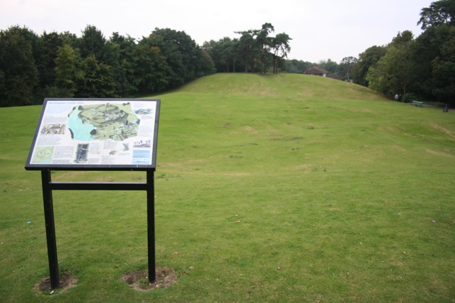
Castle Hills is a historic landmark located in Huntingdonshire, England. Situated in the town of Huntingdon, this heritage site is known for its rich historical significance and captivating architectural features. The site comprises the remains of a Norman motte and bailey castle, which dates back to the 11th century.

The castle was built shortly after the Norman Conquest of England and played a crucial role in the defense of the region during the medieval period. The motte, or mound, is the central feature of the site and offers panoramic views of the surrounding landscape. It stands at an impressive height of approximately 20 meters and is believed to have been constructed using earth and timber.

The bailey, an enclosed courtyard, is located at the foot of the motte and would have housed various buildings and structures, including the castle's keep and domestic quarters. Although most of these structures have been lost over time, the outlines of their foundations can still be seen.

Castle Hills is a popular destination for history enthusiasts and visitors interested in exploring the area's past. The site is easily accessible and offers informative displays and signage, allowing visitors to learn about the castle's history and its significance in the local context.

In addition to its historical importance, Castle Hills is also an important green space within the town, providing a peaceful setting for recreational activities. The site is surrounded by well-maintained lawns and offers benches for visitors to relax and enjoy the picturesque surroundings.

Overall, Castle Hills in Huntingdonshire is a fascinating heritage site that offers a glimpse into the region's medieval history. Its imposing motte, remnants of the bailey, and idyllic setting make it a must-visit destination for both locals and tourists alike.

If you have any feedback on the listing, please let us know in the comments section below.
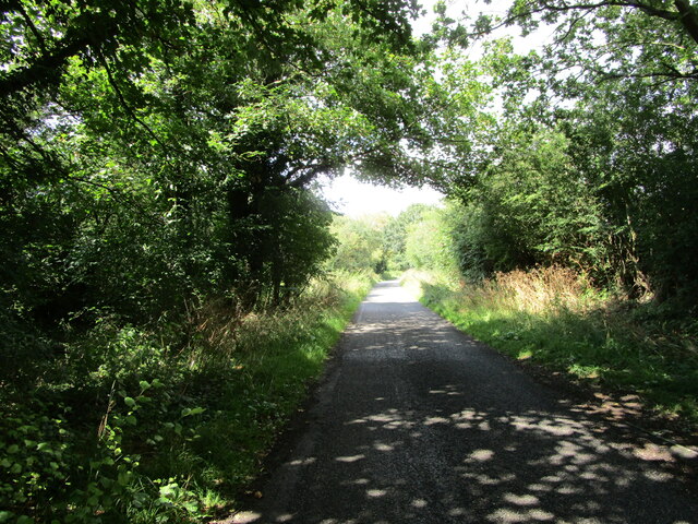
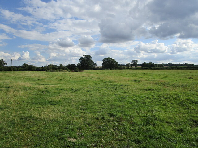
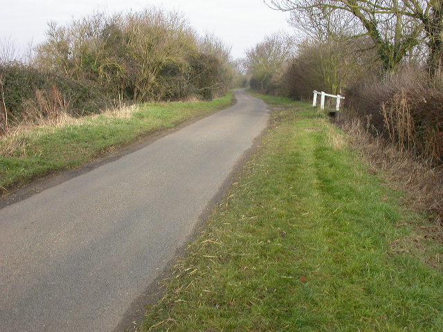
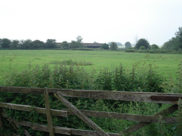
Castle Hills Images

Images are sourced within 2km of 52.327/-0.173 or Grid Reference TL2471. Thanks to Geograph Open Source API. All images are credited.

Silver Street Looking towards Godmanchester.
Silver Street
Looking towards Godmanchester.
Grass field off Berry Lane
Pathfinder Long Distance Walk Established to honour the Pathfinder Squadrons who facilitated 2nd World War attacks by preceding the heavy duty bombers to drop flares over the targets.
Pathfinder Long Distance Walk
Established to honour the Pathfinder Squadrons who facilitated 2nd World War attacks by preceding the heavy duty bombers to drop flares over the targets.
Pasture, West Farm, near Godmanchester
The southern end of Godmanchester This is the view as you arrive at Godmanchester from Royston. The straight section of road after the bend is the Roman road called Ermine Street.
The southern end of Godmanchester
This is the view as you arrive at Godmanchester from Royston. The straight section of road after the bend is the Roman road called Ermine Street.
London Road junction London Road junction with the A1198 at Godmanchester
London Road junction
London Road junction with the A1198 at Godmanchester
Pavilion on Recreation Ground
Disused stable shed
Disused stable shed
Sign indicating this Pathfinder Path The path commemorating WWII pilots who laid flares in advance of bombers
Sign indicating this Pathfinder Path
The path commemorating WWII pilots who laid flares in advance of bombers
Pond at Mansio Place This is a new man-made pond created as part of the Mansio Place development between Comben Drive and Silver Street.
Pond at Mansio Place
This is a new man-made pond created as part of the Mansio Place development between Comben Drive and Silver Street.
Play equipment and field Play equipment and field between Devana Close and Silver Street.
Play equipment and field
Play equipment and field between Devana Close and Silver Street.
Tree upheaval Recent strong winds have downed six or seven poplar trees on the side of the B1043. Shallow rooting, dry soil, and the fact that they appear to have grown out on a roadstone surface haven't helped.
Tree upheaval
Recent strong winds have downed six or seven poplar trees on the side of the B1043. Shallow rooting, dry soil, and the fact that they appear to have grown out on a roadstone surface haven't helped.
Tree upheaval Poplar trees lying prone by the B1043.
Tree upheaval
Poplar trees lying prone by the B1043.
New roundabout on A1198, Godmanchester It looks like it was built in conjunction with the housing development off to the right.
New roundabout on A1198, Godmanchester
It looks like it was built in conjunction with the housing development off to the right.
London Road, Godmanchester The Roman Ermine Street.
London Road, Godmanchester
The Roman Ermine Street.
The new Co-op on Gumcester Way, Godmanchester This has only just been completed and work continues on new houses opposite,
The new Co-op on Gumcester Way, Godmanchester
This has only just been completed and work continues on new houses opposite,
The new Co-op car park on Gumcester Way, Godmanchester
Small business park A small business park on the outskirts of Godmanchester.
Small business park
A small business park on the outskirts of Godmanchester.
Show me another place!

Castle Hills is located at Grid Ref: TL2471 (Lat: 52.327, Lng: -0.173)

Police Authority: Cambridgeshire

What 3 Words

///continued.owns.organic. Near Huntingdon, Cambridgeshire

Related Wikis

Godmanchester railway station

Godmanchester railway station was a railway station situated in the town of Godmanchester in Huntingdonshire, England. It was situated on the Huntingdon...

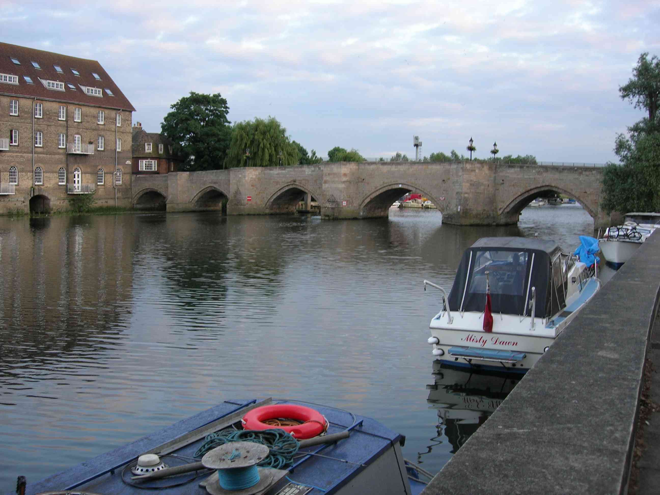
Old Bridge, Huntingdon

The Old Bridge between Huntingdon and Godmanchester (now part of Cambridgeshire, England) is a well-preserved medieval stone bridge over the River Great...

St Mary's Church, Huntingdon

St Mary's Church is located in Huntingdon, Cambridgeshire, England. The church is said to have been the "Mother Church of Huntingdon". It occupies what...

Huntingdon Community Radio

Huntingdon Community Radio is a community radio station operating from studios in Huntingdonshire, Cambridgeshire, England. It was awarded a broadcast...

Huntingdon Castle

Huntingdon Castle was situated in the town of Huntingdon in Cambridgeshire (grid reference TL240714). In 1068 a Norman motte and bailey castle was built...

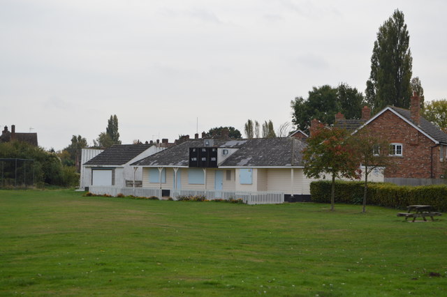
The Parks, Godmanchester

The Parks is a cricket ground situated off Fox Grove, Godmanchester, Huntingdonshire. The ground is bordered to the north and south by residential housing...

St Mary's Street drill hall, Huntingdon

The St Mary's Street drill hall is a former military installation in Huntingdon, Cambridgeshire. == History == The building was designed as the headquarters...

Literary and Scientific Institute, Huntingdon

The Literary and Scientific Institute was located in Huntingdon, Cambridgeshire, England. Founded by Robert Fox, it is currently used as Commemoration...

Nearby Amenities

Located within 500m of 52.327,-0.173
Traffic Signals
Lat/Long: 52.3278078/-0.1782996
Crossing
Crossing: traffic_signals
Crossing Ref: pelican
Lat/Long: 52.3262982/-0.1762726
Recycling
Lat/Long: 52.3312019/-0.1739917
Traffic Signals
Crossing: traffic_signals
Crossing Ref: toucan
Lat/Long: 52.3312244/-0.1748544
Traffic Signals
Lat/Long: 52.3279689/-0.1787088
Barrier: lift_gate
Lat/Long: 52.3300867/-0.1764716
Access: yes
Barrier: bollard
Bollard: fixed
Colour: black
Foot: designated
Height: 1.2
Horse: no
Material: metal
Motor Vehicle: no
Lat/Long: 52.3280611/-0.1789853
Pub
Samuel Pepys
Lat/Long: 52.3283002/-0.1795985
Restaurant
The Old Bridge Hotel
Wikidata: Q26455252
Lat/Long: 52.327685/-0.1784887
Recycling
Lat/Long: 52.3261362/-0.176095
Huntingdon Boat Haven and Caravan Park
Leisure: marina
Seamark Harbour Category: marina
Seamark Type: harbour
Tourism: caravan_site
Lat/Long: 52.3248895/-0.1790146
Crossing
Crossing: traffic_signals
Lat/Long: 52.3230905/-0.1761394
Bus Stop
Park Lane
Bus: yes
Naptan AtcoCode: 0500HGODM008
Naptan Bearing: N
Naptan CommonName: Park Lane
Naptan Indicator: opp
Naptan Landmark: Park Lane
Naptan NaptanCode: cmbdpapw
Naptan ShortCommonName: Park Lane
Naptan Street: The Avenue
Naptan Verified: no
Public Transport: platform
Source: naptan_import
Lat/Long: 52.3236063/-0.176316
Godmanchester
Historic Railway: station
Railway: site
Source: NPE
Source Name: NPE
Wikidata: Q5576744
Wikipedia: en:Godmanchester railway station
Lat/Long: 52.3262805/-0.1747906
Traffic Signals
Lat/Long: 52.3304352/-0.1754373
Traffic Signals
Lat/Long: 52.3304702/-0.1756459
Shop: hairdresser
Lat/Long: 52.3289993/-0.1770554
Bench
Lat/Long: 52.3296003/-0.1779496
Bench
Lat/Long: 52.3303132/-0.1750992
Bench
Lat/Long: 52.3312088/-0.1712431
Bench
Lat/Long: 52.3306056/-0.1740325
Bench
Lat/Long: 52.3307281/-0.1736635
Bench
Lat/Long: 52.3308482/-0.172273
Bench
Lat/Long: 52.3296746/-0.1781471
Bbq
Lat/Long: 52.3304122/-0.1748533
Barrier: kissing_gate
Lat/Long: 52.3264624/-0.1658412
Barrier: kissing_gate
Lat/Long: 52.324813/-0.1671619
Traffic Signals
Lat/Long: 52.3278578/-0.1786446
Beacon
Historic: memorial
Lat/Long: 52.3273384/-0.1795056
Tourism: viewpoint
Lat/Long: 52.3272654/-0.1794721
Power: pole
Lat/Long: 52.3249653/-0.177828
Power: pole
Lat/Long: 52.3277666/-0.1681579
Power: pole
Lat/Long: 52.3275743/-0.1728998
Power: pole
Lat/Long: 52.3277154/-0.169727
Power: pole
Lat/Long: 52.3276225/-0.1718012
Power: pole
Lat/Long: 52.3274887/-0.1752041
Power: pole
Lat/Long: 52.3275233/-0.1740668
Power: pole
Lat/Long: 52.328546/-0.1674605
Power: pole
Lat/Long: 52.3274627/-0.176269
Power: pole
Lat/Long: 52.3278744/-0.1683634
Power: pole
Lat/Long: 52.3278313/-0.1666077
web2market
Addr City: Huntingdon
Addr Housename: Riverside House
Addr Housenumber: 160
Addr Postcode: PE29 3SG
Addr Street: High Street
Building: office
Lat/Long: 52.3279666/-0.1777085
Leisure: slipway
Source: local knowledge
Lat/Long: 52.3305744/-0.1733276
Information: board
Operator: Huntingdon Town Council
Tourism: information
Lat/Long: 52.3272218/-0.1794418
Power: pole
Lat/Long: 52.3274817/-0.1754925
Bench
Lat/Long: 52.3285572/-0.1762878
Bench
Lat/Long: 52.3279154/-0.1772972
Bench
Lat/Long: 52.329193/-0.1756733
Bench
Lat/Long: 52.3290539/-0.1757902
Toilets
Lat/Long: 52.3311902/-0.173661
Cafe
Lat/Long: 52.3311914/-0.173555
Crossing
Lat/Long: 52.3277067/-0.1792196
Mooring
Mooring: public
Lat/Long: 52.3275647/-0.1777781
Bench
Lat/Long: 52.3242682/-0.1765128
Bench
Lat/Long: 52.3239599/-0.1764575
Defibrillator
Addr City: Huntingdon
Addr Postcode: PE29 2AG
Defibrillator Location: Godmanchester Community Nursery Park Lane PE29 2AG
Emergency: defibrillator
Indoor: no
Operator: Godmanchester Town Council
Lat/Long: 52.3226922/-0.174378
Traffic Signals
Crossing: traffic_signals
Crossing Ref: toucan
Lat/Long: 52.3311971/-0.174787
Colour: yellow
Marker: post
Material: plastic
Utility: gas
Lat/Long: 52.3253013/-0.1767433
Colour: red and white
Marker: aerial
Utility: gas
Lat/Long: 52.3253007/-0.1767487
Colour: red
Marker: post
Material: concrete
Utility: gas
Lat/Long: 52.3252907/-0.1764808
Colour: red and white
Marker: aerial
Utility: gas
Lat/Long: 52.3252911/-0.1764711
Colour: yellow
Inscription: GAS LTS HP GAS PIPELINE
Marker: post
Material: plastic
Utility: gas
Lat/Long: 52.3247872/-0.1789584
Colour: red and yellow
Inscription: GAS PIPELINE
Marker: sign
Material: plastic
Utility: gas
Lat/Long: 52.3247585/-0.1787515
Colour: yellow
Marker: post
Utility: gas
Lat/Long: 52.3257193/-0.1745513
Crossing
Lat/Long: 52.3269443/-0.1772601
Barrier: bollard
Motor Vehicle: no
Lat/Long: 52.3296832/-0.1782581
Fast Food
Cuisine: chinese
Lat/Long: 52.3284376/-0.1799008
Seamark Mooring Category: wall
Seamark Type: mooring
Lat/Long: 52.3277737/-0.1775015
Addr Housenumber: 9A
Lat/Long: 52.3227547/-0.1752519
Give Way
Direction: forward
Lat/Long: 52.3301502/-0.1772367
The data included in this document is from www.openstreetmap.org. The data is made available under ODbL.

Have you been to Castle Hills?

Leave your review of Castle Hills below (or comments, questions and feedback).