Newtown

Settlement in Huntingdonshire Huntingdonshire

England

Newtown

Calm water of the River Great Ouse in Huntingdon
Calm water of the River Great Ouse in Huntingdon Credit: Richard Humphrey

Newtown is a small village located in the district of Huntingdonshire, England. Situated in the eastern part of the county, it lies approximately 6 miles southeast of the town of Huntingdon. With a population of around 500 residents, Newtown exudes a charming and peaceful atmosphere.

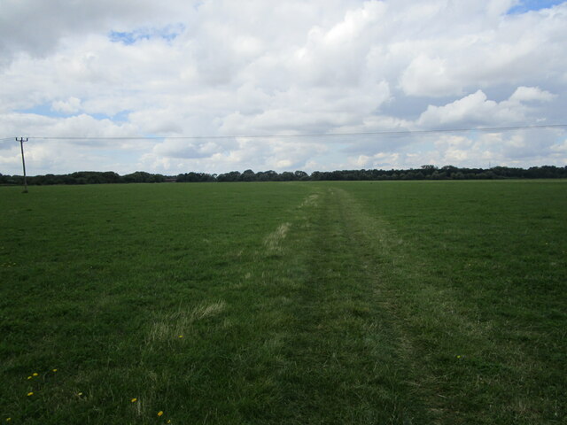
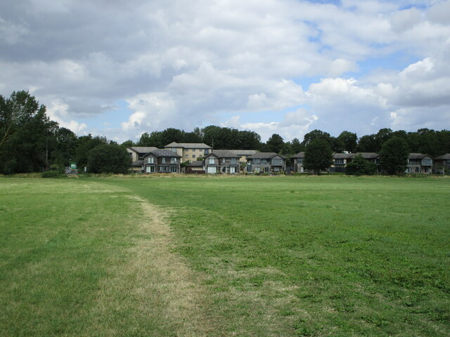
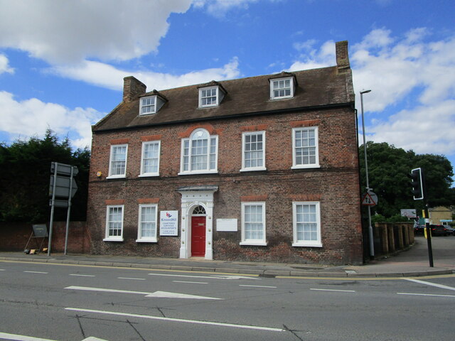
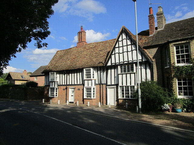
The village is characterized by its picturesque setting, surrounded by rolling countryside and lush green fields. It is dotted with traditional thatched cottages and historic buildings, offering visitors a glimpse into its rich heritage. The centerpiece of Newtown is the village church, a beautiful structure dating back to the 12th century, which stands tall at the heart of the community.

Despite its small size, Newtown boasts a close-knit and friendly community. The village has a primary school, which serves both the local children and those from surrounding areas. In addition, there is a community center that hosts various events and activities, fostering a sense of unity among residents.

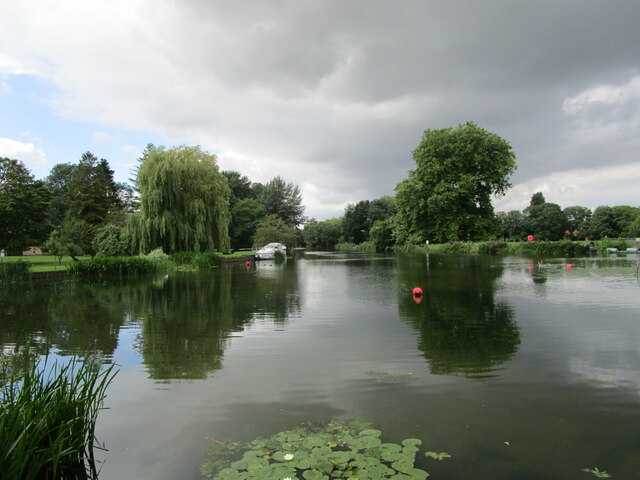
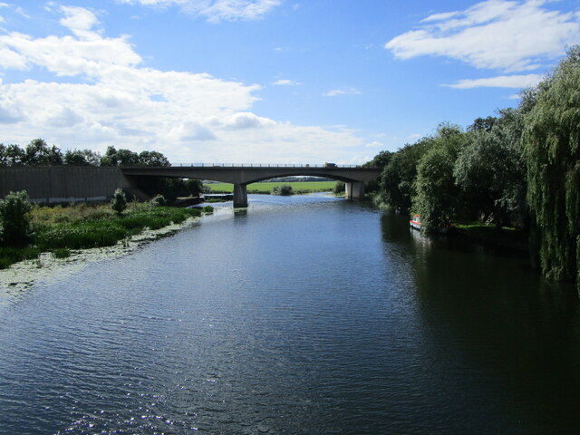
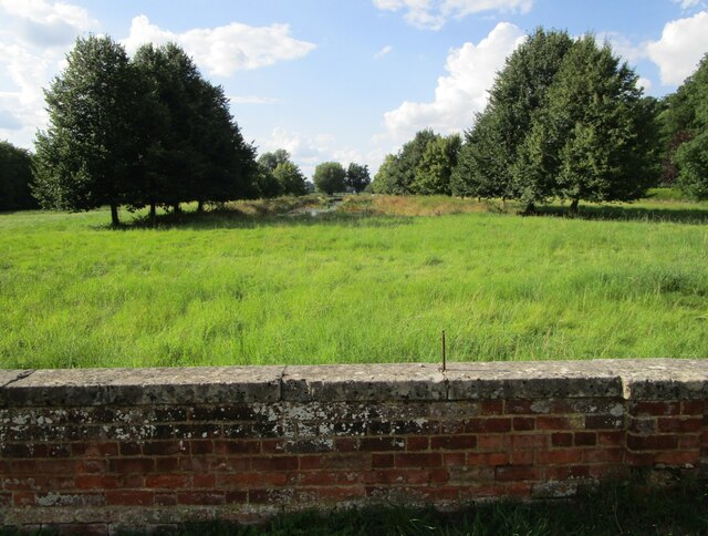
The surrounding area provides ample opportunities for outdoor activities and nature enthusiasts. Newtown is located near several nature reserves and country parks, including Hinchingbrooke Country Park, offering scenic walks and wildlife spotting. The nearby waterways, such as the Great Ouse River, are also popular for boating and fishing.

Although Newtown does not have its own shops or pubs, it is conveniently located near larger towns that offer a wider range of amenities. With its idyllic countryside setting and strong community spirit, Newtown is a peaceful and charming village that captures the essence of rural England.

If you have any feedback on the listing, please let us know in the comments section below.

Newtown Images

Images are sourced within 2km of 52.331806/-0.17354933 or Grid Reference TL2471. Thanks to Geograph Open Source API. All images are credited.

Calm water of the River Great Ouse in Huntingdon
Tree stump in the bank of the River Great Ouse in Huntingdon
The River Great Ouse at Godmanchester
The Ouse Valley Way crossing Port Holme
Port Holme and Waters Meet Waters Meet is a housing development close to a minor branch of the River Great Ouse.
Port Holme and Waters Meet
Waters Meet is a housing development close to a minor branch of the River Great Ouse.
Montague House, Huntingdon Mid eighteenth century house <span class="nowrap"><a title="https://historicengland.org.uk/listing/the-list/list-entry/1128610" rel="nofollow ugc noopener" href="https://historicengland.org.uk/listing/the-list/list-entry/1128610">Link</a><img style="margin-left:2px;" alt="External link" title="External link - shift click to open in new window" src="https://s1.geograph.org.uk/img/external.png" width="10" height="10"/></span> isolated from the town centre by the Ring Road which passes in front of it.
Montague House, Huntingdon
Mid eighteenth century house LinkExternal link isolated from the town centre by the Ring Road which passes in front of it.
The River Great Ouse at Huntingdon The bridge used to carry the A14 which has now been diverted.
The River Great Ouse at Huntingdon
The bridge used to carry the A14 which has now been diverted.
31/32 West Street, Godmanchester The former Shepherd and Dog INN. Dates from 1593 <span class="nowrap"><a title="https://historicengland.org.uk/listing/the-list/list-entry/1162411" rel="nofollow ugc noopener" href="https://historicengland.org.uk/listing/the-list/list-entry/1162411">Link</a><img style="margin-left:2px;" alt="External link" title="External link - shift click to open in new window" src="https://s1.geograph.org.uk/img/external.png" width="10" height="10"/></span>
31/32 West Street, Godmanchester
The former Shepherd and Dog INN. Dates from 1593 LinkExternal link
Canal off the River Great Ouse An ornamental feature for Farm Hall.
Canal off the River Great Ouse
An ornamental feature for Farm Hall.
Farm Hall, West Street, Godmanchester Dated to 1746 <span class="nowrap"><a title="https://historicengland.org.uk/listing/the-list/list-entry/1128580" rel="nofollow ugc noopener" href="https://historicengland.org.uk/listing/the-list/list-entry/1128580">Link</a><img style="margin-left:2px;" alt="External link" title="External link - shift click to open in new window" src="https://s1.geograph.org.uk/img/external.png" width="10" height="10"/></span>
Now subdivided.
Farm Hall, West Street, Godmanchester
Dated to 1746 LinkExternal link Now subdivided.
Crommie, the comforter In modern terms Crommie was a post traumatic stress therapy dog for British spies during WW2 <span class="nowrap"><a title="https://www.itv.com/news/anglia/2019-06-11/statue-for-crommie-the-war-time-dog-who-helped-morale-of-spies" rel="nofollow ugc noopener" href="https://www.itv.com/news/anglia/2019-06-11/statue-for-crommie-the-war-time-dog-who-helped-morale-of-spies">Link</a><img style="margin-left:2px;" alt="External link" title="External link - shift click to open in new window" src="https://s1.geograph.org.uk/img/external.png" width="10" height="10"/></span>
Crommie, the comforter
In modern terms Crommie was a post traumatic stress therapy dog for British spies during WW2 LinkExternal link
36 West Street, Godmanchester Typical cottage of this region from the sixteenth to eighteenth centuries. Not listed.
36 West Street, Godmanchester
Typical cottage of this region from the sixteenth to eighteenth centuries. Not listed.
Godmanchester Lock, River Great Ouse
The River Great Ouse below Godmanchester Lock This is the navigable channel but there are several others approached by weirs.
The River Great Ouse below Godmanchester Lock
This is the navigable channel but there are several others approached by weirs.
Seven swans a-swimming Well, one swan and six cygnets. The River Great Ouse at Godmanchester.
Seven swans a-swimming
Well, one swan and six cygnets. The River Great Ouse at Godmanchester.
The Chinese Bridge at Godmanchester The original dates from 1827 but was rebuilt in 1960 and again in 2010 <span class="nowrap"><a title="https://historicengland.org.uk/listing/the-list/list-entry/1128661" rel="nofollow ugc noopener" href="https://historicengland.org.uk/listing/the-list/list-entry/1128661">Link</a><img style="margin-left:2px;" alt="External link" title="External link - shift click to open in new window" src="https://s1.geograph.org.uk/img/external.png" width="10" height="10"/></span>
The Chinese Bridge at Godmanchester
The original dates from 1827 but was rebuilt in 1960 and again in 2010 LinkExternal link
Backwater of the River Great Ouse at Godmanchester A couple of houses on this stretch have outbuildings over the water.
Backwater of the River Great Ouse at Godmanchester
A couple of houses on this stretch have outbuildings over the water.
Backwater of the River Great Ouse at Godmanchester A couple of houses on this stretch have outbuildings over the water.
Backwater of the River Great Ouse at Godmanchester
A couple of houses on this stretch have outbuildings over the water.
Show me another place!

Newtown is located at Grid Ref: TL2471 (Lat: 52.331806, Lng: -0.17354933)

Administrative County: Cambridgeshire

District: Huntingdonshire

Police Authority: Cambridgeshire

What 3 Words

///estimate.holdings.joyously. Near Huntingdon, Cambridgeshire

Related Wikis

Huntingdon

Huntingdon is a market town in the Huntingdonshire district of Cambridgeshire, England. The town was given its town charter by King John in 1205. It was...

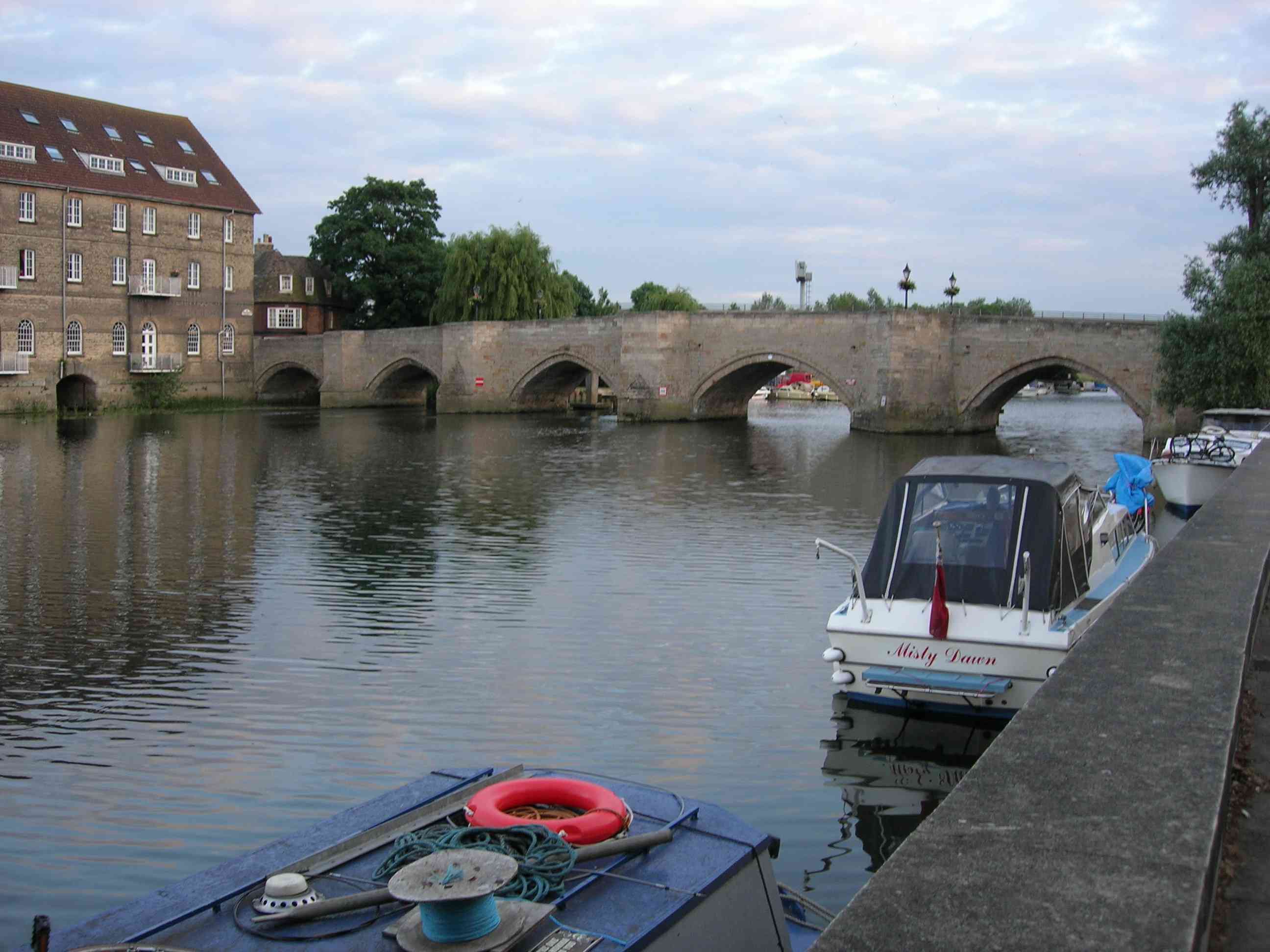
Old Bridge, Huntingdon

The Old Bridge between Huntingdon and Godmanchester (now part of Cambridgeshire, England) is a well-preserved medieval stone bridge over the River Great...

St Mary's Church, Huntingdon

St Mary's Church is located in Huntingdon, Cambridgeshire, England. The church is said to have been the "Mother Church of Huntingdon". It occupies what...

Huntingdon Community Radio

Huntingdon Community Radio is a community radio station operating from studios in Huntingdonshire, Cambridgeshire, England. It was awarded a broadcast...

Nearby Amenities

Located within 500m of 52.331806,-0.17354933
Traffic Signals
Lat/Long: 52.331324/-0.1782996
Traffic Signals
Lat/Long: 52.3316574/-0.1794522
Turning Circle
Lat/Long: 52.3360584/-0.171731
Post Box
Brand: Royal Mail
Brand Wikidata: Q638098
Collection Times: Mo-Fr 09:00; Sa 07:00
Operator: Royal Mail
Operator Wikidata: Q638098
Post Box Type: pillar
Ref: PE29 16D
Royal Cypher: GR
Royal Cypher Wikidata: Q33102273
Source: survey
Lat/Long: 52.3333043/-0.1800257
Bus Stop
Bus: yes
Public Transport: platform
Lat/Long: 52.3332629/-0.1767904
Recycling
Lat/Long: 52.3312019/-0.1739917
Traffic Signals
Crossing: traffic_signals
Crossing Ref: toucan
Lat/Long: 52.3312244/-0.1748544
Crossing
Lat/Long: 52.3320785/-0.1807366
Bus Stop
Bus: yes
Public Transport: platform
Lat/Long: 52.3359627/-0.1754091
Post Box
Lat/Long: 52.3356599/-0.1760526
Kindergarten
Playday Nursery
Lat/Long: 52.3353294/-0.1716233
Post Box
Lat/Long: 52.3324498/-0.1720611
Barrier: lift_gate
Lat/Long: 52.3300867/-0.1764716
Crossing
Crossing: unmarked
Crossing Markings: no
Kerb: lowered
Tactile Paving: yes
Lat/Long: 52.3312785/-0.1783238
Pub
The Montagu
Note: sic: no e on Montagu
Lat/Long: 52.3300962/-0.1799555
Bus Stop
Drivers Avenue
Bus: yes
Naptan AtcoCode: 0500HHUNT024
Naptan Bearing: NE
Naptan CommonName: Drivers Avenue
Naptan Indicator: opp
Naptan Landmark: Drivers Avenue
Naptan NaptanCode: cmbdpgwp
Naptan ShortCommonName: Drivers Avenue
Naptan Street: American Lane
Naptan Verified: no
Public Transport: platform
Source: naptan_import
Lat/Long: 52.3359403/-0.1755737
Bus Stop
East Street
Bus: yes
Naptan AtcoCode: 0500HHUNT030
Naptan Bearing: SW
Naptan CommonName: East Street
Naptan Indicator: opp
Naptan Landmark: East Street
Naptan NaptanCode: cmbdpjap
Naptan ShortCommonName: East Street
Naptan Street: Hartford Road
Naptan Verified: no
Public Transport: platform
Source: naptan_import
Lat/Long: 52.3322569/-0.1722908
Bus Stop
East Street
Bus: yes
Naptan AtcoCode: 0500HHUNT074
Naptan Bearing: NE
Naptan CommonName: East Street
Naptan Indicator: near
Naptan Landmark: East Street
Naptan NaptanCode: cmbdpjwt
Naptan ShortCommonName: East Street
Naptan Street: Hartford Road
Naptan Verified: no
Public Transport: platform
Shelter: no
Source: naptan_import
Lat/Long: 52.3321397/-0.1728534
Bus Stop
Primrose Lane
Bus: yes
Naptan AtcoCode: 0500HHUNT087
Naptan Bearing: NW
Naptan CommonName: Primrose Lane
Naptan Indicator: opp No 30 - 32
Naptan Landmark: Primrose Lane
Naptan NaptanCode: cmbdpmdt
Naptan ShortCommonName: Primrose Lane
Naptan Street: Primrose Lane
Naptan Verified: no
Public Transport: platform
Source: naptan_import
Lat/Long: 52.3331281/-0.1767352
Parking
gym parking
Lat/Long: 52.3354624/-0.1694907
Recycling
Lat/Long: 52.3308459/-0.1803959
Traffic Signals
Lat/Long: 52.3304352/-0.1754373
Traffic Signals
Lat/Long: 52.3304702/-0.1756459
Shop: hairdresser
Lat/Long: 52.3289993/-0.1770554
Bench
Lat/Long: 52.3296003/-0.1779496
Bench
Lat/Long: 52.3303132/-0.1750992
Bench
Lat/Long: 52.3312088/-0.1712431
Bench
Lat/Long: 52.3306056/-0.1740325
Bench
Lat/Long: 52.3307281/-0.1736635
Bench
Lat/Long: 52.3308482/-0.172273
Bench
Lat/Long: 52.3296746/-0.1781471
Bbq
Lat/Long: 52.3304122/-0.1748533
Bench
Lat/Long: 52.3322164/-0.1706111
Bench
Lat/Long: 52.3327294/-0.1697287
Barrier: yes
Lat/Long: 52.3313662/-0.1781312
Power: pole
Lat/Long: 52.3275743/-0.1728998
Power: pole
Lat/Long: 52.3276225/-0.1718012
Power: pole
Lat/Long: 52.3274887/-0.1752041
Power: pole
Lat/Long: 52.3275233/-0.1740668
Barrier: lift_gate
Lat/Long: 52.3309801/-0.1774264
Crossing
Crossing: traffic_signals
Tactile Paving: yes
Lat/Long: 52.3313279/-0.1783198
Leisure: slipway
Source: local knowledge
Lat/Long: 52.3305744/-0.1733276
Bench
Lat/Long: 52.3341423/-0.1782588
Turning Circle
Lat/Long: 52.3325191/-0.178929
Turning Circle
Lat/Long: 52.3322477/-0.1780925
Traffic Signals
Traffic Signals: signal
Lat/Long: 52.331545/-0.1790789
Parking
Disabled: designated
Lat/Long: 52.330634/-0.1805513
Crossing
Crossing: zebra
Lat/Long: 52.3318395/-0.1808158
Barrier: kissing_gate
Lat/Long: 52.3323189/-0.1717761
Power: pole
Lat/Long: 52.3274817/-0.1754925
Bench
Lat/Long: 52.3285572/-0.1762878
Bench
Lat/Long: 52.329193/-0.1756733
Bench
Lat/Long: 52.3290539/-0.1757902
Crossing
Lat/Long: 52.3317425/-0.1807676
Newtown
Place: suburb
Source: Local Knowledge
Lat/Long: 52.3327431/-0.1741077
Toilets
Lat/Long: 52.3311902/-0.173661
Cafe
Lat/Long: 52.3311914/-0.173555
Noexit: yes
Lat/Long: 52.3312898/-0.1794282
Traffic Signals
Crossing: traffic_signals
Crossing Ref: toucan
Lat/Long: 52.3311971/-0.174787
Bench
Lat/Long: 52.3309614/-0.1773549
Leisure: playground
Lat/Long: 52.3309031/-0.1769369
Barrier: bollard
Motor Vehicle: no
Lat/Long: 52.3296832/-0.1782581
Give Way
Direction: forward
Lat/Long: 52.3301502/-0.1772367
Man Made: charge_point
Operator: smartcharge
Lat/Long: 52.3314763/-0.180718
Man Made: charge_point
Operator: smartcharge
Lat/Long: 52.3315401/-0.1808273
Man Made: charge_point
Operator: smartcharge
Lat/Long: 52.3315202/-0.1807914
Man Made: charge_point
Operator: smartcharge
Lat/Long: 52.3314968/-0.1807498
Man Made: charge_point
Operator: smartcharge
Lat/Long: 52.3314565/-0.180686
Man Made: charge_point
Operator: smartcharge
Lat/Long: 52.3314346/-0.1806457
The data included in this document is from www.openstreetmap.org. The data is made available under ODbL.

Have you been to Newtown?

Leave your review of Newtown below (or comments, questions and feedback).