Brockham Big Field

Heritage Site in Surrey

England

Brockham Big Field

Reigate Road A24 Main road towards Reigate.

Info - <span class="nowrap"><a title="https://en.wikipedia.org/wiki/A24_road_(England)" rel="nofollow ugc noopener" href="https://en.wikipedia.org/wiki/A24_road_(England)">Link</a><img style="margin-left:2px;" alt="External link" title="External link - shift click to open in new window" src="https://s1.geograph.org.uk/img/external.png" width="10" height="10"/></span>
Reigate Road A24 Credit: James Emmans

Brockham Big Field, located in the county of Surrey, England, is a significant heritage site known for its historical and cultural importance. Spanning over an area of approximately 82 acres, this field holds a rich and diverse history that dates back centuries.

The field itself is a designated Scheduled Ancient Monument, recognized for its archaeological significance. It is believed to have been an important agricultural landscape since the Bronze Age, with evidence of ancient field systems and trackways still visible today. The field's historical importance is further accentuated by the presence of several ancient barrows, burial mounds that provide insights into the lives and customs of early communities in the area.

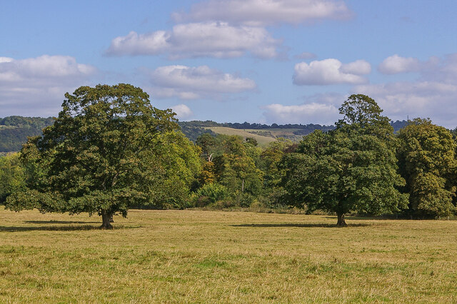
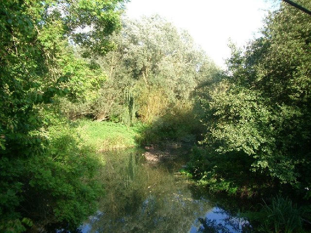
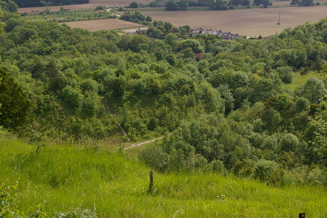
In addition to its archaeological value, Brockham Big Field is also renowned for its natural beauty and biodiversity. The field boasts a variety of habitats, including grassland, woodland, and wetland areas, which support a wide range of plant and animal species. This makes it an important site for nature enthusiasts and conservationists alike.

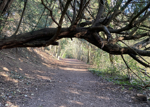
Visitors to Brockham Big Field can enjoy leisurely walks, exploring the numerous footpaths that crisscross the area. The field's tranquil ambiance and panoramic views make it an ideal spot for picnics, photography, and simply appreciating the surrounding countryside.

Overall, Brockham Big Field stands as a testament to the rich history and natural heritage of Surrey. Its archaeological significance, coupled with its stunning landscapes, make it an essential destination for those seeking to immerse themselves in the region's past and present.

If you have any feedback on the listing, please let us know in the comments section below.

Brockham Big Field Images

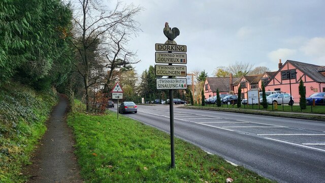
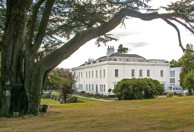
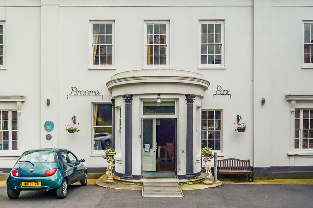
Images are sourced within 2km of 51.238/-0.285 or Grid Reference TQ1950. Thanks to Geograph Open Source API. All images are credited.

Reigate Road A24 Main road towards Reigate.

Info - <span class="nowrap"><a title="https://en.wikipedia.org/wiki/A24_road_(England)" rel="nofollow ugc noopener" href="https://en.wikipedia.org/wiki/A24_road_(England)">Link</a><img style="margin-left:2px;" alt="External link" title="External link - shift click to open in new window" src="https://s1.geograph.org.uk/img/external.png" width="10" height="10"/></span>
Reigate Road A24
Main road towards Reigate. Info - LinkExternal link
A25 main road towards Dorking Autumnal trees with Ivy growth.
A25 main road towards Dorking
Autumnal trees with Ivy growth.
Large field next to a steep Bridleway Pylons leading to Chalkpit Lane.
Large field next to a steep Bridleway
Pylons leading to Chalkpit Lane.
Woodland path on the Brockham Hills National Trust maintenance crew working hard.
Woodland path on the Brockham Hills
National Trust maintenance crew working hard.
South easterly view from Box Hill On the southerly escarpment near Oak Wood.
South easterly view from Box Hill
On the southerly escarpment near Oak Wood.
Dorking Sign Entering the Surrey market town, close to The Watermill public house.
Dorking Sign
Entering the Surrey market town, close to The Watermill public house.
Pylons close to the Pilgrim's Way
Surrey public footpath 38, Box Hill Along the top of the downs, parallel with Zig Zag Road.
Surrey public footpath 38, Box Hill
Along the top of the downs, parallel with Zig Zag Road.
Carriage Drive to Oakwood House This track is the former carriage drive to Oakwood House at the top of the hill. The drive begins at the public road at Boxhurst, about 1km to the west, and ascends at a very gentle average gradient of about 1:15, before arriving at a now disused gate into Oakwood House. This section here is the best preserved, now briefly forming part of the North Downs Way as footpath Brockham 583. It is still noticeably metalled (i.e. having a stone surface).
Carriage Drive to Oakwood House
This track is the former carriage drive to Oakwood House at the top of the hill. The drive begins at the public road at Boxhurst, about 1km to the west, and ascends at a very gentle average gradient of about 1:15, before arriving at a now disused gate into Oakwood House. This section here is the best preserved, now briefly forming part of the North Downs Way as footpath Brockham 583. It is still noticeably metalled (i.e. having a stone surface).
Broome Park Dating originally from the early 19th Century and once home to Queen Victoria's surgeon, Sir Benjamin Collins Brodie, Broome Park is now a nursing home.  Grade II listed - see <span class="nowrap"><a title="www.historicengland.org.uk/listing/the-list/list-entry/1293763" rel="nofollow ugc noopener" href="http://www.historicengland.org.uk/listing/the-list/list-entry/1293763">Link</a><img style="margin-left:2px;" alt="External link" title="External link - shift click to open in new window" src="https://s1.geograph.org.uk/img/external.png" width="10" height="10"/></span>.
Broome Park
Dating originally from the early 19th Century and once home to Queen Victoria's surgeon, Sir Benjamin Collins Brodie, Broome Park is now a nursing home. Grade II listed - see LinkExternal link.
Entrance, Broome Park Entrance to Broome Park.  The house dates originally from the early 19th Century and was once home to Queen Victoria's surgeon, Sir Benjamin Collins Brodie (a blue plaque referring to this can be seen towards the left of the photo - see <a href="https://www.geograph.org.uk/photo/7013127">TQ2150 : Blue plaque, Broome Park</a> for a close up).  It is now a nursing home.  See <a href="https://www.geograph.org.uk/photo/7013052">TQ2150 : Broome Park</a> for a photo of the whole house.
Entrance, Broome Park
Entrance to Broome Park. The house dates originally from the early 19th Century and was once home to Queen Victoria's surgeon, Sir Benjamin Collins Brodie (a blue plaque referring to this can be seen towards the left of the photo - see TQ2150 : Blue plaque, Broome Park for a close up). It is now a nursing home. See TQ2150 : Broome Park for a photo of the whole house.
Blue plaque, Broome Park Blue plaque near the entrance to Broome Park, commemorating the house having been hone to Queen Victoria's surgeon, Sir Benjamin Collins Brodie.  The other plaque  is in recognition of the grade II listing of the house.  See <a href="https://www.geograph.org.uk/photo/7013126">TQ2150 : Entrance, Broome Park</a> for a wider view and <a href="https://www.geograph.org.uk/photo/7013052">TQ2150 : Broome Park</a> for a photo of the whole house.
Blue plaque, Broome Park
Blue plaque near the entrance to Broome Park, commemorating the house having been hone to Queen Victoria's surgeon, Sir Benjamin Collins Brodie. The other plaque is in recognition of the grade II listing of the house. See TQ2150 : Entrance, Broome Park for a wider view and TQ2150 : Broome Park for a photo of the whole house.
Parkland, Broome Park Looking across parkland at Broome Park, with Colley Hill in the distance.
Parkland, Broome Park
Looking across parkland at Broome Park, with Colley Hill in the distance.
North Lodge Lodge to Broome Park.
North Lodge
Lodge to Broome Park.
River Mole near Dorking looking east from Boxhill Bridge
River Mole near Dorking
looking east from Boxhill Bridge
The bridge which carries White Road (a bridleway) over the railway near Brockham looking south
The bridge which carries White Road (a bridleway) over the railway near Brockham
looking south
The entrance to Hillcrest at Box Hill village looking south-east from the north side of Boxhill Road
The entrance to Hillcrest at Box Hill village
looking south-east from the north side of Boxhill Road
Wheelers Lane, Brockham looking north at the junction with Oakdene Road
Wheelers Lane, Brockham
looking north at the junction with Oakdene Road
Show me another place!

Brockham Big Field is located at Grid Ref: TQ1950 (Lat: 51.238, Lng: -0.285)

What 3 Words

///dust.appear.terms. Near Dorking, Surrey

Related Wikis

Brockham

Brockham is a village and civil parish in the Mole Valley district of Surrey, England. It is approximately 1.5 miles (2.4 km) east of Dorking and 4 miles...
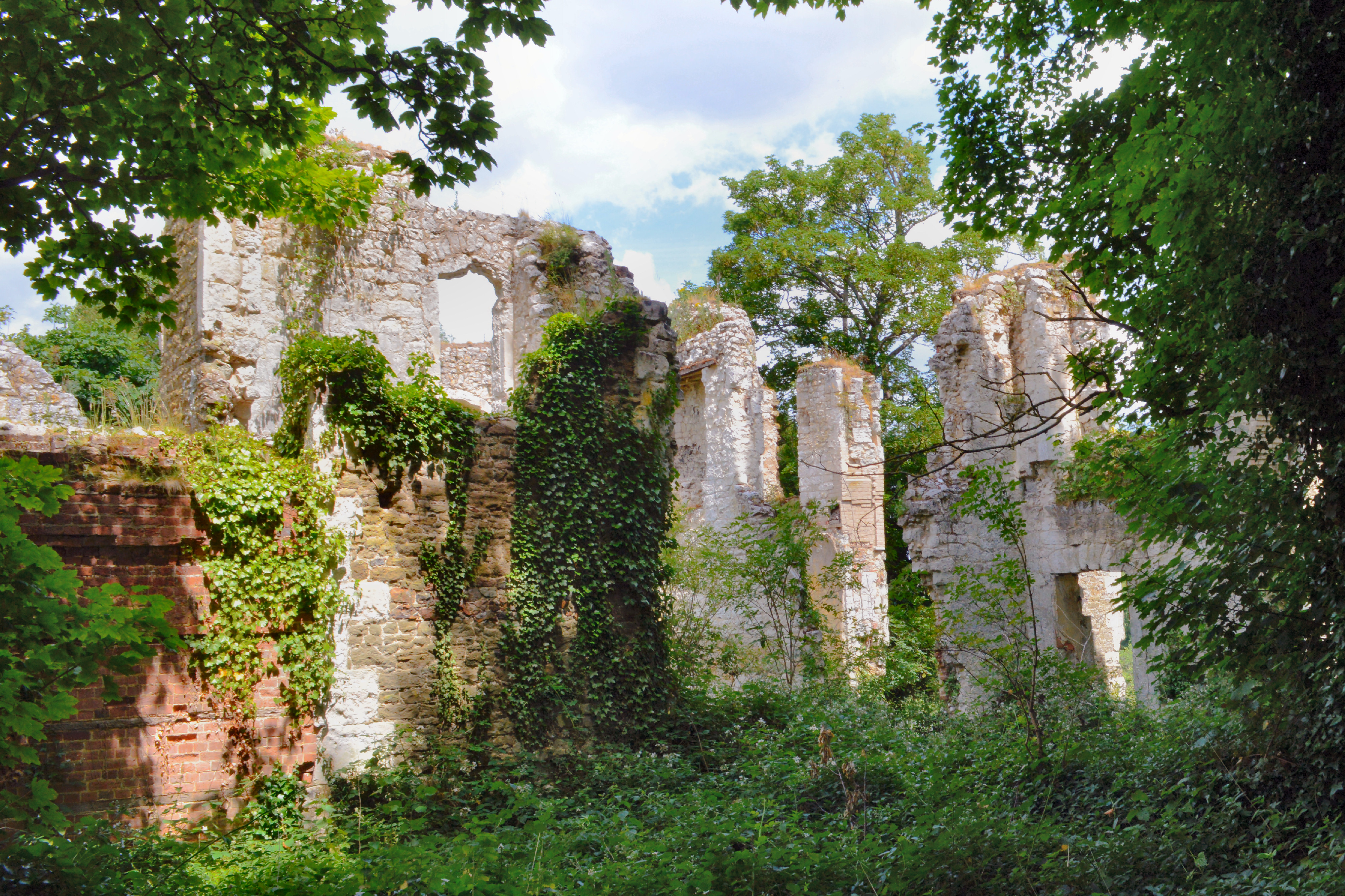
Betchworth Castle

Betchworth Castle is a mostly crumbled ruin of a fortified medieval stone house with some tall, two-storey corners strengthened in the 18th century, in...

Brockham Limeworks

Brockham Limeworks is a 45-hectare (110-acre) nature reserve north of Brockham in Surrey. It is owned by Surrey County Council. Part of it is a Scheduled...

Betchworth

Betchworth is a village and civil parish in the Mole Valley district of Surrey, England. The village centre is on the north bank of the River Mole and...

Nearby Amenities

Located within 500m of 51.238,-0.285
Post Box
Ref: RH3 193
Source: Photo P142-0248
Lat/Long: 51.2366261/-0.2820895
Pub
The Arkle Manor
Addr City: Betchworth
Addr Postcode: RH3 7HB
Addr Street: Reigate Road
Building: yes
Opening Hours: Su-Th 11:00-22:00; Fr-Sa 11:00-23:00
Phone: +44 1737 842110
Toilets Wheelchair: yes
Website: https://www.thearklemanor.co.uk/
Wheelchair: yes
Lat/Long: 51.2400532/-0.2836248
Crossing
Crossing: unmarked
Lat/Long: 51.2406134/-0.2826181
Dorking Rugby Club
Sport: rugby
Lat/Long: 51.2368911/-0.2841559
Railway: level_crossing
Lat/Long: 51.2420266/-0.2852009
Bus Stop
Arkle Manor
Bus: yes
Naptan AtcoCode: 40004408046A
Naptan Bearing: E
Naptan CommonName: Arkle Manor
Naptan Indicator: Just after
Naptan Landmark: Arkle Manor
Naptan NaptanCode: surawptd
Naptan Street: Reigate Road
Naptan Verified: no
Physically Present: no
Public Transport: platform
Source: naptan_import;survey
Wheelchair: yes
Wheelchair Description: Tactile, step-free island crossing to opposite stop just to east
Lat/Long: 51.2406916/-0.282535
Bus Stop
Arkle Manor
Naptan AtcoCode: 40004408046B
Naptan Bearing: SW
Naptan CommonName: Arkle Manor
Naptan Indicator: Just Before
Naptan Landmark: Arkle Manor
Naptan NaptanCode: surawptg
Naptan Street: Reigate Road
Naptan Verified: no
Public Transport: platform
Source: naptan_import;survey
Wheelchair: yes
Wheelchair Description: Tactile, step-free island crossing to opposite stop just to east
Lat/Long: 51.2405089/-0.2827749
Bus Stop
Nutwood Avenue
Bench: yes
Bus: yes
Naptan AtcoCode: 40004408047A
Naptan Bearing: SW
Naptan CommonName: Nutwood Avenue
Naptan Indicator: Just after
Naptan Landmark: Nutwood Avenue
Naptan NaptanCode: surawptj
Naptan Street: Kiln Lane
Naptan Verified: yes
Public Transport: platform
Shelter: yes
Source: naptan_import
Wheelchair: limited
Lat/Long: 51.2364325/-0.2823749
Bus Stop
Nutwood Avenue
Bench: no
Naptan AtcoCode: 40004408047B
Naptan Bearing: NE
Naptan BusStopType: CUS
Naptan CommonName: Nutwood Avenue
Naptan Indicator: Just before
Naptan Landmark: Nutwood Avenue
Naptan NaptanCode: surgtamj
Naptan Street: Kiln Lane
Naptan Verified: yes
Note: No bus stop sign on this side
Physically Present: no
Public Transport: platform
Shelter: no
Source: naptan_import
Wheelchair: no
Lat/Long: 51.2365148/-0.2825408
Bus Stop
Kiln Lane
Bench: no
Bin: no
Lit: no
Naptan AtcoCode: 40004408048A
Naptan Bearing: N
Naptan CommonName: Kiln Lane
Naptan Indicator: Opp
Naptan Landmark: Kiln Lane
Naptan NaptanCode: surawptm
Naptan Street: Brockham Lane
Naptan Verified: yes
Public Transport: platform
Shelter: no
Source: naptan_import
Tactile Paving: no
Lat/Long: 51.2347457/-0.2886913
Bus Stop
Kiln Lane
Naptan AtcoCode: 40004408048C
Naptan Bearing: S
Naptan CommonName: Kiln Lane
Naptan Indicator: adj
Naptan Landmark: Kiln Lane
Naptan NaptanCode: surawptp
Naptan Street: Brockham Lane
Naptan Verified: yes
Public Transport: platform
Source: naptan_import
Lat/Long: 51.2354127/-0.2885582
Bus Stop
The Avenue
Bench: no
Bin: yes
Naptan AtcoCode: 40004408049A
Naptan Bearing: SE
Naptan CommonName: The Avenue
Naptan Indicator: Just after
Naptan Landmark: The Avenue
Naptan NaptanCode: surawptw
Naptan Street: Brockham Lane
Naptan Verified: yes
Public Transport: platform
Shelter: no
Source: naptan_import
Lat/Long: 51.2391674/-0.2897226
Bus Stop
The Avenue
Bench: yes
Bin: yes
Naptan AtcoCode: 40004408049B
Naptan Bearing: NW
Naptan CommonName: The Avenue
Naptan Indicator: Just Before
Naptan Landmark: The Avenue
Naptan NaptanCode: surawpwa
Naptan Street: Brockham Lane
Naptan Verified: yes
Public Transport: platform
Shelter: yes
Source: naptan_import
Lat/Long: 51.2388371/-0.2897273
Fire Hydrant
Emergency: fire_hydrant
Fire Hydrant Type: underground
Lat/Long: 51.2410362/-0.2880755
Post Box
Ref: RH3 264
Source: Photo P142-0254
Lat/Long: 51.2380542/-0.2891835
Fire Hydrant
Emergency: fire_hydrant
Fire Hydrant Diameter: 75
Fire Hydrant Position: lane
Fire Hydrant Type: underground
Source: P142-0245
Lat/Long: 51.2368155/-0.280723
Fire Hydrant
Emergency: fire_hydrant
Fire Hydrant Type: underground
Lat/Long: 51.2401805/-0.2849598
Barrier: stile
Lat/Long: 51.2407168/-0.282669
Kiln Lane
Bus: yes
Public Transport: stop_position
Lat/Long: 51.2354301/-0.288654
Grit Bin
Lat/Long: 51.2364912/-0.2820619
Railway: level_crossing
Lat/Long: 51.2420646/-0.2851466
Stoney Croft Farm
Place: farm
Lat/Long: 51.2413196/-0.2868483
Nutwood Avenue
Bus: yes
Public Transport: stop_position
Lat/Long: 51.2364985/-0.2823941
Nutwood Avenue
Bus: yes
Public Transport: stop_position
Lat/Long: 51.2364753/-0.2825205
Kiln Lane
Bus: yes
Public Transport: stop_position
Lat/Long: 51.2347432/-0.288609
The Avenue
Bus: yes
Public Transport: stop_position
Lat/Long: 51.2388506/-0.2896065
The Avenue
Bus: yes
Public Transport: stop_position
Lat/Long: 51.2391561/-0.2897801
Arkle Manor
Bus: yes
Public Transport: stop_position
Lat/Long: 51.2405588/-0.282807
Power: pole
Source: gps;Bing
Lat/Long: 51.2373362/-0.2786091
Bench
Backrest: yes
Source: survey
Lat/Long: 51.2344913/-0.2829194
Crossing
Crossing: unmarked
Crossing Island: yes
Tactile Paving: yes
Wheelchair: yes
Lat/Long: 51.240814/-0.2818522
Crossing
Crossing: unmarked
Crossing Island: no
Tactile Paving: yes
Lat/Long: 51.240684/-0.2821013
Arkle Manor
Bus: yes
Public Transport: stop_position
Lat/Long: 51.2406477/-0.2824897
Bunker Type: pillbox
Military: bunker
Source: survey
Lat/Long: 51.2346063/-0.2823843
Crossing
Lat/Long: 51.240184/-0.2849503
Dorking Tool Hire
Shop: tool_hire
Lat/Long: 51.2404891/-0.2819268
Bench
Backrest: no
Seats: 2
Lat/Long: 51.2345929/-0.2823575
The data included in this document is from www.openstreetmap.org. The data is made available under ODbL.

Have you been to Brockham Big Field?

Leave your review of Brockham Big Field below (or comments, questions and feedback).