Braithwaite Hall
Heritage Site in Yorkshire Richmondshire
England
Braithwaite Hall

Braithwaite Hall, located in the scenic county of Yorkshire, is a historic heritage site that holds significant cultural and architectural value. Situated amidst the breathtaking beauty of the Yorkshire Dales National Park, the hall is an emblem of Yorkshire's rich history and charm.
Dating back to the 14th century, Braithwaite Hall was originally a fortified tower house that served as a defensive structure during medieval times. Over the years, it underwent various expansions and renovations, resulting in the hall's current appearance, which blends elements of medieval, Tudor, and Georgian architecture.
The hall's exterior features striking stone walls, mullioned windows, and a grand entrance adorned with a beautiful wooden door. Inside, visitors are greeted with a mix of elegantly decorated rooms that showcase the hall's rich heritage. Intricate woodwork, ornate fireplaces, and antique furniture contribute to the hall's unique character and provide a glimpse into its past.
Surrounded by lush greenery, the hall is set within well-maintained gardens and offers breathtaking views of the Yorkshire Dales. The grounds also feature a charming courtyard, a picturesque pond, and well-manicured lawns that provide an inviting atmosphere for visitors to explore and relax.
Now managed by a heritage organization, Braithwaite Hall is open to the public, offering guided tours and educational exhibits that delve into the history of the site and the surrounding area. It stands as a testament to Yorkshire's rich architectural heritage and continues to be a beloved destination for history enthusiasts and nature lovers alike.
If you have any feedback on the listing, please let us know in the comments section below.
Braithwaite Hall Images
Images are sourced within 2km of 54.267/-1.822 or Grid Reference SE1185. Thanks to Geograph Open Source API. All images are credited.


Braithwaite Hall is located at Grid Ref: SE1185 (Lat: 54.267, Lng: -1.822)
Division: North Riding
Administrative County: North Yorkshire
District: Richmondshire
Police Authority: North Yorkshire
What 3 Words
///copycat.geek.scrubber. Near Leyburn, North Yorkshire
Nearby Locations
Related Wikis
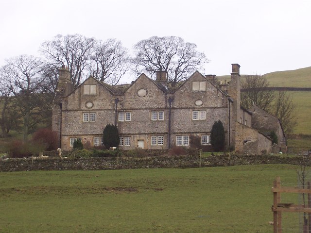
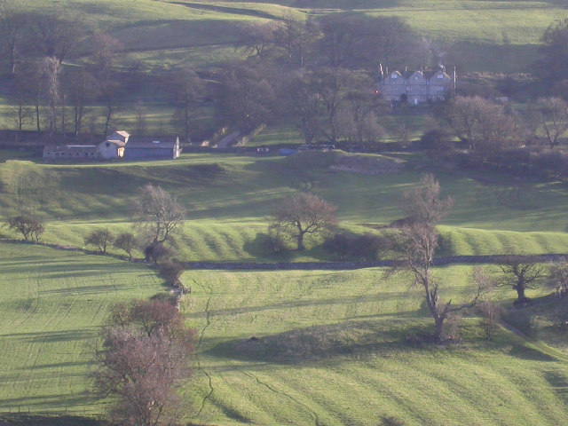
Braithwaite Hall
Braithwaite Hall is a 17th-century manor house in Coverdale in the Yorkshire Dales in England. It lies 1.8 miles (2.9 km) west of the village of East...

Coverham Abbey
Coverham Abbey, North Yorkshire, England, was a Premonstratensian monastery that was founded at Swainby in 1190 by Helewisia, daughter of the Chief Justiciar...
Coverham
Coverham is a village in Coverdale in the Yorkshire Dales in North Yorkshire, England. It lies 2 miles (3.2 km) west of the town of Middleham. == History... ==

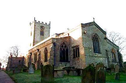
Holy Trinity Church, Coverham
Holy Trinity Church is a redundant Anglican church in the village of Coverham, North Yorkshire, England. It is recorded in the National Heritage List...
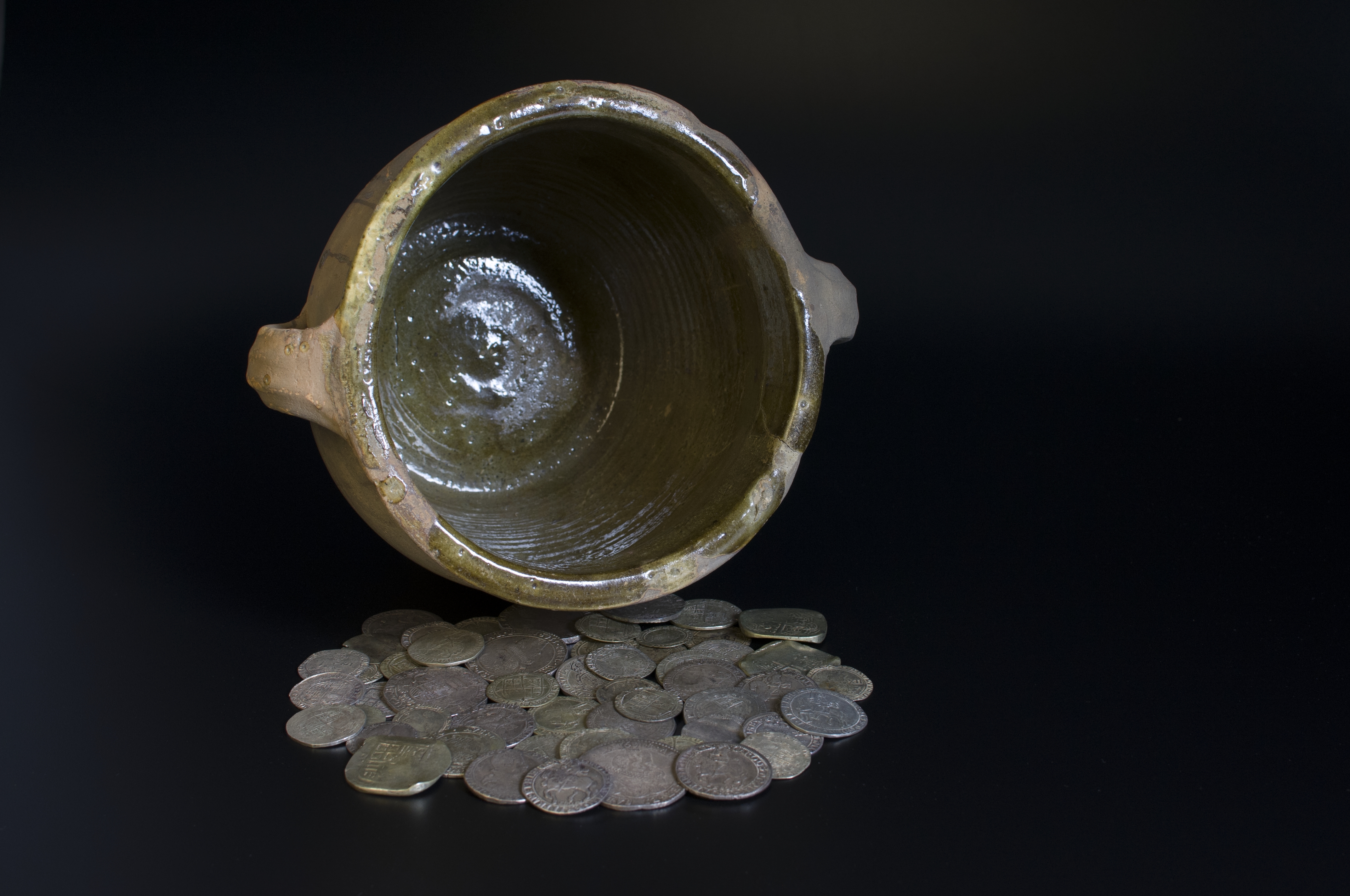
Middleham Hoard
The Middleham Hoard is a coin hoard found near Middleham, North Yorkshire in England. It dates from the period of the English Civil War, and consists of...

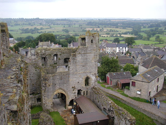
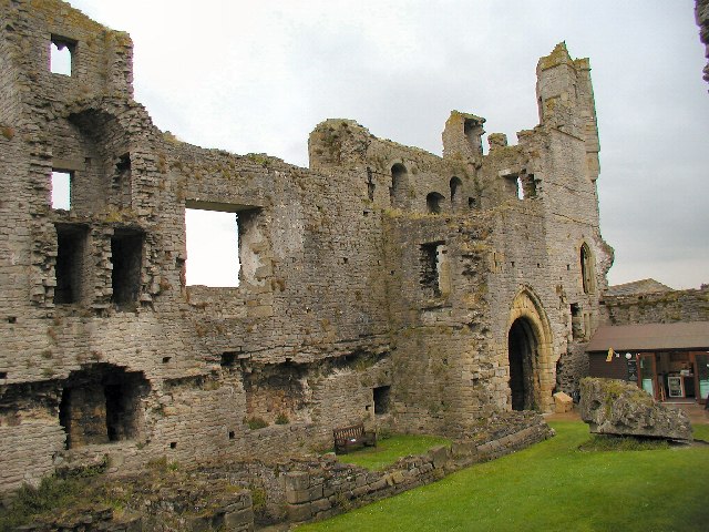
Middleham Castle
Middleham Castle is a ruined castle in Middleham in Wensleydale, in the county of North Yorkshire, England. It was built by Robert Fitzrandolph, 3rd Lord...

Middleham
Middleham is a market town and civil parish in the district and county of North Yorkshire, England. It lies in Wensleydale in the Yorkshire Dales, on...
Church of St Mary and St Alkelda, Middleham
The Church of St Mary and St Alkelda is a Church of England parish church in Middleham, Richmondshire, North Yorkshire. The church is a grade I listed...
Nearby Amenities
Located within 500m of 54.267,-1.822Have you been to Braithwaite Hall?
Leave your review of Braithwaite Hall below (or comments, questions and feedback).