Mellor

Settlement in Derbyshire

England

Mellor

Marple Marple junction.  The Macclesfield Canal emerges from the bridge on the left to join the Peak Forest Canal.
Marple Credit: David Stowell

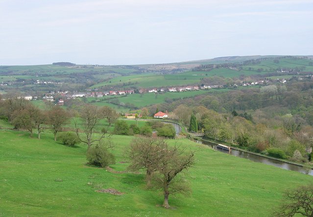
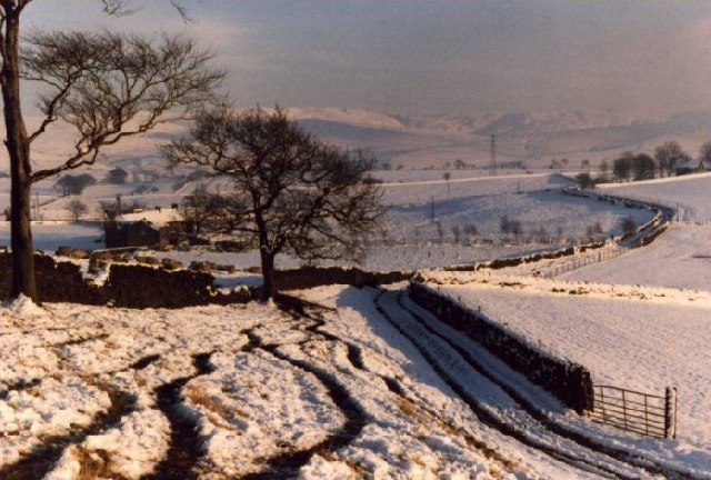
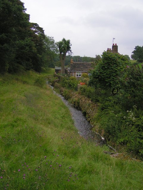
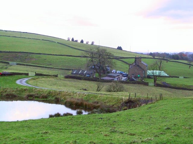
Mellor is a small village located in the county of Derbyshire, England. Situated in the heart of the Peak District National Park, it offers breathtaking natural scenery and a tranquil atmosphere. The village is nestled on the western slopes of the Lower Derwent Valley, providing residents and visitors with stunning views of the surrounding countryside.

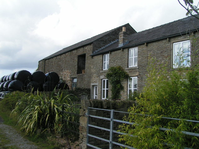
Historically, Mellor was primarily an agricultural community, with evidence of settlements dating back to the Bronze Age. Today, it remains a rural village with a strong sense of community and a population of around 1,000 inhabitants.

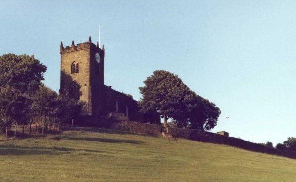
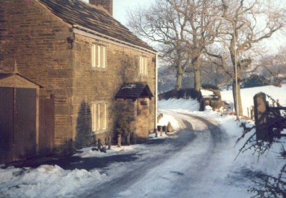
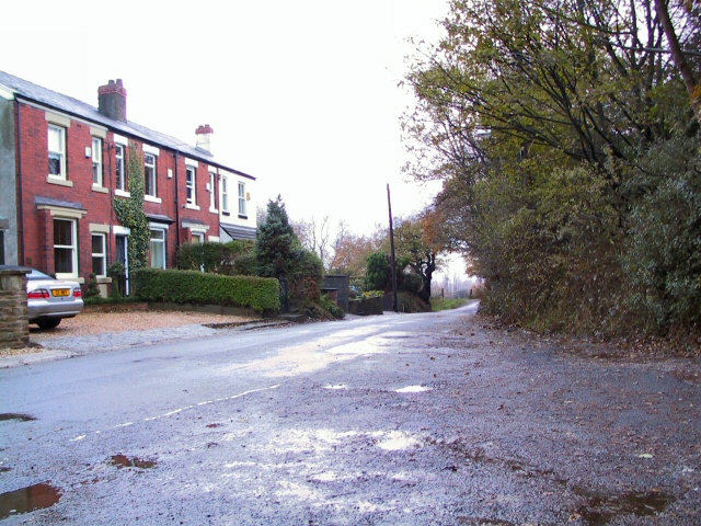
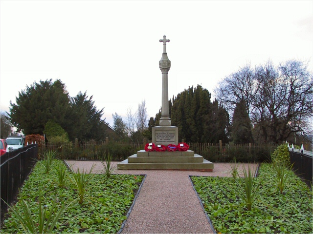
The village is renowned for its picturesque stone cottages, many of which date back to the 17th and 18th centuries, adding to its charm. The local church, St. Mary's, is a prominent feature and serves as a focal point for the community.

Despite its small size, Mellor offers a range of amenities to cater to the needs of its residents. These include a primary school, village hall, and a few local shops and pubs. The village also benefits from its proximity to nearby towns such as New Mills and Marple, which provide additional services and amenities.

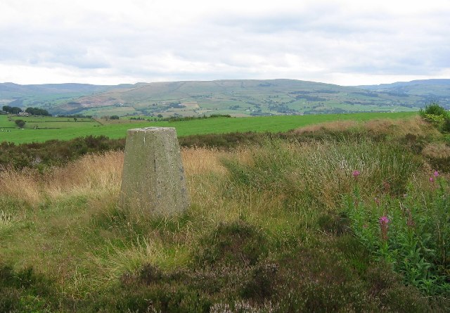
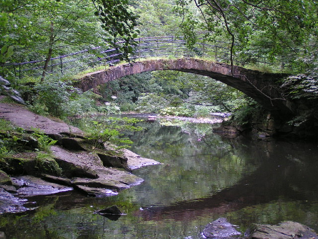
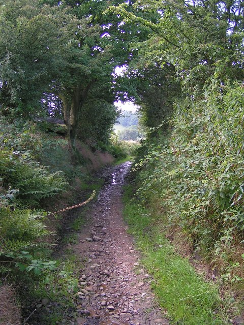
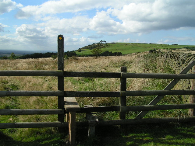
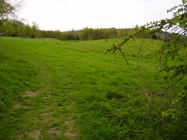
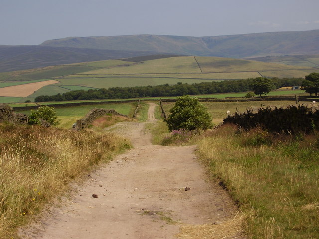
For outdoor enthusiasts, Mellor is a haven. It boasts numerous walking and cycling routes, allowing visitors to explore the stunning countryside and take in the panoramic views. The nearby Mellor Moor offers opportunities for hiking, while the picturesque Mellor Mill, a former cotton spinning mill, is a popular spot for history enthusiasts.

In conclusion, Mellor is a charming village in Derbyshire, known for its natural beauty, historic architecture, and strong community spirit. It provides a peaceful retreat for residents and a delightful destination for visitors seeking a glimpse into the idyllic English countryside.

If you have any feedback on the listing, please let us know in the comments section below.

Mellor Images

Images are sourced within 2km of 53.39332/-2.029291 or Grid Reference SJ9888. Thanks to Geograph Open Source API. All images are credited.

Marple Marple junction.  The Macclesfield Canal emerges from the bridge on the left to join the Peak Forest Canal.
Marple
Marple junction. The Macclesfield Canal emerges from the bridge on the left to join the Peak Forest Canal.
Mellor Moor Out chasing trigs when I came across this tiny parcel of surviving moorland. Good berries and views too.
Mellor Moor
Out chasing trigs when I came across this tiny parcel of surviving moorland. Good berries and views too.
Peak Forest Canal The Peak Forest canal runs through parkland just outside Marple.
Peak Forest Canal
The Peak Forest canal runs through parkland just outside Marple.
Mellor Church The church stands aloof from the village on its own special hill.  Recently, traces of an iron age settlement have been discovered behind the church.
Mellor Church
The church stands aloof from the village on its own special hill. Recently, traces of an iron age settlement have been discovered behind the church.
A winter's day on Cobden Edge, Mellor The land rises ahead to just over 1000 feet, and is now crowned with a cross erected by Churches Together in Marple and District.
A winter's day on Cobden Edge, Mellor
The land rises ahead to just over 1000 feet, and is now crowned with a cross erected by Churches Together in Marple and District.
A cottage at Tarden, Mellor, in the snow The little building between the first two trees is an old well which used to serve the cottages with their water.
A cottage at Tarden, Mellor, in the snow
The little building between the first two trees is an old well which used to serve the cottages with their water.
Approaching the eastern edge of Mellor The plateau in the background is Kinder Scout, rising to over 2000 feet above sea level.  It forms part of the Pennine Chain - the "backbone of England".
Approaching the eastern edge of Mellor
The plateau in the background is Kinder Scout, rising to over 2000 feet above sea level. It forms part of the Pennine Chain - the "backbone of England".
"Roman Bridge" This bridge over the River Goyt was named the "Roman Bridge" by the Victorians, and the name has stuck although it's actually a 17th-century packhorse bridge. The nearby "Roman Lakes" are another inaccurate but romantic Victorian coinage.
"Roman Bridge"
This bridge over the River Goyt was named the "Roman Bridge" by the Victorians, and the name has stuck although it's actually a 17th-century packhorse bridge. The nearby "Roman Lakes" are another inaccurate but romantic Victorian coinage.
Byway between Chatterton Lane and Brook Bottom
Hollywood End A pretty hamlet with some nice streamside walks.
Hollywood End
A pretty hamlet with some nice streamside walks.
Castle Edge From the footpath at SJ993870, looking east to the Cheshire Plain.
Castle Edge
From the footpath at SJ993870, looking east to the Cheshire Plain.
Castle Edge Farm Dairy farm at SJ995871.
Castle Edge Farm
Dairy farm at SJ995871.
Marple locks Marple locks on the Peak Forest Canal
Marple locks
Marple locks on the Peak Forest Canal
Mill Brow Cottages at the intersection of Hollins Lane-which comes up behind the cottages from Marple Bridge-and Ley Lane, where it meets Mill Brow.
Mill Brow
Cottages at the intersection of Hollins Lane-which comes up behind the cottages from Marple Bridge-and Ley Lane, where it meets Mill Brow.
Mellor Cenotaph Monument to the fallen of the First World War, at Mellor, Marple.
Mellor Cenotaph
Monument to the fallen of the First World War, at Mellor, Marple.
Farm at Longshaw Clough Farm above Moorend at Longshaw Clough. View looking southeast from the entrance to Hilltop Farm.
Farm at Longshaw Clough
Farm above Moorend at Longshaw Clough. View looking southeast from the entrance to Hilltop Farm.
Meadow below the Mellor & Townscliffe Golf Course Most of this square is taken up with a large private golf club, with some public footpaths running through it. However, there's a section to the east which is unused and appears, very gradually, to be returning to meadow.
Meadow below the Mellor & Townscliffe Golf Course
Most of this square is taken up with a large private golf club, with some public footpaths running through it. However, there's a section to the east which is unused and appears, very gradually, to be returning to meadow.
Black Lane, Mellor Moor This track cuts through the farmland on Mellor Moor, with the Kinder plateau on the horizon.
Black Lane, Mellor Moor
This track cuts through the farmland on Mellor Moor, with the Kinder plateau on the horizon.
Show me another place!

Mellor is located at Grid Ref: SJ9888 (Lat: 53.39332, Lng: -2.029291)

Unitary Authority: Stockport

Police Authority: Greater Manchester

What 3 Words

///pianists.secretly.dirt. Near Marple, Manchester

Related Wikis

Mellor, Greater Manchester

Mellor is a village in Greater Manchester, England, lying between Marple Bridge and New Mills, Derbyshire.Buildings in the village include St. Thomas'...

St Thomas' Church, Mellor

St. Thomas' Church is at the top of a lane overlooking the village of Mellor, Greater Manchester, England with views over Manchester, Cheshire and beyond...

Mellor hill fort

Mellor hill fort is a prehistoric site in North West England, that dates from the British Iron Ageā€”about 800 BC to 100 AD. Situated on a hill in Mellor...

Mellor Mill

Mellor Mill, also known as Bottom's Mill, was a six-story cotton mill in Marple, Greater Manchester built by Samuel Oldknow in 1793. This was a six-storey...

Marple Bridge

Marple Bridge is a district of Marple in the Metropolitan Borough of Stockport, Greater Manchester, England, on the River Goyt, which runs through the...

Ludworth, Greater Manchester

Ludworth is an area of Marple, Greater Manchester in Greater Manchester. Ludworth Civil Parish was created in 1896; it was part of Glossop Dale Rural District...

Church of St Martin, Marple

The Church of St Martin is a 19th-century church in Marple, Greater Manchester, England (grid reference SJ963894). It was designed by J. D. Sedding for...
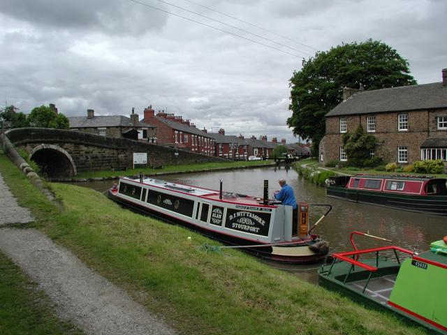
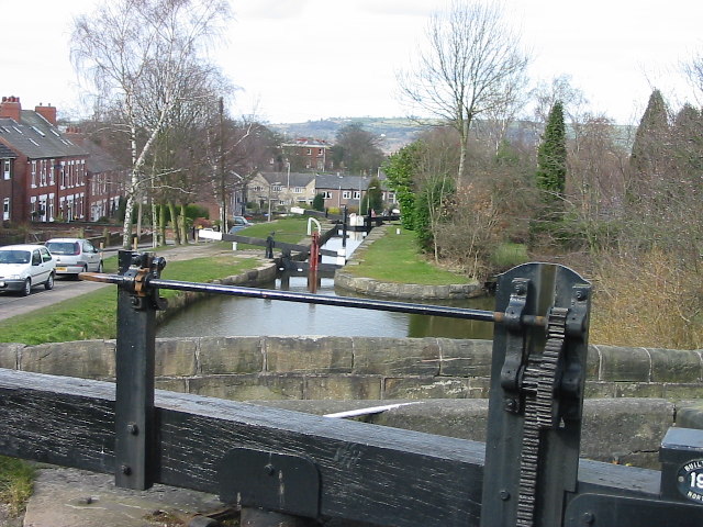
Marple Junction

Marple Junction (grid reference SJ961884) is the name of the canal junction where the Macclesfield Canal terminates and meets the Peak Forest Canal at...

Nearby Amenities

Located within 500m of 53.39332,-2.029291
Barrier: chain
Foot: yes
Lat/Long: 53.3916947/-2.0323111
Barrier: stile
Foot: yes
Lat/Long: 53.3911371/-2.0332318
Barrier: stile
Foot: yes
Lat/Long: 53.3905285/-2.0338439
Bus Stop
Mellor, Longhurst Lane / adjacent Mellor Terminus
Bus: yes
Naptan AtcoCode: 1800SG05891
Naptan Bearing: E
Naptan CommonName: Longhurst Lane/Turning Circle
Naptan Indicator: Op House 280
Naptan Landmark: OP HOUSE
Naptan NaptanCode: manjajmd
Naptan Notes: INDICATOR AMENDED
Naptan PlusbusZoneRef: MNCRPIC
Naptan ShortCommonName: Turning Circle
Naptan Street: LONGHURST LANE
Naptan Verified: no
Network: TfGM
Operator: TfGM
Public Transport: platform
Source: naptan_import
Lat/Long: 53.3929273/-2.0269926
Bus Stop
Mellor, Longhurst Lane / outside Devonshire Arms
Bus: yes
Naptan AtcoCode: 1800SG06411
Naptan Bearing: E
Naptan CommonName: Longhurst Lane/Devonshire Arms
Naptan Indicator: Devonshire Arms
Naptan Landmark: DEVONSHIRE ARMS
Naptan NaptanCode: manjamjd
Naptan PlusbusZoneRef: MNCRPIC
Naptan ShortCommonName: Devonshire Arms
Naptan Street: LONGHURST LANE
Naptan Verified: no
Network: TfGM
Operator: TfGM
Public Transport: platform
Source: naptan_import
Lat/Long: 53.3931616/-2.0243762
Bus Stop
Mellor, Longhurst Lane / opposite Damsteads Farm
Bus: yes
Naptan AtcoCode: 1800SG36021
Naptan Bearing: E
Naptan CommonName: Longhurst Lane/Brantford
Naptan Indicator: Op Coach House
Naptan Landmark: HOUSE 269
Naptan NaptanCode: manjgdwt
Naptan PlusbusZoneRef: MNCRPIC
Naptan ShortCommonName: Brantford
Naptan Street: LONGHURST LANE
Naptan Verified: no
Network: TfGM
Operator: TfGM
Public Transport: platform
Source: naptan_import
Lat/Long: 53.3926382/-2.0327669
Bus Stop
Mellor, Longhurst Lane / near Damsteads Farm
Bus: yes
Naptan AtcoCode: 1800SG36031
Naptan Bearing: W
Naptan CommonName: Longhurst Lane/Brantford
Naptan Indicator: Os Coach House
Naptan Landmark: COACH HOUSE
Naptan NaptanCode: manjgjad
Naptan PlusbusZoneRef: MNCRPIC
Naptan ShortCommonName: Brantford
Naptan Street: LONGHURST LANE
Naptan Verified: no
Network: TfGM
Operator: TfGM
Public Transport: platform
Source: naptan_import
Lat/Long: 53.3925753/-2.0329774
Bus Stop
Mellor, Longhurst Lane
Bus: yes
Naptan AtcoCode: 1800SG36041
Naptan Bearing: W
Naptan CommonName: Longhurst Lane
Naptan Indicator: O/s House 266
Naptan Landmark: HOUSE 266
Naptan NaptanCode: manjgjag
Naptan PlusbusZoneRef: MNCRPIC
Naptan ShortCommonName: Longhurst Lane
Naptan Street: LONGHURST LANE
Naptan Verified: no
Network: TfGM
Operator: TfGM
Public Transport: platform
Source: naptan_import
Lat/Long: 53.3925853/-2.0287217
Bus Stop
Mellor, Longhurst Lane / on Mellor Terminus
Bus: yes
Naptan AtcoCode: 1800SG36051
Naptan Bearing: S
Naptan CommonName: Longhurst Lane/Mellor Terminus
Naptan Indicator: Bus Terminus
Naptan Landmark: Layby
Naptan NaptanCode: manjgjaj
Naptan PlusbusZoneRef: MNCRPIC
Naptan ShortCommonName: Mellor Terminus
Naptan Street: LONGHURST LANE
Naptan Verified: no
Network: TfGM
Operator: TfGM
Public Transport: platform
Source: naptan_import
Lat/Long: 53.3930083/-2.0266919
Bus Stop
Mellor, Longhurst Lane / opposite Devonshire Arms
Bus: yes
Naptan AtcoCode: 1800SG08671
Naptan Bearing: W
Naptan CommonName: Longhurst Lane/Devonshire Arms
Naptan Indicator: O/s House 304
Naptan Landmark: HOUSE 304
Naptan NaptanCode: manjdapt
Naptan PlusbusZoneRef: MNCRPIC
Naptan ShortCommonName: Devonshire Arms
Naptan Street: LONGHURST LANE
Naptan Verified: no
Network: TfGM
Operator: TfGM
Public Transport: platform
Source: naptan_import
Lat/Long: 53.393049/-2.0243739
Pub
Devonshire Arms
Lat/Long: 53.393376/-2.0241833
Post Box
Lat/Long: 53.3929677/-2.0259019
Generator Method: photovoltaic
Generator Output Electricity: yes
Generator Source: solar
Generator Type: solar_photovoltaic_panel
Location: roof
Power: generator
Lat/Long: 53.392809/-2.0253926
Generator Method: photovoltaic
Generator Output Electricity: yes
Generator Source: solar
Generator Type: solar_photovoltaic_panel
Location: roof
Power: generator
Lat/Long: 53.3928047/-2.0327397
Generator Method: photovoltaic
Generator Output Electricity: yes
Generator Source: solar
Generator Type: solar_photovoltaic_panel
Location: roof
Power: generator
Lat/Long: 53.3928037/-2.0326233
Post Box
Collection Times: Mo-Fr 09:45, Sa 09:45
Operator: Royal Mail
Post Box Type: wall
Ref: SK6 78
Lat/Long: 53.3972529/-2.0271327
Barrier: stile
Material: stone
Stile: squeezer
Lat/Long: 53.3957147/-2.0320052
Barrier: stile
Lat/Long: 53.3964707/-2.0301026
Barrier: stile
Material: wood
Stile: stepover
Lat/Long: 53.3899932/-2.0314157
Barrier: stile
Material: wood
Stile: stepover
Lat/Long: 53.3906645/-2.0287746
Barrier: stile
Stile: squeezer
Lat/Long: 53.3896872/-2.0278841
Barrier: stile
Material: wood
Stile: stepover
Lat/Long: 53.3922406/-2.0297576
Barrier: stile
Material: wood
Stile: squeezer
Lat/Long: 53.3918194/-2.0306093
Barrier: stile
Material: wood
Stile: stepover
Lat/Long: 53.3974477/-2.0302311
Power: pole
Lat/Long: 53.3947724/-2.0358921
Power: pole
Lat/Long: 53.395247/-2.0351014
Power: pole
Lat/Long: 53.3957828/-2.0342619
Power: pole
Lat/Long: 53.3963201/-2.0334143
Power: pole
Lat/Long: 53.396751/-2.0326955
Power: pole
Lat/Long: 53.3972506/-2.0319207
Power: pole
Lat/Long: 53.3960379/-2.0330774
Power: pole
Lat/Long: 53.3958203/-2.0328105
Power: pole
Lat/Long: 53.3973872/-2.0274173
Barrier: stile
Lat/Long: 53.3948586/-2.0279636
Barrier: stile
Lat/Long: 53.3952337/-2.0280376
Barrier: stile
Lat/Long: 53.3967189/-2.0282448
Barrier: stile
Lat/Long: 53.3958786/-2.0319236
The data included in this document is from www.openstreetmap.org. The data is made available under ODbL.

Have you been to Mellor?

Leave your review of Mellor below (or comments, questions and feedback).