Mellor Brook

Settlement in Lancashire Ribble Valley

England

Mellor Brook

An odd hotel Overnight accommodation at Samlesbury Hall, twixt Preston and Blackburn, is in these Shepherd's Huts.
An odd hotel Credit: Bob Harvey

Mellor Brook is a small village located in the borough of Ribble Valley, Lancashire, England. Situated on the southern edge of the beautiful Ribble Valley, it is approximately five miles east of the town of Blackburn and around eight miles north of the city of Preston.

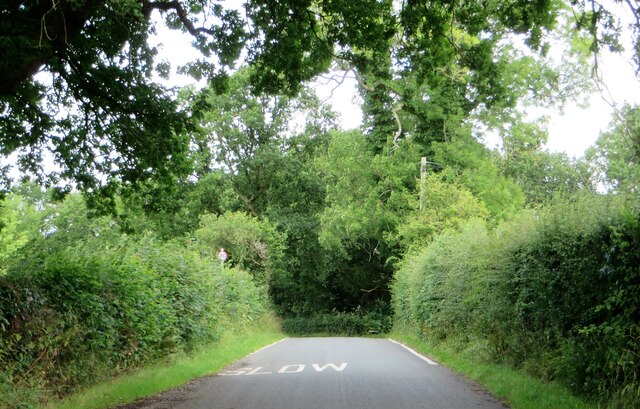
The village is known for its picturesque setting, with rolling hills and lush green countryside surrounding it. Mellor Brook is primarily a residential area, with a mix of detached houses, cottages, and bungalows. The village maintains a close-knit and friendly community atmosphere, fostering a sense of belonging and unity among its residents.

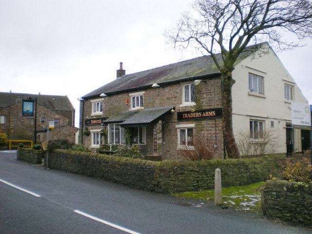
Mellor Brook offers a range of amenities to its residents, including a primary school, a village hall, and a local pub. The village hall hosts various community events and activities, providing a space for social gatherings and recreational pursuits. Additionally, there is a small convenience store that serves the local population's daily needs.

The area is also known for its proximity to beautiful natural attractions, such as the nearby Witton Country Park and the stunning Ribble Valley countryside. These areas offer opportunities for outdoor activities like hiking, cycling, and picnicking, making Mellor Brook an ideal place for nature enthusiasts.

Overall, Mellor Brook offers a tranquil and idyllic living environment for its residents, with its scenic beauty, community spirit, and convenient access to both urban and rural amenities.

If you have any feedback on the listing, please let us know in the comments section below.
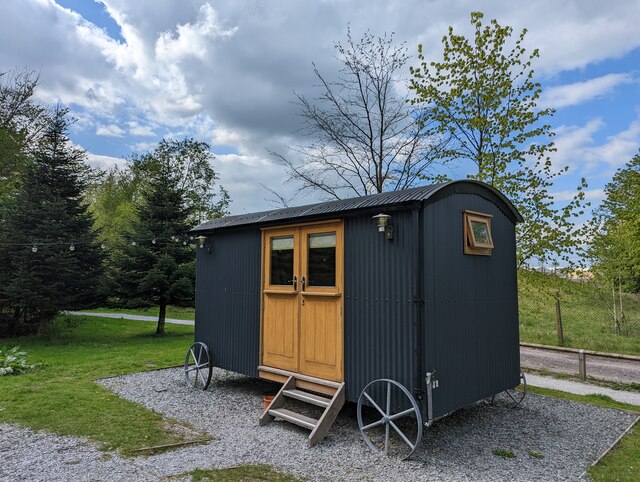
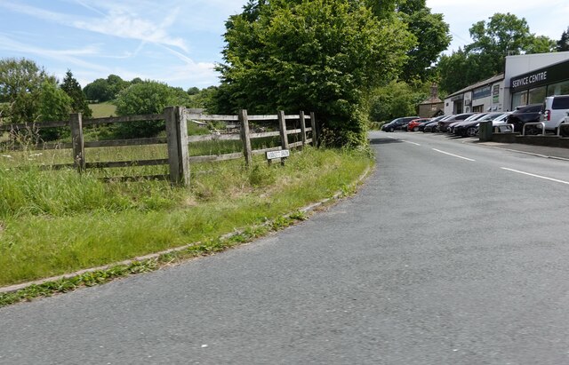
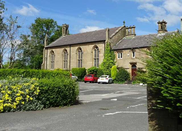
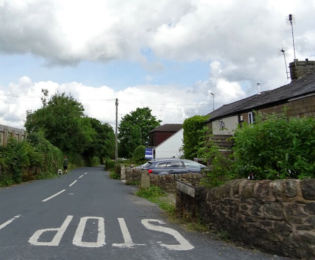
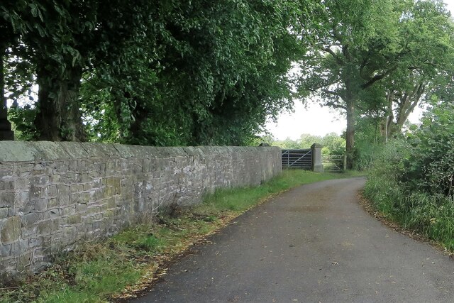
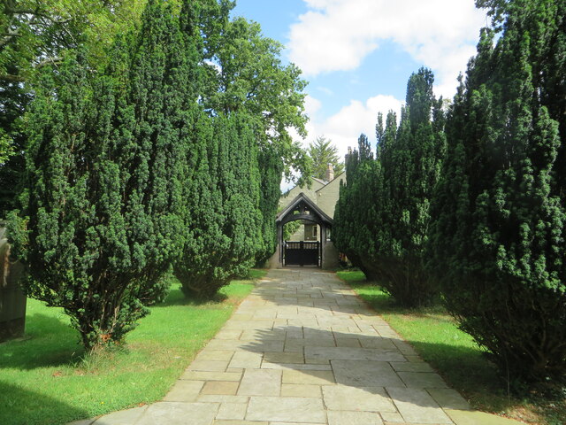
Mellor Brook Images

Images are sourced within 2km of 53.774096/-2.548484 or Grid Reference SD6431. Thanks to Geograph Open Source API. All images are credited.

An odd hotel Overnight accommodation at Samlesbury Hall, twixt Preston and Blackburn, is in these Shepherd's Huts.
An odd hotel
Overnight accommodation at Samlesbury Hall, twixt Preston and Blackburn, is in these Shepherd's Huts.
Samlesbury Hall A grade I listed building, dating in part to the 14th century - see <span class="nowrap"><a title="https://historicengland.org.uk/listing/the-list/list-entry/1361389" rel="nofollow ugc noopener" href="https://historicengland.org.uk/listing/the-list/list-entry/1361389">Link</a><img style="margin-left:2px;" alt="External link" title="External link - shift click to open in new window" src="https://s1.geograph.org.uk/img/external.png" width="10" height="10"/></span>
Samlesbury Hall
A grade I listed building, dating in part to the 14th century - see LinkExternal link
Samlesbury Hall I have no idea what this feature is called.  

This is a grade I listed building (<span class="nowrap"><a title="https://historicengland.org.uk/listing/the-list/list-entry/1361389" rel="nofollow ugc noopener" href="https://historicengland.org.uk/listing/the-list/list-entry/1361389">Link</a><img style="margin-left:2px;" alt="External link" title="External link - shift click to open in new window" src="https://s1.geograph.org.uk/img/external.png" width="10" height="10"/></span> ) owned by a charitable trust (<span class="nowrap"><a title="https://www.samlesburyhall.co.uk/" rel="nofollow ugc noopener" href="https://www.samlesburyhall.co.uk/">Link</a><img style="margin-left:2px;" alt="External link" title="External link - shift click to open in new window" src="https://s1.geograph.org.uk/img/external.png" width="10" height="10"/></span> )
Samlesbury Hall
I have no idea what this feature is called. This is a grade I listed building (LinkExternal link ) owned by a charitable trust (LinkExternal link )
Abbott Brow At its junction with the A59 in Osbaldeston.
Abbott Brow
At its junction with the A59 in Osbaldeston.
Military Aeroplanes These full scale replicas of the F-35 Lightning and F-35 Lightning II are at the main gate of BAE Systems on the A59 in Samlesbury.
Military Aeroplanes
These full scale replicas of the F-35 Lightning and F-35 Lightning II are at the main gate of BAE Systems on the A59 in Samlesbury.
St. Mary's Church, Osbaldeston On the A59.
St. Mary's Church, Osbaldeston
On the A59.
Osbaldeston Lane At its junction with the A59.
Osbaldeston Lane
At its junction with the A59.
Lane in Balderstone Running by St. Leonard's churchyard.
Lane in Balderstone
Running by St. Leonard's churchyard.
Lych gate at St. Leonard's church From the church's porch doorway.
Lych gate at St. Leonard's church
From the church's porch doorway.
Commons Lane in Balderstone
St. Leonard's church Balderstone's parish church in the deanery of Whalley.
St. Leonard's church
Balderstone's parish church in the deanery of Whalley.
Lane Ends Trig Point Flush Bracket S5004
St Mary the Virgin, Mellor
OS Cut Mark - Mellor, St Mary Church <span class="nowrap"><a title="https://www.bench-marks.org.uk/bm58946" rel="nofollow ugc noopener" href="https://www.bench-marks.org.uk/bm58946">Link</a><img style="margin-left:2px;" alt="External link" title="External link - shift click to open in new window" src="https://s1.geograph.org.uk/img/external.png" width="10" height="10"/></span>
OS Cut Mark - Mellor, St Mary Church
Location of OS Cut Mark - Mellor, St Mary Church
Traders Arms, Mellor
Start of footpath to Mellor trigpoint
Mellor ROC post and friendly cow <span class="nowrap"><a title="https://www.subbrit.org.uk/sites/mellor-roc-post/" rel="nofollow ugc noopener" href="https://www.subbrit.org.uk/sites/mellor-roc-post/">Link</a><img style="margin-left:2px;" alt="External link" title="External link - shift click to open in new window" src="https://s1.geograph.org.uk/img/external.png" width="10" height="10"/></span>

Opened in 1959 and closed in 1968
Mellor ROC post and friendly cow
LinkExternal link Opened in 1959 and closed in 1968
Show me another place!

Mellor Brook is located at Grid Ref: SD6431 (Lat: 53.774096, Lng: -2.548484)

Administrative County: Lancashire

District: Ribble Valley

Police Authority: Lancashire

What 3 Words

///quieter.renovated.mouths. Near Blackburn, Lancashire

Nearby Locations

Mellor Brook Osbaldeston

Related Wikis

Mellor Brook

Mellor Brook is a village which straddles the borders of the Boroughs of Ribble Valley and South Ribble in Lancashire, England. The village population...

Osbaldeston

Osbaldeston is a village and civil parish in Lancashire, England about 3+1⁄4 miles (5.2 km) north-west of Blackburn and 7 miles (11.3 km) east of Preston...

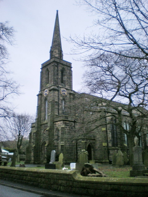
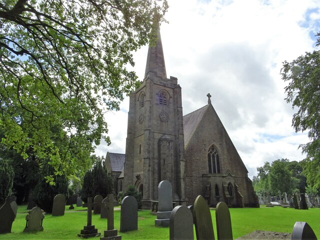
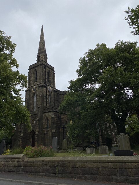
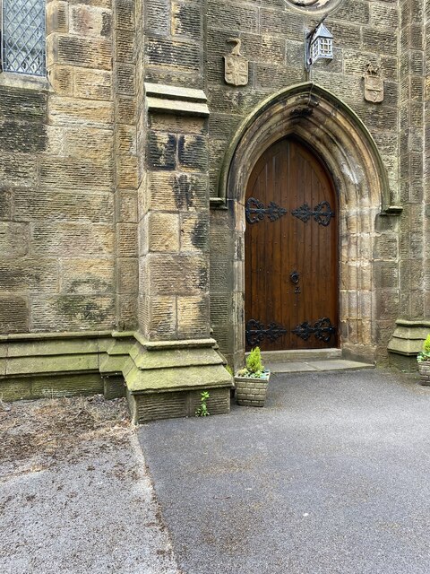
St Mary's Church, Mellor

St Mary's Church is in Church Lane, Mellor, Lancashire, England. It is an active Anglican parish church in the deanery of Whalley, the archdeaconry of...

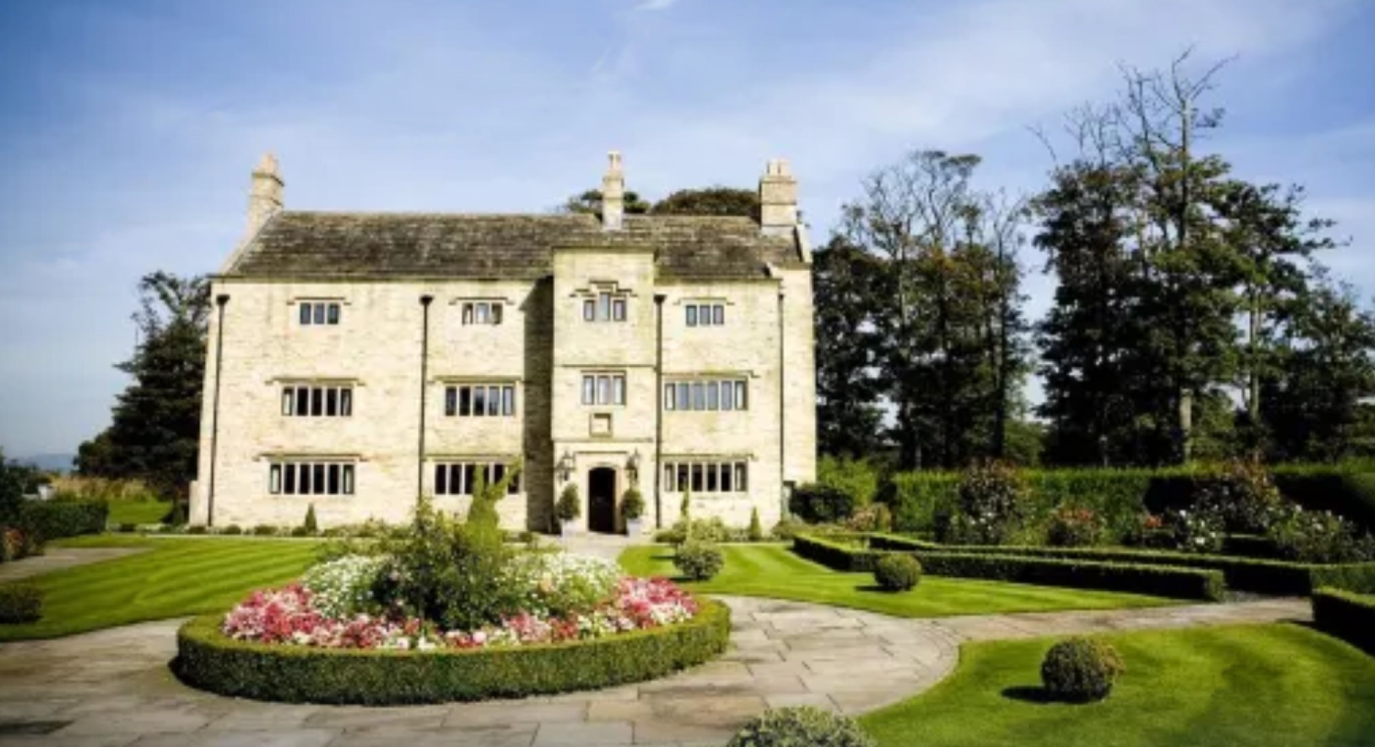
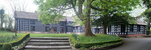
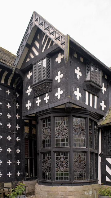
Stanley House Hotel, Mellor

Stanley House in Mellor, Lancashire, England, is a building of historical significance and is Grade II* listed on the English Heritage Register. It was...

Mellor, Lancashire

Mellor is a village situated in the Borough of Ribble Valley in Lancashire, England. The population of the civil parish at the census of 2011 was 2,262...

Samlesbury Aerodrome

Samlesbury Aerodrome is a disused airfield at Balderstone near Samlesbury and Blackburn in the Ribble Valley district of Lancashire. The aerodrome is owned...

Balderstone, Lancashire

Balderstone is a village and civil parish in the Ribble Valley district of Lancashire, England. The population of the Civil Parish taken at the 2021 census...

St Leonard's Church, Balderstone

St Leonard's Church is in the village of Balderstone, Lancashire, England. It is an active Anglican parish church in the deanery of Whalley, the archdeaconry...

Nearby Amenities

Located within 500m of 53.774096,-2.548484
Mellor Brook
Place: village
Source: npe
Lat/Long: 53.7755289/-2.5468214
The Windmill
Disused Amenity: pub
Lat/Long: 53.7699999/-2.546993
Post Box
Created By: Potlatch 0.10f
Lat/Long: 53.7747681/-2.5470789
Mini Roundabout
Direction: clockwise
Lat/Long: 53.7762361/-2.5492651
Speed Camera
Lat/Long: 53.7697282/-2.5485948
The data included in this document is from www.openstreetmap.org. The data is made available under ODbL.

Have you been to Mellor Brook?

Leave your review of Mellor Brook below (or comments, questions and feedback).