Berden Hall

Heritage Site in Essex Uttlesford

England

Berden Hall

Signpost along the B.1038 near Clavering, Essex
Signpost along the B.1038 near Clavering, Essex Credit: Robert Edwards

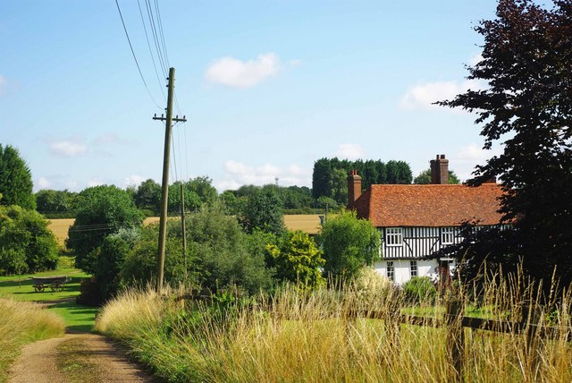
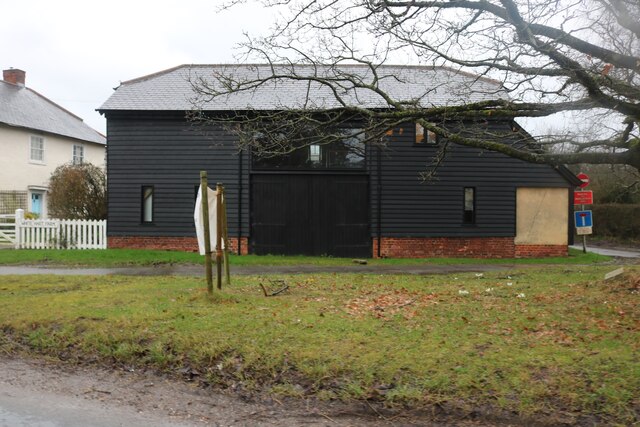
Berden Hall, located in the county of Essex, England, is a magnificent heritage site that dates back to the 15th century. This grade II listed building is situated in the picturesque village of Berden, nestled amidst the rolling countryside.

The hall is a prime example of Tudor architecture, characterized by its timber-framed structure and ornate detailing. It has undergone various renovations and additions over the centuries, yet still retains much of its original charm and grandeur. The exterior boasts a striking combination of red brickwork and exposed timber beams, while the interior features impressive oak paneling, intricate plasterwork, and elegant fireplaces.

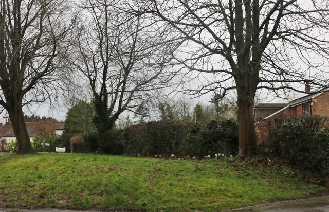
The hall is surrounded by well-manicured gardens, which add to its overall beauty. These gardens feature a mix of formal lawns, flourishing flower beds, and ancient trees, creating a serene and peaceful atmosphere. The estate also includes a moat, further enhancing its historic appeal.

Throughout its history, Berden Hall has been home to several notable families, including the De Veres and the Waldegraves. It has witnessed significant events and has been a witness to the changing times of England. Today, the hall is privately owned and serves as a private residence.

Berden Hall is not open to the public, but it can be admired from the outside, allowing visitors to marvel at its architectural splendor and appreciate its historical significance. As a cherished heritage site, it stands as a testament to the rich history and cultural heritage of the region.

If you have any feedback on the listing, please let us know in the comments section below.

Berden Hall Images

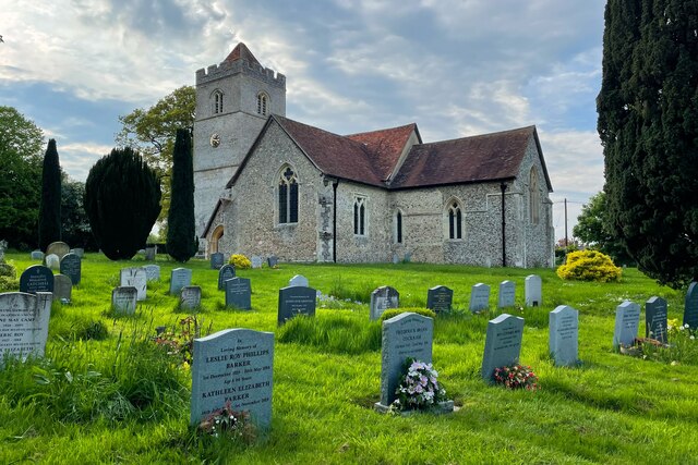
Images are sourced within 2km of 51.945/0.132 or Grid Reference TL4629. Thanks to Geograph Open Source API. All images are credited.

Signpost along the B.1038 near Clavering, Essex
Bridge over the river Stort This is known as Poor Bridge, which lies southeast of Clavering.
Bridge over the river Stort
This is known as Poor Bridge, which lies southeast of Clavering.
Barn at Clavering Hall Farm
River Stort south of Clavering This is Poor Bridge carrying the minor road to Rickling over the river. This is the bridge featured in Robert's <a href="https://www.geograph.org.uk/photo/267953">TL4830 : Bridge over the river Stort</a>
River Stort south of Clavering
This is Poor Bridge carrying the minor road to Rickling over the river. This is the bridge featured in Robert's TL4830 : Bridge over the river Stort
Berden Priory junction Berden Priory junction of roads down to the Priory and Priory Farm
Berden Priory junction
Berden Priory junction of roads down to the Priory and Priory Farm
Footpath to Berden Priory Another view of  <a href="https://www.geograph.org.uk/photo/579568">TL4630 : Berden Priory junction</a> this time showing the Rowans in fruit.
Footpath to Berden Priory
Another view of TL4630 : Berden Priory junction this time showing the Rowans in fruit.
Mell House This is Mell house near Berden Priory
Mell House
This is Mell house near Berden Priory
Byway Botany This strikingly violet flower was growing next to the byway by <a href="https://www.geograph.org.uk/photo/1413768">TL4630 : Mell House</a> my best guess it that it is Wood Cranes-bill Geranium sylvaticum but I don’t claim to be a botanist!
Byway Botany
This strikingly violet flower was growing next to the byway by TL4630 : Mell House my best guess it that it is Wood Cranes-bill Geranium sylvaticum but I don’t claim to be a botanist!
Ginns Road, Berden
Ginns Road, Berden
Field by Ginns Road, Berden
Converted barn on Ginns Road, Stocking Pelham It was converted at some point after Google saw it in 2009
Converted barn on Ginns Road, Stocking Pelham
It was converted at some point after Google saw it in 2009
Small green in Stocking Pelham
Unnamed road to Stocking Pelham Looking towards  St Mary's Church
Unnamed road to Stocking Pelham
Looking towards St Mary's Church
Footpath towards Stocking Farm
Footbridge on the footpath to Stocking Farm
Footpath to Pelham Gate
St Nicholas's Church
Bearden Village Hall
Show me another place!

Berden Hall is located at Grid Ref: TL4629 (Lat: 51.945, Lng: 0.132)

Administrative County: Essex

District: Uttlesford

Police Authority: Essex

What 3 Words

///besotted.nets.trying. Near Stansted Mountfitchet, Essex

Related Wikis

Berden Hall

Berden Hall is a Grade II* listed Elizabethan country house in Berden, in the Uttlesford District of Essex, England. The house was built in the 1580s....

St Nicholas' Church, Berden

St Nicholas' Church is a Grade I listed parish church in the village of Berden, Essex, England. Of the Early English Gothic style, the church has a Norman...
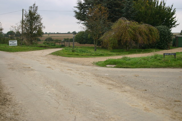
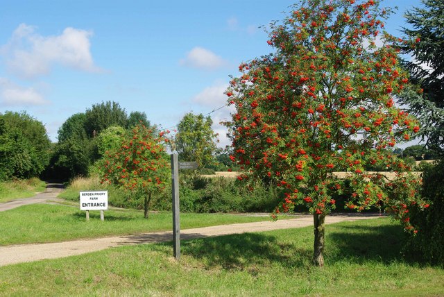
Berden Priory

Berden Priory was a priory in Essex, England. This site now has a Grade II* listed late 16th-century timber-framed house, the centre of Berden Priory Farm...

Berden

Berden is a village and civil parish in Essex, England. Berden village is approximately 6 miles (10 km) north from Bishop's Stortford, Hertfordshire and...

Stocking Pelham

Stocking Pelham is a village and civil parish in the East Hertfordshire district of Hertfordshire, England. It is located on the border with Essex, around...

Wicken Bonhunt

Wicken Bonhunt is a village and a civil parish of north-west Essex, in the non-metropolitan district of Uttlesford, England. It is on the B1038 (Buntingford...

Clavering, Essex

Clavering is a village and also a parish in north-west Essex in England. It is about 20 miles (32 km) from Cambridge and 50 miles (80 km) from Southend...

Clavering Castle

Clavering Castle remains are situated in the small parish village of Clavering in the county of Essex, England, 50m north of the church of St Mary and...

Nearby Amenities

Located within 500m of 51.945,0.132
Benskins Close
Naptan AtcoCode: 1500BERDEN1
Naptan Bearing: E
Naptan BusStopType: CUS
Naptan CommonName: Benskins Close
Naptan Indicator: Adj
Naptan Landmark: Benskins Close
Naptan NaptanCode: esxgmjga
Naptan Street: Pelham Road
Naptan Verified: no
Source: naptan_import
Lat/Long: 51.9469054/0.1292039
Bus Stop
Bonneting Lane
Bus: yes
Naptan AtcoCode: 1500IM1004
Naptan Bearing: W
Naptan BusStopType: CUS
Naptan CommonName: Bonneting Lane
Naptan Crossing: New Town Lane
Naptan Indicator: Opp
Naptan Landmark: Bonneting Lane
Naptan NaptanCode: esxdatpw
Naptan Street: Pelham Road
Naptan Verified: no
Public Transport: platform
Source: naptan_import
Lat/Long: 51.9475336/0.1342395
Bonneting Lane
Naptan AtcoCode: 1500IM1004AA
Naptan Bearing: E
Naptan BusStopType: CUS
Naptan CommonName: Bonneting Lane
Naptan Crossing: New Town Lane
Naptan Indicator: Adj
Naptan Landmark: Bonneting Lane
Naptan NaptanCode: esxgtdtg
Naptan Street: Pelham Road
Naptan Verified: no
Source: naptan_import
Lat/Long: 51.9475962/0.1342571
Power: tower
Lat/Long: 51.9416954/0.1352905
Bus Stop
St Nicholas Field
Bus: yes
Naptan AtcoCode: 1500IM1004B
Naptan BusStopType: CUS
Naptan NaptanCode: esxjmjmj
Naptan Verified: no
Public Transport: platform
Source: naptan
Lat/Long: 51.9472433/0.1354341
Bus Stop
St Nicholas Field
Bus: yes
Naptan AtcoCode: 1500IM1004BB
Naptan BusStopType: CUS
Naptan NaptanCode: esxjmjmp
Naptan Verified: no
Public Transport: platform
Source: naptan
Lat/Long: 51.9471501/0.1356336
Fixme: needs survey
Lat/Long: 51.9479733/0.1287057
Barrier: stile
Stile: stepover
Lat/Long: 51.9434936/0.1315858
Barrier: stile
Stile: stepover
Lat/Long: 51.9440326/0.1314698
Telephone
Defibrillator
Addr Postcode: CM23 1AS
Booth: K6
Covered: booth
Defibrillator Location: inside old red phone box by village green in Berden
Emergency: defibrillator
Man Made: telephone_box
Lat/Long: 51.9473027/0.1354219
Advertising: board
Direction: 80
Lat/Long: 51.9472779/0.1354246
Waste Basket
Lat/Long: 51.947277/0.1354474
Post Box
Post Box Mounting: brick_pillar
Post Box Type: wall
Royal Cypher: GVIR
Royal Cypher Wikidata: Q33102169
Lat/Long: 51.9473349/0.1354192
Bench
Lat/Long: 51.9473688/0.1354152
Bench
Lat/Long: 51.9422698/0.1350316
Barrier: bollard
Lat/Long: 51.9471094/0.1344207
Advertising: board
Direction: 115
Lat/Long: 51.946956/0.1293807
Crossing
Lat/Long: 51.9473099/0.1326023
Crossing
Lat/Long: 51.9475615/0.1333847
Man Made: village_sign
Lat/Long: 51.9473529/0.1356346
Waste Basket
Lat/Long: 51.94695/0.1293628
Barrier: stile
Lat/Long: 51.9440553/0.1348898
Barrier: swing_gate
Lat/Long: 51.9434158/0.1344933
The data included in this document is from www.openstreetmap.org. The data is made available under ODbL.

Have you been to Berden Hall?

Leave your review of Berden Hall below (or comments, questions and feedback).